Rameshvara Temple, Koodli, Karnataka
Rameshvara Temple, Koodli, Karnataka
Rameshvara Temple is a Hindu Temple dedicated to Lord Shiva located in Koodli Village in Shivamogga Taluk in Shivamogga District in the Indian state of Karnataka. Koodli is situated at the confluence of Tunga river and Bhadra river. Koodli is considered as the birthplace of the mighty Tungabhadra river. Koodli is also known as Varanasi of the south.
History
The temple was built in 12th century CE by the Hoysalas. The temple is protected as a monument of national importance by the Archaeological Survey of India.
The Temple
The temple is facing towards east and stands over a low raised platform. The temple is constructed in ekakuta (single shrine) style. The temple consists of sanctum, vestibule and sabha mandapa. The sabha mandapa has three entrance porches on the northern, southern and eastern side. Each of the entrance porches are supported by four lathe turned polished pillars. The sabha mandapa is supported by four central pillars.
Nandi can be found on the raised platform in the sabha mandapa facing towards the sanctum. The sanctum enshrines the presiding deity, Rameshvara in the form of Shiva Linga. The sanctum has a vesara style superstructure (shikara) and the vestibule (sukanasi) has a tower looks like a low protrusion of the main tower over the shrine. The royal emblem of Hoysala dynasty, a warrior stabbing a lion can be seen on the protruding tower of the vestibule.
The shikara over the sanctum is of three tiers and has a finial called the kalasha (decorative water-pot like structure) at the top. There is a heavy dome like structure called amalaka below the finial. This is the largest sculptural piece in the temple with a ground surface area of about 2x2 meters. The outer walls of the shrine are plain except the regularly spaced slender pilasters. There are three inscriptional stones in the temple premises.
Connectivity
The temple is located at about 4 Kms form Holehonnur Bus Stop, 4 Kms from Holehonnur, 17 Kms from Shivamogga Railway Station, 18 Kms from Shivamogga, 25 Kms from Bhadravathi, 31 Kms from Channagiri, 205 Kms from Mangalore Airport and 293 Kms from Bengaluru. The temple is situated at about 4 Kms from Holehonnur on Shivamogga to Chitradurga route.
Chintamani Narasimha Swamy Temple, Koodli, Karnataka
Chintamani Narasimha Swamy Temple, Koodli, Karnataka
Chintamani Narasimha Swamy Temple is a Hindu Temple dedicated to Lord Vishnu located in Koodli Village in Shivamogga Taluk in Shivamogga District in the Indian state of Karnataka. Koodli is situated at the confluence of Tunga river and Bhadra river. Koodli is considered as the birthplace of the mighty Tungabhadra river. Koodli is also known as Varanasi of the south.
Legends
It is believed that the image of Chintamani Narasimha Swamy was installed and worshipped by Prahlada.
The Temple
This temple is facing towards east with three tiered rajagopuram. Deepa Sthamba can be found in front of the rajagopuram. Dhwaja Sthambam and Balipeedam can be found immediately after the rajagopuram. The temple consists of sanctum, vestibule and sabha mandapa. The sabha mandapa has three entrance porches on the northern, southern and eastern side. The sanctum enshrines a saligrama image of Chintamani Narasimha Swamy. The sanctum has a vesara style superstructure (shikara).
Connectivity
The temple is located at about 4 Kms form Holehonnur Bus Stop, 4 Kms from Holehonnur, 17 Kms from Shivamogga Railway Station, 18 Kms from Shivamogga, 25 Kms from Bhadravathi, 31 Kms from Channagiri, 205 Kms from Mangalore Airport and 293 Kms from Bengaluru. The temple is situated at about 4 Kms from Holehonnur on Shivamogga to Chitradurga route.
Karinjeshwara Temple, Karinja – The Temple Complex
Karinjeshwara Temple, Karinja – The Temple Complex
The temple complex has two major temples. One temple is dedicated to Lord Shiva situated at the top of a Karinja Hill. This temple is situated on the peak of Karinja Hill at about 1500 feet above sea level in Kodyamale Hills. There are about 555 steps to reach this temple from the foothill. The other temple is dedicated to Goddess Parvati & Ganesha in the middle of the way to the hill top. The Parvathi temple can be accessed through flight of steps and also can be reached by road but the Shiva temple at hill top can be accessed through flight of steps only.
This temple is situated in the middle of the way to the Karinja Hill top. There is a shrine for Vinayaga on the way to Parvathi temple from the foot hill. The temple is surrounded by a courtyard. There is a dining hall at the end of the courtyard.
Ukkadada Bagilu is a massive door frame made up of a stone situated after the Parvati temple towards the hill top. One need to climb about 150 steps from Parvathi temple to reach this spot. Ukkadada Bagilu has a 0.3 cm cut mark on it, which is said to be created by the hitting of an arrow, when Arjuna tried to kill a wicked boar.
This temple is the principal shrine of the temple complex. This temple is situated on the peak of Karinja Hill at about 1500 feet above sea level in Kodyamale Hills. There are about 555 steps to reach this temple from the foothill. The temple can be reached after climbing 118 steps from Ukkadada Bagilu. The temple is also called as Shilamaya Temple.
It is regarded as Bhookailasa. Balipeedam and a short granite pillar can be seen in front of the temple. The temple consists of sanctum, antrala and mukha mandapa. The sanctum enshrines an image of Shilamaya Shiva (Karinjeshwara). The hill top provides a breath taking panoramic view of the forested foothills of the western ghats.
Theerthas:
For brief details, please refer below link;
https://hindutemples-india.blogspot.com/2022/07/karinjeshwara-temple-karinja-theerthas.html
There is a unique tradition followed in this temple by the authorities. The temple authorities place the rice offerings (Naivedya) on Naivedya Kallu, a granite platform, immediately after the Maha Pooja in the afternoon and ring the temple bell. Once, the bell rings, a troop of monkeys led by the Alpha male called the Karinje Dhadda will come to the Naivedya Kallu and eat the offerings. Devotees gather in large numbers to watch a large number of monkeys coming from all sides of the forest to feast upon the hot rice prasadam. These monkeys will not harm the devotees and also accept foods from them. Devotees also offer bananas and coconuts to these monkeys.
Baladevjew Temple, Ichhapur – History
Baladevjew Temple, Ichhapur – History
The original temple is said to have been constructed by Jajati Keshari in 10th century CE. Few believe that King Anangabhima Dev-III of Eastern Ganga Dynasty has built the original temple and suffered destruction by the Muslim general Kalapahad in 1568 CE. The temple was completely destroyed in 1661 CE by Khan-I-Duran, the subedar of Odisha during the reign of Mughal Emperor Aurangzeb. He built a mosque on the remains of the temple.
The devotees took the deity, crossed the Gobari River and kept the idols in a safe place near Baranga Jungle and later shifted to Balarampur village near Luna river at Sakhi Bata. When normalcy was restored, they finally shifted the idol to the present day Icchapur temple. The present temple was constructed in 1761 CE during the Maratha rule in Odisha. It was constructed by the king of Kujanga, Raja Gopal Sandha and Zamindar of Chhedara Killah, Srinivas Narendra Mahapatra.
Sadhu Gopi Das and Sairatak Giri convinced the then Maratha Chief Janoji to construct the Jagamohana, Bhoga Mandapa of the main temple, Gundicha temple and compound wall. The Maratha ruler agreed and built them accordingly. The Manika Debi and Jagannath Temple was built by first Mahanta Ramanuja Das. As per local belief, the temple was built by Raghuji Bhonsle, the Maratha king of Nagpur. The temple is currently under the administrative control of Endowment Department, Government of Odisha.
Baladevjew Temple, Ichhapur – Legends
Baladevjew Temple, Ichhapur – Legends
Tulasi Kshetra:
As per legend, the demon king Kandarasura was ruling over the area around Lalitagiri and Alatigiri mountain ranges. Lord Balabhadra defeated him in a pitched battle. After suffering defeat at the hands of Balabhadra, the demon king left the place and went to Kapilash mountain as he was an ardent devotee of Lord Shiva. He lived in disguise in the nearest mountain range.
Lord Balabhadra thoroughly searched the demon everywhere in the hill and could not able to locate him. Finally, he ploughed the hill with his plough as a result of which one perennial spring emerged from the hill. The spring came to be called as Langal Siar Jharana (spring of the plough). Finally, he engaged the demon and killed the demon in a fight and threw his body all over nearby places by cutting it into pieces.
It is generally believed that the scattered body pieces fell at Asureswar named after the head (Aswa Sira), Balagandi named after the trunk (Gandi of Aswa), Kamar Khandi named after the waist (Kamar Khanda) and Navi Khanda named after the naval (Navi Khanda). It is also believed that the Shiva temples of Swapneswar at Kantia, Lankeswara of Gualisingh, Bileswar of Kagal were founded by Baladeva over the face, neck and waist of the demon respectively.
Balagandi, the place where the trunk of Kandarasura had fallen came to be called as Kandara Padi. Later it got corrupted to Kandharapara / Kendrapara. It is said that Lord Balabhadra first killed Madhudaitya, the chief military general of Kandarasura at Lalitagiri before killing the demon Kandarasura through his war weapon plough. The blood gushing out from the body of the general formed a river named Madhusagar (now called as Gobari river).
It flow towards east by the side of Kandarasura Menhir and finally reaches the sea. Lord Balabhadra married Tulasi, the only daughter of Kandarasura on the 12th day of the bright fortnight in the month of Magha. This event is celebrated every year as Tulasi bibaha day (marriage day of Tulasi) in this temple. The place where this marriage was performed came to be called as Tulasi Kshetra. The deity of Tulasi Devi is worshipped in a temple nearby village Gochha on the northern side of the road from Kendrapara to Ichhapur.
Siddha Baladev Jiu:
As per legend, Lord Balabhadra established himself as a deity to be worshipped here before his departure to his abode. The deity was worshipped by devas at the door of Patalpuri (Lalitagiri) in Dwapar Yuga. When Buddhism started to spread in this area during Kali Yuga, the deity was hidden under the water of Madhusagar (Gobari River). Gopal Siddha Das, a cowherd discovered this idol near Siddha Sarobar. Since then, this deity is worshipped at Kendrapara. The deity came to be called as Siddha Baladev Jiu after the name of Gopal Siddha Das.
Other Names:
The place was called as Tulasi Kshetra, Gupta Kshetra, Brahma Kshetra, Kandarapadi, Gupta Brindaban Baladeba Kshetra and Manibigraha Kshetra.
Baladevjew Temple, Ichhapur, Odisha
Baladevjew Temple, Ichhapur, Odisha
Baladevjew Temple is a Hindu Temple dedicated to Lord Vishnu located in Ichhapur, an outskirt of Kendrapara Town in Kendrapara District in Odisha, India. Kendrapara / Ichhapur was famously known as Tulasi Kshetra. It is one of the five holy Kshetras of Odisha. The same rites and rituals of Lord Jagannath at Puri are generally followed in this temple.
Legends
For brief details, please refer below link;
https://hindutemples-india.blogspot.com/2022/07/baladevjew-temple-ichhapur-legends.html
History
For brief details, please refer below link;
https://hindutemples-india.blogspot.com/2022/07/baladevjew-temple-ichhapur-history.html
The Temple Complex
For brief details, please refer below link;
https://hindutemples-india.blogspot.com/2022/07/baladevjew-temple-ichhapur-temple-complex.html
Festivals
Dola Purnima, Janmashtami, Rath Yatra, Chaitra Purnima, Kartik Purnima, Maghasukla Dwadasi, Shravan Purnima, Snana Purnima, Pausha Purnima, Phalguna Purnima, Vasant Panchami, Bhadrapad Dwadashi, Makar Sankranti, Pana Sankranti and Chandan Jatra are the festivals celebrated here.
Connectivity
The temple is located at about 2 Kms from Kendrapara, 2 Kms from Kendrapara Bus Stand, 4 Kms from Kendrapara Railway Station, 33 Kms from Paradeep, 47 Kms from Chandikhol, 65 Kms from Cuttack, 89 Kms from Bhubaneswar and 95 Kms from Bhubaneswar Airport. The temple is situated on Chandikhol to Paradeep route.
Ashta Shambhu Temple, Kualo – The Temple Complex
Ashta Shambhu Temple, Kualo – The Temple Complex
The temple complex consists of Kanakesvara Panchayatana Temple with its subsidiary shrines dedicated to Baidyanath (north-west) Paschimesvara (south-west), Kapilesvara (north-east) & Balukesvara (south-east) and Svapnesvara Temple, Baneswar Temple & Siddheshwar Temple.
Kanakesvara Temple:
This temple follows Panchayatana style of architecture. Panchayatana is an architectural style where the main shrine is built on a raised platform with four smaller subsidiary shrines at the four corners and making it a total of five shrines. This temple is the central shrine of the Panchayatana temple complex. All the subsidiary shrines have been collapsed and exists in dilapidated condition. This temple is facing towards east and stands over a raised platform. The temple is triratha on plan and triangabada on elevation. The temple consists of rekha vimana and a pillared jagamohana.
The jagamohana is completely lost. The vimana is square on plan whereas the jagamohana is rectangular on plan. The sanctum enshrines the presiding deity Kanakesvara in the form of Shiva Linga within circular yonipitha. The shikara lost its architectural and the core stones are only visible. The exterior of the temple is decorated with images of Ardhanariswara, Parvati, Mahisasura Mardini, Ganesha, Bhairava, chaitya medallions, vajramundi, elephant friezes, lion, amorous couple and scroll works.
Kapilesvara Temple:
This temple is situated on the north eastern corner of the Ashta Shambu Temple Complex. This temple is one of the subsidiary shrines of Kanakesvara Panchayatana Temple. This temple is facing towards south and in a dilapidated condition. The temple is triratha on plan and triangabada in elevation. The temple consists of rekha deula and a shallow frontal porch. The sanctum is square on plan. The sanctum enshrines the presiding deity, Kapilesvara in the form of Shiva Linga within a square broken yonipitha. The exterior of the temple is decorated with scroll work, chaitya medallion, nayikas, divinities etc.
Baidyanatha Temple:
This temple is situated on the north western corner of the Ashta Shambu Temple Complex. This temple is one of the subsidiary shrines of Kanakesvara Panchayatana Temple. This temple is facing towards south. The temple is triratha on plan and triangabada in elevation. The temple consists of rekha deula and a shallow frontal porch. The sanctum is square on plan. The sanctum enshrines the presiding deity, Baidyanatha in the form of Shiva Linga within a square broken yonipitha. The exterior of the temple is decorated with vajramundi niche enshrining Ardhanarisvara, chaitya medallion, scroll work, ghatapallava design, animal elephants, lions, horses, amorous couple and deulacharinis.
Balukesvara Temple:
This temple is situated on the south eastern corner of the Ashta Shambu Temple Complex. This temple is one of the subsidiary shrines of Kanakesvara Panchayatana Temple. This temple is facing towards north and in dilapidated condition. The temple is triratha on plan and triangabada in elevation. The temple consists of rekha deula and a shallow frontal porch. The sanctum is square on plan. The sanctum enshrines the presiding deity, Balukesvara in the form of Shiva Linga within a square yonipitha. The exterior of the temple is decorated with images of Ganesha, Mahishasura Mardhini, scroll works, lotus medallion, hanging pendants, purnaghata, navagraha panel, elephant and lion motif.
Paschimesvara Temple:
This temple is situated on the south western corner of the Ashta Shambu Temple Complex. This temple is one of the subsidiary shrines of Kanakesvara Panchayatana Temple. The temple is facing towards north and in dilapidated condition. The temple is triratha on plan. The temple above the pabhaga moulding is missing. It is a rekha temple. The sanctum is square on plan. The sanctum enshrines the presiding deity, Paschimesvara in the form of Shiva Linga within a circular yonipitha.
Svapnesvara Temple:
This temple is located within the Ashta Shambu Temple Complex. This temple is facing towards south. The temple is triratha on plan and the pabhaga portion is buried. The temple consists of rekha deula and an open rectangular pillared platform of latter addition. The sanctum is square on plan. The sanctum enshrines the presiding deity, Svapnesvara in the form of Shiva Linga within a circular yonipitha. The temple is devoid of any decorations.
Kanakadurga Temple:
This temple is located within the Ashta Shambu Temple Complex. This temple is facing towards west and is a modern structure. The temple consists of sanctum and open rectangular pillared platform. The sanctum is square on plan. The sanctum enshrines an image of ten armed Mahisasura Mardini. She is locally called as Kanakadurga. The iconographical features of the sculpture ascribe its antiquity to 9th century CE.
Ashta Shambhu Temple, Kualo, Odisha
Ashta Shambhu Temple, Kualo, Odisha
Ashta Shambhu Temple is a Hindu Temple Complex dedicated to Lord Shiva located in Kualo Village in Parajang Block in Dhenkanal District in Odisha, India. The temple complex came to be called as Ashta Shambu Temple because of the presence of the eight Shiva Lingas in the temple complex. The temple is also called as Ashta Shambu Kshetra and Panchayatana Kshetra. The temple complex is situated on the left bank of Brahmani river.
History
The temple complex was built by the Sulkis of Kodalaka Mandala, the feudatory of Bhaumakaras in 9th century CE. The temple complex is protected as monuments of national importance by the central Archaeological Survey of India.
The Temple Complex
For brief details, please refer below link;
https://hindutemples-india.blogspot.com/2022/07/ashta-shambhu-temple-kualo-temple-complex.html
Festivals
Shivarathri, Kartika Purnima, Rakhi Purnima, Sitalasasti, Bada Usha, Durga Puja and Chaitra Purnima are the festivals celebrated here.
Connectivity
The temple complex is located at about 5 Kms from Parajang, 5 Kms from Parajang Bus Stand, 15 Kms from Talcher Bus Stand, 16 Kms from Talcher, 18 Kms from Talcher Railway Station, 25 Kms from Dhenkanal, 32 Kms from Kamakhyanagar, 122 Kms from Bhubaneswar and 128 Kms from Bhubaneswar Airport. The temple is situated at about 5 Kms from Parajang on Talcher to Kamakhyanagar route.
Svapnesvara Temple, Ranapur, Odisha
Svapnesvara Temple, Ranapur, Odisha
Svapnesvara Temple is a Hindu Temple dedicated to Lord Shiva located in Ranapurgada Town in Ranapur Block in Nayagarh District in Odisha, India. The temple was built by the ruler of ex-princely state of Ranpur in 19th century CE. The current temple is renovated completely and looked after the Svapnesvara Temple Committee.
The Temple
The temple is facing towards east. The vimana is pancharatha on plan and panchangabada in elevation. The temple consists of rekha vimana, pidha jagamohana and bhoga mandapa. The vimana and jagamohana are square on plan whereas the bhogamandapa is rectangular on plan. The sanctum enshrines the presiding deity Svapnesvara in the form of Shiva Linga within circular yonipitha.
An image of eight armed Shiva made of cement is also found on a high pedestal in the sanctum. The Nisha shrines over the parsvadevta niches are latter addition. The exterior is devoid of any decoration except the udyotasimha on each raha, dopichhasimhas and deulacharinis over the beki and a miniature rekhamundi surmounted by an udyotasimha on the frontal raha. Idols of Jagannatha, Ganesha, Bhairava and Nandi can be seen in the temple premises.
Festivals
Shivarathri, Kartika Purnima and Sankranti are the festivals celebrated here with much fanfare.
Connectivity
The temple is located at about 1 Km from Ranapur, 16 Kms from Kandhanayagarh, 26 Kms from Jankia, 21 Kms from Bolagarh Town P.H Railway Station, 27 Kms from Nirakarpur Railway Station, 32 Kms from Nayagarh, 39 Kms from Khordha, 66 Kms from Bhubaneswar and 68 Kms from Bhubaneswar Airport. The temple is situated at the outskirts of Ranapur on the Ranapur to Jankia road.
Uttaresvara Temple, Pandia, Odisha
Uttaresvara Temple, Pandia, Odisha
Uttaresvara Temple is a Hindu Temple dedicated to Lord Shiva located in Pandia Village in Purusottampur Block in Ganjam District in Odisha, India. The temple is situated on the left bank of the Rushikulya river. The temple is a protected monument of Odisha State Archaeology and under Endowment Department, Government of Odisha.
History
The temple is believed to be built in 19th century CE during the Bhanja rule of ex-Ghumsar state.
The Temple
This temple is facing towards east and enclosed within a compound wall with entrances on the western and southern side. The temple consists of pidha vimana, pidha jagamohana, nandi mandapa and bhoga mandapa. Both the vimana and jagamohana are square on plan. The temple is pancharatha on plan & panchangabada in elevation. The sanctum enshrines the presiding deity Uttaresvara in the form of Shiva Linga within a circular yonipitha
Vaishnavite & Saivite dvarapalas are found in the miniature rekhamundis at the base of the doorjambs and Gajalaxmi at the lintel. The external walls of the temple are decorated with khakharamundis & pidhamundis in talajangha and uparajangha respectively. Each mundis has images of Brahma, Bhairava, Bhairavi, Brahmani, Vaishnavi and Yamuna etc. Udyota Simhas are found on each raha pagas.
Festivals
Shivarathri and Kartika Purnima are the festivals celebrated here with much fanfare.
Connectivity
The temple is located at about 7 Kms from Purusottampur, 7 Kms from Purusottampur Bus Stand, 26 Kms from Asika, 31 Kms from Brahmapur, 36 Kms from Brahmapur Railway Station, 38 Kms from Ganjam, 157 Kms from Bhubaneswar Airport and 158 Kms from Bhubaneswar. The temple is situated at about 7 Kms from Purusottampur on the Ganjam to Asika route.
Vaishnodevi Temple, Rourkela, Odisha
Vaishnodevi Temple, Rourkela, Odisha
Vaishnodevi Temple is a Hindu Temple dedicated to Goddess Vaishnodevi located in Rourkela City in Sundargarh District in Odisha, India. This Temple is a replica of the original Temple of Vaishnodevi of Jammu (Trikuta Hills) and is situated on the top of the Durgapur Hill.
History
The images of Kali, Lakshmi and Saraswathi were found on the hill in 2000 and Maa Vaishnodevi Temple Trust was formed in the same year. The temple to house these images was completed in the year 2003. The Durga temple was opened to the devotees in 2007.
The Temple
This Temple is a replica of the original Temple of Vaishnodevi of Jammu (Trikuta Hills) and is situated on the top of the Durgapur Hill facing towards Rourkela Steel Plant. The temple can be accessed through flight of 600 hundred steps. This temple enshrines beautiful images of Goddess Kali, Goddess Lakshmi and Goddess Saraswathi.
The cave temple enshrining the Vaishnodevi is the major shrine in this hill. A Durga Temple can also be seen near this cave. Bhairabanath Temple is situated close to the Vaishnodevi Temple on the hill. The temple is situated amidst scenic surroundings and the devotees can have the scenic view of Rourkela Township from the temple.
Festivals
The Avirvav Day is observed every year on 6th February with great fanfare. Durga Pooja and Navaratri are the other festivals celebrated here.
Connectivity
The temple is located at about 1.5 Kms from Rourkela Junction Railway Station, 3 Kms from Rourkela Bus Stand, 97 Kms from Sundargarh, 121 Kms from Jharsuguda Airport and 318 Kms from Bhubaneswar. The temple is situated at about 3 Kms from the city center adjacent to Indira Gandhi park on the top of the Durgapur hill.
Someshwar Temple, Ner, Maharashtra
Someshwar Temple, Ner, Maharashtra
Someshwar Temple is a Hindu Temple dedicated to Lord Shiva located in Ner Town in Ner Taluk in Yavatmal District in Maharashtra, India. The temple might have been originally a Jain Temple but later got converted to Shiva Temple. This temple is protected as monuments of national importance by the central Archaeological Survey of India.
The Temple
This temple is facing towards east. The temple consists of sanctum, antrala, sabha mandapa and mukha mandapa. The mukha mandapa is supported two pillars and two pilasters in a row. There is a label inscription mentioning the word Thirthankar found at the entrance of the temple. The sanctum enshrines the presiding deity, Someshwar, in the form of Shiva Linga within circular yonipitha.
Connectivity
The temple is located at about 1 Km from Ner Bus Stand, 21 Kms from Linga Railway Station, 23 Kms from Darwha Railway Station, 25 Kms from Darwha, 34 Kms from Yavatmal, 50 Kms from Karanja, 59 Kms from Amravati and 182 Kms from Nagpur Airport. The temple is situated on Yavatmal to Karanja route.
Taponeshwar Temple, Tapona, Maharashtra
Taponeshwar Temple, Tapona, Maharashtra
Taponeshwar Temple is a Hindu Temple dedicated to Lord Shiva located at Tapona Village in Darwha Taluk in Yavatmal District in Maharashtra, India. The temple is one of the state protected monuments in Maharashtra declared by Archaeological Survey of India.
Legends
As per legend, Anusuya, wife of Sage Atri excavated a tank here to please Varuna, the god of rain.
The Temple
The temple follows Hemadpanthi style of architecture of Yadava Dynasty. The temple complex consists of seven shrines. Out of seven shrines, four shrines are ancient, and the rest of the shrines are relatively modern structure. The main shrine consists of sanctum, antrala and mukha mandapa. Dvarapalas can be seen at the entrance of the mukha mandapa. The sanctum enshrines the presiding deity, Taponeshwar in the form of Shiva Linga.
The sanctum is situated at lower elevation from the ground level. It is said that the Linga will be submerged in the water during the month of Sawan. Nandi, under a tree can be found facing towards the sanctum. Shrines of Gauri Shankar, Kalabhairava, Dattatreya and Hanuman can be found in the temple premises. There is a temple tank called Anusuya Kund can be seen in the temple premises. A large well can be seen on the side of the tank.
Connectivity
The temple is located at about 3.5 Kms from Bori Arabia, 14 Kms from Darwha Bus Stand, 15 Kms from Darwha, 16 Kms from Darwha Moti Bagh Junction Railway Station, 31 Kms from Yavatmal, 80 Kms from Amravati and 175 Kms from Nagpur Airport. The temple is situated on Yavatmal to Darwha route.
Trimurti Temple, Dhanora, Maharashtra
Trimurti Temple, Dhanora, Maharashtra
Trimurti Temple is a Hindu Temple dedicated to Lord Brahma, Lord Vishnu and Lord Shiva located at Dhanora Village in Chandrapur Taluk in Chandrapur District in Maharashtra, India. The temple is situated on the banks of Wardha river. The temple is one of the state protected monuments in Maharashtra declared by Archaeological Survey of India.
The Temple
The temple follows Hemadpanti style of architecture. This temple is facing towards east and stands over a low raised platform. The platform is in ruined state. The temple originally consisted of sanctum, antrala and mandapa. Only the sanctum and antrala remains intact. The mandapa had been lost completely. The sanctum doorway is profusely carved with river goddesses Ganga & Yamuna with their attendants and dvarapalas at the base.
The dedicatory block at the lintel of the sanctum doorway has an image of Nataraja carved in it. The sanctum enshrines intricately carved images of Lord Brahma, Lord Vishnu and Lord Shiva. The superstructure over the sanctum and antrala had been lost completely. The decorations and images carved on the exterior of the temple is highly eroded and unintelligible. Images of Narasimha, Thirthankara and few other deities can also be found in the temple.
Connectivity
The temple is located at about 10 Kms from Ghugus, 10 Kms from Ghugus Bus Stand, 12 Kms from Ghugus Railway Station, 17 Kms from Chandrapur, 18 Kms from Chandrapur Railway Station, 37 Kms from Wani, 153 Kms from Nagpur Airport and 160 Kms from Nagpur. The temple is situated at about 4 Kms from Anturla off the Chandrapur to Wani route.
Ukkadeshwar Mahadev Temple, Ukkad Pimpri, Maharashtra
Ukkadeshwar Mahadev Temple, Ukkad Pimpri, Maharashtra
Ukkadeshwar Mahadev Temple is a group of Hindu Temple dedicated to Lord Shiva located at Ukkad Pimpri Village in Georai Taluk in Beed District in Maharashtra, India. The temple is situated on north bank of Sindphana River, a minor tributary of Godavari River. The temple is one of the state protected monuments in Maharashtra declared by Archaeological Survey of India.
The Group of Temples
There are two temples located adjacent to each other and dedicated to Lord Shiva. One temple is called as Ukkadeshwar Temple and another temples is called as Mahadeva Temple. Both the temples are facing towards east.
Mahadev Temple:
The temple consists of sanctum, antarala, sabha manḍapa and mukha mandapa. The mukha mandapa is supported by six pillars decorated with the dwarf figures. The sabha manḍapa is supported by four pillars and pilasters. The ceiling of the mukha mandapa is carved with Lord Krishna accompanied by two gopis and two attendants. The exterior of the temple is profusely carved.
Ukkadeshwar Temple:
The temple consists of sanctum, antrala and mandapa. The doorway of the mandapa is small and devoid of any decoration. The exterior is plain devoid of any decoration.
Connectivity
The temple is located at about 7 Kms from Kolgaon, 20 Kms from Padalsingi, 23 Kms from Beed Bus Stand, 24 Kms from Beed, 32 Kms from Georai, 55 Kms from Pathardi, 107 Kms from Ahmednagar, 111 Kms from Ahmednagar Railway Station, 119 Kms from Parli Vaijnath Railway Station, 123 Kms from Aurangabad Airport, 126 Kms from Aurangabad, 221 Kms from Pune Airport and 228 Kms from Pune. The temple is situated at about 7 Kms from Kolgaon off the Padalsingi to Pathardi route.
Satgaon Group of Temples, Maharashtra
Satgaon Group of Temples, Maharashtra
Satgaon Group of Temples are group of Hindu Temples and Jain Temples located at Satgaon Village in Chikhli Taluk in Buldhana District in Maharashtra, India. The temple complex is situated on the western side of the village. The village is locally known as Satgaon Bhusari to distinguish it from another village on Buldhana – Dhad road with the same name.
History
The temples are believed to have been constructed during the reign of Later Chalukyas. The Temples are considered as state protected monuments in Maharashtra declared by Archaeological Survey of India.
The Temple Complex
The temple complex consists of four temples. Out of four temples, two temples are dedicated to Lord Vishnu, one temple is dedicated to Lord Shiva and the other one temple is dedicated to Jain Tirthankara. All the temples are in dilapidated state. One temple is completely in ruined state.
Vishnu Temple 1:
This temple is considered as the principal shrine of the temple complex. This temple is facing towards west. The temple consists of sanctum, antrala and sabha mandapa. The sabha mandapa is open pillared mandapa. The sabha mandapa is enclosed by a parapet wall on all three sides. The sabha mandapa can be entered through west, south and north side.
The superstructure over the sanctum, antrala and the sabha mandapa have been lost completely except the lower portion. The image of Lord Vishnu enshrined in the sanctum is broken and lost. Only his feet above the image of Garuda can be seen in the sanctum. The exterior walls of the temple and the ceilings of the mandapa are intricately carved.
Shiva Temple:
This Shiva temple situated at the back side of the Vishnu Temple 1. This temple is facing towards east and is in ruined state. The temple consists of sanctum, antrala and mukha mandapa. Nandi can be found in the mukha mandapa facing towards the sanctum. The dedicatory block in the lintel of the sanctum doorway has a carving of Lord Ganesha. Images of Vaishnavi, Brahmi and Parvati in miniature niches can be seen above the lintel. The sanctum enshrines a Shiva Linga within circular yonipitha.
Vishnu Temple 2:
This temple is situated to the north of the Vishnu Temple 1. This temple is facing towards south and is in ruined state. The temple consists of sanctum, antrala and mukha mandapa.
Jain Temple:
The fourth temple in the temple complex is Jain Temple. The temple has been lost completely except the four standing pillars. There is a large Peepal tree situated to north west of this temple. There is raised platform around this tree. This platform houses few ancient sculptures. One of the sculpture is Jain Thirthankara Parshvanatha with an inscription dated to 1251 CE. This image might have been enshrined in the sanctum of this temple. There is a broken image of Jain goddess found in this platform. She is having a flower crown at the top of her head with a carving of seated Jain Thirthankara.
Connectivity
The temple is located at about 10 Kms from Chikhli, 11 Kms from Chikli Bus Stand, 20 Kms from Buldhana, 20 Kms from Buldhana Bus Stand, 65 Kms from Khamgaon, 65 Kms from Malkapur Railway Station, 136 Kms from Aurangabad and 139 Kms from Aurangabad Airport. The temple is situated on Chikli to Buldhana route.
Yavateshwar Temple, Yavateshwar, Maharashtra
Yavateshwar Temple, Yavateshwar, Maharashtra
Yavateshwar Temple is a Hindu Temple dedicated to Lord Shiva located at Yavateshwar Village in Satara Taluk in Satara District in Maharashtra, India. The temple is situated in the western ghats mountain range. The temple is situated at about 2500 feet above the mean sea level.
History
The temple is believed to be built in 13th century CE by the Seuna Yadav Dynasty of Devagiri. The temple is one of the state protected monuments in Maharashtra declared by Archaeological Survey of India.
The Temple
This temple is facing towards east with an entrance arch. The temple can be accessed by climbing down flight of steps from the entrance arch. There is a deepa sthamba situated on the left side immediately after reaching the floor level of the temple. The temple follows Hemadpanthi style of architecture. The temple consists of sanctum, antrala, sabha mandapa and mukha mandapa.
The sanctum enshrines the presiding deity, Yavateshwar in the form of Shiva Linga. Lord is a Swayambhu Moorthy (self-manifested). It is unique to notice two idols of Nandi in the nandi mandapa facing towards the sanctum. There are shrines for Kala Bhairavnath, Ganesha and Parvati in the temple premises. There is a kund (water tank) accessed by steps behind the temple.
Festivals
Maha Shivaratri and Mondays on Shravan month are celebrated here with much fanfare.
Connectivity
The temple is located at about 9 Kms from Satara Bus Stand, 10 Kms from Satara, 15 Kms from Satara Railway Station, 19 Kms from Kaas, 54 Kms from Mahabaleshwar, 120 Kms from Pune, 129 Kms from Pune Airport and 263 Kms from Mumbai. The temple is situated on Satara to Kaas route.
Bhonda Mahadev Temple, Nagpur, Maharashtra
Bhonda Mahadev Temple, Nagpur, Maharashtra
Bhonda Mahadev Temple is a Hindu Temple dedicated to Lord Shiva located in Nagpur City in Nagpur Urban Taluk in Nagpur District in Maharashtra, India. The temple is also called as Munda Mahadev Temple. The temple is one of the state protected monuments in Maharashtra declared by Archaeological Survey of India.
History
The temple was constructed in 1819 CE by two Indian officials named Gundopanth Dandige and Vinayakrao Aurangabadkar under British.
The Temple
This temple is facing towards east. The temple consists of sanctum, mukha mandapa and nandi mandapa. Nandi can be found in the nandi mandapa facing towards the sanctum. The sanctum enshrines the presiding deity, Bhonda Mahadev in the form of Shiva Linga. Idols of Annapurna Devi, Ganesh and Nag can also be found in the sanctum.
There is no kalasha on top of the shikara and sabha mandapa. Due to the absence of the kalasha, the temple came to be called as Bhonda Mahadev Temple (Bhonda means incomplete). Scenes from Ramayana and Mahabharata are depicted on the walls of the temple. There is another small shrine dedicated to Hanuman can be found near the main temple.
Festivals
Sharavan and Kartik months are considered special in this temple. Bhajan, Kirtan and Mahaprasad are organized during these months.
Connectivity
The temple is located at about 100 metres from Morris College T Point Bus Stop, 150 metres from Zero Mile Metro Station, 1.5 Kms from Nagpur Junction Railway Station, 3 Kms from Nagpur Bus Stand and 10 Kms from Nagpur Airport. The temple is located at Sitabuldi Tekdi Road in Nagpur. Nagpur is well connected to the rest of India by all means of transport.
Karinjeshwara Temple, Karinja – Theerthas
Karinjeshwara Temple, Karinja – Theerthas
The temple complex has four major Theerthas namely Gadha Theertha, Ungushta Theertha, Janu Theertha and Handi Kere.
Gadha Theertha:
Gadha Theertha is located in the foothills of the Karinja hill. This theertha is in the shape of a Gadha (mace). It is said that Gadha Theertha was formed when Bhima threw his mace on the floor. This theertha measures 237 metres long, 55 metres wide and 7 metres deep. It is a general practice that the devotees will take a dip in the theertha or sprinkle water on their head before climbing the hill through the main entrance.
Janu Theertha:
Janu Theertha is situated after the Ukkadada Bagilu. It is said that the theertha is said to have originated when Bhima knelt down on the floor. This theertha serves the water requirements of the temple throughout the year as this pond never dries up.
Ungushta Theertha:
Ungushta Theertha is situated above the Janu Theertha. It is said that the theertha was created by Bhima’s thumb.
Handi Kere:
Handi Kere is a lake in the temple premises. It is said to have been formed when Arjuna killed a wicked boar with an arrow. The arrow marks are still visible on the rocky hill.
Karinjeshwara Temple, Karinja – Legends
Karinjeshwara Temple, Karinja – Legends
Karinjattaya and Ichlattaya:
As per legend, two brahmin brothers named Karinjattaya and Ichlattaya arrived Tulunadu from Uttara Kannada for propagating Sanatana Dharma in 12th century CE. Bhootha worship was prevalent in Tulunadu during this period. The place where Ichlattaya settled came to be called as Ichlampady and the place where Karinjattaya settled came to be called as Karinja. The temple was built by the brothers in a scenic mountain situated between Karinja and Ichlampady. These brahmins without any descendants had given away their agricultural property along with the temple to the Bunts who were helping them.
Karinje Dhadda:
As per legend, Lord Rama, his wife Sita and his brother Lakshman along with Vanara Sena visited this place after defeating Ravana. To commemorate his visit, he left his Vanara Sena here. There is a unique tradition followed in this temple by the authorities in remembrance of this visit. The temple authorities place the rice offerings (Naivedya) on Naivedya Kallu, a granite platform, immediately after the Maha Pooja in the afternoon and ring the temple bell. Once, the bell rings, a troop of monkeys led by the Alpha male called the Karinje Dhadda will come to the Naivedya Kallu and eat the offerings. Devotees gather in large numbers to watch a large number of monkeys coming from all sides of the forest to feast upon the hot rice prasadam. These monkeys will not harm the devotees and also accept foods from them.
Handi Kere:
As per legend, Arjuna reached Karinja to seek blessings from Lord Shiva. Lord Shiva wanted to test Arjuna and came in disguise of a tribal hunter. When Arjuna aimed at the wild boar, even disguised Lord Shiva also aimed at the same boar. Both shot the boar at the same time, so both had a fight on whom to claim the boar. After a long battle Arjuna was defeated. Finally, Lord Shiva and Parvathi gave him darshan. Goddess Parvathi blessed Arjuna with arrows having special powers. It is said that the Handi Kere is formed by the arrow aimed at the wild boar. The arrow marks are still visible on the rocky hill.
Names in different Yuga:
The place was called as Roudra Giri during Krutha Yuga, Gajendra Giri in Thretha Yuga, Bhima Shaila in Dwapara Yuga and Karinja in Kali Yuga.
Pandavas stay during Dwapara Yuga:
As per legend, Pandavas took shelter in the caves around this place during their exile.
Gadha Theertha:
It is believed that Bheema threw his mace on the floor and a pond was formed at the place due to the impact of the mace (Gadha). Thus, the theertham came to be called as Gadha Theertha.
Janu Theertha:
It is said that the Janu theertha is said to have originated when Bhima knelt down on the floor.
Ungushta Theertha:
It is said that Ungushta Theertha was created with the thumb of Bhima.
Kalkuda:
As per legend, Kalkuda built seven temples overnight in the region. This temple is considered one among them.
Karinjeshwara Temple, Karinja, Karnataka
Karinjeshwara Temple, Karinja, Karnataka
Karinjeshwara Temple is a Hindu Temple dedicated to Lord Shiva located in Karinja village in Bantwal Taluk in Dakshina Kannada District in the Indian state of Karnataka. This temple is situated on the peak of Karinja Hill at about 1500 feet above sea level in Kodyamale Hills. The temple complex has two major temples. One temple is dedicated to Lord Shiva situated at the top of a Karinja Hill and the other temple is dedicated to Goddess Parvati & Ganesha in the middle of the way to the hill top.
Legends
For brief details, please refer below link;
https://hindutemples-india.blogspot.com/2022/07/karinjeshwara-temple-karinja-legends.html
History
The temple is believed to be built in 11th century CE and received extensive patronage under the Kelady rulers, who were under Vijayanagara Kingdom.
The Temple Complex
For brief details, please refer below link;
https://hindutemples-india.blogspot.com/2022/07/karinjeshwara-temple-karinja-temple-complex.html
Temple Opening Time
The temple remains open from 09.00 AM to 12.00 Noon and 06.00 PM to 07.00 PM.
Festivals
Maha Shivaratri is the most famous festival celebrated here. This festival is celebrated for four days. Special Poojas and Homas are performed at each temple on the first night of the Shivaratri into the early hours of the morning. The idol of Lord Shiva is carried down to the Parvathi temple and husband and wife are united for the night in the next day night. The Rathotsava (Chariot Festival) is conducted on the third day. The idols of Lord Shiva and Parvati are taken in procession in chariot around the Parvati Temple and at the foot hills. Later, the two idols are brought back to the Parvati temple and Shiva returns alone to his hill top temple.
Lord Shiva once again brought to Parvati temple on the fourth day night. Both together will be taken on procession to the foot hills and return to their respective shrines. Soura Ugadi, Vrishabha Sankramana, Simha Sankramana, Nagara Panchami, Ganesha Chaturthi, Kadiru Uthsava, Navaratri, Mahanavami, Vijayadashami, Deepavali, Karthika Pooja, Laksha Deepotsava, Nemothsava for Kodamanitthaya Daiva, Subrahmanya Shashti, Aadi Amavasya, Shravana Amavasya and Bheemana Amavasya are the other festivals celebrated here.
Prayers
Devotees suffering from skin related diseases perform theertha snana at the theerthas in the temple to get rid of it and married women perform special prayers to bless them with the motherhood on Bheemana Amavasya.
Contact
Karinjeshwara Temple,
Kavalamudoor – 574 265
Karinja Post, Bantwal Taluk,
Dakshina Kannada District,
Karnataka, India
Phone: +91 8255 285 255
Email: karinjeshwaratemple@gmail.com
Connectivity
The temple is located at about 3 Kms from Karinja Cross Road, 5 Kms from Vogga Bus Stand, 12 Kms from Bantwal, 15 Kms from Bantwal Railway Station, 16 Kms from BC Road Bus Stand, 39 Kms from Mangalore Airport, 40 Kms from Mangalore, 41 Kms from Dharmasthala and 337 Kms from Bengaluru. The temple is situated at about 3 Kms from Karinja Cross Road on Bantwal to Dharmasthala State Highway. KSRTC buses are available from Mangalore, BC Road and Dharmasthala to reach this temple.
Lankeswari Temple, Sonepur, Odisha
Lankeswari Temple, Sonepur, Odisha
Lankeswari Temple is a Hindu Temple dedicated to Goddess Sakthi, located in Sonepur Town in Subarnapur District in Odisha State, India. This temple is situated on a hillock in the mid of the Mahanadi river. This temple is considered as one of the important Shakti shrines in Subarnapur District.
Legends
As per legend, it is believed that the demon King of Lanka, Ravana brought the goddess Lankeswari from Lanka to Sonepur as he had an army base in Sonepur. Sonepur is often described as Paschima Lanka / Swarnapuri Lanka / Dwitiya Lanka / Subarnapur. As this region was under Dakshina Kosala Kingdom, Ravana used to attack this area frequently.
History
Sonepur region was known as Paschima Lanka during ancient times. Goddess Lankeswari (Nikumbhila) was considered as the presiding deity of Paschima Lanka. Lankeswari is fervently worshiped by the Kaivarta (fisherman) community of Sonepur and people of Subarnapur district.
The Temple
This temple is situated on a hillock in the mid of the Mahanadi river. The rock was formerly worshipped as the deity, but an image of the goddess enshrined in a new structure is worshipped currently. There is a deep gorge near the hillock called Lankeswari Darha. The temple offers picturesque view of the river and town.
Connectivity
The temple is located at about 1 Km from Sonepur Bus Stand, 43 Kms from Boudh, 51 Kms from Balangir, 52 Kms from Balangir Railway Station, 81 Kms from Sambalpur, 142 Kms from Jharsuguda Airport and 273 Kms from Bhubaneshwar. The temple is situated in Sonepur town on Boudh to Balangir route.
Sashisena Temple, Sonepur, Odisha
Sashisena Temple, Sonepur, Odisha
Sashisena Temple is located in Sonepur Town in Sonepur Block in Subarnapur District in Odisha, India. The temple is also called as Nimunhi Temple (Temple with no entrance and exit). The Temple was constructed to commemorate the eternal love between Sashisena, the princess of Amaravati and Ahimanikya the son of the minister of Amaravati kingdom. The temple is situated on the confluence of Mahanadi river and Tel river.
Legends
As per legend, Sashisena, the daughter of Amravati King Vikram Keshari, had fallen in love with Ahimanikya. Ahimanikya was the son of a minister of Amravati Kingdom. Both of them got married secretly. Gyanadei Maluni, one of the seven famous Tantrik maidens of Sonepur, had also fallen in love with Ahimanikya. Once, when he went out alone to the market, she induced him to come to her place. There, she turned him into a lamb with her esoteric art.
She transformed him into a human again in the night for sexual gratification but remained a lamb during the day time. Sashisena frantically searched for Ahimanikya, but in vain. She then prayed to Goddess Bhagawati. With the blessings of the Goddess, Ahimanikya was freed from the witch’s spell and finally their true love won. This temple was built commemorating their true love.
History
The present temple was built by Maharaja Vira Mitrodaya Singh of the Chauhan dynasty of Subarnapur (1902-1937 CE). It is said that the current temple was rebuilt after the original eighth century temple got destroyed. The Sasisena Kavya written by Pratap Rai a well-known poet of 17th century describes the detail story behind this temple.
The Temple
The temple stands over a rectangular platform. The temple has no opening at all. The temple is about seven feet tall. The external walls of the temple are decorated with carvings depicting motifs of the love story of Sashisena and Ahimanikya. Carvings of the lamb, tiger, cobra, youths, soldiers, the women with the esoteric power can be seen on the walls of the temple.
Connectivity
The temple is located at about 1 Km from Sonepur Bus Stand, 43 Kms from Boudh, 50 Kms from Balangir, 50 Kms from Balangir Junction Railway Station, 80 Kms from Sambalpur, 141 Kms from Jharsuguda Airport, 267 Kms from Bhubaneswar and 267 Kms from Bhubaneswar Airport. Sonepur is situated on Boudh to Balangir route. Sonepur is well connected to Bhubaneswar, Cuttack, Berhampur, Sambalpur and Balangir by regular bus services.
Anantasayana Vishnu, Bhimakanda, Odisha
Anantasayana Vishnu, Bhimakanda, Odisha
Anantasayana Vishnu is a rock cut sculpture located in Bhimakanda in Kaniha Block in Anugul District in Odisha, India. It is situated within the compound of NTPC Power Plant on the right bank of Tikira river, a tributary of Brahmani river.
History
The sculpture would have been carved by the Sulki of Kodalaka mandala, the feudatory of Bhaumakaras in 8th century CE. The sculpture is protected and taken care by Archaeological Survey of India and NTPC.
The Sculpture
The sculpture depicts the reclining posture of Lord Vishnu. The sculpture is facing towards east and carved out on the natural rock surface. The sculpture is in a dilapidated condition. The right part of the sculpture has been completely eroded. The upper left hand holds a chakra whereas padma is symbolically represented on the lower left hand. The NTPC fenced and provided roof to the sculpture to safeguard it from natural and human destruction.
Connectivity
The sculpture is located at about 1.5 Kms from Bijigol Bypass Chowk, 3 Kms from Kaniha Bus Stop, 4 Kms from Kaniha, 28 Kms from Talcher, 31 Kms from Talcher Railway Station, 30 Kms from Rengali Project Town, 41 Kms from Angul, 150 Kms from Bhubaneswar and 156 Kms from Bhubaneswar Airport. The sculpture is situated on Talcher to Rengali Dam route.
Mailar Mallanna Temple, Khanapur, Karnataka
Mailar Mallanna Temple, Khanapur, Karnataka
Mailar Mallanna Temple is a Hindu Temple dedicated to Lord Marthanda Bhairava (Khandoba) located in Khanapur village in Bhalki Taluk in Bidar District in the Indian state of Karnataka. The temple is situated on Bidar to Udgir route.
Legends
As per legend, the demon Mallasur and his younger brother Manikasur (Mani) became invincible due to the boon received from Lord Brahma. They started harassing innocent people and sages in and around Mailar. The sages approached Lord Shiva for protection after Indra and Vishnu admitted their inability to protect them. Lord Shiva took the form of Marthanda Bhairava (Khandoba) riding on Nandi leading an army of the gods into the battle with the demons.
The demon army was slaughtered by the gods and finally Khandoba killed Mallasur and Manikasur. Before his death, Mallasur offered his white horse to Khandoba as an act of repentance and asked for a boon that he would be present in every shrine of Khandoba. Thus, the temple came to be called as Mailar Mallanna (Khandoba) Temple.
History
The temple is believed to be built in 15th century CE by the Vijayanagara Kings.
The Temple
This temple is facing towards east with a two-tiered gateway tower. The temple is enclosed within a fort like structure. The temple consists of sanctum and open mukha mandapa. The sanctum enshrines the image of Khandoba, a form of Marthanda Bhairava. The temple is completely painted in yellow. There are deepa sthambas situated on the left side of the inner courtyard. There are three theertha kundas situated outside the temple premises. The main priest of this temple belongs to Kurubas community.
Festivals
Shivaratri is the most famous festival celebrated here. It attracts lakhs of devotees on this festival. On Sunday, the principle worship day, the trading of goats, sheep, cows and other animals takes place nearby.
Prayers
Devotees visit this temple to seek fulfillment of salvation, wealth, health, vehicles and knowledge.
Connectivity
The temple is located at about 2 Kms from Khanapur Junction Railway Station, 15 Kms from Bidar Bus Stand, 17 Kms from Bidar Railway Station, 18 Kms from Bidar, 23 Kms from Bhalki, 37 Kms from Humnabad, 62 Kms from Udgir and 166 Kms from Hyderabad Airport. The temple is situated on Bidar to Udgir route.
Yoga Madhava Temple, Settikere, Karnataka
Yoga Madhava Temple, Settikere, Karnataka
Yoga Madhava Temple is a Hindu Temple dedicated to Lord Vishnu located in Settikere Village in the Chikkanayakanahalli Taluk of Tumkur District in the Indian state of Karnataka. This temple is protected by the Karnataka state division of Archaeological Survey of India.
History
The temple was built in 1261 CE by Gopala Dandanayaka, a military general under Hoysala King Narasimha III.
The Temple
The temple is facing towards east. The temple stands on a raised platform (jagati), a feature common to many Hoysala temples. The platform provides ample space for the devotess to circumbulate the temple. The temple is constructed in trikutachala style, consisting of three shrines, one each on north, south and west. The main shrine (western shrine) enshrines an image of Yoga Madhava, an unusual form of Lord Vishnu.
The image is about nine feet. He is shown seated in padmasana posture on a pedestal. The main shrine connects to the navaranga via vestibule while the other two shrines connects directly to the navaranga. The ceiling of the navaranga is supported by four lathe turned pillars which divide the ceiling into nine decorated bays. The navaranga has no windows. The navaranga is preceded by an open mukha mandapa.
The mukha mandapa is supported by lathe turned half pillars and parapets on either side. The tower over the central shrine and the vestibule are intact and highly decorative. The kalasa on top of the tower is replaced with metallic pinnacle at later stage. The vestibule has a superstructure called sukhanasi. It looks like a shorter extension of the main tower. The Hoysala crest (emblem of the Sala stabbing a lion) over the sukhanasi is missing.
The lateral shrines are without towers and sukanasis. The inner walls of the shrine are square and plain whereas the outer walls are semi-stellate (semi-star shaped) with numerous recesses and projections that are used for decorative relief consisting of aedicula and pilasters. The outer wall of the vestibule is also decorative but is inconspicuous because it appears like a short continuation of the shrine outer wall.
Connectivity
The temple is located at about 9 Kms from Chikkanayakanahalli Bus Stand, 10 Kms from Chikkanayakanahalli, 20 Kms from Tiptur, 23 Kms from Banasandra Railway Station, 30 Kms from Huliyar, 35 Kms from Turuvekere, 40 Kms from Arasikere, 143 Kms from Bengaluru and 158 Kms from Bengaluru Airport. The temple is situated at about 10 Kms from Chikkanayakanahalli on Turuvekere to Huliyar route.
Begunia Temple Complex – The Temple Complex
Begunia Temple Complex – The Temple Complex
The temple complex consists of four temples. All the temples are facing towards east except the Temple No III which is facing towards west. Out of four temples, two of them are dedicated to Lord Shiva, one dedicated to Lord Ganesha and other dedicated to Goddess Durga. The temple No IV is considered as one of the oldest rekha deula temples in Bengal. All the temples follow rekha deula style of architecture. Several sculptures and idols belonging to Hinduism and Jainism have been excavated from the temple complex. This place would have been a Jain religious centre during the ancient times.
Temple Nos. I and II:
For brief details, please refer below link;
https://hindutemples-india.blogspot.com/2022/07/begunia-temple-complex-temple-nos-i-and-ii.html
Temple No. III:
The Temple No. III is situated at about 50 metres towards west from the Temple Nos. I & II. This temple is advanced version of Temple Nos. I & II in terms of architectural features. The temple is facing towards west and saptaratha on plan. It consists of sanctum and antrala. The floor of the sanctum is considerably lower than the entrance. The sanctum is crowned with a rekha nagara shikara. The shikara is topped by an amalaka and a kalasha. The sanctum enshrines a figure of a fish lying flat. It serves as an argha to five lingam holes cut in it. Nandi can be found facing towards the sanctum.
Temple No. IV:
For brief details, please refer below link;
https://hindutemples-india.blogspot.com/2022/07/begunia-temple-complex-temple-no-iv.html
Begunia Temple Complex – Temple No IV
Begunia Temple Complex – Temple No IV
The Temple No. IV is famously called as Siddheswara Temple. This temple is considered as the oldest temple in the temple complex. It is situated on the south western side of the temple complex. The temple is facing towards east and triratha on plan. The temple consists of sanctum, antrala and mandapa. The floor of the sanctum is lower than the doorsill. The sanctum is square on plan.
There is a sculpture of Lord Shiva, seated in the lotus position with a snake on his right above the entrance of the sanctum. He is flanked by two other figures, one female, and one male. The sanctum enshrines the presiding deity Siddheswara in the form of Shiva Linga. The temple is about 36.5 feet tall. The shikara over the sanctum follows rekha nagara style of architecture.
The shikara is surmounted by an amalaka. There are four lion figures placed at four corners below the amalaka. The shikara has some carved panels depicting legends from epics, various incarnations of Lord Shiva, deities, human figures, apsaras and gandharvas. The sukanasa over the antrala has a relief of Lakulisa with his disciples.
The western, southern and northern side of the external wall have three projections on each face all containing niches. The central niche is capped by a superstructure of tired stages terminating in the lowest stage of the baranda, above which rises the tower. The others subsidiary niches have uniform superstructures of smaller height. Nandi can be found facing towards the sanctum.
Begunia Temple Complex – Temple Nos. I and II
Begunia Temple Complex – Temple Nos. I and II
The temple No I & II in the temple complex follows rekha deul style architecture and believed to be built around the same time. The southern temple (Temple No II) has two inscriptions. The inscriptions are engraved on the right doorjamb of the entrance of the sanctum. The temple was constructed in 1461 CE by King Harishchandra for his beloved wife Haripriya as per the inscription.
Both these temples are made of black and grey sandstone and are in good condition. Both these temples are saptaratha on plan and faces towards east. Both the temples consisted of sanctum, antrala and mandapa. The mandapa is lost completely. Only few traces of the mandapa can be seen. Both the sanctums are crowned with a rekha nagara shikara. The temples are about 50 feet tall.
The shikaras are topped by an amalaka and a kalasha. The sanctum of the temple 1 enshrines a broken image of Durga with three Shiva Lingams housed in a common argha in front of it. The sanctum of the temple II enshrines an image of Ganesha on a pedestal with an oblong argha with three yonipithas cut into it in front of the image of Ganesha. The image of Ganesha is of recent addition.
The images of Nandi and Bhringi can be found at the bottom of the door jambs. Nataraja can be seen at the center of the lintel of the doorway. Nandis can be found outside the temples facing towards their respective sanctum. The external walls and shikara of the temple are carved with sculptures of mythological figures, dancing female figures, kirtimukha motifs, floral designs and geometrical patterns.
Begunia Temple Complex, Barakar, West Bengal
Begunia Temple Complex, Barakar, West Bengal
Begunia Temple Complex is a Hindu Temple Complex dedicated to Lord Shiva located in Barakar, a neighbourhood in Asansol in the Paschim Bardhaman district in the Indian state of West Bengal. The temple complex is situated on the banks of Barakar river at the border of the states of Jharkhand and West Bengal. The temple complex is protected as monuments of national importance by the central Archaeological Survey of India.
History
The Temple No. IV (Siddheswara Temple) is considered as the oldest temple in the temple complex. The temple was probably constructed in 8th century CE. The temple No I & II was constructed in 15th century CE. The temple No. II has two inscriptions on the door jamb. The first inscription runs for 11½ lines. It records that the temple was constructed in 1461 CE by King Harishchandra for his beloved wife Haripriya.
The second inscription runs for 21 lines. It records the repair works carried out by a Brahmin named Nanda in 1547 CE. King Harishchandra might be a local chieftain ruling this part of Bengal during 15th century CE. The earliest reference to the temples can be found in a book named History of Indian & Eastern Architecture by James Fergusson.
The Temple Complex
For brief details, please refer below link;
https://hindutemples-india.blogspot.com/2022/07/begunia-temple-complex-temple-complex.html
Connectivity
The temple complex is located at about 1 Km from Barakar Mini Bus Stand, 1 Km from Barakar Railway Station, 24 Kms from Asansol, 33 Kms from Gobindpur, 44 Kms from Dhanbad, 59 Kms from Durgapur Airport, 64 Kms from Durgapur and 234 Kms from Kolkata. The temple is situated on Asansol to Gobindpur route.
Shyam Chand Temple, Baital, West Bengal
Shyam Chand Temple, Baital, West Bengal
Shyam Chand Temple is a Hindu Temple dedicated to Radha Krishna located in Baital village in the Joypur CD block in the Bishnupur subdivision of the Bankura district in the state of West Bengal, India. The Temple is one of the state protected monuments in West Bengal declared by Archaeological Survey of India.
History
The temple was constructed in 1660 CE by Queen Suvarnamani, wife of King Raghunatha, son of Vira Hambira of the Malla Dynasty.
The Temple
The temple follows pancha ratna style of architecture and stands over a low raised platform. The temple has a square flat roof with curved cornices with a pinnacle at the centre flanked by four smaller pinnacles at the corner of the roof. The pinnacles follow rekha nagara style. The temple consists of sanctum and a verandah with triple arched entrances resting on columns on all sides.
Connectivity
The temple is located at about 1 Km from Baital Bus Stop, 2 Kms from Dakshinbar, 14 Kms from Joypur Railway Station, 17 Kms from Majdiha, 17 Kms from Joypur, 21 Kms from Kamarpukur, 29 Kms from Bishnupur, 64 Kms from Bankura, 93 Kms from Durgapur and 118 Kms from Kolkata Airport. The temple is situated on Majdiha to Kamarpukur route.
Radha Damodar Temple, Baital, West Bengal
Radha Damodar Temple, Baital, West Bengal
Radha Damodar Temple is a Hindu Temple dedicated to Lord Vishnu located in Baital village in the Joypur CD block in the Bishnupur subdivision of the Bankura district in the state of West Bengal, India. The temple is one of the state protected monuments in West Bengal declared by Archaeological Survey of India.
History
The temple was constructed in 1691 CE by the ruling house of the Malla dynasty.
The Temple
The temple follows atchala style of architecture. The atchala style is similar to the four-sided char chala temple style, but with a small replica of the base temple on top. The temple is facing towards east and stands over a raised platform. The temple consists of sanctum and verandah with triple arched entrance.
Connectivity
The temple is located at about 1 Km from Baital Bus Stop, 2 Kms from Dakshinbar, 14 Kms from Joypur Railway Station, 17 Kms from Majdiha, 17 Kms from Joypur, 21 Kms from Kamarpukur, 29 Kms from Bishnupur, 64 Kms from Bankura, 93 Kms from Durgapur and 118 Kms from Kolkata Airport. The temple is situated on Majdiha to Kamarpukur route.
Jhagrai Chandi Temple, Baital, West Bengal
Jhagrai Chandi Temple, Baital, West Bengal
Jhagrai Chandi Temple is a Hindu Temple dedicated to goddess Durga located in Baital village in the Joypur CD block in the Bishnupur subdivision of the Bankura district in the state of West Bengal, India. The temple is one of the state protected monuments in West Bengal declared by Archaeological Survey of India.
History
The temple was constructed in 1659 CE by the ruler of the Malla Dynasty.
The Temple
This temple stands over a low raised platform and follows rekha nagara style of architecture. The temple consists of sanctum and a shallow porch. The sanctum enshrines an image of goddess Durga. Th exterior is plain.
Connectivity
The temple is located at about 1 Km from Baital Bus Stop, 2 Kms from Dakshinbar, 14 Kms from Joypur Railway Station, 17 Kms from Majdiha, 17 Kms from Joypur, 21 Kms from Kamarpukur, 29 Kms from Bishnupur, 64 Kms from Bankura, 93 Kms from Durgapur and 118 Kms from Kolkata Airport. The temple is situated on Majdiha to Kamarpukur route.
Shankara Lingeswara Temple,
Belur, Karnataka
Shankara Lingeswara Temple is a Hindu Temple dedicated to Lord Shiva located in Belur Town in Belur Taluk in Hassan District in the Indian state of Karnataka. The temple is situated on the banks of Yagachi River (also called Badari River in historic texts), a tributary of Hemavathi River. The temple is situated close to the famous Belur Chennakesava Temple.
History
The temple is believed to be built by the rulers of Kadamba Dynasty of Banavasi. This temple is considered older than the Belur Chennakesava Temple.
The Temple
This temple is facing towards east. The temple consists of sanctum, antrala and mukha mandapa. The mukha mandapa is a recent concrete structure with asbestos sheet roof. The roof is supported by four concrete pillars. Nandi can be found in a separate mandapam outside the main shrine facing towards the sanctum. The antrala doorway is guarded by dvarapalas on either side. The dedicatory block of the lintel has an image of Gajalakshmi. The pediment of the doorway has Lord Shiva and Parvathy in the center.
Two makaras with Varuna and Varuni riding on them can be seen on either sides of the Lord Shiva and Parvathy. The sanctum enshrines the presiding deity, Shankara Lingeswara in the form of Shiva Linga. The outer walls of the shrine are plain except the regularly spaced slender pilasters. Carvings of shikaras can be seen in between the pilasters. There are ruins of subsidiary shrines in the temple premises.
Connectivity
The temple is located at about 1 Km from Belur Bus
Stand, 17 Kms from Halebidu, 25 Kms from Chikkamagaluru Railway Station, 26 Kms
from Chikkamagaluru, 38 Kms from Hassan, 46 Kms from Banavara, 152 Kms from
Mangalore Airport, 153 Kms from Mangalore, 220 Kms from Bengaluru and 242 Kms
from Bengaluru Airport. The temple is situated on Banavara to Mangalore route.
Pathaleshvara Temple, Belur, Karnataka
Pathaleshvara Temple, Belur, Karnataka
Pathaleshvara Temple is a Hindu Temple dedicated to Lord Shiva located in Belur Town in Belur Taluk in Hassan District, in the Indian state of Karnataka. The temple is situated on the banks of Yagachi River (also called Badari River in historic texts), a tributary of Hemavathi River. The temple is believed to be built by the Hoysalas. The temple is situated close to the famous Belur Chennakesava Temple.
The Temple
This temple is facing towards east. The temple consists of sanctum and ardha mandapa. Nandi can be found in front of the ardha mandapa facing towards the sanctum. There is a stucco image of Lord Shiva at top of the ardha mandapa at the entrance. The pilasters on each side of the entrance of the ardha mandapa has sculptures of Salabhanjikas. Idol of Vinayaga can be seen in the ardha mandapa.
The sanctum is guarded by Dvarapalas on each side. The sanctum enshrines the presiding deity, Pathaleshvara in the form of Shiva Linga. It is said that Linga changes its colour. The exterior of the sanctum is carved with images of deities from Hindu pantheon. The original temple was demolished and completely renovated without giving importance to its architectural value.
Connectivity
The temple is located at about 500 metres from Belur Bus Stand, 17 Kms from Halebidu, 24 Kms from Chikkamagaluru Railway Station, 26 Kms from Chikkamagaluru, 38 Kms from Hassan, 46 Kms from Banavara, 152 Kms from Mangalore Airport, 153 Kms from Mangalore, 220 Kms from Bengaluru and 242 Kms from Bengaluru Airport. The temple is situated on Banavara to Mangalore route.
Chennakeshava Temple, Belur – The Temple Complex
Chennakeshava Temple, Belur – The Temple Complex
This temple is facing towards east with five tiered rajagopuram. The temple complex consists of a 443.5 feet by 396 feet court with several Hindu temples and minor shrines inside a walled compound. The compound is entered from the east through a gopuram. There are two main pillars (sthambas) namely Garuda Sthamba and Deepa Sthamba in the temple premises. Garuda Sthamba is facing towards the main shrine. It was erected in the Vijayanagar period. The Deepa Sthamba is 42 feet tall. It is also called as gravity pillar as it stands in its own weight. It dates back to Hoysala period. A stone slab with a couple standing side by side in a namaste posture under a canopy can be seen in the temple premises. This monument is damaged.
Chennakeshava Shrine (Main Shrine):
For brief details, please refer below link;
https://hindutemples-india.blogspot.com/2022/06/chennakeshava-temple-belur-main-shrine.html
Kappe Chennigaraya Shrine:
For brief details, please refer below link;
Veera Narayana Shrine:
This shrine is situated to the west of the sanctum. It is a smaller version of the main shrine and was built around 12th century CE. It is facing towards east. This shrine measures 70 feet by 56 feet and built over a raised platform. This shrine consists of sanctum, antrala and navaranga. The external wall is profusely decorated with 59 sculptures of Vaishnava, Shaiva and Shakta traditions. It also depicts story of Bhima from the Mahabharata epic.
Saumyanayaki Shrine:
This shrine is situated to the southwest of the sanctum. It is facing towards east and believed to be built in 12th century CE. This shrine is dedicated to the Goddess Lakshmi called as Saumyanayaki, consort of Kesava. This temple is notable because the local tradition holds that its tower is miniature version of the major tower that once rose above the main Kesava temple, which was dismantled in 1879.
Andal Shrine:
Andal Shrine is situated to the northwest of the sanctum. This shrine is also called as Ranganayaki shrine. The shrine consists of sanctum, maha mandapa and mukha mandapa. The basement of the temple has friezes of elephants, scroll designs and puranic scenes. The external walls of the shrine is decorated with 31 images of deities from Vaishnavism, Shaivism and Shaktism traditions of Hinduism. Some of the sculptures are Lakshmi Narayana flanked by female Chauri bearers, Venugopala, Mohini and Lakshmi. Some of the sculptures on the southern wall of the shrine have names of the sculptors Bechama and Madhuvanna inscribed below it.
Other Shrines:
Shrines of Narasimha, Rama, Jiyar and Alvars can be seen on the eastern side of Kappe Chennigaraya shrine. Shrines of Krishna, Desikar, Bhashyakara and Ramanuja can be seen on the eastern side of the Andal shrine.
Granary:
There is a granary for storing food reserves found in the northwest corner of the temple complex.
Community Kitchen:
A 13th century Pakasale (community kitchen) can be found near the northern gate to the temple complex.
Vahana Mandapa:
There is a mandapa called vahana mandapa situated near Veera Narayana shrine. This mandapa houses the annual procession ratha and temple mounts.
Kalyana Mandapa:
This mandapa is situated in the south east corner of the temple. It was built in 17th century CE for conducting ceremonies.
Vasudeva Theertha:
There is a stepped water tank (Kalyani) called Vasudeva Theertha towards the north east of the main shrine. It is mentioned as Vasudeva Sarovara in inscriptions. There is an entrance facing towards west. Idols of elephant can be seen on either side of the entrance. The tank also has two shrines at two corners of the stepwell.
Chennakeshava Temple, Belur – Kappe Chennigaraya Shrine
Chennakeshava Temple, Belur – Kappe Chennigaraya Shrine
This shrine is situated to the south of the main shrine. The shrine measures 124 feet by 105 feet. It has two sanctums, one dedicated to Venugopala and the other to Chennigaraya (local name of Chennakeshava, a form of Lord Vishnu). As per local folklore, a Kappe (frog) was once found near its navel. Hence, the shrine came to be called as Kappe Chennigaraya Shrine. This shrine was built by the queen Shantala Devi, wife of Hoysala King Vishnuvardhana and can be dated to the same period when the main shrine was built.
The shrine is built over a raised platform. The plan is similar to the main shrine except the additional southern shrine housing the image of Venugopala. The main shrine on the west houses the image of Keshava. The pedestal of the main image bears the inscription recording the consecration of the deity by Shantala Devi. There are five turreted niches in the hall, enshrining sculptures of Ganesha, Saraswathi, Lakshmi Narayana, Lakshmi Sridhara and Durga.
There is an interesting story associated with the Chennigaraya idol. As per legend, the famous sculptor Jakanachari from Kaidala (Kridapura) village currently in Tumkur District was entrusted with construction of this shrine. He left his native to involve in the temple building activities here before the birth of his son Dakanachari. When Dakanachari reached adulthood, he came to visit his father and noticed his father was sculpting the main image of the presiding deity.
He interfered and informed Jakanachari that the stone was defective. Jakanachari was infuriated by the advice and warned the young guy that he would cut off his right hand, if he proved him wrong. The young guy smeared the sandal paste all over the image. A particular spot remained moist. When the spot was tapped with a chisel, some water & sand along with a frog came out.
As per his vow, the master sculptor cut off his right hand before the young guy could stop him. The young guy revealed his identity to his father. As the frog (Kappe) came out from the image, Lord came to be called as Kappe Chennigaraya. Lord Keshava ordered Jakanachari to build a shrine for him in his native village in his dreams. He built a temple as instructed. Lord Keshava restored his hand. Hence, the village came to be called as Kaidala (the restored hand).
Chennakeshava Temple, Belur – Chennakeshava Shrine (Main Shrine)
Chennakeshava Temple, Belur – Chennakeshava Shrine (Main Shrine)
The main shrine is situated in the middle of the temple complex. It combines elements of North Indian Nagara and South Indian Karnata style architecture. The shrine stands on a wide platform (jagati) about 3 feet high and faces towards east. The platform follows the staggered square design of the navaranga and the star shape of the shrine. The platform provides ample space for the devotess to circumbulate the shrine. There is one flight of steps leading to the jagati and another flight of steps into the navaranga. It is constructed in ekakuta (single shrine) style of 10.5 m by 10.5 m size.
The temple consists sanctum, antrala and navaranga. The navaranga is of triratha diamond-shaped layout. It is the largest navaranga of any of the Hoysala temples. The navaranga has three entrances and their doorways are guarded by dvarapalas on either side. The outer wall on the side of the eastern entrance shows Bhairava and Durga. The outer wall on the side of the southern entrance into the temple shows Thandaveswara and Brahmani. The outer wall on the side of the northern entrance show Vishnu and Mahishasura Mardini.
The navaranga was originally open on all sides except the west where the sanctum is located, but all sides were later closed with perforated screens. This reduced the amount of light significantly and made difficult to appreciate the intricate art work inside the temple. The navaranga is supported by forty-eight pillars. All the pillars except the central four were lathe turned. The central large domed ceiling is about 10 feet in diameter and 6 feet deep supported by the four central pillars. The dome has a lotus bud with carvings of Brahma, Vishnu and Shiva at the top.
The bottom has series of friezes with the Ramayana story. Salabhanjikas (Madanikas) can be seen on the capitals of the four pillars. One represents dancing Saraswathi and others are regular dancers. The central four pillars were hand carved and added later in 1381 CE during the Vijayanagara Empire era, to support the internal structure of a damaged temple. The pillars are generally of three different sizes and designs, except for the four pillars are of the centre. Two pillars namely Narasimha pillar and Mohini pillar are particularly notable.
The Narasimha pillar is carved with miniature figures from top to bottom. It is said that this pillar could earlier be rotated but now it cannot be rotated. A small space has been left on it to be sculpted by anyone who has the talent. It remains untouched. The Mohini pillar is fluted vertically on a sixteen-pointed star plan. The eastern side of the pillar has a large bas-relief of Lord Vishnu in the enchanting form of Mohini, flanked by a Chauri bearer and a garuda. It also has eight band of carvings, including those of Brahma, Vishnu, Shiva, ten avatars of Vishnu, the eight direction deities, mythical animals with the body of a lion but the face of other wildlife.
There is an inscription dated to King Vishnuvardhana of Hoysala dynasty near the northern entrance of the navaranga. It records that the temple was built by King Vishnuvardhana and installed the presiding deity Vijaya Narayana in 1117 CE. The navaranga is separated from the antrala by an intricately carved gateway. The beam in front has carving of the twenty-four forms of Lord Vishnu. The doorway is guarded by dvarapalas, Jaya and Vijaya on either sides.
The pediment of the doorway has Lakshmi Narayan in the center. Musicians playing musical instruments can be seen below it. Two makaras with Varuna and Varuni riding on them can be seen on either sides of the Lakshmi Narayana. The sanctum is star shaped. The sanctum enshrines an image of Chenna Keshava or Vijaya Narayana as per the inscriptions. The image is about 6 feet tall with a halo and stands on a 3 feet high pedestal. He is four armed. He holds chakra & shankha in the upper hands and a gada & lotus in his lower hands.
The halo has cyclical carvings of the ten avatars of Vishnu (Matsya, Kurma, Varaha, Narasimha, Vamana, Parasurama, Rama, Krishna, Buddha and Kalki). He is flanked by his consorts Sridevi and Bhoodevi. The sanctum might have had a bhumija style shikara but currently there is no shikara over the sanctum. The sanctum has two-storeyed devakoshtas with images of Narayana, Vasudeva and Madhava. There are miniature shrines found at the entrances of the mandapa. A set of nine bands can be seen from the jagati.
The first horizontal band from the jagati contains elephants with different expressions, empty layer on the second, cornice work with a periodic lion face on the third, scroll works on fourth, cornice work except at the back of the temple where a row of horsemen in various riding positions are depicted on the fifth, female figurines with various expressions with yakshas periodically and dancers & musicians on the sixth, pilasters with carvings of females & couples on the seventh, floral motifs with scenes from Ramayana on the eighth and scenes from common life depicting couples in courtship, eroticism and sexual scenes, followed by couples with children, economic & festive activities and scenes from the Mahabharata are portrayed towards the north outer wall on the ninth.
There are 10 perforated stone windows and screens to north side and 10 to the south side of the temple has been added at later period above these bands. Purana scenes has been carved in ten of the windows and floral designs in the other ten windows. Madanikas (Salabhanjika) figures can be seen on capitals of the supporting pillars above the perforated screens. There were originally 40 Madanikas, of which 38 have survived in damaged or good form. Two of these are Durga, three huntresses (with bow), others are dancers in Natya Shastra abhinaya mudra (acting posture), musicians, women dressing or doing make up, a woman with a pet parrot, men making music.
A majority of these madanikas figures are also carved into miniatures in the sixth band of the outer wall around the pradakshina patha. There are about 80 large intricately carved reliefs around the external walls of the main shrine. Of these 32 are of Vishnu, 9 of his avatars (Narasimha, Varaha, Vamana, Ranganatha, Balarama); 4 of Shiva in various forms including Nataraja (with or without Parvati); 2 of Bhairava (Shiva); 2 of Harihara (half Shiva, half Vishnu); 4 of Surya (Sun god); 5 of Durga and Mahishasura Mardini; 1 of Kama and Rati; 1 of Ganesha, Brahma, Saraswathi, Garuda and Chandra. Other major reliefs are of Arjuna shooting an arrow to win Draupadi; Ravana lifting the Kailasha; Daksha, Bali and Sukracharya.
It is interesting to note that a number of sculptures in the shrine are inscribed with the names of the sculptors. It reveals details about the sculptors, their families, guilds and place of origin. Ruvari Mallitamma, Dasoja & his son Chavana, Malliyanna, Nagoja Chikkahampa and Malloja are the sculptors inscribed their names to their respective sculptures. The Hoysala royal emblem flanking the doorway on either side at the eastern entrance is a unique feature in this temple wherein the other Hoysala monuments have the royal emblem over sukanasi.
Chennakeshava Temple, Belur – History
Chennakeshava Temple, Belur – History
Belur is called as Beluhur, Velur or Velapura in ancient inscriptions and medieval era texts. Belur was the early capital of the Hoysala Kings. Belur was even called as Bhuloka Vaikuntha (earthly abode of Lord Vishnu) and Dakshina Varanasi (Southern Varanasi) in later inscriptions. This temple was constructed in 1117 CE by King Vishnuvardhana of the Hoysala Dynasty as per an inscription found on the east wall near the north entrance of the main mandapa of the temple.
He commissioned the temple after an important military victory in 1116 CE. The temple was built over three generations and took 103 years to finish. The temple of Viranarayana to the west of the main Kesava temple was built around the 12th century CE. The Chennigaraya temple was built concurrently along with the main temple by the queen of King Vishnuvardhana. King Narasimha I of Hoysala dynasty made grants to the temple for its maintenance and operation.
Hoysala King Veera Ballala II in 1175 CE constructed the kitchen and grain storage in the southeast corner. A stepped pond called Vasudeva Tirtha towards the north west of the main temple, was excavated by Veera Ballala II (1173–1220 CE). The compound wall along with its gateway was constructed by Somayya Dandanayaka during the rule of Veera Ballala III (1292–1343). He also covered the open mandapa with perforated stone screens.
The Hoysala Empire and its capital was invaded, plundered and destroyed in the early 14th century by Malik Kafur, a commander of the Delhi Sultanate ruler Alauddin Khalji. The temple was raided, damaged and its gateway was burnt down in a raid by a Muslim general Salar and his army working for Muhammed bin Tughlaq (1324-1351). The original tower above the sanctum was damaged and repaired in 1387 CE by Mudappa, a Minister under Vijayanagara King Harihara II and a metal kalasa or finial was fixed.
The front portion was a later addition built by the Dalavayi family of Kalale. Shrines for Saumya Nayaki, Aandal, Rama and Narasimha were added in the temple complex during Vijayanagar period. Gunda, a general of Harihara II, rebuilt the rajagopura in 1397 CE. Granite lamp posts and Vyala mandapa were built in 1414 CE and Yagasala was built in 1484 CE.
The temple premises were again damaged after the destruction of Vijayanagara Empire by a coalition of Sultanates. The first repairs were done in 1709, followed by additions in 1717 and 1736. The temple was repaired in 1774 by an officer of Hyder Ali during a period when Hyder Ali was the de facto ruler on behalf of the Wadiyar dynasty. The collapsing tower above the sanctum was removed to save the lower levels in late 19th century and never replaced.
The parts of the temple was cleaned and restored with financing by the Mysore government and grants by the Wadiyar dynasty in 1935. The Chennigaraya shrine was rebuilt, new images of Ramanuja and Garuda added along with many other facility improvements and repairs to the complex in the mid of 20th century CE. There are about 118 inscriptions dated between 12th century CE to the 18th century CE in the temple complex.
These inscriptions records the history of the temple & the region, the gifts & grants made to this temple and renovations carried out in the temple. The Belur temple complex along with the nearby Hindu and Jain Temples at Halebidu have been proposed to be listed under UNESCO World Heritage Sites. Belur also has a samadhi believed to be of Raghavanka, the celebrated Kannada poet of the 13th century.
Chennakeshava Temple, Belur, Karnataka
Chennakeshava Temple, Belur, Karnataka
Chennakeshava Temple is a Hindu Temple dedicated to Lord Vishnu located in Belur Town in Belur Taluk in Hassan District, in the Indian state of Karnataka. The temple is also called as Veera Narayana Temple. The temple is an active Hindu temple and a major Vaishnava pilgrimage site. The temple is situated on the banks of Yagachi River (also called Badari River in historic texts), a tributary of Hemavathi River. The temple complex along with the nearby Hindu and Jain Temples at Halebidu have been proposed to be listed under UNESCO World Heritage Sites. This temple is protected as monuments of national importance by the central Archaeological Survey of India.
Legends
As per legend, King Vishnuvardhana of Hoysala dynasty is said to have dreamt about Lord Kesava during his night stay in Baba Budan forest. He decided to build the Chenna Kesava Temple at Belur. Unknowingly, he separated the Lord Kesava from his consort living on the Baba Budan Hill. It is believed that Lord Kesava regularly visits the Baba Budan Hill to meet her consort. Thus, the local cobbler community offers a pair of fresh sandals every day at the altar of the shrine. Locals believe that the sandals get disappeared after being presented to the Lord Kesava.
History
For brief details, please refer below link;
https://hindutemples-india.blogspot.com/2022/06/chennakeshava-temple-belur-history.html
The Temple Complex
For brief details, please refer below link;
https://hindutemples-india.blogspot.com/2022/06/chennakeshava-temple-belur-temple-complex.html
Temple Opening Time
The temple remains open from 07.30 AM to 01.00 PM and 02.30 PM to 07.30 PM.
Contact
Chennakeshava Swamy Temple,
Belur – 573 115
Belur Taluk, Hassan District
Phone: +91 8177 222 218
Email: belurckstemple@yahoo.com
Connectivity
The temple is located at about 1 Km from Belur Bus Stand, 17 Kms from Halebidu, 24 Kms from Chikkamagaluru Railway Station, 26 Kms from Chikkamagaluru, 38 Kms from Hassan, 46 Kms from Banavara, 152 Kms from Mangalore Airport, 153 Kms from Mangalore, 220 Kms from Bengaluru and 242 Kms from Bengaluru Airport. The temple is situated on Banavara to Mangalore route.
Mahadeva Temple, Sitaram ki Lavan, Madhya Pradesh
Mahadeva Temple, Sitaram ki Lavan, Madhya Pradesh
Mahadeva Temple is a Hindu Temple dedicated to Lord Shiva located at Sitaram ki Lavan Village in Gohad Tehsil in Bhind District in Madhya Pradesh, India. The Temple is one of the state protected monuments in Madhya Pradesh declared by Archaeological Survey of India.
History
The temple is believed to be built in 11th century CE by Kachchhapaghata rulers.
The Temple
This temple is facing towards east. The temple might have originally consisted of sanctum, antrala and mandapa in the upper tier of the two-tiered temple. All the structures are in ruined state. The shikara over the sanctum is lost completely. The base of the doorjamb has images of river goddesses Ganga and Yamuna. The sanctum in the lower tier enshrines a Shiva Linga. Sculptures of various deities, Shiva Lingas and architectural fragments can be found in the temple premises. The Sapta Matrikas panel is the most notable among them. Images of Sarasvati and Ganesha are carved along with Sapta Matrikas.
Connectivity
The temple is located at about 9 Kms from Gohad Road Railway Station, 13 Kms from Gohad, 16 Kms from Gohad Bus Stand, 22 Kms from Mehgaon, 41 Kms from Bhind, 43 Kms from Gwalior Airport and 50 Kms from Gwalior. The temple is situated at about 10 Kms from Gohad Police Station on Mehgaon to Gwalior route.
Mahadeva Temple, Varahawali, Madhya Pradesh
Mahadeva Temple, Varahawali, Madhya Pradesh
Mahadeva Temple is a Hindu Temple dedicated to Lord Shiva located at Varahawali Village in Morena Tehsil in Morena District in Madhya Pradesh, India. The temple is situated close to Bateshwar Group of Temples, Padhawali. The Temple is one of the state protected monuments in Madhya Pradesh declared by Archaeological Survey of India.
History
The temple is believed to be built in 11th century CE by Kachchhapaghata rulers.
The Temple
This temple is facing towards east and stands over high raised platform. The temple consisted of sanctum and mandapa. The shikara over the temple has been completely lost. The mandapa also has been lost and the pillars are lying scattered around the temple premises.
Connectivity
The temple is located at about 5 Kms from Padhavali, 6 Kms from Bateshwar Group of Temples, 6 Kms from Rethaura Kalan Railway Station, 7 Kms from Rethaura Kalan, 14 Kms from Malanpur, 19 Kms from Gwalior Airport, 20 Kms from Nurabad, 25 Kms from Gwalior, 25 Kms from Gwalior Junction Railway Station and 35 Kms from Morena. The temple is situated on Morena to Malanpur route via Padhavali.
Mahadeva Temple, Bhensora, Madhya Pradesh
Mahadeva Temple, Bhensora, Madhya Pradesh
Mahadeva Temple is a Hindu Temple dedicated to Lord Shiva located at Bhensora Village in Morena Tehsil in Morena District in Madhya Pradesh, India. The temple is situated close to Bateshwar Group of Temples, Padhawali. The Temple is one of the state protected monuments in Madhya Pradesh declared by Archaeological Survey of India.
History
The temple is believed to be built in 11th century CE by Kachchhapaghata rulers.
The Temple
This temple is facing towards east and stands over a raised platform. The temple consisted of sanctum and a pillared mukha mandapa, The mukha mandapa is lost completely. The shikara over the sanctum is also lost. The plinth portion has carvings of Lord Shiva in various forms. The temple also has a panel depicting musical procession.
Connectivity
The temple is located at about 7 Kms from Padhavali, 8 Kms from Bateshwar Group of Temples, 18 Kms from Malanpur, 21 Kms from Nurabad Railway Station, 22 Kms from Nurabad, 31 Kms from Gwalior Airport, 32 Kms from Morena Railway Station, 33 Kms from Morena, 34 Kms from Morena Bus Stand and 40 Kms from Gwalior. The temple is situated on Morena to Malanpur route via Padhavali.
Firangi Deval, Kalsar, Gujarat
Firangi Deval, Kalsar, Gujarat
Firangi Deval is a Hindu Temple dedicated to Lord Surya located in Kalsar Village in Mahuva Taluk in Bhavnagar District in the Indian state of Gujarat. The temple is also known as Devalvasi / Vasinum Derum. The Temple is one of the state protected monuments in Gujarat declared by Archaeological Survey of India.
History
The temple is believed to be built in 7th century CE during the Maitraka rule. It is said that temple was used to hoist flag to warn the citizens to return to the fort in case of any raid.
The Temple
This temple is facing towards east and stands on plain plinth. The temple is slightly oblong in plan with a small mandapa in front of it. The external walls are devoid of any decoration except a carved band of stylized rafter's end with minor kapota at the top. The superstructure above the sanctum is of three tiers. The upper most crowning stone is missing which might have been Sala shikhara.
The mandapa also has a two-tiered superstructure. The crowning stone has large Surpa with prominent Chandrasala in front of it. The temple is not under worship now and does not contain any idol of deity. The temple was probably used as Buddhist or Hindu shrine identified by Chaitya dormers on the courses of vimana.
Connectivity
The temple is located at about 1 Km from Kalsar Bus Stop, 9 Kms from Rohisa, 16 Kms from Mahuva, 17 Kms from Mahuva Bus Stand, 18 Kms from Mahuva Railway Station, 37 Kms from Talaja, 91 Kms from Bhavnagar and 92 Kms from Bhavnagar Airport. The temple is situated at about 9 Kms from Rohisa towards the Arabian sea on the Mahuva to Talaja route.
Chakra Gudi, Aihole, Karnataka
Chakra Gudi, Aihole, Karnataka
Chakra Gudi is a Hindu Temple dedicated to Lord Vishnu, located on the banks of the Malaprabha river in the heart of Aihole, an historical town, in Bagalkot District in Karnataka, India. The temple is situated on the southern end of Durga Temple Complex. This temple is protected as monuments of national importance by the central Archaeological Survey of India.
History
The temple is believed to be built in 7th century CE by Chalukyas and later extensively renovated by Rashtrakutas in 9th century CE.
The Temple
This Temple is facing towards east. The temple consists of Sanctum and Ranga Mandapa. This temple is known for its 20 sculptures of amorous couples engraved on the door frame of the sanctum. The lintel of the sanctum has carvings of Garuda holding two snakes. The shikara over the sanctum follows Nagara style architecture. The temple is named as Chakragudi because of the shape of the amalaka atop its shikara. There is a Pushkarini (temple tank) beside the Chakra Gudi.
Connectivity
The temple complex is located at about 100 meters from Aihole Bus Stand. Aihole is located at about 13 Kms from Pattadakal, 30 Kms from Badami Railway Station, 33 Kms from Bagalkot Junction Railway Station, 34 Kms from Badami, 38 Kms from Bagalkot, 88 Kms from Gadag, 136 Kms from Hubballi Airport, 164 Kms from Belgaum Airport, 277 Kms from Goa and 446 Kms from Bengaluru. Aihole is situated on Pattadakal to Amingad route.
Chalukya Shiva Temple, Aihole – The Temple
Chalukya Shiva Temple, Aihole – The Temple
This temple is facing towards east. The temple consists of sanctum, sabha mandapa and mukha mandapa. The mukha mandapa measures 18.6 feet in length and 33.4 feet in breadth. The mukha mandapa is supported by 12 pillars in three rows. The side walls of the mukha mandapa are provided with low parapet wall with kakasanas showing purnakalasas on the exterior. The pillars of the mukha mandapa are carved with beautiful images. An image of Ganga is carved on the extreme south pillar and an image of Yamuna is carved on the extreme north pillar.
The sabha mandapa can be accessed from the mukha mandapa. The sabha mandapa is supported by 16 pillars. The pillars are arranged to form two squares one within the other. A Nandi can be found in the space between the four central pillars, facing towards the sanctum. There are five pilasters on the northern side, five pilasters on the southern side and two pilasters on the western side of the mandapa supporting the roof of the sabha mandapa. There are stone lattice windows on all sides of the sabha mandapa for the lighting and ventilation inside the temple.
These windows have floral and geometrical designs. The lintel of the sanctum has an image of Garuda indicating that the shrine might have been originally dedicated to Lord Vishnu. Dvarapalas can be seen at the entrance of the sanctum on either side. The sanctum abuts the rear wall of the sabha mandapa. The sanctum is rectangular on plan. The sanctum enshrines a Shiva Linga. The roof of the temple has log shaped stone strips imitating earlier timber model temples. There is another shrine on the roof of the sabha mandapa. This shrine is facing towards east and has flat roof without any shikara.
Images of Vishnu on the southern side, Surya on the western side and a female goddess under a tree on the northern side can be seen on the external walls of this shrine. This temple is one of the few temples in Karnataka where a stone ladder can be seen. The ladder connects the ground floor to the sloping terrace. The temple includes iconography from the Shaivism, Vaishnavism & Shaktism traditions of Hinduism, daily life, amorous couple in courtship & kama scenes, the royal emblem of Chalukyas, Kirtimukha, animals and floral motifs.
Chalukya Shiva Temple, Aihole, Karnataka
Chalukya Shiva Temple, Aihole, Karnataka
Chalukya Shiva Temple is a Hindu Temple dedicated to Lord Shiva, located on the banks of the Malaprabha river in the heart of Aihole, an historical town, in Bagalkot District in Karnataka, India. This temple is considered be one of the oldest temples in the Aihole. The temple is situated to the south of the Durga Temple. This temple is protected as monuments of national importance by the central Archaeological Survey of India.
History
This temple is considered be one of the oldest temples in India. The temple is believed to be built in 5th century CE. It is believed that this temple was originally a hall where Pulakeshin I, the first sovereign ruler of the Chalukya dynasty of Vatapi, had performed the Ashvamedha Yagna (horse sacrifice). Later, this temple was used for religious functions. Then it became a Surya Narayana Temple and subsequently a Shiva Temple. During the reign of Adil Shahi dynasty, a general named Lad Khan used this temple as his residence during his military campaign in the region. Thus, the temple came to be called as Lad Khan temple.
For brief details, please refer below link;
https://hindutemples-india.blogspot.com/2022/06/chalukya-shiva-temple-aihole-temple.html
Connectivity
The temple is located at about 300 meters from Aihole Bus Stand. Aihole is located at about 13 Kms from Pattadakal, 30 Kms from Badami Railway Station, 33 Kms from Bagalkot Junction Railway Station, 34 Kms from Badami, 38 Kms from Bagalkot, 88 Kms from Gadag, 136 Kms from Hubballi Airport, 164 Kms from Belgaum Airport, 277 Kms from Goa and 446 Kms from Bengaluru. Aihole is situated on Pattadakal to Amingad route.
Lakshmi Narayana Temple, Adagur, Karnataka
Lakshmi Narayana Temple, Adagur, Karnataka
Lakshmi Narayana Temple is a Hindu Temple dedicated to Lord Vishnu located in Adagur Village in Belur Taluk in Hassan District in the Indian state of Karnataka. This temple is considered as one of the lesser known Hoysala temples of Karnataka. This temple is a protected monument under the Karnataka state division of the Archaeological Survey of India.
History
The temple was constructed during the 11th century by the rulers of Hoysala dynasty.
The Temple
The temple is facing towards east and stands on a raised platform (jagati). The platform provides ample space for the devotess to circumbulate the temple. The temple is constructed in trikutachala style, consisting of three shrines, one each on north, south and west. The western shrine houses Lakshmi Narayana and the northern shrine houses Saraswathi and southern shrine houses Venugopala. The main shrine has an antrala (vestibule) that connects the shrine to the navaranga.
The tower over the main shrine is highly decorative. The vestibule has a superstructure called sukhanasi. It looks like a shorter extension of the main tower. The Hoysala crest (emblem of the Sala stabbing a lion) over the sukhanasi is missing. The other two shrines are directly connected to the navaranga. There are no towers over the shrines. The navaranga can be accessed from the jagati through the entrance porch on the eastern side.
The eaves runs around the sanctum where the superstructure meets the wall of the shrine. The eaves projects about half a meter from the wall. Miniature decorative towers can be seen below this eaves. Second eves can be seen below this decorative towers. Carvings of pilasters can be seen below the second eaves. There is an idol of Ramanujacharya in the temple premises. An incomplete inscription can be found in the temple premises.
Connectivity
The temple is located at about 10 Kms from Halebidu, 10 Kms from Halebidu Bus Stand, 18 Kms from Javagal, 21 Kms from Hassan, 22 Kms from Hassan Junction Railway Station, 27 Kms from Belur, 136 Kms from Mysuru, 201 Kms from Bengaluru and 223 Kms from Bengaluru Airport. The temple is situated on Hassan to Belur route.
Peruvanam Mahadeva Temple, Cherpu – The Temple
Peruvanam Mahadeva Temple, Cherpu – The Temple
The temple covers an area of about seven acres and enclosed by a compound wall on all sides. The temple is built in Kerala style of architecture and is facing towards east. There are two approaches to the inner courtyard (Chuttambalam), from the west and east sides and the main entrance is from the east. The temple consists of two sanctums namely Madathilappan shrine and other is Irattayappan (2 Lingas). The Madathilappan shrine is situated on the southern side.
It is a three storeyed structure. The shrine houses a Shiva Linga, Uma and Ganesha in its sanctum. This shrine is decorated with Kiratarjuna wooden brackets, murals of gods & goddesses of Hindu pantheon and stone sculptures of various forms of Lord Shiva around the adhistana. The structure of the sanctum is square-type which is very rare in Indian temples. The Irattayappan shrine houses twin Shiva Lingams on the same Avudaiyar Peeda. Thus, the Lord came to be called as Irattayappan.
There are Nandhis and the Balipeedam before both Shivalingas. The shrine is raised on a circular base and is of ekatala vimana The shrine is decorated with wooden carvings of various forms of Shiva, Uma, Ganesha, Narasimha, celestial beings and Bhuta Ganas. There is a huge Shiva Linga at the back of a large hall. It is said that the Shiva Linga was worshipped by Sage Puru. There is a shrine for Mother Parvathi to the east of this Linga.
The temple complex is surrounded by a naalambalam housing the shrines of Raktesvari and Manikandan in the north, Ganapathy and Pooru Maharshi both facing east on the north-west and south-west portions of the main shrine. There is a separate shrine of Gosala Krishna on the northern side of the naalambalam. The temple also has a Koothambalam, an auditorium for the performing art called Koothu. Theertham associated with this temple is Thodukulam. It is situated behind the temple.
Peruvanam Mahadeva Temple, Cherpu – Legends
Peruvanam Mahadeva Temple, Cherpu – Legends
108 Shiva Temples of Kerala:
According to Hindu mythology, Lord Parasurama created the land between Gokarna and Kanyakumari. Parasurama the sixth avatar of Maha Vishnu, he was youngest son of sage Jamadagni and Renuka. It is said that Kerala was reclaimed from the ocean using his axe for donating to Brahmins after killing of King Kartavirya Arjuna and other Kshatriyas. He split this land in to 64 villages (64 gramas). Out of these 64 villages, 32 villages are in between Perumpuzha and Gokarnam and the spoken language was Tulu.
The remaining 32 villages were in Malayalam speaking area between Perumpuzha and Kanyakumari. According legends, after donating the land to Brahmins108 Maha Shiva Lingam and Durga Idols were installed in these 64 villages. These 108 Shiva Temples are mentioned in the Shivala Stotram and song is written in Malayalam language. Of the 108 Siva Temples, 105 temples are situated in Kerala state, 2 temples in Karnataka and 1 in Kanyakumari District of Tamil Nadu.
Among these temples, the Lord Shiva of Gokarnam Mahabaleswara Temple in the north and Goddess Kumari of Kanyakumari temple in the south were considered as the protectors of Kerala. The first temple created by Parasurama was the Thrissur Vadakkunnathan Temple and the last one was the Thrikkariyoor Mahadeva Temple. This Temple is considered as one of the 108 Shiva Temples created by Lord Parasurama.
Peruvanam:
As per legend, Sage Pooru, the son of the Hasthinapura King Yayathy, performed intense penance in the dense forest at this place. Pleased with his penance, Lord Shiva appeared before the sage in his Arthanareeswara form along with Mother Parvathi. Lord Shiva further gifted him with a Shiva Linga. The sage created a spring for the ablution to the Linga by drawing 3 lines on the earth with his fingers.
As he touched (Thodu means touch) the earth and made a spring, this pond came to be called as Thodukulam. Once, the sage left the Linga in the banyan tree for a bath but could not take it back when he returned. He made 24 steps, climbed and did his worship. After this event, 24 steps are made here to worship the presiding deity. The place came to be called as Pooru Vanam after the sage, later got corrupted to Peruvanam.
Peruvanam Mahadeva Temple, Cherpu, Kerala
Peruvanam Mahadeva Temple, Cherpu, Kerala
Peruvanam Mahadeva Temple is a Hindu Temple dedicated to Lord Shiva, located in Cherpu, a suburb of Thrissur City, in Thrissur District in Kerala, India. This Temple is considered as one of the 108 Shiva Temples created by Lord Parasurama. It is one of the most important Hindu pilgrimage centers in Kerala.
Legends
For brief details, please refer below link;
https://hindutemples-india.blogspot.com/2022/06/peruvanam-mahadeva-temple-cherpu-legends.html
History
The Temple is believed to be built in 11th century CE. The temple is currently under the joint administration of Cochin Devaswom Board and Travancore Devaswom Board.
The Temple
For brief details, please refer below link;
https://hindutemples-india.blogspot.com/2022/06/peruvanam-mahadeva-temple-cherpu-temple.html
Temple Opening Time
The temple remains open from 5.00 a.m. to 10.30 a.m. and from 5.00 p.m. to 8.00 p.m.
Festivals
Peruvanam Pooram is considered as one of the famous festivals of Kerala. It is celebrated in this temple for the past 1500 years. The more famous Thrissur Pooram is celebrated for the past 200 years only. Brahmotsavam celebrations begin on the Uthara Star day in Masi (February-March) with flag hoisting and ends on the Uthara star day in Panguni (March-April). Tirukarthikai (Nov – Dec) and Maha Shivrathri in (Feb – Mar) are the other festivals celebrated here.
Prayers
Devotees pray for reunion of couples separated for some reason or other, for child boon, for salvation of departed souls, for removal of obstacles in wedding proposals and longevity. Devotees perform abishek with conches (Sangabishekam) for starting new business and projects, for progress in education. Those aged 60, 70 and 80 years arrange Mrutyunjaya Homa for longevity.
Contact
Peruvanam Mahadeva Temple,
Cherpu – 680 561,
Thrissur District, Kerala
Mobile: +91 98478 49283
Connectivity
The Temple is located at about 10 Kms from Thrissur Bus Stand, 11 Kms from Thrissur Railway Station, 12 Kms from Thrissur, 12 Kms from Irinjalakuda, 45 Kms from Cochin Airport and 73 Kms from Cochin. The Temple is situated on Thrissur to Irinjalakuda route.
Thrikkuratti Mahadeva Temple, Mannar – Legends
Thrikkuratti Mahadeva Temple, Mannar – Legends
108 Shiva Temples of Kerala:
According to Hindu mythology, Lord Parasurama created the land between Gokarna and Kanyakumari. Parasurama the sixth avatar of Maha Vishnu, he was youngest son of sage Jamadagni and Renuka. It is said that Kerala was reclaimed from the ocean using his axe for donating to Brahmins after killing of King Kartavirya Arjuna and other Kshatriyas. He split this land in to 64 villages (64 gramas). Out of these 64 villages, 32 villages are in between Perumpuzha and Gokarnam and the spoken language was Tulu.
The remaining 32 villages were in Malayalam speaking area between Perumpuzha and Kanyakumari. According legends, after donating the land to Brahmins108 Maha Shiva Lingam and Durga Idols were installed in these 64 villages. These 108 Shiva Temples are mentioned in the Shivala Stotram and song is written in Malayalam language. Of the 108 Siva Temples, 105 temples are situated in Kerala state, 2 temples in Karnataka and 1 in Kanyakumari District of Tamil Nadu.
Among these temples, the Lord Shiva of Gokarnam Mahabaleswara Temple in the north and Goddess Kumari of Kanyakumari temple in the south were considered as the protectors of Kerala. The first temple created by Parasurama was the Thrissur Vadakkunnathan Temple and the last one was the Thrikkariyoor Mahadeva Temple. This Temple is considered as one of the 108 Shiva Temples created by Lord Parasurama.
Bhoodas built the compound wall in one night:
It is believed that the mammoth temple compound wall was built by a troupe of Bhoodas of Lord Shiva in one night.
Thrikkuratti Mahadeva Temple, Mannar, Kerala
Thrikkuratti Mahadeva Temple, Mannar, Kerala
Thrikkuratti Mahadeva Temple is an ancient Hindu temple dedicated to Lord Shiva, located in Mannar Town in Alappuzha District in Kerala, India. The Temple is situated on the banks of the Pampa River. This Temple is considered as one of the 108 Shiva Temples created by Lord Parasurama.
Legends
For brief details, please refer below link;
https://hindutemples-india.blogspot.com/2022/06/thrikkuratti-mahadeva-temple-mannar-legends.html
The Temple
This is an east facing Temple, enclosed by huge compound walls. Presiding Deity is housed in the sanctum facing east. The antique wooden carvings of the Srikovil (sanctum) is famous for its workmanship. There is a shrine for Lord Krishna, built in North Indian Architecture, in the temple premises. There is a Maha Vilvam tree with uniquely shaped leaves near the pond in the north eastern corner. Circumbulating one round of this tree is said to be equivalent to 3 rounds of Mount Kailas.
There is a wedding hall in the temple premises. There is a special Nada (gate) on east side of the temple compound wall for other religious people, in particular, Muslims, present offerings on daily basis. This practice is believed to be centuries old and an example of religious harmony. The west Nada (Parvathi) will be open for ten minutes during Shivarathri Nritham on Shivarathri day only. All other days during the year it remains closed.
Festivals
Mahashivaratri festival is the most famous festival celebrated in this Temple. The west Nada will be open for ten minutes during Shivarathri Nritham on Shivarathri day only. All other days during the year it remains closed. Sahasra Kalasa Abishekam is a very special and rare puja conducted during 10 days of Mahashivaratri festival. Lord Parasurama and Kroshta Muni, during their worship of Lord Shiva, are believed to have bathed the deity with Sahasra Kalasam or a thousand pots of holy water according to Vedic rites. Now during Mahashivaratri festival days, the Thantri and his team perform this puja. It is a ten day function, each day an offering of 101 Kalasam (100 pots of Silver and one of Gold).
Connectivity
The Temple is located at about 1 Km from Mannar Bus Stand, 9 Kms from Mavelikkara, 10 Kms from Thiruvalla, 11 Kms from Chengannur, 11 Kms from Mavelikkara Railway Station, 11 Kms from Chengannur Railway Station, 12 Kms from Thiruvalla Railway Station, 18 Kms from Kayamkulam, 39 Kms from Alappuzha and 119 Kms from Thiruvananthapuram Airport. The Temple is situated on Thiruvalla – Kayamkulam Highway (State highway 6).
Lakshmi Temple, Chittorgarh, Rajasthan
Lakshmi Temple, Chittorgarh, Rajasthan
Lakshmi Temple is a Hindu Temple dedicated to goddess Lakshmi located in Chittorgarh City in Chittorgarh Taluk in Chittorgarh District in the western Indian state of Rajasthan. The temple is situated near Suraj Pol, the eastern entrance gate of the Chittorgarh Fort. The Temple is one of the state protected monuments in Rajasthan declared by Archaeological Survey of India.
The Temple
This temple is facing towards east and stands over a raised platform. The temple consists of sanctum and antrala. The door jambs of the sanctum is highly eroded. The sanctum enshrines an image of Lakshmi, the goddess of wealth and fortune.
Connectivity
The Chittorgarh Fort is located at about 5 Kms from Chittorgarh Bus Stand, 7 Kms from Chittorgarh Junction Railway Station, 38 Kms from Nimbahera, 63 Kms from Bhilwara, 98 Kms from Udaipur Airport and 116 Kms from Udaipur. Chittorgarh is situated on Bhilwara to Nimbahera route. Chittorgarh is well connected to all parts of India by roads. The Golden Quadrilateral Road Project and North-South-East-West corridor expressways pass through Chittorgarh City.
Kalika Mata Temple, Chittorgarh, Rajasthan
Kalika Mata Temple, Chittorgarh, Rajasthan
Kalika Mata Temple is a Hindu Temple dedicated to goddess Kali located in Chittorgarh City in Chittorgarh Taluk in Chittorgarh District in the western Indian state of Rajasthan. The Temple is situated between Vijay Stambh (Victory Tower) and Padmini Palace inside the Chittorgarh Fort. This temple is protected as monuments of national importance by the central Archaeological Survey of India.
History
This temple was originally built in early 8 th century CE by King Manabhanga. He is probably identified with Manuraja, the last king of Mori Rajputs. He is also credited with the construction of Kumbha Shyam and Tripura Vijaya Temple. The temple was originally a Sun temple and suffered destruction at the hands of Alauddin Khilji of Khilji dynasty during the sack of Chittorgarh. The temple was rebuilt and an idol of Kalika Mata was consecrated by Maharana Hammir Singh of Mewar Kingdom in 14th century CE.
The Temple
The temple is situated on a small hillock and can be accessed through flight of steps. The temple is facing towards east and stands over a raised platform. The temple consists of sanctum, antrala, sabha mandapa and entrance porch. The entrance porch and sabha mandapa has dome shaped roof and are of recent addition. The sabha mandapa and entrance arch are enclosed by lower parapet walls with kakasanas in the interior. The pillars of the entrance arch and sabha mandapa are intricately carved showing ghatapallava design. This is a sandhara temple, having common ambulatory passage around its sanctum.
The sanctum enshrines an image of Kalika Mata / Bhadra Kali. There is a shrine dedicated to Jogeshwar Mahadev opposite to Kalika Mata Temple. There are separate rooms for priests and saints can be seen immediately after the entrance on the left side. There is an empty space in front of the temple meant for Ratri Jagran (a unique way to worship of goddess after their wishes got fulfilled). There is a temple tank called Surya Kund, situated in front of fatta haveli near to Kalika Mata Temple. The tank was excavated by Bappa Rawal, found of the Mewar Kingdom.
Festivals
Navaratri is celebrated here for nine days. Special aratis and poojas are performed during these days.
The Chittorgarh Fort is located at about 5 Kms from Chittorgarh Bus Stand, 7 Kms from Chittorgarh Junction Railway Station, 38 Kms from Nimbahera, 63 Kms from Bhilwara, 98 Kms from Udaipur Airport and 116 Kms from Udaipur. Chittorgarh is situated on Bhilwara to Nimbahera route. Chittorgarh is well connected to all parts of India by roads. The Golden Quadrilateral Road Project and North-South-East-West corridor expressways pass through Chittorgarh City.
Kumbha Shyam Temple, Chittorgarh – The Temple Complex
Kumbha Shyam Temple, Chittorgarh – The Temple Complex
The temple is facing towards east and stands over a raised platform. The temple consists of sanctum, antrala, sabha mandapa and entrance porch. The sabha mandapa has a pyramidical roof. The sabha mandapa is enclosed by lower parapet walls with kakasanas in the interior. The pillars of the sabha mandapa are intricately carved. This is a sandhara temple, having common ambulatory passage around its sanctum. The sanctum has balconies on three sides for light and ventilation. The sanctum enshrines an image of Krishna and Balarama.
The image of the Varaha can be seen behind the image of Krishna and Balarama. Varaha is considered as the original presiding deity of this temple. The shikara over the sanctum follows nagara style of architecture. The archways in the temple are adorned by intersecting loops and patterns. The exterior and interior walls are decorated with sculptures of Hindu deities, kings, animals, floral motifs and geometrical patterns. Garuda, housed in a mandapa, can be seen in the courtyard facing towards the sanctum.
Meera Bai Temple:
Meera Bai Temple is situated to the right side of the Kumbha Shyam Temple. The temple consists of sanctum, antrala and sabha mandapa with an entrance porch. The sabha mandapa is enclosed by lower parapet walls with kakasanas in the interior. The pillars of the sabha mandapa are intricately carved showing ghatapallava design. The sanctum enshrines an image of Mira Bai in her trademark saffron Sari. She holds ektara in hand and lost in the Bhakti of Krishna. The sanctum also enshrines image of Lord Krishna.
Swami Ravi Das Chhatri:
There is a Chhatri (Cenotaph) dedicated to Swami Ravi Das, the Guru of Meera Bhai. It is situated opposite to the Meera Bhai Temple. It has the foot prints of Swami Ravi Das.
Kali Shrine:
There is a sub shrine for Kali Mata can be seen in the temple premises.
Jata Shankar Mahadev Temple, Chittorgarh, Rajasthan
Jata Shankar Mahadev Temple, Chittorgarh, Rajasthan
Jata Shankar Mahadev Temple is a Hindu Temple dedicated to Lord Shiva located in Chittorgarh City in Chittorgarh Taluk in Chittorgarh District in the western Indian state of Rajasthan. The Temple is situated inside Chittorgarh Fort near Rana Kumbha palace. The Temple is situated on the way from Kumbha Shyam Temple to Vijay Stambh (Victory Tower) inside the Chittorgarh Fort. This temple is protected as monuments of national importance by the central Archaeological Survey of India.
The Temple
This temple is facing towards east and stands over a high raised platform. The temple consists of sanctum, antrala and sabha mandapa with an entrance porch. The entrance porch and sabha mandapa are enclosed by lower parapet walls with kakasanas in the interior. The pillars of the entrance porch and sabha mandapa are intricately carved showing ghatapallava design.
The roofs of the entrance porch and sabha mandapa are pyramidal in shape. The sanctum enshrines the presiding deity, Jata Shankar Mahadev in the form of Linga. The shikara over the sanctum follows nagara style. Nandi housed in a four pillared mandapa in the platform can be seen facing towards the sanctum. The temple is connected with the Kumbha Palace with stoned pathway.
Connectivity
The Chittorgarh Fort is located at about 5 Kms from Chittorgarh Bus Stand, 7 Kms from Chittorgarh Junction Railway Station, 38 Kms from Nimbahera, 63 Kms from Bhilwara, 98 Kms from Udaipur Airport and 116 Kms from Udaipur. Chittorgarh is situated on Bhilwara to Nimbahera route. Chittorgarh is well connected to all parts of India by roads. The Golden Quadrilateral Road Project and North-South-East-West corridor expressways pass through Chittorgarh City.
Kumbha Shyam Temple, Chittorgarh, Rajasthan
Kumbha Shyam Temple, Chittorgarh, Rajasthan
Kumbha Shyam Temple is a Hindu Temple dedicated to Lord Vishnu located in Chittorgarh City in Chittorgarh Taluk in Chittorgarh District in the western Indian state of Rajasthan. The Temple is situated inside Chittorgarh Fort near Rana Kumbha palace. This temple is protected as monuments of national importance by the central Archaeological Survey of India.
History
This temple was originally built in early 8 th century CE by King Manabhanga. He is probably identified with Manuraja, the last king of Mori Rajputs. He is also credited with the construction of Surya Temple (present Kalika Mata Temple) and Tripura Vijaya Temple. His contribution to Chittorgarh fort has been recorded in one of the inscriptions of Maharana Kumba of Mewar Kingdom. The temple was extensively renovated by Maharana Kumba in 15th century CE at the behest of his wife Meera Bhai. The Meera Bhai Temple in the temple complex was constructed in 15th century CE by Maharana Kumba.
The Temple Complex
For brief details, please refer below link;
https://hindutemples-india.blogspot.com/2022/06/kumbha-shyam-temple-chittorgarh-temple-complex.html
Connectivity
The Chittorgarh Fort is located at about 5 Kms from Chittorgarh Bus Stand, 7 Kms from Chittorgarh Junction Railway Station, 38 Kms from Nimbahera, 63 Kms from Bhilwara, 98 Kms from Udaipur Airport and 116 Kms from Udaipur. Chittorgarh is situated on Bhilwara to Nimbahera route. Chittorgarh is well connected to all parts of India by roads. The Golden Quadrilateral Road Project and North-South-East-West corridor expressways pass through Chittorgarh City.
Neelkanth Temple, Kalinjar – The Temple
Neelkanth Temple, Kalinjar – The Temple
This temple is situated in the middle of the Kalinjar fort. The fort is situated atop an isolated rocky hill at a height of about 1,203 ft above the sea level, overlooking the Bundelkhand plains. The temple consists of rock cut sanctum and sixteen pillared mandapa. The cave sanctum is dated to Gupta period while the mandapa can be ascribed to Chandelas. The mandapa is octagonal in plan. The roof over the mandapa is completely lost and is open to sky but the pillars with its capital still exits.
The pillars are carved with intricate sculptures. The doorjambs of the sanctum are carved with images of Shiva & Parvati with the river goddesses Ganga & Yamuna. The sanctum enshrines the presiding deity, Neelkanth, in the form of Shiva Linga. The Linga is made of a dark blue stone. The Linga is about 1.15 metres height and has three eyes. There is a natural water source situated above the temple.
The water from this source never dries up even there is drought or famine in this region. The water droplets from the source continually drips on the Linga and keeps the throat portion of the Linga always wet. There is a deep rock cut reservoir namely Swarga Rohana, situated Just outside the temple. There is a colossal sculpture of Kal Bhairav carved on the rock surface can be seen on right side of the temple. The image is about 24 feet high and 17 feet wide.
He is 18 armed and garlanded by skulls. He is ornamented with snakes earrings and snakes armlets. Sculptures of various forms of Lord Shiva, Parvati, Ganesha, Hanuman and various deities from Hindu pantheon are carved on the rock surface on the way to the temple. There are several inscriptions on the pillars and walls of the temple of which an inscription of Chandel ruler Madan Verma of 12th century CE is very significant.
Neelkanth Temple, Kalinjar – Legends
Neelkanth Temple, Kalinjar – Legends
During the churning of the Ocean of Milk (Samudra Manthana), Mount Mandara was used as the churning rod, and Vasuki, a Nagaraja who abides on Lord Shiva's neck, became the churning rope. During the churning process, the Halahala poison escaped from the mouth of the serpent king Vasuki. This terrified the gods and demons because the poison was so powerful that it could destroy all of creation.
Despite this, the Devas and the Asuras pulled back and forth on the snake's body alternately, causing the mountain to rotate, which in turn churned the ocean. The Devas then approached Lord Shiva for protection. Lord Shiva consumed the poison. Lord Shiva was suffering intense pain. Mother Parvati immediately places a hand on his throat, stopping the poison to flow any further, and by her Maya stopped it forever.
As a result, his throat turned blue and he was henceforth called Neelakantha (the blue-throated one; Neela – blue, Kantha – throat in Sanskrit). The Halahala poison didn’t harm him but his throat was burning. He decided to take rest. So, he came to earth to take rest in Kalinjar and achieved victory over death. Thus, Lord Shiva of this temple came to be called as Neelkanth.
Neelkanth Temple, Kalinjar, Madhya Pradesh
Neelkanth Temple, Kalinjar, Madhya Pradesh
Neelkanth Temple is a Hindu Temple dedicated to Lord Shiva located in Kalinjar in Ajaigarh Tehsil in Panna district in the state of Madhya Pradesh, India. This temple is situated in the middle of the Kalinjar fort. The fort is situated atop an isolated rocky hill at a height of about 1,203 ft above the sea level, overlooking the Bundelkhand plains. The temple is protected as monuments of national importance by the central Archaeological Survey of India.
Legends
For brief details, please refer below link;
https://hindutemples-india.blogspot.com/2022/06/neelkanth-temple-kalinjar-legends.html
History
The temple was constructed by the King Paramardi (1165 – 1203 CE) of Chandela Dynasty in the Kalinjar fort. The Kalinjar fort is considered as one of the oldest forts in India and also one of the eight forts built by Chandela Kings between 10th and 13th centuries CE. It is one of the few forts that stood against the invasions of Mahmud of Ghazni.
The Temple
For brief details, please refer below link;
https://hindutemples-india.blogspot.com/2022/06/neelkanth-temple-kalinjar-temple.html
Connectivity
The temple is located at about 35 Kms from Ajaigarh, 40 Kms from Atarra, 41 Kms from Atarra Railway Station, 58 Kms from Panna, 60 Kms form Banda, 95 Kms from Khajuraho Airport and 101 Kms from Khajuraho. The Kalinjar fort is well connected to all the important centres in the region with regular bus services.
Siddhanath Temple, Mandhata, Madhya Pradesh
Siddhanath Temple, Mandhata, Madhya Pradesh
Siddhanath Temple is a Hindu Temple dedicated to Lord Shiva located at Mandhata island near Omkareshwar in Punasa Tehsil in Khandwa District in Madhya Pradesh, India. The temple is situated in Mandhadha, a riverine island in Narmada River. The temple is located at the end of the Parikrama of Omkareshwar. The temple The temple has been classified as a Monument of National Importance by the Archaeological Survey of India (ASI).
The Temple
The temple is in ruined state and stands over a raised platform. The temple consists of a sanctum with doorways on all four sides and a mandapa surrounding the sanctum. The mandapa has 76 intricately carved pillars. The original temple might have had five shikaras, four shikaras over the mandapa and the fifth over the sanctum. The sides of the platform are decorated with elephant figures.
Connectivity
The Temple is located at about 1 Km from Omkareshwar Temple, 1.5 Kms from Omkareshwar Bus Stand, 12 Kms from Mortakka, 12 Kms from Sanawad Railway Station, 17 Kms from Barwaha, 52 Kms from Punasa, 70 Kms from Khandwa, 78 Kms from Indore and 88 Kms from Indore Airport. The temple is situated in Mandhata at about 12 Kms from Mortakka off Indore to Sanawad route.
Kedareshwar Temple, Mandhata, Madhya Pradesh
Kedareshwar Temple, Mandhata, Madhya Pradesh
Kedareshwar Temple is a Hindu Temple dedicated to Lord Shiva located at Mandhata island near Omkareshwar in Punasa Tehsil in Khandwa District in Madhya Pradesh, India. The temple is situated in Mandhadha, a riverine island in Narmada River. The temple is located on the path of Parikrama of Omkareshwar.
History
This temple was constructed in the 13th century CE by the Paramara rulers.
The Temple
The temple is facing towards east. The temple is pancharatha on plan. The temple consists of sanctum and an entrance porch. The sanctum enshrines the presiding deity, Kedareshwar, in the form of Shiva Linga within a circular yonipitha. Nandi can be seen before the temple facing towards the sanctum. The shikara follows nagara style. The exterior walls are devoid of any decorations.
Connectivity
The Temple is located at about 1 Km from Omkareshwar Temple, 1.5 Kms from Omkareshwar Bus Stand, 12 Kms from Mortakka, 12 Kms from Sanawad Railway Station, 17 Kms from Barwaha, 52 Kms from Punasa, 70 Kms from Khandwa, 78 Kms from Indore and 88 Kms from Indore Airport. The temple is situated in Mandhata at about 12 Kms from Mortakka off Indore to Sanawad route.
Gauri Somnath Temple, Mandhata, Madhya Pradesh
Gauri Somnath Temple, Mandhata, Madhya Pradesh
Gauri Somnath Temple is a Hindu Temple dedicated to Lord Shiva located at Mandhata island near Omkareshwar in Punasa Tehsil in Khandwa District in Madhya Pradesh, India. The temple is situated in Mandhadha, a riverine island in Narmada River. The temple is located on the path of Parikrama of Omkareshwar.
Legends
Linga with the ability to show future births:
As per legend, the Shiva Linga of this temple is said to have the ability to show future births. If anyone looked into the Linga, the polished surface of the Linga shows his next birth. When Mughal King Aurangzeb invaded this region, he came to know about the miracle. He wanted to test the legend all by himself. He came to the temple, stood before the Linga and saw a pig in the polished surface. He got furious and desecrated the Linga. It is said that the Linga lost its ability after this heinous act of Aurangzeb.
Gigantic Linga:
The Linga housed in the sanctum is of colossal size. As per legend, the Linga cannot be embraced by two adults unless they are uncle (Mama) and nephew (Bhanja).
History
The Temple was built in 11th century CE. The temple suffered destruction during the invasion of Mughal King Aurangzeb.
The Temple
The Temple follows Bhumija style of architecture and stands over a low raised platform. The temple has three storeys. The sanctum houses a colossal Linga of about 6 feet tall. The Linga is made of black stone with a shiny surface. Nandi made of similar stone can be seen sitting in a separate enclosure facing the sanctum. An idol of Goddess Parvati, consort of Lord Shiva, can be seen behind the Linga.
Connectivity
The Temple is located at about 1 Km from Omkareshwar Temple, 1.5 Kms from Omkareshwar Bus Stand, 12 Kms from Mortakka, 12 Kms from Sanawad Railway Station, 17 Kms from Barwaha, 52 Kms from Punasa, 70 Kms from Khandwa, 78 Kms from Indore and 88 Kms from Indore Airport. The temple is situated in Mandhata at about 12 Kms from Mortakka off Indore to Sanawad route.
Lohani Caves, Mandu, Madhya Pradesh
Lohani Caves, Mandu, Madhya Pradesh
Lohani Caves are rock cut caves located near Mandi historical site in Mandu Town in Dhar Tehsil in Dhar District in Madhya Pradesh, India. These caves are located on the way from Mandu village to Royal Enclave. The rock cut caves has been classified as a Monument of National Importance by the Archaeological Survey of India (ASI).
History
It is believed that these caves were excavated between 11th and 12th century CE.
The Caves
The Lohani caves are simple excavations without much of carvings and without any inscription recoding the date of their excavation. However, the archaeological studies have yielded Hindu statues and carvings such as those of Shiva, Parvati, Vishnu and Lakshmi. These suggest that these were likely Hindu monasteries, probably belonging to the Shaivism tradition. These rock cut caves were served as residences to Shaiva Yogis in ancient times.
There is a rock cut cistern in front of the caves. It is said that around 80 images found from the caves are kept in the local museum in the dharmashala of Hoshang Shah’s Tomb. It is also said that a temple for Lord Shiva existed near the caves once. But, the temple was destroyed during Muslim rule. The materials from the temple were used in their buildings. There is a monolithic pillar of about 5 metres high to the south of the caves. This pillar is considered as the remnant of the ancient temple.
Connectivity
The Temple is located at about 1 Km from Mandav Bus Stop, 22 Kms from Sirsodiya, 32 Kms from Gajipura, 37 Kms from Dhar, 61 Kms from Mhow Railway Station, 84 Kms from Indore Airport and 86 Kms from Indore. The temple is located at about 22 Kms from Sirsodiya off the Dhar to Gajipura route.
Koteshwar Mahadeva Temple, Lanji, Madhya Pradesh
Koteshwar Mahadeva Temple, Lanji, Madhya Pradesh
Koteshwar Mahadeva Temple is a Hindu Temple dedicated to Lord Shiva located in Lanji town in Balaghat District in Madhya Pradesh State of India. The temple is believed to be built in 11th century CE. The temple has been classified as a Monument of National Importance by the Archaeological Survey of India (ASI).
The Temple
This Temple is facing towards east. The temple consists of Mukha Mandapa, Maha Mandapa, Antrala and Sanctum. The Mukha Mandapa and Maha Mandapa are of recent addition. The Antrala and Sanctum are the original structure. The Sanctum houses a Shiva Linga within a circular yoni. The Sanctum door is elaborately carved. The external walls of the sanctum are richly decorated with the sculptures. Broken idols and architectural fragments can be seen in the temple premises.
Connectivity
The Temple is located at about 1.5 Kms from Lanji, 2 Kms from Lanji Bus Stand, 27 Kms from Amgaon Railway Station, 51 Kms from Gondia, 53 Kms from Gondia Junction Railway Station, 62 Kms from Balaghat, 201 Kms from Nagpur Airport and 498 Kms from Bhopal. The temple is situated on Balaghat to Khairagarh.
Mahamaya Temple, Lanji, Madhya Pradesh
Mahamaya Temple, Lanji, Madhya Pradesh
Mahamaya Temple is a Hindu Temple dedicated to Goddess Shakti located in Lanji town in Balaghat District in Madhya Pradesh State of India. The temple has been classified as a Monument of National Importance by the Archaeological Survey of India (ASI).
History
Lanji was earlier known as Lanjika and was ruled by a branch of the Kalachuris of Ratnapura. During the Mughal period, it was a mahal (administrative division), as mentioned in the Ain-i-Akbari. This Fort was built by the Gond kings who were related to the Durg kingdom.
The Temple
The Temple is situated inside the Lanji fort. The temple consists of entrance porch, Mukha Mandapa and Sanctum. The Sanctum is flanked by two subsidiary shrines. The Mukha Mandapa is shared by these two shrines also.
Connectivity
The Temple is located at about 500 metres from Lanji Bus Stand, 25 Kms from Amgaon Railway Station, 50 Kms from Gondia, 51 Kms from Gondia Junction Railway Station, 61 Kms from Balaghat, 212 Kms from Nagpur Airport and 496 Kms from Bhopal. The temple is situated on Balaghat to Khairagarh.
Karitalai Archeological Site – The Monuments
Karitalai Archeological Site – The Monuments
Karitalai Village houses few ancient remains of Hindu Temples, Jain Temples, large number of loose sculptures and architectural fragments. All these remains are dated to Kalachuri period (10th – 12th century CE).
Vishnu Varaha Temple:
There is a ruined ancient temple complex of Varaha in this village. This temple complex enshrines an image of Varaha made of red stone of Kalachuri period (10th century CE). The temple complex also has a huge Shiva Linga, images of Hindu deities, architectural fragments and Jain related images.
Idols of Kachcha and Machcha:
There are two ancient sandstone idols of tortoise (Kachcha) and fish (Machcha) kept at the gates of government school. Kachcha and Machcha are considered to be incarnations of Lord Vishnu. It is said that these idols were brought from the ancient ruins of Vishnu Varaha Temple situated in this village.
Jain Ruins:
There are few ruins of Jain temples to the northern side of the village. It also houses ruins of few Hindu temples. Sculptures of Jain Thirthankara, Hindu deities, Yaksha & Yakshini and architectural fragments (pillars, lintels, brackets, sculptures etc.) can be seen among the ruins. Around 33 sculptures from this village were preserved in Raipur and Jabalpur Museums.
Karitalai Archeological Site, Madhya Pradesh
Karitalai Archeological Site, Madhya Pradesh
Karitalai Archeological Site is an ancient ruins of Hindu and Jain Temples, located in Karitalai village in Vijayraghavgarh Tehsil in Katni District in Madhya Pradesh, India. Karitalai Village houses few ancient remains of Hindu Temples, Jain Temples, large number of loose sculptures and architectural fragments. The ancient site has been classified as a Monument of National Importance by the Archaeological Survey of India (ASI).
History
Karitalai was called as Karanpura in ancient times named after the Kalachuri King Lakshmi Karna (1041-1073 CE). Karitalai was a regional capital during his rule. The earliest inscriptions of Kalchuris of Tripuri were found in this village. Vishnu Varaha Temple was built by Bhatt Someshwara Dixit, a royal officer under Kalachuri King Lakshmana Raja II. The sculptors from Karitalai was well known in medieval India for their expertise. They were involved in temple building activities of Khajuraho.
The Monuments
For brief details, please refer below link;
https://hindutemples-india.blogspot.com/2022/06/karitalai-archeological-site-monuments.html
Connectivity
The site is located at about 27 Kms from Vijayraghavgarh, 27 Kms from Bhadanpur Railway Station, 32 Kms from Maihar, 58 Kms from Katni, 156 Kms from Jabalpur and 164 Kms from Jabalpur Airport. The temple is situated on Katni to Maihar route via Vijayraghavgarh.
.jpg)


.jpg)
.jpg)
.jpg)


.jpg)
.jpg)
.jpg)
.jpg)


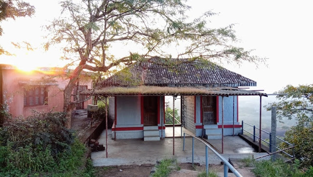


.jpg)


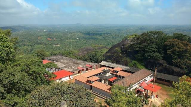
.jpg)


.jpg)


.jpg)

.jpg)

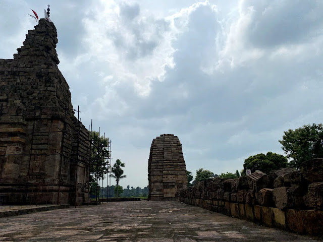

.jpg)
.jpg)
.jpg)


.jpg)
.jpg)
.jpg)


.jpg)
.jpg)
.jpg)


.jpg)
.jpg)
.jpg)
.jpg)


.jpg)

.jpg)
.jpg)


.jpg)


.jpg)


.jpg)


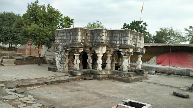

.jpg)
.jpg)
.jpg)
.jpg)
.jpg)
.jpg)

.jpg)


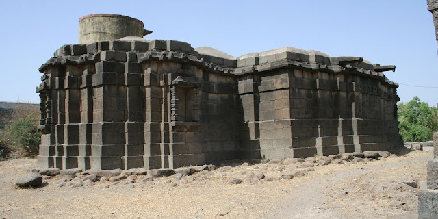


.jpg)
.jpg)


.jpg)


.jpg)
.jpg)

.jpg)


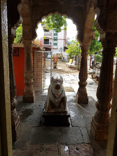

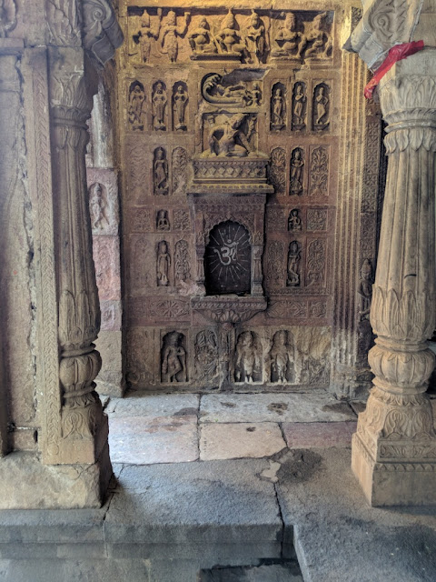

.jpg)


.jpg)

.jpg)

.jpg)


.jpg)


.jpg)

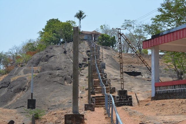

.jpg)


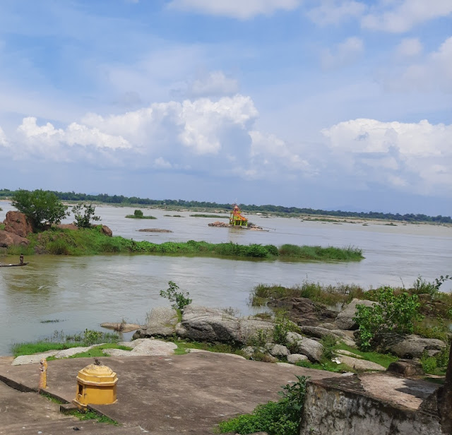


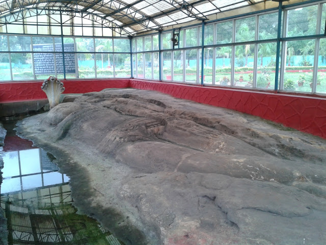

.jpg)
.jpg)


.jpg)


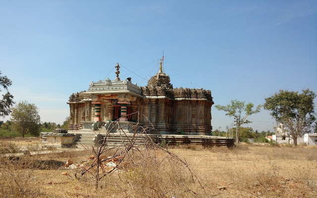
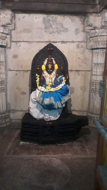


.jpg)

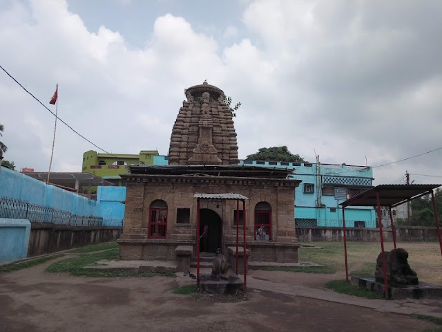

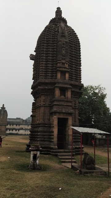
.jpg)


.jpg)
.jpg)


.jpg)


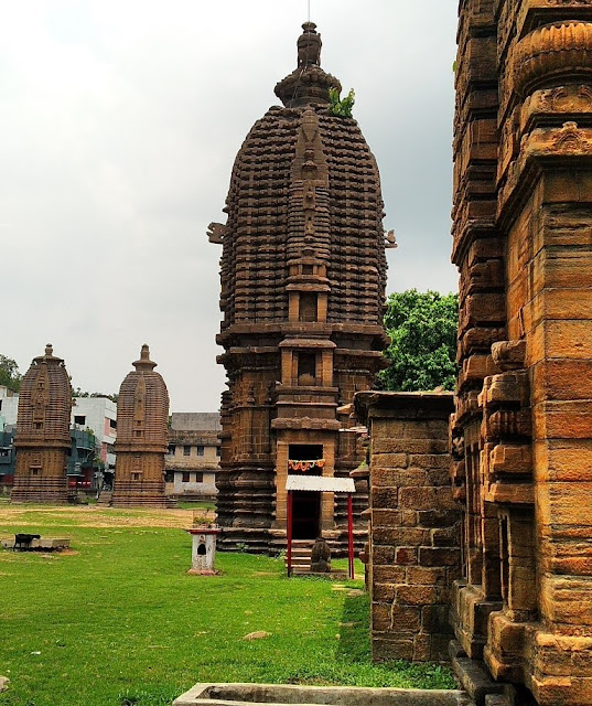

.jpg)

.jpg)
.jpg)


.jpg)
.jpg)

.jpg)


.jpg)
.jpg)
.jpg)
.jpg)
.jpg)
.jpg)
.jpg)

.jpg)
.jpg)
.jpg)
.jpg)

.jpg)
.jpg)


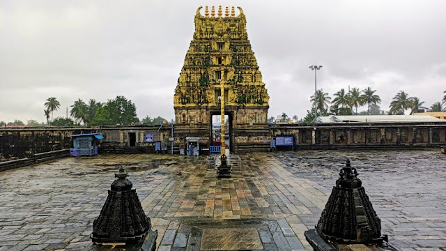


.jpg)

.jpg)
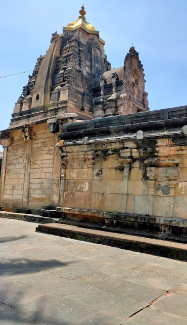


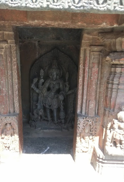
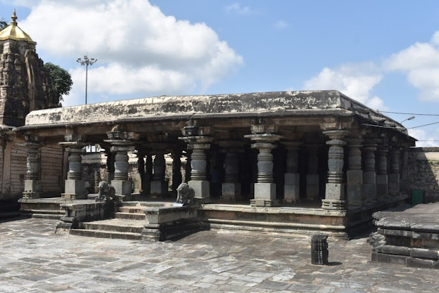


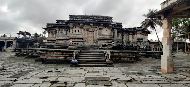


.jpg)

.jpg)


.jpg)
.jpg)
.jpg)


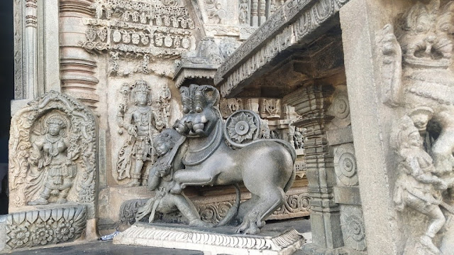


.jpg)


.jpg)
.jpg)


.jpg)

.jpg)

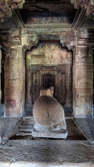

.jpg)
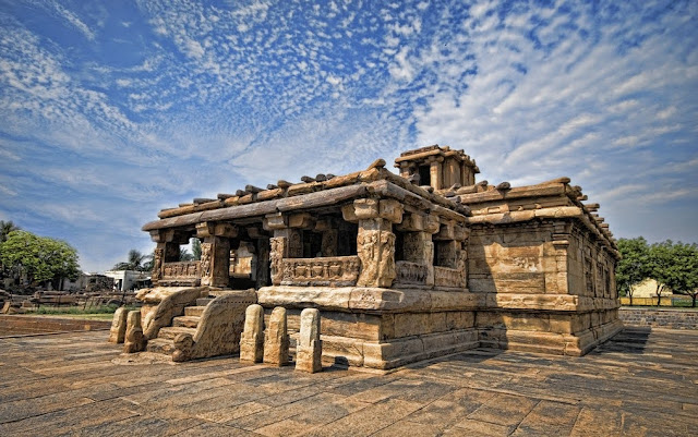
.jpg)


.jpg)
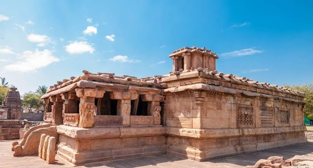

.jpg)

.jpg)

.jpg)

.jpg)
.jpg)
.jpg)
.jpg)


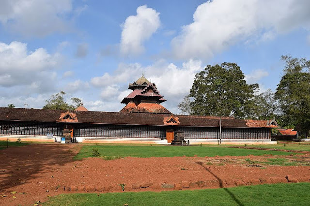


.jpg)


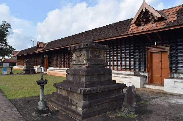
.jpg)


.jpg)
.jpg)


.jpg)
.jpg)
.jpg)

.jpg)
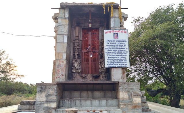


.jpg)


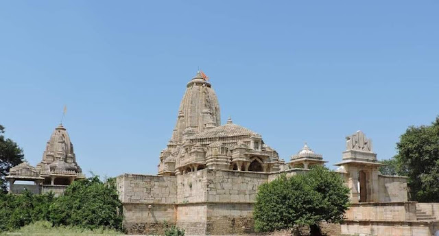

.jpg)


.jpg)
.jpg)
.jpg)
.jpg)
.jpg)
.jpg)


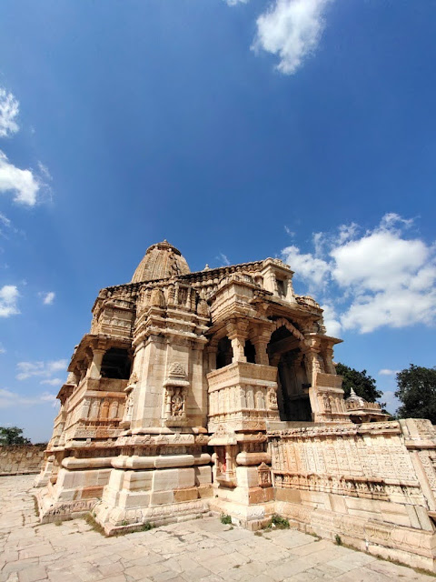


.jpg)
.jpg)
.jpg)

.jpg)


.jpg)
.jpg)


.jpg)
.jpg)


.jpg)


.jpg)


.jpg)


.jpg)
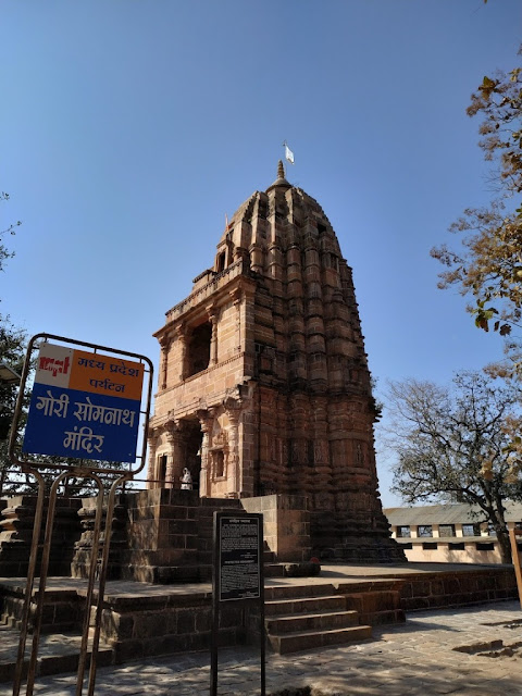


.jpg)
.jpg)
.jpg)
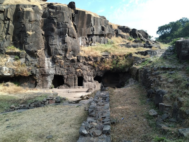
.jpg)
.jpg)
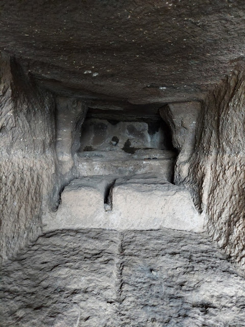
.jpg)
.jpg)
.jpg)
.jpg)


.jpg)
.jpg)


.jpg)
.jpg)

.jpg)
.jpg)
.jpg)
.jpg)
.jpg)

.jpg)


.jpg)
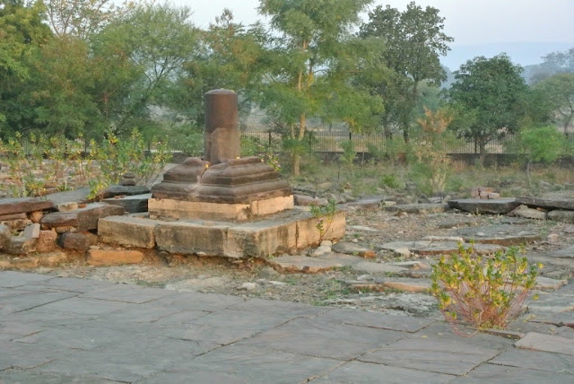
.jpg)
.jpg)
