Sri Tribhuvaneshwara Temple, Devagiri, Haveri
 |
| Sri Tribhuvaneshwara Temple, Devagiri |
 |
| Ruins Scattered |
 |
| Veeragallu Belonging to Chalukyan Era |

 |
| Sri Tribhuvaneshwara Temple |
 |
| The Front View |
 |
| Sri Basavanna Temple |
 |
| Shaiva Dwarapalaka and a Stone Inscription |
 |
| Navaranga, Antarala and Garbhagriha of Sri Tribhuvaneshwara Temple |
 |
| Lord Ganesha with Gandharvas on the Door Jamb |
 |
| Central Ceiling Decked with Lotus Flower Carving |
 |
| Makara Torana Attached to Hostilu of Mukhamantapa |
 |
| Part of Makara Torana |
 |
| Damaged Navagraha Panel with only 6 Remaining |
References:
1. Dharwad District Gazetteer - GOK

Forms of Lord Shiva, The Great Destroyer - Samharamurtis
 |
| Gajasurasamharamurti - Sri Mallikarjuna Swamy Temple |
"Samharamurtis"
are
one among the five classes of representation of Lord Shiva’s various aspects,
the others being the Anugraha-murtis (or boon-conferring aspects), the
Nritta-murtis (or dancing aspects), the Dakshina-murtis (or the yogic, musical
and philosophic aspects), and other minor aspects. Samharamurtis portray the
destructive or terrific aspects of Lord Shiva. Each form or image of Lord Shiva under
this aspect is indicative of the destruction of a particular maleficent and
troublesome being. The various forms comprised in Samharamurtis are
Kamantakamurti, Gajasuramsamharamurti, Kalarimurti, Tripurantakamurti,
Sarabhesamurti, Brahmasiraschchhedakamurti, Veerabhadramurti, Jalandharavadhamurti,
Mallarishivamurti, Andhakasuravadhamurti, Aghoramurti, and Mahakala.
The ‘Kamantakamurti’ illustrates Lord Shiva burning down and
destroying Kama/Manmatha, the god of love by opening his third eye and emitting
flames of fire which reduced Kama to ashes. Lord Shiva is portrayed in yogasana, with three eyes and four-arms. Kama lies standing before him accompanied by Devbhaga while his consort
Rati stands nearby along with Vasantha. Kamantaka’s mudras are pataka and suchi; his emblems are a drum and trident.
 |
| Kamantakamurti - Sri Mallikarjuna Swamy Temple, Basaralu |
The ‘Gajasurasamharamurti’ depicts the destruction of the
elephant demon Gajasura by Lord Shiva, who is depicted in a terrific form
dancing vigorously on the elephant’s head with the animal’s hide arranged behind
him like a prabhamandala (aureole). The right leg of Lord Shiva is planted firmly on
the elephant's head while the left is bent and lifted up towards
the knee of the other leg. He may hold a tusk, club,
dhatura flowers, alms-bowl, bell, drum, sword, skull-topped staff, antelope,
snake and spear.
 |
| Gajasurasamharamurti - Sri Hoysaleshwara Temple, Halebeedu |
The ‘Kalarimurti’ depicts the legend of Lord Shiva
punishing the god of death, Kala/Yama for attempting to kill Markandeya who was
a great devotee of Lord Shiva. Lord Shiva is seen as four armed, issuing from the
linga in front of which is the boy Markandeya kneeling with his arms folded on
his bent knees. One of the right and left hands of Lord Shiva grasp a stout handled
sharp trident aimed at Yama’s abdomen. The other right hand rests on the hip
(katyalambita hasta) and the left hand is held in vismaya pose. The right leg
of Shiva is buried up to the knee in the linga and the left leg is represented
as kicking Kala. Kalari’s emblems are a skull-cap, sword, shield,
antelope, axe, snake, noose, trident and vajra.
 |
| Kalarimurti - Dasavatara Cave, Ellora |
The ‘Tripurantakamurti’
depicts Lord Shiva destroying the
three asuras (demons) Vidyunmlali, Tarakaksha and Kamalaksha (sons of
demon
Tarakasura) who dwelt in three forts constructed of metals and caused
great
damage to the suras and the rishis (sages). Lord Shiva stands in a
chariot with his left leg kept forward and the right one behind; the
body of Shiva is turned
away form the objects aimed at, but his face and arms are turned in the
direction of the three castles which he is about to destroy. He seems to
have
had ten arms; those that still remain unbroken are seen carrying the
sword,
shield, arrow string in the bow-string and a bent bow. Lord Brahma is
driving the
chariot which is yoked to two horses.
 |
| Tripurantakamurti - Dasavatara Cave, Ellora |
 |
| Tripurantakamurti - Sri Kailashnath Temple, Ellora |
The ‘Sarabhesamurti’ depicts the slaying of Lord Narasimha by Lord Shiva in a fierce form,
part man, beast and bird, when Lord Vishnu refuses to abate his terrific
attitude after killing the demon Hiranyaksha (an ardent devotee of Lord Shiva) which was causing
damage to the inhabitants of the world. Sarabha is described as having eight
lion-like legs with sharp claws, a long tail and two wings of resplendent
beauty; the body above the loins should be that of a human being but having the
face of a lion which should be wearing a kirita-makuta upon its head.
 |
| Sarabhesamurti - Sri Airavateshwara temple, Darasuram |
The ‘Brahmasiraschchhedakamurti’ depicts the form Lord Shiva assumes
while cutting off the fifth head of Lord Brahma with his left thumb-nail. Shiva
is portrayed as three-eyed and four-armed with a jatamakuta on the head, and
wearing a makarakundala in the left ear and patrakundala in the right. In his
left hand are the shula (trident) and Brahma’s skull and the right hand are a
vajra (thunderbolt) and parasu (axe).
 |
| Brahmasiraschchhedakamurti - Srikanteshwara Swamy Temple, Nanjanagud |
The ‘Veerabhadramurti’ depicts the form Lord Shiva assumed
at the time of the destruction of the yagna (or sacrifice) of Daksha.
Lord Veerabhadra is depicted as three-eyed, four-armed, and with tusks protruding from
his mouth. He wears sandals and a jatamakuta, and is decked with garlands of
skulls, bells, scorpions and other ornaments, a yagnopavita (scared thread) of snake, and adorned with beautiful
anklets. He is seen carrying a khadga
(sword), khetaka (shield), dhanush (bow) and bana (arrow). In the
below photograph is seen an unusual and rare depiction of Lord Veerabhadra
having 5 faces and 12 arms, with Daksha Mahaprabhu standing besides him.
 |
| Panchamukhi Veerabhadra Swamy, Kurugodu |
The ‘Jalandharavadhamurti’
illustrates the destruction of the demon Jalandhara by Lord Shiva. Lord
Shiva is depicted as
three-eyed and two-armed; holding an umbrella in his right hand and a
kamandalu or a water-vessel in his left. He is adorned with kundalas
(earrings) in the ears, haaras (necklaces) on the neck, anklets on his
legs, with his feet resting on a pair of sandals. The posture of Lord
Shiva is indicative of his desire to move quickly.
 |
| Jalandharavadhamurti - Srikanteshwara Swamy Temple, Nanjanagud |
The ‘Andhakasuravadhamurti’ depicts the destruction of the demon Andhakasura by Lord Shiva. He carries a trishula (trident) at the
end of which is pinned the body of Andhakasura and from it blood drops down
into a cup held by the goddess Yogeshwari (Kali). In the below picture, he is
seen with 14 arms with Lord Nandi on his right. He may hold a drum, rosary, chisel,
trident, spear, staff with a pierced head, bow, arrow, noose, and a
thunderbolt.
 |
| Andhakasuravadhamurti - Sri Hoysaleshwara Temple, Halebeedu |
References:
1. Elements
of Hindu Iconography Vol II Part I – T.A.Gopinath
2. The Illustrated dictionary
of Hindu Iconography – Margaret Stutley
Related Posts:
The Tamarind Trees of Koongal Betta
 |
| Tangy and Tasty Tamarind Fruits |
 |
| Koongal Hill |
 |
| Tamarind Tree of Koongal Betta |
 |
| Traditional Way of dehusking Tamarind Fruits |
 |
| Lord Ganesha |
 |
| Road Way Up |
 |
| Life! Finds Its Way |
 |
| A Lovely Walkway |
 |
| Entering The Tamarind Tree Groove |
The real climb starts from here as the route turns a bit steep and
narrow. In a short while we reached a place where there was a big murti
of Lord Nandi/Basavanna. We rested under its shade for sometime after
offering prayers. Continuing our trek hereon, we entered a cave at the
exit of which were rock cut steps leading to a small temple dedicated to
Lord Anjaneya Swamy (Maruti). The murti seemed to belong to around 18th
century. The forest department has built a small view point where we
spent some time. During our descent we sighted some ruins of the fort
remains, though not much. We reached the area dedicated to the tamarinds
trees and were tempted to collect the fallen tamarind. We collected the
the fallen tamarind fruits as much as possible and carried it safely
till we reached our vehicle.
How to reach Koongal Betta: From Bangalore travel till Ramanagara
on Mysuru highway, enter Ramanagara town and take the Muduwadi road
till Koongal. Koongal is about 60 km from Bangalore and 8 Km from
Ramanagara.
Related Posts:
 |
| The Hike |
 |
| Nandi Murti |
 |
| Inside the Cave |
 |
| Lord Maruti |
 |
| Panoramic View |
 |
| Nandi Murti, Rock cut steps and Maruti Temple |
Related Posts:
A Unique and Rare Chalukyan Temple, Angur/Angoor, Ballari
 |
| Sri Kalleshwara Swamy Temple, Angur |
 |
| Beautifully Executed Seven Banded Door Jamb |
 |
| Note the Kirtimukha on the Vestibule of the Temple |
 |
| Lord Kalleshwara Swamy |
 |
| Lord Surya |
 |
| Lord Janardhana |
 |
| Beautiful and Rare Murti of Alingana Chandrashekaramurti |
 |
| Rathi-Manmatha |
 |
| Lord Daksha Mahaprabhu with Consort Prastuti |
 |
| 5 banded Door Frame of Garbhagriha |
 |
| Saptamatrikas |
 |
| Nandi Murti |
 |
| Veenadhari Shiva |
 |
| Mahishasura Mardini |
References:
1. A book " Temples of Karnataka" by Dr K M Suresh
Related Posts
1. Top 100 Lesser Known Temples of Karnataka
2. Sri Kalleshwara Swamy Temple, Hire Hadagali
3. Sri Galageshwara temple, Galaganatha
Sri Dattatreya Temple, Chattarki, Vijayapura
'Sri Dattatreya Temple' of Chattarki is one among the few
Vaishnava temples built by the Kalyani Chalukyas. Chattarki is a small
nondescript village in the Vijayapura/Bijapur district of Karnataka
state. Vijayapura is a treasure trove of many lesser known temples built
during the Kalyani Chalukya period, of which most are dedicated to
Shaiva. Only 2 of the many temples built by the Kalyani Chalukyas in
Vijayapura are dedicated to Vaishnava, the Sri Dattatreya Temple at Chattarki and the Sri Narasimha Swamy Temple
at Vijayapura. The Dattatreya temple was built in the 12th century as
per one of the inscriptions found here, which also refers this place to
be an agrahara and a center for sculptural art and temple.
Reaching Chattarki is not easy due to the limited availability of
public transport. We had to hire an auto from Devara Hippargi to reach
Chattarki. It is sad that the roads were devoid of any signage directing
us to this temple and the final stretch of road too is in a pretty bad
condition. However on reaching, it felt good to see an enclosure in the
form of a compound wall for protecting the temple. As I entered the
temple complex, I wondered about how such a beautiful gem could lay
hidden from the outside world. The temple is protected under the ASI,
who have done a fair job in the temple's restoration and maintenance
works. On interaction with the with the temple's priest cum caretaker,
I realized that not many people visit this temple which is why he was
surprised that I came all the way from Bangalore. He went on to inquire
if I was involved in any research related to that temple and its
architecture, for which I replied that my visit here was only out of
personal interest!
 |
| Sri Dattatreya Temple, Chattarki |
 |
| Full View of Sri Dattatreya Temple |
 |
| Skillfully Carved Mukhamandapa |
 |
| Beautifully Decked Mukhamandapa |
 |
| One of the Pilasters of the Navaranga |
 |
| Floral Carving on the Bhuvaneshwari |
 |
| Celestial Scenes |
 |
| Dancing Madanikas Accompanying Lord Shiva |
 |
| The Mesmerizing Pose of Madanikas |
 |
| Lord Vasudeva with Lord Brahma |
 |
| A Hero Killing Lion |
 |
| Goddess Chamundi |
This temple consists of a garbhagriha, an antarala, and a sabhamandapa
with mukhamandapa on three directions. The garbhagriha houses a murti of
Lord Dattatreya on a high peetha, while the original murti of Lord
Vishnu seems missing. The antarala is open, with two decorated circular
pilasters. The sabhamandapa stands on four central pillars and twelve
corresponding pilasters set against the walls. The central ceiling here
has a beautiful carving of an inverted lotus bud with miniature
sculptures. This temple has some fine carvings of sculptural beauty on
its outer walls. Majority of these carvings depict Madanikas in
different moods and action which are comparable to the Hoysalan style.
There is a structure opposite to this temple that seems to belong to
another temple about which the care taker had no idea. This temple too
carries fine carvings similar to the Dattatreya temple.
Places to Visit Around Chattarki: Vijayapura, Devara Hippargi, Indi, Sindigi, and many such.
How to reach Chattarki: Chattarki is about 35 km from Vijayapura, located off the Devara Hippargi - Indi Highway, about 13 km from D Hippargi.
Accommodation: There are no options for accommodation at Chattarki. It is better to treat Vijayapura as the base which offers various options to suit one's budget.
 |
| Ruined Temple with Damaged Carvings of Lord Vishnu and Madanikas |
 |
| Framed |
Places to Visit Around Chattarki: Vijayapura, Devara Hippargi, Indi, Sindigi, and many such.
How to reach Chattarki: Chattarki is about 35 km from Vijayapura, located off the Devara Hippargi - Indi Highway, about 13 km from D Hippargi.
Accommodation: There are no options for accommodation at Chattarki. It is better to treat Vijayapura as the base which offers various options to suit one's budget.
References:
1. Book on 'Temples of Karnataka' by Dr K M Suresh
BuyMaps
Related Posts
1. Top 100 Lesser Known Temples of Karnataka
2. Temples of Hale Kurugodu, Bellary
3. Sri Kalleshwara Temple Ambali, Ballari
1. Top 100 Lesser Known Temples of Karnataka
2. Temples of Hale Kurugodu, Bellary
3. Sri Kalleshwara Temple Ambali, Ballari
Sri Basaveshwara Temple, Hallur, Bagalkot
 |
| Sri Basaveshwara Temple, Hallur |
 |
| Full View of Sri Hallur Basaveshwara Temple |
 |
| Nandi Mandapa |
 |
| Lord Basaveshwara |
 |
| Shaiva Dwarapala |
 |
| Dravidian Shikara |

 |
| Inscription Stone Slab |
 |
| Bhu Varaha Swamy |
 |
| Ardhanareshwara and Gajasurasamhara Murti |

Places to Visit Around Hallur: Kudala Sangama, Badami, Aihole, Pattadakal, Banashankari, Bewoor, Mahakoota, Shivyogi Mandir, Gudur and many such.
How to reach Hallur: Hallur is located of f the Bagalkot - Kudala Sangama State Highway and is about 18 km from Bagalkot.
Accommodation: There are no options for accommodation at Hallur.
It is better to treat Bagalkot as the base which offers various options
to suit one's budget.
References:
1. Book on 'Temples of Karnataka' by Dr K M Suresh
ExploreChurches
2. Bombay Gazetteer of Bijapur
1. Top 100 Lesser Known Temples of Karnataka
2. Melguti Jain Temple, Aihole
3. Kalleshwara temple, Bethuru
P.S: Nothing changes except our web address! We are moved from www.teamgsquare.blogspot.in to www.teamgsquare.com
Melgudi Jain/Jaina Temple, Hallur, Bagalkot
'Hallur' is a nondescript village located in the district of
Bagalkot, off the Bagalkot - Kudala Sangama highway and can undoubtedly
be considered as unusual and unique. Bagalkot, the Badami Chalukyan
heart land is home to numerous temples built by the Cholas and
Rashtrakutas around the 8th and 9th centuries AD. During one of my
visits to Bagalkot, I got an opportunity of visiting the ancient temples
of Hallur town. It was fascinating! The two prominent historic temples
among them are those dedicated to Lord Basaveshwara built in 8th century
by the Cholas and a Jain temple (popularly called Melgudi Jaina temple)
built in 9th century by the Rashtrakutas. Hallur is located about 18 km
from Bagalkot. Reaching this place was an easy task and as we reached,
both the temples were easily visible.
We chose to visit the Melgudi Jaina temple at first which is located
atop a small hillock, thus giving it the name Melgudi. The temple is
built on similar lines with the Meguti Temple at Aihole
(7th century, Badami Chalukyas) with the only difference being that the
navaranga here is a closed one. The Melgudi Jain temple was built
around 870 AD during the reign of the most famous Rashtrakuta king,
Amoghavarsha. This beautiful sandstone temple consists of a garbhagriha,
an antarala and a navaranga/sabhamandapa, with an interesting stone
ladder leading to the first storey that housing a small garbhagriha. The
garbhagriha is originally believed to have consisted of a murti of a
Jaina Tirthankara. However the temple now enshrines a Shiva Linga and
Nandi along with a damaged inscription at its entrance which probably
carried details of the installation of the same. The temple having been
dedicated originally to a Jaina Tirthankara even now houses a murti of
the same which is kept in the sabhamandapa. But with no details with
regards to why and when the original Jain temple was converted into a
Shiva temple, the temple's history still remains a mystery. However,
the inscriptions may have carried information regarding the same, but
it sadly remains damaged.
I climbed the small stone ladder that opens to the first storey only to
find an empty garbhagriha. Being awestruck witnessing this small gudi
(temple), I could only imagine as to how grand it would have been back
then, during its full glory. That said, I strongly believe that my
imagination would any day fall short of its true glory. After coming
back to reality, I got down the ladder and decided to explore the
external features of this temple. There are a total of 8 life-size
carvings of various Jaina Tirthankaras on the outer walls of the temple.
There are different kinds of Jalis (perforated stone windows) fixed in
the outer walls. The details of the kutas (miniature shrine motifs),
salas (oblong members with a wagon shaped roof), panjaras (shallow
niches formed by pilasters) and makara toranas are unfinished.
While closely observing the outer walls, I was dumbstruck to sight
prehistoric kind of carvings on them! They were quite intriguing!
Although I was able to identify many carvings such as those of the
bulls, people and scenes of hunting, I have never witnessed something
like this before and was unable to believe my eyes. The carvings here
were pretty much similar to the ones at Sanganakallu.
On further visual investigation as to whether these carvings belonged
to the prehistoric period or not, I tried to trace the carving between
two stones of the wall and found them to be discontinuous. Thus
revealing that the carvings were made much before this temple was built.
Sadly, a few insensitive idiots have tried to disfigure these carvings
by their senseless graffiti. Thanks to god that some of these carvings
have remained intact. I was unable to find much of literature/details
about this temple. Once I was back in Bangalore from this trip, I
re-looked at all the photographs taken by us during our previous visits
to Badami, Pattadakal and Aihole.
On careful observation and with a keen eye for detail, I found one of
the pictures of Pattadakal having similar carvings of bulls and the only
feeling I got was 'Wow'! Probably back then in October 2010, we were
not versed with the prehistoric times and hence did not go ahead with
the search for such carvings around with interest. However, may be
during our next visit to this place, we would end up finding more about
these carvings and many such! It is truly mysterious to have found such
carvings on the temple
walls and to further ascertain whether they are really prehistoric or
not is very difficult at present. However the same can be achieved and
confirmed by a thorough and proper investigation and documentation.
 |
| First Look of Melgudi Jain Temple, Hallur |
 |
| Melgudi Jain Temple, Hallur, Bagalkot |
 |
| Inside the Garbhagriha |
 |
| Three Lotus Carving on the Central Ceiling |
 |
| Murti of Jaina Tirthankara in the Navaranga |
 |
| Small Gudi on the First Storey |
 |
| Jali Window |
 |
| Life-size Jaina Tirthankaras are Carved on the Outer Walls |
 |
| Another View of the Melgudi Jain Temple |
 |
| Detailing on the Outer walls |
 |
| Southern Wall of the Temple |
 |
| Carving of a Bull |
 |
| Proof of All the Vandalism and Ever Vanishing Evidences of Our History |
 |
| Bull Carving from Pattadakal |
A Trek to Posadigumpe Hill of Dharmathadka, Kasaragod
'Posadigumpe Hill' is one of the many offbeat places around the
district of Kasaragod in Kerala. Posadigumpe is popular among the locals
for its picturesque and panoramic 360 degree views of its surroundings.
The highest point of the hillock is about 490 m above sea level. Over a
general discussion, a cousin of ours came up with an idea of trekking
to the Posadigumpe hill to see the mist engulfing the hill. On the next
day which was the first day of year 2018, I along with two of my
cousins headed towards Posadigumpe early in the morning. We took the
longer route via Kumbla as I had traveled through this route a few years
back.
We reached the hill and found that there was no mist, but we decided to
trek the hill to catch the sunrise. We climbed a few steps and got a
good view of the surrounding hills and realized that except the main
hill, almost all the other surrounding hills were engulfed in mist/fog.
What a sight it was! and What a perfect way to begin our new year! It
was a short and easy trek. We reached the hill top and waited for the
sun to rise. The beautiful red sun was lazy to come out of the clouds
and finally showed us his face. It was a sight to behold! We spent
sometime at the peak and tried experimenting on a few interesting photo
ops. Thus spending the first morning of 2018 in an eventful manner.
 |
| Sun Playing Hide and Seek |
 |
| Sunrise over the Posadigumpe Hill |
 |
| A Panoramic View from the Peak of Posadigumpe Hill |
 |
| Have This Perfectly Shaped Ladoo... |
 |
| That's a Goal! |
 |
| In...It Goes! |
How to reach Posadigumpe from Kasaragod: There are many routes from Kasaragod - the shorter and the best one being via Maipady, Seethangoli, Permude to Posadigumpe. It is about 26 km from Kasaragod.
How to reach Posadigumpe from Mangalore: The best route from Mangalore is via NH 66. Take a right turn at Mangalapady, Permude to Posadigumpe. It is about 50 km from Mangalore.
Places to Visit Around Posadigumpe: Permude/Posadigumpe Waterfalls, Bekal Fort, Ananthapura Lake Temple, Kumbla Fort, Pooval Fort, Neelikunnu Beach, Kapila Beach, Madhur Sri Ganesha Temple, Kanva Thirtha Beach, Manjeshwara and many such.
Gooty Fort, Anantapur - Oldest Fort in Andhra Pradesh
 |
| Gooty Fort, Oldest Fort in Andhra Pradesh |
 |
| British Cemetery, Gooty |
 |
| Climb to the Mighty Fort of Gooty |
 |
| Fortification of Gooty |
 |
| View of the Top Tier of Gooty Fort |
 |
| Inside British Colony |
 |
| British Colony, Gooty Fort |
 |
| The Strong and Complicated Fortification of Gooty |
 |
| Fort Walls Snaking Through the Hills of Gooty |
 |
| One of Many Water Ponds Here |
 |
| Pillars of the Gateway Belonging to Vijayanagara Period |
 |
| Gooty Fort |
 |
| Fort Walls |
 |
| Carvings of Goddess Mahishasura Mardini and Lord Ganesha Belonging to Badami Chalukyas |
 |
| 6th Gateway |
 |
| Pillar of the Gateway Belonging to Kalyana Chalukya Style of Architecture |
 |
| Lord Kote Anjaneya |
 |
| Top Tier of Gooty Fort |
 |
| Water Pond |
 |
| Royal Enclosure of Gooty Fort |
 |
| Palace of the Kings and Queens, Gooty Fort |
 |
| King Murari Rao's Seat and View From Here |
 |
| A Discarded Yet Beautiful Kalyani at the Hill Base |
Places to Visit Around: Guntkal, Bellary, Tadpatri, Madakashira, Lepakshi, Belum Caves, Yaganti, Gandikota, Alampura, Gudibande, Ratnagiri, Rayadurga, Kalyandurga and many such.
References:
1. Kannada Inscriptions of Andhra Pradesh, A Book Edited By Dr.C.S.Vasudeva
2. Indian Vagabond
3. Shodhganga
Related:
1. Udayagiri Fort, Nellore
2. Krishnagiri Fort
3. Channarayyana Durga Fort
References:
1. Kannada Inscriptions of Andhra Pradesh, A Book Edited By Dr.C.S.Vasudeva
2. Indian Vagabond
3. Shodhganga
Related:
1. Udayagiri Fort, Nellore
2. Krishnagiri Fort
3. Channarayyana Durga Fort
Temples of Hale Kurugodu, Ballari
'Hale (Old) Kurugodu' was earlier a village of Kurugodu
during the rule of Sindhs, which later got shifted from here to the
east, in its current location. This place today stands a mute spectator
to its history and the events that took place here. There are many
temples here, most of which are in ruins today. It is hard to imagine
the grandeur of this town in the bygone era. The majestic hill fort,
the grand temples and cave temples here serve as a testimony to what a
small yet significant dynasty could achieve in a short time. There are
more than 10 temples built during their period that have survived the
test of time, significant among them are,
1. Chikka Basavanna Temple: This temple is located about 2 km
from the main village and is dedicated to Lord Basavanna (Nandi). This
murti of Basavanna is facing Lord Shiva, located on the hill of
Kurugodu. This temple was built in 12th century, with only garbhagriha
and a part of the Navaranga remaining today. This temple is located in a
calm and serene location and we spent quite a good time here.
2. Sri Veerabhadra Cave Temple: Sri Veerabhadra cave temple is
located in the interiors of the hills. We had to drive across a few
quarry vehicle routes to reach these isolated caves. There are 2 caves
here, one dedicated to Sri Veerabhadra with Sri Daksha Maharaja and the
other to Lord Shiva. There is a Kannada inscription in front of these
caves.
3. Jain Cave Temple: A small cave probably dedicated to Jain
Tirthankaras and remains incomplete due to change of rule here. These
carving date to 9th - 10th Century, before Kurugodu Sindhs taking over
this place.
4. Sri Mallikarjuna Swamy Temple: Sri Mallikarjuna Swamy temple
was built by Kurugodu Sindhs in the 12th century. It is now in a ruined
state with all the vandalizing done by our generation. The temple
consists of a garbhagriha, an antarala and an open sabhamandapa.
5. Sri Sangameshwara Temple: Sri Sangameshwara temple is the
grandest of all the surviving temples here. This huge temple was built
in the 13th century, with later additions by the Vijayanagara kings in
16th century. This temple consists of garbhagriha, an antarala, a
pradakshinapatha, an open 60 pillared mahamandapa and a mukhamandapa.
The temple is dedicated to Lord Shiva in the form of a Linga. It was
good to see that this temple was live and people were performing pujas
and offering prayers here.
 |
| Chikka Basavanna Temple, Kurugodu |
 |
| Lord Veerabhadra Swamy With Daksha Maharaja |
 |
| Cave Temple, Kurugodu |
 |
| Inscriptions in front of Veerabhadra Swamy Cave Temple |
 |
| Incomplete Carvings of Jain Tirthankaras |
 |
| Sri Mallikarjuna swamy temple, Kurugodu |
 |
| Sri Sangameshwara Temple, Kurugodu |
 |
| Veeragallu |
 |
| Srisaila Mallikarjuna Swamy Temple, Kurugodu |
 |
| Sri Siddeshwara Temple, Kurugodu |
8. Sri Rachamalleshwara Temple: Sri Rachamalleshwara temple is a
trikuta temple built in 1177 AD by the Kurugodu Sindhs. This temple is
dedicated to Lord Shiva, housing Lingas in all its three garbhagrihas
and are named Gavareshwara, Mallikarjuna and Muddeshwara. The temple was
renamed as Rachamalleshwara due to the belief that the strongest
of the Kurugodu Sindhs, Chief Rachamalla transformed into a Shiva Linga
post his death, here in the temple. It is a pity that this temple today
is in ruins.
 |
| Sri Rachamalleshwara Temple, Kurugodu |
 |
| Lord Rachamalleshwara |
9. Murugudi Temple Complex: This temple complex comprises of 4
temples, all of which are dedicated to Lord Shiva in the form of a
Linga. Two out of these temples are live with regular worships, while
the other two are in ruins. The main temple here consists of a
garbhagriha, an antarala, a sabhamandapa and a mukhamandapa.
 |
| North Temple, Murugudi Complex |
 |
| South Temple, Murugudi Complex |
 |
| Dodda Ganesha |
To be continued...
Kurugodu, Bellary - Fort, Prehistoric Paintings and Ancient Temples
 |
| A Panoramic View of Kurugodu Fort, Town and Hills |
 |
| A Bird's Eye View of Shiva Mandapa |
 |
| Kurugodu Fort Walls |
 |
| Bird's Eye View of Hale Kurugodu |
 |
| Tungabhadra Canal Traversing Across Paddy Fields |
 |
| Kurugodu Fort |
 |
| Balancing Rock inside Kurugodu Fort |
 |
| An Inscription Outside Lord Anjaneya Temple |
 |
| Lord Anjaneya |
 |
| Balancing Act by Rocks |
 |
| Lord Anjaneya Temple and Fort Walls |
 |
| Lord Shiva |
 |
| Prehistoric Rock Shelter, Hale Kurugodu |
 |
| Prehistoric Cup-marks |
 |
| Painting Depicting Hyena |
 |
| Unidentifiable Cave Paintings |
Related Posts:
Rock Carvings of Usgalimal
Gudekote, Bellary - Cave Paintings, Fort and Bear Sanctuary
 |
| Exploring Gudekote Fort with our Young Trekker |
 |
| Four of the Five Hills surrounding Gudekote as viewed from the Doregala Hill |
 |
| Bird's Eye View of Gudekote |
 |
| The Initial Climb |
 |
| The Young Trekker Growing out of Shadows |
 |
| Cave Paintings |
 |
| Cave Paintings and The Rock Shelter |
 |
| Gudekote Fort |
 |
| 2nd Fort Gateway of Gudekote |
 |
| Dried Stepped Well Inside Gudekote Fort |
 |
| Another Dried Stepped Well |
 |
| Unique Carving |
 |
| Ruins Inside Gudekote Fort |
 |
| Store House Probably Built by the British |
 |
| Tangalli Mahal |
 |
| Prehistoric Rock Shelter With Paintings |
How to reach Gudekote: Located on the Bellary - Kudligi road, it is about 60 km from Bellary and 30 km from Kudligi.
Accommodation: There are no options available for accommodation
in Gudekote. One can stay at Kudligi which has limited options, however
the best would be to find a stay in Bellary overnight. Our usual place
of halt is Hotel Ashoka Residency with an affordable budget.
Places to Visit Around Gudekote: Sandur, Kudligi, Kotturu, Ujjaini, Brahmagiri, Ashoka Siddapura, Jatinga Rameshwara, Sanganakallu, Bellary, Hampi, Nayakanahatti, Kumathi, Hulikunte and many such.
References:
1. Book on "Ballari Jilleya KotegaLu" By Dr.M.Kotresh
2. Journeys Across Karnataka
Related Posts:
1. Channarayana Durga Fort
2. Ambajidurga Fort
3. Kavaledurga Fort
4. Rock Engraving of Usgalimal
Places to Visit Around Gudekote: Sandur, Kudligi, Kotturu, Ujjaini, Brahmagiri, Ashoka Siddapura, Jatinga Rameshwara, Sanganakallu, Bellary, Hampi, Nayakanahatti, Kumathi, Hulikunte and many such.
References:
1. Book on "Ballari Jilleya KotegaLu" By Dr.M.Kotresh
2. Journeys Across Karnataka
Related Posts:
1. Channarayana Durga Fort
2. Ambajidurga Fort
3. Kavaledurga Fort
4. Rock Engraving of Usgalimal
Moonbow at Unchalli Waterfalls, Sirsi
 |
| Unchalli Waterfalls |
 |
| Note the Faint Moon Bow |
 |
| Chandra Dhanasu, Unchalli Falls |
 |
| Moon Over Unchalli Falls |

I, along with my friends reached the house of the local friend around
6.45 pm that evening. Taking a moment to refresh, we quickly started our
walk towards the view point of the waterfalls. Though that night was a
half-moon night or Ashtami Chandra, the falls was clearly visible and we
were enjoying our moonlit descent towards the view point. We made sure
to be well equipped with torches to help us descend. The view from the
watch tower was just splendid! The scene is indescribable in words or
sentences! It would easily convert any normal man into a poet. But I
instead chose to photograph this spectacular scene, which was quite
difficult due to the dim light. After a lot of trials, I managed to get
a couple of decent shots of the waterfall. While I zoomed in to take a
look at the picture, I was shell shocked to see that we had additionally
captured a Moonbow! A quite faint rainbow it is, but is yet so exciting
to realize that very few people in Asia have ever been able to witness
and capture it. Thoroughly and unbelievably excited I was! Holding the
same excitement on reaching home and transferring the pictures to my
system, I had a closer look just to reassure it was a Moonbow. I was
happy that we were able to capture it on camera. Thus making Unchalli
closer and dearer to us. Don't miss to stop by a short video tour on
Unchalli waterfalls.

Our humble request to all is 'Please take prior permission from the concerned authorities before heading into the forest area during nights as it comes under reserve forest area'. Also, entry to the falls is prohibited after 6 pm. Remember not to litter the place and leave it as it is for others and future generations to enjoy.
 |
| Descent to the Falls |

 |
| Unchalli Waterfalls |
Our humble request to all is 'Please take prior permission from the concerned authorities before heading into the forest area during nights as it comes under reserve forest area'. Also, entry to the falls is prohibited after 6 pm. Remember not to litter the place and leave it as it is for others and future generations to enjoy.
You can also read one of our experiences at this waterfalls here.
References:
1. Times of India
2. Landscape Wizards
3. Time and Date
Related Posts:
1. Neelakurinji - A rare bloom
2. Dandeli - Resting in the lap of Nature
3. Biking in heaven, Kodagu
References:
1. Times of India
2. Landscape Wizards
3. Time and Date
Related Posts:
1. Neelakurinji - A rare bloom
2. Dandeli - Resting in the lap of Nature
3. Biking in heaven, Kodagu
The earliest human settlements of South India: Sanganakallu and Kappagallu, Ballari
 |
| Dolerite Dyke, Sanganakallu |
 |
| Hiregudda, Sanganakallu |
 |
| Destroyed Ash mound |
 |
| Musical Rocks, Sanganakallu |
 |
| Natural Blasting of Rocks |
 |
| Ghante Rock |
 |
| Bulls Everywhere |
 |
| Three Horned Bull |
 |
| Carving of Waterbird |
 |
| Panchayat/ Court Hall |
 |
| Bull Axe Wheel Carving |
 |
| Carving of Long Horned Sambar Deer |
 |
| A Prehistoric Rock Music Instruments |
 |
| Carvings of Barasingha, a Few Aroused Men and Erotic Scenes |
 |
| Wow What a Scene ! |
 |
| Nandikeshvara Kamasutra Panel |
Carving of a Leader along with his Disciples.
 |
| Our Guide Sri Ramadasa and in the Background is a Carving of Leader along with his Disciples |
 |
| Carvings of Hand and Foot Impressions |
 |
| Maduve Yantra |
 |
| Carving of Lajja Gauri |
 |
| Pitlappa Temple, Sanganakallu |
 |
| Prehistoric Scribble Pad, Sanganakallu |
 |
| Carving of a 6 Bull-Axe Wheel |
 |
| Carving of a Pack of Dogs |
 |
| Kappagallu Ash Mounds |
 |
| Cave Paintings, Birappa Rock Shelter |
References:
1. Wikipedia
2. Megalithic
3. Journeys Across Karnataka
Related:
1. Chandravalli Cave Pre-historic Site
2. Dolmen Circles of Doddamalathe
3. Prehistoric Anthropomorphic Statues of Kumathi
A Short Trek to Krishnagiri Fort, Tamil Nadu
 |
| A Bird's Eye View of Krishnagiri Town |
Krishnagiri is one of the large towns of Tamil Nadu and is the district head quarters. It is located on the Bangalore - Chennai Highway. Having traveled this highway many times, we have always eyed on exploring the Krishnagiri fort, which is clearly visible from the highway. 'Krishnagiri' gets its name from a hill here, on which the Vijayanagara king Krishnadevaraya built the fort. This fort may have been a military outpost kind of fort, which was built to house a section of army to protect their kingdom. None of the structures built here by the Vijayanagara kings survive today apart from its fort walls. However, a few British structures and a Darga built during the rule of Hyder Ali is still seen today.
 |
| The Fort Walls of Krishnagiri |
 |
| 19th Century British Colony |

 |
| K R P Dam Surrounded by Hills |
 |
| Climbing Together |
 |
| Steps and Krishnagiri Town |
Last Sunday morning, we started early and reached the base of
Krishnagiri hill. Thanks to the rains due to which the entire area
looked green and was full of life! There were many small waterfalls
enroute to the fort. The steps laid here ensured a moderately easy climb
during such season. The trek was quite simple, except for two short
stretches which were a bit tricky, owing to slipperiness of the rocks.
Atop the hill, we were greeted by a ruined gateway from where there are
two diversions, the route on the left leads to a Darga and the other
leads us straight to the other remains of the fort. While we were
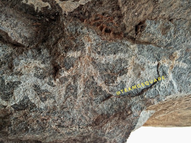
resting at this point and observing around, we sighted a prehistoric
cave settlement. Wow! We explored this small cave settlement and found a
few white colored paintings which were quite intriguing and similar to
the ones we found at Mallachandram.
Hereon we reached the summit of the fort. The terrain was perfect and I
spent some time learning to handle the flight of our drone better.
Being breezy, it was quite challenging to keep the drone stable during
flight although I tried my best. My effort in the form of a short video
is posted at the end of this post. Our descent was quick and we reached
the place were our vehicle was parked, thus ending another enticing
quest.

 |
| Slippery Path |
 |
| Rock Cut Steps |
 |
| The Young Trekker Leading The Path |
 |
| White Prehistoric Cave Paintings of Human and Birds |


Places to Visit around Krishnagiri: Mallachandram, KRP Dam, Rayakottai, Theni, Shoolagiri and many such.
How to reach Krishnagiri: Krishnagiri is well connected and
located on the Bangalore - Chennai national highway. It is about 85 km
from Bangalore and 280 km from Chennai.
References:
1. Wikipedia
Related Posts:
1. Drive to the Cape
2. The Rat Tail Waterfalls
3. Kolli Hills
References:
1. Wikipedia
Related Posts:
1. Drive to the Cape
2. The Rat Tail Waterfalls
3. Kolli Hills
A Winter Trek in the Western Ghats, Ballalarayana Durga Fort, Chikmagaluru
 |
| Kudremukha Hill Range in Monochrome |
 |
| The Initial Trek Path |
 |
| First Look of Ballalarayana Durga Fort |
 |
| Shola Forest of Ballalarayana Durga |
 |
| Break for the Little Trekker on Demand |
The walk through the grasslands was quite easy and very pleasing to the eye. Undoubtedly, we spent more time on photography then trekking! As the trek continued through the grasslands, we reached a junction with two diversions and after much deliberation, we decided to take the route on the left and bang on! We were on the right track. We had to cross a few smaller hills in order to reach the base of the hill that housed the fort. We had a clear view of the fort hereon. The early winter weather was perfect for this trek and as usual, this time of the year is always pleasant. We entered the fort wondering about the reason of its being built here in the first place, later only to be abandoned and why no further attempts were made by other kings to occupy/modify/rebuild this fort. Much of the fortification still remains intact giving us an idea of how magnificent it was, back then.
 |
| Trek Route Snaking Along the Grass Land |
 |
| Vigna vexillata Flower |
 |
| Neelakurinji Flower |

 |
| Another Stretch of Shola Forests |
 |
| Gaali Gudda Hills |
 |
| Towards Bandajje Arabi Waterfalls |
 |
| Cheering Up the Young Trekker |
 |
| Ballalarayana Durga Fort |
 |
| Fort Walls Snaking Across The Hills |
Other places to Visit nearby: Kalasa, Horanadu, Chikmagalur, Sooramane Abbi Waterfalls, Khandya, Mullayanagiri, Bababudanagiri, Kudremukha and many such.
How to reach Ballalarayana Durga: Cross Mudigere, proceed towards Kottigehara, take a right turn towards Kalasa and reach Sunkasale. Take a left turn here and proceed till you reach a dead end and take a left turn to reach the starting point of the trek. This village is located about 34 km from Mudigere and 312 km from Bangalore.
Accommodation: There are no accommodation facilities inside the village, although one can pitch their own tents inside the fort or village premises with prior permission of the villagers. However, there are many home stays in the area which also offer guided treks to this hill.
Where to eat: There are no eateries here; Kottigehara and Kalasa are the closest and better options.
Permission: Not required for this route. However, the trek through Bandajje Arabi waterfalls route requires prior permission, which can be obtained at Bandajje only. Also, guides are provided by the forest department.
Related Posts
1. A Monsoon Trek to Kavaledurga
2. Dandeli Resting in the Lap of Nature
3. Waterfalls of Agumbe
MP Diaries - Chausath Yogini temple - Bhedaghat, Jabalpur, Madhya Pradesh
While we were enjoying the sunset behind the Marble Rocks of Bhedaghat,
we realized that we were running out of time to visit the Chausath
Yogini temple here. We rushed back to our car and headed towards this
temple. Having visited a few Yogini temples such as that at Hirapur
(Orissa), Mitawali and Khajuraho,
we were excepting this to be along similar lines. The Yogini temples
generally are dedicated to the 64 Yoginis, housing 64 small shrines
enclosing a Yogini each and thus the name 'Chausath Yogini'. However,
this temple houses 81 small shrines along its periphery unlike the 64
celled temples. The word 'Chausath' means 64 in the language of Hindi
and 'Yogini' means the power of realization and the names given to the
demoness/ sorceress/ woman possessing magical powers. Goddess Durga
created these Yoginis to attend her and Lord Shiva. Also sometimes,
goddess Durga is also referred to as a Yogini. While one school of
thought says that all the 81 murtis here are Yoginis, the other assumes
they are the 64 Yoginis with associated Devi's, including the
Saptamatrikas. Originally being eight Yoginis, with other associations
they number as many as 64. They are said to have attained the form of
grama-devatas or are minor manifestations of goddess Durga.
Atop a hillock situated close by the Marble Rocks is the 'Chausath Yogini temple', built in the 10th century AD by the Kalachuri king Yuvarajadeva I. The temple is a circular structure with no roof. There are 81 cells/shrines at the periphery, out of which 64 are dedicated to the 64 Yoginis and the rest to other deities including the saptamatrikas. The murtis in most of the cells are either partially or completely damaged, with some being defaced. A board displaying the names of each is present below the murti, making the identification process a bit easier. At the middle of this enclosure is the 'Gauri-Shankar temple' dedicated to Lord Shiva and his consort Goddess Parvati. The garbagriha houses an idol of the couple deity riding on Nandi, the bull mount of Lord Shiva.
How to Reach Bhedaghat: Travel along Jabalpur - Bhopal highway
and turn left towards Bhedaghat. Drive along to reach the waterfalls and
temple, if driving from Jabalpur. It is situated at about 25 km from
Jabalpur.
Entry Fee: Entry is free to the temple.
Accommodation: Though we did not stay here, there are quite a a few options available for accommodation here. Hotel Marble Rocks maintained by the MPTDC on the banks of the river Narmada, one of the is best available here.
Where to eat: There are many eat-outs, including a few road-side eateries.
Related Posts:
1. Mitawali Chausath Yogini temple
2. Temples of Orchha
3. Bateshwar Group of Temples
 |
| Gauri Shankar Temple Inside Chausath Yogini Temple |
Atop a hillock situated close by the Marble Rocks is the 'Chausath Yogini temple', built in the 10th century AD by the Kalachuri king Yuvarajadeva I. The temple is a circular structure with no roof. There are 81 cells/shrines at the periphery, out of which 64 are dedicated to the 64 Yoginis and the rest to other deities including the saptamatrikas. The murtis in most of the cells are either partially or completely damaged, with some being defaced. A board displaying the names of each is present below the murti, making the identification process a bit easier. At the middle of this enclosure is the 'Gauri-Shankar temple' dedicated to Lord Shiva and his consort Goddess Parvati. The garbagriha houses an idol of the couple deity riding on Nandi, the bull mount of Lord Shiva.
 |
| Sri Sarvvatomukhi |
 |
| Sri Vibhatsa |
 |
| Sri Erudi (Horse Faced) |
Entry Fee: Entry is free to the temple.
Accommodation: Though we did not stay here, there are quite a a few options available for accommodation here. Hotel Marble Rocks maintained by the MPTDC on the banks of the river Narmada, one of the is best available here.
Where to eat: There are many eat-outs, including a few road-side eateries.
Related Posts:
1. Mitawali Chausath Yogini temple
2. Temples of Orchha
3. Bateshwar Group of Temples
5. MP Diaries
Tumkur Fort, Sri Ramadevara Betta, Kyatasandra
 |
| A View from Top of the Ramadevara Betta, Tumkur |
 |
| Entering The First Tier of The Fort |
Following the directions of the temple priest, we headed towards the
hill. The weather was perfect for climbing, not too hot, but cloudy and
breezy. We had to cross a small hillock before we reached the base of
the main hill, from where the actual trek began. The trek was wonderful,
with the entire hill range of Devarayanadurga being visible. After
climbing for some time, we reached the first tier of the fort or rather
the first surviving tier. As we climbed further, we reached an open
flat terrain where we were welcomed by a beautiful lotus pond filled to
the brim due to the recent rains. Hereon, the top most tier of the fort
was at a striking distance.
 We entered the last tier of the fort which had a small temple dedicated
to Lord Shiva in the form of a linga. Going by its architecture, the
temple seems to have been built in between the 9th and 11th centuries,
probably by the Hoysalas/Cholas/Gangas. It's close resemblance to the 'Rameshwara Temple of Kaidala',
situated very close to Tumkur in all likelihood indicates that these
temples were built during the same time. The temple structure has a
garbhagriha, an antarala and a navaranga. The Shikara is lost and many
portions of the temple are ruined and lay scattered. There is a small
mandapa close by to the temple where we rested and enjoyed eating our
packed food, ensuring to keep the premises clean. We later went around
exploring the surroundings and found a few ruins. We were able to spot
two caves, one of which had a perennial spring with a few Shiva lingas
while the other probably was a meditating/resting place of a sage. It
started to rain heavily by the time we reached this cave and taking
shelter in this cave, we wondered how someone could stay here, secluded
and away from the outside world.

 There are many interesting legends associated with this hill. As it is
believed that the Linga here was originally installed by Lord Rama
himself, the hill is called as 'Ramadevara Betta'. During the exile of
Lord Rama, he along with his wife Goddess Sita and brother Lord
Lakshmana stayed here for a brief period. Once during their stay, Lords
Rama and Lakshmana were away and Goddess Sita was having a bath. When
she heard them returning, she hurriedly went away from that place as she
dragged her Saree while draping it. The villagers here believe that the
mark present on the hill nearby the pond is that made by Goddess Sita
while dragging her Saree! Quite interesting it is! However, this story
may not be completely true, since Sita was kidnapped by Ravana in a
location somewhere in Maharashtra, and much before they entered
Karnataka. But then, the association with Lord Rama cannot be discarded
as there are many places in the surroundings which prove the same.
Though not much history of the fort is known, it seems to have been
built during the same time as the temple here, without undergoing any
later modifications. The fort must have either been 2 tiered originally,
which is quite unusual or it may be that the outer tiers failed to
survive the test of time to give us an exact picture. Our descent was
quick, though at a few places it was quite slippery due to the rains. We
were pleased to have done this trek.

 How to reach Tumkur Fort: Drive on NH 4 - Reach Kyatasandra -
Take a right turn towards Siddaganga Mutt - Cross the Mutt, drive
further and take a right at a brick kiln to reach the hill base, where
there is an Anjaneya temple.
 |
| The Beautiful Lotus Pond |
 |
| The Temple and Pond |
 |
| Inside the Top Tier of the Fort |

 |
| Ruins of Some Structure |
 |
| Arisaema sp. |


 |
| The Mark Made by Goddess Sita's Dragging of her Saree |


No comments:
Post a Comment
Note: Only a member of this blog may post a comment.