Mesmerizing Ladakh – Part 1: Manali to Leh, the most adventurous road trip in India
This is without doubt the most adventurous road trip in India, the
highway which connects the Manali town in the state of Himachal Pradesh
and Leh the erstwhile capital of the Himalayan kingdom of Ladakh, now
the Leh district of the state of Jammu and Kashmir (J&K). This
highway was designed, built and maintained entirely by the Boarder Roads
Organisation (BRO) of Indian Army. This highway plays a major role in
reaching the supplies to the Indian army units which are stationed in
the international border with China in the north and east and the Line
of Control along the Pakistani- administered territories of Azad Kashmir
and Gilgit-Baltistan in the west and north- west.
The highway is open for only about four and a half months in a year
during summer between end of May when the snow is cleared and to
Mid-October when the snow fall again blocks the passes. The highway has
an average elevation of more than 13,000 feet and its highest elevation
is 17,480 feet. It is flanked by mountain ranges on both sides featuring
some stunning sand and rock natural formations and breath taking
sceneries.
This 500 km highway crosses many small streams of ice-cold water from
snow-caped mountains without any bridges which demands driving skill to
negotiate fast-flowing streams. After passing the Rohtang Pass, the
landscape changes as this region lies in a rain-shadow and the slopes
become brown and arid. The highway is generally two lanes wide without a
road divider but has only one or one and a half lanes at some
stretches. This highway is very tricky due to many damaged stretches and
under maintenance portions, where little rainfall can cause landslide
making it very dangerous to cross that stretch of the road.
Travellers may experience acute mountain sickness due to high
altitude on this highway and is advised to stay at Manali one night and
minimum one night at either Keylong or Darcha to get acclimated to lower
oxygen levels. Travel time on this highway is unpredictable though
minimum three days are advised for ordinary tourists because the real
fun and pleasure is in the journey itself and not reaching the
destination.
Around Manali Town Around Manali TownOn the Manali-Leh Highway On the Manali-Leh HighwayOn the Manali-Leh HighwayOn the Manali-Leh HighwayOn the Manali-Leh HighwayOn the Manali-Leh HighwayOn the Manali-Leh HighwayOn the Manali-Leh HighwayOn the Manali-Leh HighwayOn the Manali-Leh HighwayOn the Manali-Leh HighwayOn the Manali-Leh Highway at MarhiOn the Manali-Leh Highway, between Marhi and Rohtang pass you can see paragliding activitiesOn the Manali-Leh HighwayOn the Manali-Leh Highway, rock formationsOn the Manali-Leh HighwayOn the Manali-Leh HighwayOn the Manali-Leh Highway, reaching Rohtang PassOn the Manali-Leh HighwayOn the Manali-Leh Highway, traffic jam at Rohtang passOn the Manali-Leh Highway, traffic jam at Rohtang passOn the Manali-Leh Highway, traffic jam at Rohtang passOn the Manali-Leh HighwayOn the Manali-Leh HighwayOn the Manali-Leh HighwayOn the Manali-Leh HighwayOn the Manali-Leh HighwayOn the Manali-Leh HighwayOn the Manali-Leh HighwayOn the Manali-Leh HighwayOn the Manali-Leh HighwayOn the Manali-Leh HighwayOn the Manali-Leh HighwayOn the Manali-Leh HighwayOn the Manali-Leh HighwayOn the Manali-Leh HighwayOn the Manali-Leh HighwayOn the Manali-Leh HighwayOn the Manali-Leh HighwayOn the Manali-Leh HighwayOn the Manali-Leh HighwayOn the Manali-Leh HighwayOn the Manali-Leh HighwayOn the Manali-Leh HighwayOn the Manali-Leh HighwayOn the Manali-Leh HighwayOn the Manali-Leh HighwayOn the Manali-Leh Highway, Baralacha passOn the Manali-Leh Highway, Baralacha passOn the Manali-Leh Highway, Baralacha passOn the Manali-Leh Highway, Baralacha passOn the Manali-Leh Highway, Baralacha passOn the Manali-Leh Highway, Baralacha passOn the Manali-Leh Highway, SarchuOn the Manali-Leh Highway, SarchuOn the Manali-Leh Highway, SarchuOn the Manali-Leh Highway, SarchuOn the Manali-Leh Highway, SarchuOn the Manali-Leh HighwayOn the Manali-Leh HighwayOn the Manali-Leh HighwayOn the Manali-Leh HighwayTso Moriri LakeTso Moriri LakeTso Moriri LakeA long way to goWild flowersTso Kar lakeTso Kar lakeTso Kar lakeTso Kar lakeOn the wayGracing yaks Gracing yaksGracing yaksAt Upshi
Jorchung Guest House where our accommodation is arrangedJorchung guest houseAround the guest houseAround the guest houseAround the guest houseAround the guest houseLeh Town – Street viewLeh Town – Street viewLeh Town – Street view
Mesmerizing Ladakh – Part 2: The Ancient Leh Palace
The construction of this place was initiated by Tsewang Namgyal,
the founder of the Namgyal dynasty of Ladakh in 1553 and was completed
by his nephew Sengge Namgyal, the most illustrious king of Ladakh. It
resembles Potala Palace in Lhasa, though in comparison much smaller. The
palace has nine storeys and the upper floors accommodated the royal
family while the lower floors held stables and store rooms. The palace
was abandoned when Dogra forces took control of Ladakh in the mid-19th
century and the royal family moved to Stok Palace.
The material used in the construction of the palace is stone, mud
bricks, poplar wood, mud mortar and wooden rafters. The mud plaster
utilized locally known as Mar-kalak.
The palace is in ruins and being restored by the Archaeological
Survey of India. The palace is open to the public and the roof provides
panoramic views of Leh and surrounding areas and in the back ground is
the rising Ladakh mountain ranges. The imposing structure, speak of the
royal glory of the bygone era.
Leh Mosque and in the backdrop is Leh PalaceLeh PalaceLeh PalaceLeh PalaceLeh PalaceLeh PalaceLeh PalaceLeh PalaceLeh PalaceLeh PalaceLeh PalaceLeh PalaceLeh PalaceLeh PalaceLeh PalaceLeh PalaceLeh Palace topView from the top of the palaceView from the top of the palaceView from the top of the palaceView from the top of the palaceView from the top of the palaceView from the top of the palace View from the top of the palaceAround the palaceLocals dressed in traditional style, posing for the camera
Mesmerizing Ladakh – Part 3: The Enchanting Pangong Lake
Pangong Tso or Pangong Lake is the most beautiful lake in Ladakh,
with its enchanting blue colour and the picturesque landscape
surrounding it. Pangong Tso, literally meaning “enchanted lake”. It is
located 175 km from Leh and can be reached in a five hour drive from
Leh. This rough and dramatic mountain road traverses the Chang La, one
of the highest passes in Ladakh at an elevation of 17586 feet. Chang La
literally means “Pass towards the South”. But many claim that it is
named after Changla Baba a sadhu, in whose name a small temple is
dedicated at the pass. Most of the travelers visit the temple to have
the blessings of the baba for a safe passage.
The maximum length of the lake is 134 km and extends from India to
China. Approximately 60% of the length of the lake lies in China. The
lake is 5 km wide at its broadest point. All together it covers 604 km2 .
During the winter the lake freezes completely, despite being saline
water.
There is no accommodation available at the lake. However there is
camping facility available and you can book in advance one of the tents.
We had booked in one of these tents for a night. Make sure you have
enough warm clothes as the night winds are freezing.
A picturesque meadow on the way to Leh to Pangong LakeA picturesque meadow on the way to Leh to Pangong LakeA picturesque meadow on the way to Leh to Pangong LakeA picturesque meadow on the way to Leh to Pangong LakeOn the way to Pangong LakeOn the way to Pangong LakeOn the way to Pangong LakeAt Chang La PassChang La TopThe Tibetan prayer flags at the passTemple of Changla BabaTemple of Changla BabaTemple of Changla BabaTemple of Changla BabaTemple of Changla BabaStones by the Indian ArmyStones by the Indian ArmyStones by the Indian ArmySnow caped mountains – view from Chang La PassSnow caped mountains – view from Chang La PassWild flowersGracing sheep and Pashmina goatsGracing sheep and Pashmina goatsWe met him on the road side and was happy to share with him some chocolates and juiceCamping facilities at the lakeCamping facilities at the lake – our tentCamping facilities at the lake – mess hallCamping facilities at the lakePangong LakePangong LakePangong LakePangong LakePangong LakePangong LakePangong LakePangong LakePangong LakePangong LakePangong LakePangong LakePangong LakePangong LakePangong LakePangong LakePangong LakePangong LakePangong LakePangong LakePangong LakePangong LakePangong Lake
Mesmerizing Ladakh – Part 4: Thiksey Monastery
Thiksey Gompa or Thiksay Monastery is located on top of a hill in
Thiksey village approximately 19 km from east of Leh. Affiliated with
the Gelug sect of Tibetan Buddhism this monastery resembles the Potala
Place in Lhasa, Tibet. This monastery is the largest in central Ladakh
which contains a separate buildings for female nuns. The monastery is
located at an altitude of 11,800 meters. This twelve storey complex
houses many items of Budhist art such as stupas, statues, thangkas, wall
painting and swords.
One of the main attractions is the Maitreya Temple installed to
commemorate the visit of the 14th Dalai Lama to the monastery in 1970.
It contains a 15 meters high statue of Maitreya, the largest such statue
in Ladakh covering two storeys of the building.
A temple is also dedicated to goddess Tara with her 21 images placed in glass covered wooden shelves.
Thiksey Monastery – view from the roadThiksey Monastery – a closer viewThiksey MonasteryThiksey MonasteryThiksey MonasteryThiksey Monastery – The ornamental gateA closer view of the ornamental gateThe monk issuing the entry tickets to the monasteryThiksey MonasteryThe forecourtTowards the upper levelThiksey MonasteryMurals inside the monasteryA closer viewA closer viewCloser viewCloser viewMurals inside the monasteryMurals inside the monasteryThe statue of MaitreyaThe statue of MaitreyaThe holy manuscriptsInside the sanctumGoddess TaraThe prayer hallInside the prayer hallThe colourful wooden panelsThe colourful wooden panelsThe colourful wooden panelsInside the prayer hallInside the prayer hallStunning views from top of the monasteryStunning views from top of the monasteryStunning views from top of the monasteryStunning views from top of the monasteryStunning views from top of the monasteryStunning views from top of the monasteryStunning views from top of the monasteryStunning views from top of the monasteryStunning views from top of the monasteryStunning views from top of the monasteryStunning views from top of the monasteryStunning views from top of the monasteryStunning views from top of the monasteryThe StupasThe StupasAround the monasteryAround the courtyardAround the courtyardAround the courtyard
There was a movie shoot going on in the premises of the monastery during our visit.
The movie crew on job in the forecourtMovie shootingMovie shootingMovie shootingThe monks watching the movie shoot from the first floor
Mesmerizing Ladakh – Part 5: Shey Monastery & Palace
The Shey Monastery and the Shey Palace complex are located on a
hillock in Shey village 15 km south of Leh on the Leh-Manali road. Built
in 1655 by King Deldan Namgyal, the palace is mostly in ruins now. The
Shey monastery was also built in 1655 on his instructions in memory of
his father Singay Namgyal, within the palace complex.
The monastery is noted for its giant copper with gilded gold statue
of a seated Shakyamuni Buddha. But unfortunately we could not see the
statue as the Gompa was closed at the time when we were there.
Towards the Shey Monastery and PalaceThe Shey Monastery and PalaceThe Shey Monastery and PalaceThe Shey Monastery and PalaceThe Shey Monastery and PalaceThe Shey Monastery and Palace, the detailsThe prayer wheel and the shrine which was closedThe stupa at the topRuins all aroundView from the topView from the topRuins all aroundView from topMore ruins More ruinsView from topView from top
From the palace grounds one can have a distant view of the Druk White
Lotus School locally known as Druk Padma Karpo School (Karpo means
White and Padma means Lotus in the local language Bodhi). This school
has become famous after few scenes of the Bollywood film “Three Idiots”
were shot there.
View from top, you can see the Druk White Lotus School at the back
Mesmerizing Ladakh – Part 6: Nubra Valley and Diskit Gompa
About 150 km north of Leh, lies the remote and mysteriously
beautiful Nubra Valley surrounded by rugged mountains. The Shyok River
meets the Nubra or Siachan River to form a large valley that separates
the Ladakh and Karakoram Ranges. The Shyok river is a tributary of the
Indus river. The average altitude of the valley is about 10,000 feet.
One must traverse the Khardung La or Khardung Pass to reach the Nubra
Valley. Built in 1976 Khardung La is opened to public motor vehicles in
1988 and has since seen many automobile, motorbike and mountain biking
expeditions. The pass is maintained by the Border Roads Organization as
it is strategically important for the Indian army to carry supply to the
Siachen Glacier. At an elevation of 18,379 feet Khardung La is often
referred to as the world’s highest motorable pass.
On the way to Nubra Valley, near Khardung LaPrayer flags at Khardung LaPrayer flags at Khardung LaThe souvenir shop at Khardung LaKhardung LaThe Khardung La MemorialCafeteria at Khardung La, the highest in the worldCafeteria interiorCafeteria interiorAmazing views around Khardung LaAmazing views around Khardung LaAmazing views around Khardung LaAmazing views around Khardung LaAmazing views around Khardung LaAmazing views around Khardung LaAmazing views around Khardung LaAmazing views around Khardung LaAmazing views around Khardung LaAmazing views around Khardung LaAmazing views around Khardung LaAmazing views around Khardung LaAmazing views around Khardung LaAt Khardung La – He is taking a picture
By late afternoon we reached Nubra Valley and checked into Hotel
Karma Inn. This hotel has nice rooms with picturesque surroundings and
helpful staff. You can walk around the village and enjoy the picturesque
surroundings. I came across many small shrines, mani stones and walls.
Mani stones are stone plates, rocks or pebbles inscribed with the six
syllabled mantra of Avalokiteshvara (Om mani padme hum), hence the name
“Mani Stone” , as a form of prayer in Tibetan Buddhism. Mani walls are
stone structures compiled by intricately carved stone tablets with the
inscription “Om Mani Padme Hum”.
Hotel Karma InnHotel Karma InnHotel Karma Inn – Mess hallHotel Karma Inn – view from my room windowAround the hotel courtyardAn apple tree with fruits inside the hotel courtyardInside the hotel courtyard An apricot tree with fruitsAround the villageAround the village Mani stonesMani stonesAround the villageA Mani stone engraved in the elegant Tibetan scriptA Mani stone engraved in the elegant Tibetan scriptA Mani stone engraved in the elegant Tibetan scriptA small shrine and a prayer wheelThe StupaAround the villageAround the villageA wall made up of Mani stonesOne the left side of this village road is a Mani wallAround the villageAround the village
Nubra is a high altitude cold desert with rare precipitation and
scant vegetation except along the river beds. The villages are irrigated
and fertile, producing wheat, barley, peas, mustard and variety of
fruits and nuts including apples, walnuts, apricots etc. Most of the
Nubra valley is inhabited by Nubra dialect speakers. The majority are
Buddhist. In the western end of Nubra Valley near the Indo-Pak border
the inhabitants are Balti speaking Shia Muslims.
About
10 km west of Diskit is the Hunder village which features the white
sand dunes, a total contrast in the midst of snow-capped mountain
ranges. This high altitude desert is a tourist attraction owing to the
Bactrian camel rides. Bactrian camels are natives to the central Asian
Steppes. They have two humps on their back, in contrast to the
single-humped Arabian camels.
On the way to Nubra ValleyOn the way to Nubra ValleyOn the way to Nubra ValleyOn the way to Nubra ValleyOn the way to Nubra ValleyEnchanting Nubra ValleyEnchanting Nubra ValleyEnchanting Nubra ValleyEnchanting Nubra Valley
Tourists enjoying the ride on the Bactrian camelTourists enjoying the ride on the Bactrian camel
Tourists enjoying the ride on the Bactrian camelTourists enjoying the ride on the Bactrian camelTourists enjoying the ride on the Bactrian camel
A lone camelTourists enjoying the ride on the Bactrian camelTourists enjoying the ride on the Bactrian camelTourists enjoying the ride on the Bactrian camel
Tourists enjoying the ride on the Bactrian camelTourists enjoying the ride on the Bactrian camelTourists enjoying the ride on the Bactrian camelTourists enjoying the ride on the Bactrian camelA stream right in the middle of the sand dunes
Another major attraction is Diskit Gompa or Diskit Monastery, the
oldest and largest Buddhist monastery in the Nubra Valley. It belongs to
the Gelugpa sect of Tibetan Buddhism. The monastery was founded by
Changzem Tserab Zangpo in the 14 the century. Diskit monastery is
situated on the hill, just above the flood plains of the Shyok River, on
its right bank in the Diskit village. Nubra river is a tributary of the
Shyok River, which flows parallel to the Indus River on the north side
of the Ladakh Range. Since the valley is at lower elevation, it has a
mild climate. This climatice condition has created lush vegetation in
the valley and the valley is, therefore, called the “Orchards of
Ladakh”.
The
monastery is approached through a flight of steps made of stones, which
leads to the prayer hall of the monastery. A statue of Maitreya Buddha
is enshrined in the hall. There is a huge drum located within the hall.
In the chamber on the second floor, there are many images of fierce
guardian deities. From the roof of the monastery one could get the
glorious views of the Nubra Valley and the large statue of the Jampa
Buddha located at the foot hill of the Diskit Gompa.
The photong or official residence of the Chief Lama of Nubra is
located at the foot hill where there is also a very large statue of
Jampa (Maitreya) Buddha. This impressive 32 meter statue on top of a
hill below the Monastery, faces down the Shyok River towards Pakistan.
The construction of the statue started in April 2006 and it was
consecrated by H.H. the Dalai Lama on 25th July 2010.
Monks at the monasteryDiskit GompaDiskit GompaDiskit GompaDiskit GompaDiskit GompaDiskit GompaDiskit GompaDiskit GompaDiskit GompaDiskit GompaDiskit GompaDiskit GompaDiskit GompaDiskit GompaDiskit GompaStatues of guardian deities, whose heads are uncovered only during the festival.Statues of guardian deities, whose heads are uncovered only during the festival.OfferingsStatues of guardian deities, whose heads are uncovered only during the festival.Various deities The Lamp The Prayer HallMaitreya Buddha in the hallThe drum located in the prayer hallA renovated mural depicting the Four Heavenly Kings opposite a prayer hallMore MuralsOne of the monks in the monasteryOne of the monks in the monasteryAmazing view from the roof of the Monastery Amazing view from the roof of the MonasteryAmazing view from the roof of the MonasteryAmazing view from the roof of the MonasteryAmazing view from the roof of the MonasteryAmazing view from the roof of the MonasteryAmazing view from the roof of the MonasteryAmazing view from the roof of the MonasteryAmazing view from the roof of the MonasteryAmazing view from the roof of the MonasteryAmazing view from the roof of the MonasteryAmazing view from the roof of the MonasteryJampa (Maitreya) Buddha statue as seen from the Diskit MonasteryOn the left is the Photong the official residence of the Chief Lama of Nubra and on the right is the Maitreya Buddha statueThe Maitreya Buddha StatueThe Maitreya Buddha StatueThe Maitreya Buddha StatueThe Maitreya Buddha StatueThe prayer flags around the Buddha statue
Mesmerizing Ladakh – Part 7: Alchi Monastery and Temple Complex
The Alchi monastery and temple complex is located on the south bank
of the Indus River at an altitude of 10,200 feet and 65 km west of Leh.
The Alchi village is in the high altitude rain shadow area of Ladakh.
It is laid out in four settlements on the banks of a tributary of the
Indus River. The monastic complex is separate from the other village
settlements. The Alchi village differentiate itself from other villages
of Ladakh by being so lush green. The flood plain at Alchi is very
fertile and provides good and relatively extensive agricultural land.
The monastery complex has three major shrines the Dukhang (Assembly
hall), the Sumtseg and the Temple of Manjushri all dating from between
the early 12th and early 13th centuries. In addition, the Alchi complex
has two other important temples, the Translator’s temple called the
Lotsabha Lakhang and a new temple called the Lakhang Soma.
The artistic and spiritual details of both Buddhism and the Hindu
kings of that time in Kashmir are reflected in the wall paintings in the
monastery complex. There are some of the oldest surviving paintings in
Ladakh. The complex also has huge statues of the Buddha and lavish wood
carvings and art work.
Inside the temples, photography is strictly prohibited.
On the way to Alchi – confluence of Zanskar and Indus riversOn the way to Alchi – River IndusOn the way to AlchiOn the way to AlchiAlchi MonasteryAlchi MonasteryAlchi MonasteryAlchi MonasteryAlchi MonasteryAlchi MonasteryAlchi Monastery – Woodwork detailsAlchi Monastery – Woodwork detailsEntrance of the Sumrtesk TempleAlchi MonasteryAlchi MonasteryFlowers inside Alchi Monastery complexAlchi Monastery – Entrance to the Lotsa TempleLotsa Temple – DetailsManjushri Temple EntranceAlchi Monastery – Detailed woodworksAlchi Monastery – Detailed woodworksAlchi MonasteryAlchi Monastery – A prayer wheelAlchi Monastery – the prayer wheelsAlchi MonasteryAlchi MonasteryAlchi MonasteryAlchi MonasteryAlchi MonasteryAlchi MonasteryAlchi MonasteryAlchi MonasteryAround the monastery – Apricot tree with fruitsAround the monastery – Apple tree with fruitsAround the monasteryAround the monasteryAround the monasteryAround the monasteryAround the monasteryAround the monasteryAround the monasteryAround the monastery
Mesmerizing Ladakh – Part 8: Lamayuru Monastery
Lamayuru Monastery or the Eternal Monastery is situated on the
Leh-Sreenagar highway, 107 km west of Leh. Lamayuru Monastery was
originally the foremost Bon monastery in Ladakh, its name means
sauwastika and is a popular symbol in Bon for eternity. It is currently
affiliated to the Krikung Kagyu school of Buddhism.
According to tradition the Indian scholar Naropa (956-1041AD)
allegedly caused a lake which filled the valley to dry up and founded
the Lamayuru Monastery. The oldest surviving building at Lamayuru is a
temple called Seng-ge-sgang at the southern end of the Lamayuru rock
which is attributed to the famous builder monk Rinchen Zangpo (958-1055
AD). This monastery is home to more than 150 monks and houses a rich
collection of artifacts, wall paintings, thangas, statues etc. The
monastery attracts tourists for its beautiful moon like landscapes and
remote location.
On the way to Lamayuru MonasteryThey are selling dry fruits to the tourists on the wayOne of the most treacherous roads in IndiaOne of the most treacherous roads in IndiaSpectacular landscape while approaching the Lamayuru MonasteryThe Lamayuru MonasteryThe Lamayuru MonasteryThe Lamayuru MonasteryThe Lamayuru MonasteryThe Lamayuru MonasteryThe Lamayuru MonasteryThe Lamayuru MonasteryThe Lamayuru MonasteryThe Lamayuru MonasteryThe Lamayuru Monastery – at the main entranceThe Lamayuru Monastery – One of the aspiring monksThe Lamayuru Monastery – the aspiring monksThe Lamayuru Monastery – an aspiring monkThe Lamayuru MonasteryThe Lamayuru MonasteryThe Lamayuru MonasteryThe Lamayuru MonasteryThe Lamayuru MonasteryThe Lamayuru MonasteryThe Lamayuru Monastery – the stupasThe Lamayuru Monastery – the stupaThe Lamayuru Monastery – the prayer wheelsThe Lamayuru Monastery – the stupaThe Lamayuru Monastery – Mani stonesThe Lamayuru Monastery – Mani stonesThe Lamayuru MonasteryThe Lamayuru MonasteryThe Lamayuru Monastery – the detailsThe Lamayuru Monastery – More stupasThe Lamayuru Monastery – the monk at the entranceLocals in traditional dress to pose for the shutter bugsLocals in traditional dress to pose for the shutter bugsLocals in traditional dress to pose for the shutter bugsThe Lamayuru Monastery – Murals The Lamayuru Monastery – MuralsThe Lamayuru Monastery – MuralsThe Lamayuru Monastery – MuralsThe Lamayuru Monastery – the main prayer hallThe Lamayuru Monastery – the main prayer hallThe Lamayuru Monastery – the main prayer hallThe Lamayuru Monastery – the main prayer hallThe Lamayuru Monastery – the main prayer hallThe Lamayuru Monastery – the main prayer hallViews around the monasteryViews around the monasteryViews around the monasteryViews around the monasteryViews around the monasteryViews around the monasteryViews around the monasteryViews around the monasteryViews around the monasteryViews around the monasteryViews around the monasteryOn the way to Kargil – spectacular landscape around Fotu La pass near LamayuruOn the way to Kargil – spectacular landscape around Fotu La pass near LamayuruOn the way to Kargil – spectacular landscape around Fotu La pass near LamayuruOn the way to Kargil – spectacular landscape around Fotu La pass near LamayuruOn the way to Kargil – spectacular landscape around Fotu La pass near LamayuruOn the way to Kargil – spectacular landscape around Fotu La pass near Lamayuru
Mesmerizing Ladakh – Part 9: Mulbekh, Kargil, Dras & Sonmarg
Mulbekh
This scenic village is about 67 km from Lamayuru, on the way to Srinagar
on the Leh-Srinagar highway. Just around the town is the famous Chamba
Statue, a striking enormous figure carved into the rock on the left
side of the road. It pictures a standing Maitreya Buddha (Future Buddha)
overlooking the old trade route and modern highway. This nine meter
high statue is believed to be from the Kushan period in the first
century AD. Modern scholars date it as being from around the eighth
century AD. The lower part of the statue is partly obscured by a small
temple built in 1975. But if you could go behind the temple, can get the
full view of this gigantic carving.
The statue of Maitreya BuddhaA closer look of the Maitreya Buddha StatueSign BoardThe backside of the rockAround MulbekhAround Mulbekh Around Mulbekh
Kargil
Kargil is the second largest town in Ladakh after Leh. It is located 42
km from Mulbekh on the Leh-Srinagar highway. Kargil has an average
elevation of 8,780 feet and is situated along the banks of the Suru
River, a tributary of Indus. Like other areas in the Himalayas, Kargil
has a temperate climate. Summers are hot with cool nights, while winters
are long and chilly with temperatures often dropping to -48°C.
Kargil TownKargil TownHotel Caravan Sarai, where we spent the nightView from the hotelKargil Town – Along the Suru RiverKargil Town – Along the Suru RiverKargil Town – Along the Suru RiverKargil Town
Dras
Dras is located 60 km from Kargil enroute Srinagar on the Leh-Srinagar
Highway. It has an average elevation of 10,764 feet. Dras is popularly
known as “Gateway to Ladakh”. Dras is widely recognized as the second
coldest inhabited place in the world, after Siberia. Dras came to
limelight in 1999, when Pakistan army incursions started the famous
Kargil War.
Just
after we crossed the Indian army post at Dras, we had a stopover at
Bhimbhut Stone. A short walk from the main road took us to this huge
stone, believed to be the solidified body of the second Pandava, Bhima.
The area around the stone was exceptionally beautiful due to the green
grass and wild flowers.
One of the Indian Army posts at DrasThe sign boardA mountain stream on the way to the stoneTowards the stoneThe Bhimbhut StoneAround the stoneAround the stoneAround the stone
A war memorial is erected in remembrance of the martyred soldiers of
Kargil War. The war memorial also known as Vijaypath is located 5 km
from the city centre across the Tiger Hill on the foothills of Tololing
Hill. The memorial has a huge epitaph with names of all the officers and
soldiers who died in the war. Visitors to the memorial can also see
from there some of the peaks that the Indian army captured back from
Pakistan.
Dras War Memorial – EntranceDras War MemorialDras War MemorialDras War MemorialDras War MemorialDras War MemorialThe Indian Army Band performing at the war memorialThe Indian Army Band performing at the war memorialThe Indian Army Band performing at the war memorialThe Indian Army Band performing at the war memorialThe Indian Army Band performing at the war memorialThe Indian Army Band performing at the war memorialDras War MemorialDras War Memorial – Manoj Pandey GalleryInside the galleryInside the galleryInside the galleryInside the galleryInside the galleryInside the gallery – A poem by Harivansh Rai BachanInside the galleryInside the galleryInside the galleryInside the galleryInside the galleryInside the galleryInside the galleryInside the galleryInside the galleryInside the galleryInside the galleryInside the galleryInside the galleryInside the galleryInside the galleryInside the galleryThe cafeteria at the memorial
Further on the way to Sonmarg we had another stopover at the Draupadi
Kund, a small pond on the highway. It is believed that Draupadi the
wife of Pandavas bathed here on her way to the Himalayas. Irrespective
of all such beliefs the pond is located in a picturesque surrounding and
worth a visit.
Sonmarg
Sonmarg lies 63 km from Dras, enroute Srinagar on the Leh-Srinagar
highway. One traverses the Zojila Pass on the way at an elevation of
11,575 feet. This is the second highest pass after Fotu La on the
Leh-Srinagar highway. After crossing the pass we could see the Amarnath
camping site along the Sonmarg valley. This little valley lies at the
foot of the Zojila Pass and offers breathtaking views. Sonmarg, which
means ‘meadow of gold’ has, as its backdrop, snowy mountains and deep
blue sky.
Around Draupadi Kund
On the way to Sonmarg – the most treacherous roadsSonmarg ValleySonmarg Valley and the camps of the Amaranth pilgrimsSonmarg Valley and the camps of the Amaranth pilgrimsSonmarg Valley and the camps of the Amaranth pilgrimsSonmarg ValleySonmarg ValleySonmarg ValleySonmarg ValleySonmarg ValleySonmarg Valley
Sonmarg ValleyOn the way to SonmargSonmarg ValleySonmarg – HillsAt SonmargAt SonmargAt SonmargAt Sonmarg
Mesmerizing Ladakh – Part 10: The last leg of the trip, Srinagar.
We are on the last leg of our Ladakh trip at Srinagar. Srinagar is
famous for its house boats and Mughal Gardens. It is the summer capital
of the state of Jammu and Kashmir. It lies on the banks of Jhelum River
and Dal Lake. The shore line of the Dal Lake is about 15.5 km and
encompassed by a boulevard lined with Mughal era gardens, parks, house
boats and hotels. Scenic view of the lake can be witnessed from the
shore line Mughal gardens of Shalimar Bagh and Nishat Bag built during
the reign of Mughal Emperor Jahangir. During winter the temperature
sometimes reaches -11°C, freezing the lake. The lake covers an area of
18 square kilometers.
Houseboats and Dal are widely associated with Srinagar and are
nicknamed “floating palaces”, built according to British customs. The
houseboats are generally made from local cedar wood and measure 24-38
meters in length and 3-6 meters in width and graded in a similar fashion
to hotels according to level of comfort. Many of them have lavishly
furnished rooms with verandas and terrace to serve as sun-deck or to
serve evening cocktails. They are mainly moored along the western
periphery of the lake, close to the lakeside boulevard in the vicinity
of the Dal Lake and on small islands in the lake. They are anchored
individually with interconnecting bridges providing access from one boat
to the other.
Another important attraction in Srinagar is the Shikara, a type of
wooden boat found in Dal Lake. Shikaras are of varied sizes and are used
for multiple purposes including transportation of people. A usual
Shikara, seats half a dozen people with the driver paddling at the rear.
Like the Venetian gondolas they are a cultural symbol of Kashmir. They
are also used for fishing, harvesting aquatic vegetation (usually for
fodder) and transport. They are made of local Cedar wood, which does not
decompose in water.
The Hazaratbal Shrine situated on the left bank of Dal Lake is
considered to be the holiest Shrine in Kashmir. It contains a relic,
believed to be a hair of Prophet Muhammad. The name of the shrine comes
from the Urdu word Hazrat meaning “respected” and Kashmiri word bal
meaning “place”. Thus it means the place which is given high regards and
is respected among people.
Hari
Parbat or Koe-e-Maran is a hill overlooking Srinagar and the site of
the Durrani Fort. The hill has notable religious dimension for the
Hindus, Muslims and Sikhs alike.
An eventful Ladakh trip is getting over here. We need to reach Jammu
by noon so as to catch a flight to Delhi and then to Mumbai.
The office of the houseboat provider which was arranged inside a nice orchards Inside the orchardInside the orchardInside the orchardInside the orchardInside the orchardThe HouseboatHouseboat – InteriorHouseboat – InteriorHouseboat – InteriorHouseboat – InteriorHouseboat – InteriorHouseboat – InteriorHouseboat – View from the balconyHouseboat – View from the balconyDal LakeDal LakeDal Lake – Houseboat moored to the bankDal Lake – Houseboat moored to the bankDal Lake – the shikhara boat with touristsDal Lake – Houseboat moored to the bankDal Lake – Houseboat moored to the bankDal Lake – the shikhara boat with vegetablesDal Lake – Houseboat moored to the bankDal Lake – houseboat and the shikhara boatDal Lake – Houseboat moored to the bank and shikhara boatDal Lake – Houseboats moored to the bank and in the back ground Hari Parbat and the Durrani FortShikhara boat on Dal Lake One of the houseboats moored in Dal LakeFlorist on the shikhara boatDal Lake – Lotus Florist’s shikhara boatHouseboat and the shikhara boatHazratbal ShrineAround the Harzratbal ShrineThe Mughal GardenThe Mughal GardenThe Mughal GardenThe Mughal GardenThe Mughal GardenThe Mughal GardenThe Mughal GardenThe Mughal Garden
The Mughal GardenAround the Mughal Garden
Afghan Church, Mumbai – A British legacy
The Church of St John the Evangelist better known as Afghan church
is located in Navy Nagar in the Colaba area of Mumbai. This Anglican
Church was built by the British to commemorate the dead of the First
Afghan War and the disastrous 1842 retreat from Kabul.
When we entered the church compound it gave a deserted look. But we
could locate the care taker of the church in the nearby cottage who with
reluctance agreed to open the doors of the church for us to see. But
the grumpy guy refused to switch on the lights inside so we could not
take good pictures of the interior of the church.
The foundation stone of the church was laid in December 1847 by Sir
George Russell Clerk, Governor of Bombay. The church was consecrated on
January 7, 1858 by Bishop of Bombay, John Harding. The imposing edifice
was constructed using locally available buff-coloured basalt and
limestone. Wide gothic arches and beautiful stained glass windows,
decorates the interior of the church. The floor tiles were imported from
England.
This church is a Grade I, heritage structure. The Prince of Wales and
the Duchess of Cornwall attended a Remembrance Sunday service at the
church during their visit to Mumbai in November 2013.
Afghan Church – Sign BoardAfghan Church – Sign BoardAfghan Church – Front ViewAfghan Church – the view of the bell towerAfghan Church – The main doorAfghan Church – another doorAfghan Church – A memorial in the church compoundAfghan Church – A view from the back side of the churchAfghan Church – InteriorAfghan Church – InteriorAfghan Church – The altarAfghan Church – The original stained glass designsAfghan Church – InteriorAfghan Church – InteriorAfghan Church – Interior
Chhatrapti Shivaji Terminus (Victoria Terminus) and Railway Heritage Gallery Tour
Chhatrapti Shivaji Terminus (CST) is a UNESCO World Heritage Site
in Mumbai, India. This historic railway station is one of the busiest in
India. Built in 1887 this gothic structure is the most photographed
monument in India after the Taj Mahal. Originally it was called Victoria
Terminus and was intended to house the main station and the
administrative offices of the Great Indian Peninsular Railway the
predecessor of Indian Railway. In March 1996 its name was changed to
Chhatrapti Shivaji Terminus and known simply as CST. The CST has 18
platforms out of which 7 are reserved for local suburban trains and 11
are for long distance out-station trains.
Very few people are aware of the the existence of a Railway Heritage
Gallery in the CST building which has a nice collection of old engines
and other artefacts used by the Great Indian Peninsular Railway. This
gallery is functional since December 2012 and is open to the public
along with a guided tour of the heritage CST building. The areas covered
in the tour are:
a) Heritage Gallery at Ground Floor
b) Dining Hall at Ground Floor
c) Central Dome View from Ground Floor
d) Star Chamber view from Ground Floor
e) Heritage Lounge at Second Floor
f) Four-Court at Ground Floor
The tour also includes tea and biscuits in the Heritage Lounge at second floor.
Heritage Tour Timings: 3PM to 5PM on Week days only.
Price: Rs. 200/- per Person & Rs. 100/- per Student
Chhatrapti Shivaji Terminus (Victoria Terminus) – Front viewChhatrapti Shivaji Terminus (Victoria Terminus) – Front viewChhatrapti Shivaji Terminus (Victoria Terminus) – Front viewChhatrapti Shivaji Terminus (Victoria Terminus) – View of the central domeChhatrapti Shivaji Terminus (Victoria Terminus) – View of the central domeChhatrapti Shivaji Terminus (Victoria Terminus) – View of the central domeChhatrapti Shivaji Terminus (Victoria Terminus) – The Heritage GalleryExhibits in the corridor The corridorExhibits in the corridorOne of the doorsExhibits from the heritage galleryExhibits from the heritage galleryExhibits from the heritage galleryExhibits from the heritage galleryExhibits from the heritage gallery
Exhibits from the heritage galleryExhibits from the heritage galleryExhibits from the heritage galleryExhibits from the heritage galleryExhibits from the heritage galleryExhibits from the heritage galleryExhibits from the heritage galleryExhibits from the heritage galleryExhibits from the heritage galleryExhibits from the heritage gallery – a model of the CST buildingExhibits from the heritage galleryExhibits from the heritage galleryExhibits from the heritage galleryExhibits from the heritage galleryExhibits from the heritage galleryExhibits from the heritage galleryExhibits from the heritage galleryExhibits from the heritage galleryExhibits from the heritage galleryThe stained glass door The main door of the buildingAt the entranceThe central dome from insideThe staircaseOne of the doorsInterior viewInterior viewInterior viewInterior viewThe staircaseCloser view of the structureCloser view of the structureInterior viewInterior view of the central domeInterior view of the central domeInterior viewView from the second floor corridorThe spiral staircase which leads to the top floor which is not opened for visitorsInterior viewInterior viewView of the second floor corridorInterior viewSecond floor corridorCloser view of the structureCloser view of the structureThe heritage lounge at second floor, where visitors are served teaCloser view of the structureView of the star chamber from first floorView of the star chamber from first floorView of the star chamber from first floorView of the star chamber from first floorCloser view of the central dome from the first floor balconyCloser view of the structureView of the BMC building (another heritage structure) from the first floor balconyAn ornamental windowCloser view of the structureDetailsThe dining hall at ground floorThe dining hall at ground floorThe dining hall at ground floorThe dining hall at ground floorThe dining hall at ground floorThe main entranceView from the fore-courtView from the fore-courtView from the fore-courtView from the fore-courtView from the fore-courtView from the fore-courtView from the fore-courtView from the fore-courtView from the fore-courtView from the fore-courtView from the fore-courtView from the fore-courtView from the fore-courtThe main entrance viewView from the fore-courtView from the fore-court
Just below the clock was a statue of Queen Victoria which was damaged by a lightning many decades ago and was never replaced.
The visitors passFrom the forecourt
Dahi Handi Celebrations 2017
Dahi Handi is a famous sportive event organized in many places of
Maharashtra on the next day of Janmashtami. Janmashtami, is an annual
festival that celebrates the birth of Krishna, the eighth avatar of
Vishnu. It is observed according to Hindu calendar, on the eighth day of
the dark fortnight in the month of Shraavana, which corresponds to
August and September months of the Gregorian calendar.
Dahi Handi celebration commemorates the way of living of Lord
Krishna. Dahi translates to curd and Handi translates to earthen pot
used to process and keep the milk products. In his childhood, young
Krishna was very fond of curd and butter. While growing up he became
notorious for stealing it. The female folks in the neighborhood became
cautious and started hanging the milk products from the ceiling to keep
them out of reach of Krishna and his friends. To defeat this idea
Krishna devised the idea of forming human pyramids, by which they could
reach the Handi.
Every year during Janmashtami this event from the life of Krishna is
played by youngsters. In Mumbai and suburbs it has become a competitive
sport, with participation of many teams. In the recent years, female
teams have also started to participate in the event. These sporting
events, often carries prize money with the support of local political
parties and leaders. These team’s youth called ‘Govindas’ climb one over
another and form a human pyramid and then break the Handi.
Dahi Handi hanging from the topThe team is getting readyFormation of the pyramidFormation of the pyramidFormation of the pyramidFormation of the pyramidFormation of the pyramidFormation of the pyramidFormation of the pyramidThe breaking of the HandiThe breaking of the Handi
The winning team collects the trophy and the prize money
The drummers celebratingThe drummers celebrating
Kala Ghoda Arts Festival 2016 – A Photowalk
The Kala Ghoda precinct is Mumbai’s premier art district. It has
large number of city’s heritage buildings and art galleries like
Jehangir Art Gallery, National Gallery of Modern Art etc. Also the
Chhatrapati Shivaji Maharaj Vastu Sangrahalyaya is located in here. The
area is sandwiched between the Lion Gate to the east, Regal Cinema to
the south, Fountain to the north and Oval Maidan to the west.
The name Kala Ghoda means Black Horse, a reference to the presence of
a black equestrian statue of king Edward VII placed in the area. Even
though the statue was removed from the precinct in 1965 and subsequently
placed inside the Byculla Zoo, the area was continued to be called as
Kala Ghoda (but alas without the black horse).
The Kala Ghoda Association was formed on 30th October 1998 with the
object of maintaining and preserving this art district of south Mumbai.
Every year, since 1999 the association hosts the Kala Ghoda Arts
Festival. The nine days long festival commences on the first Saturday of
February and closing on the second Sunday of February. Over the years,
the festival has grown in stature and popularity attracting visitors and
participants from other parts of the country and the world. The
festival sections are visual arts, dance, music, theatre, cinema,
literature, workshops, heritage walks, urban etc. Entry to all the
events is free to all, as the costs are met through corporate
sponsorship.
The Rampart Raw being the centre of the Festival is closed off to
vehicular traffic for the duration of the festival, with the entire area
becoming a street mela, with interactive art installations and stalls
of artisans selling their creations. In the recent years, the festival
has expanded beyond Kala Ghoda area with many events being held in Cross
Maidan and Horniman circle as well.
Kala Ghoda Art Festival-2016 was held during 6th February to 14th February 2016. Some pictures from the Festival…
Share this:
The Royal Opera House – The Pride of Mumbai
The recently renovated, The Royal Opera House is the only opera house that survives in the country.
Special mention to Kruti Garg, who took us on a heritage walk through
this iconic structure savaged by time and now returned to its previous
glory. She is a senior conservation architect and was closely involved
in the restoration of the building. Some excerpts from the journey:
Situated on Charni Road, near Girgaum Chowpatti beach, the adjective
‘Royal’ was prefixed to ‘Opera House’ to reflect the fact that its
foundation stone was laid during the British Raj in 1909, and King
George V inaugurated the building in 1911 while the building was still
under construction and then it went on to be completed by 1915. There is
the royal crest of England which has the unicorn on one side and a lion
on the other, present on the main (front) facade and on the side. As a
depiction of Opera, the designs have musical instruments like harps and
trumpets making its appearance on the architecture.
Architecturally it was designed on the likes of Morris Bandman, an
entertainer and invested by coal baron Jahangir Karaka, providing the
highest luxury of that time. The basement under the stage area has an
orchestra pit, wherein the band of Musicians would play. Ice was
introduced through pipes in the subsurface of the building, in order to
cool the interiors.
The Royal Opera House, initially saw a lot of performances from
British and American companies. Subsequently, 5 years from its
construction it started screening movies. In 1940, the Prithvi theatre
performed at Opera house when in Mumbai. Deenanath Mangeshkar has also
performed here. A lot of big staring movies were screened here and some
renowned movies even shot here.
In
1935, the opera house was taken over by Ideal pictures and converted
into a cinema hall. As a result of which in 1970s the side boxes – the
prime seats in this theatre, were torn down and completely removed from
the building because they were interfering with the sight lines for
movies. A projection room was added in the middle of the first floor of
auditorium which was not original. Hence, the building had completely
changed from its initial setting of a high octave Baroque interior to an
Art Deco Cinema, by the time it closed down in 1980s.
In 1952, it was bought over by the Maharaja and Maharani Jadeja of
Gondal, Royal family of Gujarat, as a commercial venture and run it for
another 30 years from then. In 1980s Opera house was closed down because
this single screen theatre could not make profitable business anymore
and remained closed for around 18 years. The elaborate curtain on the
stage has the crest of the royal family of Gondal.
Restoration:
Initially, in May 2001, it was noted that since the opera house was a
Heritage building, it could not be redeveloped but only restored. With a
lot of Archival researches, the building was completely restored and is
now a 585 seater auditorium. The side boxes are put back. So are the
stained glass windows and rich mouldings of sculpted foliage on the
ceiling and proscenium arch. The orchestra pit has been widened and
foyers heightened by frescoes and crystal chandeliers.
From a publication that was obtained from a scholar from New Zealand,
called ‘Territorials in India’ which had a full chapter about the Royal
Opera House and how it was constructed.
When the restoration began, the ceilings were completely different.
It had an Art deco feel with no embellishment and decoration as seen
now. There were no details on the balcony and original material from the
Site was missing.
The wood panelling and boxes were restored as in its inception. This is
the only theatre of that time, which had the Royal box designed for
family seating. Side balconies, although restored as original, are not
functional anymore for seating. Originally, these side boxes and royal
boxes were furnished with plush Irani bentwood chairs. The second
balcony had just benches and was for the lowest priced tickets. However,
the renovated building has crimson cushioned chairs throughout.
Archival research texts described the interiors as embellished with
gold and crimson. Designs on the spandrel, of the little boy are an
original design found during restoration work and put back in their
original locations. Acoustics have been improved and redone and the
building has seen an insertion of air conditioning, speaker system etc.
In the entrance choir, one will see a pair of unique crystal
chandeliers, which were donated by the David Sassoon family, from their
mansion called the ‘Sans Souci’ in Byculla.
Original ceiling was in the same shape as today. Back then there were
no speaker system to augment the sound levels, hence the ceiling was
designed in shape of a gramophone mike, for acoustical reasons to
improve sound quality.
New Technology combined with restoration of the old world charm has gone into the renovation of this building.
Some pictures from the site:
Royal Opera House – View from the other side of the roadMain entranceA closer view of the windowsArchitecture details – The harp and trumpet designsOrnamental windowsThe Royal Crest of EnglandBoroque styled windowsKruti Garg – Our heritage walk Guide, explaining the architechtureInterior view – The Grand Side BalconiesInterior view – Stained Glass WindowsDesigns on the SpandrelDesigns on the Capital of ColumnsThe First and Second floor of AuditoriumArchitectural Details – Arches and BalconiesArchitecture details – The harp and trumpet designsElegantly designed Wooden WindowsElaborately designed Dome interiorsWell lit Ticket boothHistory of the Royal Opera HouseGold Embellished CeilingsSmall Ticket CounterOne of the Crystal ChandeliersOne of the Crystal ChandeliersMirrored Wooden balconyBeautiful Gold Side TablesOne of the Crystal ChandeliersPlush Cushioned ChairsMarble installations and painted ceilingsDecorated DoorwayElaborately designed DoorwayPaintings on the Dome interiors – A closer viewThe Marbled Lobby – Ground floorThe magnificently set lobby on the second floorThe Stage -View from the second floorThe main entrance – The Side FacadeThe Front Facade
Ahmedabad – Part I : Bhadra Fort and Teen Darwaza
Ahmedabad, also known as Amdavad in Gujarati, is the largest city
and former capital of the Indian state of Gujarat. Perched on the banks
of Sabarmati River, this remarkably cosmopolitan city is rich with
Muslim history and many architectural monuments. The area around
Ahmedabad has been inhabited since the 11th century when it was known as
Ashaval or Ashapalli. The city was founded in 1411 by Ahmed Shah, at
the spot where he saw a hare chasing a dog (he was impressed by its
bravery). He established Ahmedabad as the new capital of his Sultanate
and built Bhadra Fort on the east bank of Sabarmati River. Square in
form, enclosing an area of about forty three acres and containing 162
houses, the Bhadra fort had eight gates. The second fortification was
built later by Mahmud Begada, the grandson of Ahmed Shah, with an outer
wall 10km in circumference and consisting of 12 gates, 189 bastions and
over 6,000 battlements. Almost 60 governors ruled Gujarat during the
Mughal period including the future Mughal emperors Jagangir, Shah Jahan
and Aurangzeb.
In 1732 the Maratha army under Umabaisaheb Khanderao Dabhade, the
only female commander- in- chief in the history of Marathas captured the
fort from Mughal Sardar Joravar Khan Babi. Ahmedabad was conquered by
the British in 1817 and the fort complex was used as a jail by the
British.
Bhadra fort housed the royal palaces and the beautiful Nagina Baugh
and the royal Ahmed Shah’s Mosque on the west side and an open area
known as Maidan-Shahi on the east side. The fort complex was used as a
royal court during his reign. On the eastern side of the fort, there is a
triple gateway known as Teen Darwaza which was formerly the entrance to
the royal square. The road beyond this gate leads to Manek Chowk, a
mercantile square.
The citadel’s architecture is Indo-Sarcenic with intricately carved
arches and balconies. There are Islamic inscriptions on the arches of
the Fort. The palace contains royal suites, the imperial court, halls
and a prison. A palace was also built during the time of Mughal
governor Azam Khan known as Azam Khan Sarai in 1637. It was used as
resting place for travelers in the Mughal era and a jail during British
rule. There was a gibbet on the roof of this building used for hanging
during the Gujarat sultanate and the British era. It was here that Ahmed
Shah hanged his son-in-law who was convicted of murder.
Bhadra FortBhadra Fort – entranceThe archesInscription in Arabic on the fort wallsThe fort entrance from insideBhadra fortBhadra Fort – View from top of the western bastionAt the top of the fort, where once the gibbet used to beAt the top of the Bhadra fortView of the busy market from the top of the fortView of the busy market from the top of the fortThe Teen Darwaza
A room in the north wing of Azam Khan Sarai was turned into a temple
of Bhadra Kali during Maratha rule. The legend is that years ago Laxmi,
the goddess of wealth, came to the gate of Bhadra Fort to leave the city
in the night. Watchman Siddique Kotwal stopped her and identified her.
He asked her not to leave the fort until he obtained permission from the
king. He beheaded himself in order to keep goddess Laxmi in the city.
Another version is that he was beheaded by the Sultan in order to
prevent the goddess from leaving the city. It resulted in the prosperity
of the city. There is a tomb near Bhadra gate dedicated to Siddique
Kotwal and a temple to Bhadra Kali, representing Laxmi. A lamp in one of
the holes in Teen Darwaza is lit continuously for more than six hundred
years by a Muslim family and is dedicated to Laxmi.
The façade of the Azam Khan SaraiThe façade of the Azam Khan Sarai – detailOne of the balconies of Azam Khan SaraiThe Bhadra Kali TempleIn front of the templeAround the templeAround the templeThe
tomb of Kotwal is inside this door. The locks which you see on the door
are placed by the people who visited this place for the fulfilment of
their wish
When Mahmud Begada expanded and fortified the city there were
eighteen darwazas or gates to the city, fifteen large gates and three
small ones. Of the fifteen gates, one was closed and three were added
later. Each of these gates had beautiful carvings, calligraphy and some
of them even balconies. Each of these entrances to the city has unique
names like Delhi Gate, Sarangpur Gate, Raipur Gate etc. The area
surrounding these gates has adopted the name of the gate as the name of
the locality. There were two gates constructed during the British time,
after opening of railways connecting Bombay in 1864 to facilitate the
movement of public. They are known as Prem Darwaja and Panchkuva gate.
Panchkuva gate was built in 1871 for easy access to the railway station.
This gate consists three pointed arches, the central one 18 feet wide
and 28 feet high and each side gateway measuring 7 feet wide and 19 feet
high.
Delhi Darwaza, one of the gates of the cityThe Panchkuva gate, built by the British
Ahmedabad – Part II : The Pols and Havelis
A special feature of Ahmedabad is the plan of the old city,
comprising numerous ‘pols’ or self- contained neighborhoods, sheltering a
large number of people. A pol normally comprises of many families of a
particular group, linked by caste, profession or religion. These typical
urban centers or neighborhoods are an integral part of the old city of
Ahmedabad. The old city of Ahmedabad is made up of around 360 pols
within a fortified compound. In the recent past, families have started
moving out to live in modern houses away from the city center, but many
of them still feel a strong bond to the closely-knit communities of the
pols where they have grown up. These pols are traversed by narrow lanes,
usually terminating in squares called ‘chowks’, consisting of a
community well and bird feeders called ‘Chabutro’. Some pols have
intricately carved temples as well. Each pol has its own distinctive
architectural style and motifs.
Each pol is protected by a gateway, closed at night as safeguard
against thieves. Inside each pol is one main street, with crooked lanes
branching on either side. Most vary in size from five or ten to fifty or
sixty houses. Pols are almost entirely inhabited by Hindus, in some
cases by a settlement of families belonging to one caste, and in others
by families of several of the higher castes.
Pols were originally made as a protection measure when communal riots
necessitated greater security, probably dating from 1738, during the
Mughal-Maratha rule in Ahmedabad. A typical pol would have only one or
two entrances and also some secret entrances known only to people
residing in the respective pol. Each pol generally has its own watchman
and its own sanitary arrangements. The affairs of the pol were managed
by a group of people. The house property in the pol is to some extent
held in common. Formerly no one could sell or mortgage a house to an
outsider without first offering it to the people of the pol. Though this
rule was not kept later, inmates of a pol sold their houses to same
caste people. On weddings and other great family occasions, each house
holder is expected to feast the whole pol, and in some cases, all the
men of the pol.
An entrance to a pol houseThe details of the motif on the door. This is a Maratha motif.Another entranceSee the details on the doorA typical entrance to the pol. You can see the security window at the topAnother pol entranceNarrow streets inside the polsPol housesPol housesThe windowsA pol house entranceWindowsPol house entranceAn entry to the polThe entrance to one of the templesEntrance to the templeWooden carvingsThe temple courtyardThe deityA wood carved entrance to the pol houseMore entrancesMore entrancesMore entrancesMore entrancesA typical Chabutro or bird feeder in one of the polsAnother bird feeder in a squareOne of the pol entrancesSee the details of the motifA finely carved pillar – view from the polsA Jain Temple with the toranasDetailed carvings from the templeDetailed carvings from the templeDetailed carvings from the templeExquisitely carved balconiesA temple entrance
Some pols contain old beautiful houses (havelis) with internal courts
having intricate wooden carved facades with columns and fresco work
done around court walls and ceilings. Today the owners of these havelis,
being unable to bear the heavy maintenance costs have either sold their
properties off or have let them fall to ruins, while they have settled
in other places. The heritage cell of Ahmedabad Municipal Corporation is
taking the initiative in restoring, some of these havelis.
The renovated haveli of renowned Gujarati poet DalpatramA bronze statue of poet Dalpatram in front of the haveliAnother haveli which is renovated to be a hotelMore details from the renovated haveliMore details from the renovated haveliMore details from the renovated haveliMore details from the renovated haveliAnother renovated haveliSee the steps from the side to the haveliThis is the fine architecture of the old stock exchange building of Ahmedabad which is abandoned now.
The best way to explore the pols is to join for a ‘heritage walk’, an
initiative of the Municipal Corporation, to unveil the heritage of the
city to tourists and citizens. The walk commences from the Swaminarayan
Temple, Kalupur and concludes at the Jama Masjid. Hence this walk is
popularly known as the journey of ‘Mandir to Masjid’. The walk commences
at 8.00am and concludes at around 10.30am, which also includes a slide
show of 15 minutes. The details can be obtained from the Ahmedabad
Municipal Corporation website.
Ahmedabad – Part III : The Swaminarayan Temple at Kalupur
Built in 1822 AD, this is the first temple of the Swaminarayan sect
and the headquarters of the NarNarayan Dev Gadi. The land for
construction of this temple was given by the British Imperial Government
in India to Swaminarayan. Sir Dunlop, the British officer was so
impressed with the activities of Swaminarayan and his followers, that on
behalf of the government he gave 5,000 acres of land in Kalupur area of
Ahmedabad to build this temple. When the temple was completed, the
officer was so amazed by the temple that he commanded a 101 gun salute
to the temple. When the British government wanted to build a railway
station in Kalupur, the temple returned part of the land, where Kalupur
Railway Station stands today.
The temple was mainly constructed in Burma teak wood with opulent
carvings of Hindu gods and goddesses in bright shades. The architecture
of the central gateway is a mix of regional and British styles. Marathi
and Rajasthani folk cultures and costumes are evident on the gateway
sculptors.
The NarNarayan temple is the heart of the temple complex and was
constructed with intricate carvings in pure Burma-teak, depicting
deities and episodes representing Indian tradition and culture. The
images in the temple are of Naranarayan Dev in the centre, Radhakrishna
Dev on the right, Dharmadev, Bhakti Mata and Harikrishna on the left of
the central hall.
The haveli to the west of the temple used to be the official residence
of Acharya of the Naranarayan Dev Gadi. Now the ground floor of the
front side houses the offices and inner portion accommodates the
residence of the ladies who have devoted their life to the temple. The
haveli on the north side of the temple was constructed by Acharya
Maharjshree Keshavprasadji Maharaj in 1871. This haveli made in wood
consists of intricately carved wooden pillars and balconies. An
extensive central hall has been constructed on sixty pillars.
The temple attracts a million people the day after Diwali, the festival of lights, celebrated every year in autumn.
Swaminarayan Temple at KalupurThe main entrance gate of the templeThe intricately carved doorsDoor detailsThe templeOne of the entrances to the templeThe carved archesThe carved archesDetailed carvingsDetailed carvingsAn intricately carved balconyMore of the carvingsMore detailsMore detailsThe grand haveli (traditional, ornately decorated house) in the temple complexOne of the elaborately carved pillarsOne of the elaborately carved pillarsOne of the elaborately carved pillarsMore from the haveliMore details
Ahmedabad – Part IV: The Hutheesing Jain Temple
This remarkably elegant temple is created out of white marble. It
was built in 1848 AD at an estimated cost of 8 lakh rupees, a major sum
at that period. The construction of the temple was initiated by Shet
Hutheesing Kesarising, a wealthy Ahmedabad trader. The construction was
supervised and completed by his wife Shethani Harkunvar after the
untimely death of her husband. The temple is dedicated to Dharmanatha,
the fifteenth Jain Tirthankara. The temple was built during a severe
famine in Gujarat. By employing hundreds of skilled artisans the
construction supported them for a period of two years during this
famine.
The Hutheesing Jain temple is spread over a sprawling courtyard, a
mandapa surrounded by a large ridged dome, which is supported by 12
ornate pillars. The main shrine on the east end reaches up into three
stunningly carved spires and is encircled by 52 smaller shrines
dedicated to the various Tirthankaras. The front is exquisitely
ornamented by a dome shaped structure. The architect of the temple was
Premchand Salat.
The pictures below are from the exterior of the temple. Photography inside the temple is prohibited.
Hutheesing Jain TempleDetails of the carvingsDetails of the carvingsDetails of the carvingsDetails of the carvingsDetails of the carvingsDetails of the carvingsDetails of the carvingsDetails of the carvingsDetails of the carvingsDetails of the carvingsDetails of the carvingsDetails of the carvingsDetails of the carvingsDetails of the carvings
The outer courtyard of the temple is flanked by a recently built 78
feet Mahavir stambha (tower) fashioned after the renowned tower of
Chittor in Rajasthan.
The Mahavir stambha (tower) inside the temple courtyardAnother view of the towerTower detailsThe door of the tower
Ahmedabad – Part V: Jama Masjid & Mausoleums
The Jama Masjid of Ahmedabad is one of the largest and splendid
mosques in the Indian subcontinent. Built by Sultan Ahmed Shah the
mosque is situated outside the Bhadra fort area. The mosque was
inaugurated on January 4, 1424 AD and was originally intended only for
the private use of the sultans.
The mosque complex is centred on a large rectangular courtyard 75 m long
and 66 m wide. There are three entrances to the mosque complex, one at
the centre of each side. The courtyard is lined with colonnade on three
sides and the prayer hall occupies the fourth side, which is on the
east. In the centre of the courtyard is a rectangular tank for
ablutions.
The rectangular prayer hall is covered by four domes. Some of the
central domes are carved like lotus flowers, resembling typical domes of
the Jain temples. The mosque and arcades are built of beautiful yellow
sandstone and carved with intricate details. The two huge minarets
flanking the main arched entranceway collapsed in the earthquake of
1819, their lower portions still stand. The main prayer hall has over
260 columns supporting the roof with 15 domes.
Jama MasjidJama MasjidOne of the domes, view from insideThe mihrab inside the MasjidPillars inside the masjidPillars inside the masjidThe area for women worshippers with lattice workThe main entrance of the masjid with the torana, typical feature of a templeArchitectural detailsArchitectural detailsArchitectural detailsThe hall around the compoundThe tank for ablution in front of the masjid
Stands
outside the Jama Masjid’s east gate, is the tomb of Ahmed Shah
constructed after his death in 1442 by his son and successor Muhamad
Shah. It includes the tombs of his son and grandsons. The mausoleum,
locally known as ‘Badshah no Hajiro’ is a medieval mosque with a large
central dome. There are four chambers at all four corners with
delicately carved stone screen (jaalis). Women are not allowed to enter
the mausoleum and men must cover their heads before entering.
‘Badshah no Hajiro’, the mausoleum of Ahmed ShahTombs insideDetailed stone worksDetailed stone worksThe lattice work inside the mausoleum
Across the road is the ‘Rani no hajiro’ or the tombs of Ahmed Shah’s
Queens, which is in very bad shape and encroached by the market, selling
women’s clothing and jewellery
‘Rani no hajiro’ or the tombs of Ahmed Shah’s Queens
Ahmedabad – Part VI: Sidi Saiyyed Mosque
Built in 1573, this mosque is one of the most famous mosques of
Ahmedabad due to its stone carved lattice work windows. Popularly known
as Sidi Saiyyed ni Jaali, this mosque was built by Sidi Saiyyed, an
Abyssinian one of the advisors of Bilal Jhajar Khan, general in the army
of the last Sultan Shams-ud-din Muzaffar Shah III.
The mosque was built in the last year of the existence of Sultanate
of Gujarat. The mosque has beautifully carved ten stone lattice work
windows (jaalis) on the side and rear arches. The rear wall is filled
with square stone pierced panels in geometrical designs. These
intricately carved lattice stone windows have designs of intertwined
trees and foliage and a palm motif. The mosque was used as government
office during British rule in 1880 AD. During this period paper casts of
the carved screens were taken and two wooden models were made for
museum of Kensington and New York. Today one of the jaali depicting the
tree of life has become distinguished symbol of the city of Ahmedabad
and the inspiration for the design of the logo of the Indian Institute
of Management, Ahmedabad.
It is observed that the central window arch of the mosque is walled
with stones instead of lattice work. Probably the mosque was not
completed as per the original plan before the Mughals invaded Gujarat.
Sidi Saiyyed MosqueSidi Saiyyed Mosque – View with the tank in front of the MosqueSidi Saiyyed MosqueThe view of the Jaali from insideArchitectural detailsArchitectural detailsA congregation is on in the mosqueJaali – more detailed viewArchitectural detailsA tomb inside the Mosque complexArchitectural details – external viewArchitectural details – external viewArchitectural details – external viewArchitectural details – external viewArchitectural details – external view
Ahmedabad – Part VII: Rani Rupamati’s Mosque
This mosque was built by Mahmud Begada during 1430-1440 AD. The
mosque is named after Rani Rupamati the wife of Sultan Qutubuddin. After
the death of Qutubuddin his brother, Mahmud Begada became the sultan
and he married Rani Rupamati. The mosque has three domes and slim
minarets. These minarets were collapsed during the earthquake of 1819.
This is one of the mosques where an attempt was made to combine the
arched Islamic and flat Hindu styles. The mosque is remarkable due its
richly carved lattice windows and balconies.
Rani Rupamati’s MosqueRani Rupamati’s Mosque – main entrance and the pillarsThe qiblah inside the mosquePillars inside the mosqueIntricately carved balconiesArchitectural detailsArchitectural detailsOne of the carved windowsArchitectural detailsArchitectural detailsView from back side of the mosque
Close to the mosque in the same compound, is the tomb of Rani
Rupamati and the other queen. These tombs were covered by a large
central dome and two side domes.
The tomb of Rani Rupamati and the other queenThe tomb of Rani Rupamati and the other queenInside viewView of the central dome and one of the small domes
Ahmedabad – Part VIII: Rani Sipri’s Mosque and Tomb
This small mosque is also known as Masjid-e-Nagira (Jewel of a
Mosque) due to its graceful construction. The mosque is named after the
Hindu queen of Sultan Mahmud Begada, Rani Sipri. The queen commissioned
this mosque in 1514 AD when her husband executed their son for some
minor misdemeanour. After her death, the queen was buried in this
mosque. This mosque is remarkable with delicately carved minarets (which
survived many earthquakes) and domed tomb with fine jaali screens
(lattice windows).
Rani Sipri’s MosqueRani Sipri’s Mosque – interior viewAn intricately carved pillar – detailsArchitectural detailsArchitectural detailsArchitectural detailsView from back side of the mosqueRani Sipri’s TombRani Sipri’s TombJaali work on the tombJaali work on the tombArchitectural details of the tombArchitectural details of the tomb
Ahmedabad – Part IX: The Pattharwali Masjid or Qutbuddin’s Mosque
This Mosque is one of the less explored mosques in Ahmedabad, but
rich in intricate carvings and Hindu elements in its design. The mosque
was constructed in 1449 during the reign of Sultan Muhammed Shah II by
Nizam son of Hilal.
Pattharwali Masjid or Qutbuddin’s MosqueThe main entrance of the mosqueThe main entrance and pillarsThe tank in front of the mosqueThe jaali work around the tankArchitectural detailsArchitectural detailsArchitectural detailsArchitectural detailsArchitectural detailsArchitectural detailsArchitectural details
Acknowledgement:
I would like to express my special thanks to Mr. Narendra J Otia (njotia@gmail.com),
a heritage enthusiast and photographer for his help and assistance in
exploring the various mosques and temples in Ahmedabad.
Ahmedabad – Part X: Sidi Bashir Mosque and the Shaking Minarets
This mosque is believed to be constructed by Sidi Bashir, a slave
of Sultan Ahmed Shah. The mosque was constructed in 1452. Only the
minarets and arched central gateway remain today, as the body of the
remaining part of the mosque was destroyed in 1753 during the war
between the Marathas and the Gujarat Sultanate.
The mosque is famed for its 21.3 meter high shaking minarets (jhulta
minars). A gentle shaking of either of the minarets results in the other
minaret vibrating, though the connecting passage between them remains
free of vibration. The minarets were designed to shake to protect
against earthquake damage, which certainly worked in 2001.
The Shaking Minarets of Sidi Bashir MosqueA closer view of one of the minaretsThe arched gatewayArchitectural details of the pillarsArchitectural details of the pillarsArchitectural details of the pillarsArchitectural details of the pillarsArchitectural details of the pillars
Ahmedabad – Part XI: Raj Babri Mosque and the Mausoleum of Bibiji
The Raj Babri Mosque was built in 15th century during the rule of
King Ahmed Shah and is famous for its shaking minarets. The mosque
originally had two shaking minarets out of which only one remains today.
One of the minarets was dismantled by an inquisitive English man in an
unsuccessful attempt to find out how it worked. The remaining minaret
stands 40 feet high with carved balconies and windows along with a
narrow staircase from inside. Its lower parts are richly carved with
floral ornamentation of varied patterns.
The Raj Babri MosqueThe Raj Babri Mosque – frontal viewDetails of the minaretArchitectural detailsArchitectural detailsArchitectural detailsInside the mosqueInside the mosqueArchitectural detailsArchitectural detailsView of the mosque from outside
The east of the mosque is the mausoleum of Makhduma-i-Jahan or Bibiji, mother of Sultan Qutbuddin Ahmad Shah.
The tomb of Bibiji
Ahmedabad – Part XII: Kankaria Lake and the Dutch Tombs
Kankaria lake, formerly known as Hauz-e-Qutub is situated in the
south-eastern part of the Ahmedabad city in the Maninagar area. This
polygonal lake was built in 1451 by Sultan Qutbuddin. At the centre of
the lake is a garden called Nagina Wadi (which means beautiful garden in
Urdu). In 2008 the lake front was revamped and developed around it with
many public attractions like zoo, toy train, tethered balloon ride,
water rides, food stalls etc.
Kankaria LakeView of Nagina Wadi in the centre of the lakeThe tethered balloon rideThe toy train around the lake
Another important attraction around the lake is the Dutch and
Armenian tombs. They are located on the One Tree Hill embankment,
announcing the strong trade presence of the Dutch East India Company in
the city of Ahmedabad. In the 17th and 18th centuries Dutch traders from
Holland came to Gujarat. They used to trade cotton cloth, yarn and
indigo. Surat was the main centre of their trade but a small number of
them lived in Ahmedabad. These tombs were built in their memory. The
tombs were built in Saracenic style with domes and pillars. The dates of
the tombs are ranging from 1641 to 1699. The Armenian tombs belonged to
the brokers in the Dutch factory. The inscriptions in some of the
tombs are in Dutch and Latin.
The Dutch TombsThe Dutch TombsThe Dutch TombsThe Dutch TombsThe Dutch TombsThe Dutch TombsThe Dutch TombsThe Dutch Tombs – the damages are due to the earthquakeThe Dutch TombsThe Dutch TombsThe Dutch TombsThe Dutch TombsThe Dutch Tombs
Ahmedabad – Part XIII: Dada Hari Vav
This much neglected but aesthetically built vav or stepwell is
situated in Asarwa area of Ahmedabad city. When it was built in 1500 AD,
Asarwa was a village by itself, which has now become an area of the
city of Ahmedabad. The stepwell was built by Dhai Harir, a household
lady of Sultan Mahmud Begada. She was believed to be the superintendent
of the royal harem. Behind the stepwell is the mosque and a tomb built
by Dhai Harir, where she was buried.
Built in sandstone this octagonal stepwell is five stories deep. Each
floor is built on intricately carved large numbers of pillars and
spacious enough for people to congregate. There are air and light vents
in the roofs at various floors. From the first storey level, three
staircases lead to the bottom level of the well. At the level of the
ground, it is 190 feet long by forty feet wide. At the east end, from a
domed canopy, a descent of few steps leads to a covered gallery. Built
along a east west axis, the entrance is from the east and the two spiral
staircases in the west. These spiral staircases are now closed.
The air and light vents in the roofs at various floors and at the
landing level are in the form of large openings. From the first story
level, three staircases lead to the bottom water level of the well,
which is considered a unique feature. The top part of the well is
vertical and opened to sky. The carvings of flowers and symbols of
Islamic, Hindu and Jain gods are carved at various levels of the well.
The first gallery of the well bears two inscriptions, one in Sanskrit
and one in Arabic. As per these inscriptions, the well was constructed
in 1500 AD during the reign of Mahmud Shah by Dhai Harir Sultani. The
name later corrupted into Dada Hari.
Dada Hari VavThe domed canopy at the east endThe ceiling of the domed canopySteps towards the galleryInterior view of the stepwellThe bottom of the well – there is no waterView from the bottomArchitectural detailsArchitectural detailsArchitectural detailsInscriptions in Arabic from the first galleryInscriptions in Sanskrit from the first galleryView from top
Behind the stepwell is the 16th century mosque built on a platform.
The mosque is a 5 domed structure with 2 minarets (which collapsed long
ago). The mausoleum contains the tomb of Dhai Harir Sultani. The tomb
is beautiful structure with stone carved lattice windows.
The mosque behind the stepwellThe qibla inside the mosqueMosque – architectural detailsMosque – architectural detailsThe mausoleum of Dhai Harir SultaniThe door to the tombMausoleum – architectural detailsOne of the lattice windows of the mausoleum
Mata Bhavani’s well
This is another stepwell which is located about 200m north of Dada
Hari’s. This well is several hundred years older and is used as a Hindu
temple now.
Inside Mata Bhavani’s stepwellInside Mata Bhavani’s stepwellInside Mata Bhavani’s stepwellInside Mata Bhavani’s stepwell
Ahmedabad – Part XIV: Sabarmati Ashram
A visit to Ahmedabad will be incomplete without a visit to the
Sabarmati Ashram, one of the residences of Gandhiji (Mohandas Karamchand
Ghandhi) on the banks of Sabarmati River. He stayed at the ashram from
1915 to 1933. The ashram is a witness to many important historical
events connected with the Independence movement of India.
The Ashram was originally established at the Kocharab Bungalow of
Jivanlal Desai, a barrister and friend of Gandhiji, on 25 May 1915. At
that time the ashram was called the Satyagrah Ashram. But Gandhiji
wanted to carry out various activities such as farming and animal
husbandry in addition to other pursuits which called for the need for
much larger area of useable land. So 2 years later, the ashram was
relocated to an area of thirty six acres on the banks of the river
Sabarmati, and came to be known as Sabarmati Ashram.
When you enter the ashram, the first thing, which attract your
attention is the ‘three wise monkeys’. “see no evil, hear no evil, speak
no evil”.
“see no evil, hear no evil, speak no evil”
The ashram now has a museum, the Gandhi Smarak Sangrahalya, built in
1963 and designed by the architect Charles Correa. The museum was
inaugurated by Jawaharlal Nehru on 10 May 1963. The museum contains a
vast collection of manuscripts of Gandhiji’s writings during his stay
here. It holds many photographs and other artefacts connected with the
life and works of Gandhiji.
The museumInside the museumInside the museumInside the museumInside the museumInside the museumInside the museumInside the museumMy life is my message – M K GandhiInside the museum
The main attraction of the ashram is Gandhiji’s own cottage which is
known as “Hriday Kunj”. Here visitors can see the things which Gandhiji
used – a writing desk, a khadi kurta, a yarn spun by him etc.
“Hriday Kunj”, Gandhiji’s own cottageInterior of the “Hriday Kunj”
Another important structure in the ashram is Vinoba Kutir. This
cottage is named after Acharya Vinoba Bhave who stayed here. It is also
known as Mira Kutir after Miraben (Madeleine Slade, daughter of British
Rear Admiral Sir Edmond Slade) who later lived there following
Gandhiji’s principles.
Vinoba Kutir
On the right hand side of ‘Hridaya Kunj’ is ‘Nandini’, the Ashram
guest house, where guests from India and abroad are put up. Many well
known personalities like Reginald Reynolds, Deenbandhu Andrews, Henry
Polak, Kallenbach, Dharmanand Kosambi, Jawaharlal Nehru, Rajendra
Prasad, Badshah Khan and Rajaji stayed here.
The guest house – ‘Nandini’Views inside the ashram complexViews inside the ashram complexViews inside the ashram complexView of River Sabarmati from the ashramSteps leading to the river and the promenadeThe promenade along the river
It was from the Sabarmati ashram that on 12 March 1930, Gandhiji
marched to Dandi, 241 miles from the ashram, with 78 companions to
protest the British salt law, which increased the taxes on Indian salt
in an effort to promote sales of British salt in India. This mass civil
disobedience in turn led to the jailing of some 60,000 freedom fighters
by the British Raj over the following weeks. Subsequently the ashram was
seized by the government. Gandhiji later asked the government to give
it back but they refused to do so. On 22nd July 1933, Gandhiji
disbanded the ashram, which then became a deserted place after the
detention of so many. On 12th March 1930 Gandhiji had vowed that he
would not return to the ashram until India had gained independence.
Although India was declared a free nation on 15th August 1947, Gandhiji
was assassinated on 30th January 1948.
A Short Trip to Udvada
We heard a lot about Udvada in Nani Daman and decided to make a
short trip. We hired an auto from Nani Daman to Udvada in the morning
which is at a distance of 11km. An auto will cost you Rs. 300 for a one
way trip. In ten minutes time we reached the bridge on the coastal
highway over Kolak River and crossed over to Valsad district in the
state of Gujrat. Just before this bridge there is the border check post
between the Union Territory of Daman and the state of Gujrat. In another
five minutes the driver dropped us at Udvada in front of the Zorastrian
Heritage Museum. Unfortunately the museum was closed for renovation to
welcome Prime Minister Mr. Narendra Modi who is expected to visit Udvada
in December 2015 to attend the first ever Iranshah Udvada Utsav.
However the shop which sells Parsi memorabilia and curios in the same
compound was open for visitors. Few meters from the museum is the Udvada
beach.
Zorastrian Heritage MuseumThe Well in the Museum CompoundAnother View of the Museum BuildingAnother View of the Museum BuildingThe Curio Shop inside the Museum CompoundFishermen Mending the Nets at Udvada Beach
The main attraction of the town is the Parsi fire temple which is
called Iran Shah Atash Behram. The Udvada Atash Behram (meaning
Victorious Fire) is considered to be the oldest continuously burning
fire-temple fire in the world and hence is a major pilgrimage centre for
the Parsis from all over the world. It is believed that the original
fire was carried by the group of Zorastrians fled from Iran to the west
cost of India in the 7th century to escape the Arab Muslim Invasion.
Initially the fire was consecrated in Sanjan and during the 14th century
it was again moved to the nearby caves in Barhot hills to hide it from
the invading armies of Delhi Sultanate. Finally in 1742 it was
consecrated in Udvada fire temple. Entry to the fire temple is allowed
only to the Parsis and others can only see it from outside.
Few
meters away from Iran Shah Atash Behram you can see another fire temple
which belongs to a different sect of the same religion.
The Iran Shah Atash BehramAnother Fire Temple belongs to a different sect
To experience the spirit of this quaint and sleepy town one should
walk down its narrow streets lined with houses with its unique
architectural design. These houses with high ceilings, sloppy roofs and
quaint porches are more than a century old. Some of them are in
dilapidated condition as most of the owners are living either in Mumbai
or abroad. There are also some newly constructed modern bungalows and
apartments.
Udvada Street ViewsViews of the housesAnother view from the streetHouse Under RenovationAnother Views from the StreetAn Old HouseStreet ViewsAnother ViewThe Empty StreetsAnother HouseFaçade of an Old House
By
the time we reached Globe Hotel, it was lunch time and their restaurant
is the best place where one can relish on authentic Parsi food. We are
served with a typical Parsi meal called Dhansak. The Dal cooked with
mutton and vegetables, served with brown rice and roti is called
Dhansak. The rice was cooked in caramel water to give it a typical
colour and taste. Also served was the fish fry marinated in turmeric and
chilli powder, locally called ‘boi fish’.
You should not miss the home made mango ice cream and sitafal ice
cream which are available in the shops or from vendors who are roaming
around in autos. There are Iranian bakeries who supplies the local
specialities like mawa cakes, kharis and nankhatais.
Dhansak Served at Restaurant in Globe Hotel
Adalaj Stepwell – An architectural marvel
This stepwell is situated in the village of Adalaj 18 km north of
Ahmedabad city on the Ahmedabad – Gandhinagar road, in the Indian state
of Gujarat. Such stepwells or “Vav”, as it is called in Gujarati, mostly
built between the 5th and 19th centuries, are common in Western India
and played an integral part in the life of the people of this semi-arid
region, as they provided water for drinking, washing and bathing. In the
past, these stepwells were frequented by travelers and caravans as
stopovers along the trade routes. These wells were also venues for
festivals and sacred rituals.
Built by Queen Rudabai in 1499, it has three entrances leading to a
huge platform that rests on 16 carved stone pillars with corners marked
by shrines. The stepwell is decorated with exquisite stone carvings.
Built in the Solanki architectural style, the octagonal well is five
storey deep. Each floor is spacious enough to provide for people to
congregate. From the first storey level, three staircases lead to the
bottom water level of the well. The top part of the well is a vertical
space, open to the skies. The motifs of flowers and graphics of Islamic
architecture blend well with the symbols of Hindu and Jain gods carved
at various levels of the well. An interesting depiction carved from a
single block of stone of the Ami Kumbor (symbolic pot of the water of
life) and the Kalp Vriksha (the tree of life).
The legend is that the 15th century, Rana Veer Singh of the Vaghela
dynasty reigned over this territory, then known as Dandai Desh. His
kingdom was attacked by Muhammed Begada, the Muslim ruler of a
neighboring kingdom. The Rana king was killed and his territory occupied
by the invader. Rana Veer Singh’s widow, the beautiful Rudabai, though
in deep grief at the death of her husband, agreed to a marriage proposal
by Muhammed Begada on the condition that he would first complete the
building of the stepwell. The Muslim king who was enamoured of the
queen’s beauty agreed to the proposal and built the well in record time.
Once the well was completed, he reminded the queen of her promise to
marry him. Instead the queen who had achieved her objective of
completing the stepwell started by her husband decided to end her life
as mark of devotion to her husband. She circumambulated the stepwell
with prayers and jumped into the well, ending her life.
Another
legend is linked to the tombs found near the wells, believed to be of
the masons who built the well. Begada asked the masons if they could
build another similar well and when they agreed he sentenced them to
death instead. Begada was so impressed by the architecture of the
stepwell that he did not want a replica to be built.
Adalaj StepwellAdalaj Stepwell – Main EntranceThe huge platform that rests on 16 carved stone pillarsMore views from inside the wellMore views from inside the wellMore views from inside the wellMore views from inside the wellView from bottom to top – can see the different levels on topAnother view of the interiorThe carving of symbolic pot of the water of life and the tree of lifeIntricate carvings insideIntricate carvings insideIntricate carvings insideIntricate carvings insideIntricate carvings insideIntricate carvings insideIntricate carvings insideIntricate carvings insideThe tombs found near the wells believed to be of the masons who built the well
Lothal – “the mound of the dead”.
Lothal is located in the Bhal region of the Indian state of
Gujarat. It is six kilometres south-east of the Lothal-Bhurkhi railway
station on the Ahmedabad-Bhavnagar railway line. The nearest city is
Bagodara. Lothal was one of the most prominent cities of the ancient
Indus valley civilization dating from 3700 BCE. Discovered in 1954,
Lothal was excavated from February 1955 to May 1960 by the
Archaeological Survey of India. It was vital and thriving trade centre
in ancient time with its trade of beads, gems and valuable ornaments
reaching far corners of West Asia and Africa. The techniques and tools
they pioneered for bead making and metallurgy have the test time for
over 4000 years.
The meaning of Lothal (a combination of Loth and thal) in Gujarati to
be “the mound of the dead” is not unusual as the name of the city of
Mohenjo-daro in Sindhi means the same.
Archaeologists have unearthed trenches sunk on the northern, eastern
and western flanks of the mound, bringing to light the inlet channels
and nullah connecting the dock with the river. The findings consist of a
mound a township, a marketplace and the dock.
The town was divided into blocks of 1 to 2 meter high platforms of
sun dried bricks each serving 20-30 houses of thick mud and brick walls.
The city was divided into a citadel or acropolis and a lower town. The
rulers of the town lived in the acropolis which featured paved baths
underground and surface drains and potable water well. The lower town
was subdivided into two sectors. The residential area was located to
either side of the marketplace.
Remains of canal opening built with burnt bricksThe remains of the dock wall at LothalCan you imagine these bricks were made in 2300 BC?The main well in LothalRemains of washroom drainage system at LothalMore remains from the excavation site of LothalMore remains from the excavation site of LothalMore remains from the excavation site of LothalMore remains from the excavation site of LothalThe remains of the ancient drainage system of LothalThe remains of bathroom-toilet structure at LothalThe remains of the burial placeThe remains of the lower town
The archaeological museum which stands next to the excavated area is
holding some of the most prominent collections of Indus-era antiquities
in India.
The archeological museum next to the excavation site
How to reach Lothal:
There are frequent buses from Ahmedabad to Saurashtra. Catch one of
these buses and get down at Bagodara. There are rickshaws available from
there to Lothal.
Modhera Sun Temple – An architectural masterpiece of Solanki period
The Sun Temple of Modhera was built during the reign of Bhima I of
Solanki dynasty in 1026-27 AD. It resembles the better known Konark
temple in Orissa, which it predates by 200 years. It was similarly
designed so that the dawn sun shone on the image of Surya the sun god
during the equinoxes.
Built in Solanki style the temple complex has three axially aligned
components – the main shrine (garbhagriha) in a hall (gudhamandapa), the
outer or assembly hall (sabhamandapa) and the sacred tank (kunda). The
sabhamandapa is not in continuation with gudhamandapa but is placed
little away as a separate structure. Both the structures are built on
paved platform. Their roofs have collapsed a long ago. The platform of
plinth is inverted lotus shaped.
The gudhamandapa measures 51×25 feet. It is almost equally divided
into gudhamandapa, the hall and gabhagriha the shrine proper. The
pradakshinamarga is formed by the passage between the walls of
garbhagriha and the outer walls of gudhamandapa. The roof of the passage
has stone slabs carved with rosettes.
Garbhagriha, the shrine proper, is square measuring 11 feet from
inside. The outer walls of the shrine is highly decorated. The base and
walls of the shrine and hall are divided into several stretches with
unique carvings. The hall in front of the garbhagriha was roofed by a
dome which is supported by eight principal pillars below arranged in an
octagon, four pillars in front of shrine proper and two each in recesses
of windows and door.
The sabhamandapa or the assembly hall has extensively carved exterior.
There are 52 intricately carved pillars representing 52 weeks of the
year. The roof was in shape of stepped pyramid, but no longer exists.
Inside, the walnut shaped ceiling rises in tiers which has numerous
floral girdles. It is 23 feet high and supported by pillars arranged in
an octagon. Toranas or the decorated arches arise from the lower
brackets of the pillars.
The tank in front of the temple is known as suryakunda. The flight of
steps through kirti-torana leads to the reservoir. It is rectangular. It
measures 176 feet from north to south and 120 feet from east to west.
There are four terraces and recessed steps to descend to reach the
bottom of the tank. Several miniature shrines and niches in front of the
terrace wall have images of gods.
Modhera Sun TempleModhera Sun TempleA closer view of the main temple and the assembly hallCloser view of the main templeDetails of the exterior of the main templeDetails of the exterior of the main templeDetails of the exterior of the main templeDetails of the exterior of the main templeDetails of the pillars insideThe ceiling of the main templeMain temple – pillars and the ceilingIntricate carvings on the pillarsA closer view of the ceiling of the assembly hallWhat you see is some of the intricately carved pillars of the assembly hall. There are total 52 of such pillarsView of the sacred tank from the assembly hallDetails from the assembly hallDetails from the assembly hallMore details of the carvingsMore details of the carvingsMore details of the carvingsMore details of the carvingsMore details of the carvingsThe
view of the temple complex – the sacred tank and in the back drop is
the assembly hall. The main temple is not visible as it is behind the
assembly hallTwo pillars standing alone near the templeView of the sculptured steps of the tank with various small shrinesDetails of the shrines around the sacred tankDetails of the shrines around the sacred tankThe assembly hall reflected in the sacred tank
The waning of the Solanki dynasty and the decline in Sun worship and
the vagaries of the Islamic inconoclasts and devastating earthquakes led
to the decline of the Modhera Sun temple. This masterpiece of Solanki
architecture was plundered and defaced by the armies of Allauddin
Khilji. The marauding soldiers placed gun powder inside the sanctum and
set fire to it, creating an explosion that caused the main shikhara to
collapse. In spite of all this and its magnificent dome missing, the
Modhera Sun temple still remains as an architectural wonder, which can
amaze any visitor.
The temple is located at Modhera village of Mehasana district in the Indian state of Gujarat.
A LONG WEEKEND AT DAMAN
Orientation & History
Daman the ex-Portuguese enclave is perched on both sides of Daman Ganga
River also called Dawan river by locals. Daman occupies both banks of
the river’s estuary. The southern bank is Moti Daman (‘Moti’ means
‘big’) and the Northern bank is Nani Daman (‘Nani’ means ‘small’). Both
sides are connected by the Rajiv Gandhi Bridge. The district has an area
of 72 square kms. The chief occupation of the area is fishing.
Daman is one of the two districts of the Union Territory of Daman and
Diu. It is surrounded by Valsad district of Gujrat from three sides and
by Arabian sea on the Western side. Along with Diu and Goa, Daman was
taken over by government of India from the Portuguese in 1961. The
Portuguese had been occupying the region since 1531 after they captured
it from the sultan of Gujarat.
How to Reach
The closest railway station to Daman in is Vapi (13 kms). The city of
Surat lies to the north of Vapi at a distance of 93kms by train and the
city of Mumbai lies on the south at a distance of 140kms by train. There
are ample train services on this route. From Vapi to Daman there are
plenty of taxis waiting outside the railway station and also buses from
the bus stand which is on a walkable distance from the railway station.
Accommodation & Eating
There are plenty of hotels and restaurants in and around Nani Daman. We
have booked in Hotel Marina just behind Nani Daman police station not
far from the Taxi/Bus Stand. A Portuguese style house converted in to a
hotel with nice wooden interiors and managed by a Parsi couple with very
friendly staff. The first floor rooms opening in to the large common
area with nice old world ambience. My daughters enjoyed this area very
much except for the dust and noise from the rooms on the other side
which are under renovation. The Hotel also has a nice restaurant which
serves vegetarian and non-vegetarian delicacies.
Hotel Marina DamanThe wooden Interiors on the First FloorThe Restaurant on the Ground Floor
Sights & Activities
The
main attraction is Fort St Jerome popularly known as the Nani Daman
Fort situated on the Northern side of the river Daman Ganga . The
Portuguese started the construction of the fort in 1614 AD and completed
in 1672. The impressive gateway of the fort is opening to the Daman
Ganga River. The gateway is adorned with a statue of St Jerome at the
top and two giant human figures on either sides of the gateway.
Within the fort is the Church of Our Lady of the Sea which was
constructed in 1901. Also within the fort is a small graveyard. Inside
the fort there is a pathway all around the walls with splendid views of
the Daman Ganga River and the Samudra Narayan Mandir on its banks. It is
really interesting to watch the colourful fishing fleet on the river
from the top of the fort during sunset.
The main Entrance of Fort St JeromeOne of the Giant Figures at the Main EntranceThe Church of Our Lady of the Sea inside the FortThe View of the Fishing Fleet from the Top of the Nani Daman FortView from Nani Daman Fort (You can see the walls of the Moti Daman Fort on the other side of the River)Inside Nani Daman FortAnother View of the Nani Daman FortThe Fish Drying AreasThe Fish Drying Areas Near the Nani Daman Fort
About 3 km north of Nani Daman is the black sand Devka beach. Along
the beach there are shacks which are serving liquor and beer and often
crowded in the evenings with visitors from across the border where there
is prohibition in force.
Sun Set at Devka Beach
On the other side of the river is the Moti Daman Fort, dates back to
1559 AD. Inside the fort are the sleepy streets and the quaint churches
which are reminiscent of the Portuguese era. Also inside the fort is the
Secretariat and few other government departments.
The
Church of Bom Jesus built in 1603 is a living tribute to the
craftsmanship of the Portuguese artisans. The main feature of the church
is the altar and pulpit with its detailed wood carvings. Other church
is the Church of Our Lady of the Rosary.
Moti Daman Fort Walls with the Old Light House on the BackgroundOne of the Entrances of the Moti Daman FortThe Lonely Street Inside the Moti Daman FortThe Façade of the Church of Bom JesusInterior of the Bom Jesus ChurchA Close View of the Wooden AltarThe Detailed Wood Carvings Inside the ChurchThe Church CeilingView of the Walls of Moti Daman FortAnother View of the Moti Daman Walls with the Light House in the BackgroundThe Moti Daman Light HouseThe Fishing Boat at Moti DamanSun Set behind Moti Daman FortThe Rajiv Gandhi Bridge which Connects the Moti Daman & Nani Daman
About 3km south of Moti Daman is the Jampore beach. Lined with
casuarinas, this beach also has its share of shacks selling beer and sea
food. One can also enjoy horse and camel rides on the beach.
Casuarinas at Jampore BeachThe Shacks which Serves Beer and Fried Fish at Jampore BeachHorse Ride at Jampore BeachCamel Cart at Jampore BeachSun Set at Jampore Beach
Karni Mata – The Temple of Rats
Yes, it sounds weird, but there is a temple of rats dedicated to
Karni Mata at Deshnok, 30 km from Bikaner in the Indian state of
Rajasthan. Approximately 20,000 black rats live in this temple, and is
highly revered by the devotees. The temple draws devotees and visitors
from across the country for blessings. You can also see tourists from
around the world flocking to this small town out of curiosity.
According to legend, Karni Mata a 14th century incarnation of Durga,
asked the god of death, Yama, to restore to life the son of a grieving
storyteller. When Yama refused, Karni Mata reincarnated all dead
storytellers as rats, depriving Yama of human souls. It is considered
auspicious if the rats scamper over your feet. These holy rodents are
locally called as ‘kabas’. There are few white rats in the temple which
are considered to be especially holy. Please look for one of the rare
white rats. It is good luck for you if you could spot one. Unfortunately
I couldn’t spot one, my bad luck.
The temple was constructed in its current form in the early 20th
century in the late Mughal style by Maharaj Ganga Singh of Bikaner. In
front of the temple is a beautiful marble façade, which has solid silver
doors built by Maharaja Ganga Singh. The image of the Goddess is
enshrined in the inner sanctum.
Karni Mata Fair is held twice a year at Deshnok – the first and
larger fair is held in March-April and the second one is held in
September-October. During this time thousands of people travel to the
temple by foot.
The temple appeared on the first season of the U.S. reality series
‘The Amazing Race’ in 2001. It featured a challenge were one person from
each team had to search the temple for a clue. The Karni Mata temple is
one of the wonders of Indians in the game Age of Empires III.
Karni Mata TempleThe main entrance of the templeLong line of devotees to enter the templeInside the temple complexRats feasting on milkRats every whereRats every whereRats every where – feeding on laddoos (a ball shaped sweet very popular in India)Rats every where
Nagaur Fort – The Fort of the Hooded Cobra
Nagaur Fort, locally known as Ahhichatragarh (fort of the hooded
cobra) is one of the finest examples of Rajput-Mughal architecture. It
was one of the first Muslim strongholds in northern India. The fort was
originally constructed by Nagavanshis in 2nd century and later renovated
by Mohammed Bahlim, a governor of the Ghaznivids. The fort was rebuilt
in the early 12th century and altered repeatedly over the centuries. It
witnessed many battles. The fort underwent major renovations in 2007.
The fort was shortlisted in the contender list for the “Aga Khan Award
for Architecture 2013”. This award is bestowed in credit of
architectural superiority in the area of historic safeguarding,
reprocess, area maintenance and landscape design and enhancement of the
surroundings.
The Nagaur fort has three entrance doors. First one was “Sireh Pole”,
made of iron and wood spikes to guard against elephant charges and
enemy attacks. The second gate is called “Beech ka Pole” and the last
one is “Kacheri Pol”. The fort contains many palaces like Deepak Mahal,
Hadi Rani Mahal, Akbari Mahal, Bakht Singh Palace, Rani Mahal and Amar
Sing Mahal. The fort also contains many fountains, temples, reservoirs,
open terraces and beautiful gardens that dates back to the ancient
Mughal era. Several delicate portraits embellish numerous ceilings and
walls of the places.
Hadi Rani Mahal is the most marvellously adorned palaces of the fort.
It has brilliantly engraved designs throughout its ceilings and walls.
The legendary character Hadi Rani was the the daughter of Hada Rajput
Chundawat Chieftain of Salumbar Mewar who sacrificed herself to motivate
her husband to go to the war. When Maharana Raj Singh I (1653-1680) of
Mewar called his son to join the battle against Aurangzeb, the Sardar
having married only a few days earlier hesitated about going into
battle. He asked his wife Hadi Rani for some memento to take with him to
the battlefield.
Thinking
that she was an obstacle to his doing his duty for Mewar, she cut off
her head and put it on a plate in her dying moments. A servant covered
it with a cloth and presented it to her husband. The Sardar, devastated
but nevertheless proud, tied the memento around his neck by its hair. He
fought bravely, making the Aurangzeb forces flee, and after his
victory, he got to his knees and cut his neck, having lost the desire to
live.
Nagaur lies between Bikaner and Jodhpur. Jodhpur to Nagaur is 140 km and Bikaner to Nagaur is 114 km.
Nagaur Fort – first entranceNagaur Fort – InteriorNagaur ForNagaur FortNagaur Fort – DoorNagaur Fort – InteriorNagaur Fort – InteriorNagaur Fort – InteriorNagaur Fort – InteriorHadi Rani Mahal – FrescosHadi Rani Mahal – FrescosHadi Rani Mahal – FrescosHadi Rani Mahal – FrescosHadi Rani Mahal – FrescosHadi Rani Mahal – FrescosHadi Rani Mahal – FrescosNagaur Fort – InteriorNagaur Fort – InteriorNagaur Fort – InteriorNagaur Fort – One of the tanksNagaur Fort – InteriorNagaur Fort – Frescos Nagaur Fort – FrescosNagaur Fort – FrescosNagaur Fort – FrescosNagaur Fort – FrescosNagaur FortNagaur FortNagaur Fort
Warangal Fort – A Legacy of the Kakatiya era
Warangal Fort is situated in Warangal in the Indian state of
Telangana. It existed since 12th century when it was the capital of the
Kakatiya dynasty. Most of the fort is in ruins and you can see the
ancient fort walls scattered around the area. Warangal fort is spread
over a radius of 19 km between Warangal and Hanamakonda. It was
constructed during the reign of King Ganapti Deva and his daughter
Rudramma Devi who ruled until 1289 AD and then under her grandson
Prataparudra II, whose reign came to be known as the ‘Golden Age’ of
Kakatiya dynasty.
The fort has four ornamental gates or arches, known as ‘Kakatiya Kala
Thoranam’, that originally formed the entrances to the now ruined great
Shiva temple. This Kakatiyan arch has been adopted and officially
incorporated into the Emblem of Telangana state after the state
formation in 2014. The temple inside the fort was dedicated to the
Mother Earth, Swayambhudevi.
In 1323, Muhammad bin Tughluq marched to Warangal with 65,000 mounted
soldiers carrying archery, attacked the fort and plundered and
destroyed the city. In keeping with tradition, he ordered the
destruction of the Swayambhu Shiva temple where the state deity has been
deified. All that is now visible of the temple are remnants scattered
around the fort. There are many ruins of wall slabs, brackets and
ceiling panels, which are exhibited in the outdoor museum.
Warangal Fort – one of the ornamental gates or arches, known as ‘Kakatiya Kala Thoranam’Warangal Fort – ‘Kakatiya Kala Thoranam’, the detailsWarangal Fort – one of the ornamental gates or arches, known as ‘Kakatiya Kala Thoranam’Relics from the fortRelics from the fort – you can see the minute details of the dress and ornamentsRelics from the fort – a pillarRelics from the fort – a monolithic Nandi statueRelics from the fort – some of the wall panelsRelics from the fortRelics from the fort
Relics from the fortRelics from the fortRelics from the fortRelics from the fortRelics from the fortRelics from the fortRelics from the fortRelics from the fortRelics from the fort
Relics from the fortRelics from the fort – this part of the ceilingRelics from the fortRelics from the fortRelics from the fort – part of the ceilingRelics from the fortRelics from the fort
Within 150 meters of the archaeological zone is the Kush Mahal, which
is a public hall built in the 14th century by the Delhi Sultans, who
had captured the fort. The mahal which is rectangular in shape is built
with huge sloping walls, sliced by six arched openings on each of its
sides. There are approach steps on the northeast corner that provides
access to the top of the structure, which has scenic views of the entire
fort complex. Unfortunately, I didn’t take a picture of Kush Mahal (or
may be it got deleted by mistake) but I have the pictures of the
exhibits and also views from the top of Kush Mahal.
One of the relics exhibited in the gallery of Kush MahalOne of the relics exhibited in the gallery of Kush MahalOne of the relics exhibited in the gallery of Kush MahalOne of the relics exhibited in the gallery of Kush MahalView from top of Kush MahalView from top of Kush Mahal
Within the southern quarter of the archaeological zone is a big water
tank. Inside this tank is a distinctive natural rock formation that
protrudes above the water surface. This is called locally as Ourugallu
(Single Rock) in Telugu, giving the name Warangal to the fort. A small
temple is built over this rock. From the top of the rock one can get the
panoramic view of the surrounding area.
The natural rock formation that protrudes above the water surface – There are stairs cut out to reach to the summitThe temple at the tope of the rock formationThe view from the top of the rockThe view from the top of the rockThe view from the top of the rockThe view from the top of the rock
The Qutub Shahi Tombs at Golconda
The Qutub Shahi Tombs are located in the Ibrahim Bagh, around 2 km
from the main gate of the Golconda fort. They contain the tombs and
mosques built by various kings of the Qutub Shahi dynasty. The galleries
of the smaller tombs are of single storey while the larger ones are two
storied. In the center of each tomb is a sarcophagus which overlies the
actual burial vault in the below crypt. The domes were originally
overlaid with blue and green tiles, of which only a few remain today.
The tombs are domed structures built on a square base surrounded by
pointed arches, a blend of Persian, Pashtun and Hindu styles. They are
structures with intricately carved stonework and are surrounded by
landscaped gardens. The tombs were once furnished with carpets,
chandeliers and velvet canopies on silver poles. Golden spires were
fitted over tombs of the Sultans to distinguish their tombs from those
of other members of the royal family.
During the Qutub Shahi period these tombs were held in great
veneration. But after their fall, the tombs were neglected until Salar
Jung III ordered their restoration in the early 19th century. The garden
was laid out and a compound wall was built.
The tomb garden of the Sultans of Golkonda was known as Lagar-e-Faiz
Athar (the place for bountiful entertainment) in the days of the Qutub
Shahi rulers. Occasionally there used to be some item song, dance or
play staged here in the evenings, free of cost to entertain the poor.
One of the tombs in the complexThe archways inside the Qutub Shahi TombOne of the entrances to the tombThe arch ways inside the tombsOne of the open tombs inside the complexOne of the tombs in the complexThe typical view of a tomb and the mosque adjacent to thatArabic calligraphy work on one of the tombsMore of the Qutub Shahi Tombs in the complexMore of the Qutub Shahi Tombs in the complexMore of the Qutub Shahi Tombs in the complexMore of the Qutub Shahi Tombs in the complexMore of the Qutub Shahi Tombs in the complexMore of the Qutub Shahi Tombs in the complexCalligraphy work on one of the tomb stonesSome of the original decorative tile works can still be seen on some of the buildingsInterior of one of the domesInterior view of the tombMore of the Qutub Shahi Tombs in the complexThe tomb of Muhammad Quli Qutub ShahAn interior view of the domeDetails on the wallsFrom the gardenThe incomplete tomb of Mirza Nizamuddin Ahmed who died in 1674 AD
Almost every tomb has a mosque adjacent to it. The biggest and the
grandest mosque is the one adjacent to the mausoleum of Hayat Bakshi
Begum, popularly known as the great mosque of the Golkonda tombs. It was
built in 1666 AD. Fifteen cupolas decorate the roof and the prayer hall
is flanked by two lofty minarets. Hayat Bakshi Begum was the daughter
of Muhammed Quli Qutub Shah, the fifth sultan, the wife of Sultan
Muhammed Qutub Shah, the sixth sultan and the mother of Abdullah Qutub
Shah, the seventh sultan. She was affectionately known as “Ma Saheba”
(Revered Mother).
Mausoleum of Hayat Bakshi BegumMausoleum of Hayat Bakshi Begum – closer viewThe Great Mosque adjacent to the mausoleum of Hayat Bakshi BegumThe Great Mosque – detailsThe Great Mosque – InteriorThe Great Mosque – Interior
There is a mortuary bath, which was built by Sultan Quli to
facilitate the ritual washing of the bodies of the dead kings and others
of the royal family before they were carried to their final resting
place. The bath is one of the finest existing specimens of ancient
Persian or Turkish baths.
The mortuary bath inside the complexThe mortuary bath – Interior
Ramappa Temple – The living example of Kakatiya architecture
Ramappa Temple also known as the Ramalingeswara temple is located
in Palampet village 77 km from Warangal in the Indian state of
Telangana. The temple is a marvelous example of Kakatiyan creative
genius, with beautiful art, intricate carvings adorning the walls,
pillars and ceilings. The roof of the temple is built with bricks, which
are so light that they are able to float in water.
According to inscriptions the temple was built in 1213 AD by Recherla
Rudra, an army general of Kakatiya ruler Ganapati Deva. The temple is
known by the name of the architect Ramappa, who built it. It took 40
years to build this temple. Lord Shiva is worshiped in this temple as
Ramalingeswara. The hall in front of the sanctum has numerous carved
pillars that have been positioned to create an effect that combines
light and space. The temple had remained intact even after repeated
wars and natural disasters. There was a major earthquake during the 17th
century which caused some damages to the temple.
The temple stands on a raised platform with lateral porched entrances
on three sides. The main entrance faces east. The sanctum contains a
black basalt linga installed on a high pedestal. Over the ceiling of the
main hall is depicted the scenes from Ramayana, Siva Purana and other
mythological narratives. The striking peculiarity of the building lies
in the arrangement of bracket figures, above the kakashasana level
decorated with slender graceful madanikas, Naginis etc. in different
poses.
There are two small Shiva shrines on either side of the main temple. One
of them has an enormous Nandi within, facing the shrine of Shiva which
is in very good condition.
Ramappa TempleRamappa Temple – A closer viewRemappa Temple – DetailsRemappa Temple – DetailsRemappa Temple – Around the templeA stone inscription in the temple groundsThe Nandi statue facing the templeDetailed carvings on the outer wallsThe entranceThese exquisitely carved female forms of Madanikas, Nagins etc. are considered to be the marvels of Kakatiya architectureMore CarvingsAnother detail of the templeThe detailed carvings on the outer wallsMore of the Madanikas, Nagins etc.More of the Madanikas, Nagins etc.More architectural details of the templeMore architectural details of the templeThe detailed carvings on the outer wallsThe detailed carvings on the outer wallsThe detailed carvings on the outer wallsMore architectural details of the templeThe detailed carvings on the outer wallsThe detailed carvings on the outer wallsThe detailed carvings on the outer wallsMore of the Madanikas, Nagins etc.More of the Madanikas, Nagins etc.The main hall of the temple with exquisitely carved pillarsOne of the pillarsDetails of one of the ceilingsDetails of a carved pillarDetails of one of the ceilingsThe door to the sanctum
About a kilometer away from the temple is a lake known as ‘Ramappa
Cheruvu’. The lake was constructed in the 13th century and is a
magnificent example of irrigation work of Kakatiya Rulers. It is spread
over an area of more than 82 square kms with lush greenery all around.
The lake is overlooked by beautiful hills in the background providing
spectacular views.
The lake near the temple – ‘Ramappa Cheruvu’The lake near the temple – ‘Ramappa Cheruvu’The lake near the temple – ‘Ramappa Cheruvu’The lush greenery around the lake
How to Reach:
From Warangal and Hanamakonda, there are frequent bus services to Mulugu
which is at a distance of 50 km. From Mulugu there are frequent buses
available to Palampet which is at a distance of around 20 km. The temple
is around 500 meters from here.
Golconda Fort and the Citadel – The erstwhile capital of the Qutub Shahi Dynasty
The Golconda fort is undoubtedly one of the most magnificent
fortress complexes in India. The fortress rests on a granite hill 120
meters high surrounded with huge crenellated ramparts. Golconda also
known as Gol konda (Round shaped hill) or Golla Konda (Shepherd’s hill)
is a citadel cum fort. It is located 11 km from the city of Hyderabad in
the Indian state of Telangana. The region is famous for the mines that
have produced some of the world’s most famous gems like Koh-i-noor and
Hope Diamond. The fort used to have a vault where once these diamonds
were stored.
Golconda Fort was first built by the Kakatiya dynasty as part of
their western defenses. The fort was rebuilt and strengthened by Rani
Rudrama Devi and her successor Prataparudra. Later the fort came under
the control of the Musunuri Nayaks, who defeated the Tughlaqi army
occupying Warangal. It was ceded by Musunuri Kapaya Nayak to the Bahmini
Sultante as part of the treaty in 1364. Under Bahmini rule, Golconda
slowly rose to prominence and Sultan Quli Qutub-ul-Mulk was sent to
Golconda as the governor in 1501 AD. Bahmini rule gradually weakened
during this period and Sultan Quli formally became independent in 1538
AD, establishing the Qutub Shahi dynasty based in Golconda. Over a
period of 62 years, the mud fort was expanded by the first three Qutub
Shahi sultans into the present structure, a massive fortification of
granite extending around 5 km in circumference. It remained the capital
of the Qutub Shahi dynasty until 1590 when the capital was shifted to
Hyderabad, but the fort remained to be the stronghold of the dynasty.
In January 1687 AD, Mughal Emperor Aurangzeb led his force to besiege
the Qutub Shahi dynasty at Golconda Fort. He surrounded the fort with
100 canons in order to breach the granite walls of the fort but with no
success. The siege of Golconda lasted 8 months and on various occasions
it had pushed the massive Mughal army to its limits, in fact the
Golconda fort was probably the most impregnable fort in South Asia.
After a siege of 8 months, the Mughals entered the fort through a
decisive victory but through the secret treachery of Sarandaz Khan, a
military official in the army of the Qutub Shahi dynasty, who was bribed
to open one gate and let the Mughals enter the fort. Aurangzeb left the
fort intentionally in ruins.
The Golconda consists of four distinct forts with a 10 km long outer
wall with 87 semicircular bastions (some still mounted with cannons),
eight gateways and four drawbridges, with a number of royal apartments
and halls, temples, mosques, magazines, stables etc. The lowest of these
is the outermost enclosure into which we enter by “Fateh Darwaza” or
Victory Gate (so called after Aurangzeb’s triumphant army marched in
through this gate), studded with giant iron spikes (to prevent elephants
from battering them down) near the southern corner. At Gateh Darwaza
one can experience the fantastic acoustic effect. A hand clap at certain
point below the dome at the entrance reverberates and can be heard
clearly at the main hall, almost a kilometer away, a warning note to the
royals in case of attacks.
It is an arduous task to discover every nook and corner of the
Golconda fort which spreads across an area of 11 kms. A visit to the
fort reveals the architectural beauty of the various buildings in the
complex.
The external walls of the Golconda FortThe external walls of the Golconda FortThe Fateh DarwazaThe Fateh Darwaza – a closer viewInside the Golconda FortInside the Golconda FortInside the Golconda FortInside the Golconda Fort – The recently paved roads inside the fortInside the Golconda FortInside the Golconda FortInside the Golconda FortOne of the tanks in the fortInside the Golconda FortInside the Golconda FortThe Taramati Mosque inside the fortThe Taramati Mosque – DetailsInside the Golconda FortInside the Golconda FortThe ruins of the palaceMore of the ruinsInside the Golconda FortSteps towards Baradari at the topThe final and tough climb towards BaradariRuins of the palace – view from the topRuins of the palace – view from the topInside the fortYou can see the Baradari at top (Baradari is a pavilion with 12 doors designed to allow free flow of the air)Finally at the top – in front of the BaradariThe Mahakali temple at the top of Golconda fortMore ruinsOne of the cannons from the hill behind the Mahakali templeInside the fortInside the fortMosque of Ibrahim inside the fortAn inscription – nice calligraphy workInside the fortInside the fortInside the fort – you can see the city of Hyderabad far behindThe well inside the fortA distant view of the Golconda Fort from Ibrahim Bagh few kilometres from the main entrance
Gulbarga Fort – Where the Bahmani Kingdom thrived…
Gulbarga fort is located not far from the Gulbarga city center in
the Gulbarga district of the Indian state of Karnataka. The fort was
originally built by Raja Gulchand, a feudatory of the Kakatiyas of
Warangal. The fort was strengthened with heavy fortification by Alauddin
Hasan Bahman Shah, the ruler of the Bahmani dynasty. Gulbarga was the
capital of the Bahmani Kingdom from 1347 to 1424 AD with its
headquarters at Gulbarga fort. In the year 1434 AD the capital was
transferred to Bidar. It is said that with the establishment of the
Bahmani Kingdom, the Muslim rule took firm roots in the Deccan. The
Bahmani Sultans facilitated the immigrants from Iraq, Iran and Central
Asia which changed the socio-cultural and religious life in the Deccan
but was well amalgamated with Hindu traditions.
The fort was surrounded by a 30 feet wide moat and double
fortification. A citadel was made in the center of the fort. This
monumental structure was surrounded by 15 ramparts from inside with 26
cannons, some which are 8 meters long and is still well preserved.
The Jami Masjid is the most impressive structure inside the fort. It
was built by Muhammad Shah I to commemorate Gulbarga as the capital of
the Bahmini Sultanate. The Masjid was designed in line with the Great
Mosque of Cordoba in Spain by a Moorish architect. It has a dimension of
216 x 176 feet. The mosque has no open courtyard. The outer passageways
surround the prayer hall on three sides and have low open arcades with
arches. They form a rectangular layout with ten bays each on the north
and the south and seven bays on the east. It is an excellent example of
Bahmani architectural style a combination of Persian, Moorish and Indian
styles.
The Gulbarga FortThe Main Entrance of the FortGulbarga Fort – the moat and the bastionsThe fortificationThe fortificationThe fortificationInside the fortInside the fortOne of the structures inside the fortThe remaining part of the citadel inside the fortThe remaining part of the citadel inside the fortThe remaining part of the citadel inside the fortOne of the canons positioned on top of the bastionOne of the canons positioned on top of the bastionOne of the canons positioned on top of the bastionAt the top of one of the bastionsOne of the canon balls scattered around the fortThe Jami Masjid inside the fortThe Jami Masjid inside the fortThe Jami Masjid – detailsThe Jami Masjid – detailsAround the fortAround the fortAround the fortAround the fort
Kasargod – The Land of Forts and Beaches
Kasargod is the northernmost district of Kerala is bordering the
Dakshina Kannada district of Karnataka is famous for its forts and
pristine beaches. It is located 50 km south of Mangalore city. The
principle language of Kasargod is Malayalam and Kannada but other
languages like Tulu, Beary Bhasha (spoken by Tuluva-Malayali Muslims)
and Konkani are also widely spoken. Hindi and Urdu are spoken to a
lesser extent. Havyaka speakers also have a strong base here. Havyaka
Brahmins are the Hindu Pancha Dravida Brahmin Subsect primarily from
Karnataka and North Malabar. They speak a unique language a dialect of
Kannada known as Havigannada. So many languages for such a small
town….. a living testimony to its cosmopolitan nature. The famous Malik
Dinar Mosque is also located in Kasargod. It contains the grave of Malik
Dinar one of the companions of Prophet Mohammed. The mosque is built in
typical Kerala style of architecture.
BEKAL FORT
The major attraction of Kasargod is the Bekal Fort. This is the
largest fort in Kerala, spreading over 40 acres. Unlike most other
Indian forts, Bekal Fort was not a center of administration and as a
result no remains of palace, mansion or such buildings are found within
the fort. The fort was built especially for fulfilling defense
requirements. The fort was constructed by Shivappa Nayaka of Bednore in
1650 AD. During the Perumal Age Bekal was part of Mahodayapuram.
Following the decline of Perumals of Mahodayapuram by 12th Century AD,
North Kerala including Bekal came under the sovereignty of Chirakkal
Royal Family. The Maritime importance of Bekal increased much during
this period and it became an important port town of Tulunadu and
Malabar.
After the decline of Vijayanagara Empire following the Battle of
Talikota in 1565 AD, the Keladi Nayakas (Ikkeri Nayakas) came into
prominence. Fully understanding the political and economic importance of
this region the Nayakas attacked and annexed this region to their
kingdom. Bekal served as the nucleus in establishing the dominance of
Nayakas in Malabar. Later Hyder Ali conquered the Nayakas and Bekal fell
into the hands of Mysore kings. Bekal served as an important military
station for Tipu Sultan when he attacked Malabar. After the deat of
Tipu Sultan in the fourth Anglo-Mysore war in 1799 the fort came under
the British East India Company.
Advertisement
Three
fourth of the Bekal Fort’s exterior is surrounded by sea. The fort
offers superb view of the Arabian Sea from its tall observation towers
where a few centuries ago huge cannons used to be placed. Today Bekal
Fort and its surrounding beach is a famous tourist destination and is a
favourite shooting location for film makers. The famous song “Tu hi re”
from Mani Ratnam’s movie “Bombay” was shot at Bekal Fort.
There are frequent buses from Kasargod bus stand to Pallikara which
is at distance of 12 km from Kasargod and the fort is on a 5 minutes’
walk from there. Kanhangad also is at the same distance and there are
frequent buses on this route.
The Main Entrance of Bekal FortThe Main Entrance seen from inside the FortThe Temple inside the FortOne of the ramparts of the fortThis is the highest point in the fortAnother observation point in the fortView of Arabian Sea from the FortInside the fort walls View of the fort walls and the coconut palms outsideHuge Laterite walls and the observation point View from the opening of the fort wall View of the Arabian Sea from the Fort wallsView of the Bekal beach seen from the FortView from the topAnother view from the opening on the wallOne of the ramparts which touches the shoreThe pedestrian path made by ASI around the fortSomething to ponder Around the FortView of the waves touching the rocky shores
KAPPIL BEACH
This
less crowded and unexplored beach is not very far from the Bekal fort
and a better option for tourists who seek greater solitude. The small
hill on this beach popularly known as Kodi cliff is a major attraction.
From the top of this cliff you can enjoy the charming view of the
Arabian Sea. The thick groves of casuarina trees and coconut palms along
the beach is a visual treat for the tourists. The Taj Vivanta Luxury
resort is also located close to Kappil beach.
The Coconut groves around a small lagoon next to the beach View from the Kodi CliffView of the beach and Kodi CliffThe minaret of the mosque stretching from the palm grovesRocky shoresThe lone fishing boatRocky shoresCoconut palm groves Hammock on the beach from the Taj Vivanta ResortThe Taj Vivanta Resort near the beachThe beach chairs an extension of the Tanj Vivanta ResortThis local village gang who were playing on the sea shore were more than happy to pose for the camera
CHANDRAGIRI FORT
Chandragiri Fort is located at the confluence of Payaswini River and
the Arabian Sea. The Chandragiri fort was built by Shivappa Nayaka of
Ikkeri in the 17th century. Perched atop a hill the Chandragiri fort is a
vantage point to view of the sunset. It is 50 meters above sea level
and occupies an area of 7 acres. Inside the fort there is a deep well
and a pond.
Entrance of the Chandragiri FortInside the FortInside view of the FortThe fort walls and the observation towerThe Payaswini River seen from the FortThe River and the estuary at twilight
A short walk from the Fort will take you to the river bank…
The Payaswini RiverThick coconut palm groves along the riverThe lone boat in twilightOn the river bank
How to Reach:
It is located 12 km from Bekal fort and 4 km from Kasargod town. There
are frequent buses available from Beakal and Kasardgod to reach
Chandragiri. You can get down at Melparamba and walk down to the fort
which is 10 minutes away. The nearest railway station is Kasargod.
Shravanabelagola and the Gomateshvara Statue
Shravanabelagola is a city located near Channarayaptna of Hassan
District in the Indian state of Karnataka. The Gomateshvara statue at
Shravanabelagola is one of the most important tirthas (pilgrimage
destinations) in Jainism. The town is a prominent centre for Jaina art,
architecture, religion and culture for over 2,300 years. It is a town of
ponds and temples. The name of this holy center is derived from the
pond called ‘biligola’ (white pond) between two hills. It is believed
that Chandragupta Maurya, the founder of the Maurya Dynasty and the
Maurya Empire died here in 298 BC after he became a Jain monk and
assumed an ascetic life style.
Shravanabelagola has two hills, Chandragiri and Vindhyagiri. The 58
feet tall monolithic statue of Gomateshvara (it is also referred as
“Bahubali” by the Jains) is located on the Vindyagiri Hill. It is
considered to be the world’s largest monolithic stone statue. The statue
is carved beautifully from a single block of rock with accurate sense
of proportion and expression. Gomata has curly really nice hair in
ringlets on the head and long, large ears. His eyes are open as if
viewing the world with detachment. The facial features are perfectly
chiseled with a faint touch of smile at the corner of his lips and
embody calm vitality. There is an anthill in the background which
signifies his incessant penance and from where emerges a snake and
creepers which twine around both his legs and his arms culminating as
cluster of flowers and berries at the upper portion of the arms. The
posture of meditation, of the digambara (nude) statue is known as
‘Kayotsarga’, symbolizing renunciation, self-control and subjugation of
ego as the first step towards salvation. It represents the complete
victory over earthly desires and needs that hamper spirtual ascent
towards divinity.
The statue at Shravanabelagola was voted by the readers of “Times of
India” a leading daily, as the first of the Seven Wonders of India by
scoring 49% votes.
The
base of the statue has an inscription in Prakrit, dating to 981 AD. The
inscription praises the king who funded the effort and his general,
Chavundaraya who erected the statue for his mother. Every twelve years,
thousands of devotees congregate here to perform the
Mahamastakabhisheka, a spectacular ceremony in which the statue is
anointed with water, turmeric, rice flour, sugar cane juice, sandalwood
paste, saffron, and gold and silver flowers.
The Vindhyagiri hill is about 470 feet above the ground and is of
solid rock. It must be climbed barefoot. Tourists can use the main steps
from the town consisting of dual flights of about 660 steps to the top
which was cut out in the rock. You may see old people climb these steps
however they are steep and it can be a hard climb. In summer the rock
can get hot, so you may carry a pair of socks to be worn while climbing
the steps. Old people who cannot climb can avail palanquin services. The
palanquin bearers carry them on chair.
The 58 feet tall monolithic statue of GomateshvaraThe steep flight of steps towards the Vindhyagiri hillThe view of the ‘White Pond” from top of the Vindyagiri hill and in the backdrops you can see the Chandragiri hillAt the top of Vindyagiri hillAt the top of Vindyagiri hillAt the top of Vindyagiri hillAt the top of Vindyagiri hillAt the top of Vindyagiri hillThe Gomateshvara statue at the top of the Vindyagiri hillThe Gomateshvara statue at the top of the Vindyagiri hillPilgrims offering prayers at the feet of the satueAnother view of the statueAmazing view from top of the Vindyagiri hillAmazing view from top of the Vindyagiri hillAmazing view from top of the Vindyagiri hillAmazing view from top of the Vindyagiri hill
Chandragiri hill is a small hill located just opposite to the
Vindhyagiri hill. It is believed that Chandragupta Maurya, the founder
of the Maurya dynasty, breathed his last in this hill. Steps have been
cut out in this hill and the ascent is similar to that of Vindhyagiri.
It is steep and hard to climb. The hill has memorials to numerous monks
and shravakas who have meditated here. Chandragiri also has the tomb of
Chandragupta Maurya. There are also several monuments of interest
scattered around this hill.
The entrance to the Chandragiri hillSteps leading to the summit of Chandragiri hillThe view of the pond from Chandragiri hillVarious shrines at the top of Chandragiri hillVarious shrines at the top of Chandragiri hillBharatha statue at Chandragiri hillVarious shrines at the top of Chandragiri hillVarious shrines at the top of Chandragiri hillVarious shrines at the top of Chandragiri hillVarious shrines at the top of Chandragiri hillVarious shrines at the top of Chandragiri hillVarious shrines at the top of Chandragiri hillOne of the inscriptions on the rock are protected by glassVarious shrines at the top of Chandragiri hillVarious shrines at the top of Chandragiri hillVarious shrines at the top of Chandragiri hillView of Vindyagiri hill from ChandragiriAmazing views of the surrounding areas from Chandragiri hillAmazing views of the surrounding areas from Chandragiri hillAmazing views of the surrounding areas from Chandragiri hill
Sri Vidyashankara Temple at Sringeri
Sringeri is the site of the first matha (Sringeri Sharada Peetha)
established by Adi Shankara in the 8th Century AD located on the banks
of river Tunga. A ‘matha’ is a Sanskrit word means “cloister, institute
or college” and it also refers to a monastery in Hinduism. Adi Shankara
was the Indian philosopher and theologian who consolidated the doctrine
of Advaita Vedanta and is credited with unifying and establishing the
main currents of thought in Hinduism.
According to legend, Adi Shankaracharya is said to have selected the
site as the place to stay and teach his disciples, because when he was
walking by the Tunga river, he saw a cobra with a raised hood, providing
shelter from the hot sun, to a frog about to spawn. Impressed with the
place where natural enemies had gone beyond their instincts, he stayed
here for twelve years.
Sringeri is home to the historic temples of Sri Sharadamba Temple and
Sri Vidyashankara Temple. The Sharadamba temple is dedicated to the
Goddess of learning and wisdom. The temple structure made in wood was
damaged by a fire in the early 20th century and was rebuilt in the
traditional south Indian Chettinadu style of temple architecture.
The Vidyashankara temple was built in commemoration of the pontiff
Vidyashankara, around 1357-58 AD by Harihara and Bukka, the brothers who
founded the Vijayanagara Empire. The temple, has a number of stone
sculptures from Hindu mythology. Inscriptions in the temple record
contributions made by several Vijayanagara emperors but the temple was
probably built on an earlier Hoysala site as it combines Hoysala and
Vijaynagara architectural features. The architecture also exhibits the
astronomical expertise of medieval south Indian temple builders. The
main temple hall features 12 pillars designated for the 12 signs of the
Zodiac. Windows and doors along the temple walls are arranged such that
the equinoxes sunrise rays reach the deity. The temple was built in the
year 1338 AD. It is a unique monument built entirely of stone combining
both Hoysala and Dravidian architectural styles. The structure, stand
on a high plinth and commands a magnificent view from the hills and
their slopes all around.
The
twelve pillars in the Vidyashankar temple are popularly known as
Rashistambhas (zodiacal Pillars). Symbols of the twelve divisions of the
zodiac are engraved on these pillars. It is said that the design of the
pillars involved certain astronomical concepts like the first rays of
the rising sun fall on specific pillars with the zodiacal symbol on the
pillar corresponding to the position of the sun.
How to Reach & Where to stay
KSRTC Buses operates from Bangalore. It is 95 km from Shimoga which is
connected to Bangalore through bus and rail routes. Sringeri can also be
reached from Mangalore which is at a distance of 105 km by road. From
Udupi it is at a distance of 80 km via Hebri and Agumbe.
The town has guest houses run by the temple administration of which
the details can be obtained from the Sringeri Mutt web site. There are
many private lodges available as well.
Inside the temple complex – on the left side is the Sri Sharadamba TempleSri Vidyashankara TempleSri Vidyashankara Temple – DetailsSri Vidyashankara Temple – DetailsSri Vidyashankara Temple – DetailsSri Vidyashankara Temple – DetailsSri Vidyashankara Temple – DetailsSri Vidyashankara Temple – DetailsSri Vidyashankara Temple and the entrance tower in the back groundView of the Tunga River from the temple complexSteps towards the riverThe bridge over the Tunga RiverView of the temple complex from the riverThe Yaga Mandapa in the complexView of the temple, entrance tower and the Yaga mandapa
Murudeshwara Temple and the Shiva Statue
At a distance of 162 km from Mangalore lies Murudeshwara, bounded
by the Arabian Sea and Western Ghats. It is in the Bhatkal Taluk of
Uttar Kannada district in the state of Karnataka. This is a famous
pilgrimage site in South India, being considered as the abode of Lord
Shiva. Murudeshwara is famous for its Shiva statue, which is 123 feet
high and considered as the second tallest statue of Shiva in the world
after the Kailashnath Mahadev Statue in Nepal. Equally famous is the 249
feet temple tower of Murudeshwara temple which is visible from great
distances.
According to the legend Ravana brought the Atma Lingam from Mount
Kailash. Lord Ganesha using his trick fooled Ravana on his way to Lanka
and put down the Linga on the ground at Gokarna. Angered by this Ravana
tried to uproot and destroy the Linga. The broken pieces of the linga
were cast away. The covering cloth of the lingam fell at Kanduka Giri
and the Murudeshwara temple was built at the site.
The temple, tower and the statue are built on the Kanduka Hill which
is surrounded on three sides by the waters of the Arabian Sea. A lift is
installed for the convenience of pilgrims and tourists to reach the top
of the 249 feet high tower, which offers breathtaking views of the
surrounding sea, the fishing village and the huge Shiva statue. One can
see the shore line for many kilometers from the top of the tower.
Two life-sized elephants in concrete stand guard at the entrance of
the tower. There are also few scenes from the Bhagavat Gita and Puranas
that are enacted in tableaus in the complex.
The imposing tower of the Murudeshwara templeTwo life-size elephants in concrete stand guard at the steps leading to the towerView of the temple tower and the Shiva statue behind it and the temple at the backgroundView of the statue from the top of the towerView of the statue from the top of the towerView of the fishing boats from top of the towerView from tope of the temple towerView from tope of the temple towerOne can see the shore line for kilometres from the top of the towerAnther view from the topThe huge statue from nearAnother view of the statueSome of the scenes from Bhagavat Gita and Puranas are enacted in tableaus in the complexSome of the scenes from Bhagavat Gita and Puranas are enacted in tableaus in the complexSome of the scenes from Bhagavat Gita and Puranas are enacted in tableaus in the complexSome of the scenes from Bhagavat Gita and Puranas are enacted in tableaus in the complex
Gallery – Malpe Fishing Harbour
Malpe is a natural port about six kilometers to the west of Udupi
town in Karnataka. It is an important port and fishing harbour on the
Karnataka coast. It is situated on the mouth of Malpe River. Malpe is a
hub of Mogaveera population. Mogaveera were originally a fishing
community, reside mainly in Dakshina Kannada. Blessed with scenic views
the harobour is the hub of busy fishing and commercial activities. There
are frequent local buses available from Udupi bus stand to Malpe.
Share this:
Mirjan Fort – An architectural wonder in laterite stone
The Mirjan Fort is located on the west coast of the Indian state of
Karnataka. The fort was built in the 16th century by Queen
Chennabhairadevi of Gersoppa. She ruled for 54 years and also lived in
the fort. During her reign the port at Mirjan was used for shipping
pepper, saltpetre (Potassium nitrate) and betel nut to Surat. The fort
known for its architectural elegance, was the location for several
battles in the past.
In 1757 the Marathas had seized the Mirjan Fort. The event that led
to the capture of the fort was due to the death of Basappa Naik, the
last ruler of Bednur, in 1755. His wife has taken control, representing
her 17 year old adopted son, Chanbasaviah. Since her adopted son opposed
her taking a “paramour”, she got him murdered. This had resulted in a
revolt by the agitated local people, and taking advantage of the
situation the Marathas had captured the fort.
You can see both Portuguese and Islamic influences in the fort’s
construction. The fort’s round bastions, for example, are typical of
Indian forts built by Islamic rulers. The single tall square lookout
tower along the southern wall is characteristic of Portuguese military
architecture of 1500s.
The fort is located on the bank of the Aganashini River. The mouth of
the river is 12 km from the Mirjan village. The fort was built over an
area of 10 acres with laterite stone. It has high walls and bastions.
The fort has four entrances (one main and three subsidiary entrances)
and many wells, which are interlinked and with access channels leading
to the circular moat (used as defense measure to protect the fort) that
once fully surrounded the fort, and leading to the canal works outside
the fort’s limits. At each entrance, there are wide steps to enter the
fort. The fort which was mostly in ruins was recently restored by the
Archaeological department.
One of the bastions of the fortThe laterite built high walls and the bastionsSome of the excavated items scattered around this tree inside the fortInside the fort – gracing cattleThe wonderful view around the fortThe wonderful view around the fortThis part of the fort are still in ruinsOne of the many wells inside the fortSteps towards the wellThe view of Aganashini River from the fortInterior view of the fortThe prayer hall inside the fortThe watch tower and the flag hoisting tower inside the fortFort interior viewThe round bastion and wallsThe walls made in laterite stoneFort interior viewOne of the entrancesA secret path inside the fortMore viewsMore views
During the year 2000-01, ASI (Archaeological Survey of India) carried
out excavations in the precincts of the fort. Antiquarian findings also
included a gold coin minted in 1652 with inscriptions that attribute it
to the Portuguese Viceroy Conde De Sarzedas during the reign of Joao
IV, cannon balls, Chinese porcelain, clay tablets with Islamic
inscriptions. Seven dumb-bells, 50 iron bullets, coins and designed
earth pots belonging to Sarpmallika dynasty were also found during the
excavations at the fort.
How to Reach:
It is about half a km from the National Highway 17 and 11 km from
Gokarna, the Hindu pilgrimage center on the west coast of India.
Anegundi – The Mythical Kishkindha Kingdom
Anegundi the picturesque village situated on the northern bank of
Tungabhadra River is older than Hampi. It is believed to be Kishkindha
the monkey kingdom mentioned in the epic Ramayana. Anjanadri hill in
Anegundi is believed to be the birth place of Hanuman. At Anegundi there
was a pre historic settlement called Onake Kindi. The rock paintings
discovered in Elu gudda hill range belongs to 1500 BC. The Pampa Sarovar
located in Anegundi is considered to be sacred by Hindus. Nava
Brindavana located in Anegundi contains tombs of nine Hindu Madhwa
Saints. Anegundi is the cradle of the Krishnadeveraya dynasty and the
royal descendants of the Vijayanagara royal family are still residing
there. This place is a perfect blend of mythology and history sprinkled
with lush green paddy fields and huge formations of boulders.
To reach Anegundi from Hampi you can just cross over to the other
side of the Tungabhadra River. The river crossing point is very near to
the Virupaksha temple. There are motorboats and coracles available to
cross the river. A coracle is a circular shaped country boat used to
cross the river. You can call it a huge floating basket. It is made up
of bamboo, cane and plastic sheets. It hardly takes five minutes to
cross the river and once on the other side the best way to explore
Anegundi is to hire a rikshaw for a day. I could hire a riskshaw for a
day at Rs.900/-. Mr. Basha the
driver was a very nice person and was very co-operative and helpful in
exploring all the major attractions of Anegundi. He is highly
recommended and can be contacted on his mobile no. 09480561368.
The River Crossing PointFrom the crossing point you can see the Virupaksha Temple tower and the bathing ghats.River Tungabhadra gushing through the boulders A Pavilion at the crossing pointBoulder and boulders all aroundThis sculpture is on a vertical rock near the crossing areaCoracles and motor boat at the crossing area
ANJANADRI HILL
In local language it is called Anjanadri Betta, believed to be the birth
place of lord Hanuman. It is located 3 kms west of Anegundi village.
One has to climb about 600 steps to reach the summit, sometimes
literally crawling below hanging boulders. The whole place is filled
with mischievous monkeys, so be careful if you are carrying any food
items with you. The Anjaneya temple is at the edge of the cliff. The
view from top is really incredible with green patches of paddy fields
and coconut plantation with mighty Tungabhadra flowing in between. From
the top you can even see the far away Matanga hill on the Hampi side.
The Stepped Path to the Anjanadri HillMore Steps….Some time you have to crawl below these bouldersThe Stepped PathFinally at the top of the HillThe Anjaneya Temple at the edge of the cliffThe breath taking view from the top of Anjanadri HillAnother View from the top of Anjanadri HillCoconut plantations and paddy fields as seen from the topYou can see River Tungabhadra and the distant hillsFrom the top you could see the orange painted zigzag stepped pathThe strange boulder formations
PAMPA SAROVAR
Pampa Sarovar is a sacred pond mentioned in the scriptures and located
next to the temple of Lord Shiva and his consort Pampa an incarnation of
goddess Parvathi. The pond and the temple are hidden in a valley
surrounded by boulder hills on three sides. The rectangular pond was
fully covered by lotus until recently it was cleaned. From the base of
the Anjanadri Hill when you go to Pampa Sarovar you will pass by the
remains of the ancient aqueduct which is known as the Bukka’s Aqueduct.
The Bukka’s aqueduct on the way to Pampa SarovarPampa SarovarTemple Near the Pampa Sarovar
DURGA TEMPLE & ANEGUNDI FORT
From Pampa Sarovar we proceeded to the Durga Temple. From behind the
Durga Temple a stepped path will lead you to the ancient Anegundi fort.
There is very little left of the ancient fort except the main gate. Once
you enter the gate and climb further through the boulder strewn path
you will reach the edge of the cliff from where you can have an aerial
view of the Pampa Sarovar.
The Durga TempleSee the coconuts hanged on the tree in front of the Durga TempleThe Main Entrance of the Anegundi FortThe remains of the ancient fortificationThe cave supposed to be of Vaali of Ramayana The boulder formationsThe boulder formationsMore boulders on the wayBoulders everywhereAerial view of the Pampa Sarovar from the cliff
GAGAN MAHAL & RANGANATHA TEMPLE
Right in the middle of the Anegundi village is the structure called
Gagan Mahal, the ancient palace of the Vijayanagara rulers. Now this
once abode of the kings and Queens serves as the local administrative
building. The whole structure is in semi ruined state. Next to Gagan
Mahal is the ancient Ranganatha Temple dedicated to Lord Vishnu
Gagan MahalThe Ranganatha TempleThe Temple Chariot in front of the Ranganatha Temple
NAVABRINDAVANAM & RIVERSIDE ATTRACTIONS
Navabrindavanam is a small island in the Tungabhadra River situated near
to Anegundi village. There are motor boats and coracles available to
reach there from the jetty near Anegundi village. This five minutes boat
ride will offer you the scenic views of the river and the surroundings.
Navabrindavanam is a major pilgrimage centre for the followers of
Shri Raghavendra. It has the samadhis of nine Madhwa saints, followers
of Madhavacharya and predecessors of Raghavendra. Near to the jetty you
will see a mandapa with 64 pillars believed to be the tomb of
Krisnadevaraya. King Krishnadevaraya was known to be a master in 64
various arts (vidyas) and hence these 64 pillars are erected on his
tomb. Half a kilometre away from the jetty there is a small temple and a
cave. It is believed that Lord Rama shot the arrow from here which
killed Vaali the monkey king of Kishkindha.
The Boat Jetty for Navabrindavana at Anegundi VillageOn the way to NavabrindavanaThe Navabrindavana where you can see the Tombs of the SaintsThe Names of the Saints Painted on the WallThe View from NavabrindavanaPicturesque view of the river and surroundingsThe river with the backdrop of rocksAnother view of the riverThe Mandapa with 64 pillars believed to be the tomb of KrishnadevarayaThe Cave TempleCarvings on the rockThis is the place from where Lord Ram believed to have shot the arrow which killed VaaliMore views of the riverView of the River from the Cave Temple
THE ROCK PAINTINGS OF ONAKE KINDI
Our next destination is Onake Kindi the pre historic settlement, famous
for its rock paintings dating back to 2000 BCE. My guide cum driver
Basha drove through the paddy fields and coconut plantations and
suddenly stopped below a coconut tree on the side of the road.
Surprisingly there are no signboards to guide you. From there we walked
through the fields and reached a small path leading to an enclosure
surrounded by huge boulders on all the sides. Yes we are three. The
paintings depict humans, cattle and hunting scenes. There are also
paintings depicting of mystic and geometric designs. The paintings
reminded me of the rock paintings of Bhimbetka which are 40,000 years
old.
Rock PaintingsRock PaintingRock PaintingsRock PaintingsRock PaintingsRock Paintings
SANAPUR LAKE
From the cave paintings we proceeded to Sanapur Lake. The road was
scenic with the lush green paddy fields and banana plantation. Also the
lake was huge and picturesque with full of water and hill in the
backdrop. This place is a must visit in Anegundi. There are coracle ride
available in the lake. I saw many people swimming in the waters of the
lake mostly foreigners. To my amazement I noticed a signboard warning
about crocodiles in the waters!!!!
View on the way to the LakePaddy FieldsPaddy Fields after HarvestSanapur LakeSanapur LakeBoulder formation around the lakeSanapur LakeThe huge warning sign on the rocks !!!!Spectacular view of the paddy fieldsSpectacular view of the paddy fields
By 5.30PM I was dropped at the river crossing point to Hampi, after a
memorable journey through Kishkindha the land of the monkeys.
Mahakuta Group of Temples – Another Chalukyan Legacy
Mahakuta group of temples are located at Mahakuta village, 15
kilometers from Badami in the Bagalkot district of Karnataka. The
temples are dated to the 6th and 7th Century AD and where constructed by
the early kings of the Chalukya dynasty of Badami. The temples share
the common Chalukya style followed at Aihole temples. The most important
temple is Mahakuteshwara temple dedicated to Lord Shiva. It was built
in the Dravidian style. It has a Shiv Linga in the shrine topped by a
curvilinear tower. There are many other temples in the complex. There
is natural spring fed tank inside the temple complex known as Vishnu
Pushkarini. This is one of the major attractions in the temple complex
and you can see many people taking a holy bath in this tank.
The Mallikarjuna Temple on the other side of the tank is very similar
to that of the Mahakuteshwar temple but small in size. There are
around two dozen small temples in the temple complex.
Mahakuta Temple Complex – Mahakuteshwar TempleMahakuta Temple Complex – Various small shrines inside the temple complexMahakuta Temple Complex – CarvingsThe small Nandi shrineOne of the carvings on the temple wallsInside the temple complexVarious SculpturesVarious Sculptures inside the complexVarious Sculptures inside the complexAnother view of the Temple complex – with scattered ruinsThe Vishnu Pushkarini inside the temple complexThe small shrine inside the tank with Shiv LingaVarious temples inside the complexOne of the small shrines inside the complexInside the temple complexNandi inside the shrineAnother view from the temple complex
How to Rach:
Mahakuta is well connected by road to Badami. There are local transport
available from Badami. There are regular Autos & Tum Tum plying
between Badami and Mahakuta.
Aihole & Pattadakal – The Cradle of South Indian Temple Architecture
Aihole and Pattadakal located on the banks of Malaprabha River are
often considered as the cradle of South Indian architecture. The south
Indian Temple architecture was experimented and evolved in these places
in the 5th and 6th centuries. Once in Badami, these are a must visit for
any travel enthusiast. You can visit both Aihole and Pattadakal in a
single day from Badami if you set out in the early morning. It is best
to start with the morning bus to Aihole (one hour). Frequent buses run
between Aihole and Pattadakal (half an hour) and from Pattadakal to
Badami (one hour).
AIHOLE
Aihole was earlier known as Ayyavole and Aryapura in in the ancient
inscriptions. It was established in the 450 AD as the first capital of
Chalukya kings and has about 125 stone temples some of which were
constructed as experimental structures by artisans of Chalukayan period.
The early Chalukyas inherited architectural styles largely from their
neighbours to the north and south of their kingdom. The Chalukyan
artisans brought together the prevailing styles in their neighbourhood
to create the Chalukyan style. The prominent temple groups at Aihole are
the Kontigudi group and the Galgantha group of temples, although
historians have divided all the temples into 22 groups.
The most impressive temple in Aihole is Durga Temple which dates to
the 7th century. It is notable for its semicircular apse which was
copied from Buddhist architecture and for the remains of the curvilinear
sikhara. Intricate carvings adorn the colonnaded passageway around the
temple sanctuary. To the south of the Durga Temple are several other
collections of temples the Gandar, Ladkhan, Kontigudi and Hucchapaya
groups with pavilions and slightly sloping roofs.
Durga Temple at AiholeDurga Temple – Front ViewDurga TempleDurga Temple – Carvings on the pillarDeurga Temple – More ViewsDurga Temple – InteriorDurga Temple – InteriorDurga Temple – Interior viewDurga Temple – View of the ceilingOrnamental Carvings on the PillarThe Colonnade Passage around the Durga Temple SanctuaryCarvings inside the Durga TempleCarvings inside the Temple wallsCarvings inside the Temple WallsCarvings inside the Temple Durga Temple Interior ViewsDurga Temple Interior ViewDurga Temple – Exterior ViewAnother view of the Durga Temple
Lad Khan Temple consists of a shrine with two mantapas in front of
it. The shrine bears Shiva Lingam. The mukha mantapa in front of the
sanctum has a set of 12 carved pillars. There are also stone grids on
the wall carrying floral designs. The temple was built by the Chalukyan
kings in the 5th century.
The Lad Khan Temple
Ravan Phadi cave is one of the oldest rock cut temple in Aihole. The
Temple dates back to the 6th century, with rectangular shrine, with two
mantapas. There is a Shivlinga in the sanctum sanctorum. The walls and
sides of the temple are covered with large figures including dancing
Shiva.
About a kilometre from the Durga temple on a hilltop is the Jain
Meguti temple. It is the only dated monument built in 634 AD. The temple
sits on a raised platform, and flight of stairs leads to another shrine
on the roof, directly above the main shrine. From the roof of this
temple one can have panoramic view of the surrounding plain with 100 or
more temples scattered all around. This temple which was probably never
completed gives important evidence of the early development in Dravidian
style of architecture. The inscription on the outer wall of the temple
records the construction of the temple by Ravikeerthi, a scholar in the
court of emperor Pulakeshin II.
Meguti TempleMeguti Temple CompoundThe Inscription on the outer wall of the TempleView of Aihole Village from top of Meguti Temple
En route to Meguti temple on the same hillock there is the 6th
century two storied Buddhist cave temple which is partly a rock cut
temple.
The two storied Budhist CavesThis is Raviyappa (in the middle) and his friends, the local boy whom I met around the ruinsA typical village home at Aihole VillageA bullock cart in front of the village homeAnother Village HomeA farmer’s house with all the paraphernalia
PATTADAKAL
Pattadakal also spelled as Pattadakallu is located on the left bank of
Malaprabha River and about 10 kilometres from Aihole. It is here that
the Chalukyan kings were coronated. There are ten temples at Pattadakal
including a Jain sanctuary belonging to various architectural styles.
The Chalukyan style of temple architecture originated in Aihole and
evolved their distinctive style at Pattadakal. There are many Kannada
language inscriptions at Pattadakal. The site displays both Nagara and
Dravidian style of architecture.
Virupaskha
temple is the largest and grandest of all temples in Pattadakal built
in 8th century by Queen Lokamhadevi to commemorate her husband’s
(Vikramaditya II) victory over the Pallavas of Kanchi.
Sangameshvara Temple is the oldest temple in Pattadakal, built by
Chalukya King Vijayaditya Satyashraya. The temple is in Dravidian style.
Mallikarjuna Temple is smaller version of the Virupaksha temple and
was built by Vikramaditya’s second queen Trilokymahadevi in 745 AD.
Papanatha Temple is made in the Vesara style in 680 AD. The temple
was started in Nagara style but later changed to more balance Dravidian
style.
Apart from these major temples, several small Shiva shrines are seen
here. The abundance of Shiva temples here clearly indicates that the
place was a great Shaiva center in ancient times.
Pattadakal Temple ComplexPattadakal Group of MonumentsPattadakal – Kashi Vishwanath TempleCarvings on the Temple WallsPattadakal – Carvings on the WallsPattadakal Group of MonumentsThe Shiv linga inside the sanctumPattadakal Group of MonumentsPattadakal – Various sculpturesPttadakal – Old Kannada InscriptionPattadakal – Papanatha TemplePattadakal Group of MonumentsPattadakal Group of MonumentsPattadakal Group of MonumentsPattadakal Group of MonumentsPattadakal Group of MonumentsPattadakal Group of MonumentsPattadakal Group of MonumentsPattadakal Group of MonumentsPattadakal Group of MonumentsPattadakal Group of MonumentsPattadakal Group of MonumentsPattadakal Group of MonumentsPattadakal Group of MonumentsPattadakal Group of MonumentsPattadakal Group of MonumentsPattadakal Group of MonumentsPattadakal Group of MonumentsPattadakal Group of MonumentsPattadakal Group of MonumentsPattadakal Group of MonumentsPattadakal Group of MonumentsPatadakal – More carvingsPattadakal – CarvingsS small shrine inside the temple complexPattadakal – Carved pillarsPattadakal – The monolithic Nandhi in one of the shrines
Hampi – The Ruins of Vijayanagara (Part 1)
Hampi is a remote village in northern Karnataka, was once the
capital of the mighty Vijayanagara Empire. In its prime it was one of
the richest and largest cities of the world. It is situated on the banks
of Tungabhadra River. It is surrounded by hills on three sides and
gushing Tungabhadra on the other. The ruins of Hampi stand testimony to
the architectural splendour of the Vijayanagara era. The huge boulders
from the surrounding hills where used in carving the temples and other
structures of the capital city. The ruins are declared a UNESCO World
Heritage Site in 1986. Its magnificent and functioning temples make it a
pilgrim’s delight and the royal pavilions and buildings make it a
backpacker’s paradise.
The nearest rail head is Hospet which is 13 kms from Hampi and is
well connected by a fleet of state transport buses and rikshaws. It is
535 kms from Bangalore and is 74 kms away from Bellary the district
capital.
There are basic accommodations available near the Hampi bus stand and
around Hampi bazaar. Almost every village household will provide
homestay and local food. There are many lodges with A/C, TV and Wi-fi
connections. During season it is a must to make prior reservation
otherwise you may find it difficult to get a decent accommodation.
There are few roof top restaurants which offer temple views and river
views. “Mango Tree Restaurant” is the best which is always crowded with
tourists, a hot favourite among foreign tourists.
The best time to visit Hampi is from November to March. The best way
to explore Hampi is by foot but make sure you can cover 10 to 15 kms a
day. It is really interesting to explore the ruins by walking through
the paddy fields and banana plantations with occasional breaks with
coconut water and bananas which are available with vendors at every nook
and corner. Alternatively you can hire a bicycle from one of the shops
in Hampi Bazaar. Most of them rent bicycles on hourly basis and daily
basis on very reasonable rates. You can hire rikshaws also on daily
basis but only after negotiating the prices before starting the tour.
Monuments of Hampi
VIRUPAKSHA TEMPLE
The main attraction of Hampi is the Virupaksha Temple Complex with
its imposing tower of the entrance gopura, which is 50 meters high. This
is a functioning temple and the main point of interest for the
pilgrims.
Entrance Gopura of the Virupaksha TemplePainted Ceiling of the Mandapa in Virupaksha Temple ComplexStone Carvings inside the Mandapa of Virupaksha TempleCarvings in side the Mandapa of Virupaksha TempleCarvings on one of the PillarsThe Columned Gallery inside the Virupaksha Temple ComplexThe Stone Carved Urn inside the Virupaksha TempleThe Pillared Hall inside the Virupaksha Temple Complex
HEMAKUTA HILL & GANESHA MONOLITHS
From
the main gopura of Virupaksha Temple turn right and follow the stepped
path to reach the Hemakuta Hill and the two Ganesh Monoliths.
Kadalekalu GaneshaSasivekalu GaneshaCarved Column of the Ganesh ShrineVendor Selling Tender CoconutsHemakuta Hill TopInscriptions on the Hemakuta Hill TopLingas Carved on the Hemakuta Hill TopA Small Water Body at the Hemakuta Hill TopVirupaksha Temple Complex as Seen from Hemakuta Hill TopShree Krishna Temple Complex as Seen from Hemakuta Hill TopHemakuta Hill TopA Stone Structure at the Hemakuta Hill TopThe Captivating View of the Sunset from the Hemakuta HillThe Captivating View of the Sunset from the Hemakuta Hill
MATANGA HILL
Matanga hill is one of the important places to visit in Hampi, which
will offer the best aerial view of Hampi and its environs. There are
many paths that lead to the top of Matanga hill where the Veerabhadra
temple is located. There is a stepped ramp at the west and trekking
trail on the north. The climbing will take around 30 to 40 minutes.
There are around 500 to 600 steps to reach the top. In some places these
steps are very tricky and one must be very careful especially while
descending. The best place to watch the sunset and sunrise are from the
roof of the Veerabhadra temple.
From Matanga hill top one can get the spectacular view of the ruins
of Hampi, surrounded by huge boulders from all the three sides and the
Tungabhadra River on the other and green patches of paddy and banana
fields strewn around. You can identify each and every monument that you
have visited in the previous day.
On the way to Matanga HillOn the way to Matanga HillSteps towards the Matanga HillMarkings on the rock to guide on the right pathMore steps in between the huge bouldersViews of the fields as you go up and up More views as you climb up Tungabhadra River and the way leading to the Achutaraya Temple as seen from Matanga HillBoulders and more bouldersThe view of the Virupaksha Temple Complex from the top of Matanga HillThe aerial view of the Achutaraya Temple Complex from Matanga HillThe spectacular sunset from the Matanga Hill
UGRA NARASIMHA STATUE & BADAVILINGA TEMPLE
The
Ugra Narasimha statue is carved out of a single stone and is 6.7 meters
in height. It was made in the year 1528 during the reign of
Krishnadevaraya.
The Ugra Narasimha StatueAnother View of the Ugra Narasimha Statue
Located next to the Ugra Narasimha statue is the monolithic
Badavilinga statue. It is housed in a closed chamber with an opening in
the front. A close look can reveal three eyes of the Siva.
The Monolithic Shivlinga
THE UNDERGROUND TEMPE
The underground temple so called because once it was partly buried
but now fully exposed by excavation. The interior is still partially
covered under water. The temple was originally consecrated for
Virupaksha.
The Entrance Gopura of the Underground Temple One of the Carved Pillars inside the Temple View of the coconut trees around the temple Next to the temple is the area which is still under excavation by the ASI
THE ZENANA ECLOSURE & LOTUS MAHAL
The Zenana enclosure was reserved for the royal women and was
protected by walls and watch towers. The main attraction is the Lotus
Mahal. The Queen’s palace is also visible but only the basement.
The Lotus MahalLotus Mahal seen with the watch towerA closer look of the carved archesThe encircling walls and the watch tower
THE ELEPHANT STABLE
The Elephant Stable is a major attraction of Hampi and one among the
few least destroyed structures. The long building with row of 11
chambers was used to park the royal elephants. Metal hoods used to tie
the elephants can be seen on the inside roof.
The Elephant StableThe view of the elephant stable with the parading groundThe structure with arcaded veranda on the north side of the Parade Ground
HAZARA RAMA TEMBLE
This temple was dedicated to Lord Rama and it was once the private
temple of the Vijayanagara kings and the royal family. This temple is
famous for its panels depicting the story of Ramayana. It was build
during the time of Devaraya II.
The Main Façade of the Hazara Rama TempleThe carved pillars of the templeOne of the carvings inside the templeOne of the carvings inside the templeThe Ramayana Story depicted on the wall panelsCarved pillars in front of the temple complexAnother view from inside the templeThe carved water outlet from the SanctumThe ornamental carvings on the external of the templeThe depiction of the Ramayana on the wallsA view of the external compound wall of the temple
THE QUEEN’S BATH
The
Queen’s bath is believed to be built by King Achutaraya for the women
of the royal family. This is located just outside the royal enclosure
and built in the Indo Islamic style of architecture. This rectangular
structure covers an are of 30 square meters.
The Queens BathThe arched corridor of the Queen’s BathThe intricately carved ceiling of the Queen’s Bath
MAHANAVAMI DIBBA
One of the main attractions of Hampi is Mahanavami Dibba or Dasara
Dibba, constructed by Krishnadevaraya to commemorate his victory over
Udaygiri. This grand platform was used as stage by the kings to watch
the celebration of the nine day long splendid Mahanavami festival. This
platform has a height of around 12 meters. All the three tiers of the
platform is richly decorated with engravings.
The Mahanavami DibbaThe Engravings on the Mahanavami DibbaThe Engravings on the Mahanavami DibbaThe Engravings on the Mahanavami DibbaThe Engravings on the Mahanavami DibbaThe Engravings on the Mahanavami DibbaThe remains of the other structures around the Mahanavami DibbaThe Pushkarani – A stepped tank around the Mahanavami DibbaThe duct through which water was brought to the tank
GANAGITTI JAIN TEMPLE & BHIMA’S GATE
Ganagitti temple is one of the earliest structures constructed during
the reign of the Vijayanagar empire. The temple was constructed by
Iruguppa Dandanayaka one of the ministers of Vijayanagara during the
reign of King Harihara II. It was consecrated in the year 1386.
The Ganagitti Jain TempleStone Inscriptions Inside the Temple CompoundStone Inscriptions inside the Temple Compound
Bhima’s Gatewy is one of the many gateways of the ancient walled
city. The gateway is a classic example of Vijayanagara military
architecture. The gate got its name from the legendary Bhima of Epic
Mahabharata, the strongest of the Pandava brothers. There is an
impressive carving of Bhima with Saugandhika flower in his hands.
The Bhima’s GateThe Carving of Bhima with Saugandhika Flower in his hand
PATTABHIRAMA TEMPLE
Though
bit off from the main tourist trail this temple is notable for its size
and completeness superb example of the Viyayanagara style of
architecture.
The Entrance Gopura of the Pttabhirama TempleThe Gallery with Columns in front of the main TempleOne of the carved pillarsThe exterior wall of the SanctumThe pillared gallery inside the Temple Complex
Hampi – The Ruins of Vijayanagara (Part 2)
The Monuments of Hampi (Continued…)
THE VITTALA TEMPLE
The Vittala temple is undoubtedly the most extravagant architectural
showpiece of Hampi. Vittala is a form of Lord Vishnu after whom the
temple is known. Originally built in the 15th century the temple was
extended by many successive rulers to the present form. One can see the
remains of a township called Vittalapura that existed around the temple
complex. The highlight of Vittala Temple is its impressive pillared
halls and the stone chariot. The halls are carved with overwhelming
array of sculptures on giant granite pillars. The stone chariot is often
considered as the symbol of Hampi.
The Main Entrance Gopura of the Vittala Temple ComplexThe Stone Chariot and in the background is the Main Entrance GopuraThe Stone ChariotOne of the Intricately Carved Stone Wheels of the ChariotOne of the Pillared Pavilions inside the Temple ComplexThe decorated stepped pathway to the TempleOne of the Carved Granite PillarsAnother Carved PillarThe Carved Pillars which is supposed to produce music when you tap on themSome of the many carvingsSome of the many carvingsSome of the many carvingsSome of the many carvingsCarved Granite Pillars of the PavilionMore carvingsMore carvings More Ruins at the on the left side of the main entrance of Vittala TempleMore Ruins at the on the left side of the main entrance of Vittala Temple
THE INSCRIBED VISHNU TEMPLE
The
temple got its name thanks to the numerous rows of inscriptions carved
on its outer walls. Though it’s popularly called the Inscribed Vishnu
Temple, this temple was originally a dedicated to Tirumangai Alvar, the
last of the 12 Alvar saints. The Alvars were poet-saints espoused bhakti
(devotion) to the Lord Vishnu, hence this temple’s proximity to the
Vittala (a form of Vishnu) Temple. The inscriptions on the wall says
this temple was built by Avubilaraju in 1554 CE.
The Inscribed Vishnu TempleInscriptions on the outer wall of the Temple Inscriptions on the outer wall of the Temple
THE KING’S BALANCE
The
Kings’ Balance is an ancient scale located south west of the Vittala
Temple. This rare balance is also known as Tula Bhara. The balance was
used by the Vijayanagara kings on special occasions like Dasara,
Coronation ceremony etc. The king used to weigh himself with gold,
silver, gems, precious stones and jewellery and give away those things
to the priests of the temples in charity.The
monument consists of two beautifully carved granite pillars with a
height of 15 feet. The pillars support a heavy stone beam of about 12
feet. There are three hoops on the underside of the stone beam. The
hoops were used to hang the balance. One of the pillars has the image of
the king and two queens carved on stone.
The King’s Balance
THE VARAHA TEMPLE
The Varaha Temple is located close to the river side north end of the
courtesan’s street. The temple is dedicated to Varaha swamy one of the
incarnations of Vishnu.
The Varaha TempleThe image of Varaha carved on the TempleOne of the carved pillars of the templeOne of the carved pillars of the temple
THE ACHUTARAYA TEMPLE
This was one of the last grandiose temple projects executed in the
capital, before the fall of the empire. The temple complex and the
ruined market street in front of it sit in a semi secluded valley
created by two hills – the Gandhamadana & Matanga hills . Partially
due to its off location from the main tourist track and the hidden
nature of the temple’s location makes it less crowded. The temple
dedicated to Lord Tiruvengalanatha, a form of Vishnu.
The Main Entrance Gopura of the Achyutaraya TempleThe pillars at the entrance of the templeThe pillars at the entrance of the templeMore carvings at the temple entranceThe temple tank – but without any water
THE RIVERSIDE RUINS & 1008 LINGAS
The riverside gorge just north of the Kodandarama Temple is
remarkable for the various clusters of ruins. The important ones are the
array of Shiva Lingas carved on the surface of a flat rock. One is an
array of 108 Lingas and the other is of 1008 Lingas. Not very far on a
vertical rock there is a carving of Lord Vishnu in a reclining position.
The other interesting features include a series of pavilions, partially
submerged tiny shrines, sequence of motifs carved on the rock surfaces
and spotting of sculptured artifacts lay at random all around.
To
reach this location you can hire a coracle from near the Kodandarama
temple. You can negotiate the price, normally they charge Rs. 50/- per
head and if you are alone they may ask for Rs. 300/- for a trip. Since I
was alone they finally agreed for Rs.200/-
for a trip. The ride will give you a nice view of the gorge on both
sides and they will stop you at the place where the carved Lingas are
there. The climb may be little tricky as the rocks are bit slippery and
there are no steps available. From there you can see the
Chandramauleshwara Temple on the other bank of the river which is under
renovation and is off limit to visitors.
The Coracle Ride to the RuinsOne of the pavilions on the rocksSmall shrines across the riverAn array of 108 Lingas carved on the flat rock surfaceMore pavilions and small shrinesAn array of 1008 Lingas carved on flat rock surfaceThere are still more to exploreSculpture depicting Lord Vishnu in reclining positionView of the boulders from CoracleAnother sculpture on a vertical rockMore bouldersThe view of Kodandarama temple from the CoracleThis is Ms. Tara from Canada who is enjoying the Coracle ride, whom I met at the riverside ruins.
And finally these feathery friends who made there nest on this dead coconut tree near my lodge:
I spent 2 days in Hampi, exploring the various monuments. Most of the
areas were covered by foot except for the rikshaw which I hired for
half a day to visit the Bhima’s Gate, Ganagitti Temple, Pattabhirama
Temple and the Archaeological Museum at Kamlapura. It was unfortunate
that I could not see the Museum fully due to the absence light owing to a
power failure in Kamlapura area that day. Still feel I have not covered
all the areas!!! May be next time to spend a week there….
Badami – The Remnants of the Chalukyan Era
Badami is located in the Bagalkot district of Northern Karnataka.
It was the capital of the Chalukyas from 540 AD to 757 AD. At its height
the empire was enormous, stretching from Kanchipuram in Tamil Nadu to
the Narmada River in Gujarat. The Badami fort is the most famous
attraction in Badami which is spread across two hills dotted with
temples, fortifications, carvings and inscriptions dating not from the
Chalukyan period, but also from other times when the site was occupied
as fortress. In between these two hills lays Agasthya Tirtha Lake, the
waters of which are believed to have healing powers. This manmade lake
is named after one of the Saptarishis, Agasthya. As per legend Badami
has origin in the Vatapi legend of Ramayana relating to Sage Agasthya.
The two demon siblings Vatapi and Ilvala used to kill all mendicants
by tricking them in a peculiar way. The elder Ilvala would turn Vatapi
into a ram and would offer its meat to the guest. As soon as the person
ate the meat, Ilvala would call out the name of Vatapi. As he had a
boon that whomsoever Ilvala calls would return from even the netherland,
Vatapi would emerge ripping through the body of the person thus killing
him. Their trick worked until Sage Agastya countered them by digesting
Vatapi before Ilvala could call for him, thus ending the life of Vatapi
at the hands of Ilvala. Two of the hills in Badami represent the demon
Vatapi and Ilvala.
The Bhuthanatha group of temples are located on the east side of the
lake and the Mallkarjuna group of temples are located on the north-east
side of the lake.
Another major attraction of Badami is the four cave temples carved
out of sandstone along the ravine at the foot of the rugged hill
surrounding the lake. These are considered to be the best examples of
Chalukyan architecture. These temples are dated to 6th to 7th centuries
AD.
Cave no. 1
This cave is just above the entrance to the complex, is dedicated to
Shiva. It is the oldest of the four caves, probably carved in the latter
half of the 6th century. The cave depicts the Thandava dancing of Shiva
as Nataraja.
Cave no. 2
The cave is primarily dedicated to Vishnu and is simpler in design. It
depicts Vishnu as Trivikrama. Another depiction of Vishnu as Varaha can
also be seen in this cave.
Cave no. 3
This cave was carved in 578 AD under the orders of Mangalesha, the
brother of King Kirtivarma contains some carvings of Vishnu to whom the
cave is dedicated. It is the largest and most intricately carved temple
in the complex.
Cave no. 4
This is the smallest of the four caves and was carved between the 7th
and 8th centuries. This cave is situated higher than the other caves.
This one is a Jain cave and depicted Mahavira sitting on a lion throne.
The Main Entrance of the Cave TemplesExterior of the Cave Temple ComplexHefty Rock Formations around the Cave Temple ComplexExterior of the Cave Temple ComplexAround the Cave Temple ComplexAround the Cave Temple Complex Stepped Path Towards Cave no.3View from the Cave Temple ComplexExterior of Cave No.4View of Agasthya Tirtha Lake from the Cave Temple ComplexCave No.1Nataraja the Dancing Siva Depicted on Cave no.1Vishnu Depicted as Varaha – Cave No.2Another Sculpture from Cave no.2Cave No.3Vishnu Depicted as Sitting on the Serpent ThroneVishnu Depicted as NarasimhaGallery inside Cave No.3Inside the Cave No.3The Carved Ceiling of Cave No.3 Another View of the Carved CeilingMore carvingsMore CarvingsMore Carvings inside the CaveMore CarvingsAn Ornamental Pillar inside the TempleFrom Cave No.4Tirthankara Parsvanath Depicted in Cave No.4More Carvings from Cave No.4Inside Cave No.4Inside Cave No.4The Bhuthanatha Group of Temples on the east side of the Agasthy Tirtha LakeThe Mallikarjuna Group of Temples on the North East Side of the Agasthya Tirtha LakeCarved Walls Around the Agasthy Tirtha Lake Carved Walls Around the Agasthy Tirtha LakeSmall Shrine around the Agasthya Tirtha LakeAround the Agasthya Tirtha LakeHefty Natural Walls of the Badami FortMore Views of the FortificationsMore Views of the FortificationsMore Views of the Fortification No it will not fall… It is been there for many centuriesTowards the top of the fortMore steps towards the topRock formations at the topThis Ant Hill was at the top of the FortNature the biggest artist – A view at the top of the fortA Small Water Body at the top of the FortA view of the Badami Village from the top of the FortView of the sunset from the Bhuthanatha TempleThe sunsetSun setting behind the Agasthya Tirtha Lake
KAPPE ARABHATTA INSCRIPTION
Kappe Arabhatta was a Chalukyan warrior of the 8th century who is known
from a Kannada verse inscription of 700 AD, carved on a cliff
overlooking the north east end of the Agasthya Tirtha lake. The
inscription consists of five stanzas written out in ten lines in the
Kannada script.
The Kappe Arabhatta Inscription
Getting There & Around
There are enough buses from Hubli to Badami (3hours), Bijapur to Badami
(3.5hours) and from Bengaluru (12 hours). Badami’s train station is 5 km
from town. For exploring the nearby areas there are Auto rikshaws
available.
Bidar Fort – The erstwhile capital of the Bahmani Kingdom
Bidar Fort is situated in Bidar city of the Indian state of
Karnataka. Originally built in the 8th century, the old fort of Bidar
was captured in 1321-22 AD by Prince Ulugh Khan of the Tughlaq dynasty,
who later on became Sultan Muhammad bin Tughluq of Delhi. With the
establishment of the Bahmani Sultanate in 1347, Bidar was occupied by
Sultan Alauddin Bahman Shah. During the rule of Ahmad Shah I
(1422-1486), Bidar was made the capital of Bahmani Kingdom. He rebuilt
the old fort and erected beautiful madrasas, mosques and palaces inside
it. Long and winding fort walls were constructed out of stone and mortar
by Persian and Turkish architects.
Bidar fort was captured by the independent Bijapur Sultanate in
1619-20 but fell to the Mughal viceroy Aurangzeb in 1657, and was
formally absorned by the Mughal Empire in 1686. In 1724 Bidar became
part of the Asaf Jahi Kingdom of the Nizams. Nawab Mir Said Muhammad
Khan, also known as Salabath Jung, who was the third son of Asaf Jah I
ruled from Bidar fort from 1751 to 1762, till his brother Mir Nizam Ali
Khan also known as Asaf Jah II, imprisoned him and later killed him in
the fort on 16th September 1763. The old name of Bidar “Mohammedabad”
refers to the rule of Salabath Jung. In 1956 when the state of Hyderabad
was partitioned, Bidar fort became part of the newly formed Mysore
state, now Karnataka.
The Bidar fort was constructed on the edge of a plateau and has a
haphazard rhombus-shaped layout. The present day fortress was rebuilt
using red laterite stone around the old fort in 1428 by Ahmed Shah
Bahman. The fort is 1.21 km long and 0.80 km in breadth. The fort walls
measure 2.5 km on the outside and include within numerous buildings,
arches, pavilions, mosques, gateways and gardens. To the north and east,
steep cliffs provide natural protection to the moat and the glacis
elsewhere, the walls are protected by a unique tripe channeled moat.
There were seven gates to the Fort.
There
are 37 bastions on the fort walls, with cannon made of bars of metal
welded together and held together by metal hoops were mounted on the
bastions. The fort has number of monuments within the fortress complex.
Prominent among them are the Rangin Mahal, Takht Mahal, the Jami masjid
and the Sola Khamba Masjid (Sixteen pillar mosque). Most of these
structures are in ruins now.
The spiked doors of the Bidar fortAnother gate of the Bidar FortAn arched door inside the fortThe triple moat of Bidar fortAnother arched gate inside the fortInside the fort – ruinsInside the fortOne of the buildings inside the fortMore structures inside the fortFort interiorThe dome of the Sola Khamba MasjidArched gateways inside the fortMore ruins inside the fortThe steep cliff at the north endMore structures inside the fortOne of the arched gateways inside the fortOne of the bastions and the moat belowInside the fort
How to reach:
Bidar railway station is well connected with the rest of the country.
Bidar
is well connected with the nearby cities by a network of buses by both
Karnataka State Road Transport Corporation and private buses. Hyderabad
is 147 kms from Bidar.
Vidisha – One of the oldest cities of the Indian subcontinent
Vidisha is located 10km northeast of Sanchi, between Betwa and Bes
Rivers. It was one of the oldest cities in the Indian subcontinent and
was a major commercial centre in the 5th and 6th centuries BC. Later it
was known as Besnagar during the Buddhist emperor Ashoka’s reign and
then passed through the hands of the Mughals and then to the Scindias.
There are few important monuments located near this town.
Bijamandal
Bijamandal, which is popularly known as Vijayamandira is Temple built
during the Paramara period in the eleventh century and is located at the
eastern edge of the old town of Vidisha. The temple was destroyed in
the year 1682. After its demolition, Aurangzeb, the Mughal emperor,
constructed a mosque called Alamgiri Masjid, at the site. The materials
of the destroyed temple, was used in the construction of this mosque.
Other materials are scattered all around the site. One of the pillars
bears the inscription which suggests that the original temple was
dedicated to Goddess Charchika. The same inscription also bears the name
of King Naravarman and Goddess Vijaya, after whom the temple is
believed to be named.
It appears that the original temple was of considerable dimension
approachable by a high flight of steps on its three sides. Not far from
the temple site one could see the ancient baoli (stepwell) with carved
pillars belonging to the eight century.
The huge platform where the temple was onceSculptures which are scattered around the areaSculptures which are scattered around the areaSculptures which are scattered around the areaSculptures which are scattered around the areaSculptures which are scattered around the areaSculptures which are scattered around the areaSculptures which are scattered around the areaSome of the pillarsSome of the pillarsSome of the pillarsMore sculptures which are scattered aroundMore sculptures which are scattered aroundMore sculptures which are scattered aroundMore sculptures which are scattered aroundMore sculptures which are scattered aroundThe ancient stepwell near the temple
Udayagiri Caves
Udayagiri is about 4km from the town of Vidisha and about 13km from the
Buddhist site of Sanchi. Cut into a sandstone hill, are some 20 Gupta
cave shrines dating from the reign of Chandragupta II (382 – 401). Most
are Hindu but two are Jain. Some of the caves are closed due to unsafe
roofs. Cave no. 5 has an image of Vishnu in his boar incarnation. On the
top of the hill are ruins of a 6th century Gupta temple dedicated to
the sun god.
Heliodorus Pillar
Not far from the Bijamandal is the Heliodorus Pillar. The Heliodorus
pillar is a stone column that was erected around 113 BC in Vidisha by
Heliodorus, from Taxila. He was the Greek ambassador of the Indo-Greek
King Antialcidas. The pillar was surmounted by a sculpture of Garuda and
was apparently dedicated by Heliodorus to the god Vasudeva.
The
pillar is worshipped by local fishermen. On full moon nights one is
chained to the pillar, he becomes possessed and is able to drive evil
spirits from other locals. When someone has been exorcised, they drive a
nail into the tamarind tree nearby, fixing to it a lime, a piece of
coconut, a red threat and supposedly the spirit. The large tree is
bristling with old nails.
Heliodorus PillarInscriptions on the pillarHeliodorus Pillar – detailsThe tamarind tree near byHere you can see the lime nailed to the tree
The unfinished Bhojeshwar Temple of Bhojpur
This temple is located in the Bhojpur village in the Indian state
of Madhya Pradesh. The temple construction was started in the 11th
century, during the reign of Paramara king Bhoja. The construction was
abandoned for unknown reasons, with the architectural plans engraved on
the surrounding rocks.
It appears that the construction work stopped abruptly due to unknown
reasons. Historians speculate that the abandonment may have been
triggered by a sudden natural disaster, lack of resources or a war. To
the north and east of the temple, there are several quarry sites, where
unfinished architectural fragments in various stages of carving were
discovered.
The temple lies on a platform which is 35m long, 25m wide and 4m
high. A huge limestone lingam is installed on the platform. The total
height of the lingam, including the platform is over 12m. The doorway to
the sanctum is 10m high. The wall at the entrance features sculptures
of apsaras, ganas and other goddesses. The temple walls are made of
large sandstone blocks, without windows. The northern, southern and
eastern walls of the temple, features three balconies, purely for
ornamental purpose. They cannot be approached from either inside or
outside of the temple, because they are located high up on the walls,
which provided a drainage outlet for the liquid used to bathe the
lingam.
In the year 1951, the site was handed over to the Archaeological
Survey of India (ASI) for conservation. Under the supervision of ASI,
the restoration of the damaged temple was taken place and the temple has
been designated as a Monument of National Importance.
Bhojeshwar TempleBhojeshwar TempleBhojeshwar Temple – Sculptures on the wallBhojeshwar Temple – Sculptures on the wallBhojeshwar Temple – carved drainage outletAround the templeThe huge linga installed on the platformThe roof of the templeMore sculptures from the wallsMore sculptures from the wallsMore sculptures from the wallsOne of the ornamental balconies of the temple
The Rock Shelters and Paintings of Bhimbetka
The rock shelters of Bhimbetka lies 9 km from Obedullaganj city in
the Raisen District of Madya Pradesh and 45 km south of Bhopal at the
southern edge of the Vindhya hills. The entire area is covered by thick
vegetation, natural flora and fauna. It falls inside the Ratapani Wild
Life Sanctuary. These rock shelters bears striking resemblance to
similar rock art sites such as Kakadu National Park in Australia, the
cave paintings of the Bushmen in Kalahari Desert and the Lascaux cave
paintings in France.
These rock shelters exhibits the traces of human life on the Indian
subcontinent in the beginning of the Stone Age. At least some of the
shelters were inhabited by Homo erectus more than 100,000 years age.
Some of the Stone Age rock paintings found among the Bhimbetka rock
shelters are approximately 30,000 years old. The caves also deliver
early evidence of dance. These shelters were declared as UNESCO World
Heritage Site in 2003. The name Bhimbetka is associated with Bhima, a
hero of the epic Mahabharata. The word Bhimbetka is said to derive from
Bhimbaithaka, meaning “Sitting Place of Bhima”.
The rock shelters and caves of Bhimbetka have a large number of
paintings. The oldest painings are considered to be 30,000 years old but
some of the geometric figures date to as recent as the medieval period.
The colors used are vegetable colors which have endured through time
because the drawings were generally made deep inside a niche or on inner
walls. The drawings and paintings can be classified under seven
different periods.
Period I – (Upper Paleolithic): These are linear representations, in
green and dark red, of huge figures of animals such as bison, tigers and
rhinoceroses.
Period II – (Mesolithic): Comparatively small in size, the stylized
figures in this group saw linear decorations on the body. In addition to
animals there are human figures and hunting scenes, giving a clear
picture of the weapons they used, like barbed spears, pointed sticks,
bows and arrows. The depiction of communal dances, birds, musical
instruments, mothers and children, pregnant women, men carrying dead
animals, drinking and burials appear in rhythmic movement.
Period
III – (Chalcolithic): Similar to the paintings of the Chalcolithic,
these drawings reveal that during this period the cave dwellers of this
area were in contact with the agricultural communities of the Malwa
plains, exchanging goods with them.
Period IV & V – (Early historic): The figures of this group have
schematic and decorative style and are painted mainly in red, white and
yellow. The association is of riders, depiction of religious symbols,
tunic like dresses and the existence of scripts of different periods.
The religious beliefs are represented by figures of yakshas (a broad
class of nature spirits), tree gods and magical sky chariots.
Period VI & VII – (Medieval): These paintings are geometric
linear and more schematic, but they show degeneration and crudeness in
their artistic style. The colors used by the cave dwellers were prepared
by combining manganese, hematite and wooden coal.
One rock, popularly referred to as “Zoo Rock”, depicts elephants,
sambar, bison and deer. Paintings on another rock show a peacock, a
snake, a deer and the sun. On another rock two elephants with tusks are
painted. Hunting scenes with hunters carrying bows, arrows, swords and
shields also find their place in the community of these pre-historic
paintings. In one of the caves, a bison is shown in pursuit of a hunter
while his two companions appear to stand helplessly nearby; in another
some horsemen are seen along with archers.
In one painting, a large wild boar is seen. It is not known whether
such large boars existed that time or humans drew it with enlarged
scale.
BhimbetkaThe rock shelters of BhimbetkaThe rock shelters of BhimbetkaThe rock paintings of BhimbetkaThe rock shelters of BhimbetkaThe rock shelters of BhimbetkaThe rock shelters of BhimbetkaThe rock shelters of BhimbetkaThe rock shelters of BhimbetkaThe rock shelters of BhimbetkaThe rock paintings of BhimbetkaThe rock shelters of BhimbetkaThe rock paintings of BhimbetkaThe rock paintings of BhimbetkaThe rock paintings of BhimbetkaThe rock paintings of BhimbetkaThe rock paintings of BhimbetkaThe rock paintings of BhimbetkaThe rock paintings of BhimbetkaThe rock paintings of BhimbetkaThe rock paintings of BhimbetkaThe rock paintings of BhimbetkaThe rock shelters of BhimbetkaThe rock shelters of BhimbetkaThe rock paintings of BhimbetkaThe rock shelters of BhimbetkaThe rock shelters of BhimbetkaThe rock paintings of BhimbetkaThe rock shelters of BhimbetkaThe rock paintings of BhimbetkaThe rock paintings of BhimbetkaThe rock paintings of BhimbetkaThe rock paintings of BhimbetkaThe rock paintings of BhimbetkaThe rock paintings of BhimbetkaThe rock shelters of BhimbetkaThe rock shelters of BhimbetkaThe rock shelters of BhimbetkaThe rock paintings of BhimbetkaThe rock paintings of BhimbetkaThe rock paintings of BhimbetkaThe rock shelters of BhimbetkaThe rock paintings of BhimbetkaThe rock paintings of BhimbetkaThe rock shelters of BhimbetkaThe rock paintings of BhimbetkaThe rock paintings of BhimbetkaThe rock paintings of BhimbetkaThe rock shelters of BhimbetkaThe rock shelters of BhimbetkaThe rock shelters of BhimbetkaThe rock shelters of BhimbetkaThe rock shelters of Bhimbetka
Sanchi Buddhist Complex – A legacy of the Maurya era
Sanchi Buddhist complex, famous for its great stupa at Sanchi, is
located in the Indian State of Madhya Pradesh. Commissioned by emperor
Ashoka in the 3rd century BCE, the Great Stupa of Sanchi is one of the
oldest stone structures in India. The stupa was built over the relics of
Buddha. The original construction work of this stupa was overseen by
Ashoka, whose wife Devi was the daughter of a merchant of nearby
Vidisha. Sanchi was also her birthplace as well as the venue of her
marriage with Ashoka. In the first century BCE, four elaborately carved
toranas (gateways) and balustrade encircling the entire structure were
added.
The stupa may have been vandalized in the 2nd century BCE during the
rise of the Shunga emperor Pushyamitra Shunga, who overtook the Maurya
Empire and was believed to be rebuilt by his son Agnimitra. The original
brick stupa was covered with stone during the Shunga period. During
the later Shunga period the stupa was expanded with stone slabs to
almost twice its original size. The dome was set on a high circular drum
meant for circumambulation, which could be accessed via a double
staircase. A second stone pathway at ground level was enclosed by a
stone balustrade with four monumental gateways facing the cardinal
directions. Other structures which were commissioned during the Shunga
period are the second and third stupas.
In the first century BCE, during the Satavahana period the gateways
were constructed. Further Buddhist structures were added over the
centuries until the 12th century AD. Temple 17 is attached to the Gupta
period (5th century CE). This structure consists of a flat roofed square
sanctum with a portico and four pillars.
Temple 45 was the last Buddhist temple built during the 9th century.
With the decline of Buddhism in India the monuments of Sanchi went out
of use and fell into a state of despair. Between 1912 and 1919 the
structures were restored to their preset condition under the supervision
of Sir Johns Marshall.
The stupas of SanchiThe great stupa with the northern gatewayA closer view of the northern gatewayDetails – the dvarapala from the gatewayRear view of the northern gatewayMore details from the gatewayThe eastern gateway of the great StupaMore details from the gatewayAnother view of the great stupaThe balustrade of the great stupa and the eastern gatewayAnother view of the balustradeStupa no.3Sculptural details from SanchiSculptural details from SanchiSculptural details from SanchiSculptural details from SanchiSculptural details from SanchiSculptural details from SanchiRuins around the areaSculptural details from SanchiSculptural details from SanchiSculptural details from SanchiMore ruins around the areaTemple No.18 at sanchiMore ruins aroundTemple No.17 at SanchiSculptural details from SanchiSculptural details from SanchiThe Ashokan pillar, which was reduced to pieces by a local zamindarDetails from the pillarAn inscriptionView of the surrounding fields from the topView of the surrounding fields from the topThe stupa at sunsetSun setting behind the ruins
Today around fifty monuments remain on the hill of Sanchi. These
monuments have been listed among UNESCO World Heritage Sites since 1989.
Jai Vilas Palace Museum – The grandeur of the Scindias of Gwalior
Jai Vilas Palace, also known as Jai Vilas Mahal is located in the
city of Gwalior in the Indian state of Madhya Pradesh. The palace was
established by Jayajirao Scindia, the Maharaja of Gwalior in 1874 and is
still the residence of his descendants, the former royal Maratha
Scindia dynasty. A part of this palace was converted into a museum in
1964 which occupies 35 rooms of the palace.
It is a fine example of European architecture, designed and built by
Sir Michael Filose. A combination of architectural styles, the first
storey is Tuscan, the second Italian-Doric and the third Corinthian.
The area of the Jai Vilas Palace is 12,40,771 square feet and it is
particularly famous for its large Durbar Hall. The interior of the
Durbar Hall is decorated with gilt and gold furnishings and adorned with
a huge carpet and gigantic chandeliers. It is 100 feet long, 50 feet
wide and 41 feet in height.
Supposedly, eight elephants were suspended from the Durbar Hall
ceiling to check it could cope with two 12.5 m high 3.5 ton chandeliers
with 250 light bulbs, said to be the largest pair in the world.
A visit to the palace makes you explore the royal times of the
Maratha Scindia dynasty and will help you to flip back the pages of
luxurious lifestyle of the kings and queens of those times. Items like
cut-glass furniture, stuffed tigers etc. are exhibited in the museum.
The main entrance of the palaceOne of the fountains inside the forecourt of the palaceEntrance to the museumSome of the exhibitsSome of the exhibitsOne of the exhibits from the museumSome of the exhibitsSome of the exhibitsVarious musical instrumentsSome of the exhibitsSkull of a wild buffaloOne of the stuffed tigers exhibited in the museumOne of the chandeliers Some of the exhibitsThe traditional dining areaDining area for the visiting dignitariesInside the palaceBeautifully adorned staircaseThe durbar hall with the huge chandeliersOne of the chandeliers in the durbar hallDurbar hallOne of the exhibitsThis
area is dedicated for exhibiting the life and times of Madhavrao
Scindia the son of the last ruling maharaja and leading politician and
congress minister who died in a plane crash on 30 Sep 2001
Burhanpur – The Erstwhile Capital of the Faruqi Dynasty
Burhanpur is situated on the northern bank of Tapti River in Madhya
Pradesh. It is located 340 kms southwest of Bhopal and 540 km
northeast of Mumbai.
It was an important city under the Rashtrakuta Dynasty during
753-982AD. In 1388AD, Malik Nasir Khan, the Faruqi Sultan of Khandesh
discovered Burhanpur at the behest of Shaikh Zainuddin and renamed it
after a well-known medieval Sufi saint, Burhan-ud-Din which later
became the capital of Khandesh Sultanate. In 1601AD Akbar annexed the
Khandesh Sultanate and Burhanpur became the capital of Khandesh Subah of
the Mughal Empire.
It is a beautiful city with a lot of historical monuments existing in
its expanse, primarily from the times of Sha Jahan the great Mughal
emperor. Shah Jahan spent a considerable time in this city and helped to
add to the Shahi Qila, the majestic palace situated on the banks of
Tapti River. The main attraction of the palace is the royal bath which
was made specifically for the use of Begum Mumtaz Mahal. Also it is said
that Sha Jahan was originally planned to build the Taj Mahal here as it
was the home town of Mumtaz Mahal who lived and died in Burhanpur.
Burhanpur was taken by the Peshwas and in 1761AD the Maratha army
marched for the Third Battle of Pnipat from this city. After the fall
of the Marathas the city came under the British control.
One of the remaining gates of the old cityShahi Qila on the banks of River TaptiShahi QilaRiver Side StructuresRiver side structuresView of Tapti River and the ghats from top of the Shahi QilaAnother structure on the river sideThe garden and the ruins of the palaceThe remaining arches of the old palaceMore ruins around the palaceThe Garden around the palaceThe Royal BathThe detailed work inside the Royal BathThe detailed work inside the Royal BathInside the Royal BathThe Royal Bath
The Jama Masjid is one of the most important tourist attraction of
Burhanpur. The construction of the Masjid was started by Farooqui rulers
and was completed during the time of Akbar.
Jama MasjidJama Masjid InteriorJama Masjid InteriorJama Masjid InteriorJama MasjidInscriptions Inside the Jama Masjid in Sanscrit and ArabicJama Masjid the detailed stone workJama Masjid the details on the MinarOne of the minars of the Masjid
Another attraction is Ahu Khana or the Deer House an enclosed garden
with tanks and pleasure houses constructed during the reign of Shah
Jahan. The buildings include a fine Baradari, now roofless where Mumtaz
Begum has been buried.
Ahu Khana or Deer HouseAhu KhanaAhu KhanaAhu Khana, the detailsAhu Khana, another viewAhu KhanAhu KhanaThe Ruins inside the Ahu Khana Complex More Ruins inside the Ahu Khana Complex
Another tourist attraction is Dargah-e-Hakimi the tomb complex
includes mosques gardens etc. The Dawoodi Bhora saint Saiyed Abdul
Qadir Hakimuddin is buried here. This is a major pilgrimage center for
the Dawoodi Bhora community all over the world.
Dargah E Hakimi
The Pleasure Palace at Mahal Gulara is another tourist attraction
which is few kilometers away from the city. Probably built by Prince
Khurram, later on Sha Jahan for a lady named Gulara.
Mahal Gulara
Another attraction is Raja Jai Singh’s Chhatri built at the
confluence of Mohana and Tapti Rivers. Popularly called as Raja Ki
Chhatri, this 32 pillar structure is an example of Rajastani and Mughal
architecture.
Raja Ki ChhatriRaja Ki ChhatriRaja Ki ChhatriA village scene on the banks of Tapti RiverTapti River as seen near the Raja Ki Chhatri
The tomb of Begum Shah Shuja, Bilqis Begum is a must visit in
Burhanpur. Bilqis Begum was the wife of Shah Shuja the second son of
Shah Jahan and Mumtaz Mahal. Of all the Mughal monuments built in
Burhanpur this tomb is unique in terms of its construction style. It
stands on a raised fluted circular plinth. The Maqbara is built to
resemble a melon with intricate carvings.
Tomb of Begum Shah ShujaInterior of the tomb of Begum Shah Shuja
Not far from the city is the Tomb of Shah Nawaz Khan often called as Black Taj by the locals.
Tomb of Shah Nawaz Khan
Not far from the city are the tombs of the royal family and their relatives. A well preserved complex with compound walls.
One of the tombs in the complex which is in ruins More Tombs inside the complexInterior view of one of the tombsMore tombs inside the complexMore tombs inside the complexMore tombs inside the complex More tombs inside the complexMore ruins More tombs inside the complexMore tombs inside the complex
Stay & Sightseeing
There are plenty of accommodation options available in Burhanpur.
However Hotel Ambar near bus stand managed by a Parsi couple is a good
option. They have a restaurant which serves, very nice food.
You can hire an auto rikshaw to go around different monuments. There
are guides available to show you around the monuments. I highly
recommend Mr. Yaqub Boringwala (mobile no. 09826453574) who is very
co-operative and have very good knowledge of the area.
Gallery – Asirgarh Fort
Asirgarh Fort is situated in the Satpura Range at a distance of 20
kms north of the city of Burhanpur in Madhya Pradesh. The fort was built
by Asa Ahir of the Ahir Dynasty. Mughal emperor Akbar conquered this
for in 1601AD. Later it came under the control of the British.
The architecture of the fort was influenced by the Mughals – an
amalgamation of Islamic, Persian, Turkish and Indian styles. There are
three man made ponds inside the fort to provide water supply. There is a
temple known as Gupteshwar Mahadev Mandir didicated to Lord Shiva. The
local legend is that Ashwatthama of Epic Mahabharata used to come to
this temple to worship and offer flowers to Lord Shiva. There is a
ruined mosque with minarets inside the fort known as Asir Masjid. There
are some British graves also in the fort. The fort has been deserted
following the departure of the British.
Share this
Jhansi Fort – A symbol of the Indian Mutiny of 1857
Jhansi Fort is situated on Bangira hilltop in the Indian state of
Uttar Pradesh. It was constructed in 1613 by Bir Sing Deo the king of
Orchha. In 1728 Mohammed Khan Bangash the Mughal General attacked
Maharaja Chattrasal. Peshwa Bajirao helped Maharaja Chattrasal to
defeat the Mughal army. As a mark of gratitude, the Maharaja offered
part of his state including Jhansi to Peshwa Bajirao. In 1742 the Peshwa
appointed Naroshanker as the subedar of Jhansi. During his tenure of 15
years he extended the fort and built many buildings inside the fort.
From 1766 to 1769 Vishwas Rao Laxman served as the subedar of Jhansi.
Then Raghunath Rao (II) Newalkar was appointed the subedar of Jhansi. He
was a very able administrator and built the Mahalakshmi temple and
Ragunath temple.
During the time of Raja Gangadhar Rao, a generous and sympathetic
administrator the local population of Jhansi was well satisfied. In 1842
Raja Gangadhar Rao married Manikarknika Tambe who was given the new
name of Laxmi Bai. She gave birth to a boy named Damodar Rao, in 1851,
who died after four months. The Maharaja adopted a child called Anand
Rao, the son of Gangadhar Rao’s cousin who was renamed Damodar Rao on
the day before the Maharaja died. The adoption was in the presence of
the British political officer who was given letter from the Maharaja
instructing that the child be treated with respect and that the
government of Jhansi should be given to his widow for her lifetime.
After the death of Maharaja in November 1853, because Damodar Rao (born
Anand Rao) was adopted, the British East India Company, under
Governor-General Lord Dalhousie, applied the Doctrine of Lapse,
rejecting Damodar Rao’s claim to the throne and annexing the state to
its territories. In March 1854, Laxmi Bai was given an annual pension of
Rs. 60,000/- and ordered to leave the palace and the fort. In 1857, the
revolt broke out and she took the control of the fort and led Jhansi
forces against those of the British East India Company.
Jhansi
was besieged by the company forces of General Hugh Rose in March and
April 1858 and was captured on 4th April 1858. Rani Laxmi Bai was able
to make a daring escape on horseback from the fort and the city before
the city was pillaged by Rose’s troops.
The fort of Jhansi spreads over 15 acres and the colossal structure
measures about 312m in length and 225m in width. There are twenty two
supports with a mammoth wall surrounded by a moat on both sides. The
granite walls of the fort are between 16 and 20 feet thick and on the
south side meet the city walls. There are 10 gates giving access to the
fort. The Kadak Bijli cannon used in the uprising of 1857 can be seen
inside the fort.
Jhansi Fort – towards the main entranceJhansi Fort – InteriorJhansi Fort – Interior‘Kadak Bijli’ cannon used in the uprising of 1857Jhansi Fort – InteriorJhansi Fort – Panch MahalJhansi Fort – InteriorJhansi Fort – InteriorJhansi Fort – InteriorJhansi Fort – View from topJhansi Fort – InteriorJhansi Fort – InteriorJhansi Fort – Panch MahalJhansi Fort – InteriorJhansi Fort – InteriorJhansi Fort – Kal Kothari the jailJhansi Fort – Interior
Jhansi Fort – InteriorJhansi Fort – Panch MahalJhansi Fort – the baradari inside the fort
Jai Vilas Palace Museum – The grandeur of the Scindias of Gwalior
Jai Vilas Palace, also known as Jai Vilas Mahal is located in the
city of Gwalior in the Indian state of Madhya Pradesh. The palace was
established by Jayajirao Scindia, the Maharaja of Gwalior in 1874 and is
still the residence of his descendants, the former royal Maratha
Scindia dynasty. A part of this palace was converted into a museum in
1964 which occupies 35 rooms of the palace.
It is a fine example of European architecture, designed and built by
Sir Michael Filose. A combination of architectural styles, the first
storey is Tuscan, the second Italian-Doric and the third Corinthian.
The area of the Jai Vilas Palace is 12,40,771 square feet and it is
particularly famous for its large Durbar Hall. The interior of the
Durbar Hall is decorated with gilt and gold furnishings and adorned with
a huge carpet and gigantic chandeliers. It is 100 feet long, 50 feet
wide and 41 feet in height.
Supposedly, eight elephants were suspended from the Durbar Hall
ceiling to check it could cope with two 12.5 m high 3.5 ton chandeliers
with 250 light bulbs, said to be the largest pair in the world.
A visit to the palace makes you explore the royal times of the
Maratha Scindia dynasty and will help you to flip back the pages of
luxurious lifestyle of the kings and queens of those times. Items like
cut-glass furniture, stuffed tigers etc. are exhibited in the museum.
The main entrance of the palaceOne of the fountains inside the forecourt of the palaceEntrance to the museumSome of the exhibitsSome of the exhibitsOne of the exhibits from the museumSome of the exhibitsSome of the exhibitsVarious musical instrumentsSome of the exhibitsSkull of a wild buffaloOne of the stuffed tigers exhibited in the museumOne of the chandeliers Some of the exhibitsThe traditional dining areaDining area for the visiting dignitariesInside the palaceBeautifully adorned staircaseThe durbar hall with the huge chandeliersOne of the chandeliers in the durbar hallDurbar hallOne of the exhibitsThis
area is dedicated for exhibiting the life and times of Madhavrao
Scindia the son of the last ruling maharaja and leading politician and
congress minister who died in a plane crash on 30 Sep 2001
Gallery – Asirgarh Fort
Asirgarh Fort is situated in the Satpura Range at a distance of 20
kms north of the city of Burhanpur in Madhya Pradesh. The fort was built
by Asa Ahir of the Ahir Dynasty. Mughal emperor Akbar conquered this
for in 1601AD. Later it came under the control of the British.
The architecture of the fort was influenced by the Mughals – an
amalgamation of Islamic, Persian, Turkish and Indian styles. There are
three man made ponds inside the fort to provide water supply. There is a
temple known as Gupteshwar Mahadev Mandir didicated to Lord Shiva. The
local legend is that Ashwatthama of Epic Mahabharata used to come to
this temple to worship and offer flowers to Lord Shiva. There is a
ruined mosque with minarets inside the fort known as Asir Masjid. There
are some British graves also in the fort. The fort has been deserted
following the departure of the British.
Share this:
Nagaur Fort – The Fort of the Hooded Cobra
Nagaur Fort, locally known as Ahhichatragarh (fort of the hooded
cobra) is one of the finest examples of Rajput-Mughal architecture. It
was one of the first Muslim strongholds in northern India. The fort was
originally constructed by Nagavanshis in 2nd century and later renovated
by Mohammed Bahlim, a governor of the Ghaznivids. The fort was rebuilt
in the early 12th century and altered repeatedly over the centuries. It
witnessed many battles. The fort underwent major renovations in 2007.
The fort was shortlisted in the contender list for the “Aga Khan Award
for Architecture 2013”. This award is bestowed in credit of
architectural superiority in the area of historic safeguarding,
reprocess, area maintenance and landscape design and enhancement of the
surroundings.
The Nagaur fort has three entrance doors. First one was “Sireh Pole”,
made of iron and wood spikes to guard against elephant charges and
enemy attacks. The second gate is called “Beech ka Pole” and the last
one is “Kacheri Pol”. The fort contains many palaces like Deepak Mahal,
Hadi Rani Mahal, Akbari Mahal, Bakht Singh Palace, Rani Mahal and Amar
Sing Mahal. The fort also contains many fountains, temples, reservoirs,
open terraces and beautiful gardens that dates back to the ancient
Mughal era. Several delicate portraits embellish numerous ceilings and
walls of the places.
Hadi Rani Mahal is the most marvellously adorned palaces of the fort.
It has brilliantly engraved designs throughout its ceilings and walls.
The legendary character Hadi Rani was the the daughter of Hada Rajput
Chundawat Chieftain of Salumbar Mewar who sacrificed herself to motivate
her husband to go to the war. When Maharana Raj Singh I (1653-1680) of
Mewar called his son to join the battle against Aurangzeb, the Sardar
having married only a few days earlier hesitated about going into
battle. He asked his wife Hadi Rani for some memento to take with him to
the battlefield.
Thinking
that she was an obstacle to his doing his duty for Mewar, she cut off
her head and put it on a plate in her dying moments. A servant covered
it with a cloth and presented it to her husband. The Sardar, devastated
but nevertheless proud, tied the memento around his neck by its hair. He
fought bravely, making the Aurangzeb forces flee, and after his
victory, he got to his knees and cut his neck, having lost the desire to
live.
Nagaur lies between Bikaner and Jodhpur. Jodhpur to Nagaur is 140 km and Bikaner to Nagaur is 114 km.
Nagaur Fort – first entranceNagaur Fort – InteriorNagaur ForNagaur FortNagaur Fort – DoorNagaur Fort – InteriorNagaur Fort – InteriorNagaur Fort – InteriorNagaur Fort – InteriorHadi Rani Mahal – FrescosHadi Rani Mahal – FrescosHadi Rani Mahal – FrescosHadi Rani Mahal – FrescosHadi Rani Mahal – FrescosHadi Rani Mahal – FrescosHadi Rani Mahal – FrescosNagaur Fort – InteriorNagaur Fort – InteriorNagaur Fort – InteriorNagaur Fort – One of the tanksNagaur Fort – InteriorNagaur Fort – Frescos Nagaur Fort – FrescosNagaur Fort – FrescosNagaur Fort – FrescosNagaur Fort – FrescosNagaur FortNagaur FortNagaur Fort
Rani Mahal of Jhansi – The erstwhile residence of Rani Laxmi Bai
The Rani Mahal or Queen’s Palace is a royal palace in the city of
Jhansi in the Uttar Pradesh state of India. It was built by Raghunath
II, who belonged to the Newalkar family of Peshwas, the rulers of Jhansi
from 1769 to 1796. After the death of Raja Gangadhar Rao, his wife Rani
Laxmi Bai resided in this palace. The palace rose to significance
during the Sepoy Mutiny of 1857, as it was the main center of activity
and was attacked by the British.
It is flat roofed, two-storeyed building having quadrangular
courtyard with a small well and one fountain. The darbar hall inside the
palace is beautifully decorated with paintings in bright colours
exhibiting various floral and faunal motifs.
The Rani Mahal is converted to a museum and houses a vast collection
of stone sculptures collected from the surrounding areas dating from the
Gupta to Medieval periods.
Rani Mahal – Main EntranceThe courtyard inside the MahalExhibits from the museumExhibits from the museumExhibits from the museumExhibits from the museumExhibits from the museumExhibits from the museumExhibits from the museumExhibits from the museumExhibits from the museumExhibits from the museumExhibits from the museumExhibits from the museumExhibits from the museumPainted ceiling of the Durbar HallThe Durbar HallArched ways inside the Mahal


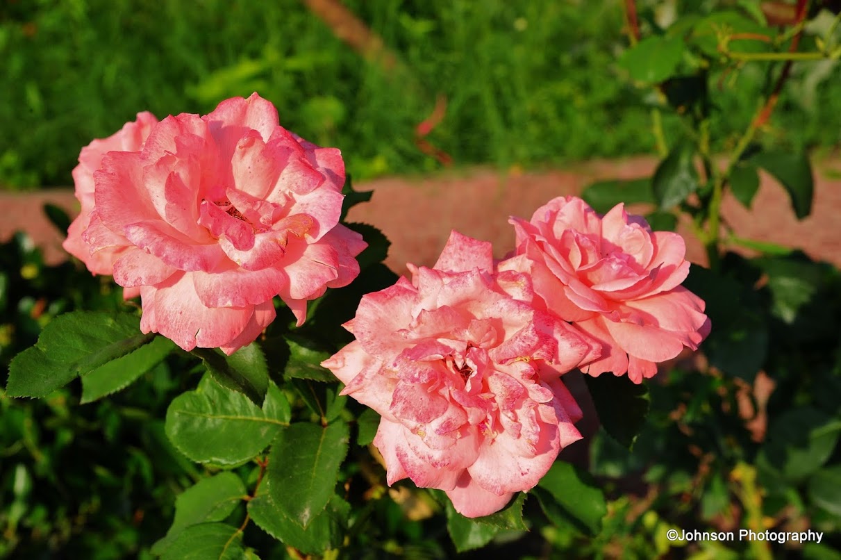


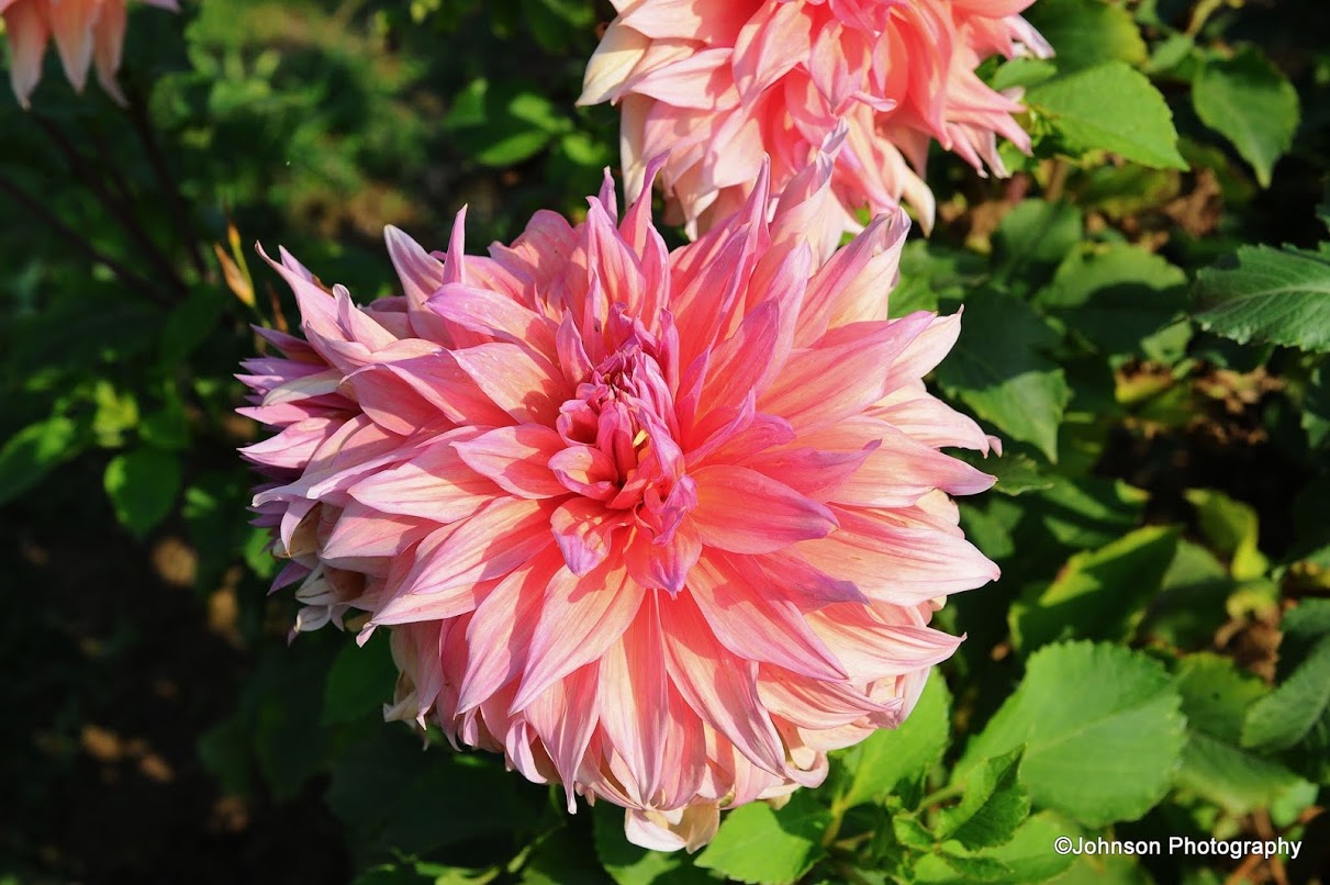


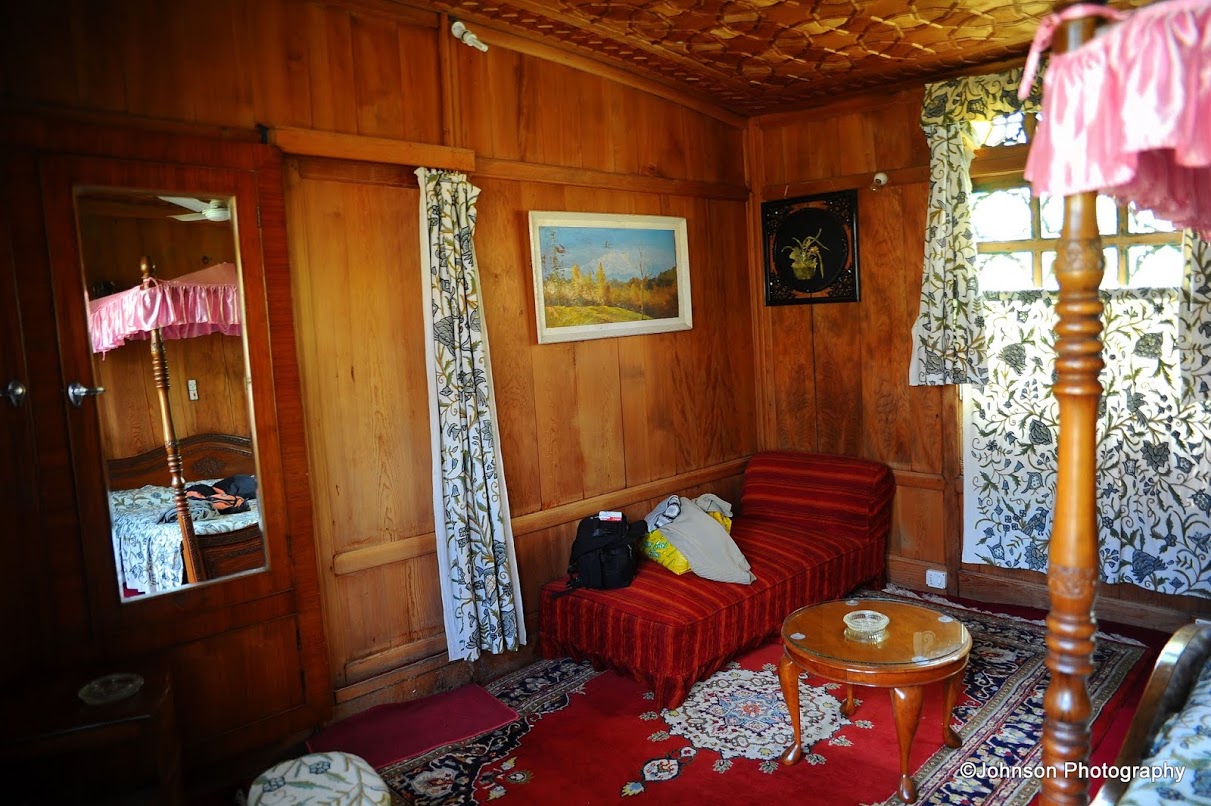


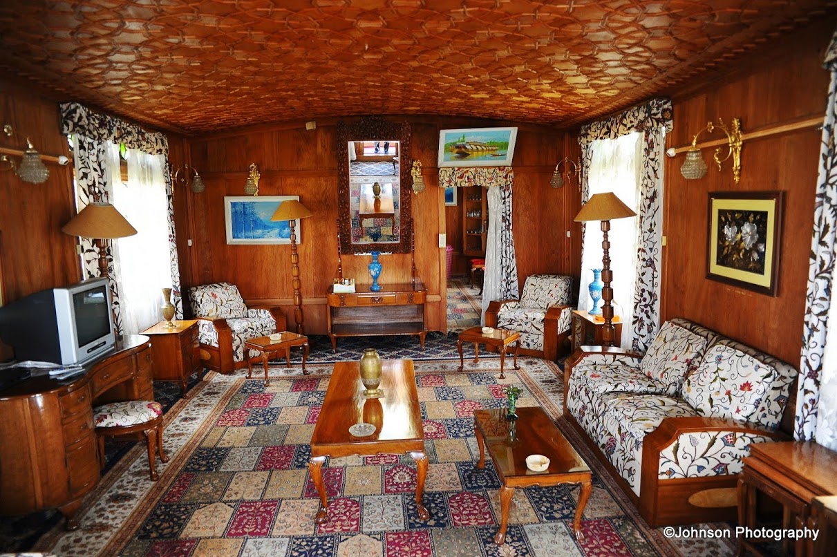

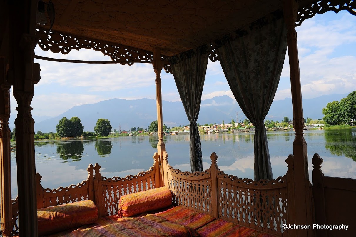

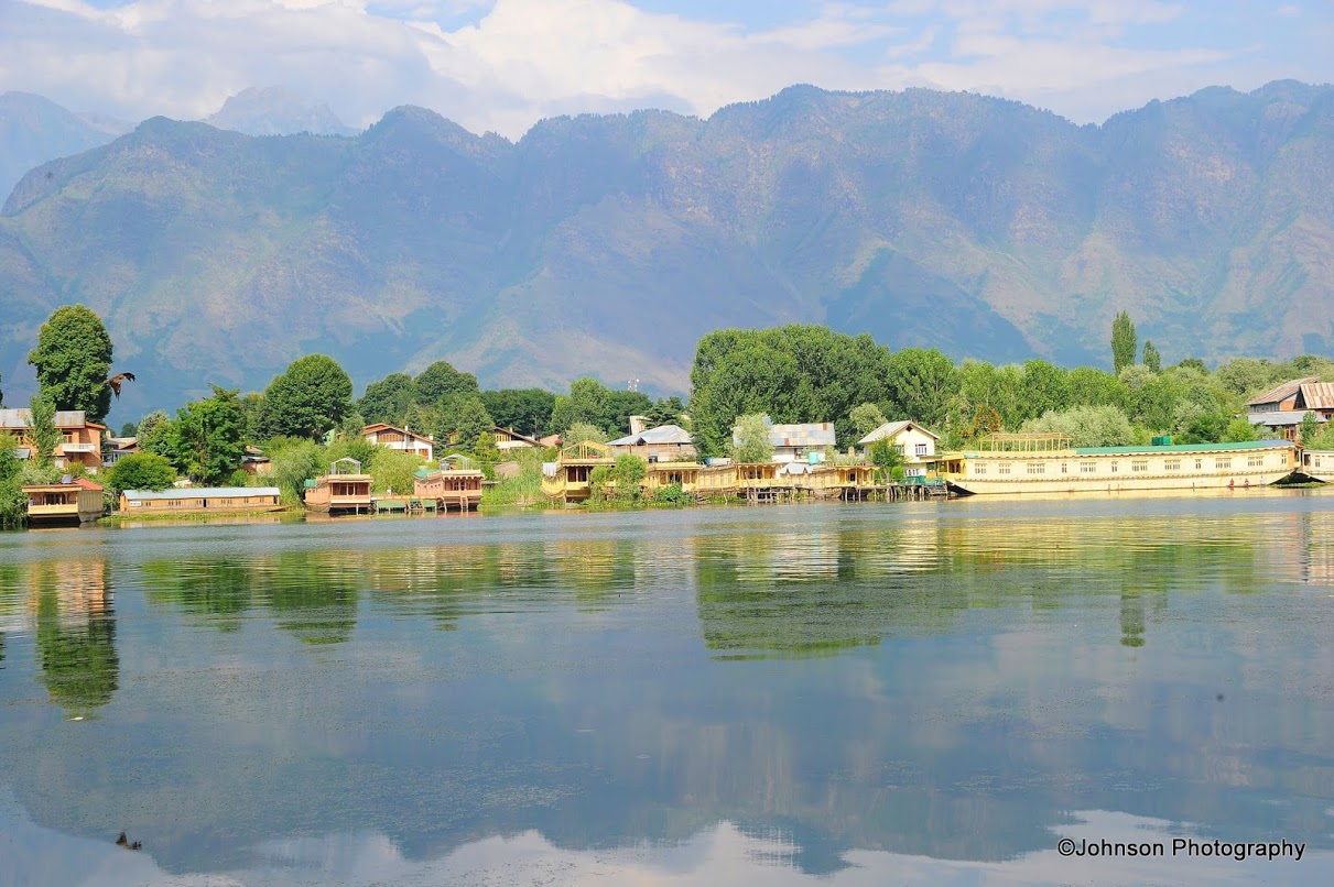
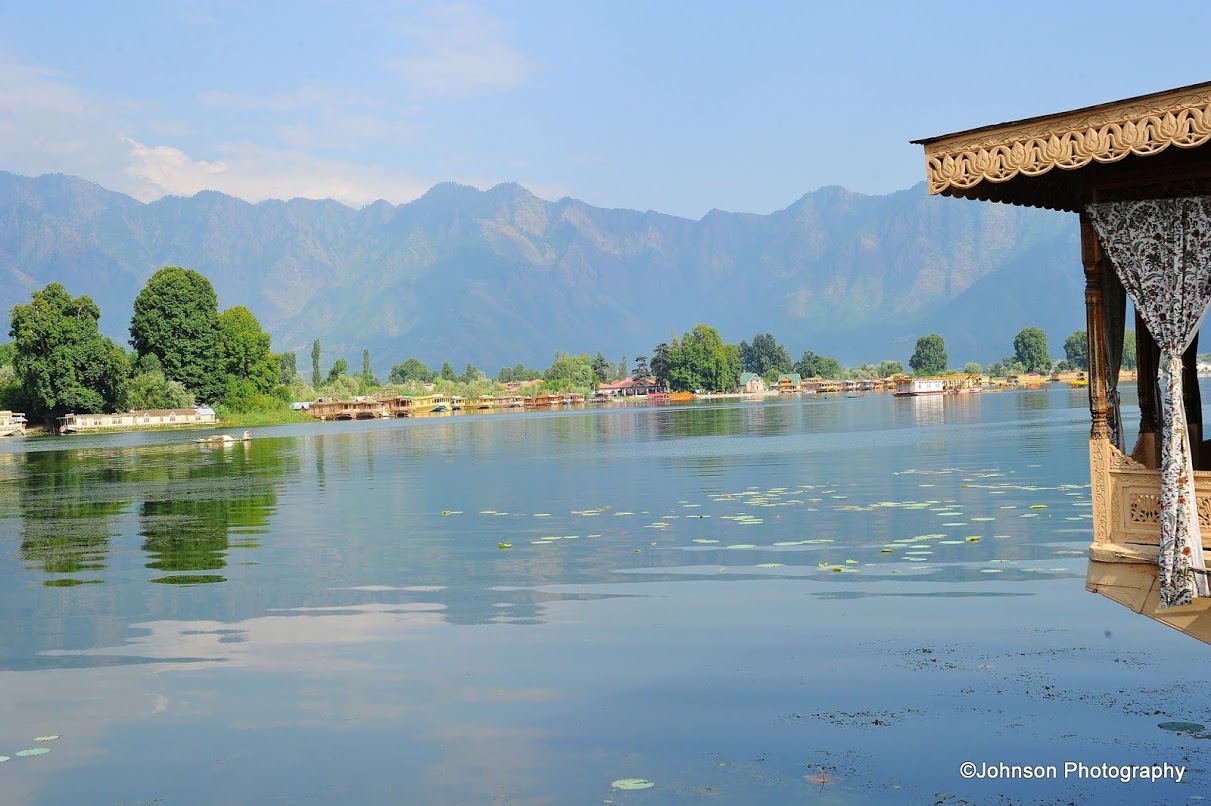


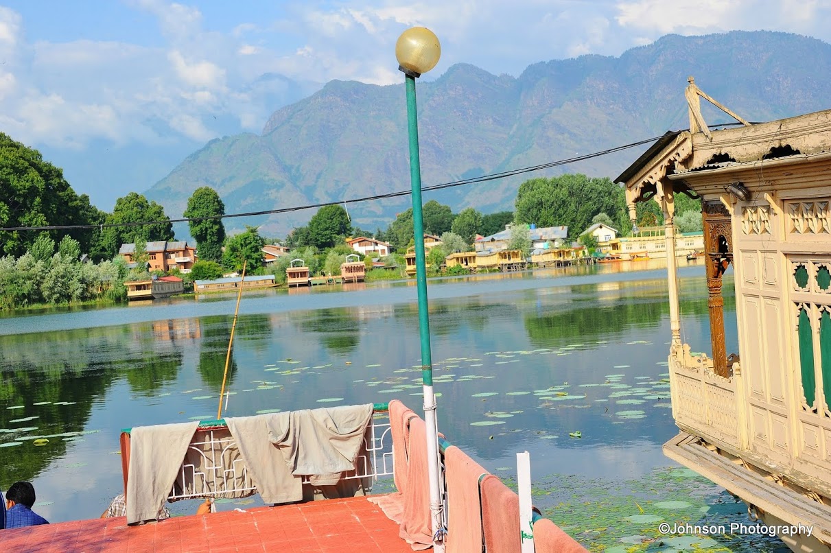
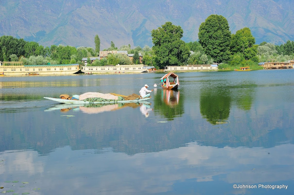


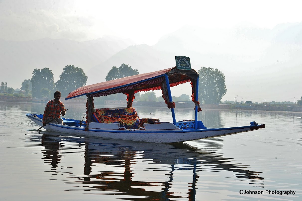


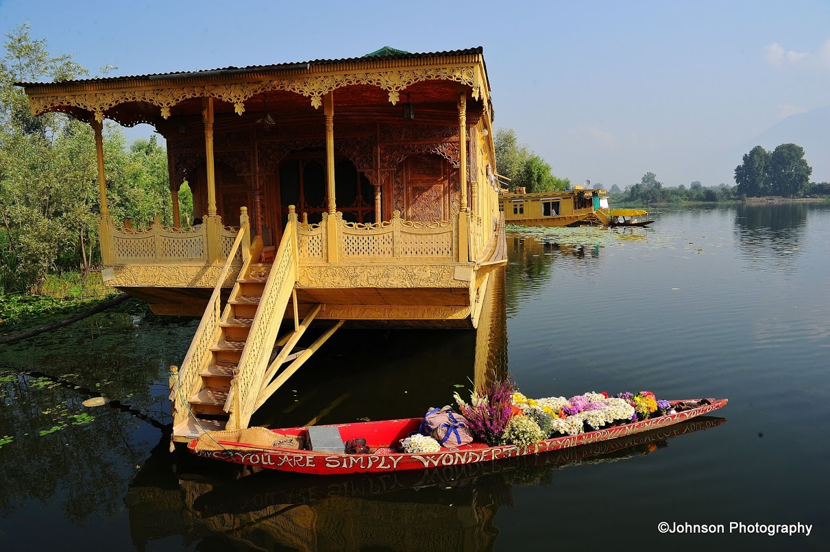


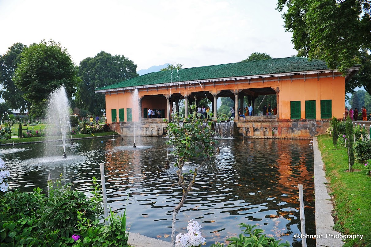


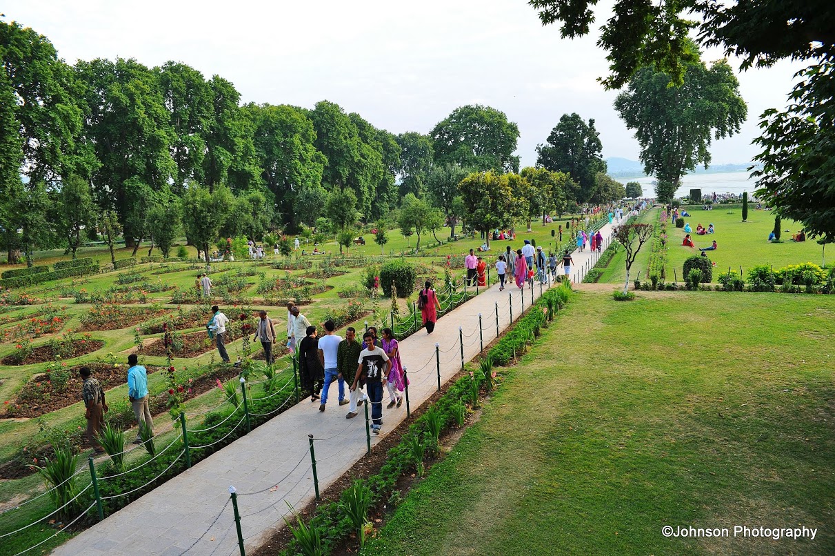


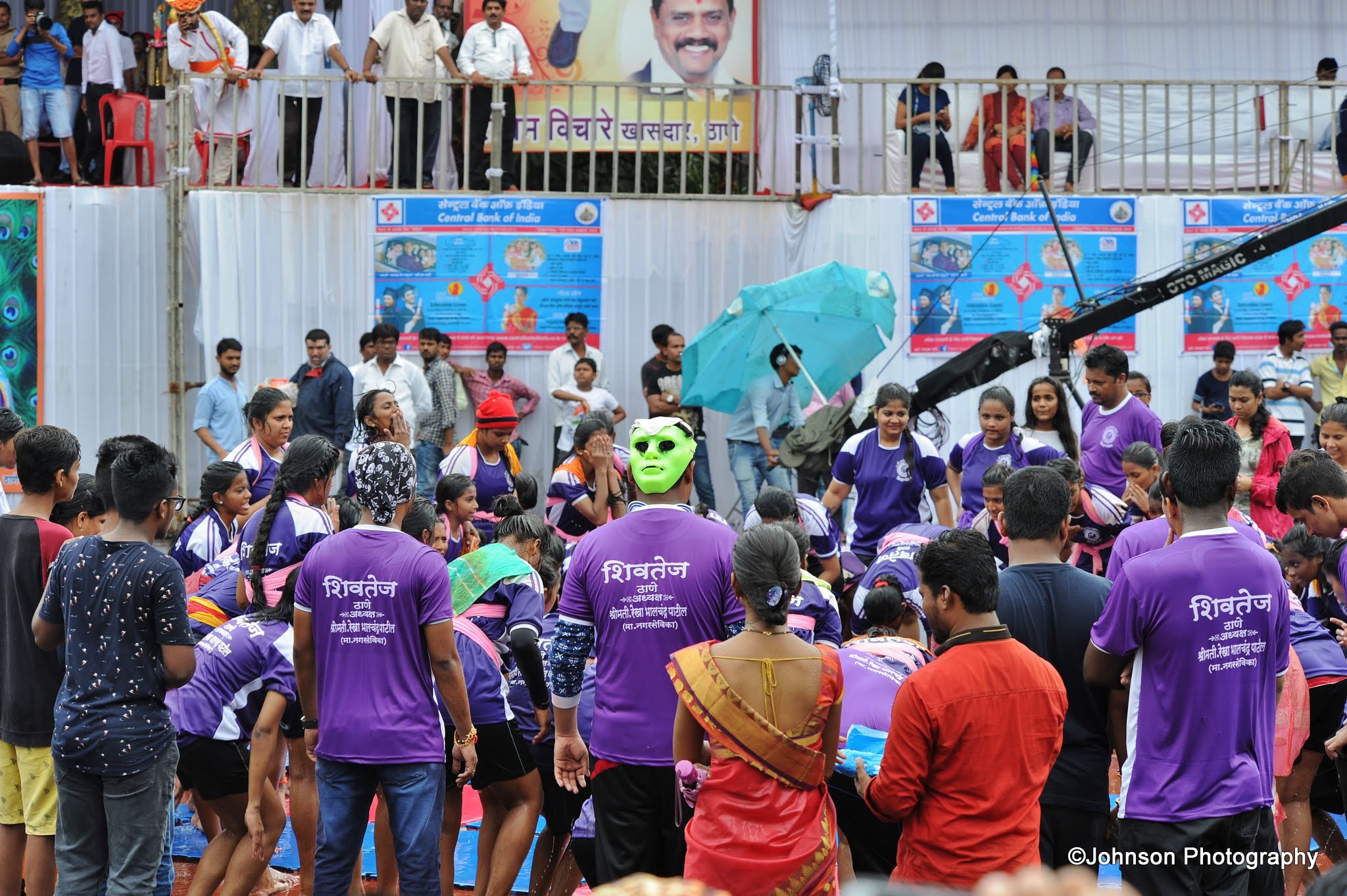


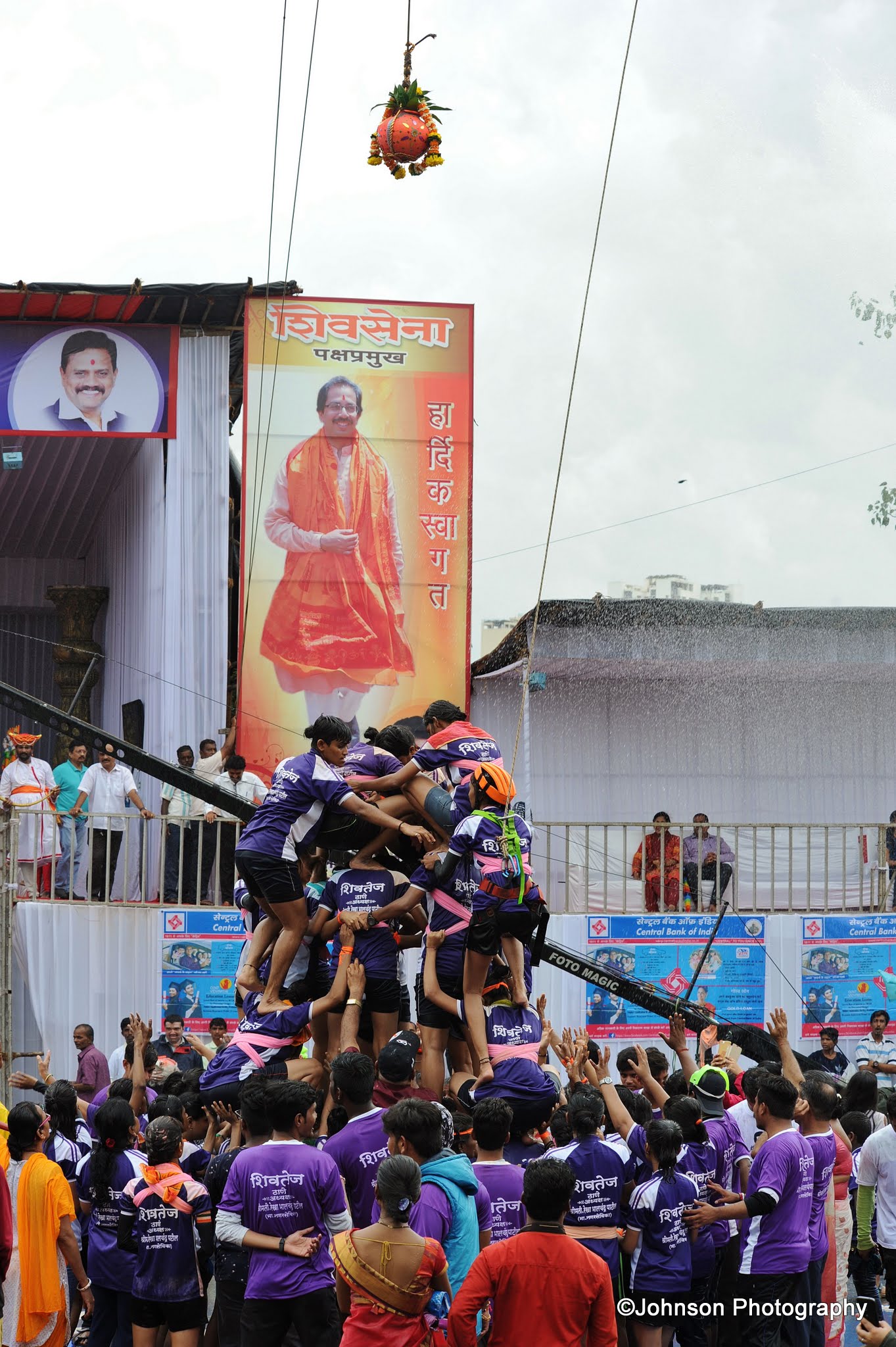
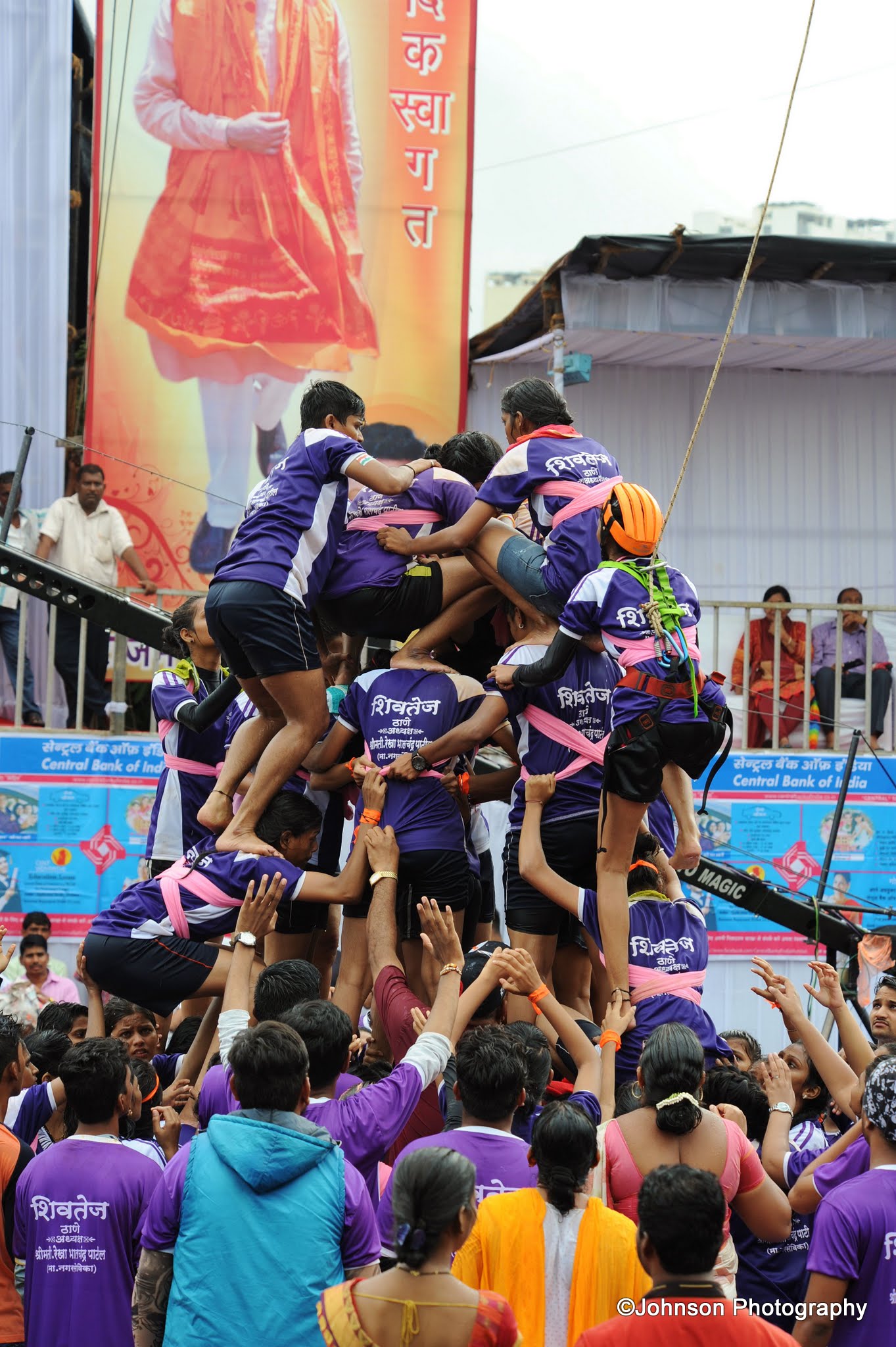


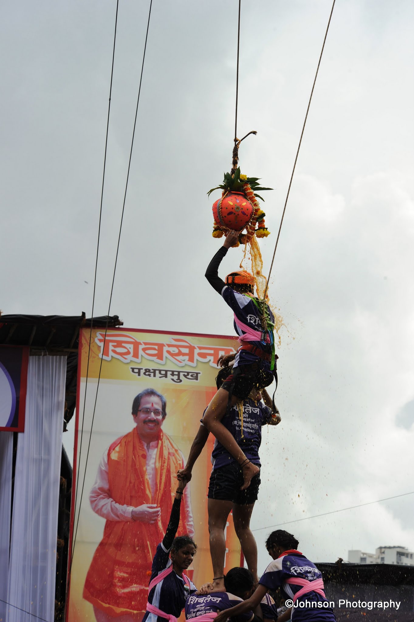


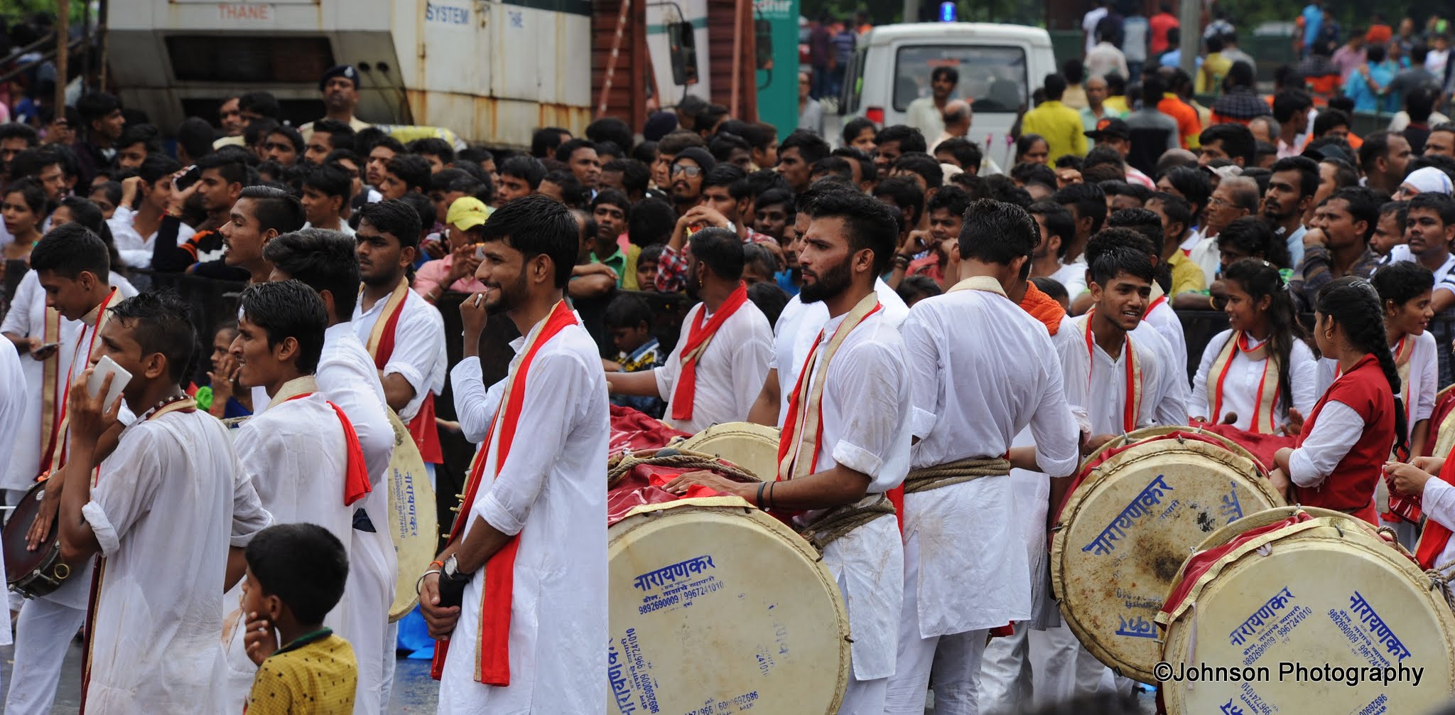


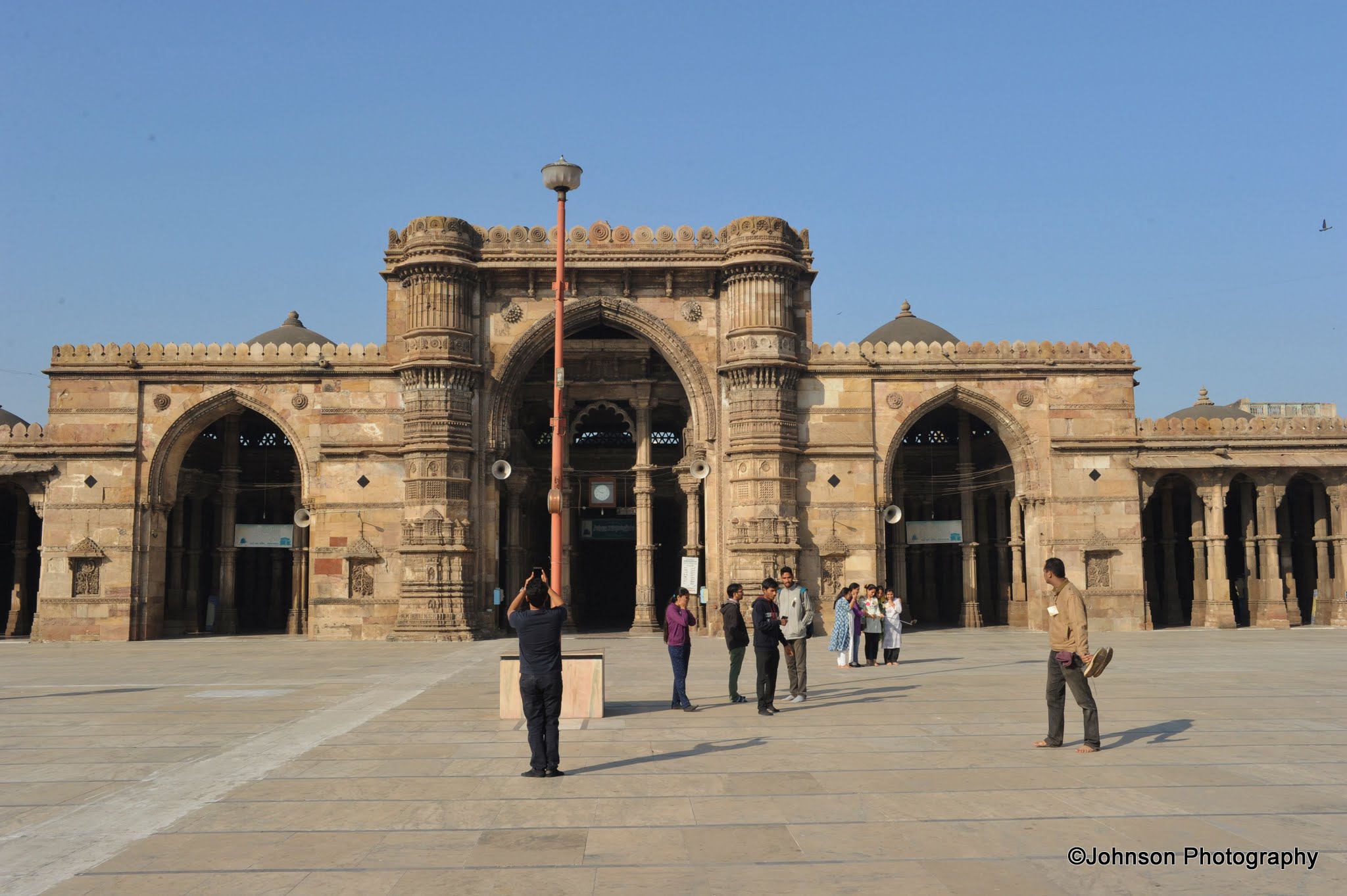
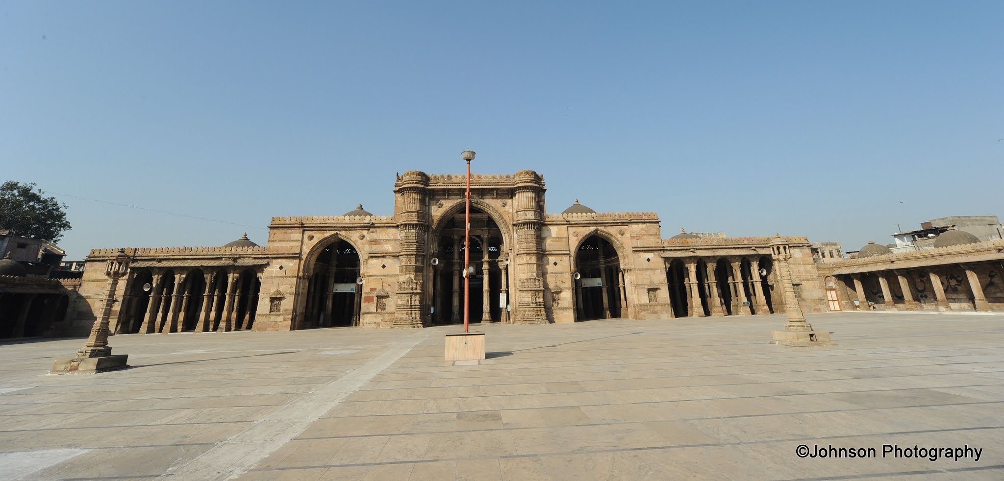
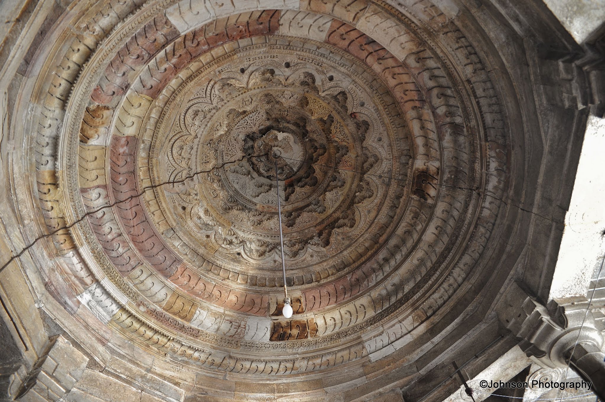

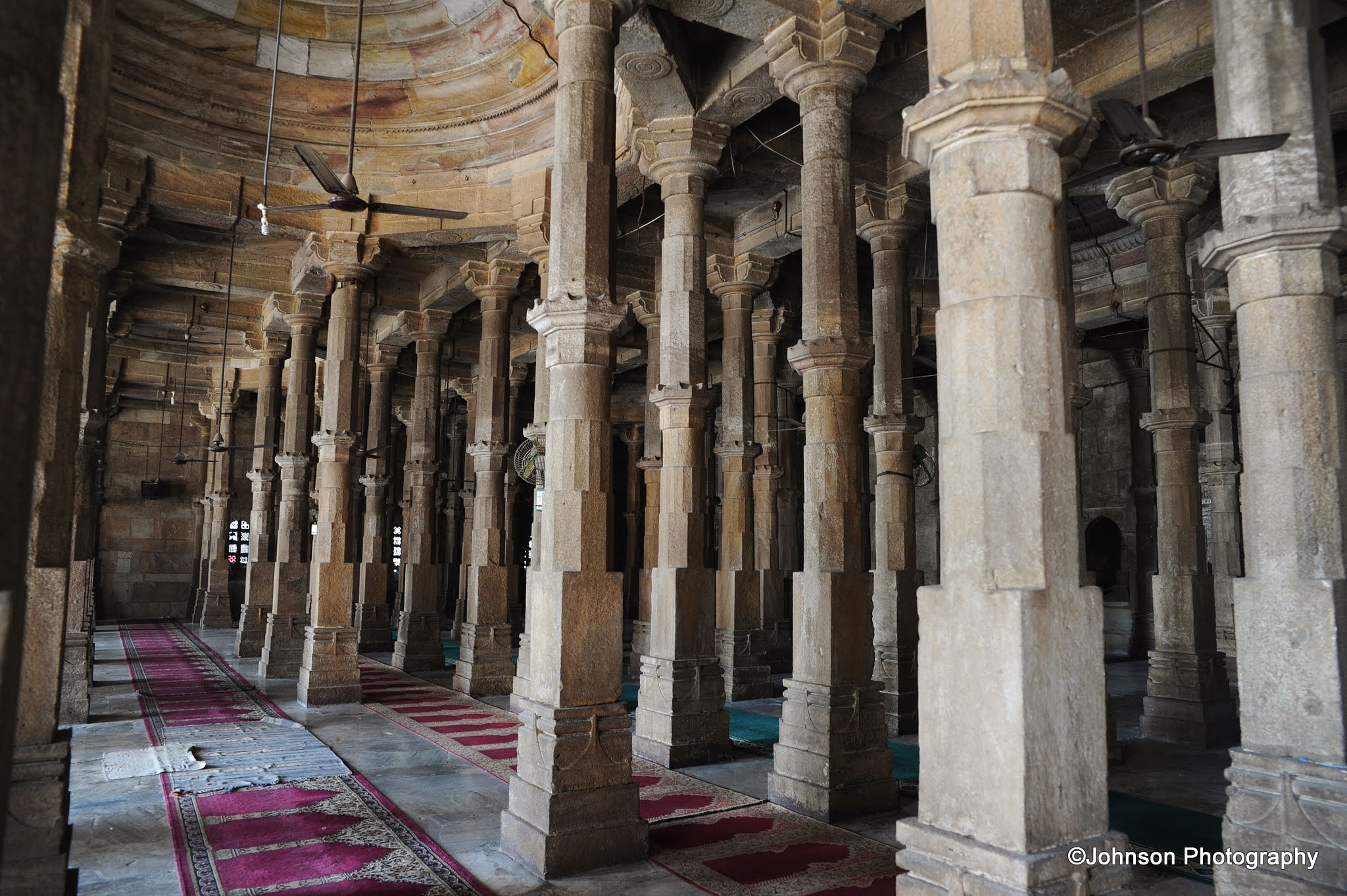
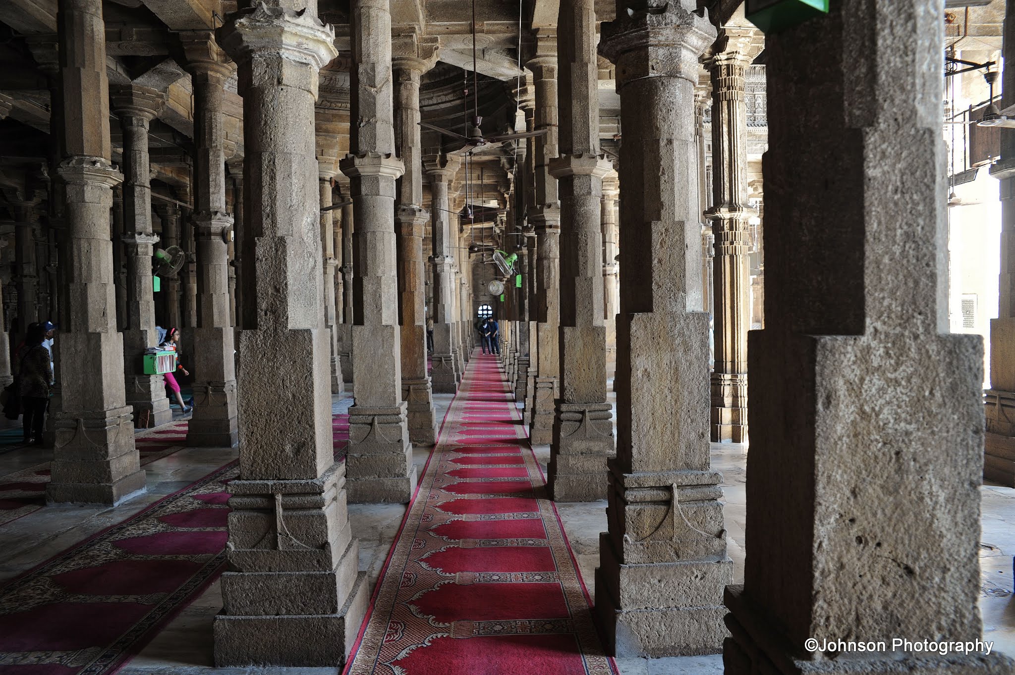
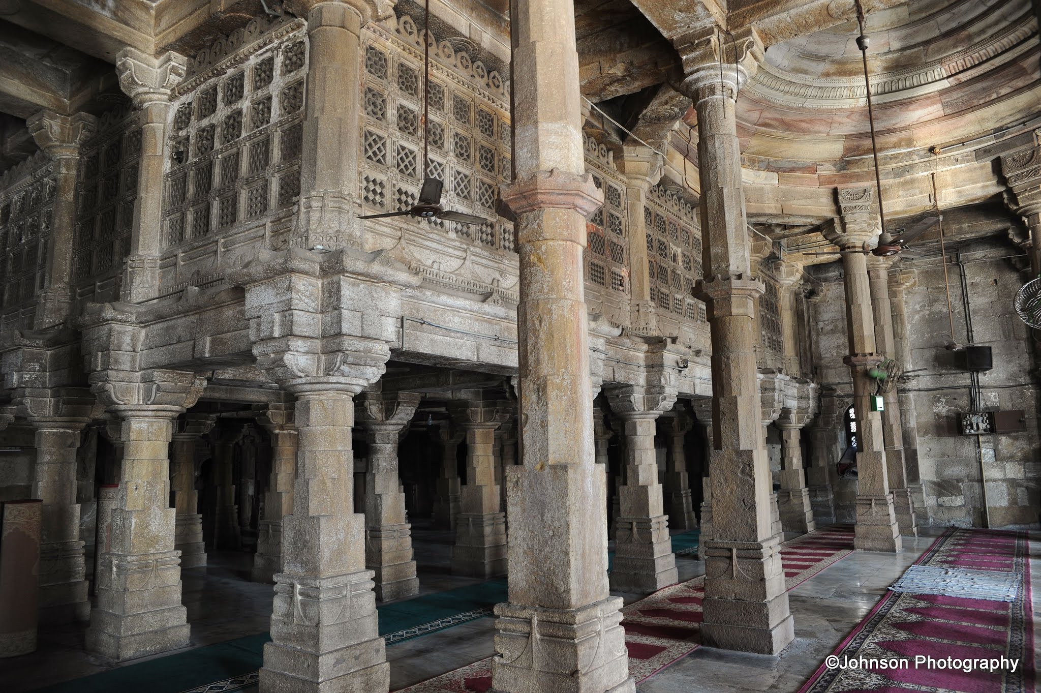
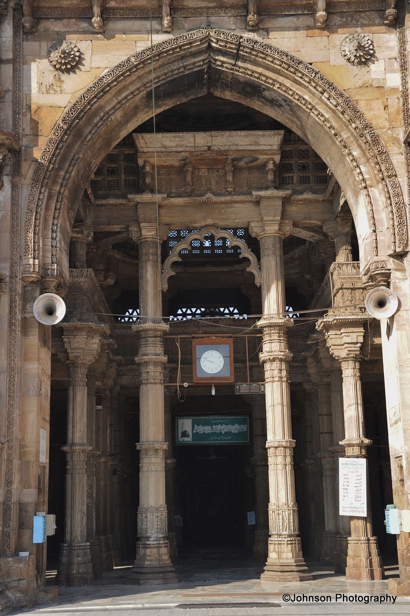


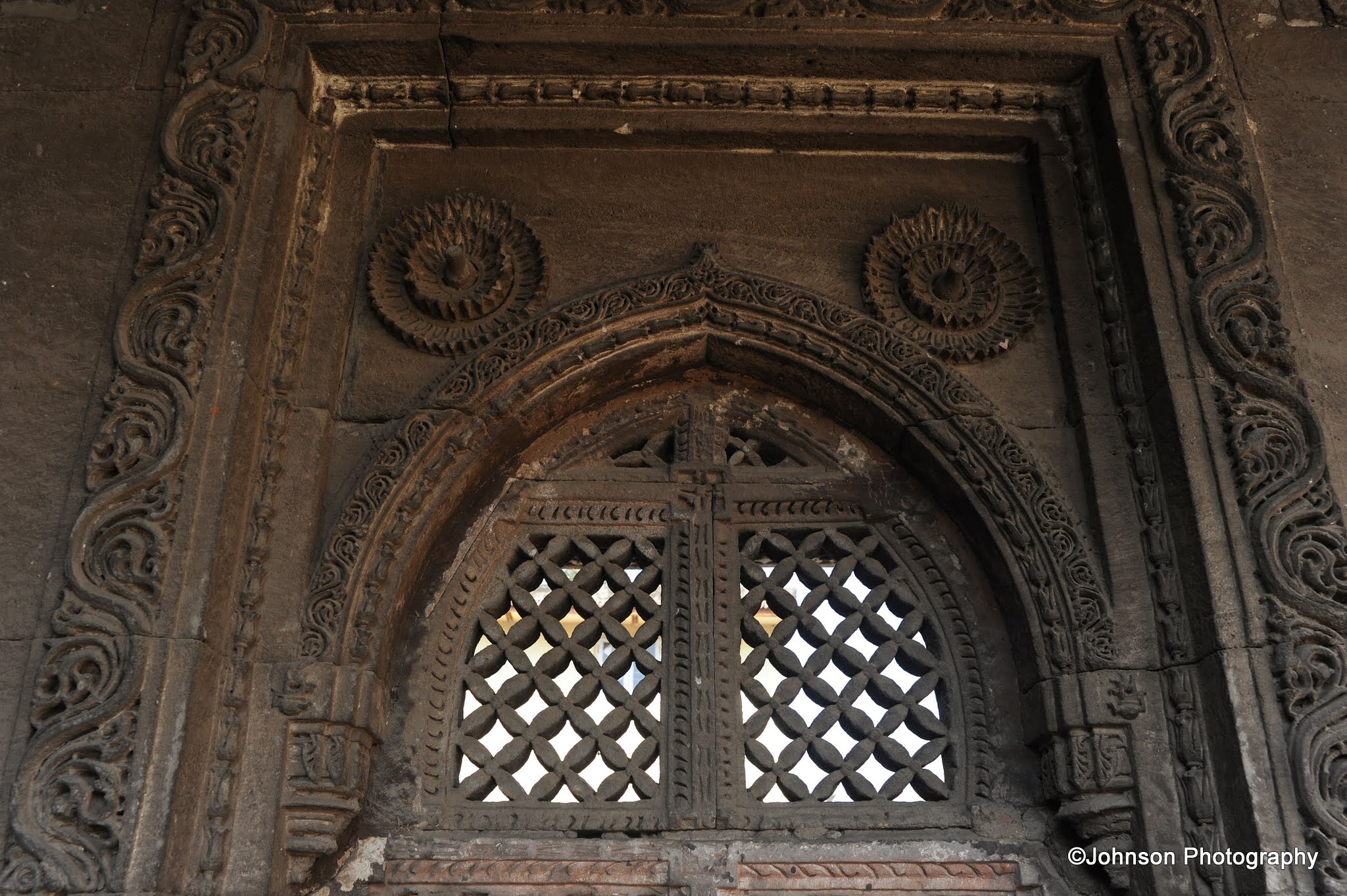


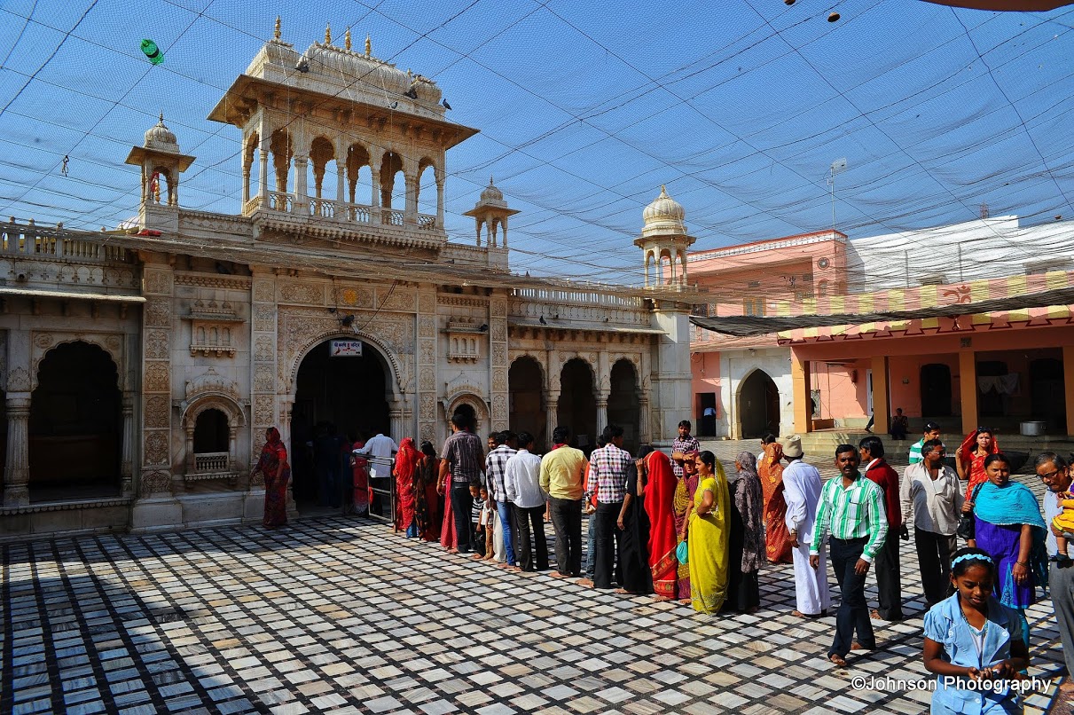
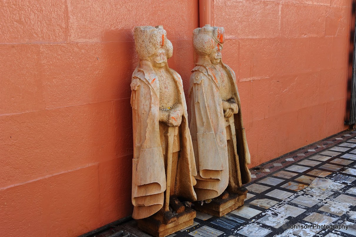

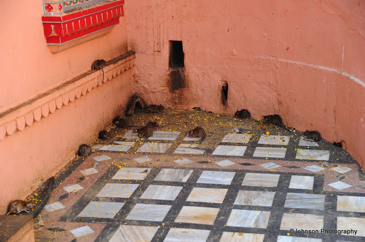


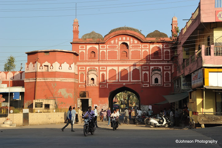


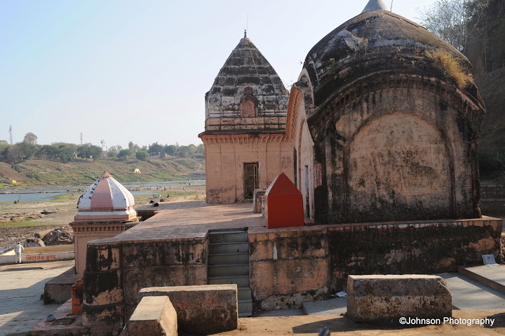


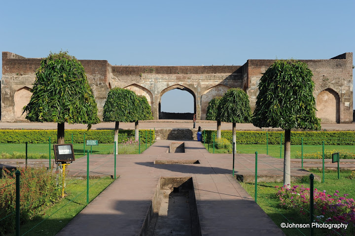
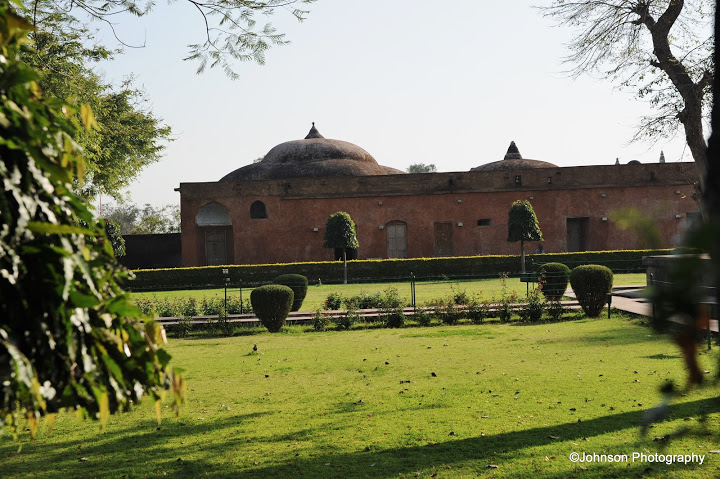
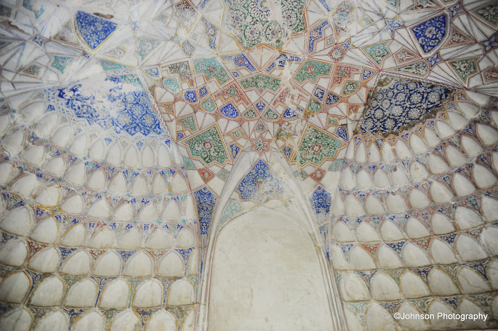


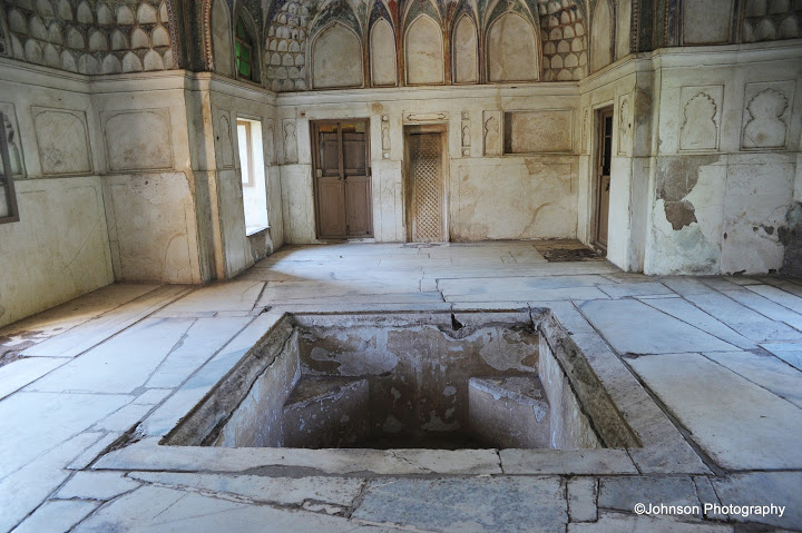

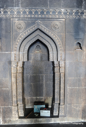
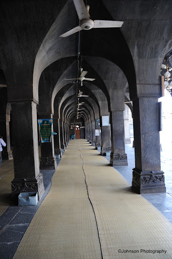


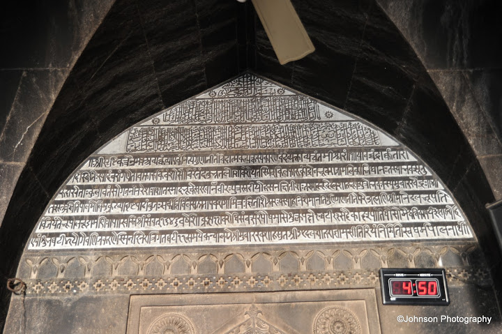
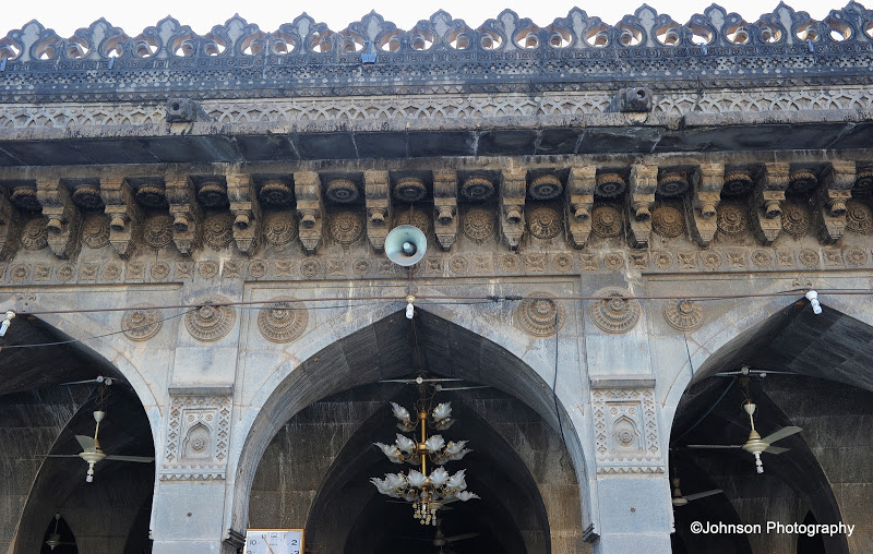
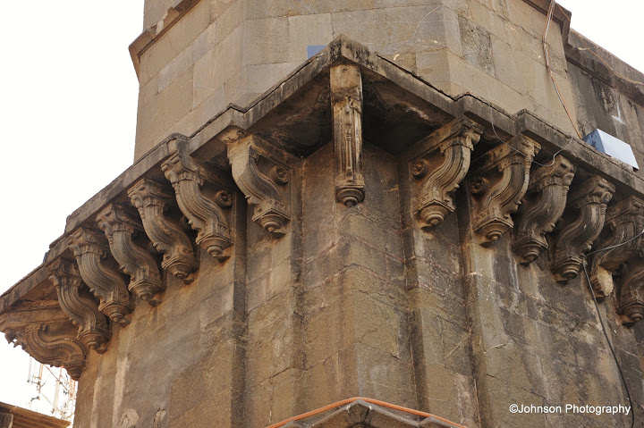


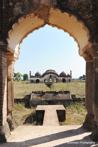


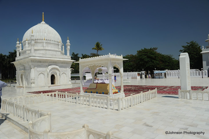


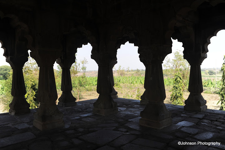

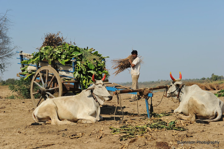

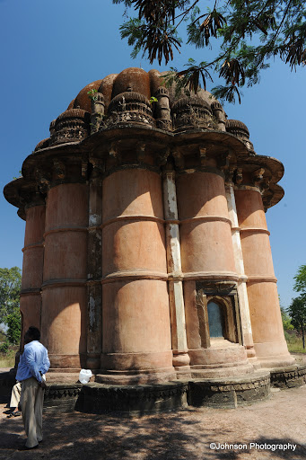

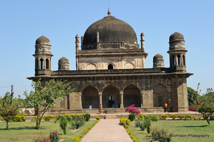


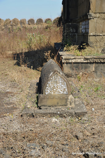


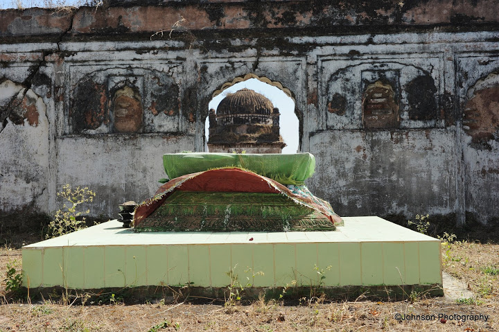


.jpg)
.jpg)

