...परवा कोणीतरी म्हणाले की बंगालमधे १९४६ जशा दंगली झाल्या तशाच आत्ता बंगालमधे सुरू आहेत. पण त्यावेळेस दंगली कशा झाल्या आणि का झाल्या हे आजच्या पिढीला कदाचित माहीत नसावे म्हणून या लेखमालिकेचा प्रपंच...
बंगाल १९४६
जूनच्या २९ तारखेला ब्रिटिश पार्लमेंटच्या सदस्यांची समिती ब्रिटनला परत गेली आणि ते एका महिन्यात ब्रिटिश कॅबिनेटला आपला अहवाल सादर करतील असे सांगण्यात आले. जिनांनी आता अशा एका हत्याराचा शोध घेण्यास सुरुवात केली ज्याने ते सूड घेऊ शकतील आणि त्यांची वैयक्तिक महात्त्वाकांक्षा पूर्ण करू शकतील. त्याने मार्चमधेच जाहीर करून टाकले होते की मुस्लिम लीगचा दृष्टिकोन आता बदललेला आहे आणि मुस्लिम लीग आणि मुसलमानांना आता कायद्याचा विश्र्वास उरलेला नाही. मुस्लिम लीगच्या आमदारांच्या सभेत पाकिस्तानची मागणी आधीच जाहीर केली गेली होती. या बैठकीत मुस्लीम नेत्यांनी हिंदूंविरुद्ध अत्यंत जहाल आणि बेताल गरळ ओकली.
१९४३ साला पासूनच धडक कृतीच्या योजनेची चर्चा मुस्लिमांच्या पुढाऱ्यांमधे चालली होती. जुलै १८ या तारखेला भारताच्या सेक्रेटरीने (श्री कप्स) बोलणी जिन्हांच्या आडमुठ्या स्वभावामुळे फिसकटली आहेत हे जाहीर केले आणि वातावरण अजूनच तापले. जिनांनी मुंबईमधे मुस्लिम लीग कौन्सीलची बैठक बोलवली व काही ठराव पारीत केले. पहिल्याच ठरावात राज्यघटनेच्या स्थापनेच्या प्रक्रियेवर विश्र्वास न उरल्यामुळे मुस्लिम लीगने त्यातून बाहेर पडण्याचा निर्णय घेतला आहे असे सांगण्यात आले. दुसऱ्या ठरावात ‘‘धडक कृती’’ (Direct Action Plan) बद्दल खालील मुद्दे मांडण्यात आले -
ब्रिटिश कॅबिनेट आणि मे १६ १९४६ व्हाईसरॉयचे निवेदन मुस्लिमलीगने फेटाळते आहे. ब्रिटिशांनी मुसलमानांचा विश्र्वासघात केला आहे असे आम्ही मानतो
पाकिस्तानची निर्मिती झाल्याशिवाय मुसलमान जनतेचं समाधान होणार नाहे हे आता स्पष्ट आहे. दुसऱ्या कुठल्याही राज्य घटनेला आम्ही कधीच मान्यता देणार नाही. यासाठी मुस्लिम लीग आता डायरेक्ट ॲक्शन अमलात आणेल. ब्रिटीश सत्ता व भविष्यातील हिंदू राजवट झुगारून देण्याशिवाय मुसलमानांना गत्यंतर नाही...
मुस्लिम लीग पाकिस्तानसाठी सर्व मुसलमानांना मुस्लिम लीगच्या झेंड्याखाली एकत्र यावे असे आवाहन करत आहे. इ. इ.
निर्णय झाला होता आणि ॲक्शन प्लॅन आता आमलात आणायचा होता. ॲक्शन प्लॅन म्हणजे काय याबद्दल मुसलमानांच्या मनात कसलाही संदेह नव्हता. कायद्याला रामराम करून आता शस्त्रे हातात घ्यायची आहेत हा संदेश जेथे पोहोचायचा होता तेथे बरोबर पोहोचला. कॉग्रेसने कितीही म्हटले की त्यांचा अहिंसात्मक मार्गाने लढा सुरू ठेवण्याचा निर्धार आहे तरीपण एक गोष्ट स्पष्ट होती की मुसलमानांना त्यांची सत्ता हस्तगत करण्याची घाई झाली होती आणि त्यासाठी ते काहीही करण्यास तयार होते. थोडक्यात लोकशाही पद्धतीने मुसलमानांना सत्ता मिळणार नव्हती हे स्पष्ट झाले होते. मला तर वाटते जिना जहाल मुसलमानांच्या मनातलेच बोलत होते. कैसरबाग येथे झालेल्या भाषणात त्यांनी डायरेक्ट ॲक्शन प्लॅनचा ऐलान केला तो यासाठीच.जेव्हा जिनांना विचारण्यात आले की हा जो प्लॅन आहे तो अहिंसात्मक मार्गाने जाणार आहे का? यावर जिनांनी उत्तर दिले, ‘‘मी येथे नैतिकतेवर चर्चा करणार नाही.’’ याचाच अर्थ असा होतो की जे वाटेत येतील त्यांना कापून काढून आम्ही आम्हाला पाहिजे ते मिळवणार.
लियाकत अलि खान यांनी असोसिएटेड प्रेस ऑफ अमेरिका या वृत्तपत्राला दिलेल्या मुलाखतीत म्हटले, ‘‘डायरेक्ट ॲक्षन प्लॅन म्हणजे अघटनात्मक मार्गाचा स्वीकार. या मार्गाचे स्वरूप कुठेही केव्हाही कसेही बदलू शकते. ते त्यावेळीच्या परिस्थितीवर अवलंबून असेल. डायरेक्ट ॲक्शन म्हणजे कायद्याविरुद्ध लढा.’’
सरदार अब्दुल रब निश्तार म्हणाला, ‘‘ पाकिस्तानची निर्मिती ही फक्त रक्त सांडूनच होऊ शकते आणि आम्ही संधी मिळाल्यास हिंदूंचे रक्त सांडू. कारण मुसलमानांचा अहिंसेवर विश्र्वास नाही.’’ हे वाक्य मला जनरल पॅटनच्या वाक्याची आठवण करून देते. ख्वाजा नज़िमुद्दीनने जाहेर केले, ‘‘ मुसलमानांनी अहिंसेची शपथ घेतलेली नाही हे लक्षात घ्या.’’
ॲक्शन प्लॅनमधे मुसलमानांकडून काय कृती करणे अपेक्षित आहे हे आता सामान्य मुसलमानांपर्यत चांगले पोहोचले होते. उन्मादाने मुसलमानांच्या मनाचा पगडा हळूहळू घेण्यास सुरुवात केली होती.
या धडक कृतीच्या मोहिमेची आता आखणी सुरू झाली. याबद्दल मुंबईच्या सभेनंतर जिनांना आणि ख्वाजा नझिमुद्दीन यांना छेडण्यात आले तेव्हा त्यांनी सफाईदारपणे खोटे सांगितले की, ‘‘अजून काही ठरले नसल्यामुळे काही बोलणे योग्य होणार नाही.’’ पण लगेचच एक कृती समिती स्थापन करण्यात आली जी हा ॲक्शन प्लॅन अमलात आणण्याची संपूर्ण योजना आखणार होती. या समितीच्या बैठकी अर्थातच गुप्तपणे दरवाजाआड भरत. पण यात काय ठरेल होते हे काही दिवसांनंतर घडलेल्या घटनांनी स्पष्ट झाले .या समितींच्या बैठकीला मुसलमानांचे राजकीय पुढारी येत असत त्यांची नावे आणि कर्तृत्व येथे सांगितले तर आपण बंगाल मधील दंगलीपर्यंत कधीच पोहोचणार नाही. यात बंगालचे मुख्यमंत्री सुऱ्हावर्दी होते हे सांगितले म्हणजे खूप झाले.
अनेक चर्चांनंतर प्लॅनची सुरवात कलकत्त्यामधे करायची अशी योजना तयार झाली. या सुऱ्हावर्दीने नंतर बंगालमधे झालेल्या दंगलीत झालेल्या हिंदूंच्या नरसंहारास भरपूर हातभार लावला आणि तो जिनाचा वारसदार म्हणून ओळखला जाऊ लागला. कलकत्त्यातील दंगलीचे त्याला बक्षिसही मिळाले. तो मला वाटते नंतर बंगालचा गव्हर्नर झाला. (निश्चित माहिती नाही) या ॲक्शन प्लॅनमधे संप, हरताळ, मोर्चे, बंद इत्यादिंचा समावेश होता पण आतून काहीतरी वेगळेच शिजत होते. या चळवळीची पत्रके वाटण्यात आली होती पण जी खरी पत्रके वाटण्यात आली होती त्यात काय लिहिले होते हे आपण पुढे पाहणार आहोत. या हरताळासाठी ऑक्टरलोनी स्मारकाजवळील होणाऱ्या एका जाहीर सभेत सुऱ्हावर्दी स्वतः भाषण देणार होते. यात नेहमीप्रमाणे मुसलमानांना चिथवणारी भाषणे देण्यात आली. याच योजनेचा एक भाग म्हणून प्रत्येक मशिदीत खालील पत्रक चिटकवण्यात आले. -
जिहादसाठी मुनाजात - म्हणजे प्रार्थना.
(जुम्मेच्या प्रत्येक नमाज़ानंतर म्हणण्यात यावी.)
रमज़ानच्या याच महिन्यात पवित्र कुराण सांगितले गेले. याच महिन्यात ३१३ मुसलमान योद्ध्यांनी बद्र्च्या लढाईत खाफिरांवर विजय मिळवला आणि मुसलमानांच्या जिहादास सुरुवात झाली. याच महिन्यात हजारो मुसलमानांनी मक्केवर स्वारी केली आणि विजय मिळवला आणि इस्लामचे राज्य स्थापन केले.
अल्लाच्या कृपेने आज इंडियामधे आपली संख्या दहा कोटी आहे पण दुर्दैवाने आपण हिंदूंचे आणि ब्रिटिशांचे गुलाम झालो आहोत. आम्ही याच महिन्यात याविरुद्ध जिहाद पुकारला आहे. काफिरांवर विजय मिळविण्यात आमची मदत कर! भारतात इस्लामचे राज्य स्थापन करण्यासाठी आम्हाला मदत करा. इ.इ. इ.
हातात तलवार असलेले जिनांचे चित्रही सगळीकडे लावण्यात आले. त्यावर लिहिले होते, ‘‘इस्लामची तलवार तळपत आहे..आम्ही हिंदुस्थानवर राज्य केले आहे. हे तख्त आमचे आहे. हे मुसलमानांनो धीर सोडू नका. विचार करा. काफिरांवर प्रेम करणे चांगले नाही. काफिरांनो तुमचा अंतःकाळ जवळ आला आहे आणि लवकरच तुमची कत्तल होणार आहे. हातात तलवार घेऊन आम्ही परत राज्य करू...
अजून एका पत्रकात लिहिले होते, ‘‘तलवारी हातात घेऊन रस्त्यावर या...मग रक्ताचे पाट वाहात असताना कोण आमच्यासमोर उभे राहते ते पाहू. उद्या आमच्या हातात तलवारी असतील आणि ओठावर तकबीर असेल... उद्या काफिरांचा शेवटचा दिवस असेल...’’ या प्रकारची अनेक पत्रके बंगालमधे वाटण्यात आली होती.
मी वर ज्या पत्रकाचा उल्लेख केला आहे ते पत्रक गुपचूपपणे वाटण्यात आले... हे पत्रक छापण्यात आले होते आणि सायक्लोस्टाईलही केले गेले होते... प्रत्येक मुसलमानाच्या हातात हे पडेल याची व्यवस्था केली गेली... काय लिहिले होते या पत्रकात?
१ भारतातील सर्व मुसलमानांनी पाकिस्तानसाठी प्राण पणास लावले पाहिजे
२ एकदा का पाकिस्तान मिळाला की सबंध भारत काबीज करायचा आहे.
३ भारतातील सर्व जनतेला इस्लाम धर्म स्विकारण्यास भाग पाडायचे आहे
४ सर्व मुस्लिम राष्ट्रांची एकजूट ही काळाची गरज आहे.
५ एका मुसलमानाने पाच हिंदूंची कत्तल केली पाहिजे.
६ पाकिस्तान व इस्लामचे साम्राज्य उभे राहात नाही तोपर्यंत प्रत्येक मुसलमानाने खालील गोष्टींचे पालन केले पाहिजे -
१ हिंदूंच्या मालकीचे दुकाने, कारखाने जाळून टाका आणि मिळालेली लूट लीगच्या कार्यालयात जमा करा.
२ मुस्लिम लीगच्या सर्व सदस्यांनी हत्यार बाळगले पाहिजे
३ राष्ट्र्वादी मुसलमान जर मुस्लिम लीगमधे सामील झाले नाहीत तर त्यांना ठार मारा.
४ हिंदूंची हळूहळू कत्तल करून त्यांची लोकसंख्या कमी केली पाहिजे.
५ सर्व मंदिरे जमीनदोस्त करा
६ प्रत्येक गावात मुस्लीम लीगचा एक तरी हेर असावा
७ एका महिन्यास एक याप्रमाणे सर्व कॉग्रेस पुढाऱ्यांची हत्या करा..
८ कॉग्रेसची कार्यालये लीगच्या सिक्रेट गेस्टापोंनी जाळून टाकावीत.
९ कराची, बाँबे, कलकत्ता, मद्रास गोवा, विशाखापट्टण ही शहरे डिसेंबर १९४६ पर्यंत बंद पाडा. (मुस्लीम लीगच्या कार्यकर्त्यांनी हे काम करावे)
१० आर्मी, नेव्ही आणि इतर सरकारी कार्यालयात मुसलमानांनी हिंदूंच्या हाताखाली काम करण्यास नकार द्यावा.
११ मुस्लिम समाजाने साऱ्या भारतात दंगेधोपे माजवून व्यवस्था खिळखिळी करावी आणि इस्लामच्या भारतावरील शेवटच्या आक्रमणास मदत करावी
१२ यासाठी जी आर्थिक मदत लागेल ती मुस्लिम लीग देईल. शस्त्रे मुस्लिम लीग पुरवेल.
१३ सर्व शहरातून मुस्लिम लीग शस्त्रांचे वाटप करेल.
१४ प्रत्येक मुसलमानाने एक तरी शस्त्र जवळ बाळगावे. कमीतकमी एक चाकू तरी. आणि संधी मिळेल तेव्हा त्याने एकातरी हिंदूचा मुडदा पाडावा.
१५ वाहतुकीची सर्व साधने या लढाईत वापरण्यात यावीत.(म्हणजे सर्व वाहने मुस्लिम लीगच्या स्वाधीन करावीत)
१६ १८ ऑक्टोबर पासून हिंदू स्त्रिया आणि मुलींवर बलात्कार करा, त्यांना पळवून न्या आणि त्यांना मुसलमान करा
१७ हिंदू संस्कृती नष्ट करा
१८ सर्व मुसलमानांनी निष्ठूरपणे हिंदूंवर बहिष्कार टाकावा.
१९ कुठल्याही मुसलमाने हिंदूच्या दुकानातून खरेदी करू नये. हिंदूंनी तयार केलेल्या सर्व वस्तूंवर बहिष्कार टाकावा. सर्व मुस्लिम लीगच्या सदस्यांनी या सूचनांचे पालन करावे व इतर मुसलमानांनाही त्यासाठी परावृत्त करावे.
हे पत्रक भूतपूर्व न्यायाधिश खोसला यांच्या पुस्तकातून घेतले आहे. हे ‘‘स्टर्न रेकनिंग’’ नावाचे पुस्तक इनटरनेट अर्काईव्हजवर फुकट उपलब्ध आहे. ते वाचकांनी जरूर वाचावे. हे पुस्तक वाचल्यावर मुस्लिम उम्मा कशी काम करते हे आपल्याला कळेल. तसेच काफिरांची हत्त्या करण्याचा त्यांचा हक्क अबाधित राहिला तर काय होणार आहे याची ही झलक आपल्याला या पुस्तकातून दिसेल... हा हक्क कसा काढून घेता येईल हा एक संशोधनाचा विषय आहे...
आजही बंगालमधे याच सुऱ्हावर्दी मुसलमानांची पिल्लावळ नांदते आहे. मला एक आश्चर्य वाटते माओवादी कम्युनिस्टांवर बंदी घातली गेली पण इंडियन युनियन मुस्लिम लीगवर (जी त्याच मुस्लिम लीगची भारतीय शाखा आहे) अजून बंदी घातली गेली नाही आणि आज त्याचीच फळे आपण भोगत आहोत. आज बंगालमधे जो काही दंगा चालला आहे तो वरील पत्रकाप्रमाणेच चाललेला आहे असे मला वाटतंय.
बंगाली मुसलमानांचे धाडस या प्रकरणामुळे अजून वाढणार आहे कारण त्यांनी या सरकारचे पाणी जोखले आहे. त्या काळात त्यांनी कॉग्रेसचे पाणी जोखले होते आणि भारताची पद्धतशीरपणे फाळणी करण्यात आली. आज बंगाली हिंदूंच्या जिवनमरणाचा प्रश्र्न आहे. आपले घरदार का प्राण हा प्रश्र्न त्यांच्यापुढे उभा राहिला आहे. त्याचे उत्तर कोण देणार? हे सरकार देणार, का याचे उत्तर हिंदूनाच शोधावे लागणार? हे काळच ठरवेल..मला हिंदुस्थानात हे काय चालले आहे हे समजत नाही. काश्मिरमधून हिंदूंची हकालपट्टी, आता बंगालमधून हिंदूंची आसाममधे हकालपट्टी... उद्या केरळमधेही असे झाले तर आश्चर्य वाटायला नको.. मलबारमधून हिंदूंना हाकलण्यात आलेच होते. मुसलमान जे पूर्वी हिंदूच होते त्यांच्या मेंदूवर असा काय परिणाम झाला आहे की ते इतर धर्मियांसोबत असे द्वेषपूर्ण वागत आहेत? त्यावर मी एक लेख लिहिणार आहे पण पुढे कधीतरी...
कधी कधी वाटते बाबासाहेबांनी केलेली संपूर्ण लोकसंख्येची आदलाबदल करावी ही सूचना अमलात आणली असती तर बरे झाले असते...त्यावेळेस ते सहज शक्य होते पण नेहरूंनी आणि कॉग्रेसने ते होऊन दिले नसते. तसे झाले असते तर कॉग्रेसची भारतातील सत्ता लवकर संपुष्टात आली असती आणि बऱ्याच प्रश्र्नांचा निकालही वेळच्या वेळीस लागला असता..असो.
आता त्यांना काय वाटेल, हा विचार सोडून आपली मते आग्रहीपणे, कडवेपणाने, न घाबरता मांडली पाहिजेत आणि त्यागाचीही तयारी केली पाहिजे... जे खरे आहे, जो इतिहास आहे (जो आपल्याला समाजवाद्यांच्या सोयीने बदलून सांगण्यात आलाय) तो सर्वांनाच मान्य असायला हरकत नसावी... जेथे हिंदू अल्पसंख्यांक आहेत तेथे हिंदूची संख्या वाढवली पाहिजे आणि तोपर्यंत आपणच ‘‘तकिया’’चा वापर केला पाहिजे. (wwwटिंबyoutubeटिंबcom/watch?v=6F4wBeshTsw)
या प्रसंगी मला मार्टिन लुथर किंग यांची दोन प्रसिद्ध वाक्ये आठवतात
‘‘चांगल्या वाईटाच्या संघर्षात जे तटस्थ राहतात त्यांच्यासाठी नरकातील ज्वाळांची सगळ्यात खोल खाई परमेश्र्वराने राखून ठेवलेली आहे. आणि दुसरे -
‘‘जी संस्कृती किंवा राष्ट्र मनाने घाबरट स्वभावाची माणसे जन्माला घालते ती संस्कृती/राष्ट्र स्वतःचा सांस्कृतिक मृत्यु हप्त्यांवर विकत घेत असते...
या ॲक्शन प्लॅनसाठी कलकत्त्याची निवड का करण्यात आली त्याची कारणे पुढच्या लेखात...
- जयंत कुलकर्णी

बंगाल! भारताचा सर्वात समृद्ध प्रांत! गंगेची सहस्र रूपे स्वतःच्या हाताने इथे शिंपण करतात. सुजला-सुफला-अमला-अतुला हि मातृभूमीची सर्व विशेषणे खरे तर कवीला बंगभूमीकडे पाहतच स्फुरलेली. प्राचीन काळापासून सुपीकतेचा वरदहस्त असल्याने विविध कला-विद्या इथे भरभराटीस आल्या. चहूबाजूंनी किरात राष्ट्रांनी वेढलेला असल्याने बंगाल प्रांताची विशेष अशी एक ओळख अवरुद्ध प्रकारे एकांतात विकसित होत गेली कि अन्य राष्ट्रांना अजूनही त्यात काही 'गौडबंगाल' वाटावे... परचक्राच्या काळात भारतावरील अधिपत्यासाठी बंगालमधील सत्तांतर निर्णायक ठरलेले दिसते. बंगाल जिंकल्यावर मुघल स्थिरावले, ब्रिटिश निर्ढावले, कारण अफाट संपत्ती व सुबत्ता एकहाती ताब्यात येत असे. अशा संपन्नतेमुळे 'सोनार बांगला' हे सार्थ अभिधान! पृथ्वीमातेचे वरदान त्यात गंगामातेचे सिंचन आणि वाग्देवीचा आशीर्वाद अशा प्रदेशात शक्तिपूजा लोकप्रिय नसावी तरच नवल!
बंगाल नावाविषयी थोडे, महाभारतातील एका कथेनुसार गिरिव्रजेतील (राजगिर-मगध) एका ऋषींच्या वरदानामुळे जन्माला आलेल्या सहा राजपुत्रांना वाटून दिलेली राज्ये पुढे त्यांच्याच नावाने प्रसिद्ध झाली. त्यातील ओड्र-कलिंग म्हणजे आजचे ओरिसा. तर सुम्ह, वंग, पुंड्र म्हणजे अखंड-बंगाल तर अंग म्हणजे झारखंड चा काही भाग, अशी हि सहा. यातील वंग चा पुढे मागधी प्राकृतातून अपभ्रंश बंग झाला, व त्याचेच बंगाल. पुढे गौड, राढ, समतट, गंगारिध्दी अशी स्थानिक राज्येही आली आणि गेली. बंग नाव तेवढे दीर्घ टिकले.
मध्ययुगीन काळात येथील पाल व सेन राजांनी मोठा पराक्रम उत्तरेत गाजवला व आपली सुसंपन्न राज्ये राखली. परंतु दृष्ट लागावी तसे म्लेंच्छसंसर्गाचे ग्रहण या सुप्रदेशाला लागले ते आजतागायत काही सुटले नाही. रक्ताचे पाट वाहिले, अब्रूची लक्तरे झाली आणि देशाची शकले विखुरली. एका सुंदर स्वप्नाची शोकांतिका... अजूनही भळभळणारी जखम...
बंगालची पहिलीच गळाभेट. रुक्ष ठेठ मराठ्याला या प्रांताची गोडी पचवायला चांगलेच कष्ट पडणार हे कळायला लागले ते बंगालीचा अभ्यास सुरु झाल्यावर. मराठीशी खूप साम्य आहे अशी तोंडओळख एका मैत्रिणीने करून दिलेली परंतु ते फारच वरवर. दारुण-सुंदर, भीषण-मधुर हि कौतुकाची विशेषणे आहेत हे नव्याने समजून घेणे होते. लिपी अजून कठीण पण वाचण्यापुरती यायला लागली. काही मध्ययुगीन बंगाली संदर्भ ग्रंथांचा अभ्यासही सुरु होताच तो सुलभ झाला. रवींद्रसंगीताचा खजिना खुला झाला आणि आधुनिक स्वरूपातील 'लो-फि' ट्यून्स इंस्टाग्रामवर साथ द्यायला लागल्या. राईचे तेल हा खाण्यातील फारच अवघड भाग पण तो सुसह्य होईल इतका परिचयाचा असणे आवश्यक. अशा प्रकारे पूर्वतयारीचा अध्याय जोमात चालू असता थोडा खंड करून परिचयातील एका आदरणीय व्यक्तीच्या आयुष्याच्या शेवटची सुश्रुषा करताना व्यतीत केला. एक ऋषितुल्य व्यक्तित्व, पद्मभूषण-कर्तृत्ववान आयुष्याची पूर्ती करत हसतमुखाने मृत्यूस सामोरे जाताना सेवा-साक्षी राहणे हे खरेच पुण्य! कुठल्यातरी जन्मातले काही ऋणानुबंध शिल्लक असावेत, तदनंतर आठवड्याभरातच बंगालकडे प्रयाण, सर्वप्रथम त्यांची रक्षा गंगेस सुपूर्त. भारतमातेचा सुपुत्र तिच्या स्वरूपात विलीन.
तूर्तास अमेरिकेत वास्तव्य असल्याने कलकत्त्यापर्यंतचा पहिलाच पल्ला बराच लांबचा होता. कलकत्त्यात पूर्वी पुर्वोत्तरेकडच्या प्रवासादरम्यान केवळ विमानबदली केली होती, पण शहरात जाणे यावेळी पहिल्यांदाच. राहणे जुन्या कलकत्त्यात कॉलेज स्ट्रीट परिसरात केले. आजकाल सॉल्टलेक वगैरे नव्या शहरात बरीच उत्तम व्यवस्था आहे पण मग मूळ शहराचा तो अनुभव नाही. अरुंद गल्ल्या, जुन्या वसाहती, दशकानुदशके प्रस्थापित असलेली खाऊची ठिकाणे अशा ठिकाणी शहराच्या काळजाजवळ वस्ती.
बंगालच्या कणाकणात गंगा सामावलेली आहे त्यामुळे गंगास्नान हा बंगालमध्ये सामावण्यासाठी सोपा उपचार. मकरसंक्रांतिच्या दिवशी सूर्योदयास पलीकडच्या तीरावर असलेला रामकृष्ण घाट त्यासाठी निवडला. हलक्या धुक्यात निरव शांततेत गंगेची भेटी. तदनंतर काही काळ हावडा क्षेत्र पाहण्यात घालवला. सकाळच्या वेळी त्यातल्या त्यात कमी गजबज असलेला हावडा ब्रिज, गंगेवरचे काही जुने घाट इत्यादी. त्यानंतर कलकत्त्याची अधिष्ठात्री देवता दक्षिण कालिकेचे दर्शन.
फार प्राचीन काळी गंगा नदी मैदानी प्रदेशातून वाहत येत ऋक्ष पर्वताला (झारखंड) वळसा घालून दक्षिणवाहिनी होत गंगासागर येथे समुद्राला मिळत असे. गंगा ब्रह्मपुत्रा यांच्या वितरिका एकमेकांमध्ये मिसळत असल्या तरी मुख्य प्रवाह पृथकपणे समुद्रास मिळत असत. बंगालची मैदानेच इतकी सपाट आहेत कि महापुरात नद्या त्यांचे काठ भेदून इतस्ततः धावत सुटतात व परिणामी मार्गही बदलतात. तशाच कुठल्याशा घटनेत गंगेचा मुख्य प्रवाह गंगा व पद्मा (बांगलादेश मध्ये जाणारा प्रवाह) अशा दोन वितरिकेत विभागला. पुढे पाण्याचा मुख्य अंश पद्मेत प्रवाहित होऊन जुना मुख्य प्रवाह आदिगंगा नावाने ओळखला गेला त्यालाच आज आपण हुगळी म्हणतो. या आदिगंगेनेही अनेक वेळा प्रवाह बदलले. मूळ कालीघाट हा या आदिगंगेच्या काठी होता.

आता कालीघाट हुगळीच्या एका लहानशा वितरिकेच्या काठी आहे. आजचे शहर हे त्याच्या उत्तरेस वाढले. कालीघाट मंदिर हे तसे अलीकडचे, १८०० च्या काळातले. विग्रह तीन मोठे नेत्र रेखाटलेला तांदळा व मोठी सुवर्णजिव्हा अशा कालिका स्वरूपातील. स्वतः देवी दक्षिण कालिका सात्विक रूपात असली तरी सोबत कात्यायिनी व चामुंडा असल्याने त्यांच्यासाठी सामिष नैवेद्याची परंपरा पाकशाळेत आहे.
कालीघाट शक्तीपीठ : दक्षिण काली

रामकृष्ण परमहंसांमुळे प्रसिद्धीस आलेले दक्षिणेश्वर काली मंदिर शहराच्या तसे उत्तरेकडे आहे. संपूर्ण सगुण स्वरूपातील विग्रह, चतुर्भुजा शस्त्रधारिणी कालिका 'भवतारिणी'. परिसरात १२ ज्योतिर्लिंग मंदिरे व अन्य लहान मंदिरे आहेत. गंगेच्या काठीच मंदिराजवळ उद्यान विकसित केलेले आहे. येथून बेलूर मठ येथे जाण्यासाठी थेट नावेची सेवा आहे. बेलूर मठ रामकृष्ण मिशन चे मुख्यालय व स्वामी विवेकानंदांच्या प्रेरणेतून साकारलेले अनेक कलाशैलींचा मिलाफ असलेले एक भव्य स्थापत्य.
बेलूर मठ

शेवटी जाता जाता कलकत्त्याची खास खाबुगिरी -
राधाबल्लभी (कचोरी) व दम आलू. लूची (पुरी) व छोलार दाल (चण्याचे वरण), झालमूडी (कोरडी भेळ), बसंती पुलाव व धोकार डालना (डाळीच्या चौकोनी वड्यांची भाजी), पोस्तो (खसखस) बडा व आलू पोस्तो, गंधराज लिबूर घोल (ईडलिंबू ताक), पुचका (पाणीपुरी) हे उल्लेखनीय. बंगाली मिठाई सुपरिचित आहेच पण त्यातल्या त्यात स्थानिक वेगळे 'खिरेर गाजा' कोरड्या गुलाबजाम सारखे...
पुढील भागात निमशहरी व ग्रामीण बंगाल कडे...
गंगेवरील सूर्यास्त

कोकण किंवा बंगाल पाहण्यापेक्षा तिथे नातेवाईक किंवा मित्रांकडे राहिल्यास अधिक चांगला अनुभवता येतो. चार दिवसांचे पर्यटन करून समजणार नाही.
कोकणच्या जीवनावरच्या कादंबऱ्या वाचून तो आपल्याला थोडा उमटलेला असतो. बंगाल साठी ......
बंगाल आणि हुगळी नदीची ओळख अमिताभ घोष यांच्या Ibis triology (तीन पुस्तके), The hungry tide या पुस्तकांतून झाली.
टागोर वाचून उपयोग नाही. शरत्चंद्र वाचायला लागेल.
बंगाली भाषा शिकण्यासाठी यूट्यूबवर बरेच विडिओ आहेत. त्यापैकी दोन -
१) https://youtu.be/C_WmUWPT51g?si=lR6H4QZg3X6hUaFt
२) https://youtube.com/@kolisstudypoint?si=m8N6JLma-aaGXw4X
भाग २ - ताम्रलिप्ती व ग्रामीण बंगाल


कलकत्ता निवासी बंगालची तोंडओळख झाली. शहर ओळखीचे झाले तसेच जेटलॅग सुद्धा गेला. पुढला टप्पा आता निमशहरी व ग्रामीण भागाकडे. पश्चिमेकडे मेदिनीपूर जिल्ह्यात तमलूक. हावडा स्टेशनवरून एक्सप्रेस ने साधारण दोन अडीच तासावर हे शहर आहे.
प्राचीन काली तमलूक ताम्रलिप्ती नावाने ओळखले जाई. महाभारत तसेच अन्य ग्रंथात या नगराचा उल्लेख आढळतो. पूर्व किनाऱ्यावरील हे सर्वात संपन्न बंदर. पुराणात या क्षेत्राचा उल्लेख विभासक्षेत्र असाही आहे. पश्चिम किनाऱ्यावर प्रभास - सोमनाथ, तर पूर्व किनाऱ्यावर विभास. टॉलेमी, ह्युएन-त्संग इत्यादी परदेशी प्रवाशांच्याही वर्णनात गंगेच्या मुखावरचे महत्वाचे बंदर असे हे शहर आढळते. या विभासक्षेत्रीची अधिष्ठात्री देवता कपालिनी. देवीचे स्थान आता वर्गभीमा नावाने ओळखले जाते. ५१ शक्तिपीठांपैकी वाम-गुल्फ पीठ (डावा-घोटा). मंदिर हे कूर्मपीठावर म्हणजे लहानशा उंचवट्यावर आहे. लहानसेच. बलीवेदीका, नृत्यमंडप, दर्शन मंडप व गर्भगृह अशी रचना. देवी शस्त्रधारिणी व उग्ररूपा आहे. नैवेद्यास मरळ वर्गातील मत्स्य व इतर पदार्थ असतात. बलिप्रथा देखील पाळली जाते. क्रांतिकारी खुदिराम बोस यांचे स्फूर्तिस्थान. गाव रुपनारायण नदीच्या किनारी असून जुने राजबाडी चे अवशेष इत्यादी ठिकाणे फिरण्यासारखी आहेत. खरेतर इथे पद्धतशीर शास्त्रीय उत्खननाची गरज आहे, पण सरकारच्या ध्यानी येईल असे वाटत नाही. शहरात फिरताना या भागात भाजप चांगलाच रुजला आहे असे जाणवले. पुढे या लोकसभेत पहिल्यांदाच भाजपने हि जागा जिंकलीदेखील.
तमलूक कपालिनी/वर्गभीमा मंदिर, मुख्य मंदिर 'देऊळ' प्रकारातले, पुढील पूजामंडप 'चारचाला' प्रकारचे स्थापत्य. त्यापुढे साधा सभामंडप.

बलिवेदिका - ताम्रलिप्ती

वर्गभीमा कपालिनी

पुढील गंतव्य हुगळी जिल्ह्यात असलेले खानाकुल. राज्य शासनाची बस, डुक्कर रिक्षा असे मिळेल तशा वाहनाने स्थानिक जीवनाचे अवलोकन करीत बंगाल अनुभवत प्रवास चाललेला होता. वाटेत मोठाल्या नद्या व त्यावर बांधलेले अगदीच कुचकामी लाकडी पूल एकंदर पायाभूत व्यवस्थांचा बोजवारा दर्शवित होते. खानाकुल गाव अगदीच छोटेखानी. इथे राजा राममोहन रॉय यांचा जन्म झाला, त्यांचे एक स्मारकही येथे आहे. परंतु माझे हे ठिकाण निवडण्याचे कारण म्हणजे येथे असलेले रत्नावली देवीचे स्थान. बंगालमधील अनेक मंदिरे आक्रमणकाळात नष्ट होऊन विस्मृतीतही गेली, परंतु ऐतिहासिक उल्लेखांवरून त्यातील बऱ्याच क्षेत्रांचे पुनरुत्थान झाले त्यापैकी हे एक. ५१ शक्तिपीठांपैकी हे दक्षिण-स्कंध पीठ (उजवा-खांदा). गावात बंगाली बांधणीची जुनी अजून दोन वैष्णव मंदिरेही आहेत. त्यातील एका ठिकाणी जो भोजन प्रसाद होता, त्यामुळे विशुद्ध बंगाली भोजनाची हौस पूर्ण झाली. अविस्मरणीय रुची!
या अशा पुलावरून लोकं, सायकली, रिक्षा, चारचाकी वाहने व म्हशी सुद्धा रोज ये जा करतात

रत्नावली चे लहानसे मंदिर

या काही फोटोच्या निमित्ताने बंगाली वास्तुकलेविषयी काही... बंगाल हा सपाट, नद्यांच्या गाळानी बनलेला प्रदेश, इथे कातळ दुर्मिळ, त्यामुळे येथील मंदिरे हि भाजक्या विटांनी बांधलेली असत. अधिक पावसाचाही प्रदेश असल्याने उतरत्या छपराची. वरील वर्गभीमा मंदिर हे 'देऊळ' प्रकारातले. त्यानंतर दोन बाजूस उतार असणारे दोचाला तर चारी बाजूस उतार असलेले चारचाला, दुमजली असेल तर आठचाला असे वर्गीकरण. काही मंदिरांना एक मोठा मध्यवर्ती कळस, ते एकरत्न. त्याभोवती कधी लहाने चार असतील तर पंचरत्न, त्याहीभोवती अजून चार असतील तर नवरत्न व अशा वाढत्या क्रमाने अजून एक वर्गीकरण. याहीपलीकडे काही प्रकार आहेत परंतु फोटो आहेतच अनायासे तर थोडी माहिती त्या अनुषंगाने.
खानकूल चे 'एकरत्न' राधा वल्लभ मंदिर

खानकूल चे 'नवरत्न' गोपीनाथ मंदिर

वाटेत कुठेतरी 'आठचाला' प्रकारची दोन मंदिरे व एक 'देऊळ'

तिसरा भाग पहिल्या दोहोंपेक्षा वेगळा, पूर्वेकडे सीमेवर बशीरहाट येथे. उत्तर २४ परगण्यात सीमेजवळ हा भाग येतो. अलीकडे वर्तमानपत्रात गाजलेले कुख्यात संदेशखाली याच भागात. कलकत्त्याहून लोकल ट्रेन इथवर अगदी सीमेपर्यंत येते त्यामुळे घुसखोरीच चित्र किती राजरोस व भयावह वास्तव आहे हे इथे जवळून बघायला मिळाले. असो, त्याचे या लेखात फार प्रयोजन नाही. कलकत्ता-ढाका वाहतूक हि मुख्यत्वाने `पेट्रापोल-बेनापोल’ या सीमेवरून होते परंतु अलीकडे कलकत्त्याहून अधिक थेट व जवळ असलेल्या भोमरा सीमेवरून वाहतूक वाढली आहे, हि सीमा बशीरहाट च्या अगदीच परसात. अत्यंत सुमार बेताच्या सोयी सुविधा, परंतु मुस्लिम बहुल पश्चिम बंगालचा जवळून अनुभव. सत्तर च्या काळात स्थलांतरित झालेल्या नामशूद्रादि मागास व अतिमागास वर्गातील लोकांचा कम्युनिस्ट-मुस्लिम दळभद्री युतीने केलेला अघोरी " मारीचझापी" नरसंहार याच भागातला. स्थलांतरित बंगाली हिंदूंच्या सीमेच्या दोन्ही बाजूस होणाऱ्या अत्याचाराच्या कथा अत्यंत हृदयद्रावक आहेत. आता (लेखन दिनांक २०२४), त्याची पुनरावृत्ती होत असताना पाहून अत्यंत खेदही वाटतो व क्रोधही येतो परंतु एकंदरच हिंदूंची परिस्थिती अत्यंत अगतिक आहे. तरी त्यातल्या त्यात यावेळेस बांगलादेशवर आंतरराष्ट्रीय दबाव बनवण्यात थोडेफार यश नक्कीच आले आहे.
संदर्भ नकाशा

दिवस-अंतर या गणितामध्ये हे लेखन/भाग बसवलेले नाहीत पण या तीन जिल्ह्यांमधील निमशहरी, ग्रामीण भागातून फिरताना बंगालची थोडी अधिक जवळून ओळख होत गेली, तशी तुम्हालाही झाली असावी. अर्थात हि तर केवळ सुरुवात, आता सीमेपलीकडे तर खऱ्या अज्ञाताची सफर... पूर्व बंगाल / बांगलादेश कडे प्रयाण!
घोजाडाङा सीमा

खुलना, बांगलादेश

भाग १ - कलकाता, भाग २ - ताम्रलिप्ती व ग्रामीण बंगाल
पूर्वी त्रिपुरा मधून वेगवेगळ्या भागातून बांगलादेश चे अवलोकन केले होते. सीमेवर एखाद दोन वैध-अवैध भेटीही झाल्या परंतु अनेक वर्षांनी ती सीमा आता अधिकृतरीत्या ओलांडली. बांगलादेश चा व्हिसा अनिवार्य असला तरी विनामूल्य असतो. 'प्रोसेसिंग फी' च्या नावाखाली थोडेफार पैसे घेतातच तरी. पण असो, प्राथमिक सोपस्कार पार पाडले आणि व्हिसा तयार ठेवला. सहा महिन्याचाच मिळाला पण पुरेसा होता. अफगाणिस्तान प्रमाणेच पायी प्रवेशाचा संकल्प, तो घोजाडाङा-भोमरा सीमेवर पासपोर्ट वर ठप्पा मारत साधला. दोन्ही बाजूचे कस्टम अधिकारी निर्लज्ज पणे पैसे मागत होते, परंतु फार त्रास देण्यासारखे काही नव्हतेच माझ्याकडे. बेनापोल ची सीमा सामान व रेल्वे इत्यादी वाहतुकीसाठी सर्वात महत्वाची आहे व इथून फार लांब नाही, त्यामुळे इथे या सीमेवर फार सेवा सुविधा विकसित झालेल्या नाहीत. सीमेपलीकडे काही चलन बदली करून अजिबात वेळ न दवडता जणू काही आधीच ठरलेले असल्याप्रमाणे बाईक वर डबल सीट लिफ्ट, तीही दीड तास प्रवासासाठी, थेट पहिला थांबा जिथे होता त्या ईश्वरीपूर या गावात.

बांगलादेशचे एकूण आठ विभाग, आपल्याकडील राज्यांप्रमाणे. त्यातील खुलना विभागामध्ये मी प्रवेश केला. आजचा खुलना विभाग प्राचीन वंग/बंग जनपदाचा मध्यवर्ती भाग तसेच मध्ययुगीन यशोहर/यशोर किंवा जशोर राज्याचा भाग. येथील अधिष्ठात्री देवता, यशोहरेश्वरी, बंगालीमध्ये जशोरेश्वरी काली. १२०४ मध्ये येथे इस्लामी परचक्र येऊन थडकले त्यानंतर काही अपवाद वगळता येथे इस्लामची सत्ता राहिली. त्यात एक गौरवपूर्ण पर्वाचा अपवाद म्हणजे यशोहर राज्य. शहाजी राजांच्या समकाळात, तेथे प्रतापादित्य राजाचे राज्य होते. त्याच्या वडिलांनी स्थानिक सुल्तानाविरुद्ध बंड करून राज्य स्थापिले. ईश्वरीपूर हि त्याची राजधानी आधी यशोर नावानेच ओळखली जात असे. परंतु नंतर कसबा येथे राजधानी हलविण्यात आली व त्याचे नाव बदलून यशोहर/जेसोर करण्यात आले व जुने राजधानीचे ठिकाण कालांतराने खेडेगाव म्हणूनच शिल्लक राहिले. पुढे मुघलांनी हिंदू मिर्झा राजा मानसिंगाकरवी (मराठ्यांविरुद्ध पाठविलेल्या जयसिंगाचा पूर्वज) हिंदू यशोहर राज्य बुडविले व वंग जनपद पुन्हा अंधकारात बुडाले. याच दरम्यानची एक दंतकथा आहे कि येथील देवीने एका दिवशी पश्चिमेकडे आपले तोंड फिरविले व तेव्हा प्रतापादित्यचा पाडाव तर झालाच पण शतकांनंतर भारताची फाळणी झाल्यावरही हिंदू बहुल असून देखील खुलना पूर्व पाकिस्तानात गेले व भारताची सीमा मंदिराच्या पश्चिमेसच राहिली. १९४७ मध्ये खुलना शहरात देखील तिरंगा फडकवण्यात आलेला होता परंतु पुढील तीन दिवसात फासे पलटले. मुस्लिमबहुल मुर्शिदाबाद पाकिस्तानात गेल्याचा आनंद साजरे करत असताना गंगेचे (हुगळीचे) विभाजन टाळण्यासाठी ते रॅडक्लीफ करेक्शन नुसार भारतास हस्तांतरित करण्यात आले व बदल्यात खुलना, अर्ध्याहून अधिक हिंदू जनतेसहित व सुंदरबनासहित पाकिस्तानात समाविष्ट झाले.
बांगलादेशात राज्य म्हणजे विभाग, प्रत्येक विभागात जिल्हे व त्यात उपजिल्हे अशी रचना. भारताच्या सीमेलगत सातखिरा हा जिल्हा, त्यात सर्वात दक्षिणेकडे श्यामनगर उपजिल्ह्यात ईश्वरीपूर हे लहानसे खेडे. सुंदरबनचे हे प्रवेशद्वार. अतिशय दुर्लक्षित व मागास असा प्रदेश.
गावात गोवऱ्यांऐवजी शेणाचे इंधन करण्याची वेगळी पद्धत दिसली

अशा प्रकारची शेवाळलेली तळी बंगालमध्ये प्रत्येक घराबाहेर पाहायला मिळतात. त्यातच अंघोळ-धुणी-भांडी-मासे सगळंच...

जशोरेश्वरी काली - ५० शक्तिपीठांपैकी हस्तकमल पीठ (हाताचे तळवे). मंदिर अलीकडेच नव्याने उजळले आहे, कारण ठरले ते मोदींच्या भेटीचे. मागील बांगलादेश भेटीत त्यांनी या जागेला भेट देण्याचे जाहीर करताच रातोरात मंदिराची डागडुजी करून रंगरंगोटी करून उत्तम करण्यात आले. गावात साडी-ओटीचे सामान घेताना गावकऱ्यांनीही मोदींच्या प्रवासाच्या हकीकती सांगितल्या. हिंदू धार्जिणा नेता म्हणून त्यांचा तिरस्कार असला तरी भक्कम नेतृत्वाचा त्यांना हेवा वाटतो हे एका शेंदरी दाढीवाल्याने आवर्जून सांगितले.
ईश्वरी काली मंदिर - पंचरत्न प्रकारातले. पत्र्याचा मंडप अलीकडचा, मोदी भेटीनंतर आलेला.

मंदिराचा आवार स्वच्छ व मोठमोठ्या वृक्षांनी सुशोभित आहे. जुन्या ऐतिहासिक मंदिराच्या बांधकामाचे अवशेष एका बाजूला अजूनही तशाच जीर्ण अवस्थेत दुःखद कथा सांगायला उभे आहेत. पत्र्याचा मंडप आता नव्याने परिसराच्या नशिबी आला आहे. देवी घोररुपा आहे. मंदिर अगदी सुंदरबनाच्या काठीच असल्याने प्राचीन काळी दाट जंगलातच असले पाहिजे. अगदी अलीकडेपर्यंत मंदिरात भगवतीच्या सान्निध्याला वाघ येत असत असे ऐकले. मंदिरात शांत एकांत जो इथे मिळाला तो पश्चिम बंगाल मध्ये अगदीच दुर्मिळ होता. पठण-ध्यान-उपचारादि आनंद करत उत्तम समय व्यतीत केला.
ईश्वरी काली विकराल विग्रह.

इथे व्हिडीओ डकवता येत नसल्याने या लिंक वर पहा: https://youtube.com/shorts/ioqZPN4zMIk?feature=shared
बाकी गावात काही सुविधा नाही. पुढे बस वा मिळेल त्या साधनाने उपजिल्ह्याचे ठिकाण श्यामनगर, तेथून सातखिरा व मग खुलना. प्रत्येक ठिकाणी काही काळ व्यतीत करत, स्थानिकांना भेटत खुलना मुक्कामी, परंतु अन्य भारतीय शहरासारखेच शहर ते. परंतु या लेखासाठी उल्लेखनीय असे तेथे फार काही नाही. तिथून पुढे शेजारील राज्य बरीषाल विभागाकडे पुढील भागात.
संदर्भ नकाशा

सुंदरबन खारफुटी

भाग ४ - बरीषाल बांगलादेश

भाग १ - कलकाता, भाग २ - ताम्रलिप्ती व ग्रामीण बंगाल , भाग ३ - खुलना, बांगलादेश
बरीषाल विभाग हा गंगा-ब्रह्मपुत्रेच्या मुखाचा प्रदेश. बंगालीत "धान-नोदी-खाल, ए-तीने-बोरीषाल" असा वाक्प्रचार आहे, म्हणजे भातशेती, मोठाल्या नद्या आणि कालवे या तीन गोष्टी म्हणजे बरीषाल. खुलन्याहून संध्याकाळची थेट बस पकडली, साडेतीन तासाचा प्रवास. गंतव्य स्थान शिकारपूर, बरीषाल पासून साधारण २० किलोमीटर. पण शिकारपूर आधीच रस्त्यात येत असल्याने वाटेतच महामार्गावर फाट्यावर उतरलो. किर्र काळोख आणि उशिराची वेळ. आजूबाजूला वस्ती असावी असे जाणवत होते परंतु घनदाट झाडी व विजेची पुसटशीही खूण नाही. साधारण १५ मिनिटे महामार्गावरून पूर्वेस चालत गेल्यावर जरा उजेड दिसायला लागला. गंतव्य मंदिराचाच चौरस्ता. फार तर फार १५-२० घरं असलेला पाडा. समोर एक चहाची टपरी होती. तो मनुष्य दुकान बंदच करत होता, शेवटची झाक पाक चाललेली होती. त्याने विचारपूस केली. जवळपास राहण्याची काहीच व्यवस्था नाही, मंदिर आवार बंद. ग्रामीण भागातच राहण्याचा थोडा आग्रह असल्याने जरा अधिक चर्चा चालली आणि तोवर पारावर बसलेले अजून २-४ लोक गोळा झाले. भारत-मुंबई वगैरे ओळख झाल्यावर उत्पल दत्त, मिथुन चक्रवर्ती इथलेच मूळचे हे त्यांनी अगदी आवर्जून सांगितले. असो, राहायची सोय काही अजून समजत नव्हती. मग त्यांचा काहीतरी ठराव झाला, एकानी शेजारच्या सायकल रिक्षावाल्याला उठवून आणलं आणि मला नदीवर सोय होईल तर पहा असे सांगून रवाना केले. भारतात जसे महामार्गावर ट्रकवाल्यांना पाठ टेकता येईल इतपत सोय असलेले स्वस्त निवासी ढाबे असतात तसे इथे ते नदीवर असतात, कारण मालवाहतूक हि प्रामुख्याने जलमार्गानेच होते. तसे इथल्या स्थानिक धक्क्यावर तशाच प्रकारचे पण अतिशय सुमार दर्जाचे निवासस्थान होते. अफगाणिस्तान ची कुठलीशी मॅच चालू होती ते पाहत चार लोक तिथे बाहेरच गाद्या टाकून बसले होते. आतापर्यंतचा मोस्ट थ्रिलिंग क्षण, शक्यतो जाऊ त्या ठिकाणाचा साधारण अभ्यास असतो परंतु इतका उशीर अपेक्षित नव्हता व त्या चहावाल्याने पाठवले ते पूर्णच अनोळखी खेडेगाव. पत्र्याने उभारलेले, एक गादी व एक खुर्ची बसेल इतकीच जागा असलेले एक कक्ष, असे उजव्या बाजूला ३, डाव्या बाजूला ३ आणि समोर न्हाणीघर. सुपर मिनिमलिस्ट. असलेल्या लोकांशी मॅच संदर्भात संवाद साधत मैत्री केली तशातच १२ वाजले झोपायला.
शिकारपूर निवास


दुसऱ्या दिवशी पहाटे धुके चांगलेच दाटले होते. थंडीही साधारण १०-१२ अंशावरची. नळावर अंघोळ करून बाजूलाच असलेल्या नदीवरच्या धक्क्यावर गेलो. गंगेच्या सहस्र वितरिकांपैकी एक पण ती ही केवढी मोठी! साडेसात नंतर सूर्य जरा वर आला व धुके कमी होऊ लागले तसे मंदिराकडे प्रस्थान केले. वाटेत एक वृंदावन दिसले, हिंदू घर असावे असे वाटून वाडीत प्रवेश केला. मोठी नारळ सुपारीची झाडे आणि त्यात उतरत्या छपराची लाकडी पारंपरिक बंगाली घरे, समोरासमोर अशी, आणि मध्ये चौक. एक वृद्ध गृहस्थ व त्यांची पत्नी असे रॉय कुटुंब, बाजूला त्यांचेच परिवारातील बंधू. त्यांनी स्वागत केले, विचारपूस केली व घरात घेऊन गेले. आग्रहाने लाल-चा म्हणजे दूधविरहित चहा पाजला. आजतागायत प्यायलेल्यापैकी हा सर्वोत्तम काळा चहा. हलकेसे लिंबू व आले असावे. हालहवाल, गावाचा इतिहास, मंदिराची कथा अशा गप्पा झाल्या. अशा लोकांचा संपर्क संवाद सत्संग हाच तर खरा उद्देश इथे येण्याचा.
हिंदू घर व लाल चा


आजूबाजूला काही दुकान वगैरे काहीच नसल्याने त्यांनी त्यांच्या वाडीतलाच एक मोठा असोला नारळ देवीसमोर ठेवण्यासाठी दिला. सुगंधा शक्तीपीठ, ५० शक्तिपीठांमधील नासिका पीठ, मंदिर परिसर तसा लहान, अलीकडे बांधलेले. देवीचा विग्रह काळ्या दगडात घडविलेला, संपूर्ण सगुण, शस्त्रधारिणी कालिकेच्या रूपातील. सुनंदा असेही नाव. ठाकूर आलेले होते त्यांच्याकरवी पूजा केली व शांत वातावरणात आनंदाचे क्षण वेचले.

तिथून मग गावातून पुन्हा महामार्गावर येऊन स्थानिक वाहनाने बरीषाल येथे. प्राचीन काळी या प्रदेशाला गंगाहृदय का म्हणत असावेत याची प्रचिती येते. सर्वत्र जलमय! येथील तरंगत्या बाजारपेठा व त्यातही खास उत्पादन पेरू फार प्रसिद्ध आहेत (वरील चित्र). आता पुढे गंगेचा मुख्य प्रवाह, पद्मा ओलांडून चितगाव/चट्टग्राम कडे प्रयाण. त्यासाठी बरीषालहुन सकाळची बस पकडली. म्हणजे पुढील दिवसभराच्या प्रवासात हिरवागार बंगाल, गंगा-ब्रह्मपुत्र-तिस्ता(त्रिस्रोता)-करतोया यांचा एकत्रित विशाल प्रवाह, ढाक्याच्या उपनगरातील ट्रॅफिक, आणि कोमिल्ला नोआखाली फेनी अशा शहरातून जातानाच्या इतिहासातील काही घटनांच्या आजही अंगावर काटा येईल अशा स्मृती अशा अनेक गोष्टी अनुभवत पूर्वेस चितगाव कडे झेप. वाटेतली एक उल्लेखनीय गोष्ट म्हणजे पद्मा ब्रिज. बंगालच्या विकासगाथेतला महत्वाचा अध्याय. पद्मेच्या एकत्रित प्रवाहावरचा हा महत्वाकांक्षी पूल प्रकल्प. याआधी ढाक्याला येण्यासाठी पहिले पद्मा मग ब्रह्मपुत्र अशा वेगवेगळ्या पार करत मोठा फेरा मारून जावे लागे, तो आता वाचला व अत्याधुनिक तंत्रज्ञानाने रेल्वे व रस्ते या दोन्हीसाठी हा पूल बंगालच्या प्रगतीत भरीव योगदान देणारा ठरेल यात शंका नाही.

संदर्भ नकाशा

पद्मा सेतू

नोआखाली जिल्ह्यात एका ठिकाणी भारत सीमा महामार्गापासून अगदी काही मिटरवर येते तो क्षण


काही व्हिडिओ:
https://youtube.com/shorts/YffkPDTiq74
https://youtube.com/shorts/F_0xBW_7e2w
https://youtube.com/shorts/fGTMxZQQG8U
नोआखाली दंगल : १९४६ कलकत्ता दंगलीचे सर्वात भयानक पडसाद उमटले ते पूर्व बंगाल मध्ये. १६ ऑगस्ट १९४६, 'डायरेक्ट ऍक्शन' नंतरच्या च्या ईद पासूनच भडकावू भाषणे, छुपे हल्ले सुरु झालेले होते. अश्विन महिन्यात कोजागिरीला बंगाली लोक लक्ष्मी पूजन करतात त्या दिवशी रामगंज चा जमीनदार मुसलमान मुलाचा बळी देणार आहे या खोट्या बतावणीतून मुसलमानांनी या नरसंहाराला सुरुवात केली. नोआखाली व फेनी जिल्ह्यात पूर्वनियोजित प्रकाराने हिंदू घरांना घेरण्यात आले. खेडेगावांना जोडणारे लहान रस्ते अनेक नदी कालव्यांना ओलांडत जात, त्यावर लाकडी 'सांको' पूल बांधलेले असत ते उध्वस्त करून शहरांशी संपर्क तोडण्यात आला. नावा चालवणारे सर्व मुसलमानच असल्याने त्यांनी या हिंदूंच्या कोंडीत सक्रिय सहभाग घेतला. एकूणएक बांधीव घरे जाळण्यात आली. एकेका खेडेगावात पद्धतशीर पणे बळजबरी गोमांस खायला घालणे, व बायकांवर बलात्कार करून त्यांना बटीक बनवून पळवून नेणे अशा प्रकारे धर्मांतर घडविण्यात आले. १० ऑक्टोबर, एकाच दिवशी सगळ्या खेड्यांमध्ये एकाच प्रकारचे हल्ले. पुरुष किमान मेले तरी, बायकांना आपल्या नवऱ्याचे मुलांचे मृत्यू उघड्या डोळ्यांनी पाहावे लागले, त्यांच्या अब्रूची धिंदवडी निघाली आणि काहींना तर मौलवींनी हे दुष्कृत्य करणाऱ्या नराधमांच्याच दावणीला बांधले. याच दरम्यान १९ ऑक्टोबर १९४६, गांधींचे कुप्रसिद्ध विधान, "अब्रू वाचविण्यासाठी हिंदू स्त्रियांनी विष पिऊन मरावे!" व न केलेले विधान "...पण मी मुसलमानांना शब्दानेही दोष देणार नाही!". कोणत्याही सजग हिंदूने कधीही विसरू नये असा हा काळा इतिहास आहे, कारण नोआखाली दंगल आता एक टेम्प्लेट/पॅटर्न म्हणून वापरला जातो. शंभर मारा, हजार बाटवा, बाकीचे लाख आपणहून त्यांची संपत्ती आपल्यासाठी सोडून पळून जातील... आणि दुर्दैव म्हणजे एखादा लेख इथे संदर्भासाठी द्यावा म्हणून पाहता मला मराठीत यावर कोणतेही संकलित लेखन सापडले नाही!!! कोणाला सापडल्यास जरूर खाली प्रतिसादात लिहा.
चट्टग्राम/चितगांव

भाग १ - कलकाता, भाग २ - ताम्रलिप्ती व ग्रामीण बंगाल , भाग ३ - खुलना, बांगलादेश , भाग ४ - बरीषाल बांगलादेश, भाग ६ – सिल्हेट बांगलादेश
चट्टग्राम - चितगाव, बंगालचे सर्वात महत्वाचे व्यापारी बंदर. गंगा-त्रिस्रोता-ब्रह्मपुत्र-बर्बरीका किंवा आजच्या बंगाली नावांप्रमाणे पद्मा-तिस्ता-जमुना-बराक/मेघना या महानद्यांच्या त्रिभुज प्रदेशाच्या पलीकडचा भाग हा "समतट" देश होय. त्यापलीकडे टेकड्यांचा प्रदेश, त्रिपुरा व त्याहीपलीकडे किरात राज्ये. दक्षिणेस धान्यवती म्हणजे आजचे 'सिटवे', आराकान, ब्रह्मदेश. समतटाची राजधानी आजचे कुमिल्ला शहर आहे तिथे होती व महत्वाचे व्यापारी नगरी "चट्टला", दक्षिणेस समुद्रकिनारी. त्यास चैत्यग्राम असेही नाव होते. दोन्हीचा अपभ्रंश, आजचे नाव चट्टग्राम, बंगाली उच्चार चॉत्तोग्राम. इथली भाषा देखील जरा वेगळी, चाटगाईया, बंगालीची एक बोली, पण स्वतंत्र भाषाही मानली जावी इतकी वेगळी. रोहिंग्या भाषेशी बरेच साधर्म्य.
चट्टग्राम विभागाचे (राज्याचे) प्रमुख चार भाग. उत्तरेस २, कुमिल्ला व नोआखाली, त्रिपुरा राज्याचे शेजारी, ढाक्क्याच्या सान्निध्यामुळे मुख्य बंगाली संस्कृतीच्या प्रभावळीतले. दक्षिणेस २, चितगाव-किनारपट्टी व चितगाव-घाट, सांस्कृतिकदृष्ट्या बरेच भिन्न व परंपरांची सरमिसळ असलेले. यातील ३ स्वातंत्र्याच्या पूर्वसंध्येसही मुस्लिमबहुल होते. परंतु चितगाव हिल ट्रॅक्ट किंवा घाट, त्याकाळीही मुस्लिमबहुल नव्हते व आजही नाही. १९४७ मध्ये रांगामाटी येथे खुलन्याप्रमाणेच तिरंगा फडकवून स्वातंत्र्याचे स्वागत करण्यात आले. परंतु रॅडक्लिफ ने अजून एक हलकट खेळी करत हा भाग पाकिस्तानला दिला. बंगालच्या विधिमंडळात तेव्हा या जिल्ह्याचे प्रतिनिधित्व नसल्याने त्यांच्या बाजूने कोणीही बोलू शकले नाही. नेहरूंची बोटचेपी धोरणं प्रसिद्धच आहेत त्यामुळे या नितांतसुंदर शांत प्रदेशावर अक्षरशः बलात्कार झाला, होत आहे, व इथून चकमा व इतर लोकांचे लोंढे आजतागायत भारतात येत राहिले आहेत. कालांतराने मिझोराम राज्यातही त्यामुळे कायमस्वरूपी चिघळणारा प्रश्न निर्माण झालेला आहे. ७१ मध्येही यावर काही भाष्य झाले नाही. बोटावर मोजण्याइतक्या लोकांच्या मूर्खपणाच्या वा हलकटपणाच्या फार मोठ्या किमती या देशातील जनतेने स्वतःच्या अब्रूनिशी प्रसंगी जीवानिशी चुकविलेल्या आहेत, अजूनही चुकवत आहेत.

संदर्भ नकाशा

मागील भागात पाहिल्याप्रमाणे बरीषालहून ढाका-कुमिल्ला-नोआखाली भेटी देत चितगाव जिल्ह्यात दाखल झालो. प्रथम गंतव्य 'सीताकुंड', महामार्गावरच पण साधारण तासभर आधीच चितगाव च्या. पोहोचलो तोवर अंधार पडलेला होता, एक हरे कृष्ण परिवार संचालित भोजनालय प्रथम दिसले. हिंदू भोजनालय म्हंटल्यावर उत्तम ताव मारला, रेशमसुती मुलायम तांदळाच्या भाकऱ्या आणि अस्सल स्थानिक घेवडा, केळफूल अशा भाज्या सोबत वांग्याचे भजे असा उत्तम बेत. त्यांच्याच ओळखीत एक ढाक्याचा हिंदू तरुण चालवत होता त्या निवासस्थानी राहायची व्यवस्था झाली. दुसऱ्या दिवशी एक वेगळेच साहस योजलेले होते...

बंगाली निरामिष जेवण
बांगलादेशची हि किनारपट्टी साधारण कोकणासारखी. अरुंद सखल जमीन व नंतर लगेच किनाऱ्याला समांतर डोंगररांगा. फरक एवढाच कि सह्याद्रीच्या डोंगररांगा या ज्वालामुखीजन्य आहेत तर बंगालच्या वलीपर्वतरांगा आहेत. हिमालयाची झाली तशीच याही डोंगररांगांची निर्मिती हि भारतीय उपखंड आशिया खंडाला भिडल्याने उमटलेल्या सुरकुत्यांमुळे झालेली आहे. भारतीय उपखंडाच्या पूर्व सीमेची ही सुरुवात म्हणता येईल. पश्चिम-पूर्व विस्तारलेल्या हिमालयाच्या डोंगररांगा अरुणाचल प्रदेशात दक्षिणेकडे विस्तार पावतात व नागालँड मणिपूर त्रिपुरा मिझोराम चितगाव आराकान मार्गे गंगासागरापर्यंत, भारतवर्षाची हि पूर्वसीमा रेखाटतात. या वलीपर्वतांपैकी पहिली रांग, त्यातील सर्वात उंच शिखर म्हणजे चंद्रनाथ पर्वत. प्रथम गंतव्य स्थान. सीताकुंड गावातून सूर्योदयालाच पहाटे सायकल रिक्षाने डोंगराच्या पायथ्याशी आलो. सोबत जुजबीच सामान होते. अजिबात वेळ न दवडता चढाईस सुरुवात केली. सुंदर हिरवागार प्रदेश, एकंदर मृदा वनस्पती व पाषाण रचना पाहता सह्याद्रीच्या पश्चिम घाटापेक्षा तिरुपती-अहोबळ भागातील पूर्व घाटाशी अधिक साधर्म्य जाणवले. साधारण दोन तासांची चढाई माथ्यावर पोहोचण्यासाठी. तर प्रथम स्थानमाहात्म्य असे, ५० शक्तिपीठांमधील चट्टला भवानीचे हे क्षेत्र. त्याचा रक्षक भैरव चंद्रशेखर. हे शिवमंदिर या डोंगरमाथ्यावर आहे. पश्चिमेस चितगाव ची उपनगरे व दूरवर गंगासागर तर पूर्वेस चितगाव हिल ट्रॅक्ट च्या हिरव्यागार वळ्या. तशी जाताना बरीच गर्दी दिसत होती. तरुणाईमध्ये पिकनिक स्पॉट म्हणून एकंदर हि जागा लोकप्रिय दिसते. पण वर माथ्यावर मंदिरात हिंदूंनाच प्रवेश आहे. बाकीच्यांसाठी बाजूने जाण्यासाठी कठडे लावून उपद्रव टाळणारी वेगळी व्यवस्था केलेली आहे. एकदा गड सर झाल्यावर उतरताना मात्र सावकाश लोकांशी गप्पा मारत काकडी सरबत इत्यादीचा आस्वाद घेत उतरणीस लागलो. वाटेत चितगाव चे निवासी अनेक लोक भेटले. त्यात उल्लेखनीय म्हणजे सामवेदी शाखेचे वेदपाठी, जे आजकाल भारतातही दुर्मिळ झाले आहेत. परचक्राच्या वरवंट्याखाली काय काय हरपलं हे असे काही सामोरे आले कि समजते. आणि ते आहेत, अजूनही आहेत. ..., ४६, ७१, ९३, २४, ... सगळे घाव सोसत टिकले आहेत...!


चंद्रनाथ पर्वत

डोंगरचा खाऊ

डोंगरमाथ्यावरून उतरताना अर्ध्या वाटेत देवीचे स्थान आहे. चट्टला भवानी. ५० शक्तिपीठांपैकी दक्षिण बाहू पीठ. मंदिर अत्यंत साधे, अलीकडेच बांधलेले. देवीची उभी कालिका रूपातील मूर्ती. काही काळ तेथे व्यतीत केला. पुढे डोंगराच्या पायथ्याशी भैरव मंदिर व शेजारीच बांधीव घाट असलेला तलाव. सर्व पाहून जेवायच्या वेळेपर्यंत पुन्हा गावात आलो. आता पुढला टप्पा जरा खोल जंगलातील. आधी कालच्याच जागी जेवून घेतले. मग पुढे स्थानिक वाहनाने बारबकुंड येथे, तेथून सायकल रिक्षाने गावाच्या अगदी टोकाला जंगलाच्या उंबरठ्यावर व पुढे पायी चालत. चितगावचे जंगल, व्हिडीओ : https://youtube.com/shorts/fyejqdcSAU8

चट्टला भवानी

भैरव तलाव

हे स्थान एका ब्लॉग मध्ये वाचनात आले होते. त्यातील वर्णनावरून आता हुडकून काढणे. ओहोळाच्या वाटेने चालत जंगलात साधारण पाऊण एक तासावर जुन्या बांधकामाच्या पायऱ्या दिसल्यावर योग्य मार्गावर असल्याची खात्री पटली. दोन स्थानिक नसलेले बांगलादेशी तरुणही वाटेत भेटले, त्याव्यतिरिक्त मात्र सर्वत्र शुकशुकाट. नैसर्गिक रित्या वाढलेले मोठाले बिल्ववृक्ष पाहून खूपच आश्चर्य वाटले. वातावरणात एक गूढ चैतन्य भरून होते. पायऱ्या चढून गेल्यावर भग्न मंदिरांचे अवशेष सर्वत्र विखुरलेले होते. त्यात एका कमानीसारख्या द्वारातून आत पाहता दुमजली इमारत असावी असे बांधकाम दिसले. एक मजला आत उतरून मध्यावर एक लहानसे ४X४ फुटाचे कुंड होते. त्या पाण्यातून सतत बुडबुडे येत असलेले दिसले. कुंडाचा अर्धा भाग विटांनी बांधून काढलेला आच्छादित होता व वरून डोकावून पाहता येईल अशी मोकळीक ठेवलेली होती. त्यात पाहता, आतमध्ये प्रज्वलित अग्नी! स्थानाचे नाव "सतीकुंड". खरेतर सीताकुंडचेही नाव सतीकुंड च असावे, कारण ज्ञात रामायणात सीता या भागात आल्याचे काही उल्लेखात नाही व सतीच्या कथेशी निगडित क्षेत्र असल्याने हेच नाव संयुक्तिकही वाटते. तसेच हे 'ज्वालामुखी काली' चे स्थानच मूळ शक्तीपीठ असण्याचीही शक्यता आहे, पुढे हे मंदिर ध्वस्त झाल्यावर अन्यत्र भवानीची स्थापना करण्यात आलेली असू शकते. किती शतके सहस्रके हे कुंड प्रज्वलित आहे कोण जाणे! पण हिमाचलच्या ज्वालादेवी व अझरबैजान-बाकूच्या ज्वालाजी प्रमाणे हे नैसर्गिक अग्नीचे स्थान असलेले मंदिर पाण्यावरील ज्योतिमुळे बाकी दोहोंपेक्षा विशेष वेगळे आहे. भूमीगत जलकुंड त्यावर प्राणमय प्रज्वलित अग्नी व यावर छत आकाशाचे, असे पंचतत्वांचे साकार स्थान! आणि हे सापडण्यास काही कष्ट न पडावेत याचे माझे मलाच अत्यंत आश्चर्य वाटले. हा दिवस खासच होता, निसर्गसान्निध्याचा पुरेपूर आनंद. आता पुढे चितगाव शहराकडे. सतीकुंड व्हिडीओ : https://www.youtube.com/shorts/mzQbmOYFo48


सतीकुंड भग्न मंदिर

सतीकुंड ज्वाला

चितगाव चे नाव पहिल्यांदा लहानपणी वाचले ते इतिहासाच्या पुस्तकात, सूर्य सेन, कल्पना दत्त (कम्युनिस्ट) आणि प्रीतिलता ओयाद्देदार (पाठ्यपुस्तकात वड्डेदार असे होते) या क्रांतिकारक हुतात्म्यांच्या कथेत. अनेक ब्रिटिश अधिकाऱ्यांना यमसदनी पाठविण्याचा पराक्रम या वीरांनी केला. पुढे पकडले न जाण्यासाठी प्रीतिलता यांनी आत्महत्या केली, कल्पना दत्त आजीवन कारावासात राहिल्या तर सूर्य सेन यांना फाशी झाली. चितगावचा भारतीय स्वातंत्र्यसमरातील सहभाग हा एक गौरवपूर्ण अध्याय आहे. दुर्दैवाने सगळे मुसळ केरात गेले. असो.
अन्य गजबजलेल्या भारतीय शहरांप्रमाणेच चितगाव हेही एक. येथे नौकाभंगाचा (Ship breaking) विशेष व्यवसाय चालतो परंतु त्यामुळे प्रदूषण फार मोठ्या प्रमाणात आहे. शहर कर्णफुली नदीच्या मुखी वसलेले आहे व नैसर्गिक खोल बंदर आहे. सुफी धर्मगुरू समुद्रावाटेच येथे पहिल्यांदा दाखल झाले व हिंदू-बौद्ध-किरात अशा मिश्र संस्कृतीच्या कमकुवत दुव्यांचा फायदा घेत उत्तरोत्तर माजले. तरीही त्यातल्यात्यात बांगलादेशात अजूनही हिंदूंची कुठे ऐपत असेल तर ती या नगरात आहे. मला इथे मर्मा जमातीच्या लांबच्या ओळखीतल्या एका विद्यार्थ्याला भेटायचे होते. मर्मा लोक म्हणजे या भागातले ब्राह्मी वंशाचे वनवासी. प्रामुख्याने बौद्ध धर्मीय. त्याच्याबरोबर पुढे चितगाव ची भटकंती झाली. बंदरावर नदीपात्रात मोठमोठ्या माल व प्रवासीवाहू नौका सर्वत्र नांगर टाकून विसावलेल्या दिसत होत्या. पश्चिमेचा समुद्रावरील सूर्यास्त अगदीच मुंबईची आठवण देत होता. बंगालची प्रसिद्ध पाणीपुरी 'पुचका' इथे चाखली. आतापर्यंत तास ग्रामीण व निमशहरी भागातच प्रवास चालू होता, प्रसंगी जंगलातही. त्यामुळे बऱ्याच काळानंतर शहराची भटकंतीची झाली आणि जरा आरामही. आता इथून पुढे प्रवासाचे वेगळे साधन, 'बांगलादेश रेल शेबा', देशाच्या नैऋत्य कोपऱ्याकडे, पुढील स्थानक, सिल्हेट!
चितगाव गजबज व्हिडीओ : https://www.youtube.com/shorts/FqW3diV8bRE
कर्णफुली नदीवरचा पर्यटक सज्जा

पुचका पाणीपुरी

चट्टग्राम कर्णफुली मुख सूर्यास्त

सिल्हेट बांगलादेश

भाग १ - कलकाता, भाग २ - ताम्रलिप्ती व ग्रामीण बंगाल , भाग ३ - खुलना, बांगलादेश , भाग ४ - बरीषाल बांगलादेश, भाग ५ –चितगांव बांगलादेश
बांगलादेश रेल्वेचा रात्रभराचा अनुभव तसा बरा होता. भारतीय रेल प्रमाणेच आरक्षण मिळायला मारामार, त्यातही परदेशातून अजिबातच शक्य नाही. त्यामुळे स्थानिक कोणीतरी ते खरेदी करून दिले तरच शक्य. एक जुना सहकर्मचारी शोधून काढला, त्याने ढाक्यातल्या त्याच्या मावस/चुलत भावाचा संपर्क दिला आणि काम झाले पण अर्धवट. कारण त्यालाही केवळ त्याच्याच नावाने तिकीट काढता येत होते, वय सारखे असल्याने चालून जाईल असे सांगत त्याने 'वातानुकूलित कुर्सीयान' किंवा बांगलादेश रेल्वेच्या 'स्निग्ध' दर्जाचे तिकीट काढून दिले. आणि खरेच ते चालूनही गेले. बसून प्रवास मला काही फारसा आवडत नाही पण एकच रात्र असल्याने चालून गेले. सूर्योदय दर्शन गाडीतूनच झाले. त्रिपुरा राज्याला वळसा घालून, सखल मैदानी प्रदेशातूनच परंतु फार धीम्या गतीने असल्याने साधारण १० तास प्रवासानंतर सिल्हेट.
बांगलादेश रेल्वे

सिल्हेट जिल्हा ब्रिटिश काळात आसाम प्रांतात होता. येथील सिल्हेटी बोली बंगलीपेक्षा थोडी वेगळी आणि असामी पेक्षा त्याहून वेगळी. गोपीनाथ बोर्डोलोई यांनी असामी न बोलणारे आणि मुस्लिमबहुल असे 'सिल्हेट आम्हाला नको' असे जाहीर केले. त्यामुळे फाळणीच्या वेळी आसाम भारतात विलीन होणार असला तरी सिल्हेटच्या पाच उपजिल्ह्यांमध्ये सार्वमत घेण्यात आले. पैकी ब्रह्माचल म्हणजे आजचे मौलवीबाजार, भारतात विलीन होणार होते तर बाकी चार पाकिस्तानात, परंतु रॅडक्लिफ दुरुस्तीमध्ये करीमगंज, त्रिपुरा राज्य भारताला सोयीने जोडता यावे म्हणून भारताला देण्यात आले, तर ब्रह्माचल त्याबदल्यात पाकिस्तानात गेले. एकंदर फाळणी किती घिसडघाईत आणि मनाला वाटेल तशी केली होती व त्यामुळे कित्येक लोकांची कशी फरपट झाली असेल हे आता लक्षात आले असेल. आज कळते आपण भारतात आहोत उद्या समजते कि हे गाव पाकिस्तानला दिले. त्याहून वाईट, नेसत्या वस्त्रानिशी लोक रातोरात ब्रह्माचल मध्ये आले आणि नंतर समजले कि नेमके हेच पाकिस्तानला देण्यात आले आहे. पुन्हा काश्मीरच्या गाजावाजात गरीब बंगल्यांच्या ससेहोलपटीकडे लक्ष द्यायला ना कुणाला वेळ ना स्वारस्य!
. .
संदर्भ नकाशा

सिल्हेटला एका बाजूने बर्बरिका किंवा बराक नदीचे तर दुसऱ्या बाजूने मेघालायमधून वाहत येणाऱ्या नद्यांचे वरदान लाभले आहे. मणिपूर मध्ये उगम पावणारी बाराक नदी आसाम च्या सीमेवर सुरमा-कुशियारा अशी द्विभाजित होते व पुढे पुन्हा एकत्र येत मेघना नदीच्या रूपात गंगेत विलीन होते. यातल्या सुरमा नदीवर सिल्हेट वसलेले आहे. सिल्हेट चे मूळ नाव श्रीहट्ट. हट्ट किंवा हाट म्हणजे बाजारपेठ. श्री आपल्याला माहीतच आहे, संपत्ती किंवा लक्ष्मी. येथेच ५० शक्तिपीठांपैकी ग्रीवा पीठ (गळा). येथील अधिष्ठात्री देवता महालक्ष्मी. देवीचे मंदिर गावाच्या दक्षिण भागात आहे. रेल्वे पोहोचेपर्यंत सकाळचे आठ वाजले होते, सकाळी उघडलेल्या काही दुकानांमधून नारळ, तांदूळ, गूळ, चणे इ. जुजबी खरेदी करत थेट मंदिरात पोहोचलो. सकाळची झाडलोट सुरु होती. ठाकुरांचे घर आवारातच होते. अर्धवट पूर्ण झालेले लहानशा धर्मशाळेचे कामही आवारातच होते. ठाकुरांनी चौकशी केली. त्यांना म्हंटले आधी स्नानाची व्यवस्था हवी आहे. ते म्हणाले समोर जा नळावर. नदीशिवाय सूर्यसाक्षीने अशी आंघोळ बऱ्याच दिवसांनी. नंतर नित्य पूजापाठ उरकून ठाकुरांबरोबर पूजेला बसलो. मंदिर नव्या बांधणीचे. हवा उजेड उत्तम. येथे देवीची मूर्ती नाही, एक चार-सहा फुटी शिळा जमिनीवरच आडवी अशी आहे, त्याच ब्रह्मशीलेची देवी म्हणून पूजा करतात. मंदिराच्या कळसाकडे अगदी वरचा भाग अनाच्छादित ठेवला आहे. जणू सूर्य-चंद्र-वरुण इत्यादी देवीचे थेट दर्शन घेतात. मंदिराच्या मागल्या बाजूस एक विशाल बिल्व वृक्ष त्या कळसाकडच्या उघड्या जागेतून डोकावू पाहत आहे. त्यानेही बिल्वाभिषेकाची साधना अव्याहत चालू ठेवलेली आहे. आवारात कदंब, पारिजात असे सुंदर वृक्ष. अत्यंत प्रसन्न असे वातावरण. ठाकुरांनी ओटीचे-पूजेचे सर्व साहित्य घेतले व म्हणाले आज या सर्वाचा उत्तम नैवेद्य करू, भोजन ग्रहण करून मगच पुढल्या प्रवासाला जा. मी हो म्हणालो. पुढे साधारण दोनेक तासात त्यांनी एकहाती उत्तम सुग्रास स्वयंपाक केला. अन्य भाविकही तोवर प्रसादासाठी आले. त्या प्रासादिक भोजनाची रुची काही औरच! पुढील गंतव्य जरा अवघड ठिकाणी होते, साधारण साठ किलोमीटर वर असलेले लहानसे खेडेगाव. ठाकूर म्हणाले बस वगैरे करण्यापेक्षा थेट रिक्षा घेऊन जा, पैसे लागतील पण लवकर वेळेत आणि सुरक्षित पोहोचशील, लगेचच मंदिराच्या बाहेरच एक रिक्षा दिसली, ठाकुरांनी त्याला पत्ता समजावून सांगितला. प्रस्थान मेघालय सीमेकडे.


महालक्ष्मी मंदिर, मंदिर प्रसाद, देवी दर्शन - ब्रह्मशिला व वर बिल्ववृक्ष

जयंतीपूर रस्ता अतिशय अविकसित अशा ग्रामीण भागातून जात होता. काही वेळाने गावेही लागेनाशी झाली. नुसती मोठाली शेते, कुरणे किंवा तळी. एके ठिकाणी रस्ताच संपला विचारायलाही कोणी नाही, पुन्हा परत येऊन वाटेवरच्या एका पाड्यावर चौकशी, कोणालाही त्या ठिकाणाविषयी काही माहिती नाही असेच चित्र. शेवटी ब्रिटिश गॅझेट मध्ये कानाईघाट चा संदर्भ वाचलेला त्याची वाट विचारली व त्या दिशेने गेलो. पुढे अजून एका गावात मग पुन्हा विचारणा केल्यावर जरा बरी दिशा सांगितली गेली. दूरवर डोंगररांगांची पुसट रेखा दिसू लागली, तो भारत! मेघालयच्या पर्वतश्रेणी. चेरापुंजी-मावसिंराम याच पहाडांवर. मेघालय भारतात असल्याने आपल्याला त्या भागाची अधिक माहिती आहे. गारो-खासी-जैंतिया अशा तीन डोंगररांगा आपल्या भूगोलाच्या पुस्तकात वाचल्याचे आठवत असेल. त्यापैकी जैंतिया हे खरे तर जयंतिया असे हवे. भविष्यपुराण/देवीभागवत-अर्गला स्तोत्रामधील "जयंति मंगला काली भद्रकाली कपालिनी। दुर्गा, क्षमा, शिवा, धात्री, स्वाहा, स्वधा नमोऽस्तुते॥" मंत्रातील जयंति देवीचे उपासक. त्यांची प्राचीन नगरी जयंतीपूर मैदानी प्रदेशात आजच्या सिल्हेट प्रांतात आजही भग्नावस्थेत आहे. जयंतीपूरहून काही अंतरावर असलेले फालजोर काली बाडी येथील बामूर (वाम उरू - डावी मांडी) किंवा बामजंघा नावानेच ओळखले जाणारे ५० शक्तिपीठांमधील जयंतिकेचे स्थान. दोन तासांच्या वर होऊन गेलेले, रिक्षेचा निर्णय अगदीच योग्य होता हे समजले. ठाकूर दादांचे आभार. बस टमटम बदलता बदलता अजून वेळ गेला असता पण वेळ वाचूनही शहरात परतीला रात्र होणार हे नक्की. मग दूरवर एक कमान दिसली, गावाचे प्रवेशद्वार असावे अशी पण बाकी गावाचे काहीच चिन्ह नाही.
भारत बांगलादेश सीमा

मंदिर-ग्राम प्रवेशद्वार

काही अंतरावर एखाद दोन घरे दिसली, पुढे एक लहानसा पाडा. तिथून पुढे लाल कमळे उमललेलं एक सुंदर सरोवर. स्थानाची ओळख पटली. पलीकडच्या बाजूला एक लहानशी यज्ञशाळेसारखी परंतु विटा-पत्र्याने बांधलेली वास्तू. हेच ते जयंतिकेचे स्थान. यज्ञशाळा किंवा सभामंडप रिकामाच होता. त्यापलीकडे लहानशी घुमटी म्हणता येईल इतकेच मंदिर ते. मंदिराशेजारी ठाकुरांचे लहानसे घर. विशीतला तरुण बाहेर आला, त्याचेसोबत पूजाविधी संपन्न झाले. देवीची मूर्ती नसून केवळ 'ब्रह्मशीला' रूपातच येथे पूजा होते. अलौकिक शांती अनुभवत आराधन चिंतानादि. मग परिसरात एक फेरफटका मारला. जुन्या मंदिराचे भग्नावशेष त्याच्या भव्यतेची कल्पना देत होते. बाजूलाच एक अश्वत्थाचा महावृक्ष. सरोवराभोवती एक प्रदक्षिणा. भारतसीमेपासून केवळ काही शे फुटांवर असलेले हे अद्भुत स्थान, आपल्याच कर्माने किती दुर्गम झाले... मावळत्या उन्हात सोनसळी शेतात ते अनुपम दर्शन डोळ्यात साठवत हळू हळू माघारी सिल्हेट कडे. जरी आधुनिक सीमा समोर दिसत असली तरी हीदेखील खरेच माझीच मातृभूमी हा भाव आता परिक्रमेने अनुभवसिद्ध झालेला होता.


प्राचीन मंदिराचे भग्नावशेष, सध्याचे जयंतिका मंदिर, ब्रह्मशिला स्वरूप देवी दर्शन

पुढे सिल्हेटचे अनुल्लेखनीय नागरी भ्रमण व पश्चात अखंड बंगालच्या हृद्देशी प्रयाण. पुंड्रदेश, राजशाही!

भाग १ - कलकाता, भाग २ - ताम्रलिप्ती व ग्रामीण बंगाल , भाग ३ - खुलना, बांगलादेश , भाग ४ - बरीषाल बांगलादेश, भाग ५ –चितगांव बांगलादेश
राजशाही बांगलादेश

भाग १ - कलकाता, भाग २ - ताम्रलिप्ती व ग्रामीण बंगाल , भाग ३ - खुलना, बांगलादेश , भाग ४ - बरीषाल बांगलादेश, भाग ५ –चितगांव बांगलादेश, भाग ६ – सिल्हेट बांगलादेश
राजशाही विभाग म्हणजे बंगालचे हृदय. प्राचीन काळचा हा पुंड्र देश. राजधानी पुंड्रवर्धन करतोया नदीच्या काठी, गंगा-ब्रह्मपुत्र यांच्या मध्ये. हे बंगालमधील सर्वात प्राचीन महानगर. आजही त्याचे अवशेष जिथे विखुरलेले आहेत ते "महास्थान" म्हणून ओळखले जाते. नंतर महाजनपदांच्या काळात अंग राज्य अधिक प्रभावशाली बनले तरी पुंड्र जनपद व हे महानगर आपले महत्व टिकवून होते. पुढे पाल व सेन हे पराक्रमी राज्यकर्ते बंगालच्याहि बाहेर गंगेच्या खोऱ्यामध्ये आपले आधिपत्य प्रस्थापित करण्यात यशस्वी झाले, त्यांचीही बहुतांश राजधान्या वा सत्ताकेंद्रे याच भागात होती. सोमपूर व जगद्दल सारख्या भव्य विद्यापीठांची ही भूमी. सत्ताकेंद्र तसेच ज्ञानकेंद्र असलेल्या या प्रदेशाचे आणखी एक नाव म्हणजे वरेंद्र (बांगला अपभ्रंश - बारिन्द) त्यात उत्तरेतील रंगपूर विभागाचाही समावेश करतात. बौद्ध तत्वज्ञानाचा येथे विकास तसेच प्रचार झाला. बंगालच्या दारुण अवस्थेचे एक कारण अतिरेकी बौद्धमत प्रसार हेही सांगितले जाते. गांधार व सुदूर पश्चिम तथा बंगाल व सुदूर पूर्व या दोन्ही ठिकाणी सारखीच परिस्थिती असावी. १२०४ मध्ये बख्तियार खिलजीच्या आक्रमणात बंगालचा पाडाव झाला नालंदा ओदंतपुरी सहित बंगालच्या सर्व विद्यापीठांचा नायनाट या राक्षसाने केला. तेव्हापासून राजा गणेशाचा अपवाद वगळता बंगालने हिंदू राजा पहिला नाही. आश्चर्य म्हणजे यानंतर महाराष्ट्रात परचक्र येण्यास तब्बल नव्वद वर्षांचा कालावधी गेला परंतु या इतरत्र झालेल्या आक्रमणाचे कोणत्याही प्रकारचे संदर्भ ज्ञानेश्वरी किंवा तत्सम समकालीन वाङ्मयात आढळत नाहीत. प्रारंभी काही दशके संपन्न बंगालची लूट करण्यात गेली परंतु नंतर बंगालमध्ये स्वतंत्र सुलतानी राज्य स्थापिले गेले. यातच एका हिंदू राजाने योग्य संधी साधून आपली सत्ता स्थापन केली त्या गणेश किंवा दनुजमर्दन राजाचा १४१४ चा अपवाद वगळता बंगाल मध्ये इस्लामची सत्ता बहुतांशाने कायम आहे. या सर्व सुलतानांची राजधानी ‘पंडुआ’ आताच्या भारताच्या हद्दीत पण याच प्रदेशात.
पुढे मुघलांनी राज्य खालसा करून हा प्रदेश सुभा म्हणून जोडून घेतला व पुढे आसाम जिंकण्याचेही अयशस्वी प्रयत्न केले. परंतु मराठ्यांच्या उदयामुळे मुघलांची सर्व शक्ती दक्षिणेत एकवटली व कालांतराने निष्प्रभ होत लोप पावली. मराठ्यांच्या फौजा बंगालच्या उंबरठ्यापर्यंत आल्या परंतु बंगालचे दुर्दैव, ओडिशा स्वतंत्र झाले परंतु मराठी सत्ता येथे बंगालमध्ये मूळ धरण्याआधीच मराठेशाहीचा दुर्दैवी अंत झाला. प्राचीन काळाच्या वैभवाची साक्ष देत आजही येथे काही प्राचीन मंदिरे तेवढी शिल्लक आहेत. सोमपूर महाविहाराला आता जागतिक वारशाचा दर्जा देण्यात आलेला आहे. दगडांच्या अभावाने येथील मंदिरे विटांनी बांधलेली असल्याने इस्लामी वरवंट्याखाली इतकी शतके उलटल्यानंतर आता फारच कमी प्रमाणात काही शिल्लक राहिलेले आहे. पुढे बंगालचे हस्तांतरण पलाशीच्या लढाईत (पळसाच्या झाडावरून नाव, आपल्याला प्लासी शिकविले जाते) ब्रिटिशांकडे झाले. त्यांनीही याच प्रदेशातून सत्ता व संपत्तीची भूक भागवली. या प्रदीर्घ पारतंत्र्यात इस्लामचे सबलीकरण या राजशाही भागात झाले. पुढे फाळणीच्या वेळी निर्विवादपणे हा सर्व भाग पाकिस्तानात जाणार हे माहितीच झालेले होते परंतु गंगेचे विभाजन टाळण्यासाठी दिनाजपूर चा काही भाग व मालदा हे दोन्ही भारताला देण्यात आले व बदल्यात खुलन्यावरच्या लेखात लिहिल्याप्रमाणे हिंदुबहुल असूनही खुलना सुंदरबनसहित पूर्व पाकिस्तानात समाविष्ट झाले.
संदर्भ नकाशा
.

सिल्हेटहून रात्रभराच्या प्रवासाची बोगुरा ला जाणारी बस पकडली. आता बंगालमधील संचार सवयीचा झालेला होता. हाही रस्ता ढाक्यामार्गेच, त्यामुळे वाहतुकीचा बोजवारा चुकविण्यासाठी रात्रीचाच प्रवास उत्तम. पहाटेस विस्तृत असा ब्रह्मपुत्र ओलांडला. प्रथम गंतव्य भवानीपूर हे महामार्गापासून थोडे आत आहे. त्यासाठी शेरपूरला बसमधून उतरलो. पहाटेचे ५ वाजले होते. बरीच थंडी धुके यामुळे बाहेर अगदी शब्दशः काळे कुत्रे देखील नव्हते. तसे या चौरस्त्यापासून सुद्धा ११ किलोमीटर म्हणजे चालत जाण्यासारखे नाहीच खरे तर, पण चालायला सुरुवात केली. काही वेळाने एक सायकल रिक्षा आली व पुढचा मार्ग गारव्यात कुडकुडत पार पडला. भवानीपूर हे अगदी लहानसे खेडे. मंदिर लगेचच सापडले. महाद्वार छान रंगरंगोटी केलेले सुशोभित व तुलनेत भव्य. गावात अजून जाग येत होती. एक दोन महिला झाडलोट सडा सारवण करत होत्या. त्यांनी मंदिरात खबर देऊन दार उघडले. मंदिर प्रांगण आतापर्यंत पाहिलेल्यात सर्वात प्रशस्त. एक मोठा पत्र्याचा मंडप व सभोवताली ८-१० लहान मोठी मंदिरे. प्रांगणात एक फेरफटका मारला. एका बाजूस आधीच्या ठिकाणी दिसलेल्याप्रमाणे प्राचीन बांधकामाचे भग्नावशेष. एका भागात जुनी इमारत जाळली असल्याच्याही सुस्पष्ट खुणा. वातावरणात अजूनही हलक्या धुक्याचा कुंद सुगंध. बाहेरच्या बाजूस कोपऱ्यात प्रसाधन व्यवस्था होती व बाहेर नळावर मुखप्रक्षालनादि उरकले. तेवढ्यात ठाकूर दिसले. त्यांना स्नानाविषयी विचारले. तळ्यावर जा म्हणाले. मागील बाजूसच मोठे कुंड होते, शंख तीर्थ नाव. एक आकडी तापमान असल्याने उघड्यावर अंघोळ जरा दिव्यच होते पण केल्यावर मात्र छान आतून उब निर्माण झाली. हरिद्वारच्या गंगा स्नानासारखी.
तोवर मंदिरात बाकी लगबग सुरु झालेली होती. पहाटेची पूजा साग्रसंगीत ज्याला म्हणतात तशी ताशा सदृश वाद्याच्या गजरात पूर्ण झाली. अजूनही धुके रेंगाळत होते त्यात एखाद्या पुराना मंदिर वगैरे चित्रपटात शोभावेत असे काही फोटो व्हिडीओ घेणे झाले. (मंदिर व्हिडीओ: https://youtube.com/shorts/sAeFwnM4avo?feature=shared). पक्ष्यांची किलबिल सुरु झालेली होती त्यातच एक वेगळा आवाज आला बऱ्याच वर्षांनी ऐकत असल्याने ओळखायला दोन क्षण लागले. आवाजाच्या दिशेने शोध घेतल्यावर गरुडाचे जोडपे मुख्य मंदिरावर सावली धरणाऱ्या वृक्षावरच विसावले होते. अगदी टोकावर घरटेही होते. हे नक्कीच एका उत्तम निसर्ग संवर्धनाचे लक्षण होय. मंदिर परिसरातील वनराई त्यांना आवश्यक ते सुरक्षेचे कवच प्रदान करत असावी. तसेही त्यांचे नेहमीचे कडेकपारींचे ठिकाण सखल बंगालमध्ये मिळणे अशक्यच. नंतर सकाळच्या मंगल वातावरणात पठण पूजनादि संपन्न झाले. देवीचे नाव अपर्णा. ५० शक्तिपीठांमधील वाम कर्ण पीठ. वामन भैरव. देवीची पूजा शिलास्वरूपात असली तरी इथे त्यावर मुखवटा लावलेला आहे त्यामुळे दर्शन सगुण सायुध सालंकृत आहे. पुराणांतर्गत तसेच मध्ययुगीन साहित्यात करतोयातट वा पुंड्रवर्धन असे या स्थानाचे दोन्ही उल्लेख आढळतात. येथेही ठाकुरांनी भोजन प्रसाद ग्रहण करूनच जाण्याचा आग्रह केला. अन्य स्थानांप्रमाणेच भात भाजी वरण व वांग्याचे एक भजे व घट्ट खीर. साधे परंतु दिव्य चविष्ट!
अपर्णा देवी व परिसरतील मंदिरे
.


पुरातत्वीय महत्वाच्या जागांवर गंजलेल्या पाट्यांव्यतिरीक्त फारशी काही सुविधा नाही. महास्थानगडला एक संग्रहालय आहे परंतु बरेच महत्वाचे अवशेष चोरापोरीच गेलेले दिसते. जुन्या महानगराची अवाढव्य सरंक्षक भिंत आजही चकित करते. सोमपूरला जरा बारी देखभाल आहे. पुनर्बांधणीच्या नावाखाली बऱ्याच विटा जोडून जिथे तिथे विद्रुपीकरण करण्यात आलेले आहे, तेथील समाजाला या सर्वांची काडीचीही किंमत नसल्याने कोणीही तेथे कसेही अनिर्बंध वावरते. असो, पुढे आता ढाक्याकडे प्रयाण. आधुनिक सत्ताकेंद्र, औद्योगिक केंद्र तसेच इस्लामी बंगालचे वैचारिक केंद्र देखील. तिथून हि अखंड बंगालची यात्रा समाप्त होईल.
सोमपुर महाविहार

जातीय (राष्ट्रीय) संसद, ढाका

भाग १ - कलकाता, भाग २ - ताम्रलिप्ती व ग्रामीण बंगाल , भाग ३ - खुलना, बांगलादेश , भाग ४ - बरीषाल बांगलादेश, भाग ५ –चितगांव बांगलादेश, भाग ६ – सिल्हेट बांगलादेश, भाग ७ – राजशाही बांगलादेश
ढाका हे सर्वार्थाने बांगलादेशचे हृदय! ढक्का या संस्कृत शब्दाचा अर्थ एक चर्मवाद्य. काही ठिकाणी डमरूला ढक्का म्हंटलेले आहे तर काही ठिकाणी रणवाद्यांमध्ये त्याची गणती केलेली आहे. माहेश्वरसूत्रांच्या निर्मितीशी निगडित "नृत्तावसाने नटराजराजो ननाद ढक्कां नवपञ्चवारम् । उद्धर्तुकामः सनकादिसिद्धानेतद्विमर्शे शिवसूत्रजालम् ॥" या प्रसिद्ध पंक्तीमध्ये चौदा वेळा ढक्कानादातून स्वरव्यंजनांच्या उत्पत्तीची कथा आहे. याच शब्दाच्या व्युत्पत्तीतून महानगराचे नाव. ढाका विभाग हा प्राचीन वंग देशाचा प्रमुख भूभाग. त्या काळातील म्हणजे साधारण अडीच हजार वर्षांपूर्वीच्या एका नगराचे अवशेष वारी-बटेश्वर पुरातत्व स्थान म्हणून प्रसिद्ध आहेत. हे बंगालमध्ये सापडलेले सर्वात प्राचीन नागरी अवशेष. ढाका शहरापेक्षाही सोनारगांव या आताच्या उपनगराचे इतिहासात अधिक महत्व होते. गौड-पंडुआ-तांडा इत्यादी मध्ययुगीन राजधान्यांच्या उतरणीनंतर बंगालचे सत्ताकेंद्र अधिक अंतर्गत भागात हलविण्यात आले ते सोनारगाव येथे. मराठ्यांनी बोटे छाटून पुण्यातून पिटाळून लावलेला शाहिस्त्या ढुंगणाला पाय लावून पळाला तो थेट देशाच्या दुसऱ्या कोपऱ्यात बंगालमध्येच. त्याच्या काळात सोनारगाव बरोबरच ढाक्याचे महत्व वाढीस लागले.
पुढे १८९७ च्या भूकंपात ब्रह्मपुत्राने मार्ग बदलून ढाक्याच्या पश्चिमेऐवजी ढाक्याच्या पूर्वेकडून वाहत पद्मेसोबत पाण्याचे बारमाही ओघ या प्रदेशास देता झाला त्यामुळे एक अंतर्गत सुरक्षित असे व्यापारी बंदर म्हणूनही ढाक्याचा वेगाने विकास झाला. ताग, सुती व रेशमी कापड, साखर, बांबू, तांदूळ व नीळ यांच्या व्यापाराचे पूर्वेकडील प्रमुख व्यापारी ठाणे म्हणून ढाक्याचे महत्व वाढले. याच काळात १९०५ च्या बंगालच्या फाळणीत ढाक्याचा राजधानी म्हणून भाग्योदय झाला. युरोपीय व्यापारी लोक फरसगंज (फ्रेंच), आरमानितोला (आर्मेनियन), पोस्तोगोला (पोर्तुगीज) तसेच ज्यू डच लोक आपापल्या वसाहती वसवत ढाक्याच्या भरभराटीला हातभार लावते झाले. पुढे हि फाळणी रद्द झाली तरी बंगालमध्ये ढाक्याचे महत्व प्रस्थापित झाले. १९०६ ची अखिल भारतीय मुस्लिम लीगची स्थापना हि ढाक्यातील ठळक घटना संपूर्ण बंगालवर तसेच देशावर दूरगामी परिणाम करणारी ठरली. मुसलमानी सत्ता येथे उत्तरोत्तर कलुषित होत गेली. स्वातंत्र्यानंतर पाकिस्तानची उपराजधानी म्हणून ढाक्याने वर्चस्वासाठी दावा बळकट केला.
पुढे सुहरावर्दीने १९५० मध्ये आवामी लीग ची स्थापना करत बंगाली मुस्लिम मते एकवटून ठेवली, तीच शक्ती पुढे १९७० च्या पाकिस्तानच्या पहिल्या सार्वत्रिक निवडणुकीत निर्णायक ठरत सत्तेची सूत्रे स्पष्ट बहुमतासहित आवामी लीगच्या रूपात पूर्व पाकिस्तानात हस्तांतरित होण्याची शक्यता निर्माण करती झाली. तत्पूर्वीच्या कुप्रसिद्ध भोला वादळात ५ लाखाहून अधिक बंगाली मृत्युमुखी पडतील याचीच व्यवस्था पाकिस्तानने केली तरीही लगेचच झालेल्या निवडणुकात ३०० पैकी १६०+ जागा मिळवत अवामी लीग ने सत्ता खेचून आणली. हीच ७१ च्या युद्धाची नांदी. सत्ता हस्तांतरणास नकार देत उलट यादवी युद्ध पुकारून याह्या खानने निकृष्ठ वंशाच्या बंगल्याचे 'शुद्धीकरण' करण्यासाठी 'ऑपेरेशन सर्चलाईट' सुरु केले. वंशशुद्धीकरण म्हणजे 'अश्राफ' तुर्क-अरबांचे रक्त असल्याचा दावा करणाऱ्या पश्चिम पाकिस्तानातील पुरुषांकरवी बंगाली बायकांच्या पोटी शुद्ध वंशाची संतती उत्पन्न करणे तसेच तरुण बंगाली पुरुषांची कत्तल करणे. अर्थात यात सामायिक शत्रू बंगाली हिंदूंचा बळी गेला हे वेगळे सांगण्याची आवश्यकता नाहीच. यात पूर्व पाकिस्तानातील स्वतःला अरबांचे वंशज म्हणवणाऱ्या चितगाव सारख्या ठिकाणच्या मुसलमानांनीही भाग घेतला. या पार्श्वभूमीवर बनलेला 'चिल्ड्रेन ऑफ वॉर' हा हृदयद्रावक चित्रपट युट्युब वर जरूर पहा. पाहवणार नाही, तरी पहा. वास्तव त्यापेक्षा कित्येक पटीने भयानक होते. इंदिरा गांधींनी अर्धवट हस्तक्षेप केला, बांगलादेश स्वतंत्र केला परंतु, शास्त्री हत्येचा बदला, तुटक सीमाप्रश्नाचा निकाल (२०१५ मध्ये लागला), चितगावच्या बौद्धबहुल टेकड्यांचे विलीनीकरण, रंगपूरच्या 'चिकन नेक' चा विस्तार, काश्मीर प्रकरणात वरचष्मा, शारदा पीठ-कर्तारपूर विलीनीकरण अशा अनेक गोष्टी राष्ट्रहितार्थ व हिंदुहितार्थ घडू शकल्या असत्या त्यापैकी एकही न करता केवळ आत्मप्रौढीसाठी त्याचा वापर करण्यात संधी वाया दवडल्या. पुन्हा अंदाजे ३ कोटी बंगाली घुसखोर/आश्रितांचा बोजा मानगुटावर कायमचा बसला तो वेगळाच. असो.
स्वातंत्र्यानंतर ढाक्याचे राजधानी म्हणून महत्व अधिकच वाढले व शून्यातून उभ्या राहणाऱ्या गरीब देशात ग्रामीण लोकांचे लोंढेच्या लोंढे ढाक्याकडे येत गेले. स्वतंत्र बांगलादेशमध्ये प्रथम शेख मुजिबूर रहमान पर्व नंतर त्याची हत्या, मग झियाउर रहमान पर्व व त्याची हत्या, व त्यानंतर बरीच विस्मरणीय नामावली वगळता खलिदा झिया व शेख हसीना या त्या दोघांच्याच कुटुंबातील बायकांनी ढाक्याचे राज्यशकट अलीकडेपर्यंत हाकले. आता त्यातील हसीना काही परत बंगभूमीवर पाय ठेवेल अशी शक्यता दिसत नाही. ढाका सत्तेचे भवितव्य ‘जमाती’ वळणाने हळूहळू अतिरेक्यांच्या हातात जाणार असे चित्र दिसते आहे. या सर्वांमध्ये ब्रिटिशांपासून स्वातंत्र्याच्या आधी व नंतर तसेच पाकिस्तानपासूनही स्वातंत्र्याच्या आधी व नंतर बंगाली हिंदूंवर होणारे हल्ले-अत्याचार यात कधीच कसर राहिलेली नव्हती व आजही राहिलेली नाही.
अखंड बंगालमधील बंगाली भाषेच्या विविध बोली. यातील उत्तरेकडच्या राजवंशी-सुरजापूरी-कामतापुरी या भाषा कामरूपी प्राकृतच्या प्रभावाखाली विकास पावल्या तसेच सिल्हेटी-चातगाईया-रोहिंग्या या काहींच्या मते वेगळ्या बोली नव्हे तर स्वतंत्र भाषाच मानल्या जातात.

ढाक्यात आल्यावर पहिल्यांदाच जरा चांगल्यापैकी हॉटेल वर राहिलो. धानमंडी हा महानगराचा मध्यवर्ती भाग. संसदेपासून पाच मिनिटांवर. त्यातल्या त्यात आधुनिक शहरी वातावरण, बऱ्याच दिवसांनी. अगदीच भारतीय शहर, संध्याकाळची लगबग, बरेच हातगाडी वाले, लहान सहान गोष्टी विकणारे इत्यादी लोक रस्त्याच्या दुतर्फा. प्रथम रेल्वे तिकीट घेण्यासाठी ज्याने मदत केलेली त्या रिद्वान ला रात्री भेटलो. त्याचे पैसे हि त्याला देऊन टाकले. त्याच्याबरोबर एक 'लाल चा' घेतला. नुकत्याच झालेल्या निवडणुका, अन्य राजकारण, समाजकारण व बाकी गप्पा गोष्टी झाल्या. मग गावात जरा फेरफटकाही मारला. आंतरराष्ट्रीय पत्रकार माणूस निघाला त्यामुळे विषयाला खोली आली. या वर्षी तो 'फोर्ब्स' च्या '३० अंडर ३०' मध्ये झळकला.
दुसऱ्या दिवशी प्रथम ढाकेश्वरीची भेट. शिवाच्या डमरूतून बीजमंत्र जन्माला आले त्यांची हि जननी. बंगालला साहित्यसेवेचा जो आशीर्वाद आहे तो काही उगीच नाही. देवीच्या मंदिराचा ज्ञात इतिहास सेन राजांच्या काळात म्हणजे हजार वर्षांपूर्वी जातो. पण स्थान त्याहून जुने असावे. इस्लामी राजवटीत असंख्य वेळा, अक्षरशः असंख्य वेळा हे मंदिर लुटले-जाळले गेले आहे. १९७१ च्या युद्धात तर गोदाम म्हणून त्याचा वापर झाला. काही भाविक मूळ विग्रह घेऊन कलकत्त्याला आले ते कायमचेच. आजही कलकत्त्याला कुमारटुलित ढाकेश्वरीचे मंदिर व तो मूळ विग्रह आहे. नंतर पुन्हा तेथे मूळ विग्रहाच्या प्रतिकृतीची स्थापना करण्यात आली व पुढे ते 'राष्ट्रीय मंदिर' म्हणूनही घोषित करण्यात आले. त्याचा अर्थ एवढाच कि सरकारने ते संस्थान घशात घातले व तेथे बांगलादेशी राष्ट्रध्वजारोहणासारख्या प्रथा सुरु केल्या. अगदी अलीकडे २०२१ मध्येही हे लुटले गेले आहे व ऑगस्ट २०२४ मध्येही येथे हल्ले झालेले आहेत. अनेक वेळा ध्वस्त होऊन, जाळले जाऊन पुन्हा पुन्हा उभे राहिलेले हे मंदिर आता हिंदू प्रतिकाराचे स्मारक बनले आहे. मुख्य मंदिर तसे छोटेखानी आहे, परिसरात अन्य शिव मंदिरे, एक विष्णू मंदिर, व जलकुंड आहे. दुर्गापूजेला असतो तशा स्वरूपातील लक्ष्मी-दुर्गा-सरस्वती असा धातूचा विग्रह आहे. समोर नव्याने बांधलेला सभामंडप. पूर्वपंतप्रधान शेख हसीना यांनी अलीकडेच मंदिराच्या हिसकावून घेतलेल्या जमिनी परत करण्याची घोषणा केलेली होती त्यामुळे इस्लामी जनतेने त्यांचेच पद हिसकावून घेत त्यांना जमिन दाखवून दिली.
ढाकेश्वरी मंदिर

ढाकेश्वरी पासून काही अंतरावर रमना काली मंदिर. महानगरातील हे दुसरे महत्वाचे मंदिर. १६ व्या शतकातील हे मंदिर ७१ मध्ये हे पूर्ण जमीनदोस्त करण्यात आले होते ते अगदी अलीकडे नव्याने उभारले व राष्ट्रपती रामनाथ कोविंद यांच्या हस्ते २०२१ मध्ये त्याचे उदघाटन करण्यात आले. याच्या बाजूलाच परमहंस योगानंदांच्या समकालीन माँ आनंदमयी यांचा आश्रमही होता. तो हि आता पुन्हा बांधण्याचा प्रयत्न केला गेला आहे. शहराच्या मध्यवर्ती असलेल्या मोठ्या उद्यानात याचे स्थान असल्याने एक महत्वाचा लँडमार्क म्हणून कायमच प्रसिद्ध असे हे मंदिर. परंतु हेच मैदान हिंदूंच्या हत्याकांडाचे स्थान ठरले. ७१ व पुढेही हिंदू विरोधी आंदोलनाचे हे प्रमुख केंद्र.


ढाकेश्वरी विग्रह, रमना काली मंदिर व विग्रह

नंतर जातीय (राष्ट्रीय) संसद वगैरे काही अन्य महत्वाच्या ठिकाणांना भेट देऊन जरा खरेदीसाठी बाजार गाठला. ढाक्याचे वस्त्र विख्यात! इथून जवळच असलेल्या सोनारगांव मध्ये बऱ्याच पूर्वीपासून तलम कापड विणण्याची कला विकास पावलेली होती. बंगाल मस्लिन नावाने सर्वदूर विख्यात असलेले हे वस्त्र आजही फॅशन च्या जगतात नाव टिकवून आहे. ढाकाई जामदानी या नावाने या वस्त्र प्रकारातील साड्याही प्रसिद्ध आहेत. आधी इस्लामी आक्रमणात व नंतर ब्रिटिश काळात या कलेची अपरिमित हानी झाली. परंतु आजही काही प्रमाणात का होईना जे काही शिल्लक आहे ते येथील कारागिरांनी टिकवून ठेवलेले आहे. गेल्या १०० वर्षात यातील बहुतांश कारागीर भारतात स्थलांतरित झाले व आता ढाक्यातही भारतात विणलेल्याच जामदानी प्रामुख्याने विकल्या जातात अशी परिस्थिती आहे. भारतातही नावाने ढाकाई साडी असली तरी ती भारतातच विणलेली असते. जमल्यास आपले कोणी कारागीर तथा विक्रेते आहेत का हे पाहण्यासाठी जरा बाजारात फेरफटका मारला. आधी लिहिल्याप्रमाणे बऱ्याच ठिकाणी जामदानी होत्या पण ढाकाई नव्हत्या. एखाद दोन ठिकाणी सापडल्या त्यात हिंदू कारागीर जिथे होते तिथून प्रियजनांसाठी बरीच खरेदी केली.

जामदानी तलम विणकाम

बाकी महानगरातील प्रवास करून झाल्यावर बंगालला आता रामराम करण्याची वेळ आली. ढाका विमानतळावरून इंडिगोची थेट मुंबई सेवा. विमानतळावर सर्व प्राथमिक औपचारिकता झाल्यावर सहज दुकानांमधून फेरफटका मारताना एक उच्च दर्जाच्या चहाच्या दुकानात विक्रेता टीव्ही वर अयोध्या मंदिराचा कार्यक्रम लावून बसलेला असल्याचे दिसले. ओळख काढायला निमित्तच मिळाले. रंगपूर मध्ये चहा लागवडीपासून ते घाऊक व किरकोळ वितरण अशा सर्व प्रकारच्या व्यापारात त्याचे घराणे कार्यरत असल्याचे कळले. बांगलादेशच्या रंगपूर या एकाच विभागात (राज्यात) तेवढे जाणे झाले नव्हते त्यामुळे रंगपूर मधील आपल्या लोकांचे हालहवाल या वार्तालापात समजले. रंगपूर आपल्या दार्जिलिंग चे शेजारी त्यामुळे येथेही चांगल्या दर्जाच्या चहाची लागवड होते. विमानतळावर तेथील चहा आवर्जून विकत घेतला. पुढे मुंबईकडे प्रयाण.
प्राचीन बंगाली मंदिरांमधील विटांवरील कोरीवकाम

मुंबईत येईपर्यंत प्रवासाची उजळणी केली. देशाची फाळणी आता एक नुसतीच इतिहासाच्या पुस्तकातील एक घटना वाटू लागली आहे असे जाणवले. भारत देश हा आता आपल्याला माहिती आहे तसाच कायम होता असाच समज सर्वत्र असल्याचे दिसून आले. विशेषतः माझ्यासारख्या लोकांचे आई वडील देखील स्वतंत्र भारतातच जन्मलेले असल्याने आमचे वास्तव-रिऍलिटी हे याच प्रकारे घडलेले आहे. ज्याला सिव्हिलायझशनल मेमरी आपण म्हणतो त्या सामाजिक स्मृतीतून आता राजकीय दृष्ट्या भारतात नसलेले भूभाग व तेथील लोक विस्मृतीत जाऊ लागले आहेत कि काय असे वाटू लागले. राष्ट्र म्हणजे भौगोलिक सीमा कि तेथे राहणारे लोक हा प्रश्न महत्वाचा वाटू लागला. मला समजलेले उत्तर असे, कि दोन्ही, देह व आत्मा या द्वयीसारखे, परंतु आत्म्याविना देह मृत असतो हे लक्षात ठेवले पाहिजे. वैदिक काळातील 'पृथिव्यै समुद्रपर्यंताया एकराळिति' हे ज्या सप्तसिंधूंच्या सान्निध्यात उद्घोषले गेले ते भूभाग आज कदाचित भारतात नाहीत, परंतु तो भारतच आहे हे आपल्या सामायिक स्मृतीमध्ये पक्के कोरलेले असले पाहिजे. हेच बंगालच्याही बाबतीत. माझ्यापुरते मी काय करू शकतो तर एकात्म ‘आसिंधु’ भारताची जवळून जाणीव वा अनुभव वा अभ्यास करण्यासाठी परिक्रमा नक्की करू शकतो. यात जाणीव हा भाग कदाचित कमी अधिक प्रमाणात आपल्या सर्वांकडे नक्कीच आहे, त्याचाच जरा खुंटा हलवून अजून बळकट करणे. अनुभव हा व्यक्ती तथा स्थळ-काळ सापेक्ष परंतु त्यामुळे काही त्याचे महत्व कमी होत नाही, बाकीचांसाठी त्याचे निरूपण नक्कीच करू शकतो आणि त्यासाठीच हे लेखन. डझनावारी देश भटकून झाले, आधी काहींवर इथे लिहिलेही होते, परंतु अलीकडच्या काळात एकंदरच ट्रॅव्हलॉग रील-शॉर्ट्स च्या महापुरात त्याची विशेष अशी आवश्यकता आता उरली नाही असे वाटू लागले व लिखाण खूपच कमी केले परंतु हा प्रवास असा वाटला कि ज्यावर काही लिखाण कुठेतरी सोडून जावे. मागे अशी एक कमेंट आलीये कि "हि काही नुसतीच भटकंती नाही तर तीर्थयात्रा आहे", अगदी खरे! हेतूही तोच ठेवला होता. आणि त्याचे कारण म्हणजे 'उत्तरं यत् समुद्रस्य हिमाद्रेश्चैव दक्षिणम्। वर्षं तद् भारतं नाम भारती यत्र सन्ततिः॥' अशा, राजकीय भारताबाहेरील भारती जनांची भेट घ्यायची असेल तर ते लोक प्रतिकूल परिस्थितीमध्ये ज्यासाठी तग धरून आहेत त्या स्फुर्तीस्थानांना भेट दिली पाहिजे. “धर्मो रक्षति रक्षितः” या उक्तीप्रमाणे या स्थानांच्या रक्षेसाठी हिंदूंनी अजूनही भूमी धरून ठेवली आहे आणि ती स्थाने व परिसर आज हिंदूंची आश्रय स्थाने बनली आहेत. मध्ययुगीन आक्रमण काळात का तीर्थस्थानांचे, यात्रेचे महत्व वाढले असावे, हे आज समजते आहे. शैव-वैष्णव-सौर-शाक्त कोणत्याही संप्रदायाची पूज्य स्थाने भारतभर असा प्रकारे स्थापित आहेत कि जी सामायिक सामाजिक जाणीव ज्याला आपण म्हणतो त्यात आपली मातृभूमी कुठवर आहे हे सतत अधोरेखित व्हावे. येथे अनेक जनपदे, गणराज्ये, स्वायत्त साम्राज्ये नांदली आणि नष्ट झाली, पण त्या पलीकडे शाश्वत ओळख जी आहे ती विसरता कामा नये. त्यासाठी या तीर्थयात्रा, तेव्हाही फलदायी होत्या व आजही आहेत. ज्याला या तीर्थयात्रा शक्य त्याने नक्की कराव्यात व आपल्या सामायिक सामाजिक स्मृतीमध्ये आपले योगदान देत राहावे. ज्यांना नाही शक्य झाल्या त्यांनी किमान आपापली सिस्टिम या अनुभवलेखरूपी 'स्मृती पॅच' ने नक्की अपडेट करून घ्यावी व "बंगालला विसरू नका" व "...'यासाठी' विसरू नका' हा संदेश आपापल्या वर्तुळात पुढेही नक्की पाठवावा.
.
.

आज महालय, भगवतीचा जागर! महालयाच्या योगावर या बंगालच्या नवदुर्गांचे, नऊ शक्तिपीठांचे स्मरण करीत भगवतीचे आवाहन करूया. कलकत्त्याची कालिका, ताम्रलिप्ती कपालिनी, रत्नेश्वरची रत्नावली जागराला ये! शिखरपूर सुनंदे, ईश्वरीपूर काली, चट्टला भवानी जगाराला ये. श्रीहट्ट महालक्ष्मी, भवानीपूर अपर्णे, जयंत पर्वतीच्या जयन्तिके जगाराला ये! म्लेंछक्षयाची दीक्षा तू एका महापुरुषाला दिलेली होतीस तेच कार्य पूर्णत्वाला नेण्यासाठी पुनश्च एकदा शस्त्र-आयुध घेऊन ये. जे तुझे भक्तगण अत्याचाराच्या सावटाखाली जगत आहेत त्यांच्यासाठी धैर्य वीर्य स्थैर्य ऐश्वर्याचा आशीर्वाद देण्यासाठी ये! जी काही उपचार पूजा आमच्याकडून होईल तिचा स्वीकार करण्यासाठी ये. जगताचे आई, रेणुके, अंबिके, भवानी, यल्लम्मे, योगेश्वरी, चतुःशृंगी, सप्तशृंगी, भद्रकाळी, गडावरची कड्यावरची सांडव्यावरची देवी सर्व रूपात ये. आम्हाला जागृतीत आणण्यासाठी ये, आम्हाला आशीर्वाद देण्यासाठी ये, बळ देण्यासाठी ये. उदे गं अंबे उदे! जगदंब उदयोस्तु! जगदंब उदयोस्तु! जगदंब उदयोस्तु!
दुर्गापूजा, ढाकेश्वरी मंदिर, ढाका

गंगासागर
Staten Island कडे जाणारी ती नारंगी रंगाची फेरी, आपल्या पोटात १५०० पेक्षा अधिक जीवांचे ओझे वागवून, काहीश्या अवघडलेल्या अवस्थेत पलीकडच्या किनाऱ्याकडे सरकताना, हडसनचा शहराच्या पसाऱ्यात घुसमटलेला प्रवाह, जणू या दिव्यातून पार पडण्याची शक्ती मिळावी म्हणून तिला गोंजारताना, जेंव्हा जेंव्हा मला माझ्या खिडकीतून दिसतो तेंव्हा तेंव्हा मला आठवण येते हुगळीच्या विस्तीर्ण पात्रात स्वताला झोकून देणाऱ्या 'त्या' फेरीची, जी विश्वासाने आणि निर्धास्त मानाने जणू आपल्या मातेच्या कुशीत झेपावत असते.
"ती फेरी" आठवण्याचे कारण, त्या अनुभवा नंतर काही दिवसातच घेतलेला हा अनुभव हे असले, तरी, दुसरे अजून एक साम्य नजरेआड करून चालणारच नाही. Staten Island कडे जाणारी फेरी, 'हडसनच्या' त्या वळणावर दिसते जे तिने खास अटलांटिककडे जाण्यासाठी घेतले आहे. आणि Sagar Island कडे जाणारी ती फेरी पण 'हुगळीच्या' त्या प्रवाहाला कापत जाते जो बंगालच्या उपसागरात मिसळून जाण्यासाठी शब्दशः घोड्याच्या नालेच्या आकारात वळून (संपूर्ण यु टर्न) आता प्रवासाच्या अंतिम टप्यात आहे. [टिप : घाबरुनये, भारत -अमेरिका अशी मुक्तपिठीय तुलना लिहिण्याचा मानस अजिबातच नाही ]
Sagar Island, गंगा जिथे बंगालच्या उपसागराला मिळते ते संगमाचे ठिकाण, जे गंगासागर नावाने एक तीर्थक्षेत्र म्हणून प्रसिद्ध आहे. आणि हुगळी, म्हणजेच गंगा नदी. गंगेच्या मुर्शिदाबादपासून निघालेल्या प्रवाहाला पश्चिम बंगाल मधे हुगळी या नावाने संबोधले जाते. पश्चिम बंगालच्या दक्षिणेस हे पवित्र संगमाचे ठिकाण आहे, जिथे लाखो भाविक आणि पर्यटक दरवर्षी मोठ्या श्रद्धेने आणि कुतूहलाने जातात.
कोलकात्याला जायचे ठरले तेंव्हा आवर्जून भेट देण्याची ठिकाणे या यादीत, सगळ्यात वरती होते सुंदरबन - Tiger of Bengal, सिक्कीम, दार्जीलिंग, गुवाहाटी मार्गे काझीरंगा, शांतीनिकेतन. आणि शहराच्या जवळपासचे पण अत्यंत महत्वाचे असे वेरुलमठ, दखीनेश्वर, सुभाष बाबू, विवेकानंदांचे निवास स्थान, ईडन गार्डन. बाकी गेल्यावर बघू / ठरवू मधे भूतान, बांगलादेश-ढाका हे पण होते. लहानपणच्या भूगोलाच्या पुस्तकापर्यंत मागे घेऊन जाणारी, बंगालचा उपसागर, त्यात होणारी वादळे, यातले काय काय अनुभवायला मिळते आहे, याची उत्सुकता पण होतीच. पण गंगासागर हे नाव, पहिल्या-शेवटच्या, कुठल्याच क्रमांकावर माझ्या यादीत नव्हते.
असेच एकदा अचानक माझ्या एका पूर्वाश्रमीच्या बॉसचा (आता मैत्रीण) फोन आला. बोलता बोलता ती म्हणाली, "तू कोलकात्याला असे पर्यंत मी एकदा नक्की येऊन जाईन, आईला बरेच दिवसांपासून गंगासागरला जायचे आहे, तिची ती इच्छा तरी पूर्ण होईल". गंगासागर इतके जवळ आहे ? मला प्रश्न पडला. मुळातच समुद्र कोलकाता शहरापासून बराच म्हणजे "जवळपास" १५० किलोमीटर इतका लांब आहे, असे ऐकले होते. लगेच गुगलचा सहारा घेतला, अंतर तपासले. संक्रांतीचा मुहूर्त साधून आपणही जानेवारीत चक्कर मारावी असे ठरवून टाकले. गंगा-सागर संगमावरचा "कुंभमेळा" अनुभवण्याची कल्पना मला अगदी मजेदार वाटत होती.
गंगेचा प्रवाह जिथे बंगालच्या उपसागरास मिळतो त्या ठिकाणाला धार्मिक महत्व आहे. गंगा सागराचा हा संगम "पवित्र संगम" म्हणून प्रसिद्ध पावला आहे. बंगाली पौष महिन्यातला हा शेवटचा दिवस, म्हणजेच मकर संक्रांत, या दिवशी सूर्य मकरवृत्तातून भ्रमण करतो म्हणून त्या दिवसाला विशेष महत्व आहे. त्या दिवशी देशभरातून, शेजारी देशातून साधू-संत, तपस्वी, धार्मिक गुरु, श्रद्धाळू लोक आणि पर्यटक असे सगळेच इथे गर्दी करतात. संगमाच्या ठिकाणाला अगदी मेळ्याचे स्वरूप प्राप्त होते. हा मेळा एकच दिवसाचा असतो. त्या दिवशी माणसांनी फुलून गेलेला सागर किनारा दुसऱ्या दिवशी मात्र पूर्ण रिकामा असतो. राज्य सरकार आणि स्थानीक प्रशासनातर्फे देशभरातून येणाऱ्या पर्यटक / भाविकांसाठी पिण्याचे स्वच्छ पाणी, जेवण याची व्यवस्था करण्याचा प्रयत्न केला जातो. उन / वारा आणि बंगालचा बेभरवशी पाऊस हे सगळे लक्षात घेता, थोडीफार आसर्याची पण सोय केली जाते. परंतु येणाऱ्या लोकांची संख्या प्रचंड असल्याने व्यवस्थेवर ताण येऊन बरेचदा ती कोलमडतेच असे ऐकले. पण भारत देशाचे '" एकात्मता गीत ", मिले सूर मेरा तुम्हारा "याची देही याची डोळा" प्रत्यक्ष अनुभवायचे असल्यास हे स्थान, हा दिवस चुकवू नये, हे मात्र खरे.
नंतर अचानकच माझी अमेरिका वारी ठरली, त्यात ती ठरल्यापेक्षा लांबली आणि
परत कोलकात्याला पोहोचायलाच फेब्रुवारी उजाडला. कुंभमेळा तर संपला. आणि
कामाचा ढीग उपसता-उपसता फेब्रुवारी पण संपला. मार्च मधे माझी आई आणि आत्या
माझ्याकडे कोलकात्याला आल्या होत्या. त्यांच्या यादीमध्ये मात्र गंगासागर
एक नंबरवर होते. मी जेंव्हा ऑफिसमधे आमच्या जाण्याबद्दल सांगितले तेंव्हा
आलेल्या प्रतिक्रिया साधारण अशा होत्या,
१. उधर क्या है देखनेको, मत जाओ.
२. मेला तो खतम हो गया, अब गंगा नहाके कुछ फायदा नही.
३. आर यु क्रेझी, व्हाय उ वॉन्ट टु गो देअर.
४. मॅम आप अकेले लेडीज मत जाओ. मी म्हंटले, "माझी आई आहे ना बरोबर, अकेले कुठे". हा मॉजी भी तो लेडीज हि है. (बर-बर)
कोलकाता शहरापासून गंगासागर साधारणपणे १३० किलोमीटर अंतरावर आहे. कोलकाता - काकद्वीप / नामखाना - हरवूड - काचुबेरीया (बेटावरचे छोटे गाव) - मेला (मेळ्याचे ठिकाण) - सागर किनारा, असा हा एकूण सगळा प्रवास. कोलकाता शहरातून स्टेट ट्रान्सपोर्टच्या बसेस नामखान्यापर्यंत जातात, तसेच सिआल्दा स्टेशनवरून थेट काकद्वीप बंदरापर्यंत जाणाऱ्या ट्रेन पण आहेत. बाकी तिथे पोहोचल्यावर थोडे इकडे तिकडे जाण्या-येण्यासाठी सायकल रिक्षा असतातच. खाजगी वाहन घेऊन पण तुम्ही जाऊ शकता. तुमची खाजगी गाडी असेल तर ती पलीकडच्या किनाऱ्याला नेण्याची सोय आहे, पण ती फेरी दिवसातून एकदाच असते असे ऐकले. ऑफिस मधल्या लोकांनी मात्र पब्लिक ट्रान्सपोर्टने जाण्यास ठाम विरोध केला आणि सूर्यास्ताच्या आत कोलकाता शहरात परत पोहोचलेच पाहिजे अशी सूचना पण केली. एकतर तिथे राहण्याची फारशी काही सोय नाही, असे ऐकले. पश्चिम बंगाल टुरिझमचे एक गेस्ट हाउस आहे म्हणे. पण त्याची पण कीर्ती फार चांगली नाही. एकदा जानेवारीतला कुंभमेळा संपला की तिथे फारशी वर्दळपण नसते आणि बाकी पश्चिम बंगालच्या परंपरेला साजेसे इतर धोकेपण आहेतच. एकजणाने स्वतः ओळखीची गाडी, खात्रीचा ड्रायव्हर शोधून आमची जाण्याची सगळी व्यवस्था केली आणि आम्ही ठरल्यावेळी, म्हणजे भल्या पहाटे निघालो. कारण दिवसा उजेडी सहीसलामत परत यायचे होते.
रस्त्याने जेवणासाठी एकही चांगले हॉटेल नाही, कोलकाता शहर सोडल्यावर
पिण्याचे चांगले पाणी पण मिळणार नाही, अशा अनेक बारीक-सारीक सूचना आधीच
मिळाल्या होत्या, त्यामुळे आम्ही जय्यत तयारीत होतो. आणि मिळालेली सगळीच
माहिती तंतोतंत जुळणारी आहे याची प्रचीतीपण आम्हाला येत होती. "कोलकाता ते
गंगासागर" हा एकूणच प्रवास अनोखा आहे, रम्य आहे. रस्त्याने लागणारी
छोटी-छोटी गावं बघत, नकळत त्या नारळी-पोफळींची, घरांची आपल्या कोकणाशी
तुलना करत, सृष्टी सौंदर्याचा आस्वाद घेत घेत रस्ता कसा संपला कळालेच नाही.
संगमाच्या ठिकाणी पोहोचण्यासाठी चार वेळा चार वाहने बदलावी लागतात. आम्ही
एक इंडिका घेऊन निघालो होतो. आधी सगळी माहिती घेतलेलीच होती. त्याप्रमाणे,
चालत्या गाडीतच नाश्ता उरकून, बरोबर ९.३० वाजता नामखाना गाठले. ड्रायव्हर
गाडी पार्क करेपर्यंत बंदर कुठे आहे याचा शोध घ्यावा म्हणून मी चार पावले
पुढे गेले तर फळ विकणाऱ्या एका माणसाने बंगालीत मला बरेच काही सांगितले. मी
त्याला, "बंगाली नही समझते, हिंदीमें बोलिये" असे सांगायचा प्रयत्न केला,
पण इतके दिवसांच्या अनुभवा प्रमाणेच या माणसानेपण हातवारे करून पुन्हा एकदा
बंगालीतच लांबलचक काहीतरी सांगितले. इतक्यात आमचा ड्रायव्हर आला. आणि इथून
फेरी जात नाही कारण पाणी लांब गेलेले आहे, भारतीच्या वेळा बघून परत या
किंवा काकद्वीपला जा, असा त्या संभाषणाचा उलगडा झाला. काकद्वीप ला जायचे
म्हणजे ३० किमी मागे आणि परत मुख्य रस्त्यापासून हरवूड बंदरापर्यंतचे अंतर
वेगळेच. म्हणजे वेळेचे गणित बिघडणार. त्या काळजीपोटी समोर दिसणारा
नामखान्याचा हिरवागच्च बाजार आम्ही महतप्रयासाने टाळला. कोलकात्याला असे
भरगच्च बाजार बरेच ठिकाणी दिसतात. भरपूर ताजा भाजीपाला, फळफळावळ सगळे अगदी
ओसंडून वाहत असते. एक सुस्कारा टाकून आम्ही पुढच्या प्रवासाला लागलो.
काकद्विपला आणि पुढे हरवूडला पोहोचलो तर पार्किंग ठेकेदाराने "लवकर पळा
फेरीची वेळ झाली आहे" असे जवळ जवळ दरडावलेच. आम्ही तिघी लगबगीने, त्याने
ज्या दिशेला हात केला होता त्या दिशेला निघालो. इथून पुढचा प्रवास 'अकेले
लेडीज'चा आहे हे लक्षात आल्यावाचून रहिले नाही.  बरेच गल्ली बोळ पार करत, खुणेनेच 'फेरी' 'फेरी' असे विचारात तिकीट
खिडकीशी पोहोचलो. तिथे उसळलेली गर्दी बघून मात्र आमचा अकेलेपणा कुठल्या
कुठे पळून गेला. अचानक इतकी माणसे कुठून उगवली कळेचना. माझे असे खूपवेळा
झाले कोलकात्याच्या वास्तव्यात. लोकांनी खूप घाबरवून टाकायचे, मीपण थोडी
धाकधूक मनात ठेऊन निघायचे आणि मग आनंदाने हुश्श म्हणायचे.
बरेच गल्ली बोळ पार करत, खुणेनेच 'फेरी' 'फेरी' असे विचारात तिकीट
खिडकीशी पोहोचलो. तिथे उसळलेली गर्दी बघून मात्र आमचा अकेलेपणा कुठल्या
कुठे पळून गेला. अचानक इतकी माणसे कुठून उगवली कळेचना. माझे असे खूपवेळा
झाले कोलकात्याच्या वास्तव्यात. लोकांनी खूप घाबरवून टाकायचे, मीपण थोडी
धाकधूक मनात ठेऊन निघायचे आणि मग आनंदाने हुश्श म्हणायचे.
तिकीट खिडकीच्या शेजारी अजून एक खिडकी होती. तिथे माश्यांसाठी खाद्य विक्री चालू होती. ती बाई मला मोठ्यामोठ्याने सांगू लागली, रंगीत मासे येतात, सोनेरी मासे येतात, मोठे मोठे मासे येतात, खाण घ्याच. बंगाली लोक थोडं मोठ्याने बोलतात (माझा अनुभव), त्यामुळे एकदम दडपून जायला होते. १० रुपयाचे मुठभर मुरमुरे आणि चार चणे घेऊन सोनेरी मासे बघायला निघालो. फेरी यायला अजून थोडा अवकाश होता. वेस्ट बेंगॉल सरफेस ट्रान्सपोर्ट कोर्पोरेशनतर्फे हि फेरी चालवली जाते. [ती पलीकडची माश्याची खिडकी कोणते कोर्पोरेशन चालवते ते काही कळाले नाही]. २५ ते ३० मिनिटांच्या या प्रवासाचे ६ ते १० रुपये असे सिझनप्रमाणे तिकीट असते.
(फेरी आणि गंगेचे पात्र)
समोर गंगेचे प्रचंड पात्र पसरलेले होते. पलीकडचा किनारा टाचा उंच करून
बघावा लागत होता. पण तिकडून इकडे येणारी फेरी मात्र नजरेस पडली. ज्या
पद्धतीने माणसे आत कोंबली होती, ती बघता आईसाठी जागा मिळवायला झगडावे
लागणार हे स्पष्ट होते. प्रखर उन, घामाचे आणि टोपलीतल्या माश्यांचे वास असे
सगळेच सहन करत पुढे पुढे घुसायचा आम्ही प्रयत्न करत होतो. अलीकडच्या
किनाऱ्यावरचा भरगच्च चिखल आणि त्यात खेळणारी लहान लहान मुले बघून मात्र मजा
वाटली. चिखल कसला, दलदलच होती ती. अंगात एकही कपडा नसलेली ती मुले,
डोक्यापासून पायापर्यंत चिखलाने माखलेली होती, संपूर्ण शरीरावर लेप
लावल्यासारखे. अजून काय शिल्लक होते म्हणून एकमेकांना चिखल फेकून मारत
होती, खाली पाडत होती, उठत होती, परत पडत होती. एकदम मजेत होती काट्टी.
"इतक्या घाणीत खेळतात, यांना कसे काहीच होत नाही, नाहीतर आपली मुले, इतके
जपतो तरी आहेच हे इन्फेक्शन, ते इन्फेक्शन" एकच विचार माझ्या आणि आईच्या
मनात आल्यावाचून राहिला नाही.
फेरीच्या रांगेत उभे असतानाच आईच्या, एका काकुंशी गप्पा झाल्या. तुम्ही कुठून आले, आम्ही कुठून आलो, कोलकात्याला कोण असत, इ.इ.इ. पुढे पूर्ण प्रवास काकूंच्या साथीनेच झाला, हे ओघानेच आले. फेरी आली, फेरीत चढलो, आई पुरती एक जागा मिळवली, तर एका बुरखेवालीने नवऱ्याला खुण केली, तो आला आणि दादागिरी करून मी पकडलेल्या जागेवर बसला सुद्धा. मी "भाईसाब" वगैरे म्हणायचा प्रयत्न केला पण तो इतके जोरात बोलला की आई म्हणाली "जाऊदे सोड". एका गुजराती कुटुंबाने त्यांच्या तरुण मुलाला उठायला सांगून आईला जागा दिली. मी आणि आत्या हातात मुरमुरे घेऊन सोनेरी माश्यांकडे डोळे लावून फेरीच्या कठड्याला अगदी रेलून उभ्या राहिलो. सोनेरी सोडाच, कुठल्याही रंगाचा एकही मासा आम्हाला संपूर्ण प्रवासात दिसला नाही. मुरमुरे मात्र मी गंगेच्या पात्रात सोडून दिले, आलेच कधी 'कोर्पोरेशन' चे मासे तर खातील, या आशेने.
(गंगेचे प्रचंड पात्र)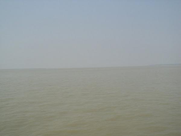
फेरी गंगेच्या पात्राच्या मधोमध आल्यावर अनेक लोकांनी भक्ती भावाने गंगेची, फुला-नारळाने पूजा केली. "गंगामैय्या" चा जयघोष झाला. गंगेचे ते रूप, ती भव्यता आम्ही डोळे भरून बघत होतो. शेकडो लोकं, माश्यांच्या टोपल्या, फळांच्या-भाजीच्या परड्या, बाजारात विकण्यासाठी गृहपयोगी सामानांच्या गोण्या, एखाद दुसरी मोटार सायकल आणि अजून बरेच काही लादलेली ती फेरी अनेक दिवसात तेल-पाणी नमिळाल्याने जशी दिसेल / जशी चालेल अगदी तशीच वागत होती.
फेरीचा प्रवास संपतो तेंव्हा, ३४ किमी लांब आणि १४ किमी रुंद अशा बेटावर, सागरव्दिप, तुम्ही उतरता. खूप पूर्वी हे संपूर्ण बेटं सुंदरबनचाच एक भाग होते. इंग्रजांनी तिथली झाडे / जंगल कापून तिथे वस्ती वसवली. त्यामुळे अजून जरी कागदोपत्री तो सुंदरबनचा भाग दिसतो तरी तिथे वाघ अजिबातच फिरकत नाहीत. बेटावर जी काही छोटी छोटी गाव आहेत ती सगळी, मुख्य रस्त्याला लागुनच आहेत. वस्ती अतिशय तुरळक आहे. पण प्रवास मोठा सुंदर आहे. एकूणच पश्चिम बंगालला सृष्टीसौंदर्याचे (नव्हे सौंदर्याचेच) वरदान लाभलेले आहे. भरपूर झाडी, फळ-फुलांचे ताटवे, सतत वाहणारा वारा प्रवास अजूनच सुखकर करतो.
तर काचुबेरीयाहून मेळ्याच्या ठिकाणी जायला तुम्हाला सार्वजनिक वाहन मिळते. जे १० रुपये प्रत्येकी घेऊन तुम्हाला मेळ्याच्या ठिकाणापासून थोड्या अंतरावर सोडते. जी गाडी पूर्ण भरली आहे असे आमच्या डोळ्याला दिसत असताना, "या गाडीत जागा आहे तुम्ही बसा", असे गाडीचा चालक आम्हा ८ जणांकडे बघून म्हणाला तेंव्हाच स्वतंत्र गाडीने जावे असे आम्ही ठरवले. आम्ही तिघी आणि फेरीत भेटलेल्या काकुंचे ५ जणांचे कुटुंब असे ८ जण मिळून एक सुमो ठरवली. ३० किमीच्या या प्रवासासाठी, सुमो सारख्या गाड्या इथे ७०० ते ८०० रुपये भाड्याने मिळतात. मेल्यापर्यंत जाऊन, पूजापाठ करून, बंदरावर परत आणून सोडणे, असे तो व्यवहार असतो. आमच्या बरोबरचे कुटुंब खास राजस्थानहून आले होते. त्या पाचपैकी एक पुरुष आणि बाकी ४ बायका होत्या. १ आजी (सासू), २ एकमेकिंच्या सौतन (काकांच्या बायका), १ त्यांची जाऊ. गाडी सुरु झाल्या बरोबर त्या चौघींनी मस्त मारवाडी / हिंदी अशी मजेदार गाणी म्हणायला सुरुवात केली. कोरसमधे आम्हाला पण सामिल करून घेतले. मेळ्याच्या ठिकाणाला पोहोचेपर्यंत त्यांच्याशी आमची गट्टीच झाली. गाडीतून उतरलो तर परत एकदा गाडीवाले भोवती घोंगावू लागले. पण आता हि गाडी म्हणजे, सायकलला मागे जोडलेले हातगाडीचे फळकुट. त्यावर आपण बसायचे आणि समुद्र किनाऱ्याला जायचे. काकांनी पुन्हा एकदा बाह्या सरसावल्या आणि १०० रुपयात २ गाड्या वरून, ३० रुपयात २ गाड्या जाऊन-येऊन असे ठरले. आम्ही ८ जण २ गाड्यांवर मावलो खरे, पण एक माणूस चार माणसांचे ओझे घेऊन सायकल ओढणार या विचारानेच खाली उतरावेसे वाटले.
(सायकल गाडी, किनार्याकडे जाणारा रस्ता)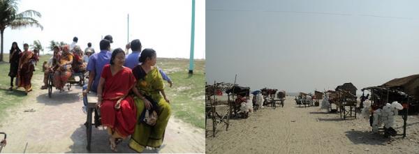
समुद्र किनार्याला लागुनच कपिलमुनींचे मंदिर आहे. सागराची आणि गंगेची प्रतीकात्मक मूर्ती बनवून त्यांचे पण मंदिर बांधलेले आहे. दरवर्षी मकरसंक्रांतीच्या दिवशी लाखो भाविक इथे येतात ते, या दिवशी गंगा-सागराच्या संगमावर आंघोळ केली तर सगळी पापं धुतली जातात, या श्रद्धेपोटी. पहाटे ४.३० ते संध्याकाळी ४.३० या वेळातच स्नान करणे आवश्यक आहे, म्हणजेच सूर्यदेवांच्या साक्षीने. थोडक्यात दिवसा उजेडी. पापं तर धुवून निघतातच शिवाय गंगा स्नानाचे पुण्यही लाभते ते वेगळेच. [ "१००% मोक्ष मिळतोच आणि स्वर्गाचे दर नक्की उघडते" असे तिथे भेटलेले अभिषेकाचे कंत्राटदार सांगत होते.] गंगा स्नानाइतकेच कपिल मुनींच्या मंदिरात जाऊन पूजा करण्यालाहि महत्व आहे.
(कपिलमुनींचे मंदिर)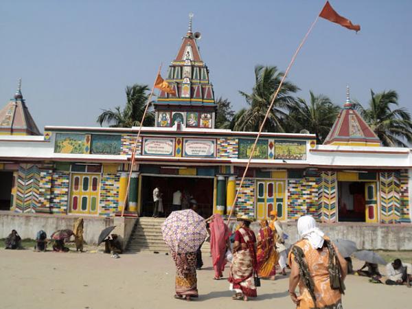
पुराणकथेनुसार, कपिलमुनी हा विष्णूचाच एक अवतार आहे. कर्दममुनींच्या इच्छेनुसार विष्णूने त्यांच्या पोटी जन्म घेतला. असे सांगितले जाते की विष्णूने कर्दम मुनिना सांसारिक आयुष्याचा मार्ग अवलंबण्यास सांगितले, त्यावेळी त्यांनी विष्णूला हि अट घातली, जी विष्णूने मान्य केली. अधिरथाने गंगा धरतीवर आणली ती इथेच गंगासागर संगमाच्या ठिकाणी. त्याची पण एक अख्यायिका सांगितली जाते. सत्य युगात 'सागर' नावाचा राजा होता. अयोध्येच्या या राजाने अश्वमेध यज्ञाचा घाट घातला होता. त्याचा यज्ञाचा अश्व, देवाधिदेव इंद्राने, कपिल मुनींच्या आश्रमा जवळच पाताळात लपवून ठेवला होता. राजाचे ६०,००० पुत्र अश्वाच्या शोधात आश्रमापर्यंत येऊन पोहोचले, त्यांना घोडा सापडला. घोडा कपिलमुनींनी लपवला या धारणेने त्यांनी तिथे उच्छाद मांडला, ज्यामुळे कपिलमुनींच्या तपश्चर्येत / ध्यान साधनेत व्यत्यय आला. क्रोधीत झालेल्या मुनींनी ध्यानातून बाहेर येत राजपुत्रांवर आपली नजर टाकताच, सर्व ६०,००० राजपुत्रांची जागेवरच राख झाली आणि कपिलमुनींच्या शापवाणीनुसार त्यांना नरकात स्थान मिळाले. सागर राजाला जेंव्हा हि हकीकत समजली तेंव्हा त्याने कपिलमुनिंचे मन वळवण्याचा बराच प्रयत्न केला. शेवटी राजाच्या तिसऱ्या पिढीला यात यश आले. राजाचा नातू, भगीरथाने, कपिलमुनींच्या आज्ञेनुसार विष्णूपत्नीस 'गंगेच्या' रुपात धरतीवर आणले आणि तिच्या पावन स्पर्शाने राजपुत्र शापमुक्त झाले. तो दिवस होता मकर संक्रांत. तर असे हे संक्रांतीचे महात्म्य. भगीरथाने शंकराच्या मदतीने गंगा धरतीवर आणली, असे आपण लहानपणापासूनच ऐकत आलो आहे.
ऐकण्यात आले की लोकांमध्ये अशी पण एक श्रद्धा आहे, कुमारिकांनी जर मकर
संक्रातीच्या दिवशी संगमावर गंगेत डुबकी मारली तर त्यांना 'देखणा' नवरा
मिळतो आणि कुमारांना देखणी बायको. [ आजकाल असेही ऐकू येते की, मार्चमधे
गंगासागाराचे दर्शन घेतले तर 'मायबोलीकर' नवरा मिळतो. ]
सूर्याचे मकार्वृत्तात भ्रमण, सूर्याचे सुरु होणारे उत्तरायण, (पूर्वी ) पवित्र असेलेले गंगाजळ, संगमाच्या ठिकाणी निर्माण होणारे प्रवाह, या आणि अशा काही गोष्टी मिळून काहीतरी वैज्ञानिक महत्व नक्कीच असणार आहे, जे आता काळाच्या पडद्याआड गेले आहे.
हि प्रथा नक्की कोणी सुरु केली, मंदिर कोणी बांधले या सगळ्या गोष्टी अजूनही गूढ वाटाव्या इतक्या अंधारातच आहेत. गंगासागर स्नानाचा उल्लेख महाभारतात पण सापडतो असे ऐकले. कोणी संत महात्म्याने भीष्माला संगमाचे आणि त्या ठिकाणाचे पावित्र्य आणि महत्व समजावून सांगितल्याचा संदर्भ सापडतो.
१८३७ मधे प्रकाशित झालेल्या एका वर्तमानपत्रात या मंदिराचा उल्लेख आहे. त्यावेळी असे म्हंटले आहे की हे मंदिर १४०० वर्षे जुने आहे. गुरु रामानंद नावाच्या कुणा तपस्व्याने ई.पु. १४३७ मधे तिथे मूर्तीची प्राणप्रतिष्ठा केली. आता तिथे दिसते ते रंगीबेरंगी मंदिर १९७० साली बांधले गेले, पूर्वीचे कच्चे काम पाडून त्याचा जीर्णोद्धार करण्यात आला. पूर्वीचे मंदिर आणि कपिलमुनींचा आश्रम समुद्राने आपल्या पोटात घेऊन टाकला, असे पण लोकं सांगतात. एकूणच गंगासागरबद्दल अनेक कथा / प्रथा / आख्यायिका ऐकायला मिळतात.
पूर्वी गंगासागरला जाणे हे एक मोठेच दिव्य होते. रस्त्यात अनेक संकटांचा सामना करत बोटीने अनेक दिवस प्रवास करावालागे. सुंदरबनचे अरण्य आणि जंगली श्वापादांबरोबरच प्रचंड संख्येने असणारा जलचरांचा वावर, पाण्याचा धोकादायक प्रवाह, लहरी निसर्ग, घनदाट झाडी असे सगळेच प्रतिकूल घटक प्रवासाच्या मार्गात होते. शहरीकरणाने "पुण्याचा" मार्ग सुलभ केला असे म्हणायला हवे.
(चंदेरी वाळु [फोटोत माझी आई], शांत-निवांत किनारा)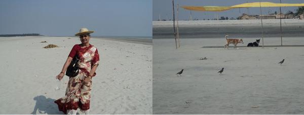
किनाऱ्यावर पोहोचलो. चंदेरी म्हणावी अशी वाळू आहे. अगदी मखमलच. ओंजळभर हातात घेऊन उगीचच खाली सोडली. पाण्यात गुडघे बुडतील इतके आत पर्यंत गेले. नजर मात्र समोरच्या दृश्यावरून हलत नव्हती. कुठे गंगा संपते-कुठे सागर झेपावतो, डोळे शोधत होते. मधे एक पुसटशी रेघ दिसली खरी. पाण्याचा रंगहि वेगळा आहे. अलीकडचा हिरवट आहे, पलीकडचा काळपट आहे. अलीकडचे पाणी शांत वाटते, पलीकडचे पाणी खळखळते आहे. किनारा शांत - स्वच्छ - निवांत आहे. गंगेचे पाणी डोळ्याला लावले, कपाळाला लावले. तिच्या भव्यतेपुढे नतमस्तक न झालो तरच नवल. गंगेची पूजा करण्यासाठी फुले-नारळ घेतले होतेच. दोन्ही पाण्यात सोडले.
(गंगासागर)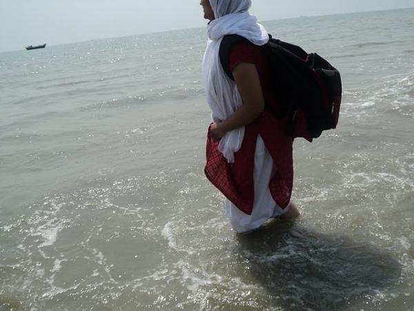
हिमालयाच्या कुशीत, गंगोत्रीला जन्म घेतलेली गंगा, मोठ-मोठ्या पर्वत रंगांचे अडथळे पार करत, ऋषिकेश-हरिद्वार मार्गे, काशी - प्रयाग असा प्रवास करून आवश्यक ती वळणे घेत, वाटेत भेटलेल्या कडू-गोड सगळ्यांनाच आपल्या पोटात सामावून, थेट पश्चिम बंगालच्या दक्षिण टोकास बंगालच्या उपसागरापर्यंत येते तेंव्हाही खळखळता आनंद भरभरून देते. तिची भव्यता डोळे दिपवून टाकते. "याच वृत्ती आयुष्याच्या प्रवासात मलाही साथ करुदेत" अशी प्रार्थना करून माघारी वळाले.
(जय काली कलकत्तेवाली(?), मंदिरातील महादेव)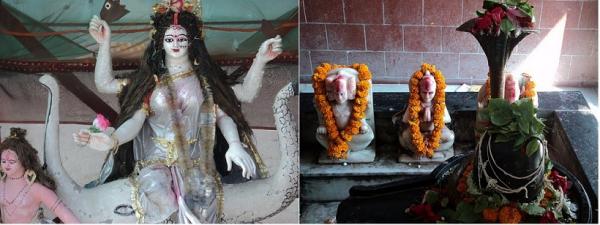
राजस्थानी कुटुंबाने स्नान, अभिषेक सगळे अगदी यथासांग केले. आम्ही स्नान करणार नसल्याने डोक्यावर-अंगावर गंगाजल शिंपडावे असे त्यांनी सुचवले. घटकाभर सगळेच भटजींनी दिलेली चटई अंथरून शांतपणे लाटांचे आवाज ऐकत बसलो. तहान लागली म्हणून सगळ्यांसाठी शहाळी घेतली तर अचानकच तिथली सगळी कुत्री माझ्या मागे लागली. पाणी पिऊन झाल्यावर खाली जी मलई उरते ती त्यांना द्यावी असा त्या भुंकण्याचा अर्थ. कुत्र्याला नारळाची मलई आवडते हे नव्यानेच कळाले. बाकी धार्मिक स्थळावर भेटतात तशी, गंगेतला नारळ पळवून परत तोच विकणारी, सुटे पैसे जाताना देतो असे म्हणून दुकानातूनच गायब होणारी मंडळी इथे पण भेटलीच. कपिल मुनींच्या मंदिरात गेलो. दर्शन घेतले. निराळ्याच मूर्ती आहेत त्या. तसेही राज्य बदलले की मूर्तींच्या रंगरुपात फरक पडतोच. या तर अतिप्राचीन पण आहेत.
(दुर्गामाता, गंगामाई)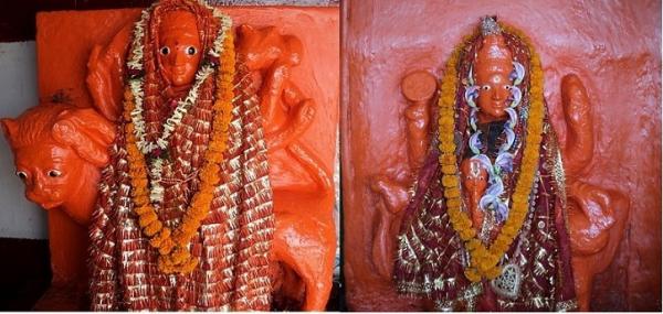
दुपारचा दीडच वाजत होता. परतीचा प्रवास सुरु केला. परत एकदा सायकलगाडी-सुमो-बोट-ईंडीका. राजस्थानी कुटुंबाचा कोलकात्याचा फोन नंबर घेऊन त्यांचा निरोप घेतला. रस्त्यात एक मोठ्ठे झाड बघून सावलीत गाडी थांबवली. ड्रायव्हरने आणि आम्ही जेवण केले. येताना ज्याची फक्त झलक बघून वेडावल्यासारखे झाले होते ते डायमंड हार्बर जाताना बघायचा विचार होताच.
कोलकात्य पासून ५० किमी अंतरावर डायमंड हार्बर नावाचे बंदर आहे. रुपनारायणी आणि हळदी अशा दोन नद्या अगदी शेवटच्या टप्प्यात गंगेला येऊन मिळतात. रुपनारायण मिळाल्यानंतर आणि हळदी मिळायच्या आधी, मधे हे बंदराचे ठिकाण आहे. रुपनारायण नदीचे पाणी मिळाल्यामुळे गंगेचे पात्र अधिकच रुंद होते, आणि तेंव्हाच गंगा दक्षिणेकडे वळते. त्यामुळे एक वेगळेच दृश्य तिथे बघायला मिळते. अगदी समुद्र वाटावा इतके रुंद आणि प्रचंड पाणी घेऊन जाणारे गंगेचे पात्र आपल्या अवाढव्य आकारासाहित संपूर्ण यु टर्न घेते ते दृश्य बघताना नक्की कसे वाटते हे शब्दात मांडणे माझ्या कुवती बाहेर आहे. 'यु' आकाराचा बेस तेव्हडा रस्त्याला लागून आहे. आणि तेव्हडेच दर्शन गंगामाई आपल्याला गंगासागरकडे जाताना देते. 'हाजीपुर' नावाच्या गावी, समुद्रमार्गे व्यापार या हेतूने पोर्तुगीजांनी हे बंदर बांधले असे सांगितले जाते. याचे 'डायमंड हार्बर' हे नामकरण मात्र इंग्रजांनी केले. त्याचे व्यापारातले महत्व आणि त्या जागेचे सौंदर्य असे दोन्हीला शोभणारे म्हणून 'डायमंड'. पण इस्ट इंडिया कंपनीने कोलकात्यामध्ये आपला जम बसवण्या आधी, भारतातला व्यापार वाढवण्याच्या दृष्टीने हे बंदर बांधले असे पण वाचले. पाण्याची खोली, गंगेच्या पत्राची रुंदी आणि समुद्रापासून तसे जवळ पण तरीही सुरक्षित अंतरावर, अश्या सगळ्याच गोष्टी जहाजांना ये-जा करण्यास अगदी पुरक आहेत म्हणुन ही जागा निवडली गेली असावी. पश्चिमबंगाल टुरिझमने आता हे ठिकाण पिकनिक स्पॉट म्हणून डेव्हलप केले आहे. तिथेच चिंगरीखाली नावाचा एक किल्ला पण आहे. आता फक्त अवशेषच आहेत. हे सगळे बघावे, जमल्यास सनसेट हि तिथेच बघावा आणि पुढे जावे. असा मनातल्या मनात प्लॅन तयार केला. आपण अगदी वेळेत आहोत, त्यामुळे डायमंड हार्बर आरामात होईल असे ड्रायव्हर कडून आश्वासन घेऊन पुढे निघालो. आणि पश्चिमबंगालचा खास असा तो थरार, ते नाट्य रस्त्यात आमची वाट बघत थांबले होते.
(हेच ते ठिकाण)
अगदी मसालेदार चित्रपटात शोभावा असा तो प्रसंग. पण प्रत्यक्ष अनुभवण्याची वेळ कधी आपल्यावर येईल असे स्वप्नात पण वाटले नव्हते. गाडीत आम्ही तिघीजणी, ड्रायव्हर तसा पोरगेलाच, त्यातही शेजारी राज्यातला. त्याने आम्हाला धीर द्यायचा तर आम्हीच त्याला धीर देत होतो. त्याचेही बरोबर होते, त्याने अशा घटना असंख्यवेळा अनुभवल्या असतील आणि त्याचा गंभीरपणा समजावा इतका आमचा अनुभव नव्हता. पण जसे जसे बाहेरचे वातावरण बदलत चालले तसे तसे गाडीतले टेंशन पण वाढत चालले. माझी आई एकदम धीराची आहे आणि तशीच मीपण :). आत्या मात्र खूपच घाबरली होती आणि तिच्या जोडीला ड्रायव्हर.
मी, आई, आत्या, आम्ही तिघी खिडकीतून बाहेर बघत-बघत गप्पा मारत होतो, रस्त्याने भरपूर झाडी, फुललेली शेतं, मधे गाव लागले तर शाळेची मुले, विचित्रच दिसणारी वाहनं, पाण्याला निघालेल्या बायका, असे बरेच काही. प्रदेश वेगळा असल्याने सगळेच बघण्यासारखे वाटत होते. सूर्य पण परतीच्या मार्गावर होता, त्यामुळे माना टाकलेली एका शेतातली सूर्यफुले त्या नारंगी छटेत खूप सुंदर दिसत होती. मी काच खाली घेऊन एक फोटो घ्यावा या विचारातच होते, तर समोरून एक बस अचानकच थांबून वळायचा प्रयत्न करते आहे असे दिसले. ड्रायव्हरने बस कशीबशी रस्त्याच्या थोडी बाहेर काढून वळवली आणि उलट दिशेने जायला लागला. मागोमाग जोरजोरात आरडा-ओरडा ऐकू येऊ लागला आणि बराच मोठा माणसांचा जमाव, हातात, काठ्या, चाकू, सुरे, कोयते असे काय काय घेऊन आमच्या दिशेने पळत येताना दिसला. आमच्या ड्रायव्हरने ताबडतोप काच बंद करण्याचा आदेश दिला, जी मी फोटो काढण्यासाठी उघडली होती, आणि तिकडे बघू पण नका अशी सूचना केली. माणसांचा जमाव आरडा-ओरडा करत आमची गाडी पार करून पुढे गेला, मागून ४-५ मोटार सायकली प्रचंड वेगाने गेल्या आणि थोडे पुढे गेलेल्या बसला आडव्या थांबल्या. बस ड्रायव्हर, बस थांबवून उतरला आणि धूम पळत सुटला. काही लोकं ड्रायव्हरच्या मागे धावले, उरलेल्यांनी लाठ्या-काठ्या-दांडकी-दगड जे सापडेल त्याने बसच्या काचा फोडायला सुरुवात केली. जोरजोरात बसचा पत्रा ठोकायला लागले. आतली सगळी लोकं घाबरून खाली उतरली, आणि आली त्या दिशेने चालत-चालत निमूट परत निघाली. तर त्यांना तसे करू न देता जिथून बस वळवली होती तिथे जाऊन थांबायला सांगितले गेले. इतर अनेक गाड्यांप्रमाणे आमची कार पण समोरचा रस्ता बंद असल्याने जागेवरच थांबली आहे, हे एव्हाना माझ्या लक्षात आले. काय झाले म्हणून ड्रायव्हरला विचारले तर "हे नेहमीचेच आहे, रास्ता रोक दिया है", असे उत्तर मिळाले. शेजार राष्ट्रातून घुसखोरी करून भारतात आलेल्या, एका ठराविक समाजाची ती वस्ती म्हणजे एक छोटे गावच आहे. जे मुख्य रस्त्याला लागून असल्याने, येणाऱ्या जाणार्यांना हा त्रास नेहमीचाच आहे, अशी माहिती मिळाली. औरंगजेबाने हिंदू तीर्थक्षेत्रांना जाण्यासाठी 'जिझिया' कर लावला होता, त्यात गंगासागर पण होते. प्रश्न पडला, हे तरी दुसरे काय आहे.
पळून जाण्याचा प्रयत्न करणाऱ्या ड्रायव्हरला पकडून आणले होते. लाथा-बुक्क्यांनी तुडवत तुडवत त्याला लोकं घेऊन गेले, ते सगळे दिसेनासे झाले. मग मी गाडीतून खाली उतरले. ड्रायव्हरपण उतरून मागच्या पुढच्या गाडीवाल्यांशी बोलू लागला. गाड्यांची रांग इतकी मोठी होती की, रस्ता कुठे अडवला आहे ते ठिकाण दिसतच नव्हते. जमावातले काही लोकं दहशत दाखवण्यासाठी इकडून तिकडे, तिकडून इकडे चकरा मारत होते. मी, अर्थातच परत काचबंद गाडीत. आमच्या शेजारच्या गाडीत लहान मुल होते. मुलाच्या वडिलांनी, "माझ मुल आजारी आहे, दवाखान्यात घेऊन चाललो आहे, आम्हाला कृपाकरून जाऊ द्या" अशी विनंती केली. "चूप बैठ - चूप बैठ" असे काहीतरी उत्तरादाखल ओरडण्यात आले. ओरडणाऱ्याचे वय जास्तीत जास्त १८ असावे. १० वर्षांपासून ४०-५० पर्यंत विविध वयोगटातील लोकं त्या जमावात होती. भीती बाजूलाच, इतकी कोवळी ती मुलं, त्यांचा उद्दामपणा, भलत्या मार्गाने होणारा त्यांचा प्रवास हे सगळे बघूनच अंगावर सर्रकन काटा आला. थोड्या वेळाने अजून एक गट आला, त्यातला एक वयस्कर इसम गाड्यांकडे बघतबघत चालला होता. मुलाच्या वडिलांनी पुन्हा काच खाली करून तोच प्रश्न विचारला. उत्तर आले "कोई कही नही जायेगा".
बर्याच वेळाने आमचा ड्रायव्हर आला. तर घडले असे होते. कुठल्याश्या गुन्ह्याखाली या गावातल्या एका मुलाला अटक झाली होती. बातमी कळताच यांनी रास्तारोको केले. जाणाऱ्या येणाऱ्यांपैकी कोणीतरी पोलिसांना कळवले. जवळच्या चौकीवरून पोलीस आले. "रस्ता मोकळा करा" सांगायला लागले तर गावकऱ्यांनी पोलिसांना बेदम मारले. दुसऱ्यादिवशी कमांडो पाठवून गावातील 'त्या' लोकांना अटक केली गेली. त्यांच्यापैकी ज्यांनी ज्यांनी पोलिसांवर हात उगारला, त्यांना कस्टडी आणि मग पोलिसी खाक्या मिळाला. हि बातमी यांना गावात कळाली. म्हणून यांनी आज पुन्हा रास्ता रोको केले होते. पोलीस येऊन 'रस्ता सोडा, मोठा जाम झाला आहे, तुमची माणसं लगेच सोडतो' असे म्हणाले. त्यावर, "माणसे सोडा, लगेच रस्ता सोडते" असे सांगितले गेले. माणसे घेऊन जीप आली. पुन्हा विनवणी केली गेली. पण "ज्या पोलिसाने आमच्या माणसाच्या अंगाला हात लावला, त्याला आमच्या ताब्यात द्या तरच आम्ही सगळ्यांना सुखरूप सोडतो" अशी नवी मागणी करण्यात आली. हे सगळ नाटक सकाळी ११ वाजल्यापासून चालले होते म्हणे. आम्ही पहाटेच गेल्यामुळे जाताना तरी सुटलो होतो. ड्रायव्हरला मारण्याचे कारण, त्याने यांचा आदेश झुगारुन वेगळ्या वाटेने जाण्याचा प्रयत्न केला.
जमावातला तो वयस्कर इसम त्याची फेरी पूर्ण करून परत जाताना शेजारच्या गाडीशी थांबला आणि "बच्चा कहा है दिखाव" असे म्हणाला. यांनी मुल दाखवले. तो म्हणाला "पुछ के आता हु". थोडे बरे वाटले. येताना त्याच्या निम्म्यावयाच्या एका मुलाला घेऊन आला, त्याच्या हातात मोठा चाकू/सुरा होता. तो ओरडतच आला, किसका बच्चा बिमार है, गाडीपाशी येऊन म्हणाला, डॉक्टर का कागज दिखाओ. तो तर नव्हताच. त्यामुळे 'नही जा सकते' असे म्हणून तो निघून गेला.
पश्चिम बंगाल हे पूर्वेकडचे राज्य असल्याने सूर्यास्त तसा लवकर होतो. एव्हाना पूर्ण अंधार पडला होता. त्यामुळे वातावरण अजूनच 'भयाण' वाटत होते. वेळ जाता जात नव्हता. शेवटी दीड-दोन तासाने कमांडोज च्या गाड्या आल्या आणि आमची (सगळ्यांचीच) सुटका झाली. 'डायमंड हार्बर' राहिले ते राहिलेच.
दुसऱ्या दिवशी ऑफिस मधे झाला प्रकार सांगितला तेंव्हा "बस इतनाही, आप इतनेमेही डर गयी" अशी प्रतिक्रिया ऐकून मात्र त्यांच्या सहनशक्तीला आणि कम्युनिस्ट राजवटीला मी सलाम केला.
भरगच्च आणि तितकाच सुंदर निसर्ग, वेगळ्या वाटेवरचा वेगळाच प्रवास, महानदीचे समुद्रात विलीनीकरण याची डोळा बघावे, यासाठीच होता सारा अट्टाहास. तो मात्र सुफळ संपुर्ण झाला
"सब तीरथ बार बार, गंगासागर एक बार"
रच्याकने, त्या नदीचं नाव रूपनारायण आहे (रूपनारायणी नाही). किती सुंदर नावं आहेत बंगालमधे नद्यांची.. पद्मा, मेघना, कालिंदी, मयूराक्षी, रूपनारायण, पियाली, कंसावती, शिलावती, इ. नाहीतर आपल्याकडे.. मुळा, मुठा, घोड, कुकडी, इ.इ. (कृष्णा, तापी जरा बरी आहेत त्यातल्या त्यात.)
त्या सायकल हातगाडीला व्हॅनरिक्षा म्हणतात तिकडे, आत खेडेगावांमधे हिडण्याचं जवळजवळ एकमेव साधन. आपल्या एस्टीच्या लाल डब्ब्याचं महत्व असं बाहेरच्या राज्यांत फार जाणवतं.
Mission Cemetery Serampore

This is my third blog in the Danish Serampore series and this blog, we will visit another cemetery. This one is the Baptist Mission Cemetery located very near to Serampore college and is also very significant in the historic perspective of Christianity in India.
The Serampore Trio
Before understanding the significance of why this small cemetery is so important to Christianity in South Asia you have to first understand “The Serampore Trio”.
William Carey, Joshua Marshman, and William Ward were true icons when it came to education and translation in India. Together they were known as The Serampore Trio.

William Carey (1761 – 1834)
He was born in the year 1761 in rural Northamptonshire, England. He arrived in India on the 11th of November 1793 and initially tried to settle down in Calcutta but then moved on to North Bengal. He found it difficult for him to spread the Baptist mission in Calcutta which was then being dominated by other sects so he settled for Serampore which was then under Danish rule.
Out here on the 10th of July 1800, he started The Serampore Mission under Baptist Missionary Society. On 5th July 1818, he started the Serampore College along with Joshua Marshman and William Ward. The main reason behind starting this college was to train the local indigenous population in theology so that they can become ministers.
In 1827 Serampore College was granted a Royal Charter by Frederick VI, King of Denmark, that allowed the college to grant a degree which was first in Asia. Serampore College superseded the Bishop’s College which was then located in Shibpur to grant theological degrees and became the sole college in the whole of South Asia to have that power.
The other major accomplishment was the translation of The New Testament into Bengali language and then printing them for the very first time in Serampore where a printing press had been set up with the help of William Ward who was a printer. At a later stage, this very printing press managed to print Bible in 44 different languages.
Another interesting fact was the love for botany and Carey started a botanical garden in Serampore which unfortunately is no longer present at the moment. It was located in the same premises where we now see India Jute Mill. He founded the Agri Horticultural Society of India located in Alipore and also acted as a temporary caretaker of Botanical Gardens in Shibpur.
He died on the 9th of June 1834 and was buried at the Mission Cemetery.

Joshua Marshman (1768 – 1837)
He was born in the year 1768 at Westbury Leigh, Wiltshire in Britain. He came to Calcutta along with William Ward in 1799 along with his family and children. Being a scholar he was instrumental in translating the Bible along with William Carey in many Indian languages. They were also instrumental in the translation of Ramayana from Sanskrit to English.
He died on the 9th of June 1834 and was buried at the Mission Cemetery.

William Ward (1769–1823)
He was born on the 20th of October 1769 at Derby in England. He was the main person behind the setting up of the printing press in Serampore. He was a trained printer which he had learned in Derby. He came to India in 1799 along with Joshua Marshman and went to Serampore since they found it difficult to settle in Calcutta.
He was also instrumental in arranging funds for Serampore College which he managed through his visits to Europe and also to the United States.
He died on the 6th of December 1837 and was buried at the Mission Cemetery.

About Mission Cemetery Serampore
The name of this cemetery is Mission Cemetery and over the years people have started referring to this also as William Carey Graveyard which is incorrect. The simple reason being that in this very cemetery also lies two of his best colleagues and friend Joshua Marshman and William Ward.
This is the second Cemetery in Serampore the other one being Danish Cemetery which is in itself divided into two parts one for the Protestants and the other for the Roman Catholics. This Cemetery was created for the English Baptist Missionaries who had taken charge of church and college. More than the Danish contribution it is the contribution of Baptist missionaries that built the legacy of Serampore.


Grave of William Carey
As you enter on your extreme left you will see a large domed tomb-like structure. If you go towards that section of the cemetery then you will find the grave spot of William Carey himself and that of his wives and children. The grave of William Carey is very simple painted in red with a marble plaque on top.


On one side of the tomb, the Stone plaque mentions Charlotte Emilia who was the second wife of William Carey, and Grace Carey the third wife of William Carey.
On the other side of the tomb, the plaque is dedicated to Mrs. D. (Dorothy) Carey the first wife of William Carey.

The red grave in front of the tomb is that of Felix Carey the eldest son of William Carey.


Grave of Joshua Marshman
This section is located right opposite the side of the cemetery from that of William Carey. This memorial site is the biggest in this cemetery marked by a domed structure with three arched entrances in the front and two on each side.
There are no visible graves here but just memorial plaques belonging to Joshua Marshman and that of his relatives.


Grave of William Ward
This is located at the end of the cemetery. From the main gate if you look straight then you will be able to see a circular dome-like structure with nine pillars. This place only has one plaque only dedicated to William Ward.


Other Graves at Mission Cemetery
Apart from the graves of William Carey, Joshua Marshman, and William Ward along with their relatives, there are other graves also in this cemetery. Some of them are in a very bad state requiring urgent repairs while some of them are freshly whitewashed. Some of the gravesites are marked with unique small pillar-like structures.


How to Visit Mission Cemetery in Serampore
The place is not open to visitors and you would need prior permission
from Serampore College for entering this place. The caretaker stays
within the cemetery compound but you will not be allowed entry unless
you have written permission from the college authority.
How to Reach Mission Cemetery in Serampore
This place is located right next to Gopinath Saha Bridge on Brojo Dutta Lane (Kash Bagan)
and although you can come by your car parking will be difficult due to
the narrow lane. Ideally park on the main road which is approaching the
bridge and then walk around fifty meters to reach the cemetery.
Location of Mission Cemetery Serampore
Metiaburuz – The Lucknow of Kolkata

I have been visiting Metiaburuz – The Lucknow of Kolkata for the past 4 years now. During my school days for a considerable time I spent at St. Thomas Boys School in Kidderpore, I used to have lots of friends from Metiaburuz but never had to opportunity to check that place out. As a middle-class Bengali, the thought of visiting Metiaburuz was way out of question and all we heard were horror stories of a country within a country.
At the maximum, I had been to Fancy Market which back in my school and college days was famous for fake Nike and Casio watches. Then there were kite shops that I used to hear from my friends that sold the best Manja (glass-coated thread) in Metiaburuz and the kites that were sold there had the perfect balance for a stable flight.
After my blogging adventure started one of the places that I always wanted to cover was Metiaburuz. Honestly, it was for the “kites and the kebabs”. What I failed to understand back then was that for both kites and the kebabs there was one person responsible for them and it was none other than Wajid Ali Shah the last king of Oudh.
My adventure into Metiaburuz started with guidance from Sohail who is somewhat veteran when it comes to “Metiaburuz Walk”. We started exploring the locality for the past few years and made numerous trips during this time. The one single question that always intrigued me what the Blue Plaque installed at the West Bengal Heritage Commission at Bichali Ghat as to why on earth the king of Oudh somewhat with the stature of Wajid Ali Shah would land at Bichali Ghat when we arrived in Calcutta for the first time.
All his travel records indicated that he was traveling in a royal style with a huge amount of treasure that he had managed to pack on his way to the city. So why would someone land at Bichali Ghat of all places which back then was just a makeshift dock for country boats and even today has a basic facility to accommodate docking of motorized boats meant for local transportation.
Short History of Wajid Ali Shah and Metiaburuz
Before I begin let me make it very clear that a lot has already been written on this subject in detail so what I am doing here is just a short brief history and then a timeline of events.
Wajid Ali Shah was the last king of Oudh (Awadh), he got the throne of Oudh (Awadh) when it was already in a decline and the end was visible. By then East India Company had already extracted much wealth from the city and on top of that, the kingdom was overburdened by paying the maintenance bills for Bengal Army.
The decline had started much before Wajid Ali Shah was born when with the treaty of 1801 a majority of the kingdom was already under the grasp of the East India Company. With Wajid Ali Shah being considered a “soft” king more interested in literature, music, and dance it was inevitable for the company to put the final nail in the coffin by annexing the kingdom under the complete control of East India Company.

Wajid Ali Shah left Awadh on the 13th of March 1856 on a steamer named General MacLeod and arrived in Calcutta on the 13th of May 1856. He wanted to travel to London to meet Queen Victoria but was now permitted so he settled in Calcutta for the time being while his mother was allowed to travel to London to present their petition directly to the queen.
That was the first time he stepped into the city of Calcutta and never left the city. He understood his future and instead created his version of mini-Lucknow in Calcutta at Metiaburuz where he remains buried at Sibtainabad Imambara.
Steamer General MacLeod and Wajid Ali Shah
I have been researching this steamer and found out some interesting details about this steamer. Knowing Wajid Ali Shah and his taste it was imperative that he travel in some opulence and as per different reports from that time we get a clear picture of this.
The steamer General Macleod was operated by a company named General Inland Steam Navigation Company established in 1844 which also operated two more steamers by the name of Sir Herbert Maddock and Sir Frederick Currie. All these three steamers were built in London and had been brought to Calcutta to be used on the Hooghly.
These steamers were one of the most powerful ones during that time having 140 horsepower engines. These steamers operated in a tug system which meant the main boat housed the engine and also housed the main passenger cabins. The steamers were powerful enough to tow 100 tons.
It is to be noted that the first steamer General Macleod did not have a very long life and shortly after being introduced into service sank in the Hooghly. Back then it was common practice to replace a ship with the same name and that’s why General Macleod still sailed even after sinking.
In the book Lady’s Travels Round The World by Ida Pfeiffer we get a somewhat look around the steamer, General Macleod. A trip from Benares (Varanasi) to Calcutta would cost Rs. 257 and with an additional Rs. 3 per day one can enjoy food and drink onboard. A trip from Benares to Calcutta was covered in fourteen to twenty days.
In many references, we get to know that Wajid Ali Shah when he set sail he carried a lot of goods along with him and this could have been only possible when a steamer like General Macleod with 140 horsepower would be available to tug the load. The nawab would also like to travel in some comfort and this steamer was equipped with dining and drinks.
General Macleod used to make regular shuttles between Calcutta to Allahabad and was on numerous times used as a charter for ferrying passengers to other parts of the country. With Calcutta being a scheduled stop for this steamer it’s logical for the steamer company to stop at Calcutta which had all the facilities for docking and refueling which would not have been possible at Bichali Ghat.
Bichali Ghat back then was where hand-rowed country boats used to stop ferrying passengers from one place to the other. It did not have any facility for docking a big tug steamer.
Timeline of Wajid Ali Shah
30 July 1822 – Born
13 February 1847 – Became the king of Oudh
11 February 1856 – Kingdom annexed by East India Company
13 March 1856 – Left for Calcutta
13 May 1856 – Reached Calcutta
29 May 1856 – Received gun salute and officially welcomed to Calcutta
1 September 1887 – Died in Calcutta
Family (line of heir) of Wajid Ali Shah
First Wife – Begum Hazrat Mahal (1820 – 7 April 1879)
Eldest son from Begum Hazrat Mahal – Birjis Qadr (20 August 1845 – 14 August 1893)
Wife of Birjis Qadr – Mehtab Ara Begum (granddaughter of Bahadur Shah Zafar)
Son of Birjis Qadr – Mehar Qadr (24 December 1893 – 1961)
Wife of Mehar Qadr – Mehdi Begum (died 1971)
Son of Mehar Qadr – Anjum Qadr, Kaukab Qadr & Nayyer Qadr
* Mehar Qadar abdicated the throne of Oudh on the 15th of August 1947.
The Poison Angle
During the rebellion of 1857, there was a massive resistance in Lucknow and Birjis Qadr was declared the monarch. With pressure mounting from the British forces, Birjis Qadr along with her mother Begum Hazrat Mahal fled to Nepal. They remained there till they were pardoned by the British to avoid any repercussions.
He returned to India along with his wife and children to Calcutta in 1893. By then it was already nearly six years past the death of Nawab Wajid Ali Shah in Calcutta. With the absence of Birjis Qadr, the government had declared another family member as the heir apparent.
When Birjis Qadr returned he staked a claim as the legal heir since he was the eldest son to be born from his first legally wedded wife. While in Calcutta he along with his family were invited to a feast at one of the relative’s house. It was by chance that his wife Mehtab Ara Begum did not attend the event as she was then pregnant with Mehar Qadr. The feast attended by Birjis Qadr and other family members turned fatal and they mysteriously died.
After that event, Mehtab Ara Begum left a quiet life along with Mehar Qadr but the legal battle kept on going and only was settled in the year 1974, and on the 1st of October that year the family got the right to the trust.
Places To Visit Around Metiaburuz
There is no existence of the actual residence that was once occupied by Wajid Ali Shah. What now remains are the Imambaras that were constructed during his reign. After the death of the Nawab, his estate was auctioned by the government and a very small portion of personal artifacts were given to the heirs.
I have listed down some of the places associated with Wajid Ali Shah that one can still visit. It usually takes around two hours to visit all these places. Keep a note that BNR House is not part of this trail and is just mentioned as a reference.
BNR House
Oudh Family Burial Ground
Qasr-Ul-Buka Imambara
Bait-Un-Nijat Imambara
Shahi Masjid
Bichali Ghat
Sibtainabad Imambara
Begum Umda Mahal Imambara
BNR House
After reaching Calcutta the first place that was allotted to Wajid Ali Shah was a house at Garden Reach which was previously occupied by Sir Lawrence Peel who was the Chief Justice of the Supreme Court from 1848 to 1855. This is now what we see as BNR House which is now part of the South-Eastern Railway and now the official residence of the General Manager.
It was from this place that the nawab was arrested as a precautionary measure during the 1857 rebellion and taken to Fort William where he remained till July 1859.
To visit this place, you would need prior permission, please get in touch with the PRO of South-Eastern Railways to get the necessary permission.


Oudh Family Burial Ground (Gulshanabad Imambargah)
This place is not exactly a tourist spot, I just mentioned it here as you will pass this site while going towards Metiaburuz. The gates usually remain locked so going inside is not always possible. This is the last resting place for many of the members of the family.


Qasr-Ul-Buka Imambara
If you are doing a Metiaburuz Walk then this would be the first stop in the tour. You will be welcomed with a façade that has nothing to do with opulence, rusted iron gates with walls all around the compound in separate need of repair. Things change once you enter the imambara and how beautifully it is maintained inside.
(Qasrul Buka Imambara) means “the house of mourning” and you will find a similar imambara in Lucknow also. This was in a way Wajid Ali Shah recreating Lucknow in Calcutta but on a smaller scale.


Bait-Un-Nijat Imambara
This is the trickiest one as this is not a functional Imambara and the current owners of the property are not that friendly towards tourists. Early in the morning when the family members are still sleeping you can get a glance at this place. Sadly, what remains visible are portions of the wall and some broken windows. The grandeur that this place once had could only be imagined by what remains visible.
(Baitunnijat Imambara) which would translate to “house of relief” was built around 1863 to commemorate Muharram by the nawab along with his family.


Shahi Masjid
A little up ahead you need to take a right turn and then you will be able to see a small lane with an iron gate, this is the Shahi Masjid (royal mosque). This is a very small mosque but this was the personal mosque of the nawab thus the name “Shahi Masjid”. Built around 1856 – 1857 the legend goes like this when the foundation stone for this mosque was supposed to be laid the nawab invited any religious person who have not missed praying five times a day to come forward and do the honors. No one came forward and it was then the nawab himself who came forward and laid down the foundation stone of the mosque.
The mosque has a square shape with a fountain on the northern side. On that side, you will also be able to see remains of some old pillars which might have been from some other structures that once were there.


Bichali Ghat
Now here comes the controversial ghat that some belief was the spot where the nawab first set foot when he landed here in Calcutta. As I mentioned above at the beginning of the blog that there is no evidence of this and even to date this is a small jetty from where small motorized passenger boats run taking people to the other side of the river. This jetty is not equipped to even till date to handle mid-sized streamers even to date.


Sibtainabad Imambara
This is the largest structure among the ones people would see during their tour of this place. Built in 1864 this was like what the nawab was trying to replicate in Lucknow in Calcutta by building an Imambara with the same name that one can see in Lucknow. Of course, the one in Lucknow is much larger and grand but this was in a way the Nawab replicating his memories of a place where he could not return.
The one is Lucknow houses the last resting place of Wajid Ali Shah so it was natural for the Nawab to wish during his lifetime that he too be buried here after he dies. Once you enter the main hall you can see his burial spot on the north side of the Imambara and at the south end of this main hall, one can see the burial spot of Birjis Qadr.


Begum Umda Mahal Imambara
Just next to Sibtainabad Imambara is the Begum Umda Mahal Imambara. This is a small Imambara that was built for Begum Umda Mahal who was one of the nawab’s wives who had accompanied the nawab from Lucknow to Calcutta. The one thing that one must see out here is the interior walls, one can still see intricate floral patterns created with glazed glass pieces on plaster. While major portions of the old walls have been replaced with regular cement plater one can still see portions all around the Imambara.


Speaking of Metiaburuz and not talking about kites and kebabs is just impossible. All around Metiaburuz, you will find several kite shops and if you are very particular about the “perfect manja” then some of these shops have the famed “Bareilly manja” considered the finest.
All these tours will surely make you hungry so the best option during any morning walk around Metiaburuz would be to have some Daal Poori, Halwa Poori, Nihari, and piping hot Paya. Wash it all down at the end with some tea in an earthen pot.


There are several kebab and biriyani shops around this part and for this, you might have to wait till noon. Though not as famous as their counterpart in the main city the shops out here are very pocket friendly and have a unique taste.


How To Reach Metiaburuz
The streets around Metiaburuz are very narrow and very crowded so if you are coming by your car then parking might be a challenge unless it’s chauffer driven. App-based cabs are the best option however the return journey can be a bit challenging. You can easily park your motorcycles around the side streets.
Location Of These Places On Map
Resources
The Tourist’s Guide To Lucknow By Edward Hilton
Account Of Some Recent Improvements In The System Of Navigating The Ganges By Iron Steam Vessels By Albert Robinson
A Collection Of The Acts By Superintendent, Government Press India
Historic Lucknow By Sidney Hay
British Library
Journal Of A Cavalry Officer; Including The Memorable Sikh Campaign Of 1845-1846 By W. W. Humbley
A Lady’s Travels Round The World By Ida Pfeiffer & William Hazlitt
Royal Collection Trust
Private Life Of An Eastern King By William Knighton
The Story Of The Assam Railways And Trading Company Limited 1881-1951 By Charles Folliott Birney
The Telegraph
Hindustan Times
Indian Express
Times Of India
Columbia University Library
Bhot Bagan Tibetan Monastery

Like many, the pandemic lockdown was a big shock and somehow, I had to get over the season of no assignments and work from home. So, to get over the boredom I made a list of places that can be visited on a day trip. One of them was Bhot Bagan Tibetan Monastery, for some strange reason I kept avoiding this place coz the name gave me the creeps. So, it was not ironic that this place was one of the last places that I had visited along with a friend at almost the end of the pandemic season which was around October 2021.
Navigating in Howrah (Ghusuri) that too on a motorcycle can be challenging as the GPS on the mobile often cannot tell me if the road is a narrow lane with barely enough space for the motorcycle to pass through or if the road is wide enough for two trucks. Somehow, I managed to navigate through lanes and by lanes before reaching a laborer’s quarters and the small concrete lane just happen to pass through it.
I was kind of reluctant and luckily found a lady who knew the family had the key to the main gates and confidently told us to enter the premises without any hesitation.
The main temple was the only place that was in slightly better condition whereas the rooms in the adjacent building were almost crumbling down. The same sorry state was seen in the temple-style memorials which surrounded the property.
History of Bhot Bagan
Calcutta being Calcutta true to its nature had adopted various communities around the globe so why not adopt another community who called this place their home? Bhot Bagan is a Tibetan Buddhist monastery and why the Tibetans had to set up a monastery out here is a story in itself.
Bhot Bagan monastery was founded by Puran Gir Goosain as a direct request from the Tashi Lama of Tibet. Back then East India Company was constantly trying to expand its reach in the subcontinent and at the same time was facing stiff resistance from Tibetan states on the northern front of Bengal.
The story however did not start in Tibet but started in the princely kingdom of Bhutan. In 1772 the chief of Bhutan invaded Kuch Behar (Cooch Behar). With no help in sight and under pressure the maharaja approached Warren Hastings for military aid. With additional force, the Bhutanese army was completely destroyed and pushed beyond the borders. In exchange, Hasting had made the Maharaja take half of the kingdom’s revenue and also join Bengal to remain protected.
The Bhutanese chief (Depa Shidar) immediately got in touch with the Tibetan chief Tashi Lama (Lobsang Palden Yeshe) 6th Panchen Lama who was then the guide to the minor Dalai Lama to intervene. A delegation from Tibet was sent to Calcutta in 1773 along with a letter for Warren Hastings. The delegation reached Calcutta and the letter was received by Hastings on the 29th of March 1774.
A treaty was signed between the Bengal Government and Bhutan on the 27th of April 1774. The treaty highlighted that Bhutan return all the prisoners of war and in return, they keep enjoying duty-free trade as they used to.
To mediate further trade talks with Tibet Warren Hastings on the 13th of May 1774 appointed George Bogle who along with Dr. Alexander Hamilton and Puran Gir Gossain traveled to Tibet to meet (Lobsang Palden Yeshe) 6th Panchen. The delegation reached Lhasa on the 8th of November 1774.


The Lama as a sign of peace and non-hostility requested Hastings to allot him land in Calcutta where he would set up a monastery for the faithful to come to meditate and pray. The request was forwarded through the hands of George Bogle to Warren Hastings.

Back in Calcutta Hastings orders the purchase of 100 (upward of 150 as per some record) acres of land to set up the monastery by Hastings. The land was purchased on the other side of the Hooghly facing the river at Howrah (Ghusuri). Once the construction of the temple and the monastery was completed Hastings personally sent a message to the Lama informing him of this.
On June 1776 the temple at Bhot Bagan was consecrated (blessed and made active). The main deity of the temple back then was Mahakal. The Lama from Tibet had sent lots of valuables like paintings, idols, carpets, etc. for the temple.
The deeds of the land were registered in the name of Puran Gir Gossain who acted as a dispel and representative of the Lama in 1778.
Over the year Puran Gir Goosain became like a liaison between the Tibetan kingdom and the company in Calcutta. He was respected and revered and thus it can be seen that many governors after Hastings had kept a steady visit to Bhot Bagan. In future diplomatic missions to Tibet Puran Gir Goosain was sent as a representative of the company.
The temple became a place for traders from Tibet to come and rest when they would come to Calcutta for trade. All around the temple premises small cottages would be constructed for the traders to rest.
Puran Gir Goosain was killed in the year 1795 when the temple compound was attacked by dacoits, he had successfully managed to save the temple but got himself killed in the process. The main idol of Mahakal was however lost and never found again. After his death, his follower Daljit Gir Gosain took over the reins of the temple.
Over the years the property hold of the temple shrunk and with limited or no maintenance the main building started to fall apart and became inhabitable.
The Mahant tradition also ceased to exist beginning of the 20th century and now the locals manage the temple and do the necessary cleanups.
What To See In Bhot Bagan
The name Bhot has nothing to do with Bhut (ghosts) which many people mistake with. The Tibetans refer to their land as Bhod from which we get Bhot and Bagan which means garden. So, in short, this is a Tibetan Garden Temple.
If you find the main gates of the temple compound closed simply knock and enquire on the house located opposite the main gate. They know the person having the key to the temple.


The vast area around the temple is densely covered in grass and shrubs, the local children often use this as a playground. The main double-story heritage structure is in a dire state and is inhabitable. The roofs almost collapsing and the walls crumbling.


The main temple however is in a relatively better state. The temple cannot be exactly called a Buddhist temple anymore as we can see a seamless mix of Hinduism in the form of Shiva Linga placed inside the temple.
The main deity which has been secured within an iron grill box is that of Tara. She is referred to as the female form of Buddha. This was one of the idols that once had occupied this temple and with the loss of the Mahakal idol, this started being worshiped.


On the eastern side of the property right next to the temple compound, one can see four small temple-like structures and another one is placed northeast side of the temple. These are tombs of Mahants who had served this temple. On the western side of the property at a distance, one can also see two more such structures but a lot bigger, these have now been converted into two Shiva temples.


As per traditions Mahants who were considered Sadhus are never cremated instead, they are buried in a seated position. The place where the dead Mahants were buried was later covered up to resemble traditional Bengal temples. Traditionally people would also offer prayers at these spots remembering them.
How To Reach Bhot Bagan Tibetan Monastery
The best way is by your vehicle be it a car or motorcycle. Two-wheelers have the advantage of easily navigating the small lanes. Just follow the map given below and you will reach the destination. Remember that this is a functioning temple that especially becomes active during Shivratri thus plan accordingly. The locals mostly refer to this temple as Mahakal Temple.
Location of Bhot Bagan Tibetan Monastery on Map
Resources
Bengal: Past and Present, Vol-02, Issue no – January-June
Buddhist Monastery at Bhot Bagan (Howrah) by Gaur Das Bysack
Journal of the Asiatic Society of Bengal 1832 by Asiatic Society
Howrah District
Royal Collection Trust
British Library UK
John Hopkins University
West Bengal Heritage Commission
Tilpi and Dhosa Archaeological Site

When I told my friend that we will be going to Tilpi and Dhosa then my friend was kind of shocked thinking that I was referring to having Jilipi (sweetmeat) and Dosa for lunch and must be planning to check out a new restaurant. I had to repeat myself that it’s a name of a place rather than the specific names of two villages Tilpi and Dhosa which are archaeological sites. Surprisingly these two villages on the southern end of Bengal land mass right before the start of the Sundarbans have Buddhist Archaeological remains.
I have been actively visiting Buddhist sites across Odisha and Bihar and have blogged about these places also. What was always puzzling my mind was why only Odisha and Bihar had a history of Buddhism and why Bengal which joins the two states had nothing significant.
History of Tilpi and Dhosa
The Archaeological records found in Tilpi make this place date back to around three periods. Period one is dated to the 2nd to 1st century BC whereas period three is dated to the 2nd to 3rd century AD. A lot of artifacts found here belong to the early Gupta Period.
There was a sudden end to the occupation of this place around the 2nd – 3rd century AD indicating some sort of devastation. Archeologists suggest that a massive fire could have been the reason behind this. Post this period no record of human civilization was recorded till around the 16th – 17th century AD.
Fa-Hien when he had come to India talked about a large stupa located which can be corresponded to the current location of Dhosa. The excavation process at Dhosa unraveled lots of terracotta bricks indicating the presence of a large well-built structure.


Both Tilpi and Dhosa are geographically located next to the Piyali river which again connects to Matla and Bidyadhari Rivers. And if we look back in time then Chandraketugarh was located on the banks of the Bidyadhari River which was once a major trading port attracting trade from all over the world.
The Tilpi Dhosa Adventure
It took around two and a half hours to reach Dhosa and another fifteen minutes drive towards the south will take you to the Archaeological site of Tilpi. Do not expect anything visual and it was tough trying to navigate the small concrete village roads trying to reach the spot. After asking a few locals and missing a few turns finally the site was reached.


With nothing visually seen it was a bit confusing, all that I could see was an open playing field and a club where local boys were playing carrom. Upon asking them they pointed toward the end of the field where there were lots of bamboo trees and a large mobile tower.


On inspecting nothing much could be made out; it was then a local man showed what remains of Archaeological digs which have now been covered up. The excavation was done years back (2005 – 2007) and the team found some terracotta and metal objects. No structures resembling a stupa were seen but random bricks were seen which could be assumed were part of some structure.


Off the record, the localities talked about rampant digging and looting of metal and other precious objects by some villagers which were sold off with the help of agents. Much before the government agencies could come and start digging a significant portion of the catch was already taken out.
The villagers were a bit offended by the lack of apathy shown by the government agencies who had promised the villagers that the place will be developed into a tourism hotspot and that would help the villagers. Nothing happened and after the dig was over the sections were simply covered up and that was the end of the story.
On the return journey, we stopped at Dhosa which was another Archaeological site and with the midday heat picking up we stopped at a shop to have some fizzy drinks. It’s my nature to strike up a conversation with the shop owners so that additional information could be gathered. Luckily the shop owner was very much aware of the Dhosa Archaeological site, he used to watch the team dig up the place for hours and informed that the site was barely five hundred meters from his shop.


He gave us easy directions as to just look out for the football ground. After a couple of minutes ride, we reach a small football ground but unlike any ground which would have level ground consisting of either soil or grass this small ground had rather an uneven surface and the ground was full of broken pieces of bricks.


Confused I ask a group of children and they happily point me to this very ground as the Dhosa Archaeological site. Similar to that to Tilpi the authorities had dug up and did their excavation and after finding a few artifacts then closed up the dig site. Unlike Tilpi a lot of terracotta bricks were discovered here which made it almost certain of remains from an earlier monastery or stupa.


In a way, I was very disappointed, while Buddhist Archaeological sites in Odisha and Bihar are so much visited and highlighted in media no one talks about these Buddhist Archaeological sites of Bengal. Disappointed I pick up a small piece of terracotta brick from the ground as a reminder to myself of what should not be done to any heritage sites like these.

Artifacts at State Archaeological Museum in Behala
Back home I made a couple of visits to the State Archaeological Museum in Behala as most of the excavated finds from Tilpi and Dhosa are supposed to be housed there and put on display. Thankfully there was a room and all the artifacts were displayed with proper labeling. The team at the museum was also helpful in explaining a lot about these sites. There are some books on sale out here which has more information about these two places but unfortunately, all of them are in Bengali.


I wish to thank my friends and Behala State Archaeological Museum for extending permission to photograph the original excavated artifacts.
How To Reach Tilpi and Dhosa
From Kolkata, it’s around 48 kilometers and the best way to reach both Tilpi and Dosha is by car or motorcycle. The road to the Tilpi site is very narrow so I would suggest parking your car at a distance and walking the last few hundred meters on foot.
Tip: The locals might sound a bit agitated so it’s better to approach them making it very clear that you are tourists and do not represent any government organization.
Location of Tilpi and Dosha on Map
Resources
Other Related Blogs
Portuguese Burial Ground Kolkata

After announcing my hiatus from blogging this is the first blog post after a few months of hibernation. Talking about hibernation when I was thinking as to which blog post should be the one to revive my blog then the first one that came to my mind was about the Portuguese Cemetery or the Portuguese Burial Ground in Kolkata.
I have been researching this cemetery for the past two years and the only reason that stopped me from writing this blog was the limited resources that were available to me all along. Now I have managed to piece it together like a jigsaw puzzle and finally, the post is ready.
We have all heard about the Scottish, Armenian, Greek, French, etc. cemeteries that the city once had or still standing. For some strange reason, we forgot about another community that is the Portuguese who was one of the early traders and had a strong presence in the city and the subcontinent as a whole.
A large contribution of the Portuguese community and the traders was primarily responsible for the spread of Roman Catholicism in this part of the country. Members from this community were the primary donors for the construction of some of the Roman Catholic churches in the city.
Even though the British were primarily Anglican and propagated the protestant version of Christianity they did not stop other branches of Christianity to also spread and that’s the reason why we also find few large Roman Catholic churches in the city.
When it came to burying the dead there were no restrictions as to which cemetery, they found their last resting place. That’s the very reason why you will find both Roman Catholic as well as Protestant graves at Lower Circular Road Cemetery. However, when the new Roman Catholic churches were founded in the city primarily by Portuguese merchants some of the contributors also invested in creating the last resting place for the members of their community.
History of Portuguese Burial Ground
The Barretto family was synonymous with building catholic churches in and around the city. Roman Catholic Cathedral (Cathedral of The Most Holy Rosary), St. Patrick’s Church Dum Dum, Church of the Sacred Heart of Jesus, Church of Our Lady of Dolours, and even the Church of Santa Madre De Deus in Serampore were also built with healthy contribution from the Barretto’s.
The one name that comes up many times when someone talks of the Barrettos is that of Joseph Barretto who was the sole person funding the Catholic churches in Calcutta and it was his initiative to have a separate burial place for the Portuguese in the city.
On the 8th of February 1786, he donated land at Baithakkhana (present-day Sealdah) to set up a burial ground. He paid Rs. 8000 back then for the purchase of this land.
Residing at a grand mansion at 25 Mangoe Lane the Barrettos were a family who generation after generations were support the expansion of churches in the city. Joseph Barretto died in September 1824 and after his death, his next generations carried on with the work.

Location of Portuguese Burial Ground
This place back then was a simple burial ground and attached to it was a small chapel. Over the years the chapel got converted into a large church that we now know as St. John’s Church. Do not confuse this with the St. Johns Church near Governors House which was once the cathedral of the city. This St. John’s Church is a Roman Catholic church located next to the Sealdah (North) Station and can be easily spotted from the flyover due to its bright red color.
The burial ground is now more popularly known as St. Johns Church Cemetery mostly due to the prominent church that now it houses.


What To See at Portuguese Burial Ground
Since this burial ground is a relatively small plot of land thus the tombs and graves have been used over and over again, this also means that the older ones which had some reference mentioned in books and journals are nowhere to be seen. The oldest gravestone that I could locate is mostly from around the 1840s.


Things took an ugly turn when the railway platforms were expanded and the western wall of the burial ground shared the railway tracks on the other side. This was around the mid-1950 and the wall back then dividing the property from the railway station was also very low. This gave a rise to vagabonds and addicts often jump over the wall and use the burial ground as a nuisance.


The sad part was that during this period a lot of the marble busts were damaged, the heads chopped off and sold off by a group of miscreants.


Some of the older graves remain and still have some of the original stone and marble works visible. A significant portion of the cemetery now contains the graves of Fathers from the church and Sisters from the Missionaries of Charity organization. The south side of the burial ground also now houses a nunnery.


Most of the old graves can be seen on the north side of the cemetery. Most of the graves are in a dire state and unfortunately, the graves are individual property and the church cannot directly start any kind of renovation unless the family owning the graves steps in. In most cases, the graves are over 150 years old and no one steps forward to assume ownership.
Overall this place is another jewel in the crown of the city of Kolkata as we can proudly say that this city is truly an amalgamation of different cultures and religions.

Location Of The Burial Ground On Map
Resources
The Complete Monumental Register Containing All The Epitaphs, Inscriptions By M. Derozario
List Of Inscriptions On Tombs Or Monuments In Bengal Possessing Historical Or Archaeological Interest
Bengal: Past And Present (July To Dec.) Vol.23
History Of The Portuguese In Bengal By J. J. A Campos
Hackers Guide To Calcutta By W. K. Firminger
Asiaticus: In Two Parts By John Hawkesworth
Indian Express
Other Related Blogs
Afghan War Memorial Kolkata

In Kolkata, we are fortunate to have many War Memorials, and recently I was collaborating with a national print media to document all the war memorials in this city. I realized that out of all the names in the name there was one name that I did not have the opportunity of visiting and that was the Afghan War Memorial Kolkata in Dum Dum. This war memorial is not a mark of victory instead it marks a dark history of defeat. It was built more as a memorial to the dead than to praise their valiant victory.
A short history of the First Anglo-Afghan War
This war was fought between 1839 – 1842 between British (East India Company) forces and the Afghan & Baloch Tribes. The British forces saw victory in the beginning but it ended with a tragedy of epic proportions.
Timeline:-
1837 – The British were seemingly getting worried about the ever-increasing reach of the Russian Empire. With a fear that they might take over provinces in and around Afghanistan. To quell this fear they decided to make the Afghan tribes ally with them. Kabul was the principal capital of Afghanistan and was ruled by Emir Dost Mohammad Khan.
Emir Dost Mohammad Khan wanted the British to help them squash the land occupied by Sikhs which they did not and this angered Dost Mohammed Khan. Instead, he went to the Russian empire for help. Now, this spooked the British into thinking that they will lose control over this region.
1839 – The British under the leadership of General Sir John Keane head towards Afghanistan along with 20,000 men. It is to be noted here that the majority of all the sepoys were native Indians.

By April of that year, Kandahar was captured and installed their dummy, Shah Shuja Durrani, there. While some troops remained back in Kandahar the rest marched on towards Kabul.
On the way, they met resistance at Ghazni where there was a large fort being protected with a strong defensive wall.

By July the fort was breached and the forces took over the fort. After this, the forces marched towards Kabul. Seeing an inevitable incoming attack Dost Mohammed fled the city this made it easy for the advancing British forced to capture Kabul.

1840 – By November Dost Mohammad handed himself over to the British and was exiled and taken to Calcutta (Kolkata).

1841 – After the victory in Kabul, a part of the force was kept back in Kabul while the rest marched back to India. Things do not go down well with the new ruler and soon there were revolts especially when it was back by one of Dost Mohammad’s sons Muhammad Akbar Khan. Sir William MacNaghten was killed in this onslaught while most of the forces were captured.

1842 – A surrender was negotiated by General Sir William Elphinstone according to which the troops had to surrender all of their gunpowder and cannons. In total, over 4,500 British troops and 12,000 support staff started their journey back to India.

It was winter so the icy roads were a death trap and along with that, the return journey was an open field for the local scattered tribesmen to keep attacking the convoy. With no gunpowder the defense was weak and the troops especially Indian sepoys were either killed or captured.

Dr. William Brydon was one of the few who survived the journey back to Jalalabad where he informed of this ordeal to Major General Sir Robert Sale who had left earlier from Kabul to clear the path back to Kandahar but was unable and decided to base at Jalalabad.

Major-General George Pollock set out from India as a reinforcement for Jalalabad. A counter-offensive was also started by Major General Sir Robert Sale on Muhammad Akbar Khan and his men to ease the passage for Pollock and his men. With the combined forces Muhammad Akbar Khan was finally defeated and the British forces went back to Kabul by September of that year.


By October that year, the British decided to withdraw all its troops from Afghanistan and set the remaining men back to India.
The entire fiasco of British forces going all the way to Afghanistan with native Indian sepoys and suffering heavy casualties was a major disaster for the British. Shah Shuja Durrani was murdered following an uprising by various factions and tribes. Ironically Dost Mohammad Khan became an ally of the British and went back to rule Afghanistan till his death. Muhammad Akbar Khan died of cholera after a few years which many believe was poisoned by his father fearing the dominance that he had created while he was in exile.


Afghan War Memorial in Kolkata
Calcutta being the main capital city for East India Company it was decided to construct a memorial for the fallen British officers. It is to be noted that even though the troops comprised of nearly 20,000 native sepoys they find no spot in this memorial. The memorial plaques around the memorial column only have the names of English men.


The design of the column is rather simple with a tapering square base having memorial plaques on two sides originally. The third plaque was put up after restoration. The column is a having a simple round structure with grooves at the base and the top. The top portion has a designed finish with honeycomb-like grooves.


This Afghan War Memorial in Kolkata was erected in the year 1844 two years after the end of the First Anglo-Afghan War.


Location of Afghan War Memorial
It is located right next to another iconic building that is the Ordnance Factory Dum Dum. Back then when the memorial was constructed the factory was not present and it came up much later in 1846. The reason the factory was built was to ensure a steady supply of ordinance, weapons which the British troops lacked the most. The forces could not breach the walls of Ghazni Fort as they did not have enough cannons and the ones that they had were not that powerful. It was only by chance when one of the doorways that protected the citadel was found to be weak and was attacked.

So, in a way it was more like a reminder for the British to start the ordinance factory in India that too next to the newly constructed Afghan War Memorial.
How to Visit the Afghan War Memorial
This monument is located right next to the Dum Dum Ordnance Factory and can be seen from the main road. However, the main gate to this monument remains locked. To access this monument, one must take prior permission from Dum Dum Ordnance Factory. You need to send them an application stating the reason for your visit and submit that to their office. You will be notified once you have the clearance to visit this place.
Note: No drone video is allowed at the monument since it shares the same boundary wall with Dum Dum Ordnance Factory.
Vlog on Afghan War Memorial in Kolkata
Location On Map
Similar Blogs
St. John’s Church Kolkata – A Complete Guide
Remembrance Sunday in Kolkata
References
British Library
Times of India
United States Library of Congress
National Army Museum UK
Art Council England
Gangani – Grand Canyon of Bengal

I always wanted to see the Grand Canyon in the US but I guess that dream will remain a dream for some time till then let’s explore what similarities we have in our own country. I had already covered Gandikota which I think is a very much underrated tourist destination. Next, the nearest that we have something close to the Grand Canyon here in Bengal in our very own Garbeta (West Midnapore) is Gangani.
How To Reach Gangani
The nearest railhead is Garbeta and many trains pass this station. From the station, you can hire a Toto (e-rickshaw) for a round trip including waiting time.
Gangani can easily be covered while touring around Bishnupur. It is around 28 Km from Bishnupur thus making it an ideal evening trip destination. There are easy road markers from the main road taking you towards the Gangani viewpoint. Usually, people come here with their vehicles and there is ample (paid) parking available.
Where To Stay in Gangani
The government tourist resort at Gangani is still under construction (May 2021) thus it’s recommended that you stay at Garbeta town which has a limited number of good hotels. Ideally, stay at Bishnupur where you have enough options when it comes to hotels and resorts.
Where To Eat at Gangani
Right at the viewpoint, there are many shacks selling tea, instant noodles, and other light snacks. These are not expensive and I would recommend a scenic evening at Gangani with a cup of tea.
Note: There are several stray dogs out there. Don’t be alarmed, these are very friendly and would jump and dance around you for some biscuits. Please do feed them they will surely make you happy with their wagging tails.
What To See at Gangani
Unlike the Grand Canyon and Gandikota which are formed by centuries of weathering and erosion of rocks out here in Gangani its more to do with soil erosion and the color of the soil is orangish-red which gives you the feeling of rock-like a canyon.

The canyons slope down to meet the Shilabati River giving a spectacular landscape. There is a concrete staircase that one can use to get down to the bottom of the canyon to explore the crevasse. One must be careful when at the bottom of the canyon as the ground is very uneven and for this do make sure you wear footwear with good grips. I would recommend sports shoes.


The canyon extends to a large area so don’t veer off to unknown corners and stay within visual range. If you are traveling during the rainy season then be prepared for a very muddy and slushy ground making it almost difficult to walk.
This part of Bengal sees a very extreme heat during the summers thus the best time to visit this place is during the winters. During summer only evening time is recommended.


Take time to enjoy nature and its natural land formation and the very beautiful Shilabati river making this a perfect photo frame.
Mythological History of Gangani
The locals swear by it and when it comes to mythology it’s very difficult to justify things logically. The locals refer to this place as Ganganii Danga. Danga when you translate from Bengali means land. The locals believe that the land formation was a result of an epic battle between Bheema and Bakāsura who was a Rakshasa. The battle was so fierce that the force created an uneven landscape.

Vlog on Gangani
Location on Map
Other Tourist Sites Nearby
Piardoba WWII Airfield Bankura
Resources
Piardoba WWII Airfield Bankura

I am always fascinated by WWII and its impact on India. Unfortunately, when we think of WWII the only thing that comes to our mind is Europe but in reality, a fierce battle front existed in the east between India and Burma (Myanmar). The Japanese Imperial Army was approaching from the east towards India to cut off the supply lines from Calcutta (Kolkata) to China. So, when I was visiting Bishnupur I made sure that I check out Piardoba Airfield.
Short History of Piardoba Airfield
The US Airforce had built several Airfields around Bengal with assistance from the British forces. These were constructed to ensure protecting the east from the Japanese. The Japanese had already captured significant portions of China and were already in full control of Burma (Myanmar).
With China cut off from any military supplies the only way they could be armed and fuel sent was through a supply route starting from the ports of Calcutta to run up towards Assam crossing the Ledo Road into China. For the Japanese, this route needed to get eliminated for them to hold on to Myanmar and China.

The Japanese Imperial Airforce was making regular sorties and attacking as far as Calcutta. Significant air support needed to be present in Bengal to counter this. The British were already suffering thus they needed the help of the United States for additional air support.
A series of airfields were constructed around Bengal so that regular bombing raids could be carried out from these places. Some of the airfields also acted as air Defence stations.
One such airfield was constructed at Piardoba for the US Air Force. It is from this very airfield that one of the longest bombing raids was carried out as far as Yawata in Japan.


This airfield was also used as a designated airfield for the B29 Superfortress which back then was one of the largest and heaviest long-range bombers operated by the US Airforce. These were operated by the 462d Bombardment Group. Consisting of B-29 Squadrons 768th, 769th, 770th, and 771st; Bomb Maintenance Squadrons 9th, 10th, 11th, and 12th; 13th Photo Lab and 86th Air Service Group.
Later after the departure of B-29 Squadrons, this place was occupied by 33d Fighter Group.
Post-war this airfield was handed back to British India and subsequently shut down. Even though this place is not any more functional but the land still belongs to the Ministry of Defence – Indian Airforce.
Piardoba Airfield Now
This is an abandoned airfield but still owned by the government thus there has been no encroachment as such on the main airstrip however all around the concrete runway and taxi way one can notice the open fields have been converted into agricultural land.


There are no paved roads leading to this abandoned airstrip instead it can be approached through multiple narrow unpaved mud roads. Keep in mind that during monsoon these roads can become treacherous.
It is easy to spot the airstrip as that would be the only concrete structure amongst lush green cultivated fields. Even though shrubs have sprung up from the cracks between the concrete slabs that form the airstrip the overall structure seems to have survived decades of abandonment.


Other structures around the airstrip are not visible any longer but the main taxiway is very much visible. You can drive along the straight airfield and can experience what used to be a thrilling takeoff on a bomber for a mission to Japan.
How To Visit Piardoba Airfield
This place is located very near to Bishnupur and if you are planning to visit Panchumura the terracotta horse artisan’s village then Piardoba can be covered on the way. Piardoba has its small railway station but it’s not a convenient way to visit this abandoned airfield.
I would recommend that you have your vehicle while visiting Piardoba Airfield since this place is a bit off-route from the main road. Keeping this in the mind day time is when you should target to visit this place and avoid evening time since there are no properly marked directions it’s easy to lose your sense of direction. This said mark your entry point on your mobile map app so that you can follow the same route to return.


Location of Piardoba Airfield on Map
Vlog on Piardoba Airfield
Other Blogs on Bankura
Resources
Places to visit in Bishnupur

In this blog, I am listing down all the places to visit in Bishnupur and the list primarily contains temples that I have also mentioned so other tourist attractions here that can be visited along with the temples. Bishnupur is not only about terracotta temples but there are stone (laterite) temples here equally. Along with that, you can visit some other ruins which were once part of the fort here at Bishnupur.
How To Visit Bishnupur
You can reach Bishnupur by train, car, or motorcycle. You can also take the bus but I would suggest not to as the bus services are not comfortable. Bishnupur has its train station and there are some regular trains from Santragachi and Howrah. I drove to Bishnupur from Kolkata and it was a comfortable journey taking around 5 hours with a breakfast stoppage.
Places to stay in Bishnupur
There are many hotels and resorts in Bishnupur alternatively you can also stay at hotels at Joypur Forest. Bishnupur is around 15 km from Joypur Forest and can be easily reached for a day trip to cover the temples.
How to Travel Around Bishnupur
The only way to cover the temples is by a toto (e-rickshaw). There are well-paved roads around Bishnupur but the roads are very narrow and, in some places, not even big to fit a large car. I had to face this and had promised never to make this mistake again. Some temples can be reached by car while for some the only way is to use a toto.
The toto’s run on per hour basis and have a fixed rate (as in the year 2022) of Rs. 200 per hour. So, it all depends on how long you will take to cover the list of temples. I would safely around somewhere between 5 – 6 hours if you want to cover all the temples and tourist attractions else can finish up with 2 – 3 hours if you only want to visit the popular ones.
I would recommend a two full-day trip to Bishnupur so that you can cover all the tourist attractions out there and explore some other nearby places.
List Of Tourist Places in Bishnupur
The list contains temples and some other interesting places located nearby. Except for three sites all other places are free. You do not have to purchase three separate tickets instead you just need one ticket which will let you cover all three. There is only one ticket counter at the Rasmancha from where you can get a physical ticket. However, you have the option to buy an e-ticket for that you don’t have to go to the counter at Rasmancha. The security guards posted at the temple gates will help you if you have any difficulty.
Photography at all these sites is free however videography has been restricted till further notice (May 2022).
All the information that I have provided about the tourist sites is taken from the information board erected by the Archeological Survey of India outside each of these places. If you want further details about the Malla kings and these temples then there is much information already available online which you can search.
I have listed down the temples and other tourist places according to a route so that all the temples can be visited with minimum travel time. At the end of the blog, you will also find a Google Map where I have pointed down all these places. You can use this map and travel with ease.
Stone Chariot
This is the smallest landmark out here in this town so don’t get disappointed by its size. This is like a miniature version of a wooden chariot but instead of wood, it has been carved out of laterite stones. It’s a double-storied structure and has a miniature Ekratna shrine on the top. Its lower portion is open on all sides and has five arched facades. The upper portion has a triple-arched facade. This structure is dated around the 17th century.


Choto Darwaza
This is a small stone gate that once stood near the Bishnupur fort. The walls are no longer visible however with some raised mounds they can be made out to be part of the fortification around the fort.
Constructed out of laterite stone was probably built during the reign of Bir Singha around the second half of the 17th century. The original structure had a plastered outer layer and only some portions of this are still visible.


Pathar Darwaza / Garh Darwaza
This gateway is located very near to the Choto Darwaza but the size is massive and has many internal sections and rooms. This gateway was the main entrance from the north into the Bishnupur Fort during the reign of Bir Singha the Malla king.


Lalji Temple
This temple is built with laterite stones in the Ekratna style. The temple is constructed on a large square plinth with a slightly curved roof. On this stands a single tower. There are three triple-arched gateways on three sides. The square sanctum has a single-arched opening on the south and east with a staircase on the east and west.
The dome-shaped ceiling and the vaulted porch are very prominent here. The single tower is Sapta Ratna with rigid Rekha turrets capped by a round Amalaka and pitcher.
The upper shrine chamber is open on all four sides by a single-arched gateway. The four corners of the temple are decorated with five series of horizontal double lines.
This temple was built by the Malla king Bir Singha in the year 1658.


Bishnupur Rajbari
Nothing remains of the erstwhile Rajbari, you can only see some portions of the main gate. This is a private property thus restrictions apply to tourists. You can see some portions of the Rajbari in a rundown condition inside.


Radhashyam Temple
This temple was built by Chaitanya Singha who was a Malla king. Built in the year 1758 this temple is on a square plan. This is an Eka Ratna south-facing temple built with laterite stones. This temple sits in a large courtyard with a high boundary. The external walls of the temple have carvings on low relief which are decorated with fine stucco works.
This is a functional temple and becomes especially important during the annual Durga Puja celebrations.


Mrinmoyee Temple
This is a very famous Durga Temple and for the past 1000 years, Durga puja has been celebrated here making it one of the oldest continuous Durga puja celebrations in Bengal. The temple structure however changed over the century but the devotion and celebration continue till date thus making this the oldest temple out here.

Krishna Balaram Deul Temple
Almost ignored these are a pair of temples located next to a large pond. From here you can view what remains of the Bishnupur Fort ruins. As the name suggests these are two temples in ruins and not under ASI. As the name suggests these have classic Deul style architecture but the size of these two temples is small compared to the other temples out here.


Bishnupur Fort / Hawa Mahal
Don’t get misguided when you hear the word fort, nothing of the original fort is present. A rather small portion of a palace is what that can be seen. This is commonly referred to as Hawa Mahal and it’s best to see this from the vicinity of Krishna Balaram Deul Temple as the place is not safe to approach considering the heavy shrubs and bushes that now have taken over this property.

Mahaprabhu Jiu Temple
Located opposite Krishna Balaram Deul Temple on the other side of the road this temple is a terracotta temple but in ruins. Entry to the temple is restricted. The board outside the temple dates around the first quarter of the eighteenth century built by king Gopal Singha.


Jor Bangla (Kesta Rai) Temple
Note: This monument requires a ticket. The physical ticket needs to be purchased from the ticket counter near Rasmancha or you can buy e-tickets on your mobile on the spot.
The actual name of this temple is Kesta Rai Temple but it’s more popularly known for its design which is in Jorbangla style. This temple was erected by Raghunath Singha who was a Malla king in the year 1655.
The temple faces the south and is raised on a square platform in the form of two traditional Bengal huts. The two slopes are joined in between and surmounted by a Char Chala Shikara on the top.
There are exquisite terracotta work and panels on the outer wall, inner wall as well as roof. These terracotta panels depict different scenes from Krishna Leela, social life, etc.


Gumghar
This is a real mysterious structure. The locals swear that this was once a torture chamber and criminals would be thrown inside the rectangular structure with a hollow in the middle. At the bottom of the hollow interior, there would be spears and other weapons that would kill the person thrown inside.
Unfortunately, there is no concrete proof of this and it has been passed by word of mouth. This is very challenging to validate as there is no way to see inside and satellite map images show the interior to be full of debris.
This could have been a granary also as having an execution place so close to several prominent temples is somewhat questionable.


Pancha Ratna (Shyamrai) Temple
Note: This monument requires a ticket. The physical ticket needs to be purchased from the ticket counter near Rasmancha or you can buy e-tickets on your mobile on the spot.
The actual name of this temple is Shyamrai Temple but popularly it’s known by its architectural style which is Pancharatna. This temple was built by Raghunath Singha in the year 1643 who was Malla king.
The square sanctum is surrounded by an ambulatory pathway with a porch opened by three multi-cusped arches on four sides. There are five Shikaras and the central one is octagonal while the others are square which are resting upon the four corners of a sloping roof in Pida order.
The decorative panels show us the contemporary socio-religious themes and other life of people back then. One can also see scenes from Ramayana and Mahabharata in the terracotta panels. Some also feature Puranic tales.


Rasmancha
Note: This monument requires a ticket. The physical ticket can be purchased from the ticket counter out here or you can buy e-tickets on your mobile on the spot.
This is one of the most iconic structures of Bishnupur and usually, this comes to mind when someone thinks or even searches for Bishnupur online.
This is built on a square structure with a small shrine at the center and three corridors around it. A triple-arched facade occurs on its four sides. The shrine in the center is approached through the central arched opening on the south. The structure has a truncated pyramidal roof. This structure was constructed around 1600 or late 17th century.
During the Ras festival, idols from other temples were brought here for celebrations.


Acharya Jogesh Chandra Purakriti Bhaban
This is a museum that one may wish to visit if they would want to explore more about terracotta, music, culture, etc. There is also a very famous sari shop located right opposite the museum.
At this moment (May 2022) this museum is undergoing major renovations and part of the museum is open to visitors.

Sarbamangala Temple
This temple is located a stone’s throw distance from the museum right on the banks of Lal Bandh (lake). This temple is dedicated to Devi Shakti and is famous for being frequented by Ma Sarada.


Lal Bandh
The Malla kings wanted to be self-sufficient when it came to water thus, they built seven large water tanks within their fort walls. This was done so that the knowledge that the land has some water scarcity would not be left vulnerable if under attack from an enemy.
Lal Bandh also has another history associated with it. According to the locals, this particular tank gets its name from a lady named Lal Bai who along with her baby were killed here. They were killed by tying them on a boat and then the boat was loaded with big stone boulders and then sunk to the bottom of the lake. This was done by the subjects of the Malla kingdom.

Dalmadal Cannon
This is a wrought iron cannon that was built by The Malla rulers. There was once an inscription in Persian on the cannon but these are not visible any longer. At a later stage, this cannon was fired during Durga puja celebrations.


Chhinnamasta Temple
This is a very famous temple in Bishnupur and one can see the idol of the headless Chinnamasta.


Jor Mandir Temple Complex
This temple complex consists of three temples. This temple was built around the 18th century by the Malla Kings. This temple complex consists of three Ekratna temples all of them have been constructed with laterite which is square in plan and constructed on a raised plinth. The temple in the middle is slightly smaller than the rest two and is elaborately decorated with stucco work that depicts scenes from Ramayana and Krishna Leela.
The northern temple was built by Gopal Singha and his wife Dhvajamani Devi in 1726.


Nandalal Temple
This temple has a laterite structure and is built in the Ekaratna style. The temple faces the south and it has ornamentations on the sides of the three arched openings. This temple was constructed circa the 18th century.


Radha Govinda Temple
This temple was built in 1729 by the Malla king Krishna Singha. This south-facing temple is built with laterite stones and is with a square plan having a curved roof and surmounted by a Sikhara at the top. It also has some bas-relief carvings which were originally applied with fine stucco work. You can also find a small chariot that had been built with bricks on the side in form of a miniature temple.


Radha Madhab Temple
Next, we have the Radha Madhab Temple which shares its compound with Kalachand Temple and the Archaeological Survey of India sub-circle office.
This temple was built by Churamony Devi the wife of Krishna Singha who was a Malla king in 1737 as the name suggests its dedicated to Radha and Krishna.


Kalachand Temple
This is a temple built with laterite stones and is in Ekaratna style. It was built in the year 1656 by Raghunath Singha a Malla king.
It is raised on a low platform and stands with a corridor around the three-arched openings on all four sides. The single tower having a Saotararatha plan is topped by an amalaka and a pitcher rises from the center of the curved roof.
The decorations are mainly low-relief carvings with Krishna Leela as the main theme and other Pauranic deities, dancers, etc. One of the panels in this temple features Chaitanya Mahaprabhu.


This completes the cluster of temples and other attractions on the eastern side of the town. Since the next set of temples are on the northern and north-western side of the town so I would recommend that you take a break and have lunch or snacks. Post which you can resume the tour after a quick rest.
The next set of temples is scattered so again one would need to travel to these places by toto.
Radhabinode Temple
This temple was constructed by Manikyabarshi who was the wife of Raghunath Singha in the year 1659. This temple faces the east and is one of the two Atchala style temples in this town. The gap between the two sets of chalas are very narrow. The temple has extensive terracotta works.


Madanmohan Temple
This temple was constructed by Malla king Durjan Singha in the year 1694. This temple is built with bricks and has a single Sikhara on a curved Chala. Many terracotta panels can be seen on the walls around the temple.


Malleswar Temple
This temple was built by Malla king Bir Singha in the year 1622. It is built in Ekratna style with laterite stone. This is a Shiva temple and one can also find a small stone Nandi Bull on the temple premise.


Muralimohan Temple
This temple was constructed by Rani Chudamani wife of Malla king Vir Singha in the year 1665. This temple is built with laterite stone and is facing the south. This is also an Ekratna-style temple but with some differences. The three arched openings are found replaced by a covered ambulatory resting on a row of pillars and the inner sanctum is topped by a tower.


Madan Gopal Temple
This temple was constructed by Shiromani Devi the wife of Veer Singha in the year 1665. This is a Vishnu temple and it’s in Pancharatna style.


Other Places Near Bishnupur
Panchmura
I would suggest a half a day trip to Panchmura which is famous for its Bankura Terracotta Horses. If you are planning to buy some terracotta souvenirs from Bishnupur then trust me to visit this artisans’ village and you will know why. Things are almost one-fourth the price out here in Panchmura than in Bishnupur. Also, you get the experience of watching the artisans in action creating wonderful terracotta horses, elephants, cups, saucers, etc.

Gangani
Another half-a-day trip would be to the Grand Canyon of Bengal. I would suggest that you visit this place in the second half of the day and enjoy a beautiful evening here. Unlike the Grand Canyon in the United States of America, this is not a stone erosion but a landscape created by land erosion. The land makes a drop to the river bed and you can see rising mud canyons all around you. Don’t forget to relax out here and have a nice warm cup of tea from one of the several snack stalls out here.
Note: You will find several dogs around here and these are very friendly. Don’t panic if they start jumping and dancing around you. They do it will all tourists and they do this just for some biscuits.

Pairadoba Airfield
This is an abandoned airfield that was used by US Airforce during WWII. You can still see the concrete runway which was once used by bombers of USAF. There are no paved roads leading to this place and you have to navigate through wild grass and vegetation with only a narrow strip of unpaved and uneven road guiding you.

Monalisa Restaurant
On a side note, if you want to taste Bengali delicacies then you must visit the restaurant called Monalisa. It’s highly recommended by several people and I have tasted them myself. And the best part is that the cost won’t make a hole in your pocket.


Locations of Places to visit in Bishnupur on Map
Other Blogs on Bankura
Piardoba WWII Airfield Bankura
References
Archeological Survey of India (Kolkata Circle)
Bankura District Administration
West Bengal Tourism
Outlook India
Jewish Cemetery Kolkata

I wanted to cover Jewish Cemetery Kolkata for a very long time. Unfortunately, due to some reason or the other, I had always missed the opportunity to cover this place. A few weeks back on a grueling summer Saturday I decided to check this place out and write a blog about it.
How To Visit Jewish Cemetery in Kolkata?
It’s located towards the east of Sealdah Station at Narkeldanga. There is limited parking space available in front of the main gate. At the maximum, a single car can be parked or around four motorcycles.
The cemetery is open to visitors and I would suggest you visit between 11 AM to 5 PM. There is a visitors’ book inside the cemetery, please do remember to sign it.
Basic mobile photography is allowed however if you want to do a professional shoot or videography, I would suggest that you take prior permission.
Location Of Jewish Cemetery Kolkata on Map
History Of Jews in Kolkata
I have already a blog about the Jewish Synagogues of Kolkata which includes the one lost synagogue also. In that blog, I have a short history as well as a timeline of events. I would request you to please visit the link below for more details.
What To See at Jewish Cemetery in Kolkata?
The cemetery has recently been renovated and restored so you will see pristine white tombs all around the cemetery. Don’t get surprised by the huge number of tombs as at one point in time the city did have a substantial number of Jewish populations which now, however, has dwindled to a two-digit number. As you enter from the main gate on the left you will find the visitor’s shed which was constructed for mourners. There is a memorial tablet inside this shed as well as there more stone plaques on the outer side (eastern wall) of the resting shed.


On the right side of the main gate, you will find quarters for the caretakers and security guards. The people manning this place most have been doing this for generations. Or they are given jobs after retirement from other Jewish institutions. The security guard proudly told me that he used to work at Jewish Girls School and after retirement was shifted to the cemetery.


The team does good work as the whole cemetery is neat and clean. Maintenance is done on regular basis and this can be made out by the landscaping that one can see here.
On the southeast corner of the resting shed, you will find a small concrete block with glass panes. If you look closely then you will see that it has coin slots. This had been constructed for collecting funds and donations.


Most tombs have memorial plaques on them. Some are simple rectangular pieces of marble while some can be seen having elaborate designs. Most of these plaques are in English while some also have been written in Hebrew. While most of the tombs are white (painted) few of them can also be seen in the red mosaic. Don’t be surprised to see some of the tombs marked “Removed”, some family members shifted their loved ones back to Israel after they had shifted to their promised land of Israel.


Genizah (Genizot)
Now the question is what do you do with old religious books or other religious literature. You just cannot throw them off in the garbage, and neither can you tear them. So, most Jewish Synagogues or a cemetery, have a special marked-out storage facility where you can come and deposit such Jewish religious materials for them to be buried as per religious guidelines.


There is one tomb out here that has text in English, Hebrew as well as Bengali making it the most unique one in this cemetery. This also bonds the community with the people of the city. How this community has adopted the city and its people and has evolved.


There are two large ponds inside its premises which I assume are mostly used for watering the plants. The cemetery has been beautifully planted with plants that have multiple-colored leaves. This creates a unique visual presence along with the pristine white tombs.


While most of the names were some did strike a chord, especially the tomb of David Nahoum the ever-smiling face behind the counter at Nahoum at New Market. The tomb of Ramah Musleah was a teacher at Jewish Girls School and the very new tomb of Rachel Elias who lived nearly 100 years.


Vlog on Jewish Cemetery
Other Blogs on Jewish Kolkata
Resources
Terracotta Temples of Baranagar

After Murshidabad and Cossimbazar this will be my last in this series and this blog, I will take you to some of the finest terracotta temples that can be found in this region. We will explore the terracotta temples of Baranagar. You can easily cover Baranagar in a day along with Koshbag and Rosnaiganj. On the way, there are a few more temples that you can also visit which I will explain at the end of the blog.
How To Visit Terracotta Temples of Baranagar?
Baranagar is on the other side of Murshidabad town across the Bhagirathi River so you need to cross the river and here comes the challenge. If you have a car and want to visit these places then you can only cross the river at Berhampore as that is the only place that has a bridge for vehicles. This also would mean that you have to take a long detour to cross the river. On the other hand, toto’s can cross the river on makeshift boats with a bamboo platform which would take around 2 to 3 minutes. But keep in mind the top speed of toto is 20 KMPH which would also mean a slow journey and it would take significant time to cover these places.
Where To Stay in Baranagar?
Tourists usually stay in Murshidabad if not then at Berhampore. But there are some new hotels also available at Azimganj and you can try these out also.
Short History of Terracotta Temple and Baranagar
The history goes back to the 1750s when a queen named Rani Bhabani decided to build 108 temples here. She wanted to rival the glamour of Varanasi in terms of the temple and financed the construction of all the temples. The reason why she did is that after the death of her husband Raja Ramakanta Moitra who was the zamindar of Natore (now in Bangladesh) she took over the zamindari and prospered. She devoted herself to a lot of philanthropic work and thus as a part of that she wanted to build temples.
It is said that she built around 107 temples here. She was a devotee of Shiva thus in most of the temples around here you will find a Shiva Linga.
Terracotta Temples of Baranagar:-
Panchamukhi Shiva Temple
The first temple that we will visit is the Panchamukhi Shiva Temple. As the name suggests Panchamukhi means five faces thus the Linga which is placed in the temple has five faces of Shiva. This is a functional temple and one of the most well maintained. The fresh coat of paint makes the temple look neat and clean but one must be careful about terracotta as layers of paint often cover up the finely detailed work overtime.
This is a do-chala temple with a look almost that of a traditional hut of Bengal.


Vlog on Panchamukhi Shiva Temple
Char Bangla Temples
This is the most famous set of terracotta temples in this region. In terms of design these four temples each have their unique flavor and together makes this place a must-visit destination. These temples are dated around 1755 A.D.
Temple 1
We are going anti-clockwise and this would be the first temple. The best way to identify is the look for the broken wall which is located right behind this temple. On the side, you will find a Shiva seated on a pedestal.
If you are looking for some of the finest terracotta work then this is the temple where you will find them all over the front panels. The panel above the central doorway shows the war in Ramayana with the ten-headed Ravana in a fierce battle with Rama.
All around you will find panels of Durga, Kali, and other goddesses. The lower panels depict battle scenes and don’t be surprised to see some panels wherein the soldiers are carrying rifles.


Temple 2
The second temple also has some terracotta panels but there are not as detailed. This temple has more motifs and flower patterns all around the front. Two rows are leading from one side to the top and then to the other side having panels of God and Goddesses.


Temple 3
This is the simplest in terms of design. Only on top of the doorway, you will find some circular patterns and the rest only plan square embossed terracotta tiles. This looks somewhat incomplete as if the panels were meant to be filled with more designs but were somehow repeated with a similar pattern.


Temple 4
This is very different from the rest three temples out here. By the looks, you can make out the white color finish instead of the red terracotta of the other three temples. This is because this temple has a fine lime plaster and all the designs are etched in these fine layers of plaster. The fine detailed work is something that needs time to be appreciated.


Vlog on Char Bangla Temples
Bhavaniswar Temple
This was also built around the same time as the Char Bangla Temples by Rani Bhavani. Being a devout Shiva follower this is another Shiva temple. The temple has a dome architecture with arched open gateways in all directions. This temple also features a plastered ornamental design instead of red terracotta panels.


Vlog on Bhavaniswar Temple
Two Shiva Temples Next to Rajrajeswari Temple
Within fifty meters from Bhavaniswar Temple is the newly built Durga Temple (Rajrajeswari Temple). Right next to this temple you will find two smaller terracotta temples. These are now in a much-dilapidated state and not worshiped any longer. By the looks of the outer face, it can be made out in some portions that these also had similar lime plaster with ornamental designs.


Vlog on Two Shiva Temples Next to Rajrajeswari Temple
Gangeswar Temple
The next temple is popularly known as the Jor-Bangla temple and this can be attributed to its design. Visually this looks like two temples have been built together sharing a common wall in between them. This is another classic terracotta temple.
The terracotta panels are on one side of the temple and depict various ways of life, daily work, the life of people, battles, and Gods and Goddesses. Watch out for the panels depicting Krishna Leela.


Vlog on Gangeswar Temple
Apart from these, I would recommend you to visit one more temple which originally was a terracotta temple and along with that on that way you can visit Dahapara Dham.
Kiriteswari Temple
This temple is located in Lalbag (Nabagram) and you can visit this while going towards Baranagar from Koshbag. This is a very famous Shakti Peeth. The original terracotta temple was destroyed around 1405 and one can still see the remains of it next to the newly constructed temple where the shrine was moved. All around the temple you can find other newly built shrines.


Vlog on Kiriteswari Temple
Dahapara Dham
Let me make it clear that this is not a terracotta nor does it have historical significance. The reason that I am mentioning it here is this temple will fall on the way and you can just relax and stroll around this newly constructed temple and hear the devotees sing kirtan (religious songs).


Vlog on Dahapara Dham
Location Of These Places on Map
Other Blogs on Murshidabad
Places to visit around Murshidabad
Places to visit around Cossimbazar
Resources
Places To Visit Around Cossimbazar

In my previous blog I have covered Murshidabad so continuing with that series in this blog I am going to cover places to visit around Cossimbazar. Cossimbazar or Kasim Bazar is very near to Murshidabad town and it can be covered within a day along with places to visit around Murshidabad. Cossimbazar mainly covers cemeteries, palaces, rajbari, and churches.
How to Visit Cossimbazar
Most tourist stays at Murshidabad or Berhampore so the best way to visit would be in a Toto (e-rickshaw) or you can come by your vehicle also. A toto would charge somewhere between 500 – 600 Rupees for a round trip from Murshidabad. Usually, there is a fixed syndicate rate but slight negotiations can be done.
The number of tourist spots in Cossimbazar is less thus you can easily combine it with your day trip around Murshidabad.
Where to stay in Cossimbazar
If you are looking for a luxurious experience then do check out the Cossimbazar Choto Rajbari (Palace of the Roys) which has been converted into a luxurious hotel and one can experience both luxury and royalty.
Places to visit around Cossimbazar:-
Armenian Church
This is the only Armenian Church in West Bengal outside of Kolkata. You must be wondering why an Armenian church that too in Cossimbazar? Back then I mean during the Cossimbazar was a hub for European traders and that is the reason why you had the Dutch, Armenian, and English all set up shops here for trade.
Just like in Calcutta the Armenians were traders and merchants and were eager to trade in Bengal with the support of the Nawabs and Cossimbazar being the next town to Murshidabad became their hub.
The actual name of the church is The Holy Virgin Mary Armenian Church of Saidabad. This church was built around 1757 – 1758 by Khoja Petros Arathoon. There is no regular church service out here since there are no Armenians in this part of Bengal anymore. Their population even in Kolkata is dwindling. Service only happens on a rare occasion when members of the Armenian community travel to Murshidabad, especially during the Armenian Christmas that takes place around the 6th of January.


Vlog on Armenian Church
Dutch Cemetery
Similar to the Armenians the Dutch merchants were also active out here. It was easier for them to get direct access to the Nawabs instead of waiting for communication to happen from Calcutta. This small cemetery has around 47 tombs.
The most attractive is the white tomb of Tammerus Canter Visscher which when one compares is a replica of the Tomb of Susanna Anna Maria in Bandel. In reality, it’s the other way round the one in Cossimbazar was built much before the one in Bandel it is believed that Susanna Anna Maria choose this design for herself. Her first husband was the Chief Administrator of Cossimbazar and during that time she had seen this and wanted something similar for herself but on a grander scale.


Vlog on Dutch Cemetery
Cossimbazar Choto Rajbari (Palace of the Roys)
This is also known as the Palace of the Roys and now functions as a museum for tourists as well as a heritage hotel. So, if you want to experience luxury and heritage then this place is very much recommended. The front portion of the palace has been renovated and the front façade is beautifully maintained in pristine white color.
You need to buy a ticket to visit the museum and the guide cost is included in the building. Photography is only allowed outside the building from the front side. However, limited mobile photography is allowed in the back section. No photography is allowed inside the museum.
The museum consists of rooms that have been decorated to what they would have been during the zamindari era. Furniture, bed, porcelain, dress, etc. are all on display. You will be taken on a tour of the back section showing you the temple and the Thakur Dalan.


Vlog on Cossimbazar Choto Rajbari
Old English Cemetery (Residency Cemetery)
This place is also referred to as the Residency Cemetery since during the East India Company days and even after that during the Crown era, there was a huge number of Englishmen living here in Cossimbazar. They had the same motive as the Armenians and the Dutch that is to ensure trade and a quick direct link with the Nawabs.
Especially after the Battle of Plassey a lot of English soldiers and officers were stationed here so at to keep a check on the activities of the Nawabs and to prevent a repeat of what Nawab Siraj ud-Daulah did by marching to Calcutta unchallenged.
These English men were buried out here along with some of their family members. One of the most prominent amongst them is the first wife and daughter of Warren Hastings who back then a British Resident of Murshidabad (back then the capital of Bengal) and later rose to the ranks of Governor-General of the Presidency of Fort William.


Vlog on Old English Cemetery
Cossimbazar Boro Rajbari (Sripur Palace)
The history of this house and the family also has a direct connection with Siraj ud-Daulah. When Siraj ud-Daulah decided to attack Calcutta his first wave consisted of taking over possessions from the English starting from Cossimbazar. Warren Hastings used to work as a clerk at the Cossimbazar factory. During the first wave of attack, Warren Hastings hid in this very place and was sheltered by Krishna Kanta Nandy. He was the grandson of Kali Nath Nandy who had settled here in Cossimbazar. Due to this favor, he was later made Diwan and had given the charge of many Zamindari. This led to the prosperity of the family for generations.
This is also the very building that had hosted the first Bangiya Sahitya Sammelan in 1907 which was attended by Rabindranath Tagore.
Unfortunately, this place is not accessible to tourists and one can only see it from the outside.


Vlog on Cossimbazar Boro Rajbari
Residency Cemetery of Babulbona
This is another cemetery that I recommend one should visit during a trip to Cossimbazar. Geographically this place is located at Berhampore but very near to Cossimbazar and can be easily reached in a toto.
This is a very large cemetery when compared to the Dutch and the Old English Cemetery. This cemetery again has a connection with the Battle of Plassey as after that the East India Company had established a cantonment and apart from Cossimbazar many of them had residence around Berhampore.
This cemetery had tombs of soldiers, officers as well as high-ranking officials. This cemetery was also used for their family members, especially children who had high mortality due to the weather and health conditions.
Some of the most prominent people buried out here in this cemetery are Captain James Skinner (1773), George Thomas (1802), and Henry Creighton (1807). This cemetery has some tall memorial pillars and columns which is very unique and easily stand out. Unfortunately, only a couple of the tombs have tombstones so it’s very difficult to identify the tombs of the three. All of the tombs are numbered so I assume some records can help in associating the names with the tombs.


Vlog on Residency Cemetery of Babulbona
Location Of These Places on Map
Other Blogs on Murshidabad
Places to visit around Murshidabad
Terracotta Temples of Baranagar
Resources
Places to Visit Around Murshidabad

In this blog post, I am going to list down places to visit around Murshidabad. I will not create one mega blog post covering all the places instead will create posts in sections that you can visit. The first post will cover places around central Murshidabad town.
After covering Malda it was obvious for me to cover Murshidabad as this would complete the entire tourist trail with the Islamic history of Bengal and its Nawabs. I am not going into the historical details of these places as most of the information is already available on the net. I have listed down places that you can visit one after the other along with a small brief history of the place.
How To Reach Murshidabad
You can take a train to Murshidabad or drive down in your car. The journey time in the car would vary between 6 to 7 hours in my opinion. So, the best comfortable and cheapest would be to take a train. If you are taking the train then the nearest railhead is Murshidabad.
Where To Stay in Murshidabad
There are many hotels in Murshidabad town itself, however, some also prefer to stay at Berhampore. In that case, you need to get down a few stations before Murshidabad at Berhampore Court. I would suggest Murshidabad as that will reduce your cost of local transportation during sightseeing.
How To Travel Around Murshidabad
If you have got your vehicle then you can always use that but do keep in mind that some places will have parking restrictions due to narrow roads. The best would be to hire a Toto (e-rickshaw) that would charge around 600 – 700 Rupees to take you all the places around Murshidabad. There are no time restrictions and you can take your sweet time going around places.
Mind it that they will cover only this part of the town and will not cross the river for tourist places on the other side of Bhagirathi River. For that, you need to book for one more day costing almost the same covering that part of the district.
Guides at Murshidabad
Trust me when I say this you will find guides at every tourist site here. Some would politely ask you while some will pester on making you believe that without him you will understand nothing. I am not against guides and they mostly will charge around 30 to 50 Rupees for their service. However, I was annoyed when I overheard a so-called tourist guide giving complete fictional stories to tourists.
Places to Visit Around Murshidabad:-
Kathgola Palace
This is located in the northernmost part of the town and would be your first stop. This place requires a ticket for entry as well as for photography. This is a very large property that consists of a palatial home which one can see with the pond in front. Apart from this the property also houses a Jain temple, Hanuman temple, and also a mini zoo.
If you come during the flowering season then you can enjoy the view of the gardens in their full bloom.
You are allowed to visit around the ground floor of the main building which had been converted into a museum but photography inside the building is not allowed. There are various rooms like a billiards room, library, drawing room, and bedroom all decorated in their former glory. This building was built around 1873.
Murshidabad was once the hub for Marwari Jain businessmen who had settled in and around this place seeing the opportunity to trade with the Muslim nawabs as well as the British in later years. Kathgola Palace belongs to the Dugar family belonging to this community of businessmen.


Vlog of Kathgola Palace
House of Jagat Seth
One who has read the history of Bengal will surely know about Jagat Seth. He was a person so rich during his times that even the British (East India Company) took loans from him. The reason he was called Jagat Seth coz it literarily meant that he was the Merchant of the World.
He was also infamously connected with the conspiracy of Mir Jaffar with East India Company for the murder of Siraj ud-Daulah.
The house has now been converted into a museum. You can visit the multiple underground chambers and see different exhibits. This is also a ticketed place and photography inside the museum (house) is not allowed.


Vlog of House of Jagat Seth
Nashipur Rajbari
The next stop is Nashipur Rajbari which looks like a miniature version of Hazarduari Palace. This was built in 1865 by Kirti Chandra Singha Bahadur. You need to buy a ticket to enter this building, any kind of photography with a camera is not allowed however, you can use your mobile phone for photography and videography.
Only the front portion facing the street has been restored and is now converted into a museum. The back portion which comprises the old palace is in ruins.


Vlog of Nashipur Rajbari
Nashipur Akhra and Raghunath Temple
I hugely underestimated this place honestly. As you buy the entrance ticket and enter this place what you see is just an old building that was once occupied by the head of the akhara. But what most people miss is the Raghunath Temple which needs to be accessed through a small doorway. The architecture is simply splendid.


Vlog of Nashipur Akhra and Raghunath Temple
Namak Haram Deorhi
As the name suggests it has everything to do with Mir Jafar. This was once the palace of Mir Jafar but sadly what now remains are just the remains of this grand doorway and some portions of the outer wall. Even though this is a prime tourist attraction it’s still private property so it’s best suggested to see it from the outside and not venture inside.
This place got its name Namak Haram (traitor) since Mir Jafar had betrayed Siraj ud-Daulah by getting him murdered so people started referring to the palace gate as the gateway of the traitor.


Vlog of Namak Haram Deorhi
Jafarganj Cemetery
This is the very cemetery where Mir Jafar is buried and this is also the cemetery that was Mir Jafar himself for his family and dynasty of nawabs from his generations forward. This was more like a family burial ground with many of the next nawabs after Mir Jafar and their wives including immediate family members buried here.
This is an active cemetery and don’t be surprised to see new tombs as recent as a few months.


Vlog of Jafarganj Cemetery
Tomb Of Azimunnisa Begum
Built-in 1734 A.D. by Azimunissa Begum, she was the daughter of Murshid Quili Khan. She was married to Shuja Ud Daula. Nothing much remains of the original mosque except for a portion of the western wall and the raised platform. After her death, she was buried out here and the grave can be seen located below the staircase leading to the raised mosque floor. Approach the site from the left doorway and you can see the grave located below the staircase. This was done in the belief that people will use the staircase and pray for her afterlife.


Vlog of Tomb Of Azimunnisa Begum
Hazarduari Palace
This is the grandest structure in Murshidabad. It’s massive and as the name suggests the building on all sides and even in between has these massive doorways. Built by Nawab Nazim Humayun Jah between 1829 – 1837. This place has now been converted into a museum under the Archaeological Survey0059a30059a3 of India. The museum house various artifacts from the reign of the Nawabs. You can also see the grand durbar halls and other grand rooms.
This is a ticketed monument and photography is not allowed inside the building. Next to the ticket counter, there are lockers where you need to store your bags to visit the museum.
Right opposite Hazarduari Palace is the Nizamat Imambara. Apart from this, there are other structures within the compound like Clock Tower, Bachhawali Tope, and Madina Masjid. On the western side right outside the Hazarduari Palace compound is the Zurud Masjid (Yellow Mosque).


Vlog of Hazarduari Palace
Nizamat Imambara
Located on the same premise as Hazarduari Palace the Nizamat Imambara was originally built by Nawab Siraj ud-Daulah in 1740 A.D. and later it was rebuilt by Nawab Mansur Ali Khan in 1847 after the original structure was destroyed by a fire. This place is out of bound for tourists however one can enter when it’s thrown open to the public during Muharram.


Zurud Masjid (Yellow Mosque)
Popularly known as the yellow mosque is located on the western side of Hazarduari Palace. This is a functioning mosque and entry inside is restricted to anyone else other than Namazi (person coming to offer Namaz).


Tripolia Gate
This grand three-arched gateway was built by Nawab Shuja Khan between 1725 – 1739. It is a single-storied building that has a Nahabat Khana with four minarets on four corners.


Chawk Masjid
This is another functioning mosque where the tourists are restricted. This mosque was founded by Munny Begum the wife of Mir Jafar in 1767 A.D.


Vlog of Tripolia Gate & Chawk Masjid
Dakhin Darwaza
This is a smaller gate than the Tripolia Gate. As the name suggests this is the south gate of what was once the Kila Nizamat.


Ghari Ghanta
This is located next to Dakhin Darwaza and the bell can still be seen hanging. Locals say that the bell used to rung to demarcate clock hours.


Vlog of Dakhin Darwaza & Ghari Ghanta
Safaid Masjid
This is another small mosque similar to that of Zurud Masjid (Yellow Mosque) located right next to the river bank.


Wasif Manzil
The original palace was destroyed during the earthquake of 1897 and was rebuilt. The original structure was built by Nawab Wasif Ali Mirza Khan. The palace has a garden in front with a non-functioning fountain and marble statues.


Vlog of Wasif Manzil & Safaid Masjid
Fauti Masjid
To reach this place we have to travel towards Katara Masjid and we need to cross the railway line. Right after crossing the railway tracks this mosque which now is in ruins can be seen on the left. It was built in the year 1740 A.D. by Nawab Sarfaraz Khan. The legend goes that this mosque was built overnight. The nawab could not however see the completion as he was killed in the battle with Nawab Alvardi Khan. The mosque is in a state which looks incomplete. Since the death of the Nawab, the mosque is called “Faut” signifying a death in battle.


Vlog of Fauti Masjid
Katra Masjid
This is indeed a grand structure and it has its charm and architectural beauty. This grand mosque was built in 1723 by Nawab Murshid Kuli Khan from whom the town gets its name Murshidabad. The Nawab himself is buried here and his tomb can be found under the staircase on the eastern side.


Vlog of Katra Masjid
Jahan Kosha Cannon
When translated this means the “Destroyer of the World” Cannon. Originally this cannon was placed on a carriage with wheels but those have disappeared over time but the cannon remains as it is. Weighing more than 7 tons this cannon was set to have been built by Subadar Islam Khan during the reign of Shah Jahan in 1637 A.D.


Vlog of Jahan Kosha Cannon
Motijheel Masjid
This is another functional mosque located right next to the entrance of Motijheel Park. Built-in 1750 by Nawab Nawaei Muhammad Khan. The nawab himself is buried in the mosque compound along with his adopted son Ekramulla. Ekramulla was the biological son of Amina Begum thus he was the own brother of Nawab Siraj ud-Daulah.


Motijhil Park
Historically Motijhil was an artificial lake built by Nawazish Muhammad Khan. Water from Bhagirathi was diverted to feed the lake. The lake was built like a horseshoe and had a palatial building in the center. Nothing of that remains, now it has been developed as a park. In the evening you get to see light and sound shows depicting the life of Nawab Siraj ud-Daulah.
This is a ticketed park with restrictions on video photography but still, photographs are allowed. Apart from gardens, you can also enjoy boating in the artificial lakes.


Usually, Toto drivers will cover these places in one day as per the day-wise trip. There are other tourist places in Cossimbazar and on the other side of Bhagirathi River comprising Koshbagh (Khushbagh) which is the last resting place of Nawab Siraj ud-Daulah and Nawab Aliverdi Khan etc., Rosnaiganj which has the Tomb of Nawab Shuja Uddin Khan and temples of Baranagar.
There will be two separate tours one covering Cossimbazar and the other covering the other side of the river. The above-mentioned tourist places and Cossimbazar can be done in a single day and the next day covering the tourist places on the other side of the river.


Koshbagh
This is located on the other side of the Bhagirathi River and if you are covering this place with a Toto then they will cross the river on motorized country boats. Two large wooden boats are joined together with bamboo and humans and small vehicles like Toto and motorcycles directly get up on these makeshift bamboo platforms and take the 2 to 3-minute journey across the river. You need to pay for the river crossing (both ways for the toto).
Koshbagh is the last resting place of Nawab Siraj ud-Daulah, Nawab Aliverdi Khan, and other family members of that dynasty.


As you enter the first raised platform you will find the last resting place of the tomb of Amina Begum, mother of Siraj ud-Daulah, and the tomb of Ghaseti Begum, the eldest daughter of Alivardi Khan. The covered building after that houses the tomb of Nawab Alivardi Khan in the center, on the right is the tomb of Nawab Siraj ud-Daulah and just below his tomb is the tomb of Lutfunnisa Begum, wife of Nawab Siraj ud-Daulah.


Vlog of Koshbagh
Rosnaiganj
This place had the tomb of Shuja Uddin Khan. He was the son-in-law of Murshid Quli Khan. He had married two of his daughters and became the Nawab after the death of Murshid Quli Khan.


Vlog of Rosnaiganj
Location Of These Places on Map
Other Blogs on Murshidabad
Places to visit around Cossimbazar
Terracotta Temples of Baranagar
Resources
Tomb Of Susanna Anna Maria

There is something really strange about the tomb of Susanna Anna Maria Yeats (Verkerk). To begin with, very little information exists. The ones with any information had very basic information and almost all other blogs on this subject are old wine in a new bottle. Somehow, I wanted to know more about her and thus this blog is finally ready after months of research.
Thanks (or no thanks) to Ruskin Bond and his short story by the name “Susanna’s Seven Husband” now her character forever has been marred by designating her as a black window. Historically there are no records or any reference that she had seven husbands. As per all official records that I have seen and verified she was married just twice.
So let’s go one step at a time and try to decipher the mysterious life of Susanna Anna Maria Brueys Verkerk and her last resting place.
Timeline of Susanna Anna Maria
Susanna Anna Maria Verkerk
Born: 5 October 1743
Father: Gerard Verkerk Mother: Adriana Raats
Died: 12 May 1809
(Husband 1) Pieter Brueys
Born: 6 November 1730
Married: 18 October 1759
Children (with Susanna Anna Maria): Susanna Jaboba de Brueys (1761), Louis Adriaan de Brueys, Maria Anna de Brueys
Died: 23 August 1783
(Husband 2) Thomas Joseph Yeats
Born: Unknown
Died: Unknown
Married: 30 March 1795
Pieter Brueys
He was a Senior Merchant and Chief Administrator of the Dutch settlement in Hooghly. In 1783 he became the Dutch Director of the settlement. Before that in 1764 he was the Merchant and Chief Administrator of Cossimbazar.
He was the first husband of Susanna Anna Maria Verkerk and fathered three children with her. A lot of wealth and influence has come to Susanna Anna Maria from him due to his position in the Dutch administration.
He was born in The Hague in Netherlands to Jean Israël de Brueys and Suzanne Sandrin. He had one brother and one sister. Interestingly the first recorded document that we get both of Pieter Brueys and Susanna Anna Maria were in a document of Baptism of the son (also named Pieter) of his sister Johanna de Brueys.
By then they were married but interestingly Susanna Anna Maria signs her name as Susanna Anna Maria Verkerk instead of using the surname “Brueys”. In this document, they have signed as a witness which is normally the norm during any baptism ceremony as one needs to stand as Godfather and Godmother.

They were married for 24 years and after his death was buried at the Dutch Cemetery in Chinsurah. One can still see the tomb of Pieter Brueys standing with a stone plaque.

Thomas Joseph Yeats (Yeates)
Originally from Gloucestershire where he owned an estate but lost it all in his horse gambling addiction. To sort things out financially he joined East India Company as a cadet in 1779 rising to the ranks of lieutenant in 1781. He resigned from service on the 13th of December 1786. He reached Calcutta via Madras from Norfolk on March 1781.
After leaving the infantry as a lieutenant we only know that he became a merchant and had settled somewhere near Chinsurah. The details of his trade and business are not known in detail.
The only reference that I have found is that he had rented a room from Bob Pott. This was found in a letter that Bob Pott had written to Sir. Elijah Impey, in this letter Thomas Yeats gets some connection as the “Administrator of L. Lyons Estate”.
I tried searching for L. Lyon and his estate but could not find anything concrete. The only thing that I found was there is a place right behind the Writers’ Building which is known as Lyons Range. This place got its name from Thomas Lyon who was the designer of the Writers’ Building.
The most interesting piece of evidence which I can produce here is the original copy of the marriage certificate of Susanna Anna Maria Brueys with Thomas Yeats which took place at St. Johns Church in Calcutta. The date on the certificate mentioned is 30th of March 1795 and bears the original signatures of both Susanna Anna Maria Brueys and Thomas Yeats. It is to be noted that Susanna Anna Maria Brueys signed herself as S.A.M. Brueys.

The marriage with Thomas Yeats was short-lived and as per some
records, the couple got divorced. However, there is no evidence in the
church record. This information is debatable since in her tomb she
chooses Yeats instead of Brueys. Also, it’s a recorded fact that Susanna
Anna Maria was a widow of both of her husbands.
Mysterious Third Husband
In some recent documents, there is a mention of a Floris Cup as the mysterious third husband (first marriage) but this is incorrect.
Records indicate that Floris Cups was the first husband of Adriana Raats (mother of Susanna Anna Maria) and that her mother was a widow.
The error usually happens due to improper translation from Dutch to English. The single piece of evidence that gives us much of the details tries to say that Susanna Anna Maria was the daughter of Gerard Verkerk and Adriana Raats who was the widow of Floris Cup. Here Adriana Raats is the widow of Floris Cup.

It took me a lot of effort but I managed to get a copy of the original marriage record of Adriana Raats with Floris Cup on May 1723.

Tomb of Susanna Anna Maria
For some strange reason, she had decided to stand out even after her death. Not only did she build a magnificent tall tomb for herself but also kept funds for the maintenance of her tomb as well as that of her two husbands. While the tomb of Pieter Brueys still can be seen there is no trace of the tomb or grave of Thomas Yeats as of now.
The tomb is painted white and was built after the death of Susanna Anna Maria. The tomb is octagonal and is seen on a high plinth. To access it you need to climb a few flights of stairs on all four sides. The structure consists of Corinthian columns and on top, there is a semi-circular dome. On the dome there is an inscription “Susanna Anna Maria Yeats, nee Verkerk overleden 1809”


The structure itself looks as if it has been built with two separate sections with the upper section a litter smaller than the base section.
There used to be a marble slab at the center under the dome previously but that is now missing. The slab contained an epitaph written in Dutch.
Ter Gedagtenis van Susanna Anna Maria Yeates Geboorene Verkery obit den 12 Maij Anno 1809
Ik Lag in het graft zonder geklag
Ep rust dar tot den jongsten dag
Dan zult gy Heer mijn graft out dekken
En mij ter ecuwige Vrengd verstrekken.
(I lie in this grave without complaint In rest until the judgment Day I hen shall you. Lord, open my grave and take me to eternal joy).
The design however is not an innovative one as it is a replica of Tammerus Canter Visscher in Cossimbazar. It is to be noted that Pieter Brueys was the Merchant and Chief Administrator
of Cossimbazar and by then they were already married so highly probable
that she had seen this tomb in Cossimbazar and wanted something similar
for herself.
Will of Susanna Anna Maria
She had created her last will in the year 1809 the year of her death. This last will was witnessed by Louis Adriaan de Brueys (son) Johannes Muller, and Daniel Anthony Overbeek (Last Dutch director of Bengal, 1818-25).
In this will, she left all her possessions to his son Louis Adriaan de Brueys. This included six mares along with a coach, a house located in Chinsurah.
Previously there was another will which was created on 21 November 1805 wherein she left behind 4000 Rupees in a trust. The interest from this will be used for the maintenance of her tomb and also that of her two dead husbands. If there was a surplus then that would go to Chinsurah Poor Fund.
The place where she was buried (her tomb) was called Ayesh Baag and consisted of around 60 bighas of land. This she wanted to be a burial ground for the English and the Dutch. This however did not happen as the existing Dutch cemetery was expanded and it did not make sense to create another burial ground at this spot. Thus, the tomb of Susanna Anna Maria stands alone surrounded by open space.
This land along with the church and cemetery was handed over to the Bishop of Calcutta in 1825.
Location of The Tomb of Susanna Anna Maria
The tomb is located right next to the main road (Grand Trunk Road). The name of the place is Khadina More. If you are traveling on the road then it can be easily be spotted from the main road. The locals also refer to this tomb as Saat Saheber Bibir Kobor which translates to the grave of a woman with seven European husbands.
How To Reach The Tomb of Susanna Anna Maria
The nearest train station is Chuchura and has many trains from Howrah. From the train station, you can take a Toto (e-rickshaw) to this place. Additionally, you may also book a Toto for a round trip.
If you are coming to this place along with other tourist places around Chandannagar and Hooghly then it’s best to come in your own or hired vehicle. There is ample parking space around this tomb.
The tomb is easily seen from the main road and is a prime tourist attraction thus won’t be difficult to locate.

Location of The Tomb of Susanna Anna Maria on Map
Reference
List of the officers of the Bengal army: 1758-1834 by V.C.P. Hodson
Columbia University In The City of New York Digital Library
List of inscriptions on tombs or monuments in Bengal possessing historical or archaeological interest – 1896
Amsterdam City Archives
Bengal Past And Present Vol.51 Part 1 – 1936
Bengal Past And Present Vol.25 – 1923
Archaeological Survey of India – Kolkata Circle
Other Places Nearby
Bandel Church
Vande Mataram Bhawan
Zafar Khan Ghazi Dargah and Mosque
Hangseshwari Temple
Hooghly Imambara
Dutch Cemetery in Chinsurah
Vande Mataram Bhawan – Chinsurah

Growing up in Bangalore in the late ’80s and early ’90s had its charm. The city was about to boom into its Information Technology space but it was not just there yet. The school that I and my sister went was relatively small back then. One of the most interesting things about that school was every morning during the Assembly prayer a different song used to be sung. Apart from the national anthem, there was “Sare Jahan Se Achha”, “Guru Bramha Guru Vishnu” and “Vande Mataram”.
So, the complete lyrics of these were known by heart and we were specifically stressed on the correct pronunciation. As a child the song Vande Mataram was difficult to understand since it was in Sanskrit and none of it made sense.
Forward to the year 1997 when A. R. Rahman release an album with the same name and it also happened to be 50 years of Indian Independence. I had managed to purchase the audio cassette and inside that, there was a booklet with the lyrics. Of course, that album was a resounding hit and became a cult classic but I was yet to understand its lyrics in depth.
Last year when travel options were limited, I usually used to go on weekend-long bike rides. On one such occasion, I managed to cover a very unique house which is known as “Vande Mataram Bhawan”. Situated on the banks of Hooghly River at Chuchura (Chinsurah).
Vande Mataram Bhawan
The moment you approach this building it’s very clear it’s something special. The appearance of this building spells out that this is an old house built during the British Raj and thanks to a recent restoration carried out on this building it’s in very good health with a pristine white coat of paint.
This was the house in which Bankim Chandra Chattopadhyay used to stay when he was appointed to Hooghly as Sub-Divisional Officer.
Originally Bankim Chandra Chattopadhyay hailed from Naihati which when you look on the map is right on the opposite side of the Hooghly river.
He did not build this house but had purchased it when he moved to Hooghly. This house was part of the huge property once owned by Qassim Mallick.


History of Vande Mataram Bhawan
Here comes the confusion which I need to clear out. Even though the name of the building has been given as Vande Mataram Bhawan there is no concrete evidence that indeed it was composed by Bankim Chandra Chattopadhyay while he was residing here. To make things clear I have somewhat tried to list down the timeline of Bankim Chandra Chattopadhyay.
1839 – 27 June 1838 – Born in Naihati, West Bengal
1856 – Joined Presidency College
1859 – Passed B.A.
1859 – Appointed Deputy Collector
1865 – Durgeshnandini published
1866 – Wrote Kapalkundala
1869 – Wrote Mrinalini
1870 – Vande Mataram Composed
1872 – Started Bangadarshan Magazine
1873 – Wrote Bishabriksha
1876 – Became Sub-Divisional Officer of Hooghly (Shifted to Hooghly in 1876)
1877 – Wrote Chandrasekhar
1877 – Wrote Rajrani
1881 – Wrote Rajsimha
1882 – Wrote Anandamath
1884 – Wrote Devi Chaudhurani
1891 – Retied
1894 – 8 April 1894 – Died
Thus, from the above timeline, it is very clear that Vande Mataram was composed initially in 1870 much before he became Sub-Divisional officer of Hooghly and shifted to this house. However, here lies the interesting bit. When he was residing in this building, he wrote Anandamath in 1882, and in this very book do we see Vande Mataram in a different avatar.
Initially, Bankim Chandra Chattopadhyay had composed the first two stanzas of Vande Mataram in 1870 which goes like this.
vande mātaram
vande mātaram
sujalāṃ suphalāṃ
malayajaśītalām
śasyaśyāmalāṃ
mātaram
vande mātaram
śubhrajyotsnām
pulakitayāminīm
phullakusumita
drumadalaśobhinīm
suhāsinīṃ
sumadhura bhāṣiṇīm
sukhadāṃ varadāṃ
mātaram
vande mātaram
However, in Anandamath which was written in 1882, he extended the Vande Mataram by additional four paragraphs which goes like this.
Saptakoṭīkanṭha-kala-kala-ninādakarāle
Dbisaptakoṭībhujaidhṛtakharakarabāle,
Abalā kena mā eta bale!
Bahubaladhārinīṃ
Namāmi tarinīṃ
Ripudalabārinīṃ
Mātaram.
Tumi bidyā[j] tumi dharma
Tumi hrṛdi tumi marma
Tbaṃ hi prānāḥ śarīre.
Bāhute tumi mā śakti,
Hṛdaye tumi mā bhakti,
Tomārai pratimā gaṛi mandire mandire.
Tbaṃ hi Durgā daśapraharanadhārinī
Kamalā kamala-dalabihārinī
Bānī bidyādāyinī
Namāmi tbaṃ
Namāmi kamalām
Amalāṃ atulām,
Sujalāṃ suphalām
Mātaram
Bande Mātaram
Śyāmalām saralām
Susmitām bhūṣitām
Dharanīṃ bharanīṃ
Mātaram
Thus it can be safely said that this building is where Bankim Chandra Chattopadhyay had composed the song Vande Mataram in its entirety however the first two paraphs which so synonymous with the freedom struggle were composed some 12 years prior.
The Fate of Vande Mataram
If you see the translation of this song from Sanskrit then the last additional paragraphs which were added you can see that this becomes an ode to Durga the goddess. This created a religious divide during the freedom struggle and many Muslim leaders opposed this song to be sung especially making it into a song for freedom struggle.
It is to be noted that Rabindranath Tagore himself had sung this song publicly in 1896 at an Indian National Congress event. In 1937 what was done was to drop the additional paragraphs and only the first two paragraphs were sung at Indian National Congress events to maintain neutrality.
In the year 1950 after independence when “Jana Gana Mana” was selected to be the national anthem of India by the Indian Constitution however, the Constituent Assembly of India adopted this song as the National Song. Only the first two paragraphs were selected as the national song which had equal importance as the national anthem.
What to See at Vande Mataram Bhawan
This house is located right next to the river and after its restoration can easily be toured. Both interior and exterior wise this building is very well maintained. A marble plaque outside the main entrance tells the visitor about the significance of this building. A burst of Bankim Chandra Chattopadhyay is also placed right next to the main entrance.


Once you go inside you will find the empty rooms but the walls have been decorated with paintings and other informative banners from the freedom struggle.


There is a spiral staircase inside the building which takes you to the upper floor which has a small room on the terrace. There is another room below the ground floor since this house is situated near the river banks thus the drop in land towards the river bank created a space from an underground room.

The ghat at this place is also very well maintained and can get a very good panoramic view of the Hooghly River. There is also a small park that has been built in between the house and the river bank.


How to reach Vande Mataram Bhawan
If you are coming by train then both Chuchura and Hooghly train stations are nearby. From the station, you can take an e-rickshaw and reach the spot (Joraghat). You can also reach Naihati (the other side of the Hooghly River) by catching a ferry from Naihati Ghat to Chinsurah Ghat.
If you are coming with your vehicle then you can park your vehicle nearby and visit the spot. Keep in mind that the road is very narrow thus for four-wheeler parking can be a bit challenging.
I would recommend that you combine other tourist places around Bandel or Chandannagar so that you can have a stopover.
There are no entry tickets for this place and anyone can visit and take photographs.
Location of Vande Mataram Bhawan on Map

Resources
West Bengal Heritage Commission
The Wire
Britannica
West Bengal Council of Higher Secondary Education
Indian Express
Indian Express
The Telegraph
Henry Martyns Pagoda

While researching on places that one can visit while visiting Serampore I stumbled upon Henry Martyn’s Pagoda. Now both the things don’t match, first of all, why would there be a Pagoda in the middle of nowhere right at the banks of Hooghly River, and secondly why would a pagoda be named after an Englishman?
This place is located right next to the river banks at a place which is usually not frequently visited by tourists instead is a perfect spot for a quick smoke break. Especially during the monsoon season the small path narrows almost covered with the overgrowth of wild grass and shrubs is the only way to reach this place. So basically, this place is a perfect spot for snakes and when I saw one with my own eyes I initially freaked out.
Keep in mind that this problem only arises during the monsoon season
and I am sure by winter and summer this place is perfectly fine to
visit.
A Brief Biography of Henry Martyn
Born on the 18th of February 1781 at Cornwall he was an Anglican missionary who had come to India in 1806 during the time of William Carey. He started his journey from England on board the ship Union from Portsmouth.

The journey took nearly nine months and finally in April 1806 he reached Madras (Chennai). After that, the ship sailed to Calcutta (Kolkata) where he was met by William Carey and William Ward.

Missionaries were not particularly seen in a good light by the British in Calcutta and were prevented from starting their missionary work. For the British rulers of India, the missionaries were an indirect threat as they were into educating the local native population. Also, they were worried that converting them into Christianity can cause a stir within the native population and can backfire on the East India Company rule.
Sir George Barlow who was the acting Governor-General of India during that time also had objections to the scriptures being translated into native languages. He was more worried that this new introduction would distract the native population from their own beliefs and can cause factions within the community which will not be good for the Company.
Henry Martyn was a chaplain commissioned by East India Company thus their main objective was for him to preach the gospel to the English population and the serving men and did not approve of the fact for him to preach to the local native population.
He was thus taken to Serampore on the invitation of David Brown. Serampore then had already been a base for Baptist missionaries William Carey, William Ward, and Joshua Marshman. He stayed there for a couple of months.
In October Henry Martyn boarded a large boat that would take him upstream on Hooghly River towards Danapur where there was a military base belonging to EIC. Along with his friends’ ministers from the Baptist Mission were also there to wish him the best for the next leg of the journey.

Henry Martyn further traveled to the middle east from India to preach
the gospel. After a brief illness, he died at the age of 31 on the 16th of October 1812 at Tokat (present Turkey).
Henry Martyn’s Pagoda
In Calcutta, he became friends with David Brown who had his house in Serampore at a place known as Aldeen House. So, Henry Martyn was invited by him to stay at Serampore at his house. Near his house, there was an old abandoned temple which was referred to as a pagoda instead by the missionaries. So, Henry Martyn went there to Aldeen House in Serampore and took shelter in that old abandoned temple which he made his home.
He spent considerable time here living in this abandoned temple and during his time had the experience of local cultures. This included visiting temples, debating with priests, and finding the local culture. What shocked him most was when he witnessed Sati being performed wherein the widow burnt herself along with the funeral pyre of her dead husband. He tried his best to stop but failed as he was stopped by the locals.
For Henry Martyn, this old abandoned temple was his home from where he prayed and worked with a local pundit to learn the local language.

However, his style of preaching and evangelism did not go hand in hand with the way of Baptist ministers of Serampore, and they often collided in their beliefs and method of preaching.
Since Henry Martyn was commissioned by East India Company to come to India so finally, he was asked to join the military station at Danapur.
For the last time, he along with few friends which included David Brown sat at the old temple and prayed for the next journey that would take Henry Martyn to Danapur and share the gospel with the Englishmen posted there.
Henry Martyn left but the old abandoned temple or the pagoda remained as it is as a memorial to his adventure in Hindoosthan.
Henry Martyn’s Pagoda Now
This place was very recently renovated but as usual, it was not maintained again you can spot plants that started popping up from its roof which if not taken care of will again damage the monument. With the renovation, the basic structure has been remade with lime plaster, bricks, and cement patches.


However, some portion of the original temple can still be spotted especially on the roof section. On some of the walls, terracotta pieces from the original temple have been plastered on the wall just to give us the feel of the original wall decoration that once adorned the wall.


While some portion of the roof remains some of it has not survived the time and it has been restored as it with the open sky visible.


Radha Ballav Temple
Coming to the origins of the temple which became a home for Henry Martyn was the original Radha Ballav Temple. Before you draw any conclusion as to why a Christian missionary captured a temple and made his home, I would suggest that you read the rest of the blog post.
The temple has its history and it all begun in a place called Chatra way back in 1577, Rudraram was a pundit (priest) who used to stay at his uncle’s house. His uncle was a worshiper of Kali and had a temple dedicated to the goddess.
Rudraram once wanted to worship Gouranga (saint) but was forbidden since it was a Kali temple. Heartbroken he left that place and reached Serampore where he meditated and adopted initiated into the Vaishnavism sect.
One day in his dreams he saw Radhaballav Jiu giving him instructions to locate a stone with mystic powers at Nawab of Gour. He found that stone and built an idol of Radhaballav with it. With that idol in place, he built a temple near the river banks. This is that very temple that we now refer to as Henry Martyn’s Pagoda
With the temple very near to the river banks and the uncertain change of direction of the river, it was in danger of being consumed by the river itself. So the new temple was constructed by Nayanchand Mallik in 1764.


Look wise it was similar to that of the original temple that we now know as Henry Martyn’s Pagoda. The new temple was a much bigger Atchala temple with a Natmandir in the front.
Aldeen House Seerampore
This place has its history since this was the building in which William Carey along with William Ward and John Marshman started educating 37 students initially in the year 1818. Later they shifted to what we now know as Serampore College.
I tried to visit this building but due to the overgrowth of weeds and wild grass, this place is not accessible during the monsoon season.

Location Henry Martyn’s Pagoda
This place is located next to Serampore Waterworks (Jol Kol). To access this place, you need to park your vehicle at the playground (Jalkal Math). You need to walk the rest to reach the monument. As you will be able to notice there are several huge water storage tanks all around this area belonging to the water treatment plant. This is probably the reason this place is infested with snakes and during the monsoon, the narrow path leading to the monument completely gets covered up.
Sources
William Carey University
West Bengal Heritage Council
Henry Martyn Of India And Persia By Jesse Page
Columbia University
University of Chicago
The Telegraph
Other Blogs on Serampore
St. Olavs Church
Danish Cemetery
Mission Cemetery Serampore
Danish Government House Serampore
Danish Government House Serampore

After covering the Danish church, and cemetery now in this blog I take you to the center of Danish rule of Serampore which is their main government building known as Danish Government House Serampore.
Now before going into the architecture and its details it’s time for a little more detailed description of the Danish rule of Serampore.
Short History of Danish Rule of Bengal
Serampore is a quiet town located around 35 kilometers from Kolkata. It is located on the other side of the River Hooghly right opposite Barrackpore.
Danish was one of the last to come to this part of India for trade. By then The Portuguese, French, British had already established their base in Bengal.
Their first attempt in 1698 resulted in a disaster since more than legitimate trade they were more into piracy, slave trade, etc. This did not go down well with the local population and with further tradeoffs with the mighty Mughal rulers things got worse and the Danes retreated to their stronghold of Tranquebar (Tharangambadi).
Their second attempt was in 1755 by The Danish Asiatic Company and this time they settled right what we now know as Serampore. This place was however renamed as Frederiksnagore honoring King Frederik V of Denmark.

In 1777 the administration of Serampore was transferred directly to the Danish Crown which was managed with great success by Governor Ole Bie. He died in the year 1805 leaving a great Danish legacy in Serampore.
In 1845 Denmark withdrew from Serampore and Tranquebar by selling off these places to the British thus ending their short presence in India.

During this short rule of Serampore by Denmark which lasted somewhat
less than a century it had established very good trade relations with
the European markets. The growth of trade also indirectly developed the
surrounding villages around Serampore with more people starting to
settle down near the administrative zone.
Danish Government House Serampore
During their second attempt at establishing a base at Serampore The Danish Asiatic Company (1755) had decided to do things the right way and one of the very first things that they did was to build an administrative building from where they could manage the day to day operations of the town.

They decided to put a strong defensive wall around the administrative compound considering their previous not-so-great attempt and in that process had got them many enemies.

Apart from the government house, there were other ancillary buildings such as gunpowder magazine, kitchen, guardhouse, jailhouse, etc. The compound also had a pond (water tank) for water supply. This was done to have a safe enclave for their officers and administrative staff.

Timeline Danish Government House Serampore
In 1755 the Danish Government House was not what we see now. Instead, it was a small mud house with a thatched roof that served as the residence as well as the office space for the Head of Serampore.
In 1771 the old building was demolished as a part of it had anyways collapsed on the 2nd December 1770.
Johan Leonard Fix (1770-1773) began the construction of the new building which was being built with bricks and lime mortar. This initial phase had two rooms and a hall along with a verandah.
Andreas Hiernoe in 1773 made some additions with two more rooms with a verandah.
In 1781 Ole Bie further added two more rooms and a verandah. This included the massive front portico and two rooms on each side.
In 1832 this building had a total of four large rooms, five smaller rooms, two verandas to the side, and the large front portico.
Around 1842 – 1843 two rooms were added on the first floor above the ground floor.
1845 the building gets transferred to the British after the Danish ceased its operations in India and sold all its properties and rights to the British. They transformed this place into a courthouse and offices. They also extended the building further to accommodate more office space.
1860 a long gallery-type hallway was added on the side. Additional walls were put over the existing wall of the old building to reinforce it.
The building over the years was in complete ruins and by 1999 it was no more used and left to crumble slowly.
In 2006 this building was declared a heritage and in 2008 restoration was started by funding from the West Bengal State Heritage Commission.
Very soon we will be able to see the interiors also which have been
planned to become an exhibition center featuring the colonial past of
Serampore.
Architectural Style of Danish Government House Serampore
The north gate has been completely restored now. The design however is not the same as it’s missing the monogram of the Danish King Christian VII.


The wall around the compound has also been restored and various encroachments have been removed. However, the guard building next to the north gate does not exist anymore.
There is a huge ground right in front of the main Danish Government House. And behind that, you see the restored building with the grand portico. The portico has four columns with Ionic capitals in front and one on each side. The portico leads to three doors. There are three windows on each side.


On the western side, you can see an open verandah with rooms on either side. The eastern section of the building just has doors and windows of the same pattern without any open sections.


On the backside (south) you have three doors at the center and a pair of windows on each side. Previously there was also a similar pillar as we see on the north side with a porch but that section now has been removed.


On the south side, there is a small gateway that has two adjoining rooms which also have been restored but with free entry, it has now become a temporary shed for rickshaw pullers.


Vheto Court Compound Heritage Canteen
One of the old buildings within the compound which of course was
added much later and not during the Danish rule of Serampore has been
beautifully restored and converted into a restaurant (Vheto). So, after a tour of Serampore if you want some delicious traditional food head off to this place.


On a personal note, this place has better food and at much affordable cost than Danish Tavern which I think is overrated and very expensive.


Location Danish Government House Serampore
Other Heritage Places in Serampore
St. Olav’s Church
Danish Cemetery
Mission Cemetery Serampore
Resources
The Telegraph
British Library
William Carey University
West Bengal Heritage Commission
Danish National Archives
National Museum of Denmark
Mission Cemetery Serampore
This is my third blog in the Danish Serampore series and this blog, we will visit another cemetery. This one is the Baptist Mission Cemetery located very near to Serampore college and is also very significant in the historic perspective of Christianity in India.
The Serampore Trio
Before understanding the significance of why this small cemetery is so important to Christianity in South Asia you have to first understand “The Serampore Trio”.
William Carey, Joshua Marshman, and William Ward were true icons when it came to education and translation in India. Together they were known as The Serampore Trio.
William Carey (1761 – 1834)
He was born in the year 1761 in rural Northamptonshire, England. He arrived in India on the 11th of November 1793 and initially tried to settle down in Calcutta but then moved on to North Bengal. He found it difficult for him to spread the Baptist mission in Calcutta which was then being dominated by other sects so he settled for Serampore which was then under Danish rule.
Out here on the 10th of July 1800, he started The Serampore Mission under Baptist Missionary Society. On 5th July 1818, he started the Serampore College along with Joshua Marshman and William Ward. The main reason behind starting this college was to train the local indigenous population in theology so that they can become ministers.
In 1827 Serampore College was granted a Royal Charter by Frederick VI, King of Denmark, that allowed the college to grant a degree which was first in Asia. Serampore College superseded the Bishop’s College which was then located in Shibpur to grant theological degrees and became the sole college in the whole of South Asia to have that power.
The other major accomplishment was the translation of The New Testament into Bengali language and then printing them for the very first time in Serampore where a printing press had been set up with the help of William Ward who was a printer. At a later stage, this very printing press managed to print Bible in 44 different languages.
Another interesting fact was the love for botany and Carey started a botanical garden in Serampore which unfortunately is no longer present at the moment. It was located in the same premises where we now see India Jute Mill. He founded the Agri Horticultural Society of India located in Alipore and also acted as a temporary caretaker of Botanical Gardens in Shibpur.
He died on the 9th of June 1834 and was buried at the Mission Cemetery.
Joshua Marshman (1768 – 1837)
He was born in the year 1768 at Westbury Leigh, Wiltshire in Britain. He came to Calcutta along with William Ward in 1799 along with his family and children. Being a scholar he was instrumental in translating the Bible along with William Carey in many Indian languages. They were also instrumental in the translation of Ramayana from Sanskrit to English.
He died on the 9th of June 1834 and was buried at the Mission Cemetery.
William Ward (1769–1823)
He was born on the 20th of October 1769 at Derby in England. He was the main person behind the setting up of the printing press in Serampore. He was a trained printer which he had learned in Derby. He came to India in 1799 along with Joshua Marshman and went to Serampore since they found it difficult to settle in Calcutta.
He was also instrumental in arranging funds for Serampore College which he managed through his visits to Europe and also to the United States.
He died on the 6th of December 1837 and was buried at the Mission Cemetery.
About Mission Cemetery Serampore
The name of this cemetery is Mission Cemetery and over the years people have started referring to this also as William Carey Graveyard which is incorrect. The simple reason being that in this very cemetery also lies two of his best colleagues and friend Joshua Marshman and William Ward.
This is the second Cemetery in Serampore the other one being Danish Cemetery which is in itself divided into two parts one for the Protestants and the other for the Roman Catholics. This Cemetery was created for the English Baptist Missionaries who had taken charge of church and college. More than the Danish contribution it is the contribution of Baptist missionaries that built the legacy of Serampore.
Grave of William Carey
As you enter on your extreme left you will see a large domed tomb-like structure. If you go towards that section of the cemetery then you will find the grave spot of William Carey himself and that of his wives and children. The grave of William Carey is very simple painted in red with a marble plaque on top.
On one side of the tomb, the Stone plaque mentions Charlotte Emilia who was the second wife of William Carey, and Grace Carey the third wife of William Carey.
On the other side of the tomb, the plaque is dedicated to Mrs. D. (Dorothy) Carey the first wife of William Carey.
The red grave in front of the tomb is that of Felix Carey the eldest son of William Carey.
Grave of Joshua Marshman
This section is located right opposite the side of the cemetery from that of William Carey. This memorial site is the biggest in this cemetery marked by a domed structure with three arched entrances in the front and two on each side.
There are no visible graves here but just memorial plaques belonging to Joshua Marshman and that of his relatives.
Grave of William Ward
This is located at the end of the cemetery. From the main gate if you look straight then you will be able to see a circular dome-like structure with nine pillars. This place only has one plaque only dedicated to William Ward.
Other Graves at Mission Cemetery
Apart from the graves of William Carey, Joshua Marshman, and William Ward along with their relatives, there are other graves also in this cemetery. Some of them are in a very bad state requiring urgent repairs while some of them are freshly whitewashed. Some of the gravesites are marked with unique small pillar-like structures.
How to Visit Mission Cemetery in Serampore
The place is not open to visitors and you would need prior permission
from Serampore College for entering this place. The caretaker stays
within the cemetery compound but you will not be allowed entry unless
you have written permission from the college authority.
How to Reach Mission Cemetery in Serampore
This place is located right next to Gopinath Saha Bridge on Brojo Dutta Lane (Kash Bagan)
and although you can come by your car parking will be difficult due to
the narrow lane. Ideally park on the main road which is approaching the
bridge and then walk around fifty meters to reach the cemetery.
Location of Mission Cemetery Serampore
Other Blogs on Serampore
Resources
William Carey University
Boston University
Columbia University
Serampore College
Danish Cemetery Serampore

This is my second blog on Serampore and in my first blog, I had already given a short brief about the Danish rule of Serampore. It does not matter which country or kingdom ruled which part of Bengal they settled in that place and apart from creating schools, colleges, and churches something that they were forced to create were cemeteries.
It was the time when life expectancy especially for that of Europeans who were settled in India was very uncertain due to malaria, cholera, and other diseases which took down even the strongest of men. The women and children were especially venerable to such diseases. Apart from that, there was always the age factor that came into place.
So Serampore was no exception and three Christian cemeteries were
created for the local European population. The Danish had their cemetery
which was divided into two sections, one for the Roman Catholics and
the other for the protestants. And the Baptist mission had its cemetery
which I will discuss in my next blog.
About Serampore Danish Cemetery
This cemetery is currently under the supervision of ASI (Archeological Survey of India) and is a protected site. No new burials take place here and the last one that I could spot was in 1964.


A decade back this place was crumbling to the ground and extensive renovation was done by ASI and now all the crumbling memorials have been restored.


Unfortunately, only 4 stone plaques remain visible while the rest have all vanished due to years of non-maintenance as none of the relatives of the deceased buried here were there to take care of the graves.
Out of these 4, only 3 are historical especially the grave of Lt. Colonel Ole Bie who served as the governor of Danish Serampore and it was he who initiated the building of St. Olav’s Church.


The only gravestone which is in Danish that still can be seen today is that of Factor Casper Top.


Surprisingly the fourth one is as recent as 1964 belonging to Dr. Mrs. Emily Christadoss.

Initially, there was just a hedge fence around the cemetery which was later replaced with a brick wall around 1770.
Now all the structures within the Danish Cemetery have been restored with lime mortar and the entire property cleaned up.
Initially, it was believed 52 gravesites were present in this section of the only It was during the restoration work the ASI stumbled upon an additional of 9 graves which were then restored.


How to visit Serampore Danish Cemetery
Since the cemetery is under the supervision of ASI (Archeological Survey of India) thus this property remains barricaded and the main gate locked.
There is a deputed caretaker who comes and opens and closes the gates. He usually stays till 4 PM so ideally, the best time to visit would be between 10 AM to 4 PM.
Photography is allowed inside the cemetery and no tickets are required to enter this place.
This place can be easily clubbed together along with other Danish heritage sites in Serampore.
The street in front of the cemetery is very narrow and at most a
small car can be parked right in front of the gate. This place is
located around 1 kilometer from the Danish Tavern so you can also easily
walk down from there.
Location of Serampore Danish Cemetery
Other Blogs on Serampore
Resources
St Olavs Church Serampore

This is my first blog in the series in which I will cover Serampore. So this is for the very first time I am touching the Danish part of Bengal very near to Calcutta (Kolkata). If you want to cover all the Danish places around Serampore along with some Indian heritage sites then one full day would be necessary.
Short History of Danish Rule IN Bengal
Serampore is a quiet town located around 35 kilometers from Kolkata. It is located on the other side of the River Hooghly right opposite Barrackpore.
Danish was one of the last to come to this part of India for trade. By then The Portuguese, French, British had already established their base in Bengal.
Their first attempt in 1698 resulted in a disaster since more than legitimate trade they were more into piracy, slave trade, etc. This did not go down well with the local population and with further tradeoffs with the might Mughal rulers things got worse and the Danes retreated to their stronghold of Tranquebar (Tharangambadi).
Their second attempt was in 1755 by The Danish Asiatic Company and this time they settled right what we now know as Serampore. This place was however renamed as Frederiksnagore honoring King Frederik V of Denmark.
In 1777 the administration of Serampore was transferred directly to the Danish Crown which was managed with great success by Governor Ole Bie. He died in the year 1805 leaving a great Danish legacy in Serampore.
In 1845 Denmark withdrew from Serampore and
Tranquebar by selling off these places to the British thus ending their
short presence in India.
History of St Olav’s Church
Most of this information has been acquired from the church itself. The rest are from the Danish Museum.
This church was built by Governor Ole Bie of Serampore as he wanted to have a grand church built for the local protestant population. This was built as a Lutheran church and its construction began in the year 1800 which was led by the governor himself. It is to be noted that Ole Bie was actually from Norway.
Governor Ole Bie died in the year 1805 and the church saw its completion in the year 1806 which was one year after his death. So, unfortunately, Governor Ole Bie never saw this in the complete state.

The population of Danish citizens in Serampore was very less and that
was also the very reason why this church never had a Danish pastor
instead the services were led by English Baptist missionaries and the
most famous of them were William Carrey, Joshua Marshman & William Ward.
Design of St Olav’s Church
The design of the church is very similar to that of St. Johns Church in Kolkata which was in itself was inspired by St. Martin-in-the-Fields of London.
In 1806 the church was missing the portico and the bell tower which was later completed in the year 1821.Lt. Robert Armstrong who was a British church builder had helped in the project and it was he who had finished the project after the death of Governor Ole Bie.


On the front face, you can see the royal monogram of the Danish King Christian VII.


Interiors of the church
As you enter you will find the holy water container carved out from stone which is generally used during a baptism or for keeping holy water.

Near the altar, you have the pulpit which is used by the pastor in
charge of the service, and the lectern used for Bible reading. The
congregation sits in a single row facing the alter.


At the altar, there are no idols or images since this is a protestant church thus there is just a wooden cross.

There are 6 marble commemorative tablets inside the church (three on each side).


At the side of the alter, there is an old iron vault.

To reach the steeple you have to go to the vestry behind the altar
and then take a spiral staircase to reach the roof of the church.


The steeple contains two bells, one big and still being used by the clock and the other a smaller one which simply hangs from the wooden roof.
The big bell has inscriptions in two lines, the top line reads:-
(Top line) GEGOSSEN VON CHRISTIAN VOGT IN STUTTGART
(Middle) 1853
(Bottom line) BLESSED ARE THE PEOPLE THAT KNOW THE JOYFUL SOUND. SERAMFORE CHURCH
Note: Serampore has been spelt as Seramfore


The smaller bell which remains hanging from the wooden ceiling is very historic since this was the first bell of the church installed during the church construction.
The small bell has inscriptions that read:-
FREDERIK WVAERK
ANNO 1804
Frederiksværk is a very famous town in Denmark and is famous for its foundry’s.


The clock now functions and is regularly maintained. However, looking at the clock machinery it can be easily made out that it’s a new machine that keeps the clock ticking.


Apart from these, there is a small commemorative plaque at the entrance which has been recently installed. This is very significant since it celebrates UNESCO Asia-Pacific Award for Cultural Heritage Conservation 2016
The church a few years back was almost crumbling to the ground and was extensively renovated with assistance from The National Museum of Denmark.

There old cannons that are placed in front of the heart-shaped garden are also from Frederiksværk foundry. The Danish did not have any military presence here and these cannons were kept for commemoration celebratory firing only.


How to Visit St Olav’s Church
Every Sunday church service takes place between 8 AM to 10 AM thus you can visit during the church service and participate. Keep in mind that you will not allow clicking photographs during the church service.
If you want to visit the church during other time then your need prior written permission from the Serampore College. The caretaker will be informed and will come to open the church gates. Prior permission is now required from the church authority for photography inside the church.
Please keep in mind that this is a church thus you are expected to dress appropriately.
How to Reach St Olav’s Church
St. Olav’s Church is located very near to The Danish Tavern, Serampore Court, and other heritage structures related to Danish settlement in Serampore. You can take a local train from Howrah station to Serampore or from Barrackpore side you can take a ferry.
If you want to visit multiple places in and around Serampore and then
also cover Chandannagar then come in your vehicle, there are enough
parking places around all the important tourist places.
Location of the St Olav’s Church
Resources
Danish National Archives
National Museum of Denmark
British Library
Garden House of Abanindranath Tagore

So I was just trying to find the quickest way to reach Serampore from Kolkata and I was plotting the route on the map when I noticed the map showing my route via a heritage site. On zooming in I could see that the words “Abanindranath Tagore” were written and upon close inspection, it read “Garden House of Abanindranath Tagore”. Since this place was on the way to my ultimate destination so I planned for a short stopover at Konnagar to check this place out.
History of Garden House of Abanindranath Tagore
This is the house where Abanindranath Tagore spent considerable time during his childhood. And a glimpse of this can be seen from the book Jorasankor Dhare written by him. Here he mentions the house being surrounded by dogs, horses, monkeys, deer, etc. How he used to spend time swimming, boating amongst innumerous servants.
Out here had the fantastic opportunity to get to see the rural life, he saw the evening prayers at the temples. Sometimes he was mesmerized by the village performers or times when his father would practice shooting a rifle next to him.
Over the years this building was passed on from the Tagore family and changed hands several times before landing in the hands of a builder eager to build a riverfront multistoried property.
Luckily with some resistance from a few citizen groups and locals, an understanding was reached wherein the house and some portion of the property were to remain untouched while the new owner could develop the rest of the vacant plot.
After the West Bengal heritage commission declared this property as a heritage site on the 28th of May 2007 and the Konnagar Municipality did the restoration of the property and that is what we get to see now.
A Few Lines About Abanindranath Tagore
Abanindranath Tagore was the nephew of Rabindranath Tagore. He was an artist as well as a writer. He is considered the one who influenced the development of modern Indian painting.

He was born on the 7th of August 1871 at Jorasanko and dies at the age of 80 on the 5th of December 1951.
I am not going in-depth about Abanindranath Tagore since there are enough resources online about him.
Garden House of Abanindranath Tagore Now
There are no entry tickets and one can just walk in. Keep in mind that this place has no parking facility thus you need to keep your car on the main road and walk around 30 meters.
Once you enter the gate on your right you will see a small building that has been converted into a library, office section, storage room, etc. This place has been beautifully and esthetically renovated and decorated.


The rest of the property is greenery with lots of trees and beautiful well-maintained landscaping.


On taking the narrow stone path you will see the burst of Abanindranath Tagore which I guess has been donated by Rabindra Bharati University.


Then comes the main building which has been extensively restored. There is a plan for a museum to be set up here dedicated to the painter and writer but at the moment you only get to see paintings by students most probably from Rabindra Bharati University.


From the property, you are just a stone throw from the Hooghly River and from the banks you get a fantastic view of Panihati Ferry Ghat.

Once there was a swimming pool on this property but that now has been converted into a lotus pond.

The area surrounding the main building is lush greenery with lots of trees and plants.
Surprising there is a Mazhar also near the lotus pond. A word of caution would be to remain careful of venomous snakes. Stay on the main walkways and avoid bushy areas.

Overall, this place is a nice stopover and you can relax here for
around thirty minutes which should be enough to go around the property.
Location of Garden House of Abanindranath Tagore
References
Disciplined Natives: Race, Freedom and Confinement in Colonial India By Satadru Sen
West Bengal Heritage Commission
Konnagar Municipality
Rajbari Bawali Heritage & Luxury

In my previous blog, I have taken you across a small village in Bengal called Bawali which has a couple of old terracotta temples built by the Zamindar of the village. Apart from these temples, there is another heritage structure that needs a dedicated blog post. The main reason as to why these terracotta temples were built in the first place was due to the Mondol family who had their Zamindari out here and they had built a palatial mansion out here which is locally known as the Rajbari Bawali.
After independence, many smaller landlords or Zamindars lost a lot of land after the land distribution. The ones that survived had purely other sources of income to sustain their opulent lifestyle and also maintain the very palatial living space that they built for themselves.
The Rajbari at Bawali had a similar fate with no maintenance the building slowly but steadily started losing its charm. Walls started crumbling and the plater gave away to show an open brick structure.
History of Rajbari Bawali
Initially, this place was known as “Bowali” but over the years this has changed to “Bawali”. There is also a local saying that this place got its name from the “Bone Eli Gayleei” which translates to coming and going from the forest. Once this part of south Bengal was a part of the Sundarbans thus this village was once a marshy land interconnected with rivers.
The history of the Mondol family dates back to the Hijli Kingdom. Mondol is not their original surname which was Roy. Mondol was a title that was bestowed on them.
The earliest member of this family can be traced back to Basudeb Roy who was a part of the army belonging to the Maharaja. His performance and leadership stood out and were well acknowledged by the Maharaja himself.
Sovaram Roy who was the son of Radhashyam Roy (son or Basudeb Roy) was working with the Maharaja of Hijli as a Patwari (in charge of land documentation) at Chandipur near Budge Budge. Radhashyam Roy was bestowed the title of Mondol by the Maharaja for his service.
The next two generations which included Meghnath Roy (son) and Rajaram Roy (grandson) kept on the work maintaining land and revenue records for the Maharaja.
Rajaram Roy had very good leadership and war skills, he helped the then emperor to suppress a local rebellion. He was the one to lead the counter-rebellion from the front. For his courageous effort, he was made in charge of tax collection for fifteen villages which covered most of what we now know as South 24 Parganas.
For the next century and a half, the family supported the Mughal emperor in land tax collection. Harananda Mondol became the first Zamindar. Bawali became their home and they built a palatial mansion around 1771, this was the same time Harananda Mondol built the first temple in Bawali.
His youngest son Manik Mondal expanded the business and Zamindari thus establishing a strong footprint in this region.
Restoration of Rajbari Bawali
With the palace walls crumbling there was just no way out as the original homeowners were not able to maintain the structural stability of this place. The owners sold off the property and instead of a factory building the new owners had a different plan and were luckily converted into a heritage hotel. What I like about the restoration work done out here is that the aesthetics of the original building has not been tampered with instead with a minimum patchwork the existing structures were made functional.
The restoration process did not include indiscriminate use of cement
mortar but rather use the original material used for the construction
for the repair work.
The Property
The Rajbari is located right next to a large pond that oversees the famous Bawali terracotta temples. As you enter the property you will be welcomed traditionally with the beating of the Dhaak (drums of Bengal) and girls dressed in a traditional white sari with a red border welcoming with traditional tika and flowers.


You can simply visit the property and enjoy one of their famous
traditional Bengali lunch served with plates that have been made with
burnt clay covered with banana leaf. The food trust me is extremely
delicious and is perfectly made in traditional Bengali style. Do not
forget to finish off the lunch with Misti Doi (sweet curd) and the famous Rasogolla.


You can enjoy the hospitality at Rajbari Bawali by spending few days out at one of their restored heritage rooms. These heritage rooms have a traditional bed and the décor matches up with the Raj era.
The property has accommodation space within the main compound and also has some separate smaller villas with multiple rooms.


Don’t forget to pack your swimming attire as this property has a fantastic swimming pool surround but lush green trees.

Apart from the main dining area, there is a smaller rooftop cafe and
also a small seating area at the balcony overlooking the main courtyard
where you can spend the evening enjoying a sip.


Places To Visit Around Bawali
Bawali is located a very short distance of only 30 kilometers from Kolkata city thus this is a perfect getaway for a weekend where you will get luxury and enjoy some beautiful sightseeing.
Old Terracotta Temples


I have already in my previous blog written about the old terracotta temples of Bawali some of which have been restored. There are a total of five old temples built by the Mondol family of Bawali.
The most notable one is the Navaratna style Radha Gopinath Jiu Temple, Atchala style Radhaballav Jiu Temple, the oldest temple in this village Radhakanta Jiu Temple, and other temples like Gopal Jiu Temple, Raj Rajeshwar Shiv Temple, and Radha Gobindo Jiu Temple.
Out here you will also find the Phul Dol Bari which is in complete ruins but was once used by the households of the Mondol family to enjoy the Holi festivities.
Jol Tungi Bagan is also another attraction here which was once a huge garden with a pond at the center. There used to be which you can still see but cannot be used anymore is the water folly.
Read this blog to know more about the Temples of Bawali.
Achipur Chinese Temple

Around 12 kilometers from Bawali is the famous Achipur Chinese Temple which is recognized as the oldest Chinese temple in India built by the Chinese community who had immigrated to India under the British Raj to establish a sugar plantation and sugar refinery.
Read this blog to know more about Achipur Chinese Temple and Sugar Trade.
Barood Ghor

This is the only abandoned gun powder magazine used during the British Raj to store Gun Powder from incoming ships.
Read this blog to know more about Moyapur Achipur Barood Ghar Magazine.
Achipur Old Telegraph and Post Office

This is an old building that once housed the Achipur Telegraph office. This was part of the telegraph network used to connect Calcutta to Diamond Harbour to alert the port of Calcutta about the movement of ships.
Read this blog to know more about Achipur Telegraph & Semaphore Station.
Falta Dutch Fort


20 kilometers in the opposite direction is another interesting place which was housed a Dutch Fort. You can read more about this place in this blog post.
Read this blog to know more about Falta Dutch Fort.
Budge Budge


Around 10 kilometers from Bawali is the town of Budge Budge where you can see interesting things like Komagata Maru Memorial, Old Budge Budge Railways Station which was once used by Swami Vivekananda when he returned to India from Chicago.
Read this blog to know more about Komagata Maru Memorial Budge Budge.
Swami Vivekananda and Budge Budge Railway Station.
Location of Rajbari Bawali
Address: The Rajbari Bawali, PS, Rajbari, Bawali, Nodakhali, West Bengal 700137.
You can easily book your stay at Rajbari Bawali on any popular online hotel aggregator portal.
References
Indian Express
West Bengal Government Tourism Department
The Telegraph
The Hindu
Anandabazar Patrika
Dakkhin Chabbish Pargana Jelar Purakirti By Sagar Chattopdhay
Bonedi Kolkatar Ghar Bari by Debasish Bandyopadhay & Alok Mitra
I
covered Rajbari Bawali while blogging about the temples of Bawali and
was not paid or sponsored to write this blog in any way. This blog was
written over time before and after the lockdown. Please contact the
resort authority to confirm availability and functioning keeping in mind
the situation.
Temples of Bawali

During one of my trips to Achipur, I made a quick detour and visited a small village called Bawali. I have been told about this village by one of the guys working in our office pantry. He knew that I often venture out on weekends and I have a special interest in old and heritage structures. On knowing that I was planning to visit Achipur he had requested me to visit his village of Bawali. According to him, this place was special as it had a couple of old dilapidated temples and also a small palace owned by the once-powerful and rich local landlord of Bawali.
Location of Bawali
There are two ways to reach Bawali, you can take the road from Behala that goes towards Thakurpukur/Joka or you can take the road to Budge Budge and reach Bawali. I have traveled both ways and I prefer the road via Budge Budge considering the less amount of traffic and less congested crossing.
I also prefer the road via Budge Budge because in this way you can visit other interesting sites around Budge Budge and Achipur. If you, however, come via Joka then you will have to pass Boro Kachari Temple in Raypur which is a very famous temple in this region especially on Saturday you will find a huge number of devotees coming to worship here.
The best and the most comfortable way to visit Bawali is with your vehicle. If you come by train then get down at Budge Budge and take a shared auto going towards Bawali and this might require you to change autos few times. If you are coming via Joka then there are many buses from Kolkata coming towards Raypur and you can then proceed with the rest via shared auto.
There is a parking spot next to a school building at Bawali which can easily accommodate quite a few vehicles thus you can easily park there and stroll around the village.
Short History of Bawali Village
Bawali Village was the home front of the Mondol family who established then Zamindari around this part of Bengal. As per the local villagers, the Zamindari is over 350 years old but various websites mention the foundation of this Zamindari from different sources thus I am not going into that. As with any Hindu landlords they usually build their own luxurious palatial house and then follow it up with a temple. In this case, the Mondol family built quite a few temples all dedicated to Krishna. At a later stage, they also expanded their temples to the city outskirts of Calcutta.
The temples were built one after the other by different generations of the Mondol family.
Temples At Bawali Village
The best part about this village is that all the things that you can visit as a tourist are within a radius of hundred meters. The temples that were once built by the Mondol Zamindars are now mostly in ruins. Some villagers have come together and formed a society that is trying to restart the worship and also to repair the damaged temples.
Unfortunately, the locals with limited knowledge of restoration have resorted to repairing the temple with cement and concrete which were originally built using lime mortar with terracotta bricks. Lime mortar has the benefit of not letting water stay trapped within instead it allows perforation of water through minutes pores. In the long run, the temple will have a problem of water seepage, and their life drastically reduced requiring patchwork repairs often.
They have got construction workers from Krishnagar which specializes
in intricate temple design works. So the design is almost that of any
modern temple but the aesthetics of a brick terracotta temple is very
much missing.
Radha Gopinath Jiu Temple
This is the very first temple that you will see as you reach Bawali. Visually this is the most stunning with terracotta bricks still visible. Luckily no cement patchworks have been started yet on this temple thus you can see the temple at its full glory.
This was the second temple constructed by the Manik Chandra Mondal (son of Harananda Mondal) in the year 1794 (Georgian).
This type of temple is classically known as Navaratna Temple which means it has nine pinnacles. In this temple, you can see the 4 + 4 + 1 style of pinnacles.
The front portion of the temple (Nat Mandir) does not have any roof-like structures, what stands now are only brick pillars. When entering this temple keep an eye for snakes as these old temples are infested with snakes.
The main temple building however remains closed and you can see around the temple. No regular prayers take place and the access to the interior chambers remains closed. You cannot access the upper sections of the temples also.
Off late, the local villagers have put metal bar barriers (which can be easily crossed) to stop visitors from entering the temple premises. This according to them is to stop selfie seekers and video makers from using this place as a shooting spot.


Rasmancha
Right opposite to Gopinath Jiu Temple is the foundation of Ras Mancha. Nothing on top is visible but the brick foundation is still visible next to the pond.


Radhaballav Jiu Temple
This temple is right next to the Radha Gopinath Jiu Temple is the Radha Gopinath Jiu Temple. If you are facing towards the front of Radha Gopinath Jiu Temple then this temple is on the left side. This temple was constructed in the year 1858 (Georgian) by Ramkamal Mondal.
The locals have done heavy restoration of the main temple and even painted it. The temple remains open from 11 AM to 12 Noon and from 5 PM to 6 PM for worshipers.
As you enter the temple compound you will come across the Nat Mandir which is in its original form with any restoration or paint. The smaller rooms around the temple compound have all been demolished and are being modified at will which I do not approve of.
As the names suggest the deities inside the temple are that of Radha and Krishna. Unlike the Radha Gopinath Jiu, this one is a simple Atchala temple which means it has a two-tier roof with four-pointed drop downs on each corner at each level. These four plus four-pointed sections make it an Ath which means eight.


For the next set of temples, you need to go to the back of Radha Gopinath Jiu Temple. Take the lane on right next to Radha Gopinath Jiu Temple and after around twenty meters you will reach a gate with a compound consisting of old temples and other old structures.


Nat Mandir
At the very center of this compound is the large Nat Mandir which was originally built as a part of Radhakanta Jiu Temple which was the first temple to be built at Bawali.


Radhakanta Jiu Temple
This according to the locals was the first temple that was constructed by the Mondal Zamindar family. Harananda Mondal built this temple in the year 1771 (Georgian). Similar to the other temples in this locality is also in Atchala style.
Very soon the villagers will start the restoration of this temple and I was lucky to see this temple in its original form.


Phul Dol Bari
On the left side of the Nat Mandir is a two-storied brick building. This building is in complete shambles and beyond repair. The Mondol family used to play Holi with flowers instead of colors thus according to the locals this building was built primarily for the household members of the Zamindar family to play Holi and enjoy private time amongst family members.


Gopal Jiu Temple
This temple is right behind Radhakanta Jiu Temple and has been fully restored by the villagers. The only sad part is that the indiscriminate use of cement instead of lime. However, something is better than nothing and it’s good to see that the villagers have managed to gather funds on their own and have managed to clear the vegetation and then restored the temple.


Raj Rajeshwar Shiv Temple
This is a small Shiva temple on the left of Radhakanta Jiu Temple. Unlike the rest of the temples, this is a really small five feet structure.


Radha Gobindo Jiu Temple
This is temple is under renovation and the scaffolding is yet to come off, the villagers plan to complete the restoration process soon and get it painted very soon. Again out here you will see the indiscriminate use of cement for the restoration process instead of traditional lime-based plasters.


Jol Tungi Bagan
Apart from these temples, there are other smaller structures spread around the village which were built by the Zamindars. One of them which still survives is the Jol Tungi Bagan. This is like a huge garden with a pond. There is a structure that has been built at the center of the pond where the family members of the Mondol Zamindar family used to spend a leisure summer afternoon with water and water lilies surrounding. This concrete structure in the middle of the pond is known as Jol Tungi. There is also a concrete Ghaat that can be seen at a distance but that now has been converted into a makeshift home by covering the sides.


Bawali Raj Bari
If you are coming to Bawali for a day trip then make sure to visit Bawali Raj Bari. This was the original palatial house of the Mondal family. Over the last few decades, this building had completely got damaged due to no maintenance. Luckily this place has been restored and converted into a luxury resort.
So if you are going there on a weekend then you can enjoy traditional Bengali hospitality mixed with the grandeur of Zamindari architecture. If you are doing a day trip then you can always stop here for a traditional Bengali lunch buffet.
I will put up a separate blog dedicated to Bawali Raj Bari soon.


Important Tips
Keeping in mind the location of temples within a short periphery you can easily cover it within half a day.
The local villagers restrict photography and sometimes demand money for restoration work against which they allow photography.
There is no fixed money so you need to bargain and see what seems best.
Carry water bottles as walking around the temple complex under the sun can make you dehydrate very fast.
Park your vehicle next to the ground adjacent to the school building.
If you have a booking stay or lunch at Bawali Raj Bari then you can directly park at their premises.
You can club nearby places like Achipur and Budge Budge along with Bawali.
The old temples are infested with snakes thus keep an eye when you move around.
The best time to visit the temples will be before noon.
Avoid the monsoon season as vegetation often covers up the old temples.
Dhanyakuria – Castle Village of Bengal

So being a travel blogger during a lockdown is not a good idea since I don’t mind admitting that I have got zero travel assignments in the last year since the pandemic had started. Initially, I was struggling to generate blog content but then I realized that I have enough stock material that could last more than a year.
My last blog was on Chandraketugarh and on the same route around eight and a half kilometers towards Taki lies the small village of Dhanyakuria. Nothing out of the ordinary village on the state highway but with a very unique architectural heritage.
History of Dhanyakuria
Few wealthy Zamindars (landlords) had settled here creating their own Europe right here in India.
They had the money and they wanted to flaunt it in a very unique way, they built a huge English castle type building at Dhanyakuria which by then was still considered as a part of Sundarbans. In the mid-1800s much of these areas were part of the delta wetlands.
While the British were decking up the city of Calcutta with flamboyant building few rich businessmen decided to set up their fairyland out here in Dhanyakuria. They replicated European style mansions and seamlessly merged them with Indian style architecture.
What one business family did was soon followed by other businessmen
who settled in this locality and made this place their own developing
the locality with schools, clinics, libraries, and of course many
temples. As with any Bengali family, these large mansions had their own
traditional Durga Pujo in their own Thakur Dalan.
Gayen Baganbari
This is the main building on Taki Road and the one that you can see from the main road. Architecture wise this building truly resembles an English castle, right from the doors and windows to the design elements it can be easily passed off as a building built by the British.
As the name suggests this summer garden house was built by the Gayen family as an extension of their house which lies another kilometer inside from the main road.
The property is not well maintained and the excessive wild vegetation makes it impossible to walk around the property safely without the fear of being bitten by a snake. Only the front portion is visible after navigating through feet long grass. The back portion remains hidden behind trees. The building is inhabitable and slowly falling apart with time.


Currently, the property is not owned by the Gayen family and there used to be an orphanage for girls which used to run from an old building within the premises. This has now shifted to a brand new building on the opposite side and the old build lies vacant.


Gayen Bari
This is one of the best-maintained buildings in this locality. This building is still inhabited by the members of the Gayen family. I would say this building to be a fusion of European and Indian styles considering the Corinthian pillars and the perfect fusion of Thakur Dalan (where idols are kept during Durga Pujo).
This building was built by Mahendranath Gaine around the 1840s however more sections were slowly added to the main building over the years. Mahendranath Gaine was the son of Gopinath Gaine the original businessman who along with other wealthy families built lavish mansions around this region. While most of the family and their extended families have relocated to Kolkata this building still is used as a family home for Monjit Gayen. According to Monjit Gayen, the reason this building still is well maintained is simply that the family regularly rents out the house for movie and television filming. The money from this rent help for the regular maintenance and the fresh coat of paint.


Another interesting structure within the premises of Gayen Bari is the Nazar Minar. This is like a three-storeyed watchtower with a fusion of Islamic and European architecture styles. This is like a watchtower built within the compound.

The building compound also encompasses the family temple Shyamsundar Jiu Temple which is a Radha and Krishna temple. The family also maintains a paid full-time priest for the regular puja rituals.


Sawoo Mansion
Another family that settled in Dhanyakuria was that of the Sawoo’s. They were also a businessman and along with the Gayen family and the Ballav Family made fortune with jute, jaggery, rice, and other commodities. It was as if each family was showing off their wealth by building grand European style mansions.
Unlike Gayen Bari none of the Sawoo family members reside here, they have also relocated to Kolkata and only come during Durga Pujo for their annual traditional celebrations.


The size of the mansion is huge and unlike Gayen Bari there is no open space at the front, however, this place has a beautiful Thakur Dalan. This building is however not that well maintained and only the front main portion of the mansion is whitewashed.


Similar to that of Gayen Bari this mansion has also been used for many film shooting.
Ballav Bari
Up ahead from the Sawoo Mansion is the house of the Ballav’s. Size-wise this might be smaller than the previous two but what it lacks in size is made up of its beautiful frontage. The white front has well-decorated face with idols on the top. The idols have a mix of Indian and western influence. The locals refer to this building as “Putul Bari” due to these.


The white and green building has a small garden in the front with iron gates. Don’t be fooled by this small frontage as there is a huge pond on the right side of the property which locals still use as a water source.
The Ballav Bari also has a Thakur Dalan which comes to life during the annual Durga Puja celebrations. Similar to that of Sawoo’s the Ballav family also do not stay here and have relocated to Kolkata.


On the right side of the Ballav Bari, there is a building similar to that of Nazar Minar that I had seen in Gayen Bari.


Rashmancha
A little up ahead from Ballav Bari is the Rasmancha Temple which forms a part of the main festivity during the Rash festival. Idols of Radha and Krishna are brought here during the annual celebrations.
Structurally this is built in the Navaratna style which means that the temple structure has nine pinnacles places in three different levels (4 + 4 + 1).


Dhanyakuria Rathkhola F P School
The rich families not only build their mansions and summer gardens but also built many schools, libraries and clinics out here as a part of their philanthropic activity. This one is located right opposite of Rashmancha and was built in the year 1884.

Dhanyakuria High School
This is a much bigger school and the old building still bears the marble plaque bearing the name of Woopendra Nath Sahoo and the year 1885.


Philomel Public School
This school is located right next to Gayen Bari and was built by them. The year plaque on the top bears the year 1300 (Bengali calendar) which corresponds to 1894 in the Georgian calendar.

Radhakanta Temple
This temple is located right opposite Philomel Public School.


Dhanyakuria Sadharon Pathoghor
This is the public library at Dhanyakuria built in the year 1937. This building also acts as a primary school. This building is located right opposite Sahoo Mansion.

Mundul Lodge
Not all the businessmen in the village had very mansions, some that of the Mundul built around 1921 are not that big in comparison but needless to say is quite big and well maintained.


Location Of These Sites On Map
Gayen Baganbari (Gayan Garden) is off-limits from the public and permission is required from the local police station to visit the interiors of this place.
Special Thanks to Monjit Gayen and Amitabha Gupta for helping me with all the facts about this place.
Additional Information Source
Chandraketugarh – The Forgotten Bengal Empire

My paternal grandmother was an avid storyteller and during the mid-80’s when Calcutta was constantly suffering from daily dosages of load shedding which in plain and simple terms means power cut due to excess demand these stories used to work like a charm. The darkrooms are only lit by kerosene lamps and my grandmother constantly swinging her haath pakha (hand fan) to cool us during the summer nights.
From fairy tales to stories from her childhood the darkness and heat did not feel that bad all with these adventurous stories. When a huge multi-storeyed building was being constructed right across the street she used to notice the black clay soil that was being dugout. After digging around ten feet water table was hit and a steady flow of water used to constantly flood the dugout sections. Pumps were deployed to drain out those water to continue the digging process. My grandmother used to mention that the heavy presence of water and a high water table was due to the numerous rivers that once dotted this region of Bengal. One river which she always used to highlight was Bidyadhari River. She used to keep saying that historically this river was a lifeline to Bengal and much of lower Bengal had connections to Bidyadhari River through numerous tributaries and channels.
During the lockdown, I was initially desperate for a quick getaway as I am used to regular travel either due to work or just for a casual time out. I had nothing to blog about and the only option for me was to look into my stock images and these were the usual tough nuts that I hadn’t blogged about.
I used to keep thinking that Kolkata unlike any other metro cities had very few historic landmarks beyond the typical British Raj-era buildings. How wrong was I when I started slowly uncovering one after the other archaeological site all within a day trip from Kolkata.
One such interesting archaeological site is that of Chandraketugarh.
What is most intriguing about this place is that very little has been
excavated and what lies beneath the ground is best left to guesswork.
History of Chandraketugarh
The region of Bengal where it meets the bay is an active delta and as with any delta, the geography dramatically can change over the years. Due to silt and sedimentation, the delta is one hand slowly increasing in length while global warming now has done the reverse with increasing sea level.
The location of Chandraketugarh has a deep historical presence and was once set to be the capital of Bengal Gangetic plains that had active trade links with Europe especially with the Greeks. The Greeks referred to this region as “Gangaridai” and have been mentioned in several Graeco-Roman texts.
Bidyadhari River was then much bigger and greater in size and was easily accessible to trading ships coming in from the Bay of Bengal.
The mounds were first located around 1905 – 1906 by a local doctor named Taraknath Ghosh and this information was passed on to the Archaeological Survey of India (ASI). A.H. Longhurst from ASI – Eastern Circle visited this site for inspection which led to the discovery of ancient pots and bricks.
It is also to be noted that eminent archaeologist Rakhaldas Bandyopadhyay had also visited this site around 1909. However nothing much happened till as recently as 1955 that a small level of excavation work was carried on by the Ashutosh Museum of Indian Art.
The excavation resulted in the discovery of pottery, beads from the various era which can be classified as:
Period I which might be Pre-Mauryan and can be characterized by Red Ware typical of this era
Period II which might be the Maurya-Sunga era was marked by Northern Black Polished Ware
Period III is Post-Sunga with redware, stone beads, cast copper coins, etc.
Period IV which is the Kushan era with terracotta figurines
Period V Gupta era with burnt bricks and other relics
The further detailed excavation was planned but never executed. The excavated mounds were covered up and waiting to be dug again.
As the name suggests “Chandraketugarh” can be
roughly translated as the region ruled by Chandraketu. Very less is
known about him and some references put him as one of the greatest
rulers of the Gangetic delta region.
Who Was Sandrocottus?
There is an ongoing debate that Sandrocottus has been mentioned by the famous Greek explorer Megasthenes. People usually assume Sandrocottus with Chandragupta Maurya or Samudragupta but recent research has pointed out various references that point out to Chandraketu the king of Chandraketugarh as Sandrocottus.
Sandrocottus is mentioned by Megasthenes as the most powerful king of Gangaridai and it’s a well-known fact that Gangaridai was the people of the Gangetic plains of Bengal as referred to by the Greeks.
Chandraketu was such a powerful king that Alexander himself had met
him personally thus placing him in the timeline somewhere between 5 – 4
century BC which matches perfectly with both the timelines of these two
great kings.
Location of Chandraketugarh
If you Google Chandraketugarh then the first location that you would be prompted would be at a crossroad at Berachampa. The historic sight lies within fifty meters of the Haroa Road and Taki Road crossing at Berachampa. But here lies the main confusion as the archaeological site at the crossroad is just one of the two sites. While this one is popularly known as Khana-Mihirer Dhipi the real location for the Chandraketugarh Fort lies in the opposite direction from the crossroads. The historic location of Chandraketugarh Fort is around 2 kilometers in the opposite direction.
Khana-Mihirer Dhipi
This is well marked and the excavations are still visible. The excavated sections have been cleaned up and various structures can be easily made out.
In 1957 excavation was carried out on a mound that revealed temple-like structures. The temple remains don’t just belong to one single dynastic rule but in fact, has all the trait marks from various periods in history which likely is the result of rebuilding over existing temple sites over and over again. The majority of the excavated pottery belonged to the Sunga-Kushana style.
During the excavation of this section various pottery, terracotta plaques, etc were also excavated. The nature of pottery clearly shows the attributes from various periods of rules in this part of the world. The nature of construction makes it similar to the Sarvatobhadra types of the temple.
Various objects that were excavated from this site included terracotta figures, cooking pots, coins, beads, long neck jars, etc. Some interesting find around this excavation site were terracotta plaques human, animal, and bird markings.
There are no parking spots around the vicinity and is approached by a narrow road from Berachampa Crossing. It is advisable to keep your vehicle before the crossing near the market and then approach the site on foot.
There are no tickets but you do have to enter your name in the register. The walking paths are well marked and you can go around the site with ease. You are not allowed to climb on top of the excavated structures and need to walk only on the designated pathway.
Visually what you get to see are huge foundation sections of various sections within the excavated area which only comprises terracotta bricks. No visual figures are present, the ones excavated from this site have been shifted to the nearby Chandraketugarh Museum.


Along with the terracotta brick foundation, you can see large soil mounds that gave the name “Dhipi” which can be roughly translated as soil mounds.


Chandraketugarh Fort
To reach the fort site take right from Berachampa Crossing and around 1.5 Kilometres take left on a small lane and go further 500 meters to reach the fort site. You will see a mud road going up from the lane. This part is not motorable and you need to park your vehicles here to visit the fort site. As with any ASI site, the place is well demarcated with fencing and signboards.
In reality, there is absolutely nothing to see at the Chandraketugarh Fort site. It’s just a huge mud mound on which you can walk. Excavations were previously done and now covered up so there is nothing visually to see.
Few important things excavated here include coins, tiles, beads, wood sections which perhaps were part of the fort, some gold coins were also excavated from this site. A very small portion of the fort which was presumed as a rampart wall around the fort was excavated here. The area around the site is used as agricultural land thus nothing extensively was excavated.


Chandraketugarh Museum
This is a new museum under the state government which was built to store the excavated artifacts from both sites. Previously these were stored at the house of two local enthusiasts while some were kept at the local school museum. Photography is not allowed inside the museum. I would recommend you to visit the museum because it’s only here you get to see the vast artifacts that were excavated from this region of Bengal.


References
Archaeological Remains Monuments And Museums Pt.1
Numismatic Literature (1982-1983)
Indian Archaeology A Review 1956-57
Journal Of The Numismatic Society Of India Vol.23 (Golden Jubilee Vol.)
Bengal Legislative Council Debates (1957) Vol.12
Indian Express
Times of India
Times of India
Falta Dutch Fort

“Ekhane bagher khancha chilo. Jara bodmasi korto tader ei bagher khachey fele dawa hoto” (There used to be a tiger cage right here and people who used to do bad things would be thrown inside the cage) muttered the boy of around ten years of age as he explained the functionality of the old structures within the fort complex.
In my last couple of blogs I have been exploring various places around the river route from Diamond Harbour to Calcutta which was primarily used by East India Company to enter India and in the future colonize it. Often lost in context the importance of this river route changed the fortunes and shaped the history of the nation. Not only the British even the Portuguese, Dutch, French, and other trading kingdoms used the Hooghly to trade with India.

History of Fulta Fort
This river route also became a hub for sea fearers and thus every kingdom built its trading post. While the British concentrated in Calcutta the French-built Chandannagar as their hub and the Dutch settled around Chinsurah.
To manage the shipping routes each of these kingdoms had set up shipping stations along the way. These supported the ships in terms of military back up in the vent of piracy attempt and also helped as a waiting station since Hooghly is a tidal river and the movement of ships is completely dependent on the position of the tide.
The Dutch had set up a shipping station in Fulta (Falta) which they referred to as Voltha.
This was a small shipping station and not many details are available as
to the structures within this station which are referred to as Fulta
Fort. Reports also suggest that the Dutch had a factory around Fulta
which was also the reason why they had a shipping station out there to
support the transportation of goods.
Clive & Fulta Fort
During the siege of Calcutta by Siraj ud-Daulah many British and Portuguese families had escaped out of Calcutta and gone to Fulta to seek refuge. What we find mentioned in different correspondents is that Fulta Fort was not big enough to support all the refugees and most of these family members were spending days and months onboard boats while some managed to stay in tents and small huts. Most of the refugees died and very few survived in these adverse conditions.
The Dutch support to the refugees did not go down well with Siraj ud-Daulah and he laid siege to Chinsurah on his way back to Murshidabad. The Dutch had to settle this with a large sum of money amounting to 4 Lakhs which they had taken a loan from Jagat Seth.
A huge despatch was sent from Madras (Chennai) which was led by Lieutenant-Colonel Clive and Admiral Watson towards Calcutta for the recapture of the city. They sailed from Madras on October 1756 and reached Diamond Harbour by December due to adverse wind conditions on the sea.
Siraj ud-Daulah’s men had taken over Fort Budge Budge and reinforced it expecting an attack. Budge Budge was located around 24 Kilometres upstream thus Clive and his men arrived at Fulta Fort on the 20th of December 1756. Before his final assault on Budge, Budge Clive gathered intelligence and sent regular small dispatches towards Budge Budge to gain knowledge of the enemy positions.
The final attack by Clive and his men took on the 29th of December 1756 on Fort Budge Budge and was liberated within a day. By 2nd January 1757, Clive managed to recapture Old Fort William thus liberating Calcutta from Siraj ud-Daulah.
Clive Finds Love at Fulta
One of the most interesting facts is that of Clive getting engaged to the widow of Capt. Buchanan at Fulta. Her husband had been killed in the infamous Black Hole incident. Clive fell in love with her and married her in Calcutta after it was liberated from Siraj ud-Daulah.
She bore two children (one boy and one girl) from Clive. The girl
died in her infancy and the boy was sent to England but also died at his
young age in 1765. She died in 1759 just three years of her married life with Clive and was buried at Kasimbzar.
Structures Present At Falta Fort
Very few random structures remain of the original fort. The fort became an illegal residence for refugees post India’s independence and squatters took over various sections of the fort. Over the years after many legal battles, most of the families have settled permanently and have built permanent structures within the fort compound.
The fort had the river on the western side and the rest three sides had deep moats which luckily are still present. Access to the fort compound is through a bridge on the eastern side. There is another access point from the west but would only support crossing over on foot as it’s not a permanent paved section.


On the western side, you have a large resort which you can book online and it has a fantastic view of the riverfront. The riverfront is also a picnic spot thus you can go for a long drive and spend some good time out here.
Once you enter the fort across the moat using the bridge you will come across the main entrance. Here is an interesting part, the ground floor of the entrance is much older and can be seen by its architectural style but the first floor has a concrete roof with iron rebar which was added much later.


A Beacon Tower was installed here to aid ship navigation along the Hooghly. More such beacon towers can be seen across the river line in Burul, Pujali, etc. These helped the ships as markers for navigation but now not used anymore as ships use GPS to navigate along the sea. These were mostly installed in the later part of the 19th century.
The beacon tower is itself installed on an old portion of the original fort and a portion of the tunnel of the old fort can still be seen.


Only a few structures survive from the original fort which is said to have multiple tunnels to aid escape in the event of an enemy attack. I was informed by the elders of this refuge colony that this whole locality was taken over by squatters and they used the bricks from the already broken structures to create temporary shelters for themselves.


A vaulted structure can be easily spotted on the northern side of the fort which is surrounded by many tiled roof houses. I found someone still using that as a part of their extended house.


One huge room like structure which had fallen walls could be seen right next to a house, the locals inform that there was a tunnel-like structure underneath it but it can’t be accessed now as the thick fallen walls now make it impossible to access them.


One of the most prominent old structures is a room with a vaulted roof made of bricks and this structure is half sunk in the ground. The member of the household told that they dug out a lot of soil from beneath to be used for their house construction and that revealed interiors of the room. They also informed about eleven feet deep concrete tunnels below the ground that they had found while digging the foundation of their home. It ran from west to east and more such tunnels were found by other families when they were digging for their house foundation.


The most confusing structure was perhaps the semi-circular concrete structure which can be seen made up of rebar iron and concrete, this surely was not part of the original Dutch fort but surely is very old. This is the spot which the boy was referring to as the cage which housed a tiger. This could very well be a cannon turret judging but its semi-circular design. The mechanism functions and the locals tell that was last tested around ten years back and the sections seem to rise and move.

How To Reach Falta Fort
You can reach Falta by your vehicle or by public bus or public train. The nearest train station is Diamond Harbour which has a frequent connection from Sealdah – South. Diamond Harbour is located around 18 kilometers from Falta and can be then reached by shared auto.
Bus routes will also involve you to take Bus towards Diamond Harbour and then taking a shared auto to reach Falta Fort.
The most convenient is by your vehicle. If you are coming by road then you can approach either from Diamond Harbour Road or from Budge Budge. I would recommend traveling via Budge Budge as Diamond Harbour Road often tends to be very crowded and frequent traffic jams delay the journey.


Location of Falta Fort on Map
Other Places To See Around Falta
If you do get time then visit the Falta Police Station to see the old cannon located in their garden. Do take prior permission with the sentry before clicking photos. The gun proof mark on the barrel has the letter “P” and the British crown. This gun proof mark does relate to any of the registered gun proof house in London or Birmingham which makes me doubt that this might have been manufactured in India.


Another very interesting place would be Bose Institute located right next to the police station. This is the summer home of renowned scientist Sir Jagadish Chandra Bose. This grand building located right next to Hooghly River is now part of Bose Institute (Falta Campus – Experimental Farm).


Overall a day trip to Falta can be easily clubbed together with Budge
Budge and Achipur. It can be a good weekend trip also and there are
numerous hotels around Burul, Falta, and Diamond Harbour.
References
Warren Hastings and British India by Penderel Moon
A History of the Military Transaction of the British Nation in Hindostan by Robert Orme
Armenians in India by Seth Mesrovb Jacob
Three Frenchmen in Bengal; Or, the Commercial Ruin of the French Settlements in 1757 by S. C. Hill
Parochial
Annals of Bengal A History of the Bengal Ecclesiastical Establishment
of the Honourable East India Company In the 17th 18th Centuries by Henry
Barry Hyde
Report for the Year (Great Britain. Army Medical Services). V. 36, 1894
Komagata Maru Memorial Budge Budge

Long before the border walls between Mexico and the USA or the European Migration Crisis something terrible had happened right in our own country and to make it more specific it happened in Bengal under the British Raj.
A group of Sikh passengers on board a ship named Komagata Maru was barred from entering Canada where they wanted to immigrate and when refused they came back to India at Calcutta and wanted to get off there. The British government thought this could destabilize the current social-political situation and wanted them forcefully to be sent back to Punjab against the wish of the passengers. What followed was a blood-soaked saga that still brings shivers if you think about the atrocity.
While returning from Achipur after celebrating Chinese New Year at the Achipur Chinese Temple I and my friend Shoail decided to take a detour to check out the Komagata Maru Memorial in Budge Budge. I had first heard about this memorial from a lecture by Ram Rahaman where he talked about some of the masterpieces of architectural achievements of his father Habib Rahman. Incidentally, his father had worked in Kolkata for many years and created some significant buildings such as Gandhi Ghat in Barrackpore, the new secretariat building located next to Calcutta High Court, and of course Komagata Maru Memorial in Budge Budge.


Short Chronology of Komagata Maru Massacre
A group of men in Hong Kong decided to rent a ship and take passengers which consisted of predominantly Sikh men to Canada for immigration and further settling out there. Canada however was not ready to welcome Indian immigrants and was very hostile towards them. They welcomed Chinese immigrants easily but somehow did not show the same attitude towards Indians.
Baba Gurdit Singh chartered a ship named Komagata
Maru in 1914 and sold tickets to others willing to go to Canada as
immigrants. The authorities in Hong Kong arrested him as both Hong Kong
and Canada were territories of Britain and they were trying all the
tricks in their books to stop Indians to immigrate to Canada. 24 March 1914 – Baba Gurdit Singh was released on bail in Hong Kong.
04 April 1914 – Komagata Maru leaves Hong Kong with 150 Passengers.
08 April 1914 – 111 immigrants picked up from Shanghai on board Komagata Maru.
14 April 1914 – 86 immigrants picked up from Moji. 14 immigrants picked up from Yokohama.
03 May 1914 – Komagata Maru leaves Yokohama for Canada.
23 May 1914 – Komagata
Maru arrives in Vancouver – Canada with 352 passengers. Only 21
returning residents of Canada were allowed to deboard the ship along
with the family of the ship doctor.
23 July 1914 – Ship escorted out of Canada and was forced to sail back to India.
26 September 1914 – Ships reaches Calcutta
29 September 1914 – Komagata Maru Massacre at Budge Budge


The passengers of the ship wanted to reach Calcutta directly after their long voyage on sea. The passengers were tired and just wanted to get off the ship instead they were held captive at Budge Budge. Baba Gurdit Singh started negotiating with the British authorities to let them get off the ship so that they can place back the Guru Granth Sahib at a Gurudwara in Calcutta.
The British authorities wanted the passengers back on board the ship at Budge Budge so that the ship would be led back to Punjab instead. The passengers led by Baba Gurdit Singh refused and in return were attacked by a policeman with batons.


What followed were horrific confrontation and firing of live weapons
on the passengers of the ships resulting in numerous deaths. Men
murdered on their soil of birth while trying to reach their own homes.
How To Reach Komagata Maru Memorial
When you reach Budge Budge you can approach this monument from three different directions. The shortest and easiest route is quite problematic since I don’t consider it as a road but a passage through the lunar surface. Due to the constant movement of heavy trucks carrying petroleum products the roads have turned really bad. This road is ok if you are on foot or a two-wheeler.
If you come by car then would suggest two roads which go past oil storage facilities but here also you might be in a traffic snarl due to oil tanker movements.
Red Line is the shortest route but the condition of the road is bad. If you are coming by car then I would suggest you take the Blue Line or Yellow Line road which originates from the main Budge Budge road.
If you are coming by train then get down as Komagata Maru Budge Budge
railway station which is connected with Sealdah South and have direct
trains to Budge Budge which is the last stoppage. You can walk down from
the station towards the memorial which would be just around a
kilometer.
Komagata Maru Memorial At Budge Budge
Surprisingly it is a very small memorial something which I could not make out from the photograph of the scale model. It is shaped like a Kirpan which is a type of dagger carried by Sikhs. The height may be of just one-storied building.


At the base of this monument, you will find several murals depicting the various scenes of the Komagata Maru incident at Budge Budge. At the front, there is the face of Baba Gurdit Singh who was the de facto leader for the passengers of the ship.


There is a stone tablet with names of the passengers killed during the Komagata Maru incident in Budge Budge, this list included people killed indirect firing as well as people killing indirectly during the attack by the police on the passengers. Another stone tablet commemorates the opening of the memorial by Jawaharlal Nehru the then prime minister of India.


Komagata Maru Memorial Museum
Kolkata Port Trust authorities had decided to open a new museum right next to the memorial spot and the building is now ready. The museum will house murals, photographs, and other memorabilia from that incident.

Gurdwara Shaheedganj Komagata Maru
There is a bug Gurdwara located around a kilometer from the Komagata Maru Memorial on Budge Budge main road. Every year on 29th September a special event is held at the Gurdwara commemorating the deadly massacre of Sikhs.


Reference
The Punjab Past and Present – Volume 45 Part 1
The Story Of My Life By Lala Lajpat Rai
Sikh Pioneers
Vancouver Public Library Historical Photographs
Gurdwara Shaheedganj Komagata Maru Committee Members
Other Blogs Around Budge Budge
Locating Fort Budge Budge And Fort Makwa Tana
Achipur Telegraph & Semaphore Station
Swami Vivekananda and Budge Budge Railway Station
Moyapur Achipur Barood Ghar Magazine
Achipur Chinese Temple and Sugar Trade
Locating Fort Budge Budge And Fort Makwa Tana

The moment someone thinks about forts and Calcutta the first thing that comes to anyone’s mind is that of Fort William and if that person has some interest in the history of the city then probably would also mention the old Fort William that was once destroyed by the army of Siraj ud-Daulah.
This blog well actually has a lot to do with Siraj ud-Daulah since we talk about some forgotten forts of Bengal and some of these played a crucial role during the siege of Calcutta by the forces of Siraj ud-Daulah.
While researching about Achipur and Budge Budge I had to go through several old records and books and one name that cropped up some way or the other was that of Fort Budge Budge. Now for a matter of fact, I never saw or heard anything about a fort in Budge Budge. After a lot of research, I could finally locate Fort Budge Budge so hang on tight let me take you back in time when most of the city that we now see were still marshes infested with mosquitoes and tigers and Salt Lake indeed was a vast dry salt bed.
Short History
East India Company had already established its business in India especially around Bengal and was slowly trying to expand its footprint across the region. Siraj ud-Daulah was then the Nawab of Bengal and he was slowly getting unhappy and impatient about the sudden flurry of activities by the company around Calcutta and their fast-expanding business empire. A gain for East India Company meant a slow increasing loss for the Nawab in terms of revenue from taxes. Apart from this the company also harbored some of the fugitives and helped some to escape out of the reach of the Nawab’s army.
Siraj ud-Daulah marched on to Calcutta and easily took control over the town renaming it Alinagar in 1756. The old Fort William was heavily damaged and not to forget the infamous Black Hole incident.
Lieutenant-Colonel Robert Clive, who was at that time posted in Arcot was summoned to reach Calcutta via the ships and help take back the city from the Nawab’s army. Five ships reached Fulta (Falta) on 20th December 1756 and assembled out there before their march towards Calcutta. At Fulta Lieutenant-Colonel Robert Clive met with Major Kilpatrick who had already been camping there and had received the first initial message of the fall of Calcutta.
Above Fulta the next line of defense from the Nawab’s army was at Budge Budge where they had captured Fort Budge Budge and reinforced it with an artillery battery.
Around the 29th of December, the Company forces launched their assault on Fort Budge Budge and on the 30th of December, the forces under the command of Robert Clive captured Fort Budge Budge thus signaling their first victory in recapturing Calcutta.
On 1st January 1757 Clive’s army managed to take over the Fort Makwa Tana
and surprisingly the well-placed battery on the opposite side of the
river was found abandoned as the Nawab’s forces had retreated up north
towards Fort William (old). By the 2nd of January, the army managed to recapture Fort William.
Location of Fort Budge Budge
This part was tricky since no official documents mentioning longitude and latitude references. All old documents simply mention it as a fort in Budge Budge. The political map of Budge Budge that we now see is very different from the one that used to exists earlier. In old maps, there are mentions of Pujali, a portion of which later became Achipur and Budge Budge which further got divided due to municipal demarcations.

The only reference that I had was an old map by Mark Wood in 1785. This was a survey may of the Hooghly river from Fort William to Budge Budge Fort. This proved to be a game-changer since now I had some visual reference. The map drawn by Mark Wood was hand-drawn and new satellite imagery could at times be a bit tricky when it comes to the river as rivers tend to change courses from time to time. Another major issue was the size and resolution of the map available with me, it was way small to read the detailed description.

To solve this problem I took a snapshot of roughly the same spot covered in that old map from satellite imagery and then overlaid it on the old map. Slowly adjusting the angle and ratio I finally managed to align key reference points of the river. One of the main points was the Khaal (canal) meeting the Hooghly.

Now finally I had the reference point of the location of Fort Budge Budge on the map by Mark Wood and its relative position of the map. I then entered those coordinates and could finally mark out Fort Budge Budge.


What Can You Now See At Fort Budge Budge
The fort does not exist anymore but there are visible remains that mark out the presence of fortification around this place. This fort was demolished as per order from Fort William on 24th March 1795. These orders were passed by Lord Cornwallis on 22nd February 1793 as he deemed the maintenance and repair cost of old forts useless and along with the Fort Midnapore, the Fort Budge Budge was also demolished.
Lord Cornwallis did not find any significance in having that fort as according to him defensively it would not be of any use and the maintenance of the property would also be of no use thus it’s better to sell off the property after handing it over to the Board of Revenue.

Initially, the walls were demolished and the cannons and guns were shifted to Fort William. It was decided that the land will be sold by the government to private parties.
The fort was demolished but what remained were the moats around the fort. Records mention of the moats still present in the last part of the 19th century. Since these were water bodies being fed by the river canal these survived.
Looking at the size of the property it is obvious that no one could have purchased this land for building a palatial house instead the company was encouraging industries to develop around these regions of Bengal.
Currently at the very site of Fort Budge Budge sits Budge Budge Jute Mills. It is one of the largest jute processing and weaving facilities in this part of Bengal. A jute mill typically employs thousands of workers and most of these workers settled around the factory in small houses and some of these moats were converted into ponds which came in handy for the mill workers and their family.
You cannot see the fort not even a single brick from that fort remains but the moats are still visible. These are in the shape of small ponds that dot around the jute mill. By their position, you can make out that these were positioned in a zig-zag manner surrounding the fort.


Fort Makwa Tana
There was another fort that was mentioned as Fort Makwa Tana and this was the second fort that was captured by Lieutenant-Colonel Robert Clive after the capture of Fort Budge Budge. This place was not clearly defined in the ship logs but was mentioned located at the narrowest section of the river right before reaching Fort William. There was also a mention of Fort Makwa Tana being located right opposite of Matia Buruz (Metiabruz) or the mud fort built by the earlier Muslim rulers of this region. Matia is roughly translated as Matti and Buruz in Arabic meant fort.
In one journal entry, it was mentioned that Fort Makwa Tana was located in the very place where the current Superintendent’s bungalow was built at Botanical Gardens. This was an important landmark since with this we get both the location of Fort Makwa Tana and the location of Metia Buruz. William Roxburgh was a famous botanist and it is with his help that the current Botanical Gardens became what it is now. The main residence of William Roxburgh at Botanical Gardens was known as Roxburgh House which still stands today. So Roxburgh House was built on the very grounds of Fort Makwa Tana.

Later on, a large iron chain used to put across Fort Makwa Tana and the Mud Fort across the Hooghly River to stop pirates from making surprise attacks.

Makwa in Arabic means iron and Tana as in Thana would mean station as in Police Thana (Police Station). This place was also referred as Thana Makwa in some places while some also referred to the fort out here as “Tanners Fort”.


This was the official residence of Dr. William Roxburgh who was the first Superintendent of the East India Company’s Garden which we now know popularly as Shibpur Botanical Gardens. He initially set up a Herbarium on the ground floor of his official residence in the year 1795 where he stored, listed, and filed various specimens.
With time the collection of specimens grew and the ground floor of Roxburgh House was not enough thus in the year 1882 a new double-story building (Herbarium House) was constructed to house the entire catalog of specimens by Sir George King. This building now not in use lies in ruins as this in turn was shifted to the newly constructed building right next to it in the year 1972.
Considering the proximity of Herbarium Houseit can be safely said that Fort Makwa Tana was also covering this portion of the property.


The adventure never stops actually and I had never planned to write this blog. It all happened when I was researching about Swami Vivekananda and his journey through Budge Budge. One thing led to the other and I got hooked on to finding more about Fort Budge Budge. Few more blogs about interesting places around Budge Budge are planned next and who knows what discovery I can come up with next.

Location Of Fort Budge Budge
Sources
British Library
Fort William India House Correspondence Vol XX by A. C. Banerjee
Kronoskaf
The Investor’s India Year=book(1927-28) Ed. 15th by Place, Siddons And Gough
Calcutta And Environs by Hassan Suhrawardy
Indian Records Series Bengal in 1756-1757 Vol III
Calcutta And Calcuttans From Dihi To Megalopolis by Oneil Biswas
Travels in India a hundred years ago with a visit to the United States by Thomas Twining
Bengal
In 1756-1757 Aselection Of Public And Private Papers Dealing With The
Affairs Of The British In Bengal During The Reign Of Siraj-Uddaula by
Samuel Charles Hill
Press List of Ancient Documents relating to the
Governor-General of Bengal in Council preserved in the Secretariat
Record Room of the Government of Bengal. Vol IX
Other Blogs On Budge Budge
Achipur Telegraph & Semaphore Station
Swami Vivekananda and Budge Budge Railway Station
Moyapur Achipur Barood Ghar Magazine
Achipur Chinese Temple and Sugar Trade
Achipur Telegraph & Semaphore Station

You take left and then take right towards Chinamantala and then you will need to cross four road bumpers, three interrupted his friend, and then for the next two minutes, both of them discussed if we have to cross three road bumpers or four road bumpers. Finally, they conclude that there will be three real road bumpers and an additional fourth one if we consider a smaller one as a real bumper. All these bumper theories were driving me insane and finally the owner of the brick factory who was telling me the direction towards the old Achipur Post Office understood that I was utterly confused so he just came up with the best possible solution. He just asked me to drive straight and take the first right next to Submarine Sporting Club. As if things were not adventurous enough we have to now lookout for a local sporting club that too named Submarine.
I start driving as per the initial direction and start counting the road bumpers before I reach Submarine Sporting Club. Finally, after four proper road bumpers, I could spot the club and a road right after it towards the right. After riding around fifty meters I reach a gate and without thinking twice just drive through it and behold there it was an old dilapidating two-storied building. We have finally managed to reach the old Achipur Post Office.
We were not the only ones out there, I mean there were a dozen kids all in their football kit practicing around the empty ground which I assume was a part of the original Achipur Post Office compound.


Remaining Structures Of Achipur Post Office
Overall the outer structures of the building are in better condition than the interior ones. According to the locals, the post office was still functional around ten years back and with the crumbling state of the building and no maintenance the post office was forced to move out.


There is a huge staircase made of bricks which takes you to the second floor and there you will still be able to see the two locked rooms on the north side full of old chairs, tables, and other furniture which once belonged to the post office. The rooms on the southern sides have no remaining floors and can be seen from the ground floor.


The ground floor is no better with tiles falling off the roof and a huge iron joist that has come off and it’s one side is lying on the floor. The local boys use this building to take shelter from the rain or just to spend leisure hours playing on their mobile phones.


Telegraph Office
Originally this building was constructed a telegraph office. It may surprise you that this was part of the first telegraph lines to be installed in India which connected Calcutta to Diamond Harbour. The need of installing telegraph messaging centers and relaying centers all along Hooghly River. The main purpose of these telegraph stations was to pass on information about ship movements from Sagar Island where normally a ship would enter from the Bay of Bengal to Hooghly River to the port authorities in Calcutta.
William Brooke O’Shaughnessy was the man responsible for initiating telegraphy in India and was the one responsible for laying this first telegraph cable from Calcutta to Diamond Harbour. On the 30th of March 1852, the first telegraphic message was sent from Calcutta to Kedgeree (Khejuri).
This section of the lines was constructed in the year 1852 thus we can assume the age of this Achipur Post Office to be around that.

Semaphore Tower
One of the most interesting structures found in this post office is the three-storied half-circular structure in the front-facing towards the river. Unlike the rest of the building which is having a typical square structure, this portion resembles exactly like a half Semaphore Tower. There was a purpose why this structure was built this way and it has everything to do with the river and the ships.


Historically Semaphore signaling predated the telegraph messaging system and in India, many such standalone Semaphore Towers were built to relay messages from one point to the other. They were built so that one tower could see the signal from the previous tower and can relay the information to the next.

These towers had signaling mast on the top. This mast would usually have a signal indicator on an axis, depending on the position of this indicator arm relative alphabets could be spelled out. There were many different forms of semaphore signaling and some also used flags and other indicating objects.


Ships back then did not have a wireless telegraph which came into existence only after 1910. So there was no possible way to communicate with the ship crews in the event any messages from the port in Calcutta or rather from anywhere could be relayed to them.

This building was originally built as a telegraph office which also had the facility of relaying Semaphore signals to ships. Anyone could send a message to the ship by sending a telegraph message to the Achipur station and then the signal would then be relayed to the ships using Semaphore signals from its Semaphore tower.

When sending a message for relaying as a semaphore message the sender
needs to follow certain guidelines as mentioned in the handbook this
way the operator will know it’s for Semaphore signaling.
End Of An Era
With the advent of wireless telegraphy, there was no need for Semaphore messaging thus slowly most of these Semaphores towers ceased its operation and over the years most of them either are in complete damaged state or have vanished altogether. The one in Achipur survived since it was also a Telegraph and Post office catering to this region of Bengal.
On the 15th of July 2013, the last telegram was dispatched by India Post thus signaling the end of telegraphic communication in India that had started way back in 1856.
Over the years with little or no maintenance the Achipur Post Office slowly became inhabitable and the post office out here finally ceased to exist. Another nail in the coffin comes down on the very first telegraph network in India.

Location Of Old Achipur Post Office
References
Posts And Telegraphs Manual Vol Xi Traffic Instructions Part I And II Up To Oct 1938
Imperial gazetteer of India by Sir William Wilson Hunter 1840 – 1900
Records Of The Bengal Government – No.7 by William Brooke O’Shaughnessy
Indian Express
Others Blogs On Achipur
Moyapur Achipur Barood Ghar Magazine
Swami Vivekananda and Budge Budge Railway Station
Achipur Chinese Temple and Sugar Trade
Other Blogs On Semaphore Tower
Optical Telegraph in India: The forgotten Saga by Amitabha Gupta
Swami Vivekananda and Budge Budge Railway Station

By now all my office colleagues know that I am into blogging and sometimes they come to me for their travel planning and sometimes they come to inform me about some new places that I might be interested in covering on my blog.
One fine day my colleague who just sits next to me whispers in my ear about an old train platform with some historic connection. He was not sure how or why it was historical but he knew that the old station which was located opposite side of the Budge Budge Railways sSation. He mentioned something about Netaji Subhas Chandra Bose who sat there at that old platform. I was a bit confused and found no reference to Subhas Chandra Bose and Budge Budge railway station. I gave it a pass and did not think about it much over the years.
Around a year back I had traveled to Achipur which of course if you visit you need to cross Budge Budge. So on our return journey, we stopped by Budge Budge railways station hoping to find something significant. Now Budge Budge railways station has been renamed as Komagata Maru Budge Budge due to an infamous incident which I shall cover in my next blog post. So I had assumed that my friend had got confused with it. While exiting the railway platform I saw a big statue of Swami Vivekananda and it somehow made me stop and go back inside to ask the railway authorities about any old platform. At once the pointed down towards the end of the platform and told that the old railway platform is out there. Still, I was not sure what to expect so I started walking along the old unused tracks which had rust all over them and some sections had weed covering up the track completely. All around were huge petroleum storage tanks belonging to Indian Oil, SK Oil Terminal, etc. the oldest I guess was the Burmah Shell.

After walking around five hundred meters and finding nothing I had to ask a few men posted at tracks belonging to RPF (Railway Protection Force). They were not Bengali but understood what I was looking for and pointed out the direction that we had to take to reach the old platform. After walking another kilometer we reached an unmanned rail gate which was right next to the Komagata Maru Memorial which I had visited earlier. There were just multiple railways tracks merging and some old abandoned railway quarters. However, there was one small structure that looked somewhat like a mini railways station from the old British era. My intuitions told me to check it out and I crossed over the railway tracks to check out that building.
There are very few trains to Budge Budge from Sealdah and this section mainly caters to goods train and petroleum tankers thus don’t be surprised to see several of these out here. The old building was not that well maintained and I could very well see being used as a temporary shelter by two homeless men. I could spot one marble plaque which I surely by now knew would be of some importance.


Reading the marble plaque gave me chills as this place has a direct connection with none other than Swami Vivekananda. Now everything made sense as I remember reading about it and its significance in history.


Swami Vivekananda had traveled to America to be a part of Parliament of the World’s Religions in Chicago in the year 1893. This was possible for the very first time that a global platform had been created to have an interfaith dialog. Representatives from most of the world religions were represented out here and Swami Vivekananda had represented Hinduism as a monk. The conference lasted from 11th to 16th of September at the Art Institute of Chicago Building (World’s Congress Auxiliary Building).

His journey to Chicago started from Bombay (Mumbai) on 31st May 1983. He took the SS Peninsular ship that made stops at Colombo, Singapore, Hong Kong, Canton (Guangzhou), and finally to Yokohama. In Japan, after spending a few days he took another ship RMS Empress of India to Vancouver (Canada) and reached on 25th July 1893. From there he took a train to Chicago to attend the Parliament of the World’s Religions.
Parliament of the World’s Religions was supposed to start earlier in August but got delayed till September. The event in Chicago lasted from 11th to 16th of September. Perhaps the most famous speech of the entire event which still resonated today was that of Swami Vivekananda when he opened his speech with the words “Sisters and brothers of America!”. He also presented a paper on the ninth day of the event on Hinduism.
In America, Swami Vivekananda managed to impress by his knowledge and his wisdom and quickly started gaining popularity.
He left America on 15th April 1896 from New York to England on board SS Germanic. He reached England via Ireland on 19th April. Swami Vivekananda would spend some time across Europe visiting many countries. Finally starting his return journey in December 1896 from Naples (Italy) and reaching Ceylon on 15th January 1897. After that, he would go to Madras (Chennai) and continue with his lecture tour there.
Swami Vivekananda reached Budge Budge on 19th February 1897 on a steamer from Madras (Chennai) onboard SS Mombasa. He had reached the night before at Budge Budge and the entourage had to wait as the train was next morning to Kolkata.


At Budge Budge back then the old railway platform was active and this was the very railway station platform that Swami Vivekananda had used for catching his train back to Calcutta after the long tour of America and Europe.

After arriving in Calcutta (Kolkata) he was given a grand reception where thousands of his followers were there to welcome him back home.
What was just a casual stroll searching for the significance of a small railway platform turned out to be one very significant in the history of Swami Vivekananda and of course Ramkrishna Mission which he formed after the tour of America and Europe and last but not the least his speech at Parliament of the World’s Religions.

Location Of Old Budge Budge Railway Station
Resources
Trent University Library
Swami Vivekananda in India: A Corrective Biography By Rajagopal Chattopadhyaya
UK National Archives
Swami Vivekananda: The Journey of a Spiritual Entrepreneur By Rakesh Tripathi
Millennium Post
Indian Express
Other Blogs On Budge Budge and Achipur
Achipur Chinese Temple and Sugar Trade
Moyapur Achipur Barood Ghar Magazine
Moyapur Achipur Barood Ghar Magazine

“What is in a name”? Everything actually when it comes to history and heritage. Around two years back I had visited a group of abandoned brick buildings that were almost in ruins while on a trip to Achipur. The locals refer to this place as a “Barood Ghar” but no such references exist in any document. There is a signboard out there that says “Land Belongs to Kolkata Port Trust” but getting any information from the port authority is just beyond my reach. So my research started on Barod Ghar about its history and any important reference that we can tie up with this place.
What is a Magazine?
As the name suggests it is just a fortified building or structure where you store active gunpowder or any other types of explosives. The problem of storing gunpowder is that it is a highly flammable explosive and if not stored or handled properly can have serious consequences.
A typical gunpowder storage facility will have multiple small buildings so that the quantity of explosive remains divided in multiple locations instead of just one single unit. In the event of a fire, the damage is limited to the quantity of that single unit only.
Also, these old magazines used to have huge thick walls and a curved
ceiling. The main reason for this was the strength of the walls to
contain the explosion in the event of a blast and the curved vault roof
is also to do with the strength of the top structure.
Why was this Magazine Built?
It was a common thing for ships back in 1800 and early 1900 to carry gunpowder which came handy for various purposes. Firstly and the most important was for self-defense, in the event of a pirate attack or offensive from any rival fleet then the cannons would be loaded with these gunpowders and fired on the enemy.
Apart from this ships also used gunpowder for signaling and also for gun salutes wherein a cannon would fire without any projectile or cannonballs. Gun salutes were required when celebrating or commemorating special occasions.
As per the official record from Fort William which was then the seat of power in this part of the country was worried about the damage that a ship with a load of gunpowder can do if it accidentally ignites. This can very well damage a huge portion of the houses and buildings on the riverfront as well as can cause harm to the structures within the Fort William which was located right next to the Hooghly River. Not to mention the other ships that also remain anchored around it will get damaged.
I would like to think from a different angle altogether. In my personal opinion, the company was worried about a surprise attack from the river or for that matter illegal gunpowder landing into the hands of the enemy from its shores.
On 16th of July 1801, an order was passed by the Governor-General in Council at Fort William stating that any ships arriving in Calcutta up the river must deposit their gunpowder at Atchepore (Achipur) where a magazine had been constructed for the safekeeping of gunpowder. The ship will receive a receipt of deposit and will be able to collect it back while on their return journey from Calcutta downstream.
A ship is allowed to keep 100 pounds of gunpowder which they can use for signaling and gun salutes while the rest has to be deposited at the Atchepore magazine. Any ships carrying excess than what is allowed and found will be seized of its gunpowder and fined with a penalty.
Another very important point in this order is the 8th paragraph which clearly states that all ships already anchored at Calcutta with excessive gunpowder must deposit the same at Atchepore Magazine by 31st of July 1801.

The above statement implies that the magazine at Atchepore was very
much present when the order was passed and ready to accept the gunpowder
from the ships.
Tax For Building The Magazine
Ships coming in and out of Calcutta not only had to deposit their gunpowder at the magazine but also had to pay a tax. This tax would cover the cost of building the magazine and its maintenance along with all the officials that would be required to run the Magazine.
A tax of one anna per tonne had to pay for every export and export did too and from Calcutta.

Shifting From Atchepore to Moyapur
So as per records initially there was a gunpowder magazine in Atchepore in 1801 but there was another one built at Moyapur. Possibly with the increase in trade, a much bigger infrastructure would have been required for storing gunpowder. Thus as per records, it was ordered for ships to store their gunpowder at the new location in Moyapur instead of Atchepore. The record indicates that from 1st of June 1803 all ships were asked to store their gunpowder at the new facility in Moyapur instead of Atchepore.

Achipur or Mayapur Magazine?
Here comes the name challenge for Barood Ghar. What do we call it Achipur Magazine, Atchepore Magazine, Mayapur Magazine, or Moyapur Magazine?
The confusion arises because most people visit this place after visiting Achipur or from Achipur so people mistakenly started assuming this to be Achipur Magazine instead if you see municipal jurisdiction then this locality comes under Mayapur which of course the British mispronounced as “Moyapur” and the name stuck. All the official old records that we have of this place are under Moyapur Magazine and not as Atchepore Magazine.
The confusion further got enhanced and most online media enthusiasts with little research and no multiple reference sources keep quoting one single official document which states the construction of a gunpowder magazine at Atchepore. In reality, the initial document did say about the construction of the Magazine at Atchepore but was later changed to Moyapur and that is where it got built and that is exactly what you still see today standing (almost).
Several records tell us about the distance if Moyapur from Calcutta and in one particular information source the author mentions the location of Moyapur Magazine in his diary as opposite of Rangamate Khal in Oolaberiah (Uluberia). Luckily Rangamate Khal is still very much in existence and is bang opposite to Moyapur (Mayapur).


Last but not least is an 1899 map of the river. In this document, we can see Atchepore and Moyapur with its magazine marked out.


Surprisingly even as recent as 1950, the Gazette of India shows the salary of Gurkha watchmen and jamadar at Moyapur Magazine thus it can be assumed that the structures were very much present some 70 years back and the one that we see now are the very same.

Thus it can be concluded that the Barood Ghar or the Gunpowder Magazine that we see today is none other than Moyapur Magazine.
The Magazine Now
The land remains under the Kolkata Port Trust thus there are no encroachments but the condition of the buildings is in complete shambles.


The structures that you can see are 3 + 1 Magazine Houses on the west side, 2 Pillbox (guardhouse) on the south can be seen while only one is still standing on the northern side. A small portion of the brick wall can still be seen on the northern side.


There is another magazine on the extreme east of the property which I am not exactly sure if it was a part of a storage facility or an office building considering the number of entry points to this small structure.


Up ahead you can see a two-storied structure with the floor between the basement and first floor completely gone and the walls standing. There were many speculations as to who used this building and for what purpose. We find references in several archive documents that British officers were posted at Moyapur Magazine for the collection of taxes and record keeping. Logically this could have been their residence or office.
Some reports also mention this building as the residence of the collector of 24 Parganas. In 1907 this building still had its floor covered in chines marble but the outer structure was completely damaged.


There is another small room right next to the two-storied structure which can be safely assumed as a house for the guards or servant quarter.


Next to the Magazine is another interesting structure that you should not miss. It’s the Moyapur Bar Semaphore signal post. Hooghly River carries heavy silt and at some points, the river is very shallow and dangerous for ships to navigate. One such location is Mayapur (Moyapur) where a signal post was installed atop a tall metal pole. This is a method to alert ships of the height of water during tides. Of course, ships don’t use these anymore as they rely more on digital communication these days but this post is still active and men from Kolkata Port Trust remain at post out here relaying information about Mayapur bar.


So finally I can rest and close another chapter. This blog has helped me explore this region of Bengal in many more details so hopefully, a few more blogs will be posted in the coming few weeks. So next time you are in Achipur do visit the Moyapur or Mayapur Magazine and please stop calling it Achipur Magazine.

Location Of Moyapur Magazine
References
Selections From Calcutta Gazettes By Seton-Karr, W. S. Walter Scott) – 1822-1910
The Calcutta Monthly Journal Vol. 6 – 1834
Gazette Of India No. 354
The Regulations And Laws, Vol. Viii By White, Henry
Journal Of The Asiatic Society Of Bengal – 1856
The Good Old Days Of Honourable John Company By W. H Carey
Cones And Co. Directory And Almanac For 1889
Diary Of William Hedges Vol.3 By Yule, Colonel Henry
Journal By Western Society Of Engineers, Chicago
Report
On The Administration Of Public Affairs In The Bengal Presidency, For
The Years 1855-56 To 1856-57 And Appendix For 1857-58
Sea Seek
Bengal Past and Present 1907
Locating Baigachi RAF Airfield

While writing the blog about the places bombed by Japanese in Calcutta one name that often crept up was “Baigachi RAF Airfield”. For some time I was not being able to locate its exact position since the name of the locality has changed and has nothing to do with an airfield anymore.
The one reference that kept coming up was a locality located 50 kilometers northeast of Kolkata. I could finally track down an old newspaper mentioning the airfield and what was being done with it after the end of WWII. Finally, I could place Baigachi on the map and I could close another piece of the puzzle of WWII and Calcutta.
History of Baigachi RAF Airfield
A vast part of WWII only concentrates on Europe and completely ignores Asia especially Sri Lanka and India. In India, the main focus of the Japanese was that of Calcutta especially its ports. Calcutta proved to be a lifeline for the supply of oil, machinery, and arms support for China and Burma.
The Japanese army had already occupied Burma and their next move was to attack the heart of India by striking at Chittagong and Calcutta. In Calcutta, they were targeting Kidderpore dock and King Geroge Dock which were aiding the allies to bring in supplies through ships. Additionally, the Japanese were also targeting communication networks especially in central Kolkata around the Dalhousie area.
The Japanese Air force was sending reconnaissance aircraft before a showdown and it was important to move some of the squadrons out of Dum Dum and create multiple backups. Calcutta then was protected by airfields in Dum Dum, Alipore, Barrackpore and a makes shift strip at Red Road in central Calcutta.


The RAF airfield at Baigachi was constructed specially to defend Calcutta and its housed No. 81, No. 152, No. 155 Squadron (Spitfires MK V and MK VIII), No. 176 Squadron (Bristrol Beaufighter MkV IF) around 8 and Airborne Interception Hurricanes.
Some of the Beaufighter was equipped with radar to track incoming Japanese aircraft apart from the ground radar at Assam and Burma border. Ground watchtowers were also established at regular intervals to provide exact movement details.


Before the arrivals of the Beaufighter, the city lacked in night-time advance attack and defense, and with much of the attacks coming at night these squadrons from Baigachi proved a strong wall of defense.
The infamous 1943 Boxing Day attack on Calcutta was
tracked by the radar and the Baigachi Airfield was alerted accordingly.
Eight Spitfires took off to the sky to face the Japanese at 8 AM. The
Japanese tactfully selected Boxing Day assuming that the troops would
surely have celebrated a long Christmas night and would be sloppy to
respond. Mitsubishi Ki-46 reconnaissance aircraft with air to air
missile capability had entered from the South East. The Spitfires
managed to track the fleet and bring down quite a few of them with a
perfect kill.
Location of Baigachi RAF Airfield
The locality is now known as Ashoknagar Kalyangarh and is often dubbed as a sister town of Kalyani. This place comes under Barasat Subdivision.

If you go now you will surely be disappointed since this locality has no memorial or any marker of its past. Several airmen had given their lives to defend the city of Calcutta and now we have completely forgotten about them.
It was difficult to place the airstrip on the satellite map online since the old photograph of the runway did not have location pointers. It took me some time to superimpose the old airport photo on the satellite image and then mapping out certain markers like ponds and main arterial roads. Finally, after a few days of hard work, I was able to get the exact position of the runway on the satellite map.

Baigachi Now
With the freedom of India in 1947, there was also a huge number of refugees from East Pakistan (Bangladesh) who had come to places around Kolkata. The state government decided to develop this as a satellite township for the refugees. Around 12,000 houses were planned for the refugees to settle down. This would become a planned satellite township similar to the ones that we see in Kalyani and would cater to middle-class refugees only who can purchase the land on direct cash payment or hire purchase.
Since Kolkata was already served by Dum Dum Airport (Netaji Subhas Chandra Bose International Airport) thus it was no need to keep this additional airstrip functional after the end of WWII.

What Can Be Seen At Baigachi Now?
There is no evidence of the airstrip or the hangars as these were all demolished for building housing colonies. However, what surprisingly remains are four Sun Pens (Sun Shelters). These are small concrete sheds long enough to house a single aircraft for basic repairs, testing, and pre-flight arrangements. These provided a small shaded area from the sun and rain to help the engineers attend to the aircraft.


These Sun Pens were located a bit far from the main airstrip to keep the aircraft under camouflage in the event of an aerial attack the airstrip can easily be spotted from the top but difficult to spot a Sun Pen far away amongst trees.
Somehow these structures have remained untouched and still very much visible. The locals however mistake these for aircraft hangars.
The first one has been converted to cowsheds and you need to navigate between cows and buffaloes to reach the structures. The locals will surely start asking you strange questions as to your actual motive etc. Just tell them that you are interested in British period history.


The Second one is in its best shape as a boundary wall has been built around it and a local municipal building has been constructed within the premises which I presume is a community hall. The gate was locked so I had to jump over the fence to go close to the structures. The structures have surprisingly survived nearly 70 years without any maintenance. At some portions, the concrete has weathered off revealing the thick iron rebar which is possibly the reason why these have survived so many years.


The third one is also a cow shed now and the most difficult to access since it has been cordoned off. I casually walked in through the gate and clicked some quick photographs before the business owners who were up ahead could figure out what I was doing.


The fourth one has small huts built underneath and the locals do give you a strange look which I assume is due to their illegal occupation of government land.


Apart from these structures, nothing else has survived. Since a lot of construction work has been done over the years for building houses nothing else of the airfield has survived.
It has always intrigued me as to why no one talks about WWII and
South Asia especially Calcutta and Colombo as these two places were
heavily attacked and were under the constant radar of the Japanese
Imperial Army. We should at least put up a commemoration plaque at
Baigachi honoring the several men who laid down their lives to protect
Calcutta for a direct attack from the air.
Location Of Sun Pen at Baigachi On Map
Other Blogs On WWII and Calcutta
Japanese Air Raids on Kolkata during WWII
Balloon Squadron That Protected Calcutta Against Japanese
References
Spitfire: The Biography by Jonathan Glancey
Air Battle for Burma: Allied Pilots’ Fight for Supremacy by Bryn Evans
Beaufighter Aces of World War 2 by Andrew Thomas
Alistair D N Edwards
Places To Visit In Santiniketan

Who knew that within a week there will be complete chaos in the country, who knew it would be the last trip for many months to come. My trip to Santiniketan was in March when COVID-19 had already spread across the world it was almost certain that it was in India too. I was there in Santiniketan to see the annual Dol Jatra which takes place a day before Holi. Something which I always wanted to capture with my camera.
It was a mixed trip as during that time there is a big cultural (Nabanna Utsav) fair that takes place any the company where I work puts up a stall there every year. So it would be both a photography trip as well as a trio to encourage my team members.
Reaching Santiniketan
Surprisingly there are just two ways you can reach Santiniketan one is to take a train to Bolpur (Bolpur Shantiniketan BHP) and then from there take a short e-rickshaw ride to Santiniketan or to take your vehicle be it a car or a motorcycle from Kolkata on a long drive. There are no known direct bus services to Santiniketan from Kolkata. Many hotels and resorts in Santiniketan facilitate parking of vehicles thus this can be a quick and comfortable way to reach Santiniketan.
I initially wanted to take my motorcycle but then I saw that the weatherman had predicted heavy rains thus opted to take the train from Howrah to Bolpur. Being peak season I could not get the fastest train instead took a slower train which takes around five hours to reach Bolpur. In between the train got delayed further due to the predicted heavy rain. To make matters worse my train coach roof was leaking and the compartment floor was full of water.
By the time the train reached its final destination, Bolpur rains had stopped but it was water everywhere. Once you step outside the station there you will find several e-rickshaws which are locally referred to as Toto willing to take you to your hotel anywhere around Bolpur or Santiniketan. They charge somewhere between Rs. 80 to Rs. 150 depending on the time of the day for a fully reserves Toto.


Staying at Santiniketan
Several options are available ranging from cheap hotel rooms, guesthouses, and expensive resorts. This place has every budget level accommodations. Keep in mind that this place is a quick weekend destination from Kolkata thus weekends and extended holidays always have sell-out rooms thus plan and book in advance.
If you have booked your hotel or resort online from the aggregator site make sure to call the hotel once before arriving as many hotels have stopped accepting these bookings and I have seen many guests being refused entry. There are some payment related issues with the aggregator sites thus many hotels have refused accepting online bookings.
If you are traveling with family or friends then you have the option of renting full bungalows where you can cook also thus have a fun weekend.
From the station when you are booking your Toto to your hotel make
sure the driver knows the hotel location and double-check with him if
required.
What to eat at Santiniketan
Trust me you get almost everything out here considering the small
town size. There are hundreds of restaurants and most hotels have
attached kitchen ready to serve your meal directly to your room. Apart
from restaurants if you are adventurous then do check out the street
food especially around Nabanna Utsav.
Places to visit around Santiniketan
Visva Bharati University
The most obvious place which anyone visits during their trip to Bolpur is Santiniketan Campus which comes under Visva Bharati University and a place of historic and cultural significance due to the obvious connection with Rabindranath Tagore.
There are many historic buildings, museums to see around the campus. Make sure to have a full day reserved for this if you want to explore all the significant places around the campus. You can do this on foot if the weather is fine or else can hire a Toto to take you around all the important landmark places.


Unfortunately for me the day I was supposed to visit the Santiniketan campus that very day the government had declared all government-owned public spots to shut down due to COVID-19. I could not enter the museum and some university buildings but could take a look around the main campus section.
Some of the heritage structures within this complex are Amarakunja, Chaiti, Chhatimtala, Deer Park, Dwija Viram, Ghanta Tala, Gour Prangana, Kalo Bari, Kuthi Bari, Mandir, Pratichi, Santiniketan Griha, Singha Sadana, Tala Dhwaja, Tin Pahar, and Uttarayana/Rabindra Bhavana.
There are no entry tickets for the Santiniketan complex. Tickets only required for Rabindra Bhavana Museum which includes Santiniketan Griha. There are no official guides as such and you will find many people offering guide service for a fee, please negotiate and understand what all places will be covered before availing such services.


Ticket Prices:-
Adults – Rs. 50
Children & Student – Rs. 10
Foreigners – Rs. 300
Website:-
http://www.visvabharati.ac.in/Museums.html
Museum remains closed on Wednesday and Thursday along with other government holidays.
Apart from Visva Bharati University, there are other prime
attractions around Santiniketan which you must visit to get the flavor
of this place.
Srijani Shilpagram
This is like an artificial village setup showcasing the culture of Bengal and its different village life especially that of the various scheduled tribes that reside around this region. This place is an open enclosure with water bodies, artificial huts, and home, museum, open-air gallery, and a place where you can buy local handicraft items directly from the local manufacturers.
Ticket Prices:-
Adults – Rs. 10
Children (up to 12 years) – Rs. 5
Still Camera – Rs. 10
Video Camera – Rs. 500


Amar Kutir
This place is a cooperative society for artisans and local handicraft makers. The main building features two-storied showrooms from where you can buy leather, wood, and clothes items at a fixed and very reasonable rate. Must buy items would be batik print products, shola art, traditional musical instruments like ektara, lac bangles, notepads, etc. There is an open stage right next to this showroom complex where you can hear some live traditional Baul songs.
There is no entry fee for this place. Photography is not allowed inside the showroom but allowed elsewhere. The Baul singers and performers expect a tip if you listen to their songs and click photographs.
Website:-
http://www.amarkutir.org/


Kopai River
This small river is located right next to Amar Kutir and you just need to follow the unpaved mud road towards the river bank. This is a popular picnic spot and don’t be surprised to see groups of tourists cooking in the open and enjoying a day off.
Don’t be disappointed by the size of the river and you will hardly find any water in the dry season however during the monsoon this small river swells up and often spreads well over its original path.
Take some time out and rest under a tree shade and enjoy the view while the streams of water slowly move on.


Amar Kutir Heshel Ghor
This is a restaurant situated within the leather workshop of Amar Kutir complex. This place is located around two hundred meters from the showroom complex. I would personally recommend the food out here and is best to have a full meal and add on non-vegetarian items. You will be served in traditional brass plates and the taste of the food is simply delicious.


Eco Park
This is a small and beautiful park located near Amar Kutir. There was once a boating facility but now the boats are non-functional. This is more of a couple’s park and is covered with trees and ponds. Only mobile photography is allowed inside the park for free.
Ticket Prices:-
Adults & Children – Rs. 20
Boating – Rs. 20
Still Camera – Rs. 300 per hour
Timing:-
10 AM to 5 PM


Buddha Statue and Stupa
There is a Buddha status are two stored high along with two small stupas which one can visit. This place is still under construction and is being expanded. This place has been built by Santiniketan Ambedkar Buddhist Welfare Mission.


Prakriti Bhavan
This is a nature art museum with displays in the open as well as in uniquely styled buildings. The basic theme of this place is to use natural stones and tree bark and give it a shape to resemble an object or animal. For that matter, some are open to interpretation as per your imagination.
There are a rock sculpture courtyard and four galleries situated in two double storied buildings. You will also find metal sculptures in one of the galleries.
Ticket Prices:-
Adults & Children – Rs. 30
Still Camera – Rs. 30
Website:-
https://prakritibhavan.org/


Sonajhuri Haat
This is possibly the most famous stop one has to take while touring Santiniketan. This place is also called Sonajhuri Sonibarer Haat which literary means Sonajhuri Saturday Open Market. If you are visiting during Holi then this place is open every day else during the off-season this place only operates as the name suggests on a Saturday.
This place is the place for all your shopping needs, you will get everything locally made and sold by local villagers. Don’t forget to bargain but keep in mind that these are local villagers who make these things at home and avoid squeezing out a lot.
You should not be surprised to see traditional Santhali dance being performed, if you are adventurous do shake your hips along with them.
This place is also referred to as Khoai Sonibarer Haat or Khoai Haat.


Shakuntala Restaurant
This restaurant is located right within Sonajhuri Haat with a fantastic view of the market from the top floor which has open sides. Check out their delicious thali meal and do not forget to try the Kosha Mangsho (mutton).


Sonajhuri Forest
This place is located right next to Sonajhuri Haat and it’s a Sal forest. On a beautiful spring morning with blue skies and yellow-green leafy Sal trees, this place looks simply beautiful.
Made popular by the Bengali TV Serial Ishti Kutum which was shot around this forest and the nearby tribal village this place is slowly becoming a major tourist attraction. The local villagers have marked the spot where the protagonist Bahamoni had her wedding.


Boner Pukur Danga
This is a Santali Adivasi village located near Sonajhuri Forest. A trip to this village will give you a sneak peek at a typical Santali village life. The houses have beautifully decorated outer walls and every house is different from each other. These traditional art and wall painting style are done by the members of the house only.


Marang Buru Temple
This is a Santali temple located at Boner Pukur Danga village. The Santali people belong to the Adivasi community thus for them Marang Buru is the supreme deity the creator of everything. The temple remains empty and only during the festivity does this place becomes the center of village activity.


Kankalitala Temple
The location of this temple is a bit far from the main Santiniketan town and takes around 30 – 40 minutes to reach in a Toto. One reason you should not miss visiting this temple is due to the fantastic view of the Kopai River.
This is a small temple but of great significance since this is a Shakti Peeth. This means that according to mythology the bones from the corpse of Sati Devi fell here when Shiva was carrying here. The word Kankal in Bangla means skeleton and since her bones had fallen here thus the name Kankalitala.


Ballabhpur Wildlife Sanctuary and Deer Park
This is a small reserves forest and is home to hundreds of various types of deer. If you visit them early morning when they are fed then you will be stunned to see their sheer number. There are watchtowers around the sanctuary from where you can get a panoramic view of the park.
Entry Fee:-
Adult – Rs. 50
Children (Below 12) – Rs. 5
Students – Rs. 5
Website:-
http://www.wildbengal.com/ballavpur-wls.php


Nabanna Utsav
This is the annual Folk Art and Craft Fair that takes place at Santiniketan. Every evening there is a musical performance at the grand stage. Along with local art, you can check the food stalls out there. Overall there is a fairground like atmosphere out here thus making the place very lively.
Website:-
http://www.samt.co.in/nabanna.html


All these places can easily be covered in two full days but it also depends on the season you are visiting. Winter and early summer months are popular high tourist times at Santiniketan thus prices of Toto tours, hotels, and the cost of items that are being sold also increases. If you want to travel during Holi then plan at least two months else getting a decent hotel room becomes impossible also train tickets become waitlisted.
If you are photographing Baul singers please do tip them as that is the only way for them to earn a living. While traveling around Santiniketan Campus do remember that this is a prestigious world-famous institution where you have students from all over the world thus avoid becoming too intrusive in the daily activities of the students.
Thank you for visiting my blog do keep checking out my new blogs which I try my level best to post one per week, thanks again.
Vel Vel Festival in Bandel

Who would have thought that a festival typical that of Tamil is widely celebrated in West Bengal with equal fanfare? One summer morning on a Saturday I and two friends of mine set off to Bandel which is around an hour train ride from Kolkata. The summer was at its peak and we were all well prepared with bottles of drinking water, sun hats, and packets of biscuits in our backpacks. We knew that it would be a long day full of activities thus there was no scope for any breaks. We also knew that we should expect a huge crowd so high chances we will lose track of each other so we decided in a meeting point so that we can all reunite back after the event.
What we witnessed will surely remain etched in our memory forever. So much so that to date whenever we meet the first thing that we say to each other is “Vel Vel”. It is something that I must recommend you to witness to truly understand the essence of the confluence of cultures in Bengal.
What is Vel Vel?
The root of this is Hindu mythology, Indian gods have many incarnations and one such is that or Kartikeya, he is also known as Murugan. He is the son of Parvathi and Shiva and the brother of Ganesha. Murugan is considered as the god of war especially in Southern India. Murugan is popular in other countries such as Sri Lanka, Singapore, and Malaysia. Basically in places where there had been major migration of Tamil population from India.
Indian mythology has a god assigned for every major activity similarly Murugan is considered as the “War God”. Considering the vastness of Indian mythology it’s not accurate to declare Murugan as the only God associated with war but can be safely said one of the many especially considered by the Tamil population.
Murugan is always depicted with a long spear in his hand and this is known as a “Vel” in the Tamil language. This as per mythology was gifted to him by his mother Parvathi so that he could use this as a battle weapon against Asura’s. Keep in mind that Asura was not just a single person but a clan who were at constant war with the gods.
There was once a fierce war between Murugan and Soorapadman from the Asura Clan. Murugan used his divine spear (Vel) to stop Soorapadman from evading eminent defeat when he disguised himself as a mango tree. Murugan used his divine spear to rip apart the mango tree into two halves. Each of the halves turned into a peacock and a rooster. Thus we can always see Kartikeya using peacock as his vahana (animals or birds used by gods and goddesses as a means of transportation). The rooster became the flag symbol of Murugan.
As a war cry of many Tamil rulers, they used the words “Vetrivel! Veeravel!” which translates to “Victorious Vel, Courageous Vel“. Thus it’s common to hear this phrase during “Vel Vel” during this festival which is a shorter version of “Vetrivel! Veeravel!”
Thaipusam
This is the main Murugan festival celebrated majorly by the Tamil
community around the world. This festival celebrates the occasion when
the Vel was presented to Murugan by his mother Parvati. This event takes
place in January – February across southern states and in places like
Singapore, Sri Lanka, Malaysia, etc.
Chaitra Navratri
However, the festivities in Bandel (West Bengal) takes place around April which is almost the peak of summer thus making is very difficult and challenging considering the extreme summer heat.
The main festivity takes place around Chaitra Navratri which symbolizes the beginning of a new year in Bengali Calendar. After nine days from this date is Poila Boisak which is the Bengali New Year.
Vel Vel in Bandel
Once you get down at Bandel railway station it becomes quite apparent that something is happening around the town. Hordes of photographers can be seen wandering around the station exit so you have no chance of getting lost. You need to go to a place called Ulaichandi Tala where there is a very famous temple by the name of Sri Sri Ulaichandi Mata Thakurani Mondir. All the activities will happen around this temple so you have to somehow reach this place.
You can avail a share auto or book a full battery operated rickshaw. Most roads will be closed to vehicle traffic due to the festival so ideally, you need to reach by 10 AM, or else you might have to walk to this temple from the station.

No sooner we left the station in an auto we saw many groups of devotees going in procession. Usually, there is one person who will be fasting and is set to do all the religious activities. All his or her relatives and family members travel along with them to encourage them to push on.


The designated person who would be performing the rituals has usually gone through day’s preparation which involves fasting, celibacy, eating only pure vegetarian food, etc. Men usually do not shave or comb their hairs, they need to spend time contemplating the activities that have been planned as a part of the rituals. They must speak less and try to build a channel of communication with the divine forces.
On the final day, most of them are exhausted and would need all the
support from the crowd and their loved ones. The procession usually
takes them from their home towards the temple. They walk bare feet in
the summer heat, some carry pots of milk which are used for the
offering.
Sri Sri Olaichandi Mata Thakurani Mondir
This is an Ola Devi temple, Ola Debi is considered as the Goddess of Cholera. Bengal (which includes West Bengal and Bangladesh) often faced devastating Cholera outbreaks thus people would pray to her for remedy and protecting their family from the disease. This temple has become an essential part of the festival even though this has nothing to do with Murugan. Many of the devotees performing Vel Vel come here after their ritual bath for a blessing.


All the devotees will first reach a temple near the Sri Sri Olaichandi Mata Thakurani Mondir, near this temple there are two large ponds where the devotees will take a dip to purify themselves. After the dip, the devotees are cleansed with turmeric paste and sacred ash around their body. Religious threads are tied around their hands and some put on neem leaves along with lemons around their waist. This is done to ward of any evil or negative forces that may stop them from performing their holy duty.


By now you will see varied activities both by men and women, most of them are in deep trance and can be seen performing something similar to Kavadi Attam. Some go into a deep level of trance and collapse to the ground only to be helped by family members and the trance dance continues. All along with the relatives and other people keep chanting “Vel Vel”.


The devotees then proceed towards Sri Sri Olaichandi Mata Thakurani Mondir where they are pierced. These would often involve their bodies pierced with Vel (spears). Some pierce their tongue, some pierce their cheeks, and the more dramatic ones involve piercing of their backs and chest.
People often bring offerings in the forms of fruits that are beautifully decorated and mounted on Van Rickshaws or chariots. Some of these chariots also are decorated with a sheaf. It’s like bringing the best of harvest and fruits to the gods for them to be blessed. Some devotees can also be seen pulling such displays with the help of metal hooks pierced on their backs.


By now there is a presence of huge crowds going I various directions. Keep a note that some sections of the road leading towards Sri Sri Olaichandi Mata Thakurani Mondir can become extremely congested and almost stampede like situation. Use your common judgment and stay away from such choke points.


Tips: Keep all your belongings within safe reach and avoid having the purse, mobile phone, and other expensive and important objects with easy access. Keep them in the pant front pocket. There have been several incidents of pickpocketing during these festivals.
Also, keep a watch on each other even if they are a stranger. On one
such occasion, I saw a photographer slipped on something and fall to the
ground in that maddening crowd. I had to grab her hand and pull her
out.
Firewalking
All the devotees after getting pierced need to take a long walk to another temple which has an open ground next to it. While the devotes are heading towards this temple you will be able to see people performing Dondi Kata. What this means is that young child usually babies and laid down on the road for the devotes performing Vel Vel to walk over them. This is considered as a symbol of getting blessed by these devotees who are supposed to have divine powers.

Once the reach the second temple which is a Shitala Temple you will be able to see a huge fire pit that is created which used as a part of the ceremony. A part of the rituals also involves the devotees walking in fire pits which are usually filled up with burning coal. The devotees by now are exhausted beyond human capacity but they are now in a trance-like state thus push on.

Only after they complete the firewalking their rituals are set to be completed. The devotees are now helped to remove their pierced items and then they pray at this temple signalling an end of the festivity.

Confluence of Cultures
Bandel surprising has a large Tamil population. According to some local seniors and stories which were spread word of mouth from one generation to another the chuck of these Tamil communities settled here before independence. These groups of people were got in as laborers and they settled here eventually.
Apart from the local Tamil population, there is also a huge Tamil community in Kolkata and they travel to Bandel to be part of the festival.
Over the decades this festival has become a festival for all communities and not just restricted to the Tamil population. The Bengali community also commemorates this festivity with the pouring of milk on the deity of Olaichandi Mata and at the Shitala Temple. Most of these devotees have wishes that they want to be fulfilled thus keep these fasting and other rituals while some do it for the good health of their near and dear ones.
So you cannot directly match the event dates with Thaipusam which is the official Murugan Vel Vel festival. What it has become truly reflects the confluence of cultures in Bengal. It’s become a mix of Tamil and Bengali festivals wherein Murugan, Olaichandi Mata and Shitala Mata have seamlessly converged into a singular festival.
Please keep in mind that I have tried my best to collate information
from various sources to write this blog. If you happen to know any
additional details or if you feel that I have written some facts wrong
then please feel free to get in touch with me, I will get it corrected.
Location On Map
Haranath Lodge And Subhas Chandra Bose

It was October 2019 and after a brief spell of rain on a Sunday afternoon, I decided to take my bike for a test long ride after a recent servicing. Not finding anything within the one-hour driving range I decided to check out Chintamani Kar Bird Sanctuary, which is quite famous for bird photography. I was not carrying any camera but had my mobile phone for navigation. I set my GPS to take me to the location.
After driving around forty-five minutes as I was approaching the park I noticed another place of importance popping up on my mobile screen. It was showing something to do with the ancestral house of Netaji Subhash Chandra Bose. For long I had known the village called Subhasgram which lies to the south of Kolkata but never actually understood why was this place referred to as “Subhas” Gram.
My interest in Netaji Subhash Chandra Bose started on a trip to Cuttack where there is the ancestral home to Netaji and that was the very place where he was born. Therefore, I thought it would be a good continuation and decided to skip Chintamani Kar Bird Sanctuary and check his ancestral house instead.
Finding the house was not that difficult considering a large concrete commemorative gate, which can be spotted from the main road. The next part was navigating the multiple turns amongst narrow roads and blind end turns. The first structure that came in view which alerted me that I have reached my destination was Kodalia Haranath Binapani Library, which had an open-air stage in front named “Subhas Moncho”.


Making it more obvious was the statue of Netaji Subhash Chandra Bose to its left followed by a huge entrance gate. By looking at its design, it is very obvious that the whole building was more than a century old. The gate had a marble plaque with the word “Haranath Lodge” written on it.


Right next to the gate was Kodalia Post Office, which by its architectural feature was a part of the original Haranath Lodge.


History of Haranath Lodge
Bose family can trace their lineage to Mahinagar, which comes under the Bardhaman district of West Bengal. At one point in history, this family was very famous and wealthy. One of their ancestors had the honorary title of “Purandar Khan” by none other than Alauddin Husain Shah. Things, however, did not remain that prosperous and over the years started declining.
The family moved from Mahinagar to Kadalia around 1760 so it can be safely said that Haranath Lodge is nearly 260 years old. So logically speaking Haranath Bose must have also been born here in Kadalia and the one who built the grand old house. The marble plaque on the gate mentioning his name is an indication that he must have built the house as this was the common norm to have the name of the patriarch who builds the house to have his name immortalized.
Janaki Nath Bose the third son on Haranath Bose was born in this very house on the 28th of May 1860. To make is clear Janaki Nath Bose was the father of Subhash Chandra Bose. Though he was born here in this very house, he did his schooling from Albert School from where he passed out in 1877. After that initially joining St. Xavier’s College for a few months before deciding to shift to Scottish Church College. In 1879, he shifted to Ravenshaw College in Cuttack where he passed his FA examination.
He came back later to Calcutta and got married in the year 1880 to Prabhabati Devi. After which he continued his educational pursuits and completed his B.A. and B.L. degrees. In 1885, he went back to Cuttack and joined the Cuttack Bar.
He had more or less settled in Cuttack and by 1891, he had become the public prosecutor. Had had his own house in Cuttack as well as another one in Puri with a fantastic view of the Bay of Bengal. It was in this very house in Cuttack that Subhash Chandra Bose was born on 23rd of January 1897.

Even though Janaki Nath Bose used to live and work in Cuttack, he
made sure to return to his roots at Kadalia, Haranath Lodge during the
yearly Durga Puja celebrations. The Durga Puja celebration of this house
had a long history and after a few years of a gap was restarted by his
wife Prabhabati Devi and made sure to keep the celebrations on year
after year. Even to date the current Bose generation keeps on the
tradition of their ancestors and celebrates Durga Puja in their
traditional way.
Did Subhash Chandra Bose Come to Haranath Lodge
Even though Subhash Chandra Bose was born and brought up in Cuttack, he did come along with his family to Kadalia to this very house to celebrate Durga Puja. During autumn the family would travel in boats from Cuttack to Kolkata and then to Kadalia and spend a few months celebrating and distributing clothes and food to the needy.
When he was doing his higher studies in Calcutta, he did frequently
travel to Kadalia even though they already had a huge house in Calcutta
at Elgin Road as the Durga Puja celebrations were always at this very
place. As per some relatives of his, he also did travel to Kadalia for
meeting with revolutionaries away from the preying eyes back in
Calcutta. This is also mentioned in the plaque installed by the state
government outside his house.
Haranath Lodge Now
The entire property is on a 10 Cottah plot along with a huge pond. There are different sections within this huge property. Once you enter through the main gate bearing the marble plaque “Haranath Lodge” you will first come across the Thakur Dalan (idol room) where the Durga idol is kept during the festivities of Durga Puja. Take the narrow lane to the left and then turn right and you will reach the house where Netaji Subhash Chandra Bose used to stay.


(Subhasgram)


According to the local caretaker, a room to the top floor was occupied by him. Currently, the house has been renovated with the help of state government and the pond which is located right in front of this house is to be beautified.

A few years back the house had massive rain damages and the roof had collapsed but now that all has been repaired. The rooms inside would soon house exhibits belonging to Subhash Chandra Bose. Even though the house was off-limits the caretaker was kind enough to take me around for a quick tour. The state government plans to open this property as a museum soon to the public.


This place is hardly an hour’s drive from my house and all these years never managed to visit this place as this place was never promoted as a tourist destination. Hopefully, this blog will help you to make up your mind and check this place out.

Other Nearby Attractions
If you are planning to travel to Subhasgram Dura Pujo then you must also check out three other Bonedi Durga Pujo. One of them also belongs to the same Bose clan and claims to be more than 400 years old. This one is located very near to Haranath Lodge and has a permanent thatched roof structure.
The other being that of Ghosh family which has a unique idol featuring half Kali and half Durga face.
The third one is that of Kashyap Bari Pujo which also is claimed by locals is over 400 years old.
I would like to thank Instagrammer Sayan Mandal (https://www.instagram.com/9pixvideo/) for showing me the other three Durga Pujo in this locality.


Location of Haranath Lodge
Other Blogs On Subhas Chandra Bose
Netaji Birthplace Museum – Cuttack
Reference
Zafar Khan Ghazi Dargah and Mosque – Complete Guide

Have you seen the entire complex? Have been to the back of the Mazar? The man constantly followed us while we were busy trying to photograph each and every section of the mausoleum. At one point the man assertively pointed out to the various Hindu mythological characters still very much visually present. He then smiled and said, “Sir, I am a Hindu and I come here often, not only me but many like me have been coming here for generations and seeking the blessing of the Ghazi. You wish out here and it will be fulfilled by the Ghazi”.
It took me five years to write this blog, not because I was lazy but because to start with my first set of photographs of this place was not clear as it had become dark during my first shoot way back in 2015 and finally when I could again shoot the entire complex I had to deal with various conflicting version of Zafar Khan Ghazi.
For some historians, he was an Islamic crusader while some legends talk of him as the worshiper of Ganges while some refer to him as the Sufi who built Madrasas and Mosques. Do you know who Ulugh-i-A’zam Humayun Zafar Khan Bahram Itgin was? Probably not, do not worry even I did not know before finishing my last blog in the Chinsurah series. Today I am going to take you to Tribeni, which is a small town in the Hooghly district in West Bengal, India. This small town has the tomb of Ulugh i A’zam Humayun Zafar Khan Bahram Itgin or better known to all as Zafar Khan Ghazi Mosque and Dargah or was it someone else who was buried there?
Temple or Mosque?
Before going to the details of Zafar Khan Ghazi let us understand the significance of this place. According to the timeline mentioned in some of the inscriptions, this could very well be the oldest surviving (13th – 14th Century AD) Islamic structure in Bengal.
If you look around the structure of the mausoleum and the mosque, you can clearly see references of a Hindu temple, a Buddhist monument, a Jain monument and last but not the least a Mosque itself. It is very much clear from many references by earlier historians as well as a visual reference also suggest that the Dargah (mausoleum) itself was a Vishnu Temple and many of the stone blocks used in the construction have been taken from the temple itself. Surprising the builders have left the Hindu mythological characters as it is and it can still be very much seen around the site.
There are some stones with the Dargah where Sanskrit verses can clearly be seen. While the structure as a whole seems to have been modified like the Eastern entrance to the temple have been blocked but the original door jambs can clearly be seen.
Further, down the Mosque it has artifacts from the temple site as
well as from a mosque, which may or may not have been the same mosque
before reconstruction or might have very well come from another nearby
site.
Who Was Zafar Khan Ghazi?
This is the most controversial question to which even I do not have a straight answer. After reading over a dozen books, I have found that Zafar Khan may have very well multiple characters in the history of this region within a specific time period. The name “Zafar Khan” could well be a title, which the sultan may have conferred for being a great warrior, learned man, a man of great virtues, someone with a great knowledge of Islam or can be anyone who has done something significant for the sultan.
Therefore, what I have done is to list all the various possibilities
as to who the Zafar Khan Ghazi might be who is buried out here and
revered as a saint by Muslims and well as the Hindus.
Zafar Khan the Commander
According to some historians, Zafar Khan (Zafar Khan Bahram Itgin) was, in fact, a commander of Ruknuddin Kaikaus Shah (Sultan) of Bengal. He was appointed the governorship of Bengal while Ikhtiyaruddin Firoz Itgin was the governor of Bihar region. The similarity of the surname suggests that they might have well been (brothers) related. In 1298 A.D. Zafar Khan was then the governor of northern parts of greater Bengal (Devkot – Dinajpur) was asked to go towards the southern part of Bengal to expand the reach of the kingdom.
Around that time the southern part of Bengal was mainly dominated by
Hindu kings and zamindars and it was the duty of Zafar Khan to capture
this territory for the expansion of the Sultanate. So during one of his
expedition, he had come to Tribeni where he has been forever buried in
the dragah.
Zafar Khan – Daraf Khan Gaji
Then there is another version wherein Zafar Khan is being referred to as the well learned Sufi who has the finest knowledge of Sanskrit and has written verses in praise of Ganges. These have passed on from one generation to the other orally and thus might have diverted from its actuality.
According to legends passed down orally, there was a saintly man at Khamarpara which is located very near to Tribeni by the name of Bhikaridas. One fine morning when the saint was cleaning his teeth while sitting atop a wall Daraf Gaji from Tribeni came to visit the saint sitting on a tiger. As he approached the saint ordered the wall he was sitting on to move and it miraculously moved and came face to face with the Daraf Gaji. This made both the saint as well as Daraf Gaji accept each other’s superiority and both came down and embraced each other. Thus, it is said that Daraf Gaji accepted the power of the saint’s belief and made him study Sanskrit. Later on, Daraf Gaji is set to have written praise about the Ganges also.
सुरधुनि मुनिकन्ये तारयेः पुण्यवन्तं स
तरति निजपुण्यैस्तत्र किन्ते महत्त्वं ।
यदि च गतिविहीनं तारयेः पापिनं मां तदपि
तव महत्त्वं तन्महत्त्वं महत्त्वं।
Oh! Suradhuni Gunga, the
daughter of Jahnu Muni, What will be thy greatness if thou wilt bestows
salvation on the virtuous, who are saved by their own merits! –
If thou bestows salvation on me, who am a helpless wretch,
I would then proclaim thy glory to the highest extremity.
If you are unable to view Sanskrit font then click here to open it as an image file.
Bhikaridas is set to be somewhere at the beginning of the 14th
century and later on, when you read about the mosque and madrasa you
will find dates overlapping with this. Daraf Gaji could very well be
Zafar Khan Ghazi and the difference in the name would be due to the
deformation in linguistic translation over the generations.
Zafar Khan the Turkish Invader
Zafar Muhammad Khan was a crusader and wanted to expand into the plains of fertile Bengal. He raided the area around Tribeni defeating the Hindu kings and zamindars. His first conquest was that of Man Nripati who he managed to convert to Islam and then further proceeded to the second battle against the much powerful Raja Bhudeb. In this second battle, Zafar Khan faced defeat and was killed during the battle.
With the death of Zafar Muhammad Khan, the conquest of lower Bengal did not end but was carried on by his son Ulugh Khan who managed to finally defeat Raja Bhudeb and then also married his daughter.
Zafar Muhammad Khan body is said to have been buried at this very
Dargah and later even his sons and daughter in law were buried here. The
only issue out here is that the name Ulugh Khan surprisingly is not
buried at this site.
Zafar Khan the Avenger
This version of the history is similar to that as the above but here Zafar Muhammad Khan along with Shah Saifuddin who was the nephew of Firuz Shah II (Jalal-ud-din Khalji) the founder and first Sultan of the Khalji Dynasty controlling much of Delhi. He had apparently sent Zafar Muhammad Khan to avenge the death of Shah Saifuddin’s son.
Raja Bhudeb is said to have sacrificed the life of a child belonging to Shah Saifuddin as a punishment for cow slaughter. The close aide of the sultan was celebrating ritual circumcision with hundreds of guests and for the feast, a cow was slaughtered. To avenge this the Raja had captured the son and sacrificed it as a punishment.
Here it is also mentioned that Shah Saifuddin went to a Pir (Shaikh Sharafuddin Bu Ali Qalandar) at Panipat to seek blessings and to ensure victory in the war.
Shah Saifuddin along with Zafar Muhammad Khan and Bahram Saqqa marched on to Hugli (Hooghly) to a place known as Chota Pandua and had defeated the Hindu king in the battle.
Surprisingly as per historical records seems to match up in this case, as there are several references to Shah Safiuddin of Chota Pandua who was a Sufi Saint and the battle conquest of Zafar Khan in this area. There is a mosque out here where Shah Saifuddin is buried along with his sons.
The problem hers is with the date as the war in Chota Pandua was around 1340 AD while the date in Ghazi Dargah Mosque is 1298 AD and Firuz Shah II ruled between 1290 AD to 1296 AD.
Zafar Khan the Governor
Zafar Khan was then appointed the governor of northern parts of greater Bengal (Devkot – Dinajpur) by Shamsuddin Firuz Shah and was asked to go towards the southern part of Bengal to expand the reach of the kingdom.
The deciphered text from the tomb in Tribeni suggests this to be the
same, Zafar Khan. This also leads you to assume that Zafar Khan was
victorious in the war with the Hindu king and was not killed in the
battle with him.
Shihabuddin Zafar Khan
Sultan of Lakhnauti appointed Shihabuddin Zafar Khan as the administrator of Saptagram. Shihabuddin Zafar Khan as per some records founded a madrasa in Tribeni. Could this be the same madrasa which is mentioned in the Dargah?
Therefore, you can clearly see there are many different theories as
to who the original Zafar Khan Ghazi was for whom the Dargah was built
and who is actually buried there, as there are many stories and legends
that are overlapping each other.
Zafar Khan Ghazi Dargah
Right on the banks of Hooghly River at Tribeni, you will find a road going up towards a raised section about ten to twelve feet above the ground. As you, approach you will find several roadside shops selling chadars, flowers, kewra water, incense sticks, candles, etc. These are for the believers of Ghazi to offer these at the Dargah.


I would suggest you to first go towards the eastern face of the Dargah which is facing the river and see the ornamented window but in reality, this was the main entrance of the Vishnu temple which you can clearly make out by looking at the door jamb. The place where the door was supposed to be had now been replaced by stone grills possibly from a different section of the original temple.

There is a small flight of stairs which after climbing you will be able to see a piece of iron rod sticking out. You can pull it with your hand and can clearly see it moving. People refer to this as the “Gazir Kurul” or the axe of Ghazi. As per legends, this is part of the battle axe of Ghazi and you can move it but cannot pull it out.
গাজীর কুড়ুল নড়ে চড়ে কিন্তু পরে না
(Gajir Kurul Nore Chore Kintu Pore Na)
If you are unable to view Bangla (Bengali) font then click here to open it as an image file.

In order to enter the Dargah, you have to enter the main heritage site. The Dargah section has two rooms one to the east (Room 1) and one to the west (Room 2). Both of these rooms are without a roof. As per historians, the Dargah is actually a Vishnu temple where Room 1 is the Antarala and Room 2 is the Garbagriha.


It’s more evident on the black basalt plinth where you can clearly see figures from Ramayana and Mahabharata thus can be clearly understood was from the original temple which was here at this very spot.
Inside the two rooms, you will find several stone blocks with Sanskrit verses written in Bengali script. These are scattered all around the two rooms usually around one foot above the ground.
Room 1 has the tombs of Barkhan Ghazi, his two sons Rahim Khan & Karim Khan. Room 2 has the tombs of Zafar Khan, Ain Khan Ghazi, Ghain Khan Ghazi & wife of Barkhan Ghazi. Surprisingly Zafar Khan is buried in the second room and not the first room, the locals quite a few of them pray to the first tomb in Room 1 belonging to Barkhan Ghazi more than the other tombs. Maximum number of Chadars are offered on the tomb of Barkhan Ghazi. This puzzled me a lot and to make the matters worse many of the locals were insisting that the first tomb in room 1 belonged to the “Ghazi”.


Some of the scenes which are depicted on the exterior
walls are from Ramayana:-
Sita Vivaha
Khara Trisiras Vadh
Rama Ravana Vadh
Sita Nirvash Ram Abhishek
Bharat Abhisek
Mahabharata (Sri Krishna):-
Dhrishtadyumna Dussasana Yudh
Krishna Banasura Yudh
Kamsa Vadh


What people often miss out is the western and the northern wall (back) of the Dargah which has some of the best preserved stone carvings clearly understood from the original temple.


Inscriptions Inside The Zafar Khan Ghazi Dargah
Room 2 Stone Tablet: Kept on the northern side surprisingly earlier historians had given the location of this stone at the mosque thus, it can be easily assumed that during the repairs over the years these must have been shifted. The translation of the inscription as follows:-

This mosque was built by the great Khan, the exalted grandee, Ulugh Ajmal Khan – may God preserve him in both words, – the commander of the army of the exalted nobleman Iqrar Khan, who is the guardian of the honour of the royal harem, commander and vazir of the district of Sajlamankhbad, and the town of Laobla – may his exalted qualities endure forever, during the reign of the just, liberal, earned and perfect king, Barbak Shah son of Mahmud Shah, the Sultan. 1456 A.D.
The two long black basalt stones which can be seen on the tombs of Room 2 from the northern side has the following inscription:-

First Slab: Praise be to Him to whom praise is due! This Madrasah which goes by the name Dar-ul Khairat, was built during the reign of the Lord of munificence, the owner of the crown and the signet, the shadow of God on earth, the generous, the liberal, the great, the master of the necks of nation, the sun of the world and the faith Shams Uddunya Wa-uddin, who is distinguished by the grace of the Lord of the universe, the heir of the realm of Salaiman, Abdul Muzafdar Firuz Shah – may God perpetuate his reign

Second Slab: By order of the distinguished Khan, the generous, the respected, the liberal, the praiseworthy, the helper of Islam, the aider of mankind, the mentor of truth and faith, the supporter of kings and sovereigns, the patron of enquirers, Khan Muhammad Zafar Khan may God give him victory over his enemies and guard his friends. 28 April 1313

These above two slabs gives us the date of the madrasah, which was opened by Zafar Khan as 1313.


Zafar Khan Ghazi Mosque
Just like the Dargah, the Mosque is also built with materials taken from an earlier temple as well as from an earlier mosque. In most probability, there would have been an earlier mosque, which was demolished to build the new mosque. To make matters more confusing some of the stones with inscriptions as per historians are from a different mosque, which was brought here and might have been installed when the mosque was being rebuilt. This leads to confusion of dates but it is a well-known fact that the mosque was built by Zafar Khan thus we can very well figure as to which of the inscription originally belonged to this place.
The mosque had ten domes, which was divided into two rows, five to the east and five to the west. Out of the ten domes, only six domes are visible. Four domes of the west section are missing. The mosque originally had five mihrabs but now only three are visible. None of the minarets is visible and a dump towards the northeast section of the mosque shows several pieces of stones, which almost resemble a minaret.

Some portions of this mosque still have a close reference to the temple like the ornamental design patterns or for that matter some of the pillar which has very distinct temple patterns on them. The mosque also has some terracotta panels, which can be obviously made out due to its natural coloring and creates an unusual visual bond with the other stone structures.


Inscriptions Inside Zafar Khan Ghazi Mosque

Right of South Mihrab (Marked in Red): And I (Zafar Khan) hope to obtain the pious wishes of such as are learned in the law, the God may strengthen my faith at the time I am in the tomb. May God reward me; for He is truly merciful, and liberal, and kind; and (hope) He will honor me.
Top of South Mihrab (Marked in Yellow): Zafar Khan,
the Turk, the lion of lions, and the most excellent one of builders of
benevolent edifices, after the heroes, and by smothering the Infidels with
sword and spear, and lavishing treasures on every…
Keystone (Marked in Green): Also contains inscriptions.
Left of the South Mihrab (Marked in Pink): And by honoring all the learned of the faith, in order to elevate the standard of God. 1298 A.D.
The date 1298 A.D. is very significant, as that would mean this would be one of the oldest mosques in Bengal.

Black Basalt Stone Left of the South Mihrab: (verses from Surah Al Mulk from the Holy Quran). The Surah emphasizes that no individual can impose his will on another, he may only guide and set an example. Blessed is He in whose hand is dominion, and He is over all things competent [He] who created death and life to test you [as to] which of you is best in deed – and He is the Exalted in Might, the Forgiving [And] who created seven heavens in layers. You do not see in the creation of the Most Merciful any inconsistency. So return [your] vision [to the sky]; do you see any breaks? Then return [your] vision twice again. [continued]


Black Basalt Stone Right of the Central Mihrab: (verses from the Holy Quran).
O God, vouchsafe unto us in this world a great comfort, and in the world to come a great comfort. (Quran II 197). A help from God, and an approaching gift; announce it to the believers (Quran LXI 13).
God has said “Surely he will build the mosques of God who believes in Him and in a future life, and performs his prayers, and gives the legal alms, and fears no one except God. Such perhaps will belong to those that are guided (Quran IX 18). And he upon whom be peace has said – “To try and to begin is mine; but the completion rests with God.” God has said – “The mosques belong to God. Worship no one else but God (Quran LXXII 18).

Rectangular Black Basalt: (verse 255 of second Surah Al Baqarah)
Allah! There is no god but He – the Living, The Self-subsisting, Eternal. No slumber can seize Him Nor Sleep….
Other Unknown Structures
There are some new tombs around the complex, which do not have any direct connection historically and most probably belong to the caretakers or members of the family taking care of this site.


Apart from this on the North West side of the property near the mosque, you will find a section scattered with stones some of which have visible carvings of patterns. Therefore, it can be safely assumed that these are most probably from the original mosque which had been present here and which in turn had used sections of stones from the temple.


In the end, I have laid down all the possibilities as to who Zafar Khan Ghazi could have been and showed you all the remaining fragments of the temple and well as the mosque. It took me sometime but I had to interpret some of the stone tablets to ensure that no information is missed. I would urge the readers not to go into the past and find out the reason why this temple was remodelled into a mosque and a Dargah rather I would urge you to look at it from the point of historic significance.
All the information have been collected from various sources thus if you happen to find any mistakes or discrepancies please feel free to write back to me.
This blog would have been complete without additional inputs. Special thanks to Qussain Gujjar for the Arabic and Persian translations and Shashi for the Sanskrit translations. These were important to make this blog complete with the missing pieces of the puzzle.

Reference
Journal, Volume 16, Part 1 by Asiatic Society of Bengal
Journal of the Asiatic Society of Bengal 1832 by Asiatic Society
Journal of Asiatic Society of Bengal 1870 by Asiatic Society of Bengal
Annual Reports of The Archaeological Survey Of India 1936 Part I by C L Fabri
Hooghly District Gazetteers by Monmohan Chakravarti
Official Website of Districy Hooghly
Hughli medical gazetteer by Dirom Grey Crawford
Revealing India’s Past by Sir John Cumming
The Rise of Islam and the Bengal Frontier 1204 1760 by Richard M Eaton
The Sunday Gurdian
1875 Report of Archaeological Survey of India by Alexander Cunningham
Columbia University
Bengal Muslim Research Institute
ASI Kolkata Circle
Dictionary of Islamic Architecture by Andrew Petersen
Temples & Legends of Bengal by P. C. Roy Choudhury
UNESCO Digital Library
Graphics from pngtree.com
Other Blogs around Tribeni
Guide to Bandel Church
Dutch Cemetery in Chinsurah
Clock Tower Chinsurah
Hooghly Imambara
Hangseshwari Temple
Kolakham Travel Guide

It was a bright and sunny morning, a perfect time to enjoy the morning chill and with a cup of Darjeeling Tea in my hand, I was simply gazing at the ranges towards Sikkim. It was not yet tourist season thus the hotel owners were frantically doing the last minute patches to the newly constructed dining area. My daughter had managed to find a playing partner of her age and was busy building sand castles amongst the heaps of sand that were there for the construction. My wife, on the other hand, was relaxing back in the room.
Grrrrrrrrrrrrrrrr oooooooo mmmmmmmm a thunderous sound erupted and the ground started shaking violently. Since all the houses have tin roofs thus the sound was amplified even further. All around hell broke loose the trees were violently shaking and then the locals started shouting “Bhoochal Ayooo”. Even though I don’t understand Nepali but by then I knew it was an Earthquake.
It lasted for few seconds but the damage was done, I was speechless
and the construction workers had jumped from the rooftop to take cover.
This was for the very first time I was witnessing earthquake in the
hills and with a good panoramic view, I could see the shock waves moving
away towards the hills of Sikkim.
Trip to Kolakham
My trip to Kolakham was taken in the year 2013 along with my family and that year I wanted to travel somewhere which was out of the common tourist trails. After much deliberations with my family, we managed to freeze on Kolakham. As luck would have it one of the travel agents who manages to book for Kolakham had their office just within 100 meters from my house.
The booking for Kolakham are done as a package and this would include lodging and food. Rooms are almost similar and the rate differs according to the view of the mountains. The food includes breakfast, lunch, evening snacks and dinner. The menu is almost the same as being an isolated village the options for anything exotic are remote.
Additionally, travel arrangements need to be made from the station or airport to Kolakham. The travel agent themselves will help you do this booking also but the rates are standardised as per the fixed rate from the taxi syndicate.
We took the evening train from Sealdah are reached early morning at NJP (New Jalpaiguri). Our driver Jemling Bhutia was waiting for us at the station with his well-maintained Bolero. We purchased a crate of packaged water 1 X 12 Litres since there are no shops in Kolakham and it’s better to stock up on water else be dependent on the spring water.
The journey took us through Oodlabari – Gorubathan
and the scenic beauty dramatically changed from plains to the lust green
tea gardens of Darjeeling. Kolakham is an isolated tourist spot near Neora Valley,
the isolation has its advantage as well as disadvantage also. You get
very low tourist compared to other tourist spots due to its offbeat
location but on the negative side, the place is like a prison and the
only way in or out is through jeeps that connect the village to Lava
which is comparatively a small hill town with paved motor ways. From
Lava, the vehicle takes a left which will take you to Kolakham.
New Jalpaiguri Station to Kolakham

If you want to experience a lunar surface driving then this is the
best spot. I am sure NASA would come here soon to test their lunar or
mars rovers soon. The journey from Lava to Kolakahm takes around an hour
and it’s a pain in every single bone in your body. There are actually
no paves roads but stones and boulders placed randomly all throughout.
This very last leg of the journey makes one extremely tired but this all
pays off once you reach your final destination.
Kolakham Village


Kolakham’s isolation is its plus point, the natural beauty is in itself the beauty of this place. This place only recently has been connected through electricity and was once just a small village on the map of Darjeeling district. The enterprising locals saw the opportunity and opened up several resorts (more of small hotels) all along the hill slopes.


Changey Falls – Kolakham
There are no sightseeing points and the only place one can visit that too with a vehicle is Changey Falls. If you are brave enough then do trek the 4.5 Kilometres but it’s not recommended since the uphill climb will be real tough.


Walking Around Kolakham
The best way to enjoy Kolakham is to go around the village for short walks, carry some water and a camera and just starting walking around. The flowers, trees and orchids will greet you all around and if you want some space just look North-West and on a clear day you will get the perfect view of Kanchenjunga.


As mentioned earlier the food out here is limited, for breakfast, you will be served puri sabzi, for lunch and dinner it will alternate between chicken and egg. Fish is not available here since there are no markets but I can bet that you will fall in love with the chicken since these are all country chicken from the hotel owner stock. In the evening you will be served bhajji pakoras with hot Darjeeling Tea.
Do not come to Kolakham if you want 24X7 action and roaming around sightseeing points, come here to enjoy nature in its most natural form. This is the best place to relax and disconnect from the crazy city life. Our hotel did not have a television set and this was much needed to disconnect for the world that we leave behind.
And did I forget to mention about the earthquake that I was mentioning in the beginning, don’t worry it was just a 5.0 magnitude earthquake but then at that point it really spooked me.

Our initial plan was to spend the full vacation at Kolakham but then during our stay, we decided to leave bit early and detour to Darjeeling since I had never visited Darjeeling previously and since we were so close it would be unwise for us no to visit Darjeeling.
That’s it for now, hope you enjoyed going through my blog and see you in my next blog about Darjeeling, the “Queen of hills”.


Contact for Kolakham
Jemling Bhutia – (driver for Kolakham / Lava / Rishop) – 97330 48001
Spring Vale Resort – (Kolakham tour operator) – 98301 07780 / 94329 64242 / 91430 58689 / 94772 16161
Title Image Courtesy – Classroomclipart
House of Sarat Chandra Chattopadhyay at Deulti

All hell breaks loose when it’s your daughter’s birthday party and for me, it was no different. Planning for weeks, calling up relatives and of course meticulously planning every minute by minute activities. We were having this birthday party a day after her actual birthday since the weekend would ensure good attendance. All shopping was done, the menu for the evening planned but there was just one problem, my office picnic was also scheduled the same day. The saving grace was that the picnic was in the morning and the birthday party was in the evening. But on the other hand, so many activities would for sure make me dog tired.
One of our senior colleagues stays at Deulti which is around 60 Kilometres from the city and also a good picnic spot. For many times we had been invited by this colleague of ours to visit him but that never materialized instead the office picnic gave me a good opportunity to visit Deulti.
How To Reach House of Sarat Chandra Chattopadhyay
Deulti is a small village on the banks of the River Rupnarayan thus the waterfront forms a good picnic spot during the winter season. Deulti has a good train as well as road connectivity, by train just get down at Deulti Station itself and by car take the Mumbai – Kolkata Highway. Our designated picnic spot happened to be right next to the house of famous Bengali novelist Sarat Chandra Chattopadhyay. For long I wanted to visit this important heritage landmark but for some or the other reason, this did not materialise. In case you are wondering who he is then to put the matter to rest he is the very same author who wrote classics like Devdas, Parineeta, Srikanta etc.
It took roughly two hours for us to reach Deulti and we were, of course, travelling on a private bus. Just before reaching Deulti we took the left lane which would take us below the flyover towards the right. If you are coming by train then get down at Deulti station and walk around 5 – 6 minutes till you reach the bridge underpass from here you can take an auto which will take around Rs. 6 (INR 2018) per person to Mellack (Samtaber). The road is well demarcated with pointers so finding out the house of Sarat Chandra Chattopadhyay (Sarat Chandra Kuthi). If travelling by auto/minivan then you will be dropped at the main crossing and you would need to walk another ten minutes to reach the house.


The day we reached the villagers were celebrating Sheetala Puja – Redhay Khawa (Cook & Eat) and during this, the villagers do not lit up their stove in their own house instead cook at the village temple. The open space around the temple gets converted into multiple mud stoves wherein the women of the house cook food which they eat after offering to the gods. The children were seen eating puffed rice and batasa (sugar candies) at the temple courtyard. The villagers even offered us to join them in their feast.


The picnic spots are right next to the house of Sarat Chandra Chattopadhyay with some payments basic arrangements are provided like toilets, covered seating area, table, chair and covered cooking spot. Electricity is provided by means of mini generators. This is a fairly large are thus do not be surprised if other groups also come to the same place for the picnic.


My colleagues got busy with the morning snacks while I took off to check out the house of Sarat Chandra Chattopadhyay. It was just a short 2-minute walk and by then, most of the villagers had gathered around the temple to cook their lunch.


The house of Sarat Chandra Chattopadhyay located right next to a large pond which I came to know later also belonged to the author. In fact, many surrounding properties were once part of the author’s family. The house is actually a private building and owned by the nephew of the author who now resides in Kolkata. The gates open at around 10 AM in the morning and closes at around 5 PM with a one-hour lunch break in the afternoon. There are no official guides but a person who has been appointed as the caretaker looks after the property.


The government of West Bengal had renovated the house completely a couple of year’s back thus the house is in quite a good condition. Once you enter the gate you will find a marble bust of the author to your left and an old dead guava tree in the front. Apparently, this guava tree is the very same tree that gets featured in the novel Ramer Sumati.
The whole building is a classic two-storied structure with a
terracotta tiled roof. The walls of the building are 40 feet in
thickness thus even during the peak of summer you will find it cool
inside and during the chilling winter season, the house would still
remain warm from inside.
House of Sarat Chandra Chattopadhyay


All around you will find furniture of Burma Teak something which was classical of that era. The first room to the left is where the author would sit and write, the Writing Desk has an adjustable inclined tray. Right next to it you will find the Plantation Chair which has a photo of the author and his wife in a frame. Other objects include a plaster of Paris statue of the author, a Book Rack and a photo of the author’s own brother.


The main room on the ground floor was the main Drawing Room. In those days there were no sofas and guests usually rested on a raised platform which was more of a small bed with big side pillows. This room also has a Cupboard full of books, and a Wooden Trunk, a Coat Hanger in the shape of Star of David, a Book Rack which can be accessed from all four direction, a traditional Indian Hookah (Shisha), a Writing Aisle and a Japanese Wall Clock which according to the caretaker needs to be wound once every week.


The room next to this room also doubles up as the deity room with a marble deity of Radha and Krishna which according to the caretaker was given to the author by Deshbandhu Chittaranjan Das just before he was arrested so that the author could take of them and perform regular pujas.


The author was also a practising free Homeopathic Doctor and this room also served as his chamber. This room has a cupboard with Homeopathic ampules however not sure if these are the original ones or just kept for representation. Two more interesting objects that you can find in this room are the two Charkha (Spinning Wheel).


Coming back to the front courtyard on to the right you will find a big caged portion which once housed a pet peacock. Apparently, the author was an animal lover and you will find two more cages on the first floor and one of them still have Budgerigars (Bodri). The big pond at the front of the house had giant Catla and a Rohu fish named Kartik and Ganesh. Apparently, these fishes had gold nose rings. These two fish also features in the story of Ramer Sumati.

Up on the first floor, the two rooms remain closed for direct access and can only be seen from the windows on two sides. These rooms were once occupied by the author and his brother. From the first floor you do not get a clear view of Rupnarayan River now but previously the river did flow very near to the house.


On the left side of the house, there is a Thakur Dalan or a place where puja would have been performed. For three years Sarat Chandra Chattopadhyay conducted Annapurna Puja here.

On the left outer limits of the compound are three memorials to the author, his wife and his brother.

By now it was almost lunchtime and the caretaker informed that he will now close the gate for an hour for lunch break. I thanked him for his service and handed him some money as a token of appreciation for his service which he gladly accepted. I asked him his name and mobile number to which he replied that he was Upal Chandra Manna and he did not have any mobile number. Anyone who comes to the house will find him at the house always.

Since it was late afternoon so even I was hungry by now and at the village temple the women had already started preparing lunch. For me, I had to reach my picnic tent where hot fired Hilsa fish was being served. As a Bengali, you can never say no to fish and if it’s Hilsa then its crème de la crème. I had nearly four pieces of the fish and almost skipped the main lunch just a spoonful of rice with some mutton curry.


The rest of the team members were to return by bus in the evening but
I could not afford that as I had to rush back to my home to see through
the final preparation for the evening party. I returned to Kolkata by
train and rushed back to the house in time. The birthday party was one
of the best that we ever had in recent times. All together it was a
really wonderful day being able to visit the house of Sarat Chandra
Chattopadhyay and also to meet cousins who I only get to meet during
special occasions due to our work timing and lifestyle.
Location on Google Maps
Important Contact Details
For Picnic Venue – 8609854148 / 9732540748
Generator, Sound System, Cooking Utensils, Tent etc.- 769012544 9134341258
Places To Visit in Darjeeling

I have travelled so many places around the India and abroad but for some reason or the other I have never managed to travel to Darjeeling. I still remember when I was around eight (1988) a big family vacation was planned for Darjeeling but it was cancelled the very day we were supposed to board the train as there was travel restriction imposed due to the ongoing Gorkhaland agitation. Reluctantly we had to change our plans to the sea beaches of Puri.
This time, however, I was sure not given Darjeeling a miss thus cut short my stay at Kolakham and proceeded to Darjeeling. We wanted to start early so that we can reach Darjeeling as early as possible and enjoy our stay. We started our journey from Kolakham at around 4 AM and after travelling through Lava – Rishop – Riksum – Lamahata – Kalingpong we finally reached Darjeeling.
Kolakham to Darjeeling

The journey was equally picturesque as the places through which we just passed are all tourist spots and each have their own unique beauty. Unfortunately, we were not able to stop but we did stop at Lamahata for a quick cup of tea and some momos.

By the time we reached Darjeeling it was around 10.30 AM and the town
looked picture perfect. The hotel that we booked was right at the Mall
area and vehicles are not permitted within 100 meters of the Mall so the
last stretch we had to trek with our luggage.
And Which One Is Our Hotel?
Our hotel was booked by our travel agent and I was informed over the phone that I need to go to Bellevue Hotel. When I reached the spot I noticed that there was two hotel with the same name Bellevue Hotel and New Bellevue Hotel. Not knowing which one I called my travel agent and he confidently confirmed that both of them are the same hotel and the one with the “New” tag is their new extension.
So with confidence, I walk into Bellevue Hotel and go straight to the reception and told my name so that the receptionist could assign the room. The receptionist went through his booking chart and could not find my name, after such a long journey all of us were really tiered and obviously were bit agitated. I confidently demanded the receptionist to at once speak to the owner of the hotel as my bookings were confirmed by my travel agent who also happens to be the owner’s good friend.
The receptionist apologised and gave us the room key and the bell buy started taking the luggage to our designated room. We were served a hot cup of tea while all the check in formalities were done. It was by chance that the owner of the hotel walked in and shook his hand thanking him for confirming the booking over the phone. The owner was bit perplexed and even after repeated reminders could not remember confirming the booking neither did he know my travel agent.
The owner was a true gentleman and asked me to once check out my bookings at New Bellevue Hotel and in the meantime my family cold rest in his hotel. I immediately rush next door to New Bellevue Hotel and sheepishly return confirming that our actual booking was at the other hotel (New Bellevue Hotel) and not at Bellevue Hotel.
According to the owner, it seems that this is a regular confusion and they are all used to it and do not mind, apparently both the hotels did have a single owner until the brothers decided to split.
We took our luggage next door and finally settled down. This hotel was one of the best hotel in Darjeeling commanding a grand view of Mall.

SPlaces To Visit In Darjeeling
Our travel agent had already booked a local transport for a local sightseeing and after a quick brunch at Glenary’s we
set out to explore Darjeeling. If you are visiting Darjeeling then not
dining at Glenary’s would be a crime. This place has the most awesome
collection of cakes, cookies, bread, coffee and teas. Enjoy the food
with a sip of fresh Darjeeling tea and enjoy the panoramic view of the
town with occasional glimpses of Kanchenjunga.
Darjeeling Zoo
The first stop on our itinerary was Padmaja Naidu Himalayan Zoological Park (Darjeeling Zoo) and Himalayan Mountaineering Institute (HMI). These are right next to each other thus needs to be visited together. Darjeeling Zoo is a cute little zoo thus don’t expect a big one like you have in other cities but its occupants are really unique to this region. You will get to see Himalayan (Red) Panda, Snow Leopards, Tibetan Wolf, Yak etc. Even though it’s small but the scenery with green coniferous trees and occasional clouds make it much romantic.


Himalayan Mountaineering Institute
Right up ahead is the Himalayan Mountaineering Institute (HMI), even though I had no wish to join their short mountaineering courses but I was definitely interested to see the memorial of Tenzing Norgay. Incidentally Tenzing Norgay was also the first director and chief instructor of this institute.


Tenzing Rock – Darjeeling
Our next stop was Tenzing Rock, if you are
interested in a short course in rock climbing this is the place. Guided
rock climbing can be done here but I had no interest in it since
considering my weight I had doubts that the safety ropes would be able
to sustain me dangling.
Darjeeling Tea Garden View Point
Moving on our next stop was at the Tea Garden View Point. This is just a viewpoint from where you can see the famous slopes of Darjeeling where the much prized Darjeeling Tea is grown. You will also find many tea sellers trying to sell packets claiming to be authentic Darjeeling Tea but you need to restrain yourself as most of these are fake.


Japanese Temple – Darjeeling
Our next stop was Japanese Temple and Peace Pagoda. These are also right next to each other thus plan accordingly. If you are truly seeking some private moment with yourself while the Buddhist monks chant mantras then this is the place to be. Built in 1972 this temple is also known by its traditional name Nipponzan Myohoji Buddhist Temple. Go to the first floor and get enchanted by the chants and spend some time reflecting.


Peace Pagoda – Darjeeling
A little ahead is the Peace Pagoda, built by the same Japanese Buddhist sect this pagoda was built in the 70’s. From the top of the pagoda, you get a good clear panoramic view of the surroundings.


Rock Garden – Darjeeling
The next destination Rock Garden & Ganga Maya Park was bit far from the rest and takes some time to reach. This is a park which has been developed around a waterfall locally known as Chunnu Summer Falls. It’s basically a terraced garden where you can spend some time enjoying the waterfall and climbing the stone walkways.


By now it was evening and it was time for us to head back to our
hotel. Darjeeling being a hill town does not have a night life as such
and by 7 PM the shutters are down at most places only some eateries
remain open thus plan your dinner accordingly. We had our train back to
Kolkata the next day evening thus we wanted to visit few more places in
the morning before our departure.
Darjeeling Toy Train
Next day our first target was to take the Toy Train for a joy ride, these rides take you around for a short trip on the toy train line and stops for some time at Batasia Loop for people to see around. It is to be noted that these joy ride trains have a diesel powered engine and not the traditional coal powered engine. The coal powered engines are only used for the commuter version. Alternately to the joy ride you can just take the train from Darjeeling to Ghoom station and ask the car to wait for you at that station.
Unfortunately, for us, we could not take the Joy Ride at the scheduled time would not suit our day’s plan. This did not hamper the opportunity for my daughter to enjoy the toy trains, there are plenty of coaches and engines and she happily hopped from one to another.


Tiger Hill – Darjeeling
The first stop for the day was Tiger Hill, apparently from this place you get to see Kanchenjunga at its best and grandest, unfortunately, the chances of actually seeing the Kanchenjunga is quite remote as most of the time it’s covered in heavy clouds. Whatever it may be the journey from Darjeeling to Tiger Hill is fantastic, the trees that line the roads on both sides makes you actually feel you are in the Swiss Alps.
People mostly go to Tiger Hill to watch sunrise thus the time we went there had less crowd but if you are lucky you will get a view that makes your best friend jealous of you.

Batasia Loop – Darjeeling
Our next stop for the day was Batasia Loop, this place was actually created for the toy train to loop slowly up towards Darjeeling instead of making a sudden steep climb. A Gorkha War Memorial was constructed at the centre which is a major point of attraction. It was by luck that when we were about to enter this place the very same time the Toy Train joy ride was also entering thus I could manage to click some wonderful photographs.


Ghum Monastery
A distance away near Ghum station we will find Ghum Monastery or Yiga Choeling Monastery. You need to visit this place to see the statue of Maitreya Buddha which is nearly fifteen feet high and the golden colour makes it look stunning.


Right outside the monastery, you will find a small market selling
woollen clothes and other traditional items, this is the best place for
you to buy some semi-authentic Tibetan, Bhutia and Nepali mementoes. The
reason I am saying the word “semi” as some of the items sold here is
actually Chinese made.
Darjeeling MAll
Last but not the least if you are in Darjeeling you have to spend some quality time at the Mall locality. Just buy a cup of tea and settle down in the numerous benches and watch the majestic Himalayan ranges in front of you.


We left Darjeeling post lunch and returned back to the plains of Siliguri to catch our train back to Kolkata. This trip was remarkable since originally we had only plans to travel to Kolakham but we managed to add on Darjeeling making this a trip of a lifetime.
Hope you have enjoyed going through my blog see you in my next destination of Lachen – Lachung (North Sikkim).
Title Clipart Courtesy – Vecteezy, Clipartoons & Welovesolo
Jhalong Bindu Murti

If you are visiting Dooars then you have many places to see which includes day trips to the hills as well as complete residential experience inside a forest. One of the most common day trips would be:-
Jhalong –> Bindu –> Murti
The first time that I had visited Dooars was in the year 2011 along with my family. That time my daughter was around one and a half years old thus I needed to plan my tour accordingly so that she can be rested as well as fed from time to time.
We were staying at a Tuskers Den Resort at Lataguri just opposite to the Nature Interpretation Center which is quite a prominent landmark in this locality and a very short distance from the Forest Office from where you can book the Jungle Safari tickets.
Apart from the obvious safaris tourists usually go for short day
trips to various locations. One which I have already mentioned above is
quite a common and popular day trip. Tourists usually depart after
breakfast and return late afternoon to evening depending on the time you
would like to spend at the different spots.
Lataguri to Jhalong Bindu and Murti

Chapramari Forest
This trip will take you to the hills bordering the mountain kingdom of Bhutan thus you can expect a dramatic change in the landscape from lush green forest to rocky hills. The route also takes you through Chapramari Forest which according to me is much denser than Gorumara and even during bright midday sun you will fell the darkness all around you.

It is also to be noted that Jhalong and Murti lie in the Darjeeling district of West Bengal so technically we will go from one district to another.
We were enjoying the drive up the winding hills towards Jhalong when we came to a sudden stop while trying to cross a metal bridge over a small rivulet. A small signboard in Nepalese confirmed that the bridge is going through urgent maintenance and all traffic would be stopped for a time being. This would mean that we go back to our hotel or wait for the repairs to get completed.


One good thing I have seen in the hills is that the locals help the tourist out of their way. In seeing us they laid temporary metal plates on the damaged section and let the vehicle cross over. Just to keep us safe in the event something might collapse during the crossing we were not allowed to sit in the car when it was crossing and had to cross the bridge on foot helped by the locals.

Dalgaon View Point – Jaldhaka
After driving for some time we reached Dalgaon which is near Jhalong and has a fantastic view of the Jaldhaka River which also acts as a natural boundary between India and Bhutan. You can see the beautiful valley below and the villages far in the distant hills in Bhutan.


There are few shops here and would recommend you stop for a cup of tea and some lovely hot steamed Momos. I was surprised when the shop owner returned me the change which was Bhutanese Nu (Bhutanese Currency). Apparently villagers of this region use both Indian as well as Bhutanese currency since there is a very active day to day trade between the two neighbors.


Bindu
Moving on we head towards Bindu, this is the only road that ends up with the Indo-Bhutan border. Officially the border is restricted for movement and you cannot visit Bhutan, for that you have to go to Jaigaon. There is a good presence of BSF (Border Security Force) personnel and the dam on the Jaldhaka River are secured by them. This dam is quite an old dam and is used to generate Hydel power.


This is the closest that you will come to Bhutan from this part of
the world and even though the boulders on the river looks easy to jump
and cross over to Bhutan I would definitely put a word of caution as the
water current is quite strong and there is a high chance of you
injuring yourself.
Jaldhaka River at Bindu


Murti River
On the way back when you reach the plains again you will be taken to the banks of river Murti. With crystal clear water from the melting glaciers of the Himalayas, the water is actually quite cold. I have tried taking a bath during the peak of summer and the temperature was still quite cold. This river goes and merges into Jaldhaka River downstream.


By the time you reach back to your hotel it will be late afternoon or evening totally depending on the amount of time you will be spending in each of the locations. I would recommend you to have your lunch along the way so that you do not hurry back and enjoy the day tour to the maximum.
My next blog will be on Suntalekhola (opens in a new tab)”>Samsing –> Suntalekhola day trip from Lataguri. Thanks for stopping by I hope you have enjoyed going through the blog.
Samsing Suntalekhola

If you are in Dooars the second day trip after Jhalong ->Bindu -> Murti would be the one to Samsing -> Suntalekhola. This is relatively a short day trip and you would be back to Lataguri at around 3 – 4 PM. But this all depends on you as to how much you would like to explore. Personally, for me, I could have stayed back an entire day.
You would depart from your hotel right after breakfast and you do not require an SUV or a Jeep to go for this trip. The road conditions are relatively all right and a smaller Maruti Van would do the job. This leg of the journey will take you through some famous tea gardens and the views that you would get would only be nothing less than that the tea gardens of Darjeeling.
Lataguri to Samsing and Suntalekhola

Satpaki View Point
From Lataguri, you would go straight to Chalsa and start climbing up the hills. This point is known as “Satpaki” the reason behind the name is the seven turn one need to take before reaching the top. Cleverly a new viewpoint has also been developed here and one can get a wonderful panoramic view of the forest range in front of you.

Tea Gardens
If you drive on you will start slowly seeing the landscape changing into lush green tea gardens all around you. A stop in these gardens are a must after all probably this is where your morning cup of tea comes from. You will also have the wonderful opportunity to see tea leaf pickers busy plucking the young green buds and putting them into the basket tied to their backs.


Samsing
After driving for some time you will reach Samsing, this is mainly a viewpoint from where you will see the beautiful valleys and the mountain slopes. As usual, you will find some shops here and have a plate of Momo’s or Noodle is not a bad idea, this way you will have enough time to enjoy the beauty of the surroundings.


Suntalekhola
Further, if you drive you will reach your final destination of Suntalekhola. In Nepalese language khola means river and Suntale mean orange so it means “Orange River”. If you like to spend some undisturbed time in the hills then it’s probably a good idea to book the West Bengal Tourism Eco Forest Bungalows which are just a few meters from the river.


The time we went the water level was quite low else during the monsoon the water stream can be quite menacing. It is recommended to spend some time here and enjoy the beauty of nature and the beautiful calm and serene surrounding. If you are adventurous enough then do take a dip in the flowing river and enjoy a cold splash.


I hope you have enjoyed going through my blog, will be back soon with some more blogs from the Dooars.
Gorumara National Park Jungle Safari

Visiting the Dooars region and not visiting Gorumara National Park would be like visiting Agra and not visiting Taj Mahal. Gorumara is one of the main tourist attractions when it comes to the tourism around Doors region. Most of the hotels, resorts and jungle lodges are located around Lataguri which is in a stone throw distance from the Dooars safari entry points.
My first encounter with Gorumara was in the year 2011 when I went for the first planned holiday with my family which included my wife and my one and a half-year-old daughter. Since my daughter was quite small thus all my planning’s were kept in mind that my young daughter needed to be fed and rested at regular interval else if she falls sick our holiday will no longer be fun. This is the same reason all the sightseeing tours and the safari tours were planned on separate days giving ample time for us to prepare well.
I have already mentioned about my earlier blogs about the day tour you can do in your Dooars tour, in case you have missed them you can check them out here:-
These are not the only ones as there are few more but since I have
not visited them thus have not blogged about them yet, will keep adding
to the list as and when I visit them.
Gorumara National Park on Map
Coming back to Gorumara it’s quite a dense forest, spread across 80 square kilometres this park is a designated Indian National Park. We took the train and got down at New Mal Junction which one of the nearest rail head to Gorumara. Our accommodation was booked at Tuskers Den which was just a walk away from the main forest office.


New Mal Junction to Lataguru


Gorumara Park Safari
If you are planning for a safari at Gorumara then the best timing would be either in the early hours of the morning or in the evening. Animals usually rest during the peak day time and are difficult to spot.
As per new guidelines, no diesel vehicles are allowed into the park and you have to hire Maruti Gypsy which has open hood and are perfect for safari. These are easy to spot as all of them are green in colour. Normally the rates are fixed for the safari so you do not have to bargain much. Just check with a couple of them to ensure you are getting the right bargain.
Once finalised the safari vehicle will take you to the forest office where you need to purchase a safari permit. Along with this, you have to take a guide. The charges for the guides are fixed and mentioned in the rate chart. Apart from this you also need to buy tickets for your cameras. Please note that for video cameras the rates are different and needs to be purchased additionally. To sum it all you need to hire a safari vehicle, hire a guide, buy park entry tickets and buy camera tickets.
There are different entry points to Gorumara and this is where the guide comes into the picture, it’s his responsibility to take you to the Rhinos or Elephants the main attraction of the safari. Unfortunately, most of the guards are ceremonial in nature and have no clue whatsoever. This is where you need to tweak a little bit, promise them a good tip if they manage to show elephants and rhinos. What they usually do is to call up the forest office on their cell phone and take the report on the last sighting and thus take you to the spot.


Once the vehicle enters the forest you will feel the real difference, all around you will see tall trees and shrubs. It’s so dense here that even if an elephant is standing right next to you it would be impossible to see them. Gorumara itself is quite a large forest area thus, it has much more to offer than elephants and rhinos, you will see various species of birds, monkeys and of course creepy crawly insects.


There are several small streams and the best bet to have an animal sighting would be near them as most would come for a drink. If you book the Gorumara Forest Bungalow belonging to West Bengal Government then the added advantage is that you will be able to spend the night inside the forest which is an experience in its own. No other hotels or resorts give you that feeling at night. Additionally, you will be able to go on Elephant Safari which is only conducted by the forest department and priority is given to its residents before others.


Gorumara Park – Watch Tower
There are also several Watch Towers from where you
can get a panoramic view of the forest and rivers in front and your best
chance of spotting animals. Spending some time at the tower is also
recommended.
Spotting Elephants at Gorumara National Park
As mentioned earlier about tipping the guide to show elephants and rhinos well unfortunately or fortunately our guide could not manage to track any wild elephants on his own so on the offer of being tipped he called another experienced guide called Thapa who happens to have a close relationship with the local officer. Thapa tells our guide that the main elephant herd is not in the forest area and has come out to a village nearby.
At once our safari jeep drove towards the village and after driving for a couple of minutes we reached a point beyond which the vehicle could not go. Thapa the experienced guide was standing there and pointed us to a field nearby. With no demarcated paths, I started running with my camera amongst the tall grass followed by my wife. What I noticed later that my daughter was not with my wife’s but instead Thapa the senior guide was carrying her on his shoulders so that we could run and catch a glimpse of the elephant herd.


Next, what I saw is beyond what my photographs and this blog can explain, a big herd of elephants rampaging through the village outskirts and have come inside the cultivated lands for food. The bigger male elephants were in the outer periphery guarding the herd and the female elephants along with the baby elephants were in the centre.
The villagers were using firecrackers to keep them away, it was a site straight out of a movie. The villagers were loading cracker bombs in a slingshot and lighting them and throwing them towards the elephants. With each of the blast, the elephants were trumpeting showing their displeasure.


The local villagers were asking us to keep a distance and to keep a clear path to run back if the elephants decide to attack. We were at a safe distance but in front of the majestic elephants always felt small.
In the meantime, the forester had arrived along with is assistants. The forester looked exactly like Shikari Shambhu minus the hat. Wearing a magenta shirt and a Double Barrel .375 Magnum slung on his shoulder. Apparently whenever the elephants enter the village outer limit it’s the duty of the forest officer to come to the spot and check the situation. They are not allowed to shoot the elephants and mostly use warning shots to scare them away.

All this while the forester did not notice me and suddenly he turned towards me and shouted “Who are you? What on earth are you doing here? Do you think this is a safari? These are wild elephants on the rampage, please stand back along with your family”.
Then he looked towards Thapa, “And you must be the one with the most brilliant of idea to bring tourist here..” Sheepishly Thapa managed the situation by talking his way out confirming that he really is the boss when it comes to guides at Gorumara.
Finally, the safari was over and we saw much more than what we had bargained for, Thapa was specially tipped for his service along with the promised tip to our original guide. The safari was over but the memory stayed on forever. Hope you have enjoyed my Dooars series of blogs, keep watching this space will be back with more such adventures.


Dutch Cemetery in Chinsurah - Indian Vagabond

Last year in the month of November I made a short day trip to Chuchurah along with my wife and daughter. This was a road trip and since I do not drive myself I hired a car to take us around. I had two main intentions, one to visit Bandel Church and the second to visit my cousin brother who stays with his family in Khamarpara, Bokultala. My brother knew that I am into photography and blogging thus he asked me to plan it in a way so that in one day we would be visiting them as well as covering some old Dutch heritage sites.
Instead of writing about multiple locations within one blog which makes the blog really long and difficult to read I have decided to write in parts. I will be writing about:-
Dutch Cemetery – Clock Tower – Imambara
Bandel Church – Hanseswari Temple – Zafar Khan Ghazi Mosque & Dargah
This blog will be regarding the Dutch Cemetery, in the coming days, I will keep adding one location after another. I would recommend travellers to follow the exact order mentioned above as this will help them visit all the sites within the shortest time without wasting going to and fro within the same stretch of road.
It takes around 2 – 3 hours to reach by car from Kolkata depending on the traffic, it’s better to go on a weekend just to avoid the heavy traffic. We took the route via Kalyani express toll way, this is a faster option in my opinion. By the time we reach Basberia it’s passed noon and we first settle down to finish some quick lunch before proceeding to our adventure.
Chuchurah or Chinsurah was a Dutch Colony from 1615 to 1825, just around seventy-five kilometres from Kolkata this rivalled the British Calcutta in terms of architectural beauty. Till today some of these marvellous structures still exist and the beauty can only be imagined during its peak. The Dutch wanted to use this as a production hub for fabric for export to various European cities.
Location of CHINSURAH Dutch Cemetery

The Dutch Cemetery was not the first one in this particular location, the original one was raised and was later shifted to this current location. The exact date of this shift cannot be concretely proven as no detailed report exists as of now. The current Dutch cemetery is a heritage site and is under the supervision of ASI (Archaeological Survey of India). It is to be noted that this cemetery is no longer in use and the local Christian population uses a plot of land on the right-hand side of this cemetery which is an active burial site. My eldest maternal uncle and aunt were buried here.
Since this is under the ASI thus its maintenance is being regularly done, this can be seen by the clear walkways around the cemetery. Though the tombs are more than centuries old still their grandeur can be well felt. It also to be noted that this was a Dutch cemetery but many English families were also buried here. This can be well understood if one studies the name on the graves and tombs.
There is one similarity that I have seen with South Park Street Cemetery, the tombs and cenotaphs are somewhat identical. You can spend hours around the cemetery enjoying the remarkable diversity of this city within a city.
The oldest record is that of Cornelis de Jonge (Jong) who died in the year 1743 and the last recorded burial was held in 1887 that of Emma Draper.


Inside Dutch Cemetery at Chinsurah


Thank you for visiting my blog, wait for my next Chinsurah Clock Tower Blog.
Samsing Suntalekhola
If you are in Dooars the second day trip after Jhalong ->Bindu -> Murti would be the one to Samsing -> Suntalekhola. This is relatively a short day trip and you would be back to Lataguri at around 3 – 4 PM. But this all depends on you as to how much you would like to explore. Personally, for me, I could have stayed back an entire day.
You would depart from your hotel right after breakfast and you do not require an SUV or a Jeep to go for this trip. The road conditions are relatively all right and a smaller Maruti Van would do the job. This leg of the journey will take you through some famous tea gardens and the views that you would get would only be nothing less than that the tea gardens of Darjeeling.
Lataguri to Samsing and Suntalekhola
Satpaki View Point
From Lataguri, you would go straight to Chalsa and start climbing up the hills. This point is known as “Satpaki” the reason behind the name is the seven turn one need to take before reaching the top. Cleverly a new viewpoint has also been developed here and one can get a wonderful panoramic view of the forest range in front of you.
Tea Gardens
If you drive on you will start slowly seeing the landscape changing into lush green tea gardens all around you. A stop in these gardens are a must after all probably this is where your morning cup of tea comes from. You will also have the wonderful opportunity to see tea leaf pickers busy plucking the young green buds and putting them into the basket tied to their backs.
Samsing
After driving for some time you will reach Samsing, this is mainly a viewpoint from where you will see the beautiful valleys and the mountain slopes. As usual, you will find some shops here and have a plate of Momo’s or Noodle is not a bad idea, this way you will have enough time to enjoy the beauty of the surroundings.
Suntalekhola
Further, if you drive you will reach your final destination of Suntalekhola. In Nepalese language khola means river and Suntale mean orange so it means “Orange River”. If you like to spend some undisturbed time in the hills then it’s probably a good idea to book the West Bengal Tourism Eco Forest Bungalows which are just a few meters from the river.
The time we went the water level was quite low else during the monsoon the water stream can be quite menacing. It is recommended to spend some time here and enjoy the beauty of nature and the beautiful calm and serene surrounding. If you are adventurous enough then do take a dip in the flowing river and enjoy a cold splash.
I hope you have enjoyed going through my blog, will be back soon with some more blogs from the Dooars.
Jhalong Bindu Murti
If you are visiting Dooars then you have many places to see which includes day trips to the hills as well as complete residential experience inside a forest. One of the most common day trips would be:-
Jhalong –> Bindu –> Murti
The first time that I had visited Dooars was in the year 2011 along with my family. That time my daughter was around one and a half years old thus I needed to plan my tour accordingly so that she can be rested as well as fed from time to time.
We were staying at a Tuskers Den Resort at Lataguri just opposite to the Nature Interpretation Center which is quite a prominent landmark in this locality and a very short distance from the Forest Office from where you can book the Jungle Safari tickets.
Apart from the obvious safaris tourists usually go for short day
trips to various locations. One which I have already mentioned above is
quite a common and popular day trip. Tourists usually depart after
breakfast and return late afternoon to evening depending on the time you
would like to spend at the different spots.
Lataguri to Jhalong Bindu and Murti
Chapramari Forest
This trip will take you to the hills bordering the mountain kingdom of Bhutan thus you can expect a dramatic change in the landscape from lush green forest to rocky hills. The route also takes you through Chapramari Forest which according to me is much denser than Gorumara and even during bright midday sun you will fell the darkness all around you.
It is also to be noted that Jhalong and Murti lie in the Darjeeling district of West Bengal so technically we will go from one district to another.
We were enjoying the drive up the winding hills towards Jhalong when we came to a sudden stop while trying to cross a metal bridge over a small rivulet. A small signboard in Nepalese confirmed that the bridge is going through urgent maintenance and all traffic would be stopped for a time being. This would mean that we go back to our hotel or wait for the repairs to get completed.
One good thing I have seen in the hills is that the locals help the tourist out of their way. In seeing us they laid temporary metal plates on the damaged section and let the vehicle cross over. Just to keep us safe in the event something might collapse during the crossing we were not allowed to sit in the car when it was crossing and had to cross the bridge on foot helped by the locals.
Dalgaon View Point – Jaldhaka
After driving for some time we reached Dalgaon which is near Jhalong and has a fantastic view of the Jaldhaka River which also acts as a natural boundary between India and Bhutan. You can see the beautiful valley below and the villages far in the distant hills in Bhutan.
There are few shops here and would recommend you stop for a cup of tea and some lovely hot steamed Momos. I was surprised when the shop owner returned me the change which was Bhutanese Nu (Bhutanese Currency). Apparently villagers of this region use both Indian as well as Bhutanese currency since there is a very active day to day trade between the two neighbors.
Bindu
Moving on we head towards Bindu, this is the only road that ends up with the Indo-Bhutan border. Officially the border is restricted for movement and you cannot visit Bhutan, for that you have to go to Jaigaon. There is a good presence of BSF (Border Security Force) personnel and the dam on the Jaldhaka River are secured by them. This dam is quite an old dam and is used to generate Hydel power.
This is the closest that you will come to Bhutan from this part of
the world and even though the boulders on the river looks easy to jump
and cross over to Bhutan I would definitely put a word of caution as the
water current is quite strong and there is a high chance of you
injuring yourself.
Jaldhaka River at Bindu
Murti River
On the way back when you reach the plains again you will be taken to the banks of river Murti. With crystal clear water from the melting glaciers of the Himalayas, the water is actually quite cold. I have tried taking a bath during the peak of summer and the temperature was still quite cold. This river goes and merges into Jaldhaka River downstream.
By the time you reach back to your hotel it will be late afternoon or evening totally depending on the amount of time you will be spending in each of the locations. I would recommend you to have your lunch along the way so that you do not hurry back and enjoy the day tour to the maximum.
My next blog will be on Suntalekhola (opens in a new tab)”>Samsing –> Suntalekhola day trip from Lataguri. Thanks for stopping by I hope you have enjoyed going through the blog.
Dooars Elephant Attack

I have been to Dooars a couple of times, with family, with friends and with office colleagues. People often mistake Dooars to be a single forest location but in reality, it’s quite a huge zone with many individual forest zones and small hill towns which one can visit during day trips.
It was in the year 2011 that I somehow managed to convince my seniors to have our office annual All India IT Conference at Dooars and to make it much better we managed to get a very good forest resort at a steal considering an offseason.
Dooars Elephant Sighting Zone

Things were on track and we were in for a surprise when we landed in New Jalpaiguri Station as we could see Kangchenjunga range from the station itself. This was a record of a sort since in my many visits in the past this was the first time I had seen it so clearly and that too from the station.

The schedule was for a two days of official planning and discussion
and the last day was dedicated for local sightseeing. The two days of
office work was really stretched and we finished them by midnight
leaving us little rest so most of us were looking forward to the last
day.
Gorumara Forest
The place where we were staying was at that time known as Rose Valley Resort (now known as Chocolate Hotels and Resorts) and was the only resort right next to the Gorumara forest. Its beautiful location was equally complimented by the wonderful landscaping around the resort. Being right at the edge of the forest we were asked not to venture out at night as there were chances of an encounter with wild elephants.


Somehow all of us were actually hoping to see wild elephants in the forest, this is the reason why our local sightseeing was cancelled and we opted to go deeper and selected to visit Jaldapara – Holong – Chilapata. All these places are said to be hotbeds for elephant sighting.

Jaldapara
Unlike my other visit to this region somehow for the first time, I managed to see very few wildlife, the only real wildlife we spotted was a lone Leopard during one of the forest safaris. That too it vanished within few seconds, we tried our level best to track it down but couldn’t.


As far as elephants, we did see several but all captive tamed elephants which are kept under the watchful eyes of the forest department. However the scenic beauty of the Dooars is unparalleled to any other forests in India, it has its own charm which mesmerises me every time I visit it.


Jaldapara Holong Bungalow

Chilapata

Disheartened we pack our bags for our return trip to Kolkata, we had our tickets from New Jalpaiguri station thus needed to drive back to Siliguri from Lataguri. There are different routes back to Siliguri and we opted to return via the Coronation Bridge as it’s quite beautiful.

It was evening and the sun was about to set beyond the horizon, our short trip was finally over and we were returning to our home. We were travelling in two separate SUV’s as were twelve in number, the vehicle that I was travelling in was in front while the other one was a bit behind us.

It’s a practice that I follow to always have my cameras around my neck during such long drives as I keep clicking along the way. It may be my intuition somehow that I preferred to take the seat behind the driver so as to have a clear view of the incoming traffic.
The journey was going smooth and then my driver suddenly saw the
vehicle coming from the other direction in the distance using his cars
headlight dipper function. My driver being very experienced slowed down
as he was expecting something which the car coming towards him wanted to
be aware of. The driver whispered that it must be the luggage tied
above the roof which might have come loose and the driver from the other
direction may be alerting him to this.
Elephant Attack
And then it happened…. Suddenly my driver slammed his brakes and uttered “Elephants….elephants….elephants”. Before we could understand anything we were completely surrounded by a herd of wild elephants. The other car which was travelling behind us had braked far away.


Luckily for me since I have my cameras with me I started taking photographs and shooting videos. Suddenly I hear a loud sound of a trumpet and I realised it was the elephant right in front of me suddenly change course and dashed towards me. I somehow managed to run back to the safety of the car and stayed inside. Luckily for me the elephant did not come all the way but was just showing its strength, its then I realised that there was another female elephant on the other side of the road completely hidden behind a tree and to accompany her was another young baby elephant. The elephants were actually trying to protect the little baby elephants that’s why they were so aggressive.
Video of elephant Attack in Dooars
We waited for some time till all the elephant cross the road and after all of them have crossed did we finally proceed. This was perhaps the best way to see wild elephants, really wild and in the real wild forests of Gorumara. All our previous disappointments of not seeing much wildlife during this trip were completely erased as this was something which I would never forget in my life.

Hangseshwari Temple, Hooghly

This blog is part of my Chinsurah Series and today I would be telling you some new and fascinating facts about the Hangseshwari Temple. If you search online you will get only a basic knowledge about this temple and when I was about to write about this temple I found it quite challenging to get details from different sources. Finally after going through several books and other documents managed to stitch together a fascinating story.
Hangseshwari Temple is situated in Bansberia in the Hooghly district of West Bengal, as mentioned earlier in my previous blogs that I have visited Bansberia several times since my relatives stay there and surprisingly never visited this temple. I had visited this temple as a part of a day trip to this wonderful town where there is history in every corner.
Hangseshwari Temple on Map

History of Hangseshwari Temple
Bansberia, in fact, Hooghly overall was a very important port towns in this part of the country but this place was not populated as such and was more the hinterlands of Bengal.
There was a large exodus of Hindu zamindars to Patuli which was a small village in the district of Bardhaman district. This was a small yet beautiful village where Joyanondo Rai had his zamindari. Joyanondo Rai had five sons and the eldest of them was Raghab Rai who somehow managed to get a favour from Emperor Shah Jahan and was conferred the title “Chowdhuri”, matters did not end here and the next year he was given the title of “Majundar”.
Along with this, he got the zamindari rights of 21 Parganas which were Arsba, Haldaha, Mamdanipur, Panjnaur, Boro, Shahapur, Jehanabad, Shaistanagorc, Shahanagore, Raipur Kotwali, Paonan, Khosalpore, Moiat, Bux- bunder, Havilishahar, Paikan, Mozzaferpore, Hathikanda, Selimpur, Amirabad and Janglipur.

Raja Mahasai Rameshwar Rai – Hangseshwari Temple
Thus, the Rai family fortunes suddenly jumped folds and became one of the most affluent Bengali families of the region. After the death of Raghab Rai Chowdhuri his two sons Rameshwar Rai and Basudeb Rai decided to divide the property. Rameshwar Rai being the eldest son got two-thirds of the property whereas Basudeb Rai got one-third.
Rameshwar Rai then moved out of Patuli and settled in Banskabati which we now know by the name Bansberia. Settling in this region Rameshwar Rai opened many Sanskrit Tol
(school) and even managed to get teachers from Banaras. Just like his
predecessors, he was also very loyal to the Mughals, he found out that
some of the Parganas (Regions) were not paying the correct tax which was
due to the emperor and took the onus on himself to get those zamindars
ousted and taking possession and paying the rightful tax to the emperor.
Aurangzeb them emperor of the Mughal dynasty took note of this and conferred the title of “Raja Mahasai” to Rameshwar Rai in the year 1673.
Seal of Emperor Aurangzeb

Things did not end here and he was rewarded with more Parganas and land for his private residence. He was given 401 Bigah
(160 Acres) of land for his personal residence which was completely
rent free. Apart from this, he was also given additional twelve Parganas
of Kalikata, Dharsa, Amirpur, Balanda, Khalore, Manpur, Sultanpore, Hathiagarh, Medamulla, Kujpore, Kaunia and Magura.
Ananta Basudeba Temple
Raja Mahasai Rameshwar Rai was a devote Hindu and a deep sense of belief of the Hindu God Vishnu also known as Basudeb. In his honour he built a beautiful terracotta temple in the year 1679. This is what we now know as the Ananta Basudeba Temple.
This temple is one of the classic examples of the fine terracotta architecture of Bengal. There is a basalt slab attached in the temple which has the following inscription in Bengali (old).


Raja Nrisinhadeb Rai – Hangseshwari Temple
Fast forwarding to the next three generation we get Raja Nrisinhadeb Rai. By now the legacy was much divided amongst the many male members of the family and the Mughal dynasty was getting replaced by the fierce powers of British East India Company in the region. Raja Nrisinhadeb Rai was a Sanskrit scholar and had spent quite some time in Banaras learning the true meaning of life and practising Yoga. He got a chance to go to England to pursue higher studies but instead headed back to Bansberia.

He wanted to build a temple in accordance with the mystic formula of Shata-Chakra-Bheda with five stone staircases to represent the five Narheis or vital channels in the spinal cord, namely, Era, Pingala, Susumna, Bajrakhya and Chitrini. Central to this was Goddess Hangseshwari to represent the Kundalini Shakti or Para Saakti of Yoga.
He was so inspired that he himself went to Chunar (a small town near Varanasi) and purchased stones that were sent by boats to Bansberia.
He reached Bansberia and laid the foundation stone to the temple in the year 1799. Unfortunately, he did not survive to see its completion and died 1802, by now only the second floor of the temple was completed.
Rani Sankari
Raja Nrisinhadeb Rai had two wives and as per the then tradition the elder wife died (Sati) along with the funeral pyre of the Raja Nrisinhadeb Rai. The younger wife Rani Shankari took the onus on herself to complete the construction of the temple. Finally, in the year 1814, the temple and its five-storied structure were completed. The total cost for construction was nearly Rupees 5 Lacks during that time which was a huge sum.
There is a stone slab with words in Sanskrit in the front portion of the temple which has the following text. “This
holy temple made resplendent by Hangseshwari in the company of fourteen
Sivas who are so many doors to salvation (Mokska) it was begun by the
earthly lord Nrisinhadeb of good deeds, and has in obedience to his
mandate been completed by his wife, the auspicious Sankari, who is
constantly devoted to the lotus- feet of her Guru. In the Saka year 1736”.
Hangseshwari Temple
This temple is one of a unique temple structure that I have ever seen. It is a perfect example of beauty, symmetry, and unique architecture. It has thirteen minarets which are shaped on top like lotus buds with the deity being placed under the central spire standing on a lotus.


The goddess is carved Neem wood and painted blue. In the upper storey, there is a Shiva carved out of white marble and there are another twelve underneath the remaining twelve minarets.
In order to really appreciate the beauty of this temple I would recommend you to spend a couple of hours to enjoy its real architectural beauty.


House of the Raja – Hangseshwari Temple
The house of the raja is still present next to the temple complex. Unfortunately, the present condition is nothing in compares to the original grandeur. Apart from the main housing section, there are several broken uncatalogued brick structures around the property.


This blog was part of my Chinsurah series. My next blog will be on Zafar Khan Ghazi Mosque & Dargah so keep watching this space.
Mandarmani Travel Guide

This is the only beach in the country which has the potential to become a truly international go-to beach destination just like Goa and Kovalam. People from Kolkata have been a regular visitor to the bay side in places like Digha and Puri but this is now the go-to place for a quick weekend break. Mandarmani is a new considerable new baby in the beach scenes in India and it’s quite unique also.
I have heard many people compare Mandarmani with Daytona Beach since just like Daytona you can drive the car on the beach when the tides are right. If developed more than what it is today it will be one the most beautiful bayside locations in India.
My chance to visit Mandarmani came by luck when my company had
organised a weekend get together for the IT department in the year 2010.
It was in the month of August so it wasn’t that hot with few occasional
showers. We had booked two cars to take us to Mandarmani. Personally, I
always prefer journey by a car when it comes to Mandarmani instead of
Train. Even if you take a train you would again need to catch a car from
the designated station as there are no direct train connections to
Mandarmani.
Kolkata to Mandarmani Road Map

If you do travel by car then you must also keep in mind that the route is also a key route for major truck movements thus make sure you plan well when to leave the city limits and head for the highway. And talking about highway the first thing that comes to mind are the numerous Dhabas that you will find at regular interval. Of course, the famous one is the Sher-E-Punjab at Kolaghat but now there are many equally good Dhabas along the way.
Since we had to start the journey from office thus we were bit late and started after lunch. Make sure you do regular stops from time to time to enjoy the journey rather than have a fixed agenda to reach the end destination. We made a couple of stops and one stop was particularly to taste hot egg omelettes.


The journey from Kolkata to Mandarmani is not at all boring and all throughout the way you will be able to see wonderful scenery of rural Bengal. Most of these are cultivation land so you will get to see a perfect example of a day in a life of a farmer in this country.


Reaching Mandarmani
Mandarmani is around 170 Kilometres from Kolkata thus on an average it takes between four to five hours to reach the destination. But here there is a small catch since the last stretch of the journey needs to be done on the beach sands thus it’s important to know the tide timings. The beach roads completely get under water during high tide and on the other end it goes back nearly a kilometre when the tides are low.
Make sure you reach your destination before evening as the tides shift in the evening and you don’t want to get caught in one of them.


Legally all the resorts at Monmdarmoni are officially illegal but it’s a virtual agreement between the concerned parties that make the whole hotel business go on. Almost all the hotels and resorts are right on the beach. There are no roads just the sandy beaches directly in front of the hotels and resorts. There is also no electricity connectivity from any power grids to this place and all hotels run on diesel-powered generators. These generators run 24X7 thus you need not worry. However as per some latest information, some hotels near the entrance to the beach are starting to have electric connectivity.
Keep this in mind that once the tides are high there is no way to reach the highway and you need to wait till next day sunrise to exit your hotel.
There are quite a few good resorts that are available here and you can choose from a variety depending your budget. For food, you must try the various fishes that are available here which are directly purchased by the hotels from the fishermen.


One of the resort also has an attached entertainment park making it really enjoyable to children. Other than that you can also go for a Jet Ski ride, Banana Boat ride, Parachute ride and RTV rides along the beach. Alternately if you have an all-terrain vehicle then you can surely take it for a spin in the beach when the tides are low. Keep in mind that the beach can look extremely deceptive and you may encounter some loose sand patches where your car might get stuck. Thus, it’s not all recommended for small less powerful cars to take a chance. If you do get stuck then the locals come to your rescue with a tractor but you need to shell out nearly 2000 to 3000 Rupees as you will have no option.


Mandarmani – River Champa Mohana
There is a Mohana at the end of Mandarmani where the River Champa flows into the Bay of Bengal. You can take a Vano (Motorised Cycle Van) to this place to enjoy its natural beauty. You will find hundreds of red crabs all over the beach. The name Mandarmani came from the word “Mondar” which means crab in the local dialect that is spoken by the people over here.


I would recommend spending an extended weekend at Mandarmani with your family or with friends and come back really fresh back to your office. Hope you have enjoyed going through my blog, it’s by chance that I found the DVD full of photographs from this trip and decided to write down a short blog about it.


Hope you have enjoyed going through my short photo blog and for the next weekend, you will surely check out Mandarmani.
Daytona Beach = Courtsey pixabay
Dutch Cemetery in Chinsurah
Last year in the month of November I made a short day trip to Chuchurah along with my wife and daughter. This was a road trip and since I do not drive myself I hired a car to take us around. I had two main intentions, one to visit Bandel Church and the second to visit my cousin brother who stays with his family in Khamarpara, Bokultala. My brother knew that I am into photography and blogging thus he asked me to plan it in a way so that in one day we would be visiting them as well as covering some old Dutch heritage sites.
Instead of writing about multiple locations within one blog which makes the blog really long and difficult to read I have decided to write in parts. I will be writing about:-
Dutch Cemetery – Clock Tower – Imambara
Bandel Church – Hanseswari Temple – Zafar Khan Ghazi Mosque & Dargah
This blog will be regarding the Dutch Cemetery, in the coming days, I will keep adding one location after another. I would recommend travellers to follow the exact order mentioned above as this will help them visit all the sites within the shortest time without wasting going to and fro within the same stretch of road.
It takes around 2 – 3 hours to reach by car from Kolkata depending on the traffic, it’s better to go on a weekend just to avoid the heavy traffic. We took the route via Kalyani express toll way, this is a faster option in my opinion. By the time we reach Basberia it’s passed noon and we first settle down to finish some quick lunch before proceeding to our adventure.
Chuchurah or Chinsurah was a Dutch Colony from 1615 to 1825,
just around seventy-five kilometres from Kolkata this rivalled the
British Calcutta in terms of architectural beauty. Till today some of
these marvellous structures still exist and the beauty can only be
imagined during its peak. The Dutch wanted to use this as a production
hub for fabric for export to various European cities.
Location of CHINSURAH Dutch Cemetery
The Dutch Cemetery was not the first one in this particular location, the original one was raised and was later shifted to this current location. The exact date of this shift cannot be concretely proven as no detailed report exists as of now. The current Dutch cemetery is a heritage site and is under the supervision of ASI (Archaeological Survey of India). It is to be noted that this cemetery is no longer in use and the local Christian population uses a plot of land on the right-hand side of this cemetery which is an active burial site. My eldest maternal uncle and aunt were buried here.
Since this is under the ASI thus its maintenance is being regularly done, this can be seen by the clear walkways around the cemetery. Though the tombs are more than centuries old still their grandeur can be well felt. It also to be noted that this was a Dutch cemetery but many English families were also buried here. This can be well understood if one studies the name on the graves and tombs.
There is one similarity that I have seen with South Park Street Cemetery, the tombs and cenotaphs are somewhat identical. You can spend hours around the cemetery enjoying the remarkable diversity of this city within a city.
The oldest record is that of Cornelis de Jonge (Jong) who died in the year 1743 and the last recorded burial was held in 1887 that of Emma Draper.
Inside Dutch Cemetery at Chinsurah
Thank you for visiting my blog, wait for my next Chinsurah Clock Tower Blog.
Clock Tower Chinsurah

EDWARDVS VII DEI GRA BRITT OMN REX which is the Latin abbreviation for Edward the Seventh, by the Grace of God, King of All Britain Defender of the Faith. These are the inscription which people often do not notice when the cross the small clock tower in Chinsurah. Most just simply call it the “Ghorir More” (Clock Crossing) due to its presence at a four-point crossing.
As mentioned in my previous blog Chinsurah was part of the East India Company and under the Dutch it was the Dutch East India Company. Once one of the jewels in the crown this small town had its good share of glorious past and one such example is the Edwardian Clock Tower that sits right in the middle of the road.
Location of Clock Tower Ghorir More

This is a small clock tower constructed out of steel, there are four
clock faces indicating time to four different directions. There is a
bell on top which rings at certain intervals. There are also four lamp
shades in the four corners which light up at night giving it a very
beautiful feel.
History of The Clock Tower
This clock tower was installed in 1914 to commemorate the life of Albert Edward (King Edward VII) who was the eldest son of Queen Victoria and Albert of Saxe-Coburg-Gotha. King Edward VII reigned Britain and its dominions from 22 January 1901 – 6 May 1910.

Clock Tower Now


Statue of Bhupati Majumdar
In 1973, a statue of Bhupati Majumdar (1890-1973) was installed right in front of the clock tower. This was inaugurated by then Chief Minister of West Bengal, Siddhartha Shankar Ray. Bhupati Majumdar was a freedom fighter and a close aide of Bagha Jatin.

Though the clock tower is fully functional with proper illumination at night and the ringing of the chimes at the regular interval I was a bit disappointed by the numerous flex banners that people have tied up against the railing of the Clock Tower. This spoils the beauty of the clock tower, I hope that the local administration realises this soon and keep all the façade clutter free.
Apart from the clock tower this small town being right next to the Hoogly River is dotted with numerous concrete banks with adjacent park, you can spend hours here enjoying the cool breeze and watch the numerous traditional boats which keep crisscrossing.


This small town is also famous for its terracotta temples, I am not getting into the details of these as that would require a separate detailed blog. You will be totally surprised to see this century old terracotta temple at every nook and corner of the town, some even tucked between houses completely obscured from view. Some are famous while some are not, however, the classic terracotta structure will surely draw your attention.


This blog was part of my Dutch heritage and Chinsurah series. My next blog will be on Imambara so keep watching this space.
Dutch Cemetery – Clock Tower – Imambara
Bandel Church – Hanseswari Temple – Zafar Khan Ghazi Mosque & Dargah
Original Photo of Albert Edward (King Edward VII) = Courtesy – Jean-Pierre Dalbéra
Profile of Edward VII on A Half Penny= Courtesy – beastcoins.com
Original Photo of Bhupati Majumdar = Courtesy – radhikaranjan.blogspot.in
Hooghly Imambara

Continuing with my Chinsurah series today I will take you to the famous Hooghly Imambara. So it’s not only the Dutch Christian Cemeteries but this Islamic institution is also a famous landmark in the town and a must visit destination. As mentioned earlier, I have been to this part of the town several times since my childhood but never seemed to bother visiting the Hooghly Imambara as I was never aware of its historical significance.
Location of Hooghly Imambara on Map

It’s a short distance from the Edwardian Clock Tower so if you are in a car it will take maximum five to ten minutes. There is ample parking space outside the Imambara but remember that there is an unofficial parking fee that you need to plat the locals for your vehicle thus do remember to bargain. Approximately you will be charged 20 to 30 Rupees, avoid paying anything more.
There are entry tickets to the Imambara just at the gate but before you enter take some time to enjoy its architecture and its magnanimous presence from outside. It is to be noted here that this is not the original structure as the original structure was rebuild to its present condition.
Hooghly Imambara – Exteriors


History of Hooghly Imambara
This Imambara was originally built by a Persian merchant named Muhammad Aga Motahar in 1717. Being a merchant he had a flourishing salt business and with that money built a small building. This building was not as big as the current Imambara but just one storied structure. This is where he stayed with his family along with his entourage of servants.
He dedicated this building in the name of “Allah” the almighty and name is Nazargah Hossein. Further extensions to this building were done by Mirza Saleh-ud-din who was his son in law. This new extension was called the Tazia Khana (possibly where the Tazia is kept).
This, however, is not the Imambara that we see today, the current one was built on the ruins of the earlier by Hazi Muhammad Mohsin. He was related to Muhammad Aga Motahar through his daughter Mannoojan Khanam. The construction was started in the year 1841 and completed in the year 1861. The cost incurred for the construction was a mammoth Rs. 2,17,413 which was a massive sum of money during that time.
Hooghly Imambara – Interiors
Once you enter the main complex you will see a gigantic courtyard with a water tank and a fountain in the centre. Being an Islamic institution this is where the ritual washing is performed. On two sides you can see numerous rooms which I believe is the classroom for the local students of the madrasa.


On the main tower at the entrance one can see a large clock; this was made in England and procured at a sum of Rs. 11,721 from Black and Murray Company of London and Calcutta. This clock has two faces, one can be seen from the main road and the other from inside the courtyard. The clock dial has time written in Eastern Arabic-Indic numerals. You can climb up the clock tower by climbing 152 steps from each of the two sides. Each side has a demarcation as to its access by men or women. Please ensure that you follow this rule.

Hooghly Imambara – Clock Tower


Zari Dalan – Hooghly Imambara
Right in front of the courtyard is the main prayer hall which is known as Zari Dalan. This is the jewel in the crown according to me in this building complex. The hall has beautiful black and white marble something which resembles a chess board and the windows and sky light have equally beautiful coloured glass which creates a spell bounding effect.

There are also beautifully Islamic calligraphy with verses from Quran on the walls. Years of neglect hand most of them in ruins but some of them could still be clearly made out. Unfortunately, photography is not allowed inside the main prayer hall and my words do not do the right justification to its beauty.


The lane left of the Zari Dalan takes you to the back of the complex and right in front of the Hoogly River. Here you can see another landmark the Sun Dial. I have seen several sun dials in my life but never seen one working, unfortunately, it was an overcast afternoon and the sun was not that clear enough to get a good reading.

Hooghly Imambara – Sun Dial

If you look back towards the Zari Dalan building you can see the deed of Hajee Mohummud Mohsin engraved on the wall in English and Eastern Arabic-Indic.


Deed of Mohummud Mohsin – Hooghly Imambara


English version of the deed:-
I, Hajee Mohummud Mohsin, son of Hajee Fyzoolah, son of Agha Fuzloollah, inhabitant of the port of Hooghly, in full possession of all my senses and faculties, with my own free will and accord do make the following correct and legal declaration. That the zumindaree of pergunnah Qismut Syedpore, etc. appendant to Zillah Jesore, and pargunnah Sobhnal, also appendnt to the Zillah aforesaid, and one house situated in Hooghly (Known and distinguished as Imambarah and Imambazar, and haut (market) , also situated in Hooghly, and all the gods and chattels appertaining to the Imambara aforesaid, agreeably to a separate list; the whole of which have devolved on me by inheritance and the proprietary possession of which I have enjoyed up to the present time. As I have neither children, nor grand-children, nor other relatives, who would become my legal heirs and as it is my earnest wish and desire to keep up and continue the usages and charitable expenditures(Murasum-o-Musaruf-i-husneh) of the nature of fateha, and tuheeat, etc, of the Huzerat (on whom be blessings and rewards), which have been the established customs of this family, Itherefore hereby give, purely for the sake of God, the whole of the above property, with all its rights, immunities, and privileges, whole and entire, little or much, in it with it, or from it, and whatever (by way of appendage) might arise from it, or relate or belong to it, as a permanent appropriation for the following expenditure; and I have hereby appointed Rujub Uli Khan , son of Shekh Mohummud Sadiq, and Shakur Uli Khan, son of Ahmud Khan, who have been tried and approved by me, as possessing understanding, knowledge, relighin, and probity Mootawullees (or trustees) of the said Waqf or appropriation, which I have entrusted to the above two individuals, that aiding and assisting each other they may consult, advise, and agree together in all matters connected with the joint management of the business of the said appropriation, in the manner following. The aforenamed Mutawallis, after paying the revenues of the Government, shall divide the remaining produce of the Muhals aforenamed into nine shares, of which three shares, first of all they shall disburse in the observance of of the fateha of Huzrut Syud-i-Kayunat, (head of the creation) the last of pro;hest, and of the sinless Imams (on all of whom be the blessings and peace of God); and in the expenditures appertaining to the Ushra of Moohurrum-ool-Huram (10 days of the sacred Mhourrum) and all other blessed days of Feasta and festivals); and in the repairs of the Imambara and cemetery. Two shares, the Mutawallis, in equal proportion, shall appropriate to themselves for their own expenses; and four shares shall be disbursed in the payment of the servants of the establishment, and of those whose names oare inserted in a separate list singed and sealed by me. In regard to the daily expenses, monthly stipends of the stipendiaries, respectable men, peadas and other persons, who, at the present moment, stand appointed, the Mutawallis aforenamed, after me have full pwer to retain abolish or discharge as it may appear to them most fit and expedient. I have committed the Mutawlliship to the charge of the two abovenamed individuals as a common (aum) towleeut, In the event of a Mutawalli finding himself unable to conduct the business of the endowment, he may appoint any one whom he may think most fit and most deserving, as Mutawalli to act in his stead. Consequently this writing is executed as a deed, this 9th day of Bysakh in the year of Hijree 1221, corresponding with the Bengal year 1213 that whenever it be required, it may prove a legal deed.


You can actually spend a whole day at this Imambara thus make sure you have enough time in your hand. Unfortunately, my blog needs to end here see you at the next destination in this series. This blog was part of my Dutch heritage and Chinsurah series. My next blog will be on Bandel Church so keep watching this space.
Sources
Original Photo of Hajee Mohummud Mohsin & Will of Hajee Mohummud Mohsin = imambarahhooghlycommitteeofmanagement.com
Black and Murray Company of London and Calcutta = polyvore.com
Guide to Bandel Church

Continuing with my Chinsurah series, this time, I will take you the famous Bandel Church. This is a must stop if you are on a day visit to Chinsurah, this famous church dates back centuries and is one of the most important landmarks in the town. Probably this is the only church that I have seen with my own eyes where non-Christians visit more than Christians. People flock to this church in lakhs every year seeking blessings and sometimes to give thanks for the blessings received.
This church has a long history in itself as well as with my family. Before going into the details of the church let me start off with my family connection. My grandfather used to be a clerk working at Ministry of Finance (Sales Dept), Government of India during the early 1950’s. In those days, government salaries were very meagre and often not enough for a family of six to have a comfortable life. One day my grandfather had prayed at Bandel church for divine blessings by which he would be able to manage his family life in a modest way.
His prayers were answered and within a month he became an office and when he retired he was the Deputy Director of his department and finally even promoted as the Director a couple of months before his retirement. He never forgot the blessings that he received and till his death contributed to the church every month.
So as a family tradition we have not forgotten the blessings received
and continue to receive and keep visiting this church from time to
time.
Location of Bandel Church on Map


Bandel Church History – Portuguese in India
Most of these can be seen posted around the church but unfortunately most do not find the time to read them, let me tell you the story of Bandel church one chapter at a time.
India was soon becoming a hub for European trade and Calcutta was becoming the de facto capital of India. From the British to Dutch to French everyone had come down to the banks of the Hoogly River and established a trading post. Seeing all these the Portuguese were also not far behind and they had a quite flourishing trading port on the banks of Hooghly in the year 1537.

It is to be noted that by this time the Portuguese had already established another base in Kerala / Goa thus this was more of an extension of their trading circle.
It is also a fact of history that wherever the Europeans went they took Christianity along with them. This was also applicable here in Hooghly. Monks from Goa came to this place and built a small monastery along with a church in the year 1599. These monks belonged to the Augustinians order of the Roman Catholic denomination. The church was known by the name Church of the Holy Rosary.

Bandel Church History – Pardon of Shah Jahan
In the year 1632, the armies of the Mughal emperor Shah Jahan under the leadership of Qasim Khan Juvayni Nawab attacked the Hooghly port during this attack five of the Augustinians monks were killed however one survived. His name was Father Joan Da Cruz. During this siege a believer named Tiago tried to cross the Hooghly River along with the statue of Our Lady of Happy Voyage to take it to safety, however, he did not succeed and was killed during the crossing. The statue in the process sank into the Hooghly River and was lost.


Father Joan Da Cruz along with other followers was captured and taken to Agra to the courts of Shah Jahan. Here they were sentenced to death by trampling under the feet of ferocious elephants. A large crowd had gathered along with the emperor to watch the sentence being carried out. A miracle folded right in front of their eyes, the elephant instead of killing lifted Father Joan Da Cruz on its back bits its trunk and slowly proceeded towards the emperor and bent to ask for forgiveness.

Seeing this miracle the emperor Shah Jahan decided to free Father Joan Da Cruz along with other followers and sent them back to Hooghly. He also gave them money to reconstruct the church along with 777 bighas (311 Acres) of land.

Bandel Church History – Our Lady of Happy Voyage
Father Joan Da Cruz in the meantime rebuilt the church and the only missing piece was the statue of Our Lady of Happy Voyage. One night Father Joan Da Cruz heard a mysterious call from the Hooghly River, this was the voice of Tiago the servant of God who tried to save the statue of Our Lady of Happy Voyage. Father Joan Da Cruz heard his friend tell him that “Our Lady” was coming back and that it was she who had saved the believers.
Next morning Father Joan Da Cruz found the statue of Our Lady of Happy Voyage in front of the doorstep of the church. The local fisherman had found it. This was the second miracle to happen in this church.

Bandel Church History – Portuguese Ship
The return of the status of Our Lady of Happy Voyage signified a big celebration to give thanks to the miracles that the statue had brought to this church. During the closing of the celebration, people saw a Portuguese ship approaching from the south. The captain disembarked near the church and joined the closing celebrations. Once it was over the captain of the ship donated the flag mast of his ship and installed it in front of the church. This was done as the captain had prayed during a dangerous storm which the ship had faced at the Bay of Bengal. He had prayed to keep the ship and his shipmates safe from the storm that threatened them.

This is a critical information that I had to research and cross check over several documents and finally come to this conclusion that the word “Bandel” from which we get “Bandel Church” actually came from the word “Mastro de Bandeira” In Portuguese this word means the Flag Post. As a ship’s captain it’s an honour to give the ships flag as it represents the kingdom or the king that the ship represents. The word “Bandeira” slowly got transformed in the word “Bandel” and it stuck.

History – Visit of Pope John Paul
The church with the support of the emperor Shah Jahan had now enough
money as well as land to flourish. Slowly down the years a number of
schools and seminaries were added around the church. In 1988 during the visit of Pope John Paul II visit to Calcutta, he declared the church as a basilica. The church went through a major facelift in the 1990’s when the entire church was covered with marble and granite.
Differest Sections within Bandel Church
The church is not that big when compared with other major churches in Bengal like St. Pauls Cathedral. It’s rather small but it’s really impressive when you see the overall size of the campus. There is a huge open field in front of the church which used to have a direct access to the Hooghly River. I remember when we were you we used to often see guests and general public sometimes enjoying a picnic over there. Over the years, these have been restricted and a boundary wall has been constructed on the campus.

In the last one year, the church has made many significant changes to the place by adding some beautiful murals on the wall. Some new grottos have also been constructed making this place quite nice to spend some time contemplating.


The mast which was installed and remain erected in front of the church for centuries till a storm in the year 2010. A large tree got uprooted and fell on the mast causing it to crack and fall down. A major restoration work was taken and now again the visitors can see the mast in a glass enclosure.

It’s a tradition to light candles at the church and I always prefer to buy them from the shop inside the church compound which is run by the nuns. This way the money spent will go back as a contribution towards the church.


The main church is off limits to the general public during a mass but is free to visit and spend time inside in silence throughout the day. Photography inside the church is prohibited and one can spend hours looking at the beautiful paintings depicting the life of Christ. One can also see the statue of Our Lady of Happy Voyage at the altar which is beautifully decorated.


Another common place to spend time is in the courtyard in front of the grotto with a fountain. Some pray put here and light a candle while others drop a coin in the fountain with a wish in their heart.


The stairs around this central courtyard take you to the rooftop of the main church. Here you will see another shrine dedicated to Our Lady of Happy Voyage. Personally, this is my favourite spot and spend the maximum time here praying and then enjoying the beautiful 360-degree view that you get from here.


I keep imagining the captain of the ship carrying the large flag pole word “Mastro de Bandeira” along with his crew from the Hooghly River at the distance on the horizon.
This blog was part of my Chinsurah series. My next blog will be on Hanseswari Temple so keep watching this space.
Dutch Cemetery – Clock Tower – Imambara
Bandel Church – Hanseswari Temple – Zafar Khan Ghazi Mosque & Dargah
Bandel Church – Early 20th Century – Curtsey Old Indian Photos
Portuguese Eastern Empire in the 16th And 17th Century – Curtsey Wikpedia (Public Domain)
A View of Chinsura the Dutch settlement in Bengal by W. Hodges – Curtsey British Library
Shah Jahan at his Durbar – Curtsey Wikpedia (Public Domain)
Types of Portuguese ships that operated in the Indian Ocean in the 16th century – Curtsey Wikpedia (Public Domain)
Mandarmani Travel Guide
This is the only beach in the country which has the potential to become a truly international go-to beach destination just like Goa and Kovalam. People from Kolkata have been a regular visitor to the bay side in places like Digha and Puri but this is now the go-to place for a quick weekend break. Mandarmani is a new considerable new baby in the beach scenes in India and it’s quite unique also.
I have heard many people compare Mandarmani with Daytona Beach since just like Daytona you can drive the car on the beach when the tides are right. If developed more than what it is today it will be one the most beautiful bayside locations in India.
My chance to visit Mandarmani came by luck when my company had
organised a weekend get together for the IT department in the year 2010.
It was in the month of August so it wasn’t that hot with few occasional
showers. We had booked two cars to take us to Mandarmani. Personally, I
always prefer journey by a car when it comes to Mandarmani instead of
Train. Even if you take a train you would again need to catch a car from
the designated station as there are no direct train connections to
Mandarmani.
Kolkata to Mandarmani Road Map
If you do travel by car then you must also keep in mind that the route is also a key route for major truck movements thus make sure you plan well when to leave the city limits and head for the highway. And talking about highway the first thing that comes to mind are the numerous Dhabas that you will find at regular interval. Of course, the famous one is the Sher-E-Punjab at Kolaghat but now there are many equally good Dhabas along the way.
Since we had to start the journey from office thus we were bit late and started after lunch. Make sure you do regular stops from time to time to enjoy the journey rather than have a fixed agenda to reach the end destination. We made a couple of stops and one stop was particularly to taste hot egg omelettes.
The journey from Kolkata to Mandarmani is not at all boring and all throughout the way you will be able to see wonderful scenery of rural Bengal. Most of these are cultivation land so you will get to see a perfect example of a day in a life of a farmer in this country.
Reaching Mandarmani
Mandarmani is around 170 Kilometres from Kolkata thus on an average it takes between four to five hours to reach the destination. But here there is a small catch since the last stretch of the journey needs to be done on the beach sands thus it’s important to know the tide timings. The beach roads completely get under water during high tide and on the other end it goes back nearly a kilometre when the tides are low.
Make sure you reach your destination before evening as the tides shift in the evening and you don’t want to get caught in one of them.
Legally all the resorts at Monmdarmoni are officially illegal but it’s a virtual agreement between the concerned parties that make the whole hotel business go on. Almost all the hotels and resorts are right on the beach. There are no roads just the sandy beaches directly in front of the hotels and resorts. There is also no electricity connectivity from any power grids to this place and all hotels run on diesel-powered generators. These generators run 24X7 thus you need not worry. However as per some latest information, some hotels near the entrance to the beach are starting to have electric connectivity.
Keep this in mind that once the tides are high there is no way to reach the highway and you need to wait till next day sunrise to exit your hotel.
There are quite a few good resorts that are available here and you can choose from a variety depending your budget. For food, you must try the various fishes that are available here which are directly purchased by the hotels from the fishermen.
One of the resort also has an attached entertainment park making it really enjoyable to children. Other than that you can also go for a Jet Ski ride, Banana Boat ride, Parachute ride and RTV rides along the beach. Alternately if you have an all-terrain vehicle then you can surely take it for a spin in the beach when the tides are low. Keep in mind that the beach can look extremely deceptive and you may encounter some loose sand patches where your car might get stuck. Thus, it’s not all recommended for small less powerful cars to take a chance. If you do get stuck then the locals come to your rescue with a tractor but you need to shell out nearly 2000 to 3000 Rupees as you will have no option.
Mandarmani – River Champa Mohana
There is a Mohana at the end of Mandarmani where the River Champa flows into the Bay of Bengal. You can take a Vano (Motorised Cycle Van) to this place to enjoy its natural beauty. You will find hundreds of red crabs all over the beach. The name Mandarmani came from the word “Mondar” which means crab in the local dialect that is spoken by the people over here.
I would recommend spending an extended weekend at Mandarmani with your family or with friends and come back really fresh back to your office. Hope you have enjoyed going through my blog, it’s by chance that I found the DVD full of photographs from this trip and decided to write down a short blog about it.
Hope you have enjoyed going through my short photo blog and for the next weekend, you will surely check out Mandarmani.

.jpg)


No comments:
Post a Comment
Note: Only a member of this blog may post a comment.